Ren-ai, Nantou
24°02′46.4″N 121°07′49.6″E / 24.046222°N 121.130444°E

Ren'ai Township Office

Mount Hehuan
Ren'ai Township 仁愛鄉 | |
|---|---|
 | |
 Ren'ai Township in Nantou County | |
| Location | Nantou County, Taiwan |
| Area | |
• Total | 1,274 km (492 sq mi) |
| Elevation | 1,669 m (5,476 ft) |
| Population (March 2023) | |
• Total | 15,670 |
| • Density | 12/km (32/sq mi) |
| Website | www.renai.gov.tw |
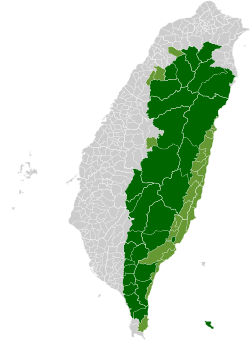
Ren'ai Township (Chinese: 仁愛鄉; pinyin: Rén'ài Xiāng; Wade–Giles: Jen-ai Hsiang) is a mountain indigenous township in Nantou County, Taiwan. It has a population total of 15,670 and an area of 1,273.5312 km, making it the second largest township by area in the county after Xinyi Township. The populations is mainly of the indigenous Seediq, Atayal and Bunun peoples. At an average elevation of 1,669 m (5,476 ft), it is one of the highest settlements in Taiwan.
Administrative divisions

| Ren'ai Township administrative divisions | ||||||
|---|---|---|---|---|---|---|

|
- 1 Rongxing Village
- 2 Cuihua Village
- 3 Lixing Village
- 4 Faxiang Village
- 5 Datong Village
- 6 Hezuo Village
- 7 Douda Village
- 8 Jingying Village
- 9 Chunyang Village
- 10 Qinai Village
- 11 Fazhi Village
- 12 Zhongzheng Village
- 13 Wanfeng Village
- 14 Nanfeng Village
- 15 Xinsheng Village
- 16 Huzhu Village
Tourist attractions
This section is written like a travel guide. (January 2022) |

- Aowanda National Forest Recreation Area
- Atayal Resort
- Chuping Archaeological Site
- Huisun Forest Recreation Area
- Mount Hehuan
- Mount Shimen
- Qingjing Farm
- Small Swiss Garden
- Wujie Dam
- Wushe Dam
- Wushe Incident Memorial Park
- Zhuoshe Mountain
-
Map of Ren-ai (north) area (1944)
-
Map of Ren-ai (south) area (1944)
Climate
| Climate data for Ren'ai, Nantou (National Taiwan University Highland Experimental Farm), elevation 2,165 m (7,103 ft), (2016–2023 normals, extremes 2016–present) | |||||||||||||
|---|---|---|---|---|---|---|---|---|---|---|---|---|---|
| Month | Jan | Feb | Mar | Apr | May | Jun | Jul | Aug | Sep | Oct | Nov | Dec | Year |
| Record high °C (°F) | 19.4 (66.9) |
19.5 (67.1) |
22.3 (72.1) |
22.4 (72.3) |
27.8 (82.0) |
25.5 (77.9) |
27.0 (80.6) |
26.8 (80.2) |
25.7 (78.3) |
26.4 (79.5) |
24.3 (75.7) |
21.1 (70.0) |
27.8 (82.0) |
| Mean daily maximum °C (°F) | 12.7 (54.9) |
13.1 (55.6) |
14.5 (58.1) |
17.0 (62.6) |
18.9 (66.0) |
20.0 (68.0) |
21.4 (70.5) |
21.1 (70.0) |
20.8 (69.4) |
19.8 (67.6) |
18.0 (64.4) |
14.8 (58.6) |
17.7 (63.8) |
| Daily mean °C (°F) | 7.8 (46.0) |
8.2 (46.8) |
10.0 (50.0) |
12.4 (54.3) |
14.7 (58.5) |
15.8 (60.4) |
16.6 (61.9) |
16.4 (61.5) |
15.9 (60.6) |
14.5 (58.1) |
12.4 (54.3) |
9.7 (49.5) |
12.9 (55.2) |
| Mean daily minimum °C (°F) | 4.1 (39.4) |
4.4 (39.9) |
6.2 (43.2) |
8.7 (47.7) |
11.6 (52.9) |
12.7 (54.9) |
12.8 (55.0) |
13.0 (55.4) |
12.2 (54.0) |
10.6 (51.1) |
8.5 (47.3) |
5.8 (42.4) |
9.2 (48.6) |
| Record low °C (°F) | −4.5 (23.9) |
−4.0 (24.8) |
−3.5 (25.7) |
−1.4 (29.5) |
6.8 (44.2) |
9.6 (49.3) |
10.0 (50.0) |
10.4 (50.7) |
7.5 (45.5) |
3.5 (38.3) |
1.8 (35.2) |
−3.1 (26.4) |
−4.5 (23.9) |
| Average precipitation mm (inches) | 119.4 (4.70) |
90.7 (3.57) |
212.2 (8.35) |
231.2 (9.10) |
497.4 (19.58) |
590.1 (23.23) |
303.9 (11.96) |
446.2 (17.57) |
221.9 (8.74) |
112.2 (4.42) |
65.8 (2.59) |
65.0 (2.56) |
2,956 (116.38) |
| Average precipitation days | 10.4 | 9.6 | 13.6 | 14.2 | 19.1 | 23.1 | 19.7 | 21.1 | 17.1 | 11.7 | 9.9 | 9.7 | 179.2 |
| Average relative humidity (%) | 81.0 | 80.8 | 83.3 | 84.7 | 89.0 | 91.5 | 87.9 | 90.9 | 88.8 | 84.5 | 80.8 | 79.6 | 85.2 |
| Source 1: Central Weather Administration | |||||||||||||
| Source 2: Atmospheric Science Research and Application Databank (precipitation 2016–2024, precipitation days and humidity 2015–2024) | |||||||||||||
References
- ^ https://en-us.topographic-map.com/map-z8dl3q/Renai-Township
- ^ "月報表(逐日資料) : 梅峰 (C0I480)". Central Weather Administration. Retrieved 29 January 2025.
- ^ "中央氣象署 測站氣候資料 : 南投梅峰 C0I480". Atmospheric Science Research and Application Databank. Retrieved 29 January 2025.
Wikivoyage has a travel guide for Ren'ai.
Wikimedia Commons has media related to Renai Township, Nantou.


