Sandilands, South Australia
| Sandilands South Australia | |||||||||||||||
|---|---|---|---|---|---|---|---|---|---|---|---|---|---|---|---|
| Coordinates | 34°30′51″S 137°46′49″E / 34.514119°S 137.780312°E | ||||||||||||||
| Population | 85 (SAL 2021) | ||||||||||||||
| Established | 1999 | ||||||||||||||
| Postcode(s) | 5571 | ||||||||||||||
| Time zone | ACST (UTC+9:30) | ||||||||||||||
| • Summer (DST) | ACST (UTC+10:30) | ||||||||||||||
| Location | |||||||||||||||
| LGA(s) | Yorke Peninsula Council | ||||||||||||||
| Region | Yorke and Mid North | ||||||||||||||
| County | Fergusson | ||||||||||||||
| State electorate(s) | Narungga | ||||||||||||||
| Federal division(s) | Grey | ||||||||||||||
| |||||||||||||||
| |||||||||||||||
| Footnotes | Adjoining localities | ||||||||||||||
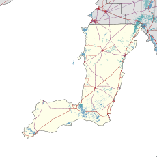
Sandilands is a locality in the Australian state of South Australia located on the east coast of Yorke Peninsula immediately adjoining Gulf St Vincent about 88 kilometres (55 mi) north-west of the state capital of Adelaide and about 18 kilometres (11 mi) south-east of the municipal seat in Maitland.
Its boundaries which were created in May 1999 for the “long established name.” The locality's name is derived from Robert Hamilton Sandilands (1841-1923) who lived there during the 1880s.
As of 2014, the majority land use within the locality is “primary production.”
Sandilands is located within the federal division of Grey, the state electoral district of Narungga and the local government area of the Yorke Peninsula Council.
References
- ^ "Search results for 'Sandilands, LOCB' with the following datasets selected - 'Suburbs and localities', 'Counties', 'Local Government Areas', 'SA Government Regions' and 'Gazetteer'". Location SA Map Viewer. South Australian Government. Retrieved 22 May 2020.
- ^ Australian Bureau of Statistics (28 June 2022). "Sandilands (SA) (suburb and locality)". Australian Census 2021 QuickStats. Retrieved 28 June 2022.
- ^ Kentish, Peter McLaren (27 May 1999), "GEOGRAPHICAL NAMES ACT 1991, Notice to Assign Boundaries and Names to Places (in the District Council of Yorke Peninsula)" (PDF), The South Australian Government Gazette: 2696, retrieved 21 May 2020 – via AustLII
- ^ "Sandilands, South Australia (Postcode)". postcodes-australia.com. Retrieved 27 February 2016.
- ^ Narungga (Map). Electoral District Boundaries Commission. 2016. Retrieved 1 March 2018.
- ^ "Federal electoral division of Grey" (PDF). Australian Electoral Commission. Retrieved 24 July 2015.
- ^ "Monthly climate statistics: Summary statistics PRICE". Commonwealth of Australia, Bureau of Meteorology. Retrieved 27 February 2016.
- ^ "Development Plan - Yorke Peninsula Council" (PDF). Department of Planning, Transport and Infrastructure. pp. 153, 231–232 & 323. Archived from the original (PDF) on 4 June 2015. Retrieved 25 February 2016.
- ^ "OBITUARY". Observer. Vol. LXXX, no. 5, 983. South Australia. 29 September 1923. p. 39. Retrieved 27 February 2016 – via National Library of Australia.
- ^ "Sandilands, Nomenclature". State Library of South Australia. Retrieved 25 February 2016.
