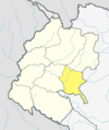
Sanphebagar
Demographics
At the time of the 2011 Nepal census, Sanphebagar Municipality had a population of 34,128. Of these, 89.2% spoke Achhami, 9.0% Nepali, 0.3% Bajureli, 0.3% Maithili, 0.2% Doteli, 0.2% Tharu, 0.1% Hindi, 0.1% Kham, 0.1% Magar, 0.1% Tamang, 0.1% Urdu and 0.2% other languages as their first language.
In terms of ethnicity/caste, 57.2% were Chhetri, 17.9% other Dalit, 9.7% Kami, 5.2% Hill Brahmin, 4.5% Damai/Dholi, 1.4% Sarki, 0.8% Thakuri, 0.6% Teli, 0.5% Musalman, 0.3% Magar, 0.3% Sanyasi/Dasnami, 0.2% Badi, 0.2% Rai, 0.2% Tharu, 0.1% Bengali, 0.1% Terai Brahmin, 0.1% Lohar, 0.1% Newar, 0.1% Tamang, 0.1% other Terai and 0.3% others.
In terms of religion, 99.0% were Hindu, 0.5% Muslim, 0.3% Christian, 0.1% Buddhist and 0.1% others.
In terms of literacy, 64.9% could read and write, 3.8% could only read and 31.3% could neither read nor write.
Transportation
Sanphebagar Airport was out of operation since 2005. On 14th Oct, 2018 flights resumed after 13 years from the initiatives of former mayor Kul Bahadur Kunwar.
References
- ^ "72 New Municipalities Announced", Republica, 8 May 2014.
- ^ "Govt Announces 72 New Municipalities, The Kathmandu Post, 8 May 2014.
- ^ "National Population and Housing Census 2011" (PDF). Central Bureau of Statistics. November 2017. Retrieved 1 May 2018.
- ^ NepalMap Language [1]
- ^ NepalMap Caste [2]
- ^ NepalMap Religion [3]
- ^ NepalMap Literacy [4]
