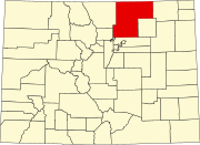
Stoneham, Colorado
Stoneham is approximately 24 miles west of Sterling, 24 miles north of Brush, 43 miles south of Kimball, and 56 miles northeast of Greeley.
History
The Chicago, Burlington, and Quincy Railroad built a rail line from Holdrege to Cheyenne in 1887, passing through the future Stoneham. Stoneham was established in 1888, although a drought strained the town's resources, and forced the closure of the post office from 1892 to 1907.
During the days of CB&Q passenger service, Stoneham was served by the 159 and 160 trains between Sterling and Cheyenne. By train in 1951, Stoneham was 4 hours and 10 minutes away from Cheyenne on the 159 train, and 103 minutes away from Sterling on the 160 train. Passenger service to Stoneham was terminated in 1971 due to the creation of Amtrak, and the termination of many CB&Q passenger routes as a result.
The railway, now owned by the Burlington Northern, was abandoned and torn up by 1983, leaving Stoneham without any rail access.
Geography
Stoneham is located at 40°36′17″N 103°39′56″W / 40.60472°N 103.66556°W (40.604830,-103.665447).
The community is located near the junction of ![]() SH 71, heading between La Junta and the Nebraska border, and
SH 71, heading between La Junta and the Nebraska border, and ![]() SH 14, heading between Muddy Pass and Sterling.
SH 14, heading between Muddy Pass and Sterling.
References
- ^ "US Board on Geographic Names". United States Geological Survey. October 25, 2007. Retrieved January 31, 2008.
- ^ "ZIP Code Lookup" (JavaScript/HTML). United States Postal Service. January 3, 2007. Retrieved January 3, 2007.
- ^ "Jim Forte Postal History". Retrieved July 1, 2022.
- ^ Fraser, Clayton, B. (August 31, 1997), The History and Evolution of Colorado's Railroads: 1858-1948 (PDF), Loveland: United States Department of the Interior, p. 54
{{citation}}: CS1 maint: multiple names: authors list (link) - ^ "Burlington Railroad (CB&Q): Map, History, Timetable, Photos". American Rails. Retrieved July 1, 2022.
- ^ United States Geological Survey (1983). TopoView - Sterling, Colorado (Map). United States Department of the Interior. Retrieved July 1, 2022.
