Templeogue
Geography
Location
Templeogue is 6 kilometres (4 mi) from Dublin city centre to the north, from the Dublin Mountains to the south, and from the coast at Dublin Bay, on the Irish Sea. It is 55 metres (180 ft) above sea level and occupies an area of 534 hectares (2 sq mi).
Suburbs adjacent to Templeogue are Ballyroan, Firhouse, Greenhills, Kimmage, Knocklyon, Perrystown, Rathfarnham, Tallaght, and Terenure.
Transport
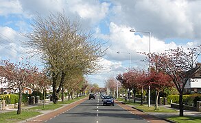
The three main routes through the suburb are the R112 regional road (Templeville Road), the R137 regional road (Templeogue Road), and the R817 regional road (Cypress Grove Road and Wainsfort Road). The M50 motorway borders the suburb to the west.
Dublin Bus operates the following bus routes through Templeogue: 15, 15A, 15B, 15D, 49, 54A, 65, 65B and 150.
Natural features
The River Dodder forms a natural southern border with Rathfarnham and Knocklyon, while the River Poddle forms the northern border with Greenhills and Kimmage. The historical artificial watercourse from the Dodder at Firhouse to the Poddle passed through Templeogue.
Prominent views from Templeogue are of Montpelier Hill 5.7 km (3.5 mi) to the southwest, topped by the ruin of the Hellfire Club at 383 metres (1,257 ft), and of Three Rock Mountain (450 m), topped by transmitter masts, 7.3 km (4.5 mi) to the southeast.
Etymology
The original Irish language name Teampal Óg ("new chapel") refers to a chapel that was built there in about 1273.
History
Templeogue was originally a village in the rural, southern part of County Dublin.
In Elizabethan times it was owned by the Talbot family, who later became prominent as the owners of Mount Talbot. The Talbot's estate was forfeited to the Crown on the Restoration of Charles II.
In the later seventeenth and eighteenth centuries, it was owned by the Domviles. The Domviles effectively had some control over the canal drawn from the Dodder to the Poddle, which passed through their estates- at that time it provided Dublin's main drinking water supply, as well as critical power for multiple watermills.

An illustration of the Doric temple at Templeogue House by Gabriel Beranger from around 1751 illustrates the grounds of the Domville estate as it would have looked when lived in by Sir Compton Domvile, 2nd Baronet. The temple was later moved to another family property, Santry Court, along with a number of other follies in 1781 when Charles Domvile vacated the estate as the house had fallen into disrepair. Today Templeogue House still contains many of the original features and is one of the oldest structures in the area.
In 1801, the Templeogue Road was constructed, originally as a toll road.
Urban expansion of Dublin during the 1950s and '60s absorbed the village.
Amenities
Schools

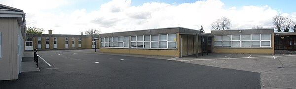
The local schools are St. Pius X National School, Our Lady's Secondary School, Templeogue College, St. Mac Dara's Community College, Bishop Galvin National School, Bishop Shanahan National School, and Ashfield College.
Sports
Local sports facilities are Faughs GAA Club, St. Judes GAA Club, St. Mary's College RFC, Templeogue Swimming Club, Templeogue Tennis Club, and Templeogue United Football Club.
Shops and services

Shops, restaurants, and small business services are located in the village on Templeogue Road, as well as in Fortfield Park, Cypress Park, Wainsfort Drive, and Rathfarnham Shopping Centre.
Although surrounded by pubs in adjacent neighbourhoods, Templeogue has only one pub inside its boundaries, The Templeogue Inn, also known as The Morgue. In the 19th and early 20th centuries, the Dublin and Blessington Steam Tramway passed through Templeogue so close to the pub that pedestrians were sometimes hit. Some corpses were sheltered in the pub until taken away and the pub acquired the permanent, morbid nickname. The Templeogue Inn was, for a while, the most expensive pub in Ireland when it changed hands on 12 October 1983 for IR£660,000, a remarkable sum at the time.
Churches

The Roman Catholic parish church is St. Pius X which opened on 27 November 1960 on College Drive. A historical chapel was built in the 13th century beside the graveyard which survives at Wellington Lane, where the original village of Templeogue was located.
St. Jude's church was built at Orwell Park on 7 December 1975 to serve the newer housing estates of Orwell, Willington, Rossmore and surrounding areas.
Politics and administration
Templeogue straddles two Dáil constituencies, with five of its electoral divisions (Templeogue-Cypress, Templeogue-Limekiln, Templeogue-Orwell, Templeogue-Osprey, and Templeogue Village) in the Dublin South-West constituency, and one electoral division (Templeogue-Kimmage Manor) is in Dublin South-Central.
It is administered by South Dublin County Council, and its local electoral area for county council elections is Rathfarnham–Templeogue.
Templeogue is part of the Dublin 6W postal district.
Population
Templeogue's population at the 2022 census was 18,076, a rise of 3.9 percent from the previous 2016 census. In the 36 years from 1986 to 2022, the population fell by 1,566, a decrease of 8 percent.
| Year | Pop. | ±% |
|---|---|---|
| 1986 | 19,642 | — |
| 1991 | 19,647 | +0.0% |
| 1996 | 18,662 | −5.0% |
| 2002 | 18,383 | −1.5% |
| 2006 | 17,699 | −3.7% |
| 2011 | 17,378 | −1.8% |
| 2016 | 17,395 | +0.1% |
| 2022 | 18,076 | +3.9% |
| Source: www.cso.ie | ||
| Electoral Division | Population 2022 |
Population 2016 |
Population 1986 |
Change 2016-2022 |
Change 1986-2022 |
|---|---|---|---|---|---|
| Templeogue-Cypress | 2,807 | 2,714 | 3,150 | +3.43% | –10.89% |
| Templeogue-Kimmage Manor | 4,929 | 4,856 | 3,782 | +1.50% | +30.33% |
| Templeogue-Limekiln | 3,821 | 3,449 | 4,616 | +10.79% | –17.22% |
| Templeogue-Orwell | 1,991 | 2,056 | 2,864 | –3.16% | –30.48% |
| Templeogue-Osprey | 2,258 | 2,246 | 3,047 | +0.53% | –25.89% |
| Templeogue Village | 2,270 | 2,074 | 2,183 | +9.45% | +3.99% |
| Templeogue Total | 18,076 | 17,395 | 19,642 | +3.91% | –7.97% |
Culture
James Joyce, who was born 2 km to the northeast in Rathgar, mentions Templeogue in Finnegans Wake, Book III, Episode 3, page 553, line 12.
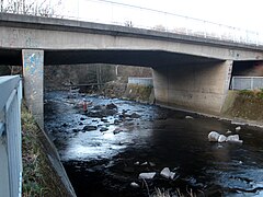
The poet Austin Clarke lived in Bridge House beside Templeogue Bridge, which spans the River Dodder. After his death, there was a proposal to preserve the house and his library of 6,500 books as a memorial. This was not possible owing to long-term plans to demolish the house and widen the road. The old Templeogue Bridge, built in 1800, and Bridge House were removed and a new bridge at the same location was opened by Councillor Mrs. Bernie Malone, Chairman Dublin City Council on 11 December 1984, which was renamed Austin Clarke Bridge in his honour.
The novelists Mary Beckett, Charles Lever, and Flora Shaw resided in Templeogue as did journalists Ursula Halligan and Michael Mills, and radio music host Larry Gogan.
Notable residents
- Mary Beckett — Novelist and short story writer.
- Austin Clarke — Poet, novelist, playwright, author, English lecturer.
- Liam Cosgrave — Taoiseach; leader of Fine Gael.
- W. T. Cosgrave — First President of the Executive Council of the Irish Free State.
- Larry Gogan — Disc jockey; radio and television broadcaster.
- Hermann Görtz — Nazi spy, stayed at 245 Templeogue road during May 1940.
- Ursula Halligan — Journalist and broadcaster.
- Charles Lever — Doctor and novelist.
- John McCann — Teachta Dála for Dublin South; Alderman on Dublin City Council; Lord Mayor of Dublin; playwright and author; journalist; father of the actor Donal McCann.
- Kevin McManamon — Football player for St Jude's GAA club and formerly for Dublin county football team (2010 to 2021).
- Michael Mills — Political journalist with the Irish Press and Ombudsman of Ireland.
- Flora Shaw — Writer who coined the name "Nigeria" for the African country.
- Sir Frederick Shaw — Recorder of Dublin 1830–76 and Dundalk; built Kimmage Manor.
- Sir Robert Shaw — Tory MP for Dublin City 1830–1831 and 1832; member of the Privy Council of Ireland; owner of Bushy Park estate.
- George Simms — Church of Ireland Archbishop of Dublin; Archbishop of Armagh and Primate of All Ireland.
- Mervyn Taylor — Dublin County Councillor, Teachta Dála, Minister for Labour, and Minister for Equality and Law Reform.
Gallery
-
 Templeogue Road (R137) in the 1960s
 -
 The River Dodder
 -
 The River Poddle
 -
 Cypress Grove House
 -
 Templeville Road (R112)
 -
-
 The Templeogue Inn (The Morgue)


.jpg)


References
- ^ "Elevation data from earthtools.org". Archived from the original on 29 January 2013. Retrieved 20 November 2009.
- ^ Myles V. Ronan (December 1942 – February 1943). "Tobar Moling and Templeogue". Dublin Historical Record. 5 (2): 73–74. JSTOR 30080682.
- ^ "Templeogue entry at the official Placenames Database of Ireland". Retrieved 17 October 2021.
- ^ Templeogue - Chronology Archived 3 May 2014 at the Wayback Machine South Dublin County History. Retrieved: 2013-02-25.
- ^ "Census 2006: Volume 1 – Population classified by area". Central Statistics Office. 2007. p. 63. ISBN 0-7557-7183-4.
- ^ Timetables: Search by place name Archived 2 April 2018 at the Wayback Machine Dublin Bus. Retrieved: 2018-04-01.
- ^ Doyle, Joseph (May 2013). Ten Dozen Waters: The Rivers and Streams of County Dublin (7th ed.). Dublin, Ireland: Rath Eanna Research. ISBN 978-0-9566363-6-2.
- ^ "Montpelier Hill Wikimapia reference". Archived from the original on 25 December 2018. Retrieved 6 October 2009.
- ^ "Three Rock Mountain Wikimapia reference". Archived from the original on 25 December 2018. Retrieved 6 October 2009.
- ^ "View at Temple-oge, in the demesne of Domville Esqr., 3 miles from Dublin, RIA MS 3 C 31/1 - Digital Repository of Ireland". repository.dri.ie. Retrieved 14 November 2023.
- ^ Beranger, Gabriel (French draftsman (11 July 2008). "Temple at Templeogue". hdl:2262/18481?show=full. Retrieved 14 November 2023.
- ^ "Templeogue House, Templeogue Road, TEMPLEOGUE, DUBLIN". Buildings of Ireland. Retrieved 14 November 2023.
- ^ Ashfield to reopen under new owner by Martha Kearns, Sunday Business Post, August 28, 2011.
- ^ Jones, Karl (13 October 1983). "Templeogue pub raises £660,000 at auction". The Irish Times. p. 1. Retrieved 3 December 2009.
- ^ "St Pius X Parish Templeogue Dublin Ireland". Archived from the original on 22 September 2023. Retrieved 25 January 2024.
St Pius X Church opened on the 27 November 1960.
- ^ "Parish of St. Jude the Apostle, Templeogue". Archived from the original on 25 January 2024. Retrieved 25 January 2024.
On Sunday 7th December 1975 the new parish church of St Jude The Apostle Willington Templeogue was opened and blessed by the Most Reverend Dermot Ryan, D.D. Archbishop of Dublin.
- ^ Electoral (Amendment) (Dáil Constituencies) Act 2017, Schedule (No. 39 of 2017, Schedule). Enacted on 23 December 2017. Act of the Oireachtas. Retrieved from Irish Statute Book on 15 June 2022.
- ^ Polling Scheme 2010 Archived 21 July 2011 at the Wayback Machine South Dublin County Council, 2010-09-13.
- ^ County of South Dublin Local Electoral Areas Order 2018 (S.I. No. 633 of 2018). Signed on 19 December 2018. Statutory Instrument of the Government of Ireland. Retrieved from Irish Statute Book.
- ^ "Census Interactive Map". Central Statistics Office. Retrieved 1 December 2024.
- ^ "Census 1991, Volume 1, Population Classified by Area" (PDF). Central Statistics Office. 1993. p. 41. ISBN 0-7076-0289-0.
- ^ "All Reports/Demography/Census/1996/Volume 1 - Area/06. Population and area of each Province, County, County Borough, Urban District, Rural District and District Electoral Division/Ward, 1991 and 1996". Central Statistics Office. Retrieved 23 January 2012.
- ^ "All Reports/Demography/Census/2002/Volume 1 - Area/06. Population of each Province, County, City, urban area, rural area and Electoral Division, 1996 and 2002". Central Statistics Office. Retrieved 23 January 2012.
- ^ "Census 2011 - Preliminary results: Actual and percentage change in population 2006 to 2011 by Province County City Urban area Rural area and Electoral division by District, Year and Statistic". Central Statistics Office. Retrieved 19 November 2011.Archived 14 March 2016 at the Wayback Machine
- ^ "Central Statistics Office - Census 2016 Small Area Population Statistics". Central Statistics Office. Retrieved 22 December 2019.Archived 12 October 2014 at the Wayback Machine
- ^ "Brighton Square, Rathgar Wikimapia reference". Archived from the original on 25 December 2018. Retrieved 6 October 2009.
- ^ Online Finnegans Wake Archived 2 April 2010 at the Wayback Machine, Trent University, Peterborough, ON, Canada. Retrieved 2010-07-31. (Note that this e-text contains errors, many of which are listed at F.W.E.E.T. Archived 12 April 2010 at the Wayback Machine)
- ^ The dedication plaque on the bridge reads, "Austin Clarke Bridge opened by Councillor Mrs. Bernie Malone Chairman Dublin City Council 11 December 1984. Chief Engineer: Brendan Murphy B.E., C. Eng., F. IEI."
- ^ History of Templeogue Archived 2010-11-17 at the Wayback Machine South Dublin County History: Templeogue. Retrieved: 2011-11-19.
- ^ Healy 2004, p. 7.
- ^ "My Club: Kevin McManamon - St Jude's". www.gaa.ie. Retrieved 26 January 2022.
- ^ MILLS, Michael : Acknowledgement notice Archived 16 June 2017 at the Wayback Machine The Irish Times, 2008-06-19.
Sources
- Healy, Patrick (2004). All Roads Lead to Tallaght. Dublin: South Dublin County Council. ISBN 0954766008.
External links
- The Story of Templeogue, Templeogue Ladies' Club, 1992–05. Text in PDF form at South County Dublin Libraries. Retrieved 2010-12-24.