Timeline Of The 2013 Pacific Hurricane Season
The season produced twenty-one tropical depressions. All but one further intensified into tropical storms and nine further intensified to become hurricanes. Despite this level of activity, only one hurricane – Raymond – strengthened into a major hurricane. The most significant storm, in terms of loss of life and damage, was Hurricane Manuel. Forming in mid-September, Manuel attained its peak as a minimal Category 1 hurricane before moving ashore on the coastline of Mexico. In total, the storm contributed to 123 confirmed fatalities and $4.2 billion (2013 USD) in damage. Throughout the duration of the season, four other named storms – Hurricane Barbara and tropical storms Juliette, Octave, and Sonia – made landfall in Mexico, causing minor damage and loss of life.
This timeline includes information that was not released in real time, but derived from post-season analyzes by the National Hurricane Center and Central Pacific Hurricane Center; as a result, it may include storms that were not operationally warned upon. This timeline documents tropical cyclone formations, strengthening, weakening, landfalls, extratropical transitions, and dissipations during the season.
Timeline

May
May 15

- The 2013 East Pacific hurricane season officially begins.
- 0600 UTC (11:00 p.m. PDT May 14) – Tropical Depression One-E develops from an area of low pressure about 650 mi (1,045 km) south-southwest of Acapulco, Mexico, becoming the second lowest-latitude-forming tropical cyclone on record.
- 1800 UTC (11:00 a.m. PDT) – Tropical Depression One-E intensifies into Tropical Storm Alvin roughly 665 mi (1,070 km) south-southwest of Acapulco, Mexico.
May 16
- 0600 UTC (11:00 p.m. PDT May 15) – Tropical Storm Alvin attains its peak intensity with maximum sustained winds of 60 mph (95 km/h) and a minimum barometric pressure of 1000 mb (hPa; 29.53 inHg) about 705 mi (1,135 km) southwest of Acapulco, Mexico.
May 17
- 0600 UTC (11:00 p.m. PDT May 16) – Tropical Storm Alvin dissipates roughly 775 mi (1,245 km) southwest of Manzanillo, Mexico.
May 28
- 1200 UTC (5:00 a.m. PDT) – Tropical Depression Two-E develops from an area of low pressure about 125 mi (200 km) south-southeast of Puerto Ángel, Mexico.
- 1800 UTC (11:00 a.m. PDT) – Tropical Depression Two-E intensifies into Tropical Storm Barbara roughly 110 mi (175 km) south-southeast of Puerto Ángel, Mexico.
May 29
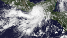
- 1200 UTC (5:00 a.m. PDT) – Tropical Storm Barbara intensifies into a Category 1 hurricane about 75 mi (120 km) southeast of Salina Cruz, Mexico.
- 1950 UTC (12:50 p.m. PDT) – Hurricane Barbara attains its peak intensity with maximum sustained winds of 80 mph (130 km/h) and a minimum barometric pressure of 983 mb (hPa; 29.03 inHg) and simultaneously makes landfall roughly 15 mi (25 km) west-southwest of Tonalá, Mexico, becoming the easternmost landfalling Pacific hurricane on record.
May 30
- 0000 UTC (5:00 p.m. PDT May 29) – Hurricane Barbara weakens to a tropical storm about 10 mi (15 km) east of Cintalapa.
- 0600 UTC (11:00 p.m. PDT May 29) – Tropical Storm Barbara weakens to a tropical depression roughly 70 mi (115 km) southwest of Villahermosa, Mexico.
- 1200 UTC (5:00 a.m. PDT) – Tropical Depression Barbara degenerates into a non-convective remnant area of low pressure about 35 mi (55 km) east-northeast of Coatzacoalcos, Mexico.
June
June 1
- The 2013 Central Pacific hurricane season officially begins.
June 23
- 1200 UTC (5:00 a.m. PDT) – Tropical Depression Three-E develops from an area of low pressure about 500 mi (805 km) south of Manzanillo, Mexico.
June 24
- 0000 UTC (5:00 p.m. PDT June 23) – Tropical Depression Three-E intensifies into Tropical Storm Cosme roughly 410 mi (660 km) south-southwest of Zihuatanejo, Mexico.
June 25
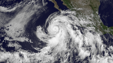
- 1200 UTC (5:00 a.m. PDT) – Tropical Storm Cosme intensifies into a Category 1 hurricane about 410 mi (660 km) southwest of Manzanillo, Mexico.
June 26
- 0000 UTC (5:00 p.m. PDT June 25) – Hurricane Cosme attains its peak intensity with maximum sustained winds of 85 mph (135 km/h) and a minimum barometric pressure of 980 mb (hPa; 28.94 inHg).
- 1800 UTC (11:00 a.m. PDT) – Hurricane Cosme weakens to a tropical storm roughly 465 mi (750 mi) southwest of the southern tip of Baja California.
June 27
- 1200 UTC (5:00 a.m. PDT) – Tropical Storm Cosme degenerates into a non-convective remnant area of low pressure about 690 mi (1,110 km) west-southwest of Cabo San Lucas, Mexico.
June 29
- 1800 UTC (11:00 a.m. PDT) – Tropical Depression Four-E develops from an area of low pressure roughly 480 mi (770 km) south of Manzanillo, Mexico.
June 30
- 0600 UTC (11:00 p.m. PDT June 29) – Tropical Depression Four-E intensifies into Tropical Storm Dalila about 280 mi (450 km) southwest of Acapulco, Mexico.
July
July 2

- 1200 UTC (5:00 a.m. PDT) – Tropical Storm Dalila intensifies into a Category 1 hurricane roughly 165 mi (265 km) south-southwest of Cabo Corrientes, Mexico.
- 1800 UTC (11:00 a.m. PDT) – Hurricane Dalila attains its peak intensity with maximum sustained winds of 80 mph (130 km/h) and a minimum barometric pressure of 984 mb (hPa; 29.06 inHg).
July 3
- 1800 UTC (11:00 a.m. PDT) – Hurricane Dalila weakens to a tropical storm about 255 mi (410 km) southwest of Manzanillo, Mexico.
July 4
- 1200 UTC (5:00 a.m. PDT) – Tropical Depression Five-E develops from an area of low pressure roughly 205 mi (330 km) southeast of Acapulco, Mexico.
July 5
- 0000 UTC (5:00 p.m. PDT July 4) – Tropical Storm Dalila weakens to a tropical depression about 440 mi (710 km) west-southwest of Manzanillo, Mexico.
- 0000 UTC (5:00 p.m. PDT July 4) – Tropical Depression Five-E intensifies into Tropical Storm Erick roughly 170 mi (275 km) south of Acapulco, Mexico.
July 6

- 0600 UTC (11:00 p.m. PDT July 5) – Tropical Storm Erick intensifies into a Category 1 hurricane about 125 mi (200 km) southwest of Zihuatanejo, Mexico.
- 1200 UTC (5:00 a.m. PDT) – Hurricane Erick attains its peak intensity with maximum sustained winds of 80 mph (130 km/h) and a minimum barometric pressure of 983 mb (hPa; 29.03 inHg).
July 7
- 0600 UTC (11:00 p.m. PDT July 6) – Tropical Depression Dalila degenerates into a non-convective remnant area of low pressure roughly 460 mi (740 km) south-southwest of Cabo San Lucas, Mexico.
- 1800 UTC (11:00 a.m. PDT) – Hurricane Erick weakens to a tropical storm about 165 mi (265 km) west-southwest of Puerto Vallarta, Mexico.
July 9
- 0600 UTC (11:00 p.m. PDT July 8) – Tropical Storm Erick degenerates into a non-convective remnant area of low pressure roughly 115 mi (185 km) southwest of La Paz, Mexico.
July 25
- 0000 UTC (5:00 p.m. PDT July 24) – Tropical Depression Six-E develops from an area of low pressure about 980 mi 1,575 km) west-southwest of the southern tip of Baja California.
- 0600 UTC (11:00 p.m. PDT July 24) – Tropical Depression Six-E intensifies into Tropical Storm Flossie roughly 1,040 mi (1,675 km) southwest of the southern tip of Baja California.
July 27
- 1200 UTC (5:00 a.m. PDT) – Tropical Storm Flossie attains its peak intensity with maximum sustained winds of 70 mph (115 km/h) and a minimum barometric pressure of 994 mb (hPa; 29.36 inHg).
- ~1800 UTC (~11:00 a.m. PDT) – Tropical Storm Flossie crosses 140°W, entering the jurisdiction of the Central Pacific Hurricane Center.
July 30
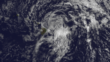
- 0000 UTC (5:00 p.m. PDT July 29) – Tropical Storm Flossie weakens to a tropical depression about 25 mi (40 km) northeast of Maui, Hawaii.
- 1200 UTC (5:00 a.m. PDT) – Tropical Depression Flossie degenerates into a non-convective remnant area of low pressure roughly 5 mi (8.0 km) of Kauai, Hawaii.
- 1200 UTC (5:00 a.m. PDT) – Tropical Depression Seven-E develops from an area of low pressure about 1,025 mi (1,650 km) south-southwest of the southern tip of Baja California.
- 1800 UTC (11:00 a.m. PDT) – Tropical Depression Seven-E intensifies into Tropical Storm Gil roughly 805 mi (1,295 km) southwest of the southern tip of Baja California.
July 31
- 1800 UTC (11:00 a.m. PDT) – Tropical Storm Gil intensifies into a Category 1 hurricane about 925 mi (1,490 km) southwest of the southern tip of Baja California.
August
August 2

- 0000 UTC (5:00 p.m. PDT August 1) – Hurricane Gil attains its peak intensity with maximum sustained winds of 85 mph (135 km/h) and a minimum barometric pressure of 985 mb (hPa; 29.09 inHg).
- 1800 UTC (11:00 a.m. PDT) – Hurricane Gil weakens to a tropical storm roughly 1,370 mi (2,205 km) west-southwest of the southern tip of Baja California.
August 3
- 1200 UTC (5:00 a.m. PDT) – Tropical Depression Eight-E develops from an area of low pressure about 1,090 mi (1,755 km) southwest of the southern tip of Baja California.
August 4
- 0000 UTC (5:00 p.m. PDT August 3) – Tropical Depression Eight-E intensifies into Tropical Storm Henriette roughly 1,180 mi (1,900 km) southwest of the southern tip of Baja California.
- 1200 UTC (5:00 a.m. PDT) – Tropical Storm Gil weakens to a tropical depression about 1,325 mi (2,130 km) east-southeast of the Hawaiian Islands.
August 6
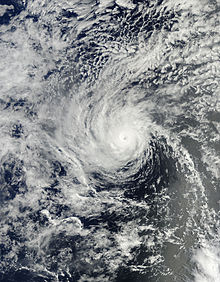
- ~0000 UTC (~5:00 p.m. PDT August 5) – Tropical Depression Gil crosses 140°W, entering the jurisdiction of the Central Pacific.
- 0600 UTC (11:00 p.m. PDT August 5) – Tropical Depression Gil re-intensifies into a tropical storm roughly 1,055 mi (1,700 km) southeast of the Hawaiian Islands.
- 0600 UTC (11:00 p.m. PDT August 5) – Tropical Storm Henriette intensifies into a Category 1 hurricane about 1,495 mi (2,405 km) west-southwest of the southern tip of Baja California.
- 1800 UTC (11:00 a.m. PDT) – Tropical Storm Gil weakens to a tropical depression for a second time roughly 985 mi (1,585 km) southeast of the Hawaiian Islands.
August 7
- 0000 UTC (5:00 p.m. PDT August 6) – Tropical Depression Gil dissipates about 1,065 mi (1,715 km) east-southeast of the Hawaiian Islands.
August 8
- 1800 UTC (11:00 a.m. PDT) – Hurricane Henriette intensifies into a Category 2 hurricane and simultaneously attains its peak intensity with maximum sustained winds of 105 mph (170 km/h) and a minimum barometric pressure of 976 mb (hPa; 28.82 inHg).
August 9
- ~0000 UTC (~5:00 p.m. PDT August 8) – Hurricane Henriette crosses 140°W, entering the jurisdiction of the Central Pacific Hurricane Center.
- 0600 UTC (11:00 p.m. PDT August 8) – Hurricane Henriette weakens to a Category 1 hurricane roughly 945 mi (1,520 km) east-southeast of the Hawaiian Islands.
- 1200 UTC (5:00 a.m. PDT) – Hurricane Henriette weakens to a tropical storm about 885 mi (1,425 km) southeast of the Hawaiian Islands.
August 11
- 1200 UTC (5:00 a.m. PDT) – Tropical Storm Henriette weakens to a tropical depression roughly 380 mi (610 km) south of Ka Lae, Hawaii.
- 1800 UTC (11:00 a.m. PDT) – Tropical Depression Henriette degenerates into a non-convective remnant area of low pressure about 385 mi (620 km) south-southwest of Ka Lae, Hawaii.
August 16
- 1500 UTC (5:00 a.m. HST) – Tropical Storm Pewa develops from an area of low pressure roughly 1,240 mi (1,995 km) southwest of Lihue, Hawaii.

August 18
- ~0600 UTC (~8:00 p.m. HST August 17) – Tropical Storm Pewa crosses the International Date Line and moves into the West Pacific.
August 19
- 0300 UTC (5:00 p.m. HST August 18) – Tropical Storm Unala develops from an area of low pressure about 1,360 mi (2,190 km) west of Honolulu, Hawaii.
- ~0900 UTC (~11:00 p.m. HST August 18) – Tropical Storm Unala crosses the International Date Line and moves into the West Pacific.
- 2100 UTC (11:00 a.m. HST) – Tropical Depression Three-C develops from an area of low pressure roughly 1,075 mi (1,730 km) west of Lihue, Hawaii.
August 20
- ~1500 UTC (~5:00 a.m. HST) – Tropical Depression Three-C crosses the International Date Line and moves into the West Pacific basin.
August 22
- 1200 UTC (5:00 a.m. PDT) – Tropical Depression Nine-E develops from an area of low pressure about 495 mi (795 km) west-southwest of Manzanillo, Mexico.
August 23
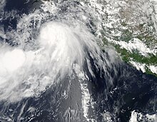
- 0000 UTC (5:00 p.m. PDT August 22) – Tropical Depression Nine-E intensifies into Tropical Storm Ivo roughly 385 mi (620 km) south-southwest of the southern tip of Baja California.
August 24
- 0000 UTC (5:00 p.m. PDT August 23) – Tropical Storm Ivo attains its peak intensity with maximum sustained winds of 45 mph (70 km/h) and a minimum barometric pressure of 997 mb (hPa; 29.44 inHg).
August 25
- 0000 UTC (5:00 p.m. PDT August 24) – Tropical Storm Ivo weakens to a tropical depression about 265 mi (425 km) west of the southern tip of Baja California.
- 1800 UTC (11:00 a.m. PDT) – Tropical Depression Ivo degenerates into a non-convective remnant area of low pressure roughly 325 mi (525 km) northwest of La Paz, Mexico.
August 28
- 1200 UTC (5:00 a.m. PDT) – Tropical Storm Juliette develops from an area of low pressure about 310 mi (500 km) south-southeast of Cabo San Lucas, Mexico.
August 29
- 0600 UTC (11:00 p.m. PDT August 28) – Tropical Storm Juliette attains its peak intensity with maximum sustained winds of 65 mph (105 km/h) and a minimum barometric pressure of 997 mb (hPa; 29.44 inHg).
- 0900 UTC (2:00 a.m. PDT) – Tropical Storm Juliette makes landfall near Punta Santa Marina, Mexico, with winds of 65 mph (105 km/h).
August 30

- 0000 UTC (5:00 p.m. PDT August 29) – Tropical Storm Juliette degenerates into a non-convective remnant area of low pressure roughly 50 mi (80 km) south of El Pocito, Mexico.
- 1200 UTC (5:00 a.m. PDT) – Tropical Depression Eleven-E develops from an area of low pressure about 530 mi (855 km) southwest of the southern tip of Baja California.
August 31
- 1200 UTC (5:00 a.m. PDT) – Tropical Depression Eleven-E intensifies into Tropical Storm Kiko roughly 500 mi (805 km) west-southwest of the southern tip of Baja California.
September
September 1
- 0600 UTC (11:00 p.m. PDT August 31) – Tropical Storm Kiko intensifies into a Category 1 hurricane and simultaneously attains its peak intensity with maximum sustained winds of 75 mph (120 km/h) and a minimum barometric pressure of 989 mb (hPa; 29.21 inHg).
- 1800 UTC (11:00 a.m. PDT) – Hurricane Kiko weakens to a tropical storm about 380 mi (610 km) west-southwest of the southern tip of Baja California.
September 2
- 1200 UTC (5:00 a.m. PDT) – Tropical Storm Kiko degenerates into a non-convective remnant area of low pressure roughly 405 mi (650 km) west-southwest of the southern tip of Baja California.
September 5
- 0600 UTC (11:00 p.m. PDT September 4) – Tropical Depression Twelve-E develops from an area of low pressure about 145 mi (235 km) southwest of Manzanillo, Mexico.
- 1200 UTC (5:00 a.m. PDT) – Tropical Depression Twelve-E intensifies into Tropical Storm Lorena roughly 135 mi (215 km) southwest of Manzanillo, Mexico.
September 6

- 1200 UTC (5:00 a.m. PDT) – Tropical Storm Lorena attains its peak intensity with maximum sustained winds of 50 mph (80 km/h) and a minimum barometric pressure of 1002 mb (hPa; 29.59 inHg).
September 7
- 1200 UTC (5:00 a.m. PDT) – Tropical Storm Lorena weakens to a tropical depression about 95 mi (155 km) southwest of La Paz, Mexico.
- 1800 UTC (11:00 a.m. PDT) – Tropical Depression Lorena degenerates into a non-convective remnant area of low pressure roughly 60 mi (95 km) west-southwest of Santa Fe, Mexico.
September 13
- 1200 UTC (5:00 a.m. PDT) – Tropical Depression Thirteen-E develops from an area of low pressure about 150 mi (240 km) south-southwest of Acapulco, Mexico.
- 1800 UTC (11:00 a.m. PDT) – Tropical Depression Thirteen-E intensifies into Tropical Storm Manuel roughly 175 mi (280 km) southwest of Acapulco, Mexico.
September 15
- 1200 UTC (5:00 a.m. PDT) – Tropical Storm Manuel makes its first landfall near Pichilinguillo, Mexico, with winds of 70 mph (115 km/h).
September 16
- 0000 UTC (5:00 p.m. PDT September 15) – Tropical Storm Manuel weakens to a tropical depression about 45 mi (70 km) north-northwest of Manzanillo, Mexico.
- 0600 UTC (11:00 p.m. PDT September 15) – Tropical Depression Manuel degenerates into a tropical disturbance roughly 30 mi (50 km) south of Puerto Vallarta, Mexico.
September 17
- 1800 UTC (11:00 a.m. PDT) – The remnants of Tropical Depression Manuel regenerate into a tropical depression about 175 mi (280 km) east of Cabo San Lucas, Mexico.
September 18
- 0600 UTC (11:00 p.m. PDT September 17) – Tropical Depression Manuel intensifies into a tropical storm roughly 140 mi (225 km) east of Cabo San Lucas, Mexico.

September 19
- 0000 UTC (5:00 p.m. PDT September 18) – Tropical Storm Manuel intensifies into a Category 1 hurricane about 140 mi (225 km) northeast of Cabo San Lucas, Mexico.
- 0600 UTC (11:00 p.m. PDT September 18) – Hurricane Manuel attains its peak intensity with maximum sustained winds of 75 mph (120 km/h) and a minimum barometric pressure of 983 mb (hPa; 29.03 inHg).
- 1200 UTC (5:00 a.m. PDT) – Hurricane Manuel makes its second and final landfall near Culiacán, Mexico, with winds of 75 mph (120 km/h).
- 1800 UTC (11:00 a.m. PDT) – Hurricane Manuel weakens to a tropical storm roughly 30 mi (50 km) east-southeast of Guamúchil, Mexico.
September 20
- 0000 UTC (5:00 p.m. PDT September 19) – Tropical Storm Manuel dissipates over the Sierra Madre Occidental.
October
October 6

- 1800 UTC (11:00 a.m. PDT) – Tropical Depression Fourteen-E develops from an area of low pressure about 865 mi (1,390 km) southwest of the southern tip of Baja California.
October 7
- 0000 UTC (5:00 .m. PDT October 6) – Tropical Depression Fourteen-E intensifies into Tropical Storm Narda roughly 915 mi (1,475 km) southwest of the southern tip of Baja California.
- 1800 UTC (11:00 a.m. PDT) – Tropical Storm Narda attains its peak intensity with maximum sustained winds of 65 mph (105 km/h) and a minimum barometric pressure of 997 mb (hPa; 29.44 inHg).
October 9
- 0000 UTC (5:00 p.m. PDT October 8) – Tropical Storm Narda weakens to a tropical depression about 1,245 mi (2,005 km) west-southwest of the southern tip of Baja California.
October 10
- 1200 UTC (5:00 a.m. PDT) – Tropical Depression Narda degenerates into a non-convective remnant area of low pressure roughly 1,320 mi (2,125 km) west-southwest of the southern tip of Baja California.
October 12
- 1800 UTC (11:00 a.m. PDT) – Tropical Depression Fifteen-E develops from an area of low pressure about 545 mi (875 km) south of the southern tip of Baja California.
October 13

- 0000 UTC (5:00 p.m. PDT October 12) – Tropical Depression Fifteen-E intensifies into Tropical Storm Octave roughly 500 mi (805 km) south of the southern tip of Baja California.
- 1800 UTC (11:00 a.m. PDT) – Tropical Storm Octave attains its peak intensity with maximum sustained winds of 65 mph (105 km/h) and a minimum barometric pressure of 994 mb (hPa; 29.36 inHg).
October 14
- 0000 UTC (5:00 p.m. PDT October 13) – Tropical Depression Sixteen-E develops from an area of low pressure about 810 mi (1,305 km) south-southwest of the southern tip of Baja California.
- 0600 UTC (11:00 p.m. PDT October 13) – Tropical Depression Sixteen-E intensifies into Tropical Storm Priscilla roughly 740 mi (1,190 km) southwest of the southern tip of Baja California.
- 1200 UTC (5:00 a.m. PDT) – Tropical Storm Priscilla attains its peak intensity with maximum sustained winds of 45 mph (70 km/h) and a minimum barometric pressure of 1001 mb (hPa; 29.56 inHg).

October 15
- 0500 UTC (10:00 p.m. PDT October 14) – Tropical Storm Octave makes landfall near Cabo San Lazaro, Mexico, with winds of 45 mph (70 km/h).
- 1200 UTC (5:00 a.m. PDT) – Tropical Storm Octave weakens to a tropical depression about 120 mi (195 km) north-northwest of La Paz, Mexico.
- 1800 UTC (11:00 a.m. PDT) – Tropical Depression Octave degenerates into a non-convective remnant area of low pressure roughly 65 mi (105 km) northwest of Los Mochis, Mexico.
- 1800 UTC (11:00 a.m. PDT) – Tropical Storm Priscilla weakens to a tropical depression about 585 mi (940 km) southwest of the southern tip of Baja California.
October 16
- 1800 UTC (11:00 a.m. PDT) – Tropical Depression Priscilla degenerates into a non-convective remnant area of low pressure roughly 720 mi (1,160 km) west-southwest of the southern tip of Baja California.
October 20
- 0000 UTC (5:00 p.m. PDT October 19) – Tropical Depression Seventeen-E develops from an area of low pressure about 220 mi (355 km) south-southwest of Acapulco, Mexico.
- 0600 UTC (11:00 p.m. PDT October 19) – Tropical Depression Seventeen-E intensifies into Tropical Storm Raymond roughly 195 mi (315 km) southwest of Acapulco, Mexico.
October 21
- 0000 UTC (5:00 p.m. PDT October 20) – Tropical Storm Raymond intensifies into a Category 1 hurricane about 160 mi (255 km) southwest of Acapulco, Mexico.
- 0600 UTC (11:00 p.m. PDT October 21) – Hurricane Raymond intensifies into a Category 2 hurricane roughly 165 mi (265 km) west-southwest of Acapulco, Mexico.
- 1200 UTC (5:00 a.m. PDT) – Hurricane Raymond intensifies into a Category 3 hurricane about 160 mi (255 km) west-southwest of Acapulco, Mexico.
- 1800 UTC (11:00 a.m. PDT) – Hurricane Raymond attains its peak intensity with maximum sustained winds of 125 mph (200 km/h) and a minimum barometric pressure of 28.08 inHg).

October 22
- 0600 UTC (11:00 p.m. PDT October 21) – Hurricane Raymond weakens to a Category 2 hurricane roughly 135 mi (215 km) west-southwest of Acapulco, Mexico.
- 1800 UTC (11:00 a.m. PDT) – Hurricane Raymond weakens to a Category 1 hurricane about 135 mi (215 km) west-southwest of Acapulco, Mexico.
October 23
- 0600 UTC (11:00 p.m. PDT October 22) – Hurricane Raymond weakens to a tropical storm roughly 170 mi (275 km) southwest of Acapulco, Mexico.
October 27
- 1200 UTC (5:00 a.m. PDT) – Tropical Storm Raymond re-intensifies into a Category 1 hurricane about 730 mi (1,175 km) south-southwest of the southern tip of Baja California.
October 28
- 0000 UTC (5:00 p.m. PDT October 27) – Hurricane Raymond re-intensifies into a Category 2 hurricane roughly 715 mi (1,150 km) southwest of the southern tip of Baja California.
- 1200 UTC (5:00 a.m. PDT) – Hurricane Raymond weakens to a Category 1 hurricane for a second time about 660 mi (1,060 km) southwest of the southern tip of Baja California.
October 29
- 0000 UTC (5:00 p.m. PDT October 28) – Hurricane Raymond weakens to a tropical storm for a second time roughly 620 mi (1,000 km) southwest of the southern tip of Baja California.
October 30
- 0600 UTC (11:00 p.m. PDT October 29) – Tropical Storm Raymond weakens to a tropical depression about 420 mi (675 km) southwest of the southern tip of Baja California.
- 1200 UTC (5:00 a.m. PDT) – Tropical Depression Raymond degenerates into a non-convective remnant area of low pressure roughly 370 mi (595 km) west-southwest of the southern tip of Baja California.
November
November 1
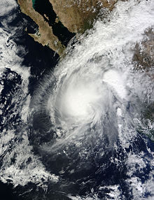
- 0600 UTC (11:00 p.m. PDT October 31) – Tropical Depression Eighteen-E develops from an area of low pressure about 320 mi (515 km) southwest of Manzanillo, Mexico.
November 3
- 0000 UTC (4:00 p.m. PST November 2) – Tropical Depression Eighteen-E intensifies into Tropical Storm Sonia roughly 350 mi (565 km) south of the southern tip of Baja California.
- 1800 UTC (10:00 a.m. PST) – Tropical Storm Sonia attains its peak intensity with maximum sustained winds of 45 mph (70 km/h) and a minimum barometric pressure of 1002 mb (hPa; 29.59 inHg).
November 4
- 0500 UTC (9:00 p.m. PST November 3) – Tropical Storm Sonia makes landfall near El Dorado, Mexico, with winds of 40 mph (65 km/h).
- 0600 UTC (10:00 p.m. PST November 3) – Tropical Storm Sonia weakens to a tropical depression about 20 mi (30 km) north-northwest of El Dorado, Mexico.
- 1200 UTC (4:00 a.m. PST) – Tropical Depression Sonia dissipates over the Sierra Madre Occidental.
November 30
- The 2013 Pacific hurricane season officially ends.
See also
Footnotes
- ^ An average season, as defined by the National Oceanic and Atmospheric Administration, has fifteen tropical storms, eight hurricanes and three major hurricanes.
- ^ The East Pacific is defined as the region east of 140°W, while the Central Pacific is defined as the region west of 140°W to the International Date Line.
- ^ A major hurricane is a storm that ranks as Category 3 or higher on the Saffir–Simpson hurricane wind scale.
- ^ The figures for maximum sustained winds and position estimates are rounded to the nearest 5 units (knots, miles, or kilometers), following the convention used in the National Hurricane Center's operational products for each storm. All other units are rounded to the nearest digit.
References
- ^ "Background Information: East Pacific Hurricane Season". Climate Prediction Center. National Oceanic and Atmospheric Administration. May 23, 2013. Retrieved November 26, 2013.
- ^ Christopher W. Landsea (June 2, 2011). "G: Tropical Cyclone Climatology". In Neal Dorst (ed.). Hurricane Research Division: Frequently Asked Questions. Miami, Florida: National Oceanic and Atmospheric Administration. G1) When is hurricane season ?. Archived from the original on June 15, 2006. Retrieved January 6, 2015.
{{cite book}}:|work=ignored (help) - ^ Christopher W. Landsea (June 2, 2011). "A: Basic Definitions". In Neal Dorst (ed.). Hurricane Research Division: Frequently Asked Questions. Miami, Florida: National Oceanic and Atmospheric Administration. A3) What is a super-typhoon? What is a major hurricane ? What is an intense hurricane ?. Archived from the original on June 15, 2006. Retrieved January 6, 2015.
{{cite book}}:|work=ignored (help) - ^ Richard J. Pasch; David A. Zelinsky (January 6, 2014). Tropical Cyclone Report: Hurricane Manuel (PDF). National Hurricane Center (Report). Miami, Florida: National Oceanic and Atmospheric Administration. pp. 2, 3, 7, 8. Retrieved January 5, 2015.
- ^ Stacy R. Stewart (May 31, 2013). Tropical Cyclone Report: Tropical Storm Alvin (PDF). National Hurricane Center (Report). Miami, Florida: National Oceanic and Atmospheric Administration. pp. 1, 3. Retrieved May 28, 2014.
- ^ Daniel P. Brown (August 19, 2013). Tropical Cyclone Report: Hurricane Barbara (PDF). National Hurricane Center (Report). Miami, Florida: National Oceanic and Atmospheric Administration. pp. 2, 6. Retrieved May 28, 2014.
- ^ Eric S. Blake (September 10, 2013). Tropical Cyclone Report: Hurricane Cosme (PDF). National Hurricane Center (Report). National Oceanic and Atmospheric Administration. pp. 2, 5, 6. Retrieved December 15, 2013.
- ^ Richard J. Pasch (December 10, 2013). Tropical Cyclone Report: Hurricane Dalila (PDF). National Hurricane Center (Report). National Oceanic and Atmospheric Administration. pp. 2, 5, 6. Retrieved December 15, 2013.
- ^ Lixion A. Avila (August 28, 2013). Tropical Cyclone Report: Hurricane Erick (PDF). National Hurricane Center (Report). Miami, Florida: National Oceanic and Atmospheric Administration. pp. 2, 5. Retrieved January 3, 2015.
- ^ John P. Cangialosi; Derek Wroe (November 4, 2013). Tropical Cyclone Report: Tropical Storm Flossie (PDF). National Hurricane Center and Central Pacific Hurricane Center (Report). Miami, Florida and Honolulu, Hawaii: National Oceanic and Atmospheric Administration. pp. 2, 5. Retrieved January 3, 2015.
- ^ John L. Beven II; Sam Houston (February 6, 2014). Tropical Cyclone Report: Hurricane Gil (PDF). National Hurricane Center and Central Pacific Hurricane Center (Report). Miami, Florida and Honolulu, Hawaii: National Oceanic and Atmospheric Administration. pp. 2, 5, 6. Retrieved January 3, 2015.
- ^ Robbie J. Berg; Jeff Powell (January 23, 2014). Tropical Cyclone Report: Hurricane Henriette (PDF). National Hurricane Center and Central Pacific Hurricane Center (Report). Miami, Florida and Honolulu, Hawaii: National Oceanic and Atmospheric Administration. pp. 2, 3, 5, 6. Retrieved January 5, 2015.
- ^ Tom Birchard (August 16, 2013). Tropical Storm Pewa Public Advisory Number 1. Central Pacific Hurricane Center (Report). Honolulu, Hawaii: National Oceanic and Atmospheric Administration. Retrieved August 17, 2013.
- ^ Robert Ballard (August 17, 2013). Tropical Storm Pewa Discussion Number 7. Central Pacific Hurricane Center (Report). Honolulu, Hawaii: National Oceanic and Atmospheric Administration. Retrieved August 17, 2013.
- ^ Jeff Powell (August 19, 2013). Tropical Storm Unala Public Advisory Number 1. Central Pacific Hurricane Center (Report). Honolulu, Hawaii: National Oceanic and Atmospheric Administration. Retrieved August 19, 2013.
- ^ Sam Houston (August 19, 2013). Tropical Storm Unala Discussion Number 3. Central Pacific Hurricane Center (Report). Honolulu, Hawaii: National Oceanic and Atmospheric Administration. Retrieved August 19, 2013.
- ^ Tom Birchard (August 19, 2013). Tropical Depression Three-C Public Advisory Number 1. Central Pacific Hurricane Center (Report). Honolulu, Hawaii: National Oceanic and Atmospheric Administration. Retrieved August 19, 2013.
- ^ Tom Powell (August 20, 2013). Tropical Depression Three-C Discussion Number 4. Central Pacific Hurricane Center (Report). Honolulu, Hawaii: National Oceanic and Atmospheric Administration. Retrieved August 28, 2013.
- ^ Todd B. Kimberlain (November 25, 2013). Tropical Cyclone Report: Tropical Storm Ivo (PDF). National Hurricane Center (Report). Miami, Florida: National Oceanic and Atmospheric Administration. pp. 2, 3, 6, 7. Retrieved January 5, 2015.
- ^ Stacy R. Stewart (December 23, 2013). Tropical Cyclone Report: Tropical Storm Juliette (PDF). National Hurricane Center (Report). Miami, Florida: National Oceanic and Atmospheric Administration. pp. 2, 3, 5. Retrieved January 5, 2015.
- ^ Daniel P. Brown (November 4, 2013). Tropical Cyclone Report: Hurricane Kiko (PDF). National Hurricane Center (Report). Miami, Florida: National Oceanic and Atmospheric Administration. pp. 2, 3, 5. Retrieved January 5, 2015.
- ^ Eric S. Blake (January 8, 2014). Tropical Cyclone Report: Tropical Storm Lorena (PDF). National Hurricane Center (Report). Miami, Florida: National Oceanic and Atmospheric Administration. pp. 2, 4. Retrieved January 5, 2015.
- ^ Lixion A. Avila (November 13, 2013). Tropical Cyclone Report: Tropical Storm Narda (PDF). National Hurricane Center (Report). Miami, Florida: National Oceanic and Atmospheric Administration. pp. 2, 4. Retrieved January 6, 2015.
- ^ John P. Cangialosi (December 2, 2013). Tropical Cyclone Report: Tropical Storm Octave (PDF). National Hurricane Center (Report). Miami, Florida: National Oceanic and Atmospheric Administration. pp. 2, 5. Retrieved January 6, 2015.
- ^ John L. Beven II (February 5, 2014). Tropical Cyclone Report: Tropical Storm Priscilla (PDF). National Hurricane Center (Report). Miami, Florida: National Oceanic and Atmospheric Administration. pp. 2, 5. Retrieved January 6, 2015.
- ^ Robbie J. Berg (January 6, 2014). Tropical Cyclone Report: Hurricane Raymond (PDF). National Hurricane Center (Report). Miami, Florida: National Oceanic and Atmospheric Administration. pp. 2, 3, 7, 8. Retrieved January 6, 2015.
- ^ Todd B. Kimberlain (January 8, 2014). Tropical Cyclone Report: Tropical Storm Sonia (PDF). National Hurricane Center (Report). Miami, Florida: National Oceanic and Atmospheric Administration. pp. 2, 5. Retrieved January 6, 2015.
External links
- The NHC's 2013 Tropical Cyclone Advisory Archive