21 Aug, 2019
By, Wikipedia
Trempealeau Mountain State Natural Area
Location and access
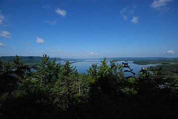
Trempealeau Mountain State Natural Area is located in western Trempealeau County approximately 2 miles (3.2 km) southwest of Trempealeau within Perrot State Park. Access is via the Mississippi and Trempealeau Rivers.
Description
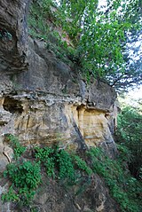
Trempealeau Mountain is mostly wooded, dominated by black and white oak and basswood. In a hollow on the southeast-facing side, red oaks are found mixed with patches of interrupted ferns. On the cooler northeast-facing slopes, sugar maple and basswood dominate. The dry south-facing slopes contain small patches of dry prairie with big blue-stem, needle grass, side-oats grama, hairy grama, white and purple prairie-clover, prairie larkspur, and partridge pea. Numerous Native American mounds, burial sites, and habitation sites make this a rich archeological site. French explorers were among the first Europeans to explore the area and the name Trempealeau comes from the French, “la montagne qui trempe à l’eau” meaning “the mountain whose foot is bathed in water”.
References
- ^ "Trempealeau Mountain State Natural Area". Wisconsin DNR. Retrieved 1 December 2013.
- ^ Trempealeau Mountain State Natural Area (PDF) (Map). Wisconsin Department of Natural Resources. Retrieved 2013-11-29.
External links
- http://dnr.wi.gov/topic/Lands/naturalareas/index.asp?SNA=356 WI DNR
- http://dnr.wi.gov/topic/lands/naturalareas/documents/topomaps/map356.pdf


