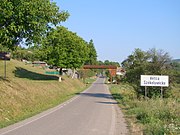
Vețca
Geography
The commune is situated on the Transylvanian Plateau, on the banks of the river Vețca, at an altitude of 379 m (1,243 ft). It is located in the southeastern part of Mureș County, 35 km (22 mi) from the county seat, Târgu Mureș, on the border with Harghita County. Vețca is crossed by county road DJ1134, which joins it to Fântânele, 10 km (6.2 mi) to the north, and to Șoard, 17 km (11 mi) to the southeast.
History
Vețca is part of the Székely Land region of the historical Transylvania province. Until 1918, the village belonged to the Maros-Torda County of the Kingdom of Hungary. After the Hungarian–Romanian War of 1918–19 and the Treaty of Trianon of 1920, it became part of Romania.
Demographics
The commune has an absolute Hungarian majority. According to the 2011 census, it had a population of 892; out of those, 84.9% were Hungarians, 11.0% were Roma, and 1.3% were Romanians. At the 2021 census, Vețca had a population of 753; out of those, 89.24% were Hungarians, 6.77% were Roma, and 2.12% were Romanians.
See also
References
- ^ "Results of the 2020 local elections". Central Electoral Bureau. Retrieved 10 June 2021.
- ^ "Populaţia rezidentă după grupa de vârstă, pe județe și municipii, orașe, comune, la 1 decembrie 2021" (XLS). National Institute of Statistics.
- ^ Tab8. Populația stabilă după etnie – județe, municipii, orașe, comune, 2011 census results, Institutul Național de Statistică, accessed 4 March 2020.
- ^ "Populația rezidentă după grupa de vârstă, pe județe și municipii, orașe, comune, la 1 decembrie 2021" (in Romanian). INSSE. 31 May 2023.


