Vrboec
Geography and location

The village is located in the southeastern lower part of Krushevo Municipality, whose territory borders the area of Krivogastani Municipality. The village is hilly, at an altitude of 640 metres (2,100 ft). The village is 6 kilometres (3.7 mi) away from the city of Krushevo. The village is located at the foot of the Crn Vrv ridge. In the past, there was a well in every yard of the houses. West of the village, the springs of Manastirishte, Leskoo Kladenche, Ezerishte and Milea Cesma sprang up. The places in the area bear the following names: Steže, Ropeš, Opaljenik, Kobel, Radobirka, Klenika, Kalojca, Skršena Vrba, Orlov Dab, Grobishta, Kale, Manastirishte, Čair, Šero Trlo, Cer, Limanova Niva, Alimov Kamen and Spaiski Grobishta. The village has a compact type, divided into two neighborhoods: Dolno and Gorno Maalo. They are further divided into groups of family houses. The neighborhoods are not significantly distant from each other.
History
Traces of antiquity are found in the Kale area, a hill west of Vrboec (945 metres (3,100 ft)). There are remains of a fortress there, around which a forest has grown. However, the locals have no traditions about this fortress. Not far from Kale is the Leskovo Kladenče spring. At the Manastirishte site, about 1,000 metres (3,300 ft) west of the village, there are smaller terraces with meadows and a fountain. There are remains of walls there, and some locals think that the St. Bogorodica monastery was located there. Today, the Church of the Assumption of the Blessed Virgin Mary has been erected there.
In the village itself, the foundations of the demolished church St. Athanasius can be seen. The stone is of different shapes and sizes and was brought from the surrounding area. There are also several pieces of broken marble columns. The church was 12 metres (39 ft) long and 5 metres (16 ft) wide, in an east-west direction. Until the beginning of the 20th century, the walls of the church were clearly visible, but later the Albanian Faik Shuteski used the material from those walls to build his house. Around the churchyard is the village cemetery.
The remains of antiquities and folk tradition say that Vrboec was first a Christian Slavic village. From the first half of the 19th century, Muslim Albanians from Northern Albania began to settle here, who came through Debar. Because of this, in the same century, all Christians left the village. By 1912, when Vrboec was a purely Muslim village, the Albanians had grown to 35 houses. The main Albanian families were: Redzepovci, Ajrovci, Dalipovci, Amedovci, Shutevci, Chakre, Svetotododorci and others. In the period 1912-1926, the Albanians left the village, selling their fields and houses, going to Bitola, Turkey and Albania. Immigrants now live in this village - Vlachs and Macedonians, mostly from the surrounding villages.
Economy
The settlement covers an area of 6.9 square kilometres (2.7 sq mi). It is dominated by arable land, covering an area of 298.8 hectares (738 acres), forests cover 264.8 hectares (654 acres), and pastures cover 103.1 hectares (255 acres). The village is mainly agricultural. There is a shop in the village.
Population
On the Ethnographic Map of Bitola Vilayet from 1901, Vrbovec is listed as a purely Turkish village in the Prilep kaza of the Bitola Sandzak with 42 houses. According to Dimitar Gadzhanov, in 1916 there were 250 Turks in Vrboec. According to a German map published in 1941, based on the 1931 census of the Kingdom of Yugoslavia, the village had 150 Macedonians. Vrboec is a medium-sized village, without major population changes. In 1961, the village had 352 inhabitants, and in 1994 the number decreased to 288 inhabitants, Macedonian population. According to the 2002 census, the village of Vrboec had 256 inhabitants, of whom 255 were Macedonians. According to the last census of 2021, the village had 227 inhabitants, all Macedonians.
Clans
Vrboec is a Macedonian village, and previously Albanian and until recently Vlach clans also lived there.
According to the research of Jovan Trifunoski in 1952, the clans in the village are:
- Vlach clans in the village were: Lega (1 c.), the first village settlers, they moved from Krushevo, they moved to purchased land in 1913, some of their relatives live in Krushevo; Babushka (1 c.), they moved after the First World War also from Krushevo; Brezovci (1 c.), they also moved from Krushevo, they speak Vlach, but they come from a Macedonian ancestor from the Demirhisar/Krushevo village Ostrilci; Grošarovci (1 k.), they also came from Kruševo, they also speak Vlach, however they also descend from a Macedonian ancestor from the now displaced village of Barbaros.
- Macedonian families in the village are: Mitrevci (3 k.), they moved in 1925 from the village of Edinakovci, they moved to Edinakovci from the displaced village of Ljutoica (which was located near the village of Vardino); Mitanovci (2 k.), they moved in 1925 from the village of Ostrilci; Vardinci (5 k.), they moved in 1925 from the village of Vardino, they have relatives there (Stojkovci); Divjakovci (2nd family), immigrated in 1925 from the village of Krusheani, they have relatives who immigrated there from the village of Divjaci (Gorno or Dolno); Anjelevci (5th family), immigrated in 1925 from the village of Krivogastani, where they have relatives of the same name; Birinci (3rd family), immigrated in 1925 from the village of Birino, there they were called Topalovci, more distant origin from a village in Železnik; Boškovci (1st family), immigrated from Ostrilci; Todorovci (2nd family), originally from Presil, from where they fled to Korenica, then to Krivogastani, and finally to the present-day village in 1925; Patlidžanovci (1 c.), originally from the village Slansko, from where they first fled to Krusheani, and finally in 1925 to the present-day village; Bilejca (1 c.), moved from the village Pusta Reka in 1925; Kuzmanovci (2 c.), moved from the village Sveta; Nanevci (1 c.), moved from Varoš; Kolarovci (6 c.), moved from Sveto Mitrani, more distantly originating from the village Vishni near Struga; Rilevci (2 c.), moved in 1926 from the village Arilevo; Gađerovci (1 c.), moved in 1927 from the village Sveto Mitrani, more distant origin from a village in Železnik; Barakovci (3 c.), moved in 1927 from the village Barakovo. There they were called Durtanovci; Zengovci (1 c.), moved in 1930 from the village Selce, they moved there from the village Steblevo; Jovevci (3 c.), moved from the village Birino in 1926. They moved there from Aldanci, where they were called Mrsnakovci; Božinovci (1 c.), moved in 1926 from the village Rakitnica; Neshkovci (1 k.), moved in 1928 from the village Krivogastani, they moved there from Rilevo; Prchkovci (1 k.), moved in 1930 from the village Birino; Zdravevci (1 k.), originally from the village Rastojca, where they came to today's village via Aldanci in 1934; Micevci (1 k.), from the village Zhvan they moved to the village Trnovci, and from there they moved to Vrboec in 1935; Nikolovci (1 k.), moved in 1932 from the village Gorno Divjaci.
Social institutions

- Primary School "Nikola Karev", a regional five-year primary school within the Primary School "Nikola Karev" - Krushevo
- House of Culture
Self-government and politics
In the 19th century, Vrboec was a village in the Prilepska kaza of the Ottoman Empire. In the period 1952-1955, the village was part of the then Municipality of Krivogaštani, which, in addition to the village of Vrboec, also included the villages of Godivje, Korenica, Krivogaštani, Krušeani, Lokveni, Miloševo, Sveto Mitrevi and Tursko. The village was part of the Municipality of Sveto Mitrani in the period 1950-1952, when it included the villages of Vrboec, Miloševo, Presil and Sveto Mitrani. In the period from 1955 to 1996, the village was located within the larger municipality of Kruševo. In the period from 1996-2004, the village belonged to the then Municipality of Krushevo.
The village is part of the Municipality of Krushevo, which was one of the few municipalities in Macedonia that was not changed during the territorial division in 2004.
Polling station
There is a polling station no. 1196 according to the State Election Commission, located in the premises of the primary school. During the presidential elections in 2019, a total of 202 voters were registered at this polling station. During the local elections in 2021, a total of 202 voters were registered at this polling station 209 voters.
Cultural and natural landmarks
- Archaeological sites
- Stari Dol — a settlement and necropolis from late antiquity.
- Churches
- Church "Nativity of the Blessed Virgin Mary" — the main village church; and
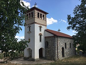
- Church of the Assumption of the Blessed Virgin Mary — a renovated church on the site of Manastirishte.
In the past, the village also had the church St. Athanasius, from which remains of the walls were known until the 20th century.
- Monasteries
- In the past, there was a monastery in the area of Manastirishte, about 1,000 metres (3,300 ft) west of the village.
- Mosques
- While the village was inhabited by the Albanian population, there was a mosque with a minaret in the center of the village, which was demolished after their eviction.
Gallery
-
 Main village church "Nativity of the Virgin Mary"
 -
 Renovated church "Assumption of the Virgin Mary"
 -
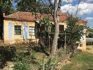 Old house in the village
 -


