Whitesville, Virginia
Whitesville is a census-designated place (CDP) in Accomack County, Virginia, United States. It was first listed as a CDP in 2010. As of the 2020 census, it had a population of 241.
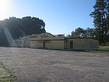
Dream Roller Rink, now abandoned, in Wattsville in 2008
Geography
It rests at an elevation of 30 feet.
Demographics
| Census | Pop. | Note | %± |
|---|---|---|---|
| 2010 | 219 | — | |
| 2020 | 215 | −1.8% | |
| U.S. Decennial Census 2010 2020 | |||
2020 census
| Race / Ethnicity (NH = Non-Hispanic) | Pop 2010 | Pop 2020 | % 2010 | % 2020 |
|---|---|---|---|---|
| White alone (NH) | 47 | 39 | 21.46% | 18.14% |
| Black or African American alone (NH) | 138 | 113 | 63.01% | 52.56% |
| Native American or Alaska Native alone (NH) | 0 | 0 | 0.00% | 0.00% |
| Asian alone (NH) | 5 | 4 | 2.28% | 1.86% |
| Pacific Islander alone (NH) | 4 | 0 | 1.83% | 0.00% |
| Other race alone (NH) | 0 | 2 | 0.00% | 0.93% |
| Mixed race or Multiracial (NH) | 5 | 5 | 2.28% | 2.33% |
| Hispanic or Latino (any race) | 20 | 52 | 9.13% | 24.19% |
| Total | 219 | 215 | 100.00% | 100.00% |
_01.jpg)
References
- ^ "Whitesville Census Designated Place". Geographic Names Information System. United States Geological Survey, United States Department of the Interior.
- ^ "Whitesville CDP, Virginia". United States Census Bureau. Retrieved December 25, 2022.
- ^ "Decennial Census by Decade". US Census Bureau.
- ^ "P2 Hispanic or Latino, and Not Hispanic or Latino by Race – 2010: DEC Redistricting Data (PL 94-171) - Whitesville CDP, Virginia". United States Census Bureau.
- ^ "P2 Hispanic or Latino, and Not Hispanic or Latino by Race – 2020: DEC Redistricting Data (PL 94-171) - Whitesville CDP, Virginia". United States Census Bureau.

This Accomack County, Virginia state location article is a stub. You can help Wikipedia by expanding it. |