Aspen Park, Colorado
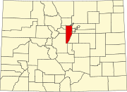
Aspen Park is an unincorporated community and a census-designated place (CDP) located in Jefferson County, Colorado, United States. The CDP is a part of the Denver–Aurora–Lakewood, CO Metropolitan Statistical Area. The population of the Aspen Park CDP was 810 at the United States Census 2020. The Aspen Park Metropolitan District provides services. The Conifer post office (ZIP Code 80433) serves the area.
Geography
Aspen Park is located in southern Jefferson County. U.S. Route 285 passes through the community, leading northeast 25 miles (40 km) to Englewood and southwest 55 miles (89 km) to Fairplay. Downtown Denver is 30 miles (48 km) northeast of Aspen Park. The community sits at the headwaters of South Turkey Creek, and the western edge of the CDP follows the course of North Turkey Creek. The two creeks are part of the South Platte River watershed.
The Aspen Park CDP has an area of 1,595 acres (6.455 km), including 4.2 acres (0.017 km) of water.
Demographics
The United States Census Bureau initially defined the Aspen Park CDP for the United States Census 2000.
| Year | Pop. | ±% |
|---|---|---|
| 2000 | 874 | — |
| 2010 | 882 | +0.9% |
| 2020 | 810 | −8.2% |
| Source: United States Census Bureau | ||
Education
Aspen Park is served by the Jefferson County Public Schools.
See also
- Bibliography of Colorado
- Geography of Colorado
- History of Colorado
- Index of Colorado-related articles
- List of Colorado-related lists
References
- ^ "Colorado Counties". Colorado Department of Local Affairs. Retrieved January 17, 2025.
- ^ "Aspen Park, Colorado". Geographic Names Information System. United States Geological Survey, United States Department of the Interior. Retrieved January 17, 2025.
- ^ "State of Colorado Census Designated Places - BAS20 - Data as of January 1, 2020". United States Census Bureau. Retrieved November 3, 2021.
- ^ United States Census Bureau. "Aspen Park_CDP, Colorado". Retrieved April 15, 2023.
- ^ "Zip Code 80433 Map and Profile". zipdatamaps.com. 2020. Retrieved December 20, 2020.
