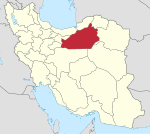
Beyarjomand
Beyarjomand (Persian: بيارجمند) is a city in, and the capital of, Beyarjomand District of Shahrud County, Semnan province, Iran. It was the capital of Beyarjomand Rural District before its capital was transferred to the village of Khan Khvodi.
Demographics
Population
At the time of the 2006 National Census, the city's population was 2,246 in 706 households. The following census in 2011 counted 2,441 people in 734 households. The 2016 census measured the population of the city as 2,528 people in 846 households.
Climate
Beyarjomand has a cold desert climate (BWk).
| Climate data for Biarjamand, Semnan Province, Altitude: 1099.3 M from: 1992-2010 | |||||||||||||
|---|---|---|---|---|---|---|---|---|---|---|---|---|---|
| Month | Jan | Feb | Mar | Apr | May | Jun | Jul | Aug | Sep | Oct | Nov | Dec | Year |
| Mean daily maximum °C (°F) | 7.6 (45.7) |
11.2 (52.2) |
16.7 (62.1) |
23.3 (73.9) |
28.6 (83.5) |
33.5 (92.3) |
35.6 (96.1) |
34.7 (94.5) |
30.7 (87.3) |
24.5 (76.1) |
16.3 (61.3) |
9.6 (49.3) |
22.7 (72.9) |
| Daily mean °C (°F) | 2.2 (36.0) |
5.0 (41.0) |
10.1 (50.2) |
16.5 (61.7) |
21.7 (71.1) |
26.7 (80.1) |
29.3 (84.7) |
28.0 (82.4) |
23.3 (73.9) |
17.0 (62.6) |
9.6 (49.3) |
4.1 (39.4) |
16.1 (61.0) |
| Mean daily minimum °C (°F) | −3.2 (26.2) |
−1.1 (30.0) |
3.4 (38.1) |
9.7 (49.5) |
14.9 (58.8) |
20.0 (68.0) |
22.9 (73.2) |
21.4 (70.5) |
16.0 (60.8) |
9.4 (48.9) |
2.9 (37.2) |
−1.5 (29.3) |
9.6 (49.2) |
| Average precipitation mm (inches) | 15.4 (0.61) |
13.2 (0.52) |
28.2 (1.11) |
23.7 (0.93) |
15.4 (0.61) |
4.3 (0.17) |
0.6 (0.02) |
1.3 (0.05) |
2.0 (0.08) |
3.1 (0.12) |
7.2 (0.28) |
13.1 (0.52) |
127.5 (5.02) |
| Average relative humidity (%) | 66 | 57 | 49 | 43 | 35 | 30 | 30 | 30 | 33 | 39 | 50 | 66 | 44 |
| Source: | |||||||||||||
See also
Notes
References
- ^ OpenStreetMap contributors (7 January 2025). "Beyarjomand, Shahrud County" (Map). OpenStreetMap (in Persian). Retrieved 7 January 2025.
- ^ Census of the Islamic Republic of Iran, 1395 (2016): Semnan Province. amar.org.ir (Report) (in Persian). The Statistical Center of Iran. Archived from the original (Excel) on 17 November 2020. Retrieved 19 December 2022.
- ^ Beyarjomand can be found at GEOnet Names Server, at this link, by opening the Advanced Search box, entering "-3056190" in the "Unique Feature Id" form, and clicking on "Search Database".
- ^ Habibi, Hassan (c. 2024) [Approved 21 June 1369]. Approval of the organization and chain of citizenship of the elements and units of the national divisions of Semnan province, centered in Semnan city. lamtakam.com (Report) (in Persian). Ministry of the Interior, Defense Political Commission of the Government Council. Proposal 3233.1.5.53; Letter 93808-907; Notification 82836/T140K. Archived from the original on 2 January 2024. Retrieved 2 January 2024 – via Lam ta Kam.
- ^ Mousavi, Mirhossein (25 August 1391) [Approvded 4 October 1366]. Creation and establishment of 11 rural districts including villages, farms and places in Shahrud County under Semnan province. rc.majlis.ir (Report) (in Persian). Ministry of the Interior, Board of Ministers. Proposal 53.1.11953; Notification 118522/T956. Archived from the original on 15 November 2012. Retrieved 20 December 2023 – via Islamic Parliament Research Center.
- ^ Habibi, Hassan (c. 2024) [Approved 12 December 1371]. Making reforms in the rural areas of Semnan province. lamtakam.com (Report) (in Persian). Ministry of the Interior, Political-Defense Commission of the Government Board. Proposal 1.4.41.12929. Archived from the original on 7 January 2025. Retrieved 7 January 2025 – via Lam ta Kam.
- ^ Census of the Islamic Republic of Iran, 1385 (2006): Semnan Province. amar.org.ir (Report) (in Persian). The Statistical Center of Iran. Archived from the original (Excel) on 20 September 2011. Retrieved 25 September 2022.
- ^ Census of the Islamic Republic of Iran, 1390 (2011): Semnan Province. irandataportal.syr.edu (Report) (in Persian). The Statistical Center of Iran. Archived from the original (Excel) on 20 January 2023. Retrieved 19 December 2022 – via Iran Data Portal, Syracuse University.
- ^ "آمار 166 ايستگاه سينوپتيك كشور تا پایان سال 2010 میلادی + 37 ایستگاه تا پایان سال 2005". Archived from the original on 17 February 2016. Retrieved 13 February 2016.
