CH Postcode Area
The CH postcode area, also known as the Chester postcode area, is a group of 37 postcode districts in North West England and North East Wales. Together the districts cover west Cheshire, the Wirral part of Merseyside, and east Flintshire. Its thirteen post towns are Bagillt, Birkenhead, Buckley, Chester, Deeside, Ellesmere Port, Flint, Holywell, Mold, Neston, Prenton, Wallasey, and Wirral.
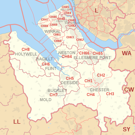
CH postcode area map, showing postcode districts in red and post towns in grey text, with links to nearby CW, L, LL, SY and WA postcode areas.
The postcodes for the Wirral Peninsula were originally covered by the L postcode area, until they were transferred to the CH postcode area in 1999. The postcode numbers were unchanged, for example L41 became CH41.
Coverage
The approximate coverage of the postcode districts:
Map
KML is from Wikidata

See also
Notes
References
- ^ "ONS Postcode Directory Version Notes" (ZIP). National Statistics Postcode Products. Office for National Statistics. May 2020. Table 2. Retrieved 19 June 2020. Coordinates from mean of unit postcode points, "Code-Point Open". OS OpenData. Ordnance Survey. February 2012. Retrieved 21 April 2012.
- ^ Royal Mail, Address Management Guide, (2004)
- ^ "Why we are changing postcodes – Royal Mail". Wirral Globe website. Newsquest Media Group. 18 March 1999. Archived from the original on 7 December 2008. Retrieved 29 May 2009.
- ^ "RM non-geographical postcode list" (PDF).