File:Geographical Distribution Of Extant Slavic And East Baltic Languages 2015.png
https://journals.plos.org/plosone/article?id=10.1371/journal.pone.0135820#sec021
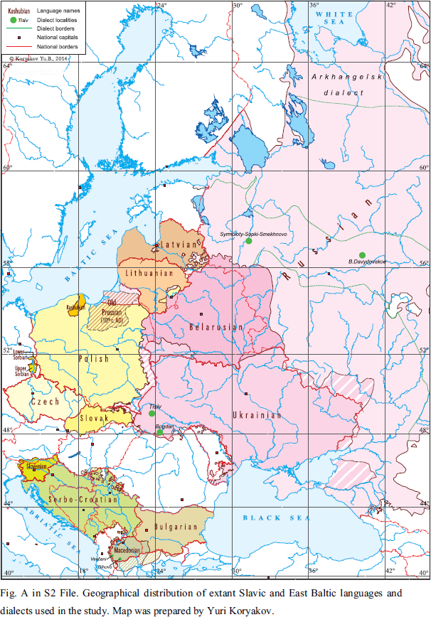
Fig A in S2 File. Geographical distribution of extant Slavic and East Baltic languages and dialects used in the study. Map was prepared by Yuri Koryakov.
Author
Yuri Koryakov
Licensing
This file is licensed under the Creative Commons Attribution 4.0 International license.
- You are free:
- to share – to copy, distribute and transmit the work
- to remix – to adapt the work
- Under the following conditions:
- attribution – You must give appropriate credit, provide a link to the license, and indicate if changes were made. You may do so in any reasonable manner, but not in any way that suggests the licensor endorses you or your use.