Jász-Nagykun-Szolnok County
Geography
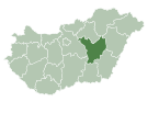
This county has a total area of 5,582 km (2,155 sq mi) – 6.00% of Hungary.
Neighbouring counties
- Heves and Borsod–Abaúj–Zemplén County in the North.
- Hajdú–Bihar and Békés County in the East.
- Csongrád County in the South.
- Bács–Kiskun and Pest County in the West.
Symbols
Coat of arms and flag
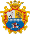
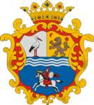
The county's coat of arms was recreated in 1991 from the coats of arms of the former Jászkun periphery, with the crown and frame decoration on it. It consists of the unification of the coat of arms of Jászság, Nagykunság and former Exterior-Szolnok County. The upper part is divided into two equally spaced vertices from top to bottom.
 |
|
The flag is vertically divided into two equal sections (blue and white), with the coat of arms on it, and the county's name embroidered with gold thread under the coat of arms. Its ratio is 2:1. The use of both coat of arms and flag is regulated by the county council.
History
This section is empty. You can help by adding to it. (September 2017) |
Demographics
Religion in Jász-Nagykun-Szolnok County (2022 census – of those who declared their religion (59.4%))
In 2015, it had a population of 379,897 and the population density was 68/km.
| Year | County population | Change |
|---|---|---|
| 1949 | 449,551 | n/a |
| 1960 | 2.62% | |
| 1970 | -5.08% | |
| 1980 | 1.77% | |
| 1990 | -4.50% | |
| 2001 | -2.27% | |
| 2011 | -7.05% | |
| 2015 | -1.76% | |
| 2018 | -2.31% |
Ethnicity
Besides the Hungarian majority, the main minorities are the Roma (approx. 19,000), German and Romanian (500).
Total population (2011 census): 386,594
Ethnic groups (2011 census):
Identified themselves: 344,488 persons:
- Hungarians: 323,293 (93.85%)
- Roma: 18,935 (5.50%)
- Others and indefinable: 2,260 (0.66%)
Approx. 56,000 persons in Jász-Nagykun-Szolnok County did not declare their ethnic group at the 2011 census.
Religion
Religious adherence in the county according to 2011 census:
- Catholic – 124,331 (Roman Catholic – 123,208; Greek Catholic – 1,106);
- Reformed – 42,968;
- Evangelical – 1,127;
- other religions – 4,312;
- Non-religious – 108,247;
- Atheism – 4,651;
- Undeclared – 100,958.
Regional structure

| No. | English and Hungarian names |
Area (km) |
Population (2011) |
Density (pop./km) |
Seat | No. of municipalities |
| 1 | Jászapáti District Jászapáti járás |
544.45 | 33,172 | 61 | Jászapáti | 9 |
| 2 | Jászberény District Jászberényi járás |
617.01 | 51,274 | 83 | Jászberény | 9 |
| 3 | Karcag District Karcagi járás |
857.26 | 43,226 | 50 | Karcag | 5 |
| 4 | Kunhegyes District Kunhegyesi járás |
464.58 | 20,045 | 43 | Kunhegyes | 7 |
| 5 | Kunszentmárton District Kunszentmártoni járás |
576.49 | 36,147 | 63 | Kunszentmárton | 11 |
| 6 | Mezőtúr District Mezőtúri járás |
725.74 | 28,191 | 39 | Mezőtúr | 5 |
| 7 | Szolnok District Szolnoki járás |
914.48 | 118,241 | 129 | Szolnok | 18 |
| 8 | Tiszafüred District Tiszafüredi járás |
417.05 | 19,559 | 47 | Tiszafüred | 7 |
| 9 | Törökszentmiklós District Törökszentmiklósi járás |
464.54 | 36,739 | 79 | Törökszentmiklós | 7 |
| Jász-Nagykun-Szolnok County | 5,581.61 | 386,594 | 69 | Szolnok | 78 | |
|---|---|---|---|---|---|---|
Transport
Road network
As of 2012, Jász–Nagykun–Szolnok County has a dense network of public roads, totalling 1,330 km (830 mi) in length of which 112 km (70 mi) are primary and 283 km (176 mi) are secondary. There are 935 km (581 mi) of county and communal roads and 14 km (8.7 mi) are covered with light road surfaces.
- Highway network
 from Budapest to Nagykereki (Romanian border). (planned)
 from Szolnok to Szentgotthárd (Austrian border). (planned)
 from Kecskemét to Gyula (Romanian border). (under construction)
- Road network

 runs from Budapest to Záhony (Ukrainian border), via Szolnok, Törökszentmiklós and Karcag. – 81 km (50 mi)
 runs from Budapest to Füzesabony, via Jászberény and Jászapáti.
 runs from Szolnok to Hatvan, via Újszász, Jászberény and Jászfényszaru. ~ 74 km (46 mi)
 runs from Füzesabony to Debrecen, via Tiszafüred.
 runs from Tiszafüred to Fegyvernek, via Kunhegyes. ~ 53 km (33 mi)
 old sections of Main road 4.
 runs from Kecskemét to Gyula (Romanian border), via Kunszentmárton and Öcsöd. – 29 km (18 mi)
 runs from Kunszentmárton to Hódmezővásárhely. – 10 km (6.2 mi)
 runs from Törökszentmiklós to Mezőberény, via Mezőtúr. – 33 km (21 mi)
- 402 runs from Szolnok-center to Main road 4.
 runs from Szolnok to Kunszentmárton, via Martfű. – 43 km (27 mi)
Rail network
Rail lines in the county cover 503 km (313 mi) of route. 35% are double track, and over 45% (243 km, 151 mi) are electrified.
Politics

County Assembly
The county is governed by the County board of supervisors, which is located in the county seat. The Jász-Nagykun-Szolnok County Council, elected at the 2024 local government elections, is made up of 18 counselors, with the following party composition:
| Party | Seats | Current County Assembly | |||||||||||
|---|---|---|---|---|---|---|---|---|---|---|---|---|---|
| Fidesz–KDNP | 11 | ||||||||||||
| Our Homeland Movement | 3 | ||||||||||||
| Democratic Coalition | 2 | ||||||||||||
| Momentum Movement | 1 | ||||||||||||
| Jobbik | 1 | ||||||||||||
Presidents of the County Assembly
| List of presidents since 1990 | |
|---|---|
| Lajos Boros (MDF) | 1990–1994 |
| Imre Iváncsik (MSZP) | 1994–1998 |
| Lajos Búsi (Fidesz) | 1998–2002 |
| István Tokár (MSZP) | 2002–2006 |
| Andor Fejér (Fidesz–KDNP) | 2006–2010 |
| Sándor Kovács (Fidesz-KDNP) | 2010–2019 |
| Imre Hubai (Fidesz–KDNP) | 2019– |
Members of the National Assembly
The following members elected of the National Assembly during the 2022 parliamentary election:
Municipalities
Jász–Nagykun–Szolnok County has 1 urban county, 21 towns, 4 large villages and 52 villages.
- City with county rights
(ordered by population, as of 2011 census)
 Szolnok (72,953) – county seat
- Towns
 Jászberény (27,087)
 Törökszentmiklós (21,071)
 Karcag (20,632)
 Mezőtúr (17,510)
 Kisújszállás (11,397)
 Tiszafüred (11,382)
 Tiszaföldvár (11,129)
 Jászapáti (8,889)
 Túrkeve (8,878)
 Kunszentmárton (8,714)
 Jászárokszállás (7,929)
 Kunhegyes (7,704)
 Martfű (6,535)
 Fegyvernek (6,507)
 Újszász (6,321)
 Jászfényszaru (5,680)
 Jászkisér (5,467)
 Rákóczifalva (5,434)
 Kenderes (4,809)
 Abádszalók (4,180)
 Besenyszög (3,339)
- Large villages
- Villages
- Alattyán
- Berekfürdő
- Csataszög
- Csépa
- Cserkeszőlő
- Fegyvernek
- Hunyadfalva
- Jánoshida
- Jászágó
- Jászalsószentgyörgy
- Jászboldogháza
- Jászdózsa
- Jászfelsőszentgyörgy
- Jászivány
- Jászjákóhalma
- Jászszentandrás
- Jásztelek
- Kengyel
- Kétpó
- Kőtelek
- Kuncsorba
- Mesterszállás
- Mezőhék
- Nagyiván
- Nagykörű
- Nagyrév
- Örményes
- Pusztamonostor
- Rákócziújfalu
- Szajol
- Szászberek
- Szelevény
- Tiszabő
- Tiszabura
- Tiszaderzs
- Tiszagyenda
- Tiszaigar
- Tiszainoka
- Tiszajenő
- Tiszakürt
- Tiszaörs
- Tiszapüspöki
- Tiszaroff
- Tiszasas
- Tiszasüly
- Tiszaszentimre
- Tiszaszőlős
- Tiszatenyő
- Tiszavárkony
- Tomajmonostora
- Tószeg
- Vezseny
- Zagyvarékas
Gallery
-
Szolnok Gallery (former synagogue) in Szolnok
-
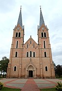
Holy Trinity Church in Törökszentmiklós
-
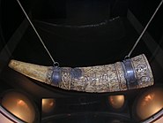
Horn of Lehel in Jászberény
-
Chapel in Kunhegyes
-
Windmill Hill in Kengyel
-
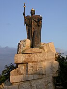
Statue of Stephen I of Hungary in Martfű
-
River Tisza near Tiszapüspöki
Notable people
Many famous people have been born or lived in present-day Jász–Nagykun–Szolnok County:
- Statesman: Miklós Horthy
- Politicians: János Tóth, István Antal, Sándor Fazekas, Mihály Varga
- Writers, poets and playwrights: Ferenc Verseghy, István Csukás
- Musicians Classical: Déryné Róza Széppataki, Zoltán Jeney, Zoltán Mága. Other: Pál Kalmár, Ferenc Molnár "Caramel"
- Scientists: Gábor Szegő, Kalman Laki, Albert Kónya, József Hámori, Avram Hershko
- Sportspeople: Aladár Gerevich, Bertalan Papp, Gábor Benedek, Tibor Csík, Pál B. Nagy, Géza Csapó
- Actors, entertainers and film directors: Alexander Korda, Zoltan Korda, Vincent Korda, János Görbe, Gyula Szabó, Eszter Tamási
- Militarian: Lajos Czinege
- Businessman: Sándor Csányi
- Others: Gyula Németh, István Sándor
International relations

Jász-Nagykun-Szolnok County has a partnership relationship with:
|
|
See also
- Cumans – the ancient nomadic warriors after whom the county is named
References
- ^ nepesseg.com, population data of Hungarian settlements
- ^ Regions and Cities > Regional Statistics > Regional Economy > Regional GDP per Capita, OECD.Stats. Accessed on 16 November 2018.
- ^ magyarcimerek.hu, "Coat of arms of Jász-Nagykun-Szolnok County"
- ^ Jász-Nagykun-Szolnok Megye lobogója (in Hungarian)
- ^ népesség.com, "Jász-Nagykun-Szolnok megye népessége 1870–2015"
- ^ 1.1.6. A népesség anyanyelv, nemzetiség és nemek szerint – Frissítve: 2013.04.17.; Hungarian Central Statistical Office (in Hungarian)
- ^ 2011. ÉVI NÉPSZÁMLÁLÁS, 3. Területi adatok, 3.11 Jász-Nagykun-Szolnok megye, (in Hungarian) [1]
- ^ "Tájékoztató JÁSZ-NAGYKUN-SZOLNOK MEGYE állami közúthálózatának állapotáról és fejlesztlési lehetőségeiről" (PDF) (in Hungarian).
{{cite journal}}: Cite journal requires|journal=(help) - ^ "Nemzeti Választási Iroda - Helyi önkormányzati választások". vtr.valasztas.hu (in Hungarian). Retrieved 2024-10-26.
- ^ "Megyei közgyűlés tagjai 2019–2024 (Jász-Nagykun-Szolnok megye)". valasztas.hu. Retrieved 2019-10-28.
- ^ Önkormányzati választások eredményei (in Hungarian)
- ^ "Jász-Nagykun-Szolnok megye parlamenti képviselői (Parlamenti Információs Rendszer 2022–)" (in Hungarian). Hungarian National Assembly.
- ^ A testvérmegyék rövid bemutatása (Jász-Nagykun-Szolnok megye)
External links
- Official site in Hungarian, English, German and French
- Új-Néplap (szoljon.hu) – The county portal
- Hungary at GeoHive

