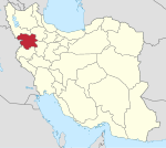
Marivan
Demographics
Language
The city is populated by ethnic Kurds and the people of Marivan speak Kurdish.
The linguistic composition of the city:
Population
At the time of the 2006 National Census, the city's population was 91,664 in 22,440 households. The following census in 2011 counted 110,464 people in 29,743 households. The 2016 census measured the population of the city as 136,654 people in 39,368 households.
Climate
| Climate data for Marivan | |||||||||||||
|---|---|---|---|---|---|---|---|---|---|---|---|---|---|
| Month | Jan | Feb | Mar | Apr | May | Jun | Jul | Aug | Sep | Oct | Nov | Dec | Year |
| Mean daily maximum °C (°F) | 5.3 (41.5) |
7.2 (45.0) |
13.6 (56.5) |
17.6 (63.7) |
25.2 (77.4) |
31.7 (89.1) |
36.2 (97.2) |
35.7 (96.3) |
31.2 (88.2) |
24.5 (76.1) |
16.0 (60.8) |
8.4 (47.1) |
21.1 (69.9) |
| Mean daily minimum °C (°F) | −4.5 (23.9) |
−3.2 (26.2) |
2.2 (36.0) |
5.8 (42.4) |
10.2 (50.4) |
14.2 (57.6) |
18.4 (65.1) |
17.9 (64.2) |
12.9 (55.2) |
8.0 (46.4) |
2.8 (37.0) |
−2.0 (28.4) |
6.9 (44.4) |
| Average precipitation mm (inches) | 172 (6.8) |
159 (6.3) |
160 (6.3) |
106 (4.2) |
45 (1.8) |
0 (0) |
0 (0) |
0 (0) |
0 (0) |
27 (1.1) |
88 (3.5) |
121 (4.8) |
878 (34.8) |
| Source: Climate-Data.org | |||||||||||||
Archaeology
The archaeological site of Tepe Qaleh Naneh is located in the Marivan plain near the city of Marivan. It is a large site that extends to the south and around the modern city.
Lake Zaribar is roughly at the centre of the Marivan plain. The settlement of Qaleh Naneh goes back to the Late Chalcolithic period. During that time, this already became a complex society, and had extensive cultural and commercial links with the neighbouring regions.
A joint Italo-Iranian project, ‘Qaleh Naneh: Text Excavations and Survey in the Marivan Valley’ (QaNaTES), is now conducting the scientific investigations in this region of Marivan. It is focusing on the area of the Lake Zarībār and the valley of Marivan, and their development during the Bronze and Iron Ages (ca. 3000-600 BCE).
The region of Qaleh Naneh is mentioned in cuneiform texts from the time of Amar-Sin (c. 2046–2037 BC), the third ruler of the Ur III Dynasty. A series of ancient place-names is known, that referred to journeys along the mountain roads between Qaleh Naneh area and the Tanjero river valley in Iraq.
So this area has long time cultural and trade connections to the Diyala valley in Iraq. Especially the area around the modern Iraqi city of Halabja is relevant. That's where the Tanjero river joins Sirwan river and together they form the Diyala valley. Traditionally, the Diyala valley provided an important trade route between Iran and Iraq.
At the time of Ashurnasirpal II (883-859 BC), the plain of Marivan belonged to 'the region of Zamua', that was probably politically autonomous.
Some ancient texts also refer to 'a sea of Zamua'. There has been considerable confusion in past scholarship about this location. Although Assyriologist Adolf Billerbeck (1834-1908) identified it with Lake Zaribar as early as 1898, other scholars also preferred to identify it with the much bigger Lake Urmia, that is also located in Iran, but a very considerable distance (about 250km) directly to the north of Zaribar.
See also
Notes
References
- ^ OpenStreetMap contributors (28 December 2024). "Marivan, Marivan County" (Map). OpenStreetMap (in Persian). Retrieved 28 December 2024.
- ^ Census of the Islamic Republic of Iran, 1395 (2016): Kurdistan Province. amar.org.ir (Report) (in Persian). The Statistical Center of Iran. Archived from the original (Excel) on 8 May 2022. Retrieved 19 December 2022.
- ^ Marivan can be found at GEOnet Names Server, at this link, by opening the Advanced Search box, entering "-3074138" in the "Unique Feature Id" form, and clicking on "Search Database".
- ^ Habibi, Hassan (2 November 2017) [Approved 21 June 1369]. Approval of the organization and chain of citizenship of the elements and units of the national divisions of Kurdistan province, centered in the city of Sanandaj. rc.majlis.ir (Report) (in Persian). Ministry of the Interior, Defense Political Commission of the Government Board. Proposal 3233.1.5.53; Letter 907-93808; Notification 83352/T130K. Archived from the original on 23 October 2018. Retrieved 22 January 2024 – via Islamic Parliament Research Center of the Islamic Republic of Iran.
- ^ Barani Zaghe, Nariman; Mehri, Azar; Jalaie, Shohreh; Moradi, Ronak (10 March 2019). "Cognate Status on Kurdish–Persian Bilingual Individuals' Ability to Retrieve Cognate and Non–Cognate Verbs". Middle Eastern Journal of Disability Studies. 9: 24.
- ^ "Language distribution: Kordestan Province". Iran Atlas. Retrieved 26 September 2021.
- ^ Census of the Islamic Republic of Iran, 1385 (2006): Kurdistan Province. amar.org.ir (Report) (in Persian). The Statistical Center of Iran. Archived from the original (Excel) on 20 September 2011. Retrieved 25 September 2022.
- ^ Census of the Islamic Republic of Iran, 1390 (2011): Kurdistan Province. irandataportal.syr.edu (Report) (in Persian). The Statistical Center of Iran. Archived from the original (Excel) on 19 January 2023. Retrieved 19 December 2022 – via Iran Data Portal, Syracuse University.
- ^ "Climate: Marivan". Retrieved 14 April 2020.
- ^ Binandeh, A., Di Paolo, S. 2023, A Recent Archaeological Project in the Iranian Kurdistan. Iranian Scientific Archaeological Association.
- ^ QaNaTES project website
- ^ QaNaTES: historical background
- ^ QaNaTES: historical background
- ^ D.T. Potts 2022, Adolf Billerbeck: A Contribution to the Biography of a Forgotten Soldier and Scholar. Archiv für Orientforschung 55: 117-135
- ^ QaNaTES: historical background
External links
