North-America
North America covers an area of about 24,709,000 square kilometres (9,540,000 square miles), representing approximately 16.5% of the Earth's land area and 4.8% of its total surface area. It is the third-largest continent by size after Asia and Africa, and the fourth-largest continent by population after Asia, Africa, and Europe. As of 2021, North America's population was estimated as over 592 million people in 23 independent states, or about 7.5% of the world's population. In human geography, the terms "North America" and "North American" can refer to Canada, the United States, Mexico, and Greenland or, alternatively, Canada, Greenland and the US (Mexico being classified as part of Latin America) or simply Canada and the US (Greenland being classified as either Arctic or European (due to its political status as a part of Denmark) and Mexico classified as Latin American).
It is unknown with certainty how and when first human populations first reached North America. People were known to live in the Americas at least 20,000 years ago, but various evidence points to possibly earlier dates. The Paleo-Indian period in North America followed the Last Glacial Period, and lasted until about 10,000 years ago when the Archaic period began. The classic stage followed the Archaic period, and lasted from approximately the 6th to 13th centuries. Beginning in 1000 AD, the Norse were the first Europeans to begin exploring and ultimately colonizing areas of North America.
In 1492, the exploratory voyages of Christopher Columbus led to a transatlantic exchange, including migrations of European settlers during the Age of Discovery and the early modern period. Present-day cultural and ethnic patterns reflect interactions between European colonists, indigenous peoples, enslaved Africans, immigrants from Europe, Asia, and descendants of these respective groups.
Europe's colonization in North America led to most North Americans speaking European languages, such as English, Spanish, and French, and the cultures of the region commonly reflect Western traditions. However, relatively small parts of North America in Canada, the United States, Mexico, and Central America have indigenous populations that continue adhering to their respective pre-European colonial cultural and linguistic traditions.
Name


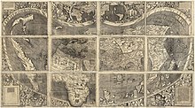
The Americas were named after the Italian explorer Amerigo Vespucci by German cartographers Martin Waldseemüller and Matthias Ringmann. Vespucci explored South America between 1497 and 1502, and was the first European to suggest that the Americas represented a landmass then unknown to the Europeans. In 1507, Waldseemüller published a world map, and placed the word "America" on the continent of present-day South America. The continent north of present-day Mexico was then referred to as Parias. On a 1553 world map published by Petrus Apianus, North America was called "Baccalearum", meaning "realm of the Cod fish", in reference to the abundance of cod on the East Coast.
Waldseemüller used the Latinized version of Vespucci's name, Americus Vespucius, in its feminine form of "America", following the examples of "Europa", "Asia", and "Africa". Americus originated from Medieval Latin Emericus (see Saint Emeric of Hungary), coming from the Old High German name Emmerich. Map makers later extended the name America to North America.
In 1538, Gerardus Mercator used the term America on his world map of the entire Western Hemisphere. On his subsequent 1569 map, Mercator called North America "America or New India" (America sive India Nova).
The Spanish Empire called its territories in North and South America "Las Indias", and the name given to the state body that oversaw the region was called the Council of the Indies.
Definitions

The United Nations and its statistics division recognize North America as including three regions: Northern America, Central America, and the Caribbean. "Northern America" is a term distinct from "North America", excluding Central America, which itself may or may not include Mexico. In the limited context of regional trade agreements, the term is used to reference three nations: Canada, the United States, and Mexico.
France, Italy, Portugal, Spain, Romania, Greece, and the countries of Latin America use a six-continent model, with the Americas viewed as a single continent and North America designating a subcontinent comprising Canada, the United States, Mexico, and Saint Pierre and Miquelon (politically part of France), and often Greenland and Bermuda.
North America has historically been known by other names, including Spanish North America, New Spain, and América Septentrional, the first official name given to Mexico.
Regions
North America includes several regions and subregions, each of which have their own respective cultural, economic, and geographic regions. Economic regions include several regions formalized in 20th- and 21st-century trade agreements, including NAFTA between Canada, Mexico, and the United States, and CAFTA between Central America, the Dominican Republic, and the United States.
North America is divided linguistically and culturally into two primary regions, Anglo-America and Latin America. Anglo-America includes most of North America, Belize, and Caribbean islands with English-speaking populations. There are also regions, including Louisiana and Quebec, with large Francophone populations; in Quebec, French is the official language..
The southern portion of North America includes Central America and non-English-speaking Caribbean nations. The north of the continent maintains recognized regions as well. In contrast to the common definition of North America, which encompasses the whole North American continent, the term "North America" is sometimes used more narrowly to refer only to four nations, Canada, Greenland, Mexico, and the U.S. The U.S. Census Bureau includes Saint Pierre and Miquelon, but excludes Mexico from its definition.
The term Northern America refers to the northernmost countries and territories of North America: the U.S., Bermuda, Canada, Greenland, and St. Pierre and Miquelon. Although the term does not refer to a unified region, Middle America includes Mexico, Central America, and the Caribbean.
North America's largest countries by land area are Canada and the U.S., both of which have well-defined and recognized subregions. In Canada, these include (from east to west) Atlantic Canada, Central Canada, the Canadian Prairies, the British Columbia Coast, Western Canada, and Northern Canada. In the U.S., they include New England, the Mid-Atlantic, and the South Atlantic, East North Central, West North Central, East South Central, West South Central, Mountain, and Pacific states. The Great Lakes region and the Pacific Northwest include areas in both the U.S. and Canada.
Countries, dependencies, and other territories
| Arms | Flag | Country / Territory | Area | Population (2021) |
Population density |
Capital | Name(s) in official language(s) | ISO 3166-1 |
|---|---|---|---|---|---|---|---|---|
| Anguilla (United Kingdom) |
91 km (35 sq mi) |
15,753 | 164.8/km (427/sq mi) |
The Valley | Anguilla | AIA | ||
| Antigua and Barbuda | 442 km (171 sq mi) |
93,219 | 199.1/km (516/sq mi) |
St. John's | Antigua and Barbuda | ATG | ||
| Aruba (Kingdom of the Netherlands) |
180 km (69 sq mi) |
106,537 | 594.4/km (1,539/sq mi) |
Oranjestad | Aruba | ABW | ||
| The Bahamas | 13,943 km (5,383 sq mi) |
407,906 | 24.5/km (63/sq mi) |
Nassau | Bahamas | BHS | ||
| Barbados | 430 km (170 sq mi) |
281,200 | 595.3/km (1,542/sq mi) |
Bridgetown | Barbados | BRB | ||
| Belize | 22,966 km (8,867 sq mi) |
400,031 | 13.4/km (35/sq mi) |
Belmopan | Belize | BLZ | ||
| Bermuda (United Kingdom) |
54 km (21 sq mi) |
64,185 | 1,203.7/km (3,118/sq mi) |
Hamilton | Bermuda | BMU | ||
| Bonaire (Kingdom of the Netherlands) |
294 km (114 sq mi) |
12,093 | 41.1/km (106/sq mi) |
Kralendijk | Boneiru | BES | ||
| British Virgin Islands (United Kingdom) |
151 km (58 sq mi) |
31,122 | 152.3/km (394/sq mi) |
Road Town | British Virgin Islands | VGB | ||
| Canada | 9,984,670 km (3,855,100 sq mi) |
38,155,012 | 3.7/km (9.6/sq mi) |
Ottawa | Canada | CAN | ||
| Cayman Islands (United Kingdom) |
264 km (102 sq mi) |
68,136 | 212.1/km (549/sq mi) |
George Town | Cayman Islands | CYM | ||
| Clipperton Island (France) | 6 km (2.3 sq mi) |
0 | 0/km (0/sq mi) |
— | Île de Clipperton | CPT | ||
| Costa Rica | 51,100 km (19,700 sq mi) |
5,153,957 | 89.6/km (232/sq mi) |
San José | Costa Rica | CRI | ||
| Cuba | 109,886 km (42,427 sq mi) |
11,256,372 | 102.0/km (264/sq mi) |
Havana | Cuba | CUB | ||
| Curaçao (Kingdom of the Netherlands) |
444 km (171 sq mi) |
190,338 | 317.1/km (821/sq mi) |
Willemstad | Curaçao (Dutch); Kòrsou (Papiamento) | CUW | ||
| Dominica | 751 km (290 sq mi) |
72,412 | 89.2/km (231/sq mi) |
Roseau | Dominica | DMA | ||
| Dominican Republic | 48,671 km (18,792 sq mi) |
11,117,873 | 207.3/km (537/sq mi) |
Santo Domingo | República Dominicana | DOM | ||
| El Salvador | 21,041 km (8,124 sq mi) |
6,314,167 | 293.0/km (759/sq mi) |
San Salvador | El Salvador | SLV | ||
| Federal Dependencies of Venezuela (Venezuela) |
342 km (132 sq mi) |
2,155 | 6.3/km (16/sq mi) |
Gran Roque | Dependencias Federales de Venezuela | VEN-W | ||
| Greenland (Kingdom of Denmark) |
2,166,086 km (836,330 sq mi) |
56,243 | 0.026/km (0.067/sq mi) |
Nuuk | Kalaallit Nunaat (Greenlandic); Grønland (Danish) | GRL | ||
| Grenada | 344 km (133 sq mi) |
124,610 | 302.3/km (783/sq mi) |
St. George's | Gwenad | GRD | ||
| Guadeloupe (France) |
1,628 km (629 sq mi) |
396,051 | 246.7/km (639/sq mi) |
Basse-Terre | Gwadloup | GLP | ||
| Guatemala | 108,889 km (42,042 sq mi) |
17,608,483 | 128.8/km (334/sq mi) |
Guatemala City | Guatemala | GTM | ||
| Haiti | 27,750 km (10,710 sq mi) |
11,447,569 | 361.5/km (936/sq mi) |
Port-au-Prince | Ayiti/Haïti | HTI | ||
| Honduras | 112,492 km (43,433 sq mi) |
10,278,345 | 66.4/km (172/sq mi) |
Tegucigalpa | Honduras | HND | ||
| Jamaica | 10,991 km (4,244 sq mi) |
2,827,695 | 247.4/km (641/sq mi) |
Kingston | Jumieka | JAM | ||
| Martinique (France) |
1,128 km (436 sq mi) |
368,796 | 352.6/km (913/sq mi) |
Fort-de-France | Martinique (French); Matinik (Martinican Creole) | MTQ | ||
| Mexico | 1,964,375 km (758,449 sq mi) |
126,705,138 | 57.1/km (148/sq mi) |
Mexico City | México | MEX | ||
| Montserrat (United Kingdom) |
102 km (39 sq mi) |
4,417 | 58.8/km (152/sq mi) |
Plymouth, Brades |
Montserrat | MSR | ||
| Nicaragua | 130,373 km (50,337 sq mi) |
6,850,540 | 44.1/km (114/sq mi) |
Managua | Nicaragua | NIC | ||
| Nueva Esparta (Venezuela) |
1,151 km (444 sq mi) |
491,610 | 427.1/km (1,106/sq mi) |
La Asunción | Nueva Esparta | VEN-O | ||
| Panama | 75,417 km (29,119 sq mi) |
4,351,267 | 45.8/km (119/sq mi) |
Panama City | Panamá | PAN | ||
| Puerto Rico (United States) |
8,870 km (3,420 sq mi) |
3,256,028 | 448.9/km (1,163/sq mi) |
San Juan | Puerto Rico | PRI | ||
| Saba (Kingdom of the Netherlands) |
13 km (5 sq mi) |
1,537 | 118.2/km (306/sq mi) |
The Bottom | Saba | BES | ||
| San Andrés and Providencia (Colombia) |
53 km (20 sq mi) |
77,701 | 1,468.59/km (3,803.6/sq mi) |
San Andrés | San Andrés | COL-SAP | ||
| Saint Barthélemy (France) |
21 km (8.1 sq mi) |
7,448 | 354.7/km (919/sq mi) |
Gustavia | Saint-Barthélemy | BLM | ||
| Saint Kitts and Nevis | 261 km (101 sq mi) |
47,606 | 199.2/km (516/sq mi) |
Basseterre | Saint Kitts and Nevis | KNA | ||
| Saint Lucia | 539 km (208 sq mi) |
179,651 | 319.1/km (826/sq mi) |
Castries | Sainte-Lucie | LCA | ||
| Saint Martin (France) |
54 km (21 sq mi) |
29,820 | 552.2/km (1,430/sq mi) |
Marigot | Saint-Martin | MAF | ||
| Saint Pierre and Miquelon (France) |
242 km (93 sq mi) |
5,883 | 24.8/km (64/sq mi) |
Saint-Pierre | Saint-Pierre-et-Miquelon | SPM | ||
| Saint Vincent and the Grenadines | 389 km (150 sq mi) |
104,332 | 280.2/km (726/sq mi) |
Kingstown | Saint Vincent and the Grenadines | VCT | ||
| Sint Eustatius (Kingdom of the Netherlands) |
21 km (8.1 sq mi) |
2,739 | 130.4/km (338/sq mi) |
Oranjestad | Sint Eustatius | BES | ||
| Sint Maarten (Kingdom of the Netherlands) |
34 km (13 sq mi) |
44,042 | 1,176.7/km (3,048/sq mi) |
Philipsburg | Sint Maarten | SXM | ||
| Trinidad and Tobago | 5,130 km (1,980 sq mi) |
1,525,663 | 261.0/km (676/sq mi) |
Port of Spain | Trinidad and Tobago | TTO | ||
| Turks and Caicos Islands (United Kingdom) |
948 km (366 sq mi) |
45,114 | 34.8/km (90/sq mi) |
Grand Turk (Cockburn Town) | Turks and Caicos Islands | TCA | ||
| United States | 9,629,091 km (3,717,813 sq mi) |
336,997,624 | 32.7/km (85/sq mi) |
Washington, D.C. | United States of America | USA | ||
| United States Virgin Islands (United States) |
347 km (134 sq mi) |
100,091 | 317.0/km (821/sq mi) |
Charlotte Amalie | US Virgin Islands | VIR | ||
| Total | 24,500,995 km (9,459,887 sq mi) |
583,473,912 | 22.1/km (57/sq mi) |
|||||
Geography


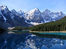

North America occupies the northern portion of the landmass generally referred to as the New World, the Western Hemisphere, the Americas, or simply America, which, in many countries, is considered a single continent with North America a subcontinent. North America is the third-largest continent by area after Asia and Africa.
North America's only land connection to South America is in present-day Panama at the Darien Gap on the Colombia–Panama border, placing almost all of Panama within North America. Alternatively, some geologists physiographically locate its southern limit at the Isthmus of Tehuantepec, Mexico, with Central America extending southeastward to South America from this point. The Caribbean islands, or West Indies, are considered part of North America. The continental coastline is long and irregular. The Gulf of Mexico is the largest body of water indenting the continent, followed by Hudson Bay. Others include the Gulf of Saint Lawrence and the Gulf of California.
Before the Central American isthmus formed, the region had been underwater. The islands of the West Indies delineate a submerged former land bridge, which had connected North and South America via what are now Florida and Venezuela.
There are several islands off the continent's coasts; principally, the Arctic Archipelago, the Bahamas, Turks and Caicos, the Greater and Lesser Antilles, the Aleutian Islands (some of which are in the Eastern Hemisphere proper), the Alexander Archipelago, the many thousand islands of the British Columbia Coast, and Newfoundland. Greenland, a self-governing Danish island, and the world's largest, is on the same tectonic plate (the North American Plate) and is part of North America geographically. In a geologic sense, Bermuda is not part of the Americas, but an oceanic island that was formed on the fissure of the Mid-Atlantic Ridge over 100 million years ago (mya). The nearest landmass to it is Cape Hatteras, North Carolina. However, Bermuda is often thought of as part of North America, especially given its historical, political and cultural ties to Virginia and other parts of the continent.
The vast majority of North America is on the North American Plate. Parts of western Mexico, including Baja California, and of California, including the cities of San Diego, Los Angeles, and Santa Cruz, lie on the eastern edge of the Pacific Plate, with the two plates meeting along the San Andreas Fault. The southernmost portion of the continent and much of the West Indies lie on the Caribbean Plate, whereas the Juan de Fuca Plate and Cocos Plate border the North American Plate on its western frontier.
The continent can be divided into four great regions (each of which contains many subregions): the Great Plains stretching from the Gulf of Mexico to the Canadian Arctic; the geologically young, mountainous west, including the Rocky Mountains, the Great Basin, California, and Alaska; the raised but relatively flat plateau of the Canadian Shield in the northeast; and the varied eastern region, which includes the Appalachian Mountains, the coastal plain along the Atlantic seaboard, and the Florida peninsula. Mexico, with its long plateaus and cordilleras, falls largely in the western region, although the eastern coastal plain does extend south along the Gulf.
The western mountains are split in the middle into the main range of the Rockies and the coast ranges in California, Oregon, Washington, and British Columbia, with the Great Basin—a lower area containing smaller ranges and low-lying deserts—in between. The highest peak is Denali in Alaska.
The U.S. Geographical Survey (USGS) states that the geographic center of North America is "6 miles [10 km] west of Balta, Pierce County, North Dakota" at about 48°10′N 100°10′W / 48.167°N 100.167°W, about 24 kilometres (15 mi) from Rugby, North Dakota. The USGS further states that "No marked or monumented point has been established by any government agency as the geographic center of either the 50 states, the conterminous United States, or the North American continent." Nonetheless, there is a 4.6-metre (15 ft) field stone obelisk in Rugby claiming to mark the center. The North American continental pole of inaccessibility is located 1,650 km (1,030 mi) from the nearest coastline, between Allen and Kyle, South Dakota at 43°22′N 101°58′W / 43.36°N 101.97°W.
Canada
Canada can be divided into roughly seven physiographic divisions:
- The Canadian Shield
- The interior plains
- The Great Lakes-St. Lawrence Lowlands
- The Appalachian region
- The Western Cordillera
- Hudson Bay Lowlands
- Arctic Archipelago
United States
The lower 48 U.S. states can be divided into roughly eight physiographic divisions:
- The Intermontane Plateaus
- The Laurentian Upland, part of the Canadian Shield Northern portion of the upper midwestern U.S.
- The Interior Plains
- The Atlantic Plain
- The Appalachian highlands
- The Interior highlands
- The Rocky Mountain system
- The Pacific Mountain system
Mexico
Mexico can be divided into roughly fifteen physiographic divisions:
- The Baja California Peninsula
- The Sonoran Basin and Range
- The Western Sierra Madre
- The Northern Mountains and Plains
- The Eastern Sierra Madre
- The Great Plain
- The Pacific Coastal Plain
- The Northern Gulf Coast Plain
- The Central Plateau
- The Volcanic Axis
- The Southern Sierra Madre
- The Southern Gulf Coast Plain
- The Chiapas Sierra Madre
- The Chiapas Highlands
- The Yucatán Peninsula
Climate

North America is a very large continent that extends from north of the Arctic Circle to south of the Tropic of Cancer. Greenland, along with the Canadian Shield, is tundra with average temperatures ranging from 10 to 20 °C (50 to 68 °F), but central Greenland is composed of a very large ice sheet. This tundra radiates throughout Canada, but its border ends near the Rocky Mountains (but still contains Alaska) and at the end of the Canadian Shield, near the Great Lakes. Climate west of the Cascade Range is described as being temperate weather with average precipitation 20 inches (510 millimetres). Climate in coastal California is described to be Mediterranean, with average temperatures in cities like San Francisco ranging from 57 to 70 °F (14 to 21 °C) over the course of the year.
Stretching from the East Coast to eastern North Dakota, and stretching down to Kansas, is the humid continental climate featuring intense seasons, with a large amount of annual precipitation, with places like New York City averaging 50 in (1,300 mm). Starting at the southern border of the humid continental climate and stretching to the Gulf of Mexico (while encompassing the eastern half of Texas) is the humid subtropical climate. This area has the wettest cities in the contiguous U.S., with annual precipitation reaching 67 in (1,700 mm) in Mobile, Alabama. Stretching from the borders of the humid continental and subtropical climates, and going west to the Sierra Nevada, south to the southern tip of Durango, north to the border with tundra climate, the steppe/desert climates are the driest in the U.S. Highland climates cut from north to south of the continent, where subtropical or temperate climates occur just below the tropics, as in central Mexico and Guatemala. Tropical climates appear in the island regions and in the subcontinent's bottleneck, found in countries and states bathed by the Caribbean Sea or to the south of the Gulf of Mexico and the Pacific Ocean. Precipitation patterns vary across the region, and as such rainforest, monsoon, and savanna types can be found, with rains and high temperatures throughout the year.
Ecology

Notable North American fauna include the bison, black bear, jaguar, cougar, prairie dog, turkey, pronghorn, raccoon, coyote, and monarch butterfly. Notable plants that were domesticated in North America include tobacco, maize, squash, tomato, sunflower, blueberry, avocado, cotton, chile pepper, and vanilla.
Geology
Geologic history
Laurentia is an ancient craton which forms the geologic core of North America; it formed between 1.5 and 1.0 billion years ago during the Proterozoic eon. The Canadian Shield is the largest exposure of this craton. From the Late Paleozoic to Early Mesozoic eras, North America was joined with the other modern-day continents as part of the supercontinent Pangaea, with Eurasia to its east. One of the results of the formation of Pangaea was the Appalachian Mountains, which formed some 480 mya, making it among the oldest mountain ranges in the world. When Pangaea began to rift around 200 mya, North America became part of Laurasia, before it separated from Eurasia as its own continent during the mid-Cretaceous period. The Rockies and other western mountain ranges began forming around this time from a period of mountain building called the Laramide orogeny, between 80 and 55 mya. The formation of the Isthmus of Panama that connected the continent to South America arguably occurred approximately 12 to 15 mya, and the Great Lakes (as well as many other northern freshwater lakes and rivers) were carved by receding glaciers about 10,000 years ago.
North America is the source of much of what humanity knows about geologic time periods. The geographic area that would later become the United States has been the source of more varieties of dinosaurs than any other modern country. According to paleontologist Peter Dodson, this is primarily due to stratigraphy, climate and geography, human resources, and history. Much of the Mesozoic Era is represented by exposed outcrops in the many arid regions of the continent. The most significant Late Jurassic dinosaur-bearing fossil deposit in North America is the Morrison Formation of the western U.S.
Canada

Canada is geologically one of the oldest regions in the world, with more than half of the region consisting of Precambrian rocks that have been above sea level since the beginning of the Palaeozoic era. Canada's mineral resources are diverse and extensive. Across the Canadian Shield and in the north there are large iron, nickel, zinc, copper, gold, lead, molybdenum, and uranium reserves. Large diamond concentrations have been recently developed in the Arctic, making Canada one of the world's largest producers. Throughout the Shield, there are many mining towns extracting these minerals. The largest, and best known, is Sudbury, Ontario. Sudbury is an exception to the normal process of forming minerals in the Shield since there is significant evidence that the Sudbury Basin is an ancient meteorite impact crater. The nearby, but less-known Temagami Magnetic Anomaly has striking similarities to the Sudbury Basin. Its magnetic anomalies are very similar to the Sudbury Basin, and so it could be a second metal-rich impact crater. The Shield is also covered by vast boreal forests that support an important logging industry.


