Loading
  • 21 Aug, 2019

  • By, Wikipedia

Portal:Geography

The Geography Portal

Geography (from Ancient Greek γεωγραφία geōgraphía; combining 'Earth' and gráphō 'write') is the study of the lands, features, inhabitants, and phenomena of Earth. Geography is an all-encompassing discipline that seeks an understanding of Earth and its human and natural complexities—not merely where objects are, but also how they have changed and come to be. While geography is specific to Earth, many concepts can be applied more broadly to other celestial bodies in the field of planetary science. Geography has been called "a bridge between natural science and social science disciplines."

Origins of many of the concepts in geography can be traced to Greek Eratosthenes of Cyrene, who may have coined the term "geographia" (c. 276 BC – c. 195/194 BC). The first recorded use of the word γεωγραφία was as the title of a book by Greek scholar Claudius Ptolemy (100 – 170 AD). This work created the so-called "Ptolemaic tradition" of geography, which included "Ptolemaic cartographic theory." However, the concepts of geography (such as cartography) date back to the earliest attempts to understand the world spatially, with the earliest example of an attempted world map dating to the 9th century BCE in ancient Babylon. The history of geography as a discipline spans cultures and millennia, being independently developed by multiple groups, and cross-pollinated by trade between these groups. The core concepts of geography consistent between all approaches are a focus on space, place, time, and scale.

Today, geography is an extremely broad discipline with multiple approaches and modalities. There have been multiple attempts to organize the discipline, including the four traditions of geography, and into branches. Techniques employed can generally be broken down into quantitative and qualitative approaches, with many studies taking mixed-methods approaches. Common techniques include cartography, remote sensing, interviews, and surveying. (Full article...)

Featured articles are displayed here, which represent some of the best content on English Wikipedia.

  • Image 2 Town Hall Manchester (/ˈmæntʃɪstər, -tʃɛs-/ ⓘ) is a city and metropolitan borough of Greater Manchester, England, which had an estimated population of 568,996 in 2022. It contributes to the third-most populous metropolitan area in the United Kingdom as a part of Greater Manchester, which has a population of approximately 2.92 million.  It is bordered by the Cheshire Plain to the south, the Pennines to the north and east, and the neighbouring city of Salford to the west. The city borders the boroughs of Trafford, Stockport, Tameside, Oldham, Rochdale, Bury and Salford. The history of Manchester began with the civilian settlement associated with the Roman fort (castra) of Mamucium or Mancunium, established in about AD 79 on a sandstone bluff near the confluence of the rivers Medlock and Irwell. Throughout the Middle Ages, Manchester remained a manorial township but began to expand "at an astonishing rate" around the turn of the 19th century. Manchester's unplanned urbanisation was brought on by a boom in textile manufacture during the Industrial Revolution and resulted in it becoming the world's first industrialised city. Historically part of Lancashire, areas of Cheshire south of the River Mersey were incorporated into Manchester in the 20th century, including Wythenshawe in 1931. Manchester achieved city status in 1853. The Manchester Ship Canal opened in 1894, creating the Port of Manchester and linking the city to the Irish Sea, 36 miles (58 km) to the west. The city's fortune declined after the Second World War, owing to deindustrialisation, and the IRA bombing in 1996 led to extensive investment and regeneration. Following considerable redevelopment, Manchester was the host city for the 2002 Commonwealth Games. (Full article...)

    Manchester (/ˈmænɪstər, -ɛs-/ ) is a city and metropolitan borough of Greater Manchester, England, which had an estimated population of 568,996 in 2022. It contributes to the third-most populous metropolitan area in the United Kingdom as a part of Greater Manchester, which has a population of approximately 2.92 million.  It is bordered by the Cheshire Plain to the south, the Pennines to the north and east, and the neighbouring city of Salford to the west. The city borders the boroughs of Trafford, Stockport, Tameside, Oldham, Rochdale, Bury and Salford.

    The history of Manchester began with the civilian settlement associated with the Roman fort (castra) of Mamucium or Mancunium, established in about AD 79 on a sandstone bluff near the confluence of the rivers Medlock and Irwell. Throughout the Middle Ages, Manchester remained a manorial township but began to expand "at an astonishing rate" around the turn of the 19th century. Manchester's unplanned urbanisation was brought on by a boom in textile manufacture during the Industrial Revolution and resulted in it becoming the world's first industrialised city. Historically part of Lancashire, areas of Cheshire south of the River Mersey were incorporated into Manchester in the 20th century, including Wythenshawe in 1931. Manchester achieved city status in 1853. The Manchester Ship Canal opened in 1894, creating the Port of Manchester and linking the city to the Irish Sea, 36 miles (58 km) to the west. The city's fortune declined after the Second World War, owing to deindustrialisation, and the IRA bombing in 1996 led to extensive investment and regeneration. Following considerable redevelopment, Manchester was the host city for the 2002 Commonwealth Games. (Full article...)
  • Image 3 The Maya civilization (/ˈmaɪə/) was a Mesoamerican civilization that existed from antiquity to the early modern period. It is known by its ancient temples and glyphs (script). The Maya script is the most sophisticated and highly developed writing system in the pre-Columbian Americas. The civilization is also noted for its art, architecture, mathematics, calendar, and astronomical system. The Maya civilization developed in the Maya Region, an area that today comprises southeastern Mexico, all of Guatemala and Belize, and the western portions of Honduras and El Salvador. It includes the northern lowlands of the Yucatán Peninsula and the Guatemalan Highlands of the Sierra Madre, the Mexican state of Chiapas, southern Guatemala, El Salvador, and the southern lowlands of the Pacific littoral plain. Today, their descendants, known collectively as the Maya, number well over 6 million individuals, speak more than twenty-eight surviving Mayan languages, and reside in nearly the same area as their ancestors. (Full article...)

    The Maya civilization (/ˈmə/) was a Mesoamerican civilization that existed from antiquity to the early modern period. It is known by its ancient temples and glyphs (script). The Maya script is the most sophisticated and highly developed writing system in the pre-Columbian Americas. The civilization is also noted for its art, architecture, mathematics, calendar, and astronomical system.

    The Maya civilization developed in the Maya Region, an area that today comprises southeastern Mexico, all of Guatemala and Belize, and the western portions of Honduras and El Salvador. It includes the northern lowlands of the Yucatán Peninsula and the Guatemalan Highlands of the Sierra Madre, the Mexican state of Chiapas, southern Guatemala, El Salvador, and the southern lowlands of the Pacific littoral plain. Today, their descendants, known collectively as the Maya, number well over 6 million individuals, speak more than twenty-eight surviving Mayan languages, and reside in nearly the same area as their ancestors. (Full article...)
  • Image 4 Canada is a country in North America. Its ten provinces and three territories extend from the Atlantic Ocean to the Pacific Ocean and northward into the Arctic Ocean, making it the world's second-largest country by total area, with the world's longest coastline. Its border with the United States is the world's longest international land border. The country is characterized by a wide range of both meteorologic and geological regions. It is a sparsely inhabited country of just over 41 million people, the vast majority residing south of the 55th parallel in urban areas. Canada's capital is Ottawa and its three largest metropolitan areas are Toronto, Montreal, and Vancouver. Indigenous peoples have continuously inhabited what is now Canada for thousands of years. Beginning in the 16th century, British and French expeditions explored and later settled along the Atlantic coast. As a consequence of various armed conflicts, France ceded nearly all of its colonies in North America in 1763. In 1867, with the union of three British North American colonies through Confederation, Canada was formed as a federal dominion of four provinces. This began an accretion of provinces and territories and a process of increasing autonomy from the United Kingdom, highlighted by the Statute of Westminster, 1931, and culminating in the Canada Act 1982, which severed the vestiges of legal dependence on the Parliament of the United Kingdom. (Full article...)

    Canada is a country in North America. Its ten provinces and three territories extend from the Atlantic Ocean to the Pacific Ocean and northward into the Arctic Ocean, making it the world's second-largest country by total area, with the world's longest coastline. Its border with the United States is the world's longest international land border. The country is characterized by a wide range of both meteorologic and geological regions. It is a sparsely inhabited country of just over 41 million people, the vast majority residing south of the 55th parallel in urban areas. Canada's capital is Ottawa and its three largest metropolitan areas are Toronto, Montreal, and Vancouver.

    Indigenous peoples have continuously inhabited what is now Canada for thousands of years. Beginning in the 16th century, British and French expeditions explored and later settled along the Atlantic coast. As a consequence of various armed conflicts, France ceded nearly all of its colonies in North America in 1763. In 1867, with the union of three British North American colonies through Confederation, Canada was formed as a federal dominion of four provinces. This began an accretion of provinces and territories and a process of increasing autonomy from the United Kingdom, highlighted by the Statute of Westminster, 1931, and culminating in the Canada Act 1982, which severed the vestiges of legal dependence on the Parliament of the United Kingdom. (Full article...)
  • Image 5 Seacology is a nonprofit 501(c)(3) charitable organization headquartered in Berkeley, California, that works to preserve island ecosystems and cultures around the world. Founded in 1991, it began with the work of ethnobotanist Paul Alan Cox, who researched tropical plants and their medicinal value in the village of Falealupo in Samoa during the mid-1980s. When the villagers were pressured into selling logging rights to their rainforest in 1988 to build a new school, Cox and his wife offered to help secure funds for the new school in return for an agreement with the villagers to protect their forest. With the help of his friends and family, Cox secured the funds within six months, later earning him and the village chief, Fuiono Senio, the Goldman Environmental Prize for their efforts. Word spread throughout the islands, and with increasing demand for similar projects, Cox, along with Bill Marré and Ken Murdock, decided to form Seacology and expand their work internationally. For the first few years, the organization operated on a volunteer basis. Because of the high risk of extinction for island fauna and the decline in coral reef ecosystems, Seacology's primary focus is projects in which villagers sign contracts under which they agree to help protect either terrestrial or marine habitat for a specified time in return for new buildings or services. The operations are low-cost, averaging around US$20,000 to $25,000. Construction is done with local labor and sometimes without the use of machinery. Seacology selects its projects by reviewing the recommendations of its field representatives and its scientific advisory board. (Full article...)
    Seacology is a nonprofit 501(c)(3) charitable organization headquartered in Berkeley, California, that works to preserve island ecosystems and cultures around the world. Founded in 1991, it began with the work of ethnobotanist Paul Alan Cox, who researched tropical plants and their medicinal value in the village of Falealupo in Samoa during the mid-1980s. When the villagers were pressured into selling logging rights to their rainforest in 1988 to build a new school, Cox and his wife offered to help secure funds for the new school in return for an agreement with the villagers to protect their forest. With the help of his friends and family, Cox secured the funds within six months, later earning him and the village chief, Fuiono Senio, the Goldman Environmental Prize for their efforts. Word spread throughout the islands, and with increasing demand for similar projects, Cox, along with Bill Marré and Ken Murdock, decided to form Seacology and expand their work internationally. For the first few years, the organization operated on a volunteer basis.

    Because of the high risk of extinction for island fauna and the decline in coral reef ecosystems, Seacology's primary focus is projects in which villagers sign contracts under which they agree to help protect either terrestrial or marine habitat for a specified time in return for new buildings or services. The operations are low-cost, averaging around US$20,000 to $25,000. Construction is done with local labor and sometimes without the use of machinery. Seacology selects its projects by reviewing the recommendations of its field representatives and its scientific advisory board. (Full article...)
  • Image 6 Map showing Morrell's reported location of the "New South Greenland" coast (1823, red line), and "Ross's Appearance" as reported by Sir James Clark Ross in 1841. The dotted line indicates the area of Captain Johnson's 1821 voyage. New South Greenland, sometimes known as Morrell's Land, was an appearance of land recorded by the American captain Benjamin Morrell of the schooner Wasp in March 1823, during a sealing and exploration voyage in the Weddell Sea area of Antarctica. Morrell provided precise coordinates and a description of a coastline which he claimed to have sailed along for more than 300 miles (500 km). Because the Weddell Sea area was so little visited and hard to navigate due to ice conditions, the alleged land was never properly investigated before its existence was emphatically disproven during Antarctic expeditions in the early 20th century. At the time of Morrell's voyage, the geography of the then-unnamed Weddell Sea and its surrounding coasts was almost entirely unknown, making the claimed sighting initially plausible. However, obvious errors in Morrell's voyage account and his general reputation as a fabulist created scepticism about the existence of this new land. In June 1912, the German explorer Wilhelm Filchner searched for but found no traces of land after his ship Deutschland became icebound in the Weddell Sea and drifted into the locality of Morrell's observation. A line sounding of the sea bottom revealed more than 5,000 feet (1,500 m) of water, indicating no land in near proximity. Three years later, trapped in the same waters with his ship Endurance, Ernest Shackleton was able by similar means to confirm the land's implausibility. (Full article...)
    Chart shows the positions of the supposed New South Greenland coast, and Ross's Appearance, in relation to the Antarctic peninsula, the South American mainland, the South Sandwich Islands and South Georgia.
    Map showing Morrell's reported location of the "New South Greenland" coast (1823, red line), and "Ross's Appearance" as reported by Sir James Clark Ross in 1841. The dotted line indicates the area of Captain Johnson's 1821 voyage.


    New South Greenland, sometimes known as Morrell's Land, was an appearance of land recorded by the American captain Benjamin Morrell of the schooner Wasp in March 1823, during a sealing and exploration voyage in the Weddell Sea area of Antarctica. Morrell provided precise coordinates and a description of a coastline which he claimed to have sailed along for more than 300 miles (500 km). Because the Weddell Sea area was so little visited and hard to navigate due to ice conditions, the alleged land was never properly investigated before its existence was emphatically disproven during Antarctic expeditions in the early 20th century.

    At the time of Morrell's voyage, the geography of the then-unnamed Weddell Sea and its surrounding coasts was almost entirely unknown, making the claimed sighting initially plausible. However, obvious errors in Morrell's voyage account and his general reputation as a fabulist created scepticism about the existence of this new land. In June 1912, the German explorer Wilhelm Filchner searched for but found no traces of land after his ship Deutschland became icebound in the Weddell Sea and drifted into the locality of Morrell's observation. A line sounding of the sea bottom revealed more than 5,000 feet (1,500 m) of water, indicating no land in near proximity. Three years later, trapped in the same waters with his ship Endurance, Ernest Shackleton was able by similar means to confirm the land's implausibility. (Full article...)
  • Image 7 Lahars covering the town of Armero The Armero tragedy (Spanish: Tragedia de Armero [tɾaˈxeðja ðe aɾˈmeɾo]) occurred following the eruption of the Nevado del Ruiz stratovolcano in Tolima, Colombia, on November 13, 1985. The volcano's eruption after 69 years of dormancy caught nearby towns unprepared, even though volcanological organizations had warned the government to evacuate the area after they detected volcanic activity two months earlier. As pyroclastic flows erupted from the volcano's crater, they melted the mountain's glaciers, sending four enormous lahars (volcanically induced mudflows, landslides, and debris flows) down its slopes at 50 km/h (30 mph). The lahars picked up speed in gullies and engulfed the town of Armero, killing more than 20,000 of its almost 29,000 inhabitants. Casualties in other towns, particularly Chinchiná, brought the overall death toll to 23,000. Footage and photographs of Omayra Sánchez, a young victim of the disaster, were published around the world. Other photographs of the lahars and the impact of the disaster captured attention worldwide and led to controversy over the degree to which the Colombian government was responsible for the disaster. A banner at a mass funeral in Ibagué read, "The volcano didn't kill 22,000 people. The government killed them." (Full article...)

    The Armero tragedy (Spanish: Tragedia de Armero [tɾaˈxeðja ðe aɾˈmeɾo]) occurred following the eruption of the Nevado del Ruiz stratovolcano in Tolima, Colombia, on November 13, 1985. The volcano's eruption after 69 years of dormancy caught nearby towns unprepared, even though volcanological organizations had warned the government to evacuate the area after they detected volcanic activity two months earlier.

    As pyroclastic flows erupted from the volcano's crater, they melted the mountain's glaciers, sending four enormous lahars (volcanically induced mudflows, landslides, and debris flows) down its slopes at 50 km/h (30 mph). The lahars picked up speed in gullies and engulfed the town of Armero, killing more than 20,000 of its almost 29,000 inhabitants. Casualties in other towns, particularly Chinchiná, brought the overall death toll to 23,000. Footage and photographs of Omayra Sánchez, a young victim of the disaster, were published around the world. Other photographs of the lahars and the impact of the disaster captured attention worldwide and led to controversy over the degree to which the Colombian government was responsible for the disaster. A banner at a mass funeral in Ibagué read, "The volcano didn't kill 22,000 people. The government killed them." (Full article...)
  • Image 8 The Viscount of Inhaúma around the age of 56, c. 1864 Joaquim José Inácio, Viscount of Inhaúma (Portuguese: [iɲaˈũmɐ]; 1 August 1808 – 8 March 1869), was a naval officer, politician and monarchist of the Empire of Brazil. He was born in the Kingdom of Portugal, and his family moved to Brazil two years later. After Brazilian independence in 1822, Inhaúma enlisted in the Brazilian navy. Early in his career during the latter half of the 1820s, he participated in the subduing of secessionist rebellions: first the Confederation of the Equator, and then the Cisplatine War, which precipitated a long international armed conflict with the United Provinces of the Río de la Plata. Throughout the chaos that characterized the years when Emperor Dom Pedro II was a minor, Inhaúma remained loyal to the government. He helped quell a military mutiny in 1831 and was involved in suppressing some of the other rebellions that erupted during that troubled period. He saw action in the Sabinada between 1837 and 1838, followed by the Ragamuffin War from 1840 until 1844. In 1849, after spending two years in Great Britain, Inhaúma was given command of the fleet that was instrumental in subduing the Praieira revolt, the last rebellion in imperial Brazil. (Full article...)

    Joaquim José Inácio, Viscount of Inhaúma (Portuguese: [iɲaˈũmɐ]; 1 August 1808 – 8 March 1869), was a naval officer, politician and monarchist of the Empire of Brazil. He was born in the Kingdom of Portugal, and his family moved to Brazil two years later. After Brazilian independence in 1822, Inhaúma enlisted in the Brazilian navy. Early in his career during the latter half of the 1820s, he participated in the subduing of secessionist rebellions: first the Confederation of the Equator, and then the Cisplatine War, which precipitated a long international armed conflict with the United Provinces of the Río de la Plata.

    Throughout the chaos that characterized the years when Emperor Dom Pedro II was a minor, Inhaúma remained loyal to the government. He helped quell a military mutiny in 1831 and was involved in suppressing some of the other rebellions that erupted during that troubled period. He saw action in the Sabinada between 1837 and 1838, followed by the Ragamuffin War from 1840 until 1844. In 1849, after spending two years in Great Britain, Inhaúma was given command of the fleet that was instrumental in subduing the Praieira revolt, the last rebellion in imperial Brazil. (Full article...)
  • Image 9 View of Ambohimanga Ambohimanga is a hill and traditional fortified royal settlement (rova) in Madagascar, located approximately 24 kilometers (15 mi) northeast of the capital city of Antananarivo. It is situated in the commune of Ambohimanga Rova. The hill and the rova that stands on top are considered the most significant symbol of the cultural identity of the Merina people and the most important and best-preserved monument of the precolonial Merina Kingdom. The walled historic village includes residences and burial sites of several key monarchs. The site, one of the twelve sacred hills of Imerina, is associated with strong feelings of national identity and has maintained its spiritual and sacred character both in ritual practice and the popular imagination for at least four hundred years. It remains a place of worship to which pilgrims come from Madagascar and elsewhere. (Full article...)

    Ambohimanga is a hill and traditional fortified royal settlement (rova) in Madagascar, located approximately 24 kilometers (15 mi) northeast of the capital city of Antananarivo. It is situated in the commune of Ambohimanga Rova.

    The hill and the rova that stands on top are considered the most significant symbol of the cultural identity of the Merina people and the most important and best-preserved monument of the precolonial Merina Kingdom. The walled historic village includes residences and burial sites of several key monarchs. The site, one of the twelve sacred hills of Imerina, is associated with strong feelings of national identity and has maintained its spiritual and sacred character both in ritual practice and the popular imagination for at least four hundred years. It remains a place of worship to which pilgrims come from Madagascar and elsewhere. (Full article...)
  • Image 10 Male in Toronto, Ontario, Canada The peregrine falcon (Falco peregrinus), also known simply as the peregrine, and historically as the duck hawk in North America, is a cosmopolitan bird of prey (raptor) in the family Falconidae. A large, crow-sized falcon, it has a blue-grey back, barred white underparts, and a black head. The peregrine is renowned for its speed. It can reach over 320 km/h (200 mph) during its characteristic hunting stoop (high-speed dive), making it the fastest animal on the planet. According to a National Geographic TV program, the highest measured speed of a peregrine falcon is 389 km/h (242 mph). As is typical for bird-eating (avivore) raptors, peregrine falcons are sexually dimorphic, with females being considerably larger than males. The peregrine's breeding range includes land regions from the Arctic tundra to the tropics. It can be found nearly everywhere on Earth, except extreme polar regions, very high mountains, and most tropical rainforests; the only major ice-free landmass from which it is entirely absent is New Zealand. This makes it the world's most widespread raptor and one of the most widely found wild bird species. In fact, the only land-based bird species found over a larger geographic area owes its success to human-led introduction; the domestic and feral pigeons are both domesticate forms of the rock dove, which are a major prey species for Eurasian Peregrine populations. Due to their prevalence over most other bird species in cities, feral pigeons support many peregrine populations as a staple food source, especially in urban settings. (Full article...)

    The peregrine falcon (Falco peregrinus), also known simply as the peregrine, and historically as the duck hawk in North America, is a cosmopolitan bird of prey (raptor) in the family Falconidae. A large, crow-sized falcon, it has a blue-grey back, barred white underparts, and a black head. The peregrine is renowned for its speed. It can reach over 320 km/h (200 mph) during its characteristic hunting stoop (high-speed dive), making it the fastest animal on the planet. According to a National Geographic TV program, the highest measured speed of a peregrine falcon is 389 km/h (242 mph). As is typical for bird-eating (avivore) raptors, peregrine falcons are sexually dimorphic, with females being considerably larger than males.

    The peregrine's breeding range includes land regions from the Arctic tundra to the tropics. It can be found nearly everywhere on Earth, except extreme polar regions, very high mountains, and most tropical rainforests; the only major ice-free landmass from which it is entirely absent is New Zealand. This makes it the world's most widespread raptor and one of the most widely found wild bird species. In fact, the only land-based bird species found over a larger geographic area owes its success to human-led introduction; the domestic and feral pigeons are both domesticate forms of the rock dove, which are a major prey species for Eurasian Peregrine populations. Due to their prevalence over most other bird species in cities, feral pigeons support many peregrine populations as a staple food source, especially in urban settings. (Full article...)
  • Image 11 The visitor centre, formerly a lifeboat station Blakeney Point (designated as Blakeney National Nature Reserve) is a national nature reserve situated near to the villages of Blakeney, Morston and Cley next the Sea on the north coast of Norfolk, England. Its main feature is a 6.4 km (4.0 mi) spit of shingle and sand dunes, but the reserve also includes salt marshes, tidal mudflats and reclaimed farmland. It has been managed by the National Trust since 1912, and lies within the North Norfolk Coast Site of Special Scientific Interest, which is additionally protected through Natura 2000, Special Protection Area (SPA), International Union for Conservation of Nature (IUCN) and Ramsar listings. The reserve is part of both an Area of Outstanding Natural Beauty (AONB), and a World Biosphere Reserve. The Point has been studied for more than a century, following pioneering ecological studies by botanist Francis Wall Oliver and a bird ringing programme initiated by ornithologist Emma Turner. The area has a long history of human occupation; ruins of a medieval monastery and "Blakeney Chapel" (probably a domestic dwelling) are buried in the marshes. The towns sheltered by the shingle spit were once important harbours, but land reclamation schemes starting in the 17th century resulted in the silting up of the river channels. The reserve is important for breeding birds, especially terns, and its location makes it a major site for migrating birds in autumn. Up to 500 seals may gather at the end of the spit, and its sand and shingle hold a number of specialised invertebrates and plants, including the edible samphire, or "sea asparagus". (Full article...)

    Blakeney Point (designated as Blakeney National Nature Reserve) is a national nature reserve situated near to the villages of Blakeney, Morston and Cley next the Sea on the north coast of Norfolk, England. Its main feature is a 6.4 km (4.0 mi) spit of shingle and sand dunes, but the reserve also includes salt marshes, tidal mudflats and reclaimed farmland. It has been managed by the National Trust since 1912, and lies within the North Norfolk Coast Site of Special Scientific Interest, which is additionally protected through Natura 2000, Special Protection Area (SPA), International Union for Conservation of Nature (IUCN) and Ramsar listings. The reserve is part of both an Area of Outstanding Natural Beauty (AONB), and a World Biosphere Reserve. The Point has been studied for more than a century, following pioneering ecological studies by botanist Francis Wall Oliver and a bird ringing programme initiated by ornithologist Emma Turner.

    The area has a long history of human occupation; ruins of a medieval monastery and "Blakeney Chapel" (probably a domestic dwelling) are buried in the marshes. The towns sheltered by the shingle spit were once important harbours, but land reclamation schemes starting in the 17th century resulted in the silting up of the river channels. The reserve is important for breeding birds, especially terns, and its location makes it a major site for migrating birds in autumn. Up to 500 seals may gather at the end of the spit, and its sand and shingle hold a number of specialised invertebrates and plants, including the edible samphire, or "sea asparagus". (Full article...)
  • Image 12 Robert Marshall (January 2, 1901 – November 11, 1939) was an American forester, writer and wilderness activist who is best remembered as the person who spearheaded the 1935 founding of the Wilderness Society in the United States. Marshall developed a love for the outdoors as a young child. He was an avid hiker and climber who visited the Adirondack Mountains frequently during his youth, ultimately becoming one of the first Adirondack Forty-Sixers. He also traveled to the Brooks Range of the far northern Alaskan wilderness. He wrote numerous articles and books about his travels, including the bestselling 1933 book Arctic Village. A scientist with a PhD in plant physiology, Marshall became independently wealthy after the death of his father in 1929. He had started his outdoor career in 1925 as forester with the U.S. Forest Service. He used his financial independence for expeditions to Alaska and other wilderness areas. Later he held two significant public appointed posts: chief of forestry in the Bureau of Indian Affairs, from 1933 to 1937, and head of recreation management in the Forest Service, from 1937 to 1939, both during the administration of President Franklin D. Roosevelt. During this period, he directed the promulgation of regulations to preserve large areas of roadless land that were under federal management. Many years after his death, some of those areas were permanently protected from development, exploitation, and mechanization with the passage of the Wilderness Act of 1964. (Full article...)

    Robert Marshall (January 2, 1901 – November 11, 1939) was an American forester, writer and wilderness activist who is best remembered as the person who spearheaded the 1935 founding of the Wilderness Society in the United States. Marshall developed a love for the outdoors as a young child. He was an avid hiker and climber who visited the Adirondack Mountains frequently during his youth, ultimately becoming one of the first Adirondack Forty-Sixers. He also traveled to the Brooks Range of the far northern Alaskan wilderness. He wrote numerous articles and books about his travels, including the bestselling 1933 book Arctic Village.

    A scientist with a PhD in plant physiology, Marshall became independently wealthy after the death of his father in 1929. He had started his outdoor career in 1925 as forester with the U.S. Forest Service. He used his financial independence for expeditions to Alaska and other wilderness areas. Later he held two significant public appointed posts: chief of forestry in the Bureau of Indian Affairs, from 1933 to 1937, and head of recreation management in the Forest Service, from 1937 to 1939, both during the administration of President Franklin D. Roosevelt. During this period, he directed the promulgation of regulations to preserve large areas of roadless land that were under federal management. Many years after his death, some of those areas were permanently protected from development, exploitation, and mechanization with the passage of the Wilderness Act of 1964. (Full article...)
  • Image 13 Bust of Shen at the Beijing Ancient Observatory Shen Kuo (Chinese: 沈括; 1031–1095) or Shen Gua, courtesy name Cunzhong (存中) and pseudonym Mengqi (now usually given as Mengxi) Weng (夢溪翁), was a Chinese polymath, scientist, and statesman of the Song dynasty (960–1279). Shen was a master in many fields of study including mathematics, optics, and horology. In his career as a civil servant, he became a finance minister, governmental state inspector, head official for the Bureau of Astronomy in the Song court, Assistant Minister of Imperial Hospitality, and also served as an academic chancellor. At court his political allegiance was to the Reformist faction known as the New Policies Group, headed by Chancellor Wang Anshi (1021–1085). In his Dream Pool Essays or Dream Torrent Essays (夢溪筆談; Mengxi Bitan) of 1088, Shen was the first to describe the magnetic needle compass, which would be used for navigation (first described in Europe by Alexander Neckam in 1187). Shen discovered the concept of true north in terms of magnetic declination towards the north pole, with experimentation of suspended magnetic needles and "the improved meridian determined by Shen's [astronomical] measurement of the distance between the pole star and true north". This was the decisive step in human history to make compasses more useful for navigation, and may have been a concept unknown in Europe for another four hundred years (evidence of German sundials made circa 1450 show markings similar to Chinese geomancers' compasses in regard to declination). (Full article...)

    Shen Kuo (Chinese: 沈括; 1031–1095) or Shen Gua, courtesy name Cunzhong (存中) and pseudonym Mengqi (now usually given as Mengxi) Weng (夢溪翁), was a Chinese polymath, scientist, and statesman of the Song dynasty (960–1279). Shen was a master in many fields of study including mathematics, optics, and horology. In his career as a civil servant, he became a finance minister, governmental state inspector, head official for the Bureau of Astronomy in the Song court, Assistant Minister of Imperial Hospitality, and also served as an academic chancellor. At court his political allegiance was to the Reformist faction known as the New Policies Group, headed by Chancellor Wang Anshi (1021–1085).

    In his Dream Pool Essays or Dream Torrent Essays (夢溪筆談; Mengxi Bitan) of 1088, Shen was the first to describe the magnetic needle compass, which would be used for navigation (first described in Europe by Alexander Neckam in 1187). Shen discovered the concept of true north in terms of magnetic declination towards the north pole, with experimentation of suspended magnetic needles and "the improved meridian determined by Shen's [astronomical] measurement of the distance between the pole star and true north". This was the decisive step in human history to make compasses more useful for navigation, and may have been a concept unknown in Europe for another four hundred years (evidence of German sundials made circa 1450 show markings similar to Chinese geomancers' compasses in regard to declination). (Full article...)
  • Image 14 SNAE expedition ship Scotia, in the ice at Laurie Island, South Orkneys, 1903–1904 The Scottish National Antarctic Expedition (SNAE), 1902–1904, was organised and led by William Speirs Bruce, a natural scientist and former medical student from the University of Edinburgh. Although overshadowed in terms of prestige by Robert Falcon Scott's concurrent Discovery Expedition, the SNAE completed a full programme of exploration and scientific work. Its achievements included the establishment of a staffed meteorological station, the first in Antarctic territory, and the discovery of new land to the east of the Weddell Sea. Its large collection of biological and geological specimens, together with those from Bruce's earlier travels, led to the establishment of the Scottish Oceanographical Laboratory in 1906. Bruce had spent most of the 1890s engaged on expeditions to the Antarctic and Arctic regions, and by 1899 was Britain's most experienced polar scientist. In March of that year, he applied to join the Discovery Expedition; however, his proposal to extend that expedition's field of work into the Weddell Sea quadrant, using a second ship, was dismissed as "mischievous rivalry" by Royal Geographical Society (RGS) president Sir Clements Markham. Bruce reacted by obtaining independent finance; his venture was supported and promoted by the Royal Scottish Geographical Society. (Full article...)
    Rear view of a three-masted sailing ship with all sails furled, lying in an ice-covered sea.
    SNAE expedition ship Scotia, in the ice at Laurie Island, South Orkneys, 1903–1904


    The Scottish National Antarctic Expedition (SNAE), 1902–1904, was organised and led by William Speirs Bruce, a natural scientist and former medical student from the University of Edinburgh. Although overshadowed in terms of prestige by Robert Falcon Scott's concurrent Discovery Expedition, the SNAE completed a full programme of exploration and scientific work. Its achievements included the establishment of a staffed meteorological station, the first in Antarctic territory, and the discovery of new land to the east of the Weddell Sea. Its large collection of biological and geological specimens, together with those from Bruce's earlier travels, led to the establishment of the Scottish Oceanographical Laboratory in 1906.

    Bruce had spent most of the 1890s engaged on expeditions to the Antarctic and Arctic regions, and by 1899 was Britain's most experienced polar scientist. In March of that year, he applied to join the Discovery Expedition; however, his proposal to extend that expedition's field of work into the Weddell Sea quadrant, using a second ship, was dismissed as "mischievous rivalry" by Royal Geographical Society (RGS) president Sir Clements Markham. Bruce reacted by obtaining independent finance; his venture was supported and promoted by the Royal Scottish Geographical Society. (Full article...)
  • Image 15 The Somerset Levels, seen from Glastonbury Tor The Somerset Levels are a coastal plain and wetland area of Somerset, England, running south from the Mendips to the Blackdown Hills. The Somerset Levels have an area of about 160,000 acres (650 km2) and are bisected by the Polden Hills; the areas to the south are drained by the River Parrett, and the areas to the north by the rivers Axe and Brue. The Mendip Hills separate the Somerset Levels from the North Somerset Levels. The Somerset Levels consist of marine clay "levels" along the coast and inland peat-based "moors"; agriculturally, about 70 per cent is used as grassland and the rest is arable. Willow and teazel are grown commercially and peat is extracted. (Full article...)
    The Somerset Levels, seen from Glastonbury Tor

    The Somerset Levels are a coastal plain and wetland area of Somerset, England, running south from the Mendips to the Blackdown Hills.

    The Somerset Levels have an area of about 160,000 acres (650 km) and are bisected by the Polden Hills; the areas to the south are drained by the River Parrett, and the areas to the north by the rivers Axe and Brue. The Mendip Hills separate the Somerset Levels from the North Somerset Levels. The Somerset Levels consist of marine clay "levels" along the coast and inland peat-based "moors"; agriculturally, about 70 per cent is used as grassland and the rest is arable. Willow and teazel are grown commercially and peat is extracted. (Full article...)
  • Vital articles Vital article

    Vital articles to understand Geography.

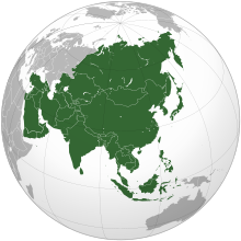
    Asia (/ˈʒə/ AY-zhə, UK also /ˈʃə/ AY-shə) is the largest continent in the world by both land area and population. It covers an area of more than 44 million square kilometers, about 30% of Earth's total land area and 8% of Earth's total surface area. The continent, which has long been home to the majority of the human population, was the site of many of the first civilizations. Its 4.7 billion people constitute roughly 60% of the world's population. (Full article...)
    Other vital articles

    Get involved

    For editor resources and to collaborate with other editors on improving Wikipedia's Geography-related articles, visit WikiProject Geography.


    Here are some tasks awaiting attention:

    Selected pictures

    Featured biography articles in geography

    Albert Henry Stanley, 1st Baron Ashfield, TD, PC (8 August 1874 – 4 November 1948), born Albert Henry Knattriess, was a British-American businessman who was managing director, then chairman of the Underground Electric Railways Company of London (UERL) from 1910 to 1933 and chairman of the London Passenger Transport Board (LPTB) from 1933 to 1947.

    Although born in Britain, his early career was in the United States, where, at a young age, he held senior positions in the developing tramway systems of Detroit and New Jersey. In 1898, he served in the United States Navy during the short Spanish–American War. (Full article...)

    More featured biographies

    Did you know

    Did you know it about Geography?

    Places around you

    You can read about interesting Wikipedia articles about places around you.

    Special:Nearby

    This following Geography-related articles is a most visited articles of WikiProject Geography, See complete list at Wikipedia:WikiProject Geography/Popular pages.

  • Image 4 Generation X (often shortened to Gen X) is the demographic cohort following the Baby Boomers and preceding Millennials. Researchers and popular media often use the mid-1960s as its starting birth years and the late 1970s as its ending birth years, with the generation being generally defined as people born from 1965 to 1980. By this definition and U.S. Census data, there are 65.2 million Gen Xers in the United States as of 2019. Most of Generation X are the children of the Silent Generation and early Baby Boomers; Xers are also often the parents of Millennials and Generation Z. (Full article...)
    Generation X (often shortened to Gen X) is the demographic cohort following the Baby Boomers and preceding Millennials. Researchers and popular media often use the mid-1960s as its starting birth years and the late 1970s as its ending birth years, with the generation being generally defined as people born from 1965 to 1980. By this definition and U.S. Census data, there are 65.2 million Gen Xers in the United States as of 2019. Most of Generation X are the children of the Silent Generation and early Baby Boomers; Xers are also often the parents of Millennials and Generation Z. (Full article...)
  • Image 5 Cartogram of the world's population in 2018; each square represents 500,000 people. This is a list of countries and dependencies by population. It includes sovereign states, inhabited dependent territories and, in some cases, constituent countries of sovereign states, with inclusion within the list being primarily based on the ISO standard ISO 3166-1. For instance, the United Kingdom is considered a single entity, while the constituent countries of the Kingdom of the Netherlands are considered separately. In addition, this list includes certain states with limited recognition not found in ISO 3166-1. Also given in a percentage is each country's population compared with the world population, which the United Nations estimates at 8.119 billion as of 2024. (Full article...)
    Cartogram of the world's population in 2018; each square represents 500,000 people.


    This is a list of countries and dependencies by population. It includes sovereign states, inhabited dependent territories and, in some cases, constituent countries of sovereign states, with inclusion within the list being primarily based on the ISO standard ISO 3166-1. For instance, the United Kingdom is considered a single entity, while the constituent countries of the Kingdom of the Netherlands are considered separately. In addition, this list includes certain states with limited recognition not found in ISO 3166-1. Also given in a percentage is each country's population compared with the world population, which the United Nations estimates at 8.119 billion as of 2024. (Full article...)
  • Image 6 Hong Kong is a special administrative region of the People's Republic of China. With 7.4 million residents of various nationalities in a 1,104-square-kilometre (426 sq mi) territory, Hong Kong is the fourth most densely populated region in the world. (Full article...)

    Hong Kong is a special administrative region of the People's Republic of China. With 7.4 million residents of various nationalities in a 1,104-square-kilometre (426 sq mi) territory, Hong Kong is the fourth most densely populated region in the world. (Full article...)
  • Image 7 Millennials, also known as Generation Y or Gen Y, are the demographic cohort following Generation X and preceding Generation Z. Researchers and popular media use the early 1980s as starting birth years and the mid-1990s to early 2000s as ending birth years, with the generation typically being defined as people born from 1981 to 1996. Most Millennials are the children of Baby Boomers and older Generation X. In turn Millennials are often the parents of Generation Alpha. (Full article...)
    Millennials, also known as Generation Y or Gen Y, are the demographic cohort following Generation X and preceding Generation Z. Researchers and popular media use the early 1980s as starting birth years and the mid-1990s to early 2000s as ending birth years, with the generation typically being defined as people born from 1981 to 1996. Most Millennials are the children of Baby Boomers and older Generation X. In turn Millennials are often the parents of Generation Alpha. (Full article...)
  • Image 8 England is a country that is part of the United Kingdom. It is located on the island of Great Britain, of which it covers approximately 62%, and over 100 smaller adjacent islands. It has land borders with Scotland to the north and Wales to the west, and is otherwise surrounded by the North Sea to the east, the English Channel to the south, the Celtic Sea to the south-west, and the Irish Sea to the west. Continental Europe lies to the south-east, and Ireland to the west. At the 2021 census, the population was 56,490,048. London is both the largest city and the capital. (Full article...)
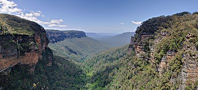
    England is a country that is part of the United Kingdom. It is located on the island of Great Britain, of which it covers approximately 62%, and over 100 smaller adjacent islands. It has land borders with Scotland to the north and Wales to the west, and is otherwise surrounded by the North Sea to the east, the English Channel to the south, the Celtic Sea to the south-west, and the Irish Sea to the west. Continental Europe lies to the south-east, and Ireland to the west. At the 2021 census, the population was 56,490,048. London is both the largest city and the capital. (Full article...)
  • Image 9 Generation Alpha (often shortened to Gen Alpha) is the demographic cohort succeeding Generation Z. Researchers and popular media use the early 2010s as starting birth years to the mid-2020s as the ending birth years (see § Date and age range definitions). Named after alpha, the first letter in the Greek alphabet, Generation Alpha is the first to be born entirely in the 21st century and the third millennium. The majority of Generation Alpha are the children of Millennials. (Full article...)
    Generation Alpha (often shortened to Gen Alpha) is the demographic cohort succeeding Generation Z. Researchers and popular media use the early 2010s as starting birth years to the mid-2020s as the ending birth years (see § Date and age range definitions). Named after alpha, the first letter in the Greek alphabet, Generation Alpha is the first to be born entirely in the 21st century and the third millennium. The majority of Generation Alpha are the children of Millennials. (Full article...)
  • Image 10 Dymaxion map of the world with the 30 largest countries and territories by area This is a list of the world's countries and their dependencies by land, water, and total area, ranked by total area. (Full article...)
    Dymaxion map of the world with the 30 largest countries and territories by area

    This is a list of the world's countries and their dependencies by land, water, and total area, ranked by total area. (Full article...)
  • Click to enlarge and view description.

    Main articles

    CategoriesCategories

    Select [►] to view subcategories.

    Associated Wikimedia

    The following Wikimedia Foundation sister projects provide more on this subject:

    Discover Wikipedia using portals
    Retrieved from "https://en.wikipedia.org/w/index.php?title=Portal:Geography&oldid=1202464975"