Loading
  • 21 Aug, 2019

  • By, Wikipedia

Portal:Geography

The Geography Portal

Geography (from Ancient Greek γεωγραφία geōgraphía; combining 'Earth' and gráphō 'write') is the study of the lands, features, inhabitants, and phenomena of Earth. Geography is an all-encompassing discipline that seeks an understanding of Earth and its human and natural complexities—not merely where objects are, but also how they have changed and come to be. While geography is specific to Earth, many concepts can be applied more broadly to other celestial bodies in the field of planetary science. Geography has been called "a bridge between natural science and social science disciplines."

Origins of many of the concepts in geography can be traced to Greek Eratosthenes of Cyrene, who may have coined the term "geographia" (c. 276 BC – c. 195/194 BC). The first recorded use of the word γεωγραφία was as the title of a book by Greek scholar Claudius Ptolemy (100 – 170 AD). This work created the so-called "Ptolemaic tradition" of geography, which included "Ptolemaic cartographic theory." However, the concepts of geography (such as cartography) date back to the earliest attempts to understand the world spatially, with the earliest example of an attempted world map dating to the 9th century BCE in ancient Babylon. The history of geography as a discipline spans cultures and millennia, being independently developed by multiple groups, and cross-pollinated by trade between these groups. The core concepts of geography consistent between all approaches are a focus on space, place, time, and scale.

Today, geography is an extremely broad discipline with multiple approaches and modalities. There have been multiple attempts to organize the discipline, including the four traditions of geography, and into branches. Techniques employed can generally be broken down into quantitative and qualitative approaches, with many studies taking mixed-methods approaches. Common techniques include cartography, remote sensing, interviews, and surveying. (Full article...)

Featured articles are displayed here, which represent some of the best content on English Wikipedia.

  • Image 2 One of T2's sister ships, T3 T2 was a seagoing torpedo boat operated by the Royal Yugoslav Navy between 1923 and 1939. Originally 77 T, a 250t-class torpedo boat of the Austro-Hungarian Navy built in 1914, she was armed with two 66 mm (2.6 in) guns and four 450 mm (17.7 in) torpedo tubes, and could carry 10–12 naval mines. She saw active service during World War I, performing convoy, patrol, escort, minesweeping and minelaying tasks, anti-submarine operations, and shore bombardment missions. In 1917, the suffixes of all Austro-Hungarian torpedo boats were removed, and thereafter she was referred to as 77. The vessel was in the Bocche di Cattaro during the short-lived mutiny by Austro-Hungarian sailors in early February 1918; members of her crew raised the red flag but undertook no other mutinous actions. 77 was part of the escort force for the Austro-Hungarian dreadnought Szent István during the action that resulted in the sinking of that ship by Italian torpedo boats in June 1918. Following Austria-Hungary's defeat in 1918, 77 was allocated to the Navy of the Kingdom of Serbs, Croats and Slovenes, which later became the Royal Yugoslav Navy, and was renamed T2 and had her armament upgraded. At the time, she and seven other 250t-class boats were the only modern sea-going vessels of the fledgling maritime force. During the interwar period, the navy was involved in training exercises and cruises to friendly ports, but activity was limited by reduced naval budgets. Worn out after twenty-five years of service, T2 was stricken from the naval register and scrapped in 1939. (Full article...)

    T2 was a seagoing torpedo boat operated by the Royal Yugoslav Navy between 1923 and 1939. Originally 77 T, a 250t-class torpedo boat of the Austro-Hungarian Navy built in 1914, she was armed with two 66 mm (2.6 in) guns and four 450 mm (17.7 in) torpedo tubes, and could carry 10–12 naval mines. She saw active service during World War I, performing convoy, patrol, escort, minesweeping and minelaying tasks, anti-submarine operations, and shore bombardment missions. In 1917, the suffixes of all Austro-Hungarian torpedo boats were removed, and thereafter she was referred to as 77. The vessel was in the Bocche di Cattaro during the short-lived mutiny by Austro-Hungarian sailors in early February 1918; members of her crew raised the red flag but undertook no other mutinous actions. 77 was part of the escort force for the Austro-Hungarian dreadnought Szent István during the action that resulted in the sinking of that ship by Italian torpedo boats in June 1918.

    Following Austria-Hungary's defeat in 1918, 77 was allocated to the Navy of the Kingdom of Serbs, Croats and Slovenes, which later became the Royal Yugoslav Navy, and was renamed T2 and had her armament upgraded. At the time, she and seven other 250t-class boats were the only modern sea-going vessels of the fledgling maritime force. During the interwar period, the navy was involved in training exercises and cruises to friendly ports, but activity was limited by reduced naval budgets. Worn out after twenty-five years of service, T2 was stricken from the naval register and scrapped in 1939. (Full article...)
  • Image 3 Routes of Endurance, the James Caird, and Aurora, the overland supply depot route of the Ross Sea party, and the planned overland route of the Weddell Sea party led by Ernest Shackleton on his Trans-Antarctic Expedition of 1914–1915:[image reference needed]   Voyage of Endurance   Drift of Endurance in pack ice   Sea ice drift after Endurance sinks   Voyage of the James Caird   Planned trans-Antarctic route   Voyage of Aurora to Antarctica   Retreat of Aurora   Supply depot route The Ross Sea party was a component of Sir Ernest Shackleton's 1914–1917 Imperial Trans-Antarctic Expedition. Its task was to lay a series of supply depots across the Great Ice Barrier from the Ross Sea to the Beardmore Glacier, along the polar route established by earlier Antarctic expeditions. The expedition's main party, under Shackleton, was to land near Vahsel Bay on the Weddell Sea on the opposite coast of Antarctica, and to march across the continent via the South Pole to the Ross Sea. As the main party would be unable to carry sufficient fuel and supplies for the whole distance, their survival depended on the Ross Sea party setting up supply depots, which would cover the final quarter of their journey. Shackleton set sail from London on his ship Endurance, bound for the Weddell Sea in August 1914. Meanwhile, the Ross Sea party personnel gathered in Australia, prior to departure for the Ross Sea in the second expedition ship, SY Aurora. Organisational and financial problems delayed their start until December 1914, which shortened their first depot-laying season. After their arrival the inexperienced party struggled to master the art of Antarctic travel, in the process losing most of their sled dogs. (Full article...)
    Outline of Antarctica coast, with different lines indicating the various journeys made by ships and land parties during the Imperial Trans-Antarctic Expedition
    Routes of Endurance, the James Caird, and Aurora, the overland supply depot route of the Ross Sea party, and the planned overland route of the Weddell Sea party led by Ernest Shackleton on his Trans-Antarctic Expedition of 1914–1915:
      Voyage of Endurance
      Drift of Endurance in pack ice
      Sea ice drift after Endurance sinks
      Voyage of the James Caird
      Planned trans-Antarctic route
      Voyage of Aurora to Antarctica
      Retreat of Aurora
      Supply depot route

    The Ross Sea party was a component of Sir Ernest Shackleton's 1914–1917 Imperial Trans-Antarctic Expedition. Its task was to lay a series of supply depots across the Great Ice Barrier from the Ross Sea to the Beardmore Glacier, along the polar route established by earlier Antarctic expeditions. The expedition's main party, under Shackleton, was to land near Vahsel Bay on the Weddell Sea on the opposite coast of Antarctica, and to march across the continent via the South Pole to the Ross Sea. As the main party would be unable to carry sufficient fuel and supplies for the whole distance, their survival depended on the Ross Sea party setting up supply depots, which would cover the final quarter of their journey.

    Shackleton set sail from London on his ship Endurance, bound for the Weddell Sea in August 1914. Meanwhile, the Ross Sea party personnel gathered in Australia, prior to departure for the Ross Sea in the second expedition ship, SY Aurora. Organisational and financial problems delayed their start until December 1914, which shortened their first depot-laying season. After their arrival the inexperienced party struggled to master the art of Antarctic travel, in the process losing most of their sled dogs. (Full article...)
  • Image 4 India, officially the Republic of India (ISO: Bhārat Gaṇarājya), is a country in South Asia. It is the seventh-largest country by area; the most populous country with effect from June 2023; and from the time of its independence in 1947, the world's most populous democracy. Bounded by the Indian Ocean on the south, the Arabian Sea on the southwest, and the Bay of Bengal on the southeast, it shares land borders with Pakistan to the west; China, Nepal, and Bhutan to the north; and Bangladesh and Myanmar to the east. In the Indian Ocean, India is in the vicinity of Sri Lanka and the Maldives; its Andaman and Nicobar Islands share a maritime border with Thailand, Myanmar, and Indonesia. Modern humans arrived on the Indian subcontinent from Africa no later than 55,000 years ago. Their long occupation, initially in varying forms of isolation as hunter-gatherers, has made the region highly diverse, second only to Africa in human genetic diversity. Settled life emerged on the subcontinent in the western margins of the Indus river basin 9,000 years ago, evolving gradually into the Indus Valley Civilisation of the third millennium BCE. By 1200 BCE, an archaic form of Sanskrit, an Indo-European language, had diffused into India from the northwest. Its evidence today is found in the hymns of the Rigveda. Preserved by an oral tradition that was resolutely vigilant, the Rigveda records the dawning of Hinduism in India. The Dravidian languages of India were supplanted in the northern and western regions. By 400 BCE, stratification and exclusion by caste had emerged within Hinduism, and Buddhism and Jainism had arisen, proclaiming social orders unlinked to heredity. Early political consolidations gave rise to the loose-knit Maurya and Gupta Empires based in the Ganges Basin. Their collective era was suffused with wide-ranging creativity, but also marked by the declining status of women, and the incorporation of untouchability into an organised system of belief. In South India, the Middle kingdoms exported Dravidian-languages scripts and religious cultures to the kingdoms of Southeast Asia. (Full article...)
    India, officially the Republic of India (ISO: Bhārat Gaṇarājya), is a country in South Asia. It is the seventh-largest country by area; the most populous country with effect from June 2023; and from the time of its independence in 1947, the world's most populous democracy. Bounded by the Indian Ocean on the south, the Arabian Sea on the southwest, and the Bay of Bengal on the southeast, it shares land borders with Pakistan to the west; China, Nepal, and Bhutan to the north; and Bangladesh and Myanmar to the east. In the Indian Ocean, India is in the vicinity of Sri Lanka and the Maldives; its Andaman and Nicobar Islands share a maritime border with Thailand, Myanmar, and Indonesia.

    Modern humans arrived on the Indian subcontinent from Africa no later than 55,000 years ago.
    Their long occupation, initially in varying forms of isolation as hunter-gatherers, has made the region highly diverse, second only to Africa in human genetic diversity. Settled life emerged on the subcontinent in the western margins of the Indus river basin 9,000 years ago, evolving gradually into the Indus Valley Civilisation of the third millennium BCE.
    By 1200 BCE, an archaic form of Sanskrit, an Indo-European language, had diffused into India from the northwest. Its evidence today is found in the hymns of the Rigveda. Preserved by an oral tradition that was resolutely vigilant, the Rigveda records the dawning of Hinduism in India. The Dravidian languages of India were supplanted in the northern and western regions.
    By 400 BCE, stratification and exclusion by caste had emerged within Hinduism,
    and Buddhism and Jainism had arisen, proclaiming social orders unlinked to heredity.
    Early political consolidations gave rise to the loose-knit Maurya and Gupta Empires based in the Ganges Basin.
    Their collective era was suffused with wide-ranging creativity, but also marked by the declining status of women, and the incorporation of untouchability into an organised system of belief. In South India, the Middle kingdoms exported Dravidian-languages scripts and religious cultures to the kingdoms of Southeast Asia. (Full article...)
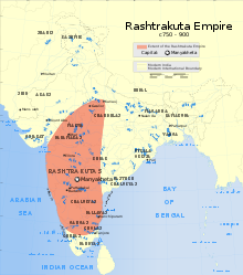
  • Image 5 Rashtrakuta (IAST: rāṣṭrakūṭa) (r. 753 – 982 CE) was a royal Indian dynasty ruling large parts of the Indian subcontinent between the 6th and 10th centuries. The earliest known Rashtrakuta inscription is a 7th-century copper plate grant detailing their rule from Manapur, a city in Central or West India. Other ruling Rashtrakuta clans from the same period mentioned in inscriptions were the kings of Achalapur and the rulers of Kannauj. Several controversies exist regarding the origin of these early Rashtrakutas, their native homeland and their language. The Elichpur clan was a feudatory of the Badami Chalukyas, and during the rule of Dantidurga, it overthrew Chalukya Kirtivarman II and went on to build an empire with the Gulbarga region in modern Karnataka as its base. This clan came to be known as the Rashtrakutas of Manyakheta, rising to power in South India in 753 AD. At the same time the Pala dynasty of Bengal and the Prathihara dynasty of Gurjaratra were gaining force in eastern and northwestern India respectively. An Arabic text, Silsilat al-Tawarikh (851), called the Rashtrakutas one of the four principal empires of the world. (Full article...)

    Rashtrakuta (IAST: rāṣṭrakūṭa) (r. 753 – 982 CE) was a royal Indian dynasty ruling large parts of the Indian subcontinent between the 6th and 10th centuries. The earliest known Rashtrakuta inscription is a 7th-century copper plate grant detailing their rule from Manapur, a city in Central or West India. Other ruling Rashtrakuta clans from the same period mentioned in inscriptions were the kings of Achalapur and the rulers of Kannauj. Several controversies exist regarding the origin of these early Rashtrakutas, their native homeland and their language.

    The Elichpur clan was a feudatory of the Badami Chalukyas, and during the rule of Dantidurga, it overthrew Chalukya Kirtivarman II and went on to build an empire with the Gulbarga region in modern Karnataka as its base. This clan came to be known as the Rashtrakutas of Manyakheta, rising to power in South India in 753 AD. At the same time the Pala dynasty of Bengal and the Prathihara dynasty of Gurjaratra were gaining force in eastern and northwestern India respectively. An Arabic text, Silsilat al-Tawarikh (851), called the Rashtrakutas one of the four principal empires of the world. (Full article...)
  • Image 6 Caxias in 1878 Luís Alves de Lima e Silva, Duke of Caxias (pronounced [kaˈʃi.ɐs]; 25 August 1803 – 7 May 1880), nicknamed "the Peacemaker" and "the Iron Duke", was an army officer, politician and monarchist of the Empire of Brazil. Like his father and uncles, Caxias pursued a military career. In 1823 he fought as a young officer in the Brazilian War for Independence against Portugal, then spent three years in Brazil's southernmost province, Cisplatina, as the government unsuccessfully resisted that province's secession in the Cisplatine War. Though his own father and uncles renounced Emperor Dom Pedro I during the protests of 1831, Caxias remained loyal. Pedro I abdicated in favor of his young son Dom Pedro II, whom Caxias instructed in swordsmanship and horsemanship and eventually befriended. During Pedro II's minority the governing regency faced countless rebellions throughout the country. Again breaking with his father and other relatives sympathetic to the rebels, from 1839 to 1845 Caxias commanded loyalist forces suppressing such uprisings as the Balaiada, the Liberal rebellions of 1842 and the Ragamuffin War. In 1851, under his command, the Brazilian army prevailed against the Argentine Confederation in the Platine War; a decade later Caxias, as army marshal (the army's highest rank), led Brazilian forces to victory in the Paraguayan War. As a reward he was raised to the titled nobility, becoming successively a baron, count, and marquis, finally becoming the only person created duke during Pedro II's 58-year reign. (Full article...)

    Luís Alves de Lima e Silva, Duke of Caxias (pronounced [kaˈʃi.ɐs]; 25 August 1803 – 7 May 1880), nicknamed "the Peacemaker" and "the Iron Duke", was an army officer, politician and monarchist of the Empire of Brazil. Like his father and uncles, Caxias pursued a military career. In 1823 he fought as a young officer in the Brazilian War for Independence against Portugal, then spent three years in Brazil's southernmost province, Cisplatina, as the government unsuccessfully resisted that province's secession in the Cisplatine War. Though his own father and uncles renounced Emperor Dom Pedro I during the protests of 1831, Caxias remained loyal. Pedro I abdicated in favor of his young son Dom Pedro II, whom Caxias instructed in swordsmanship and horsemanship and eventually befriended.

    During Pedro II's minority the governing regency faced countless rebellions throughout the country. Again breaking with his father and other relatives sympathetic to the rebels, from 1839 to 1845 Caxias commanded loyalist forces suppressing such uprisings as the Balaiada, the Liberal rebellions of 1842 and the Ragamuffin War. In 1851, under his command, the Brazilian army prevailed against the Argentine Confederation in the Platine War; a decade later Caxias, as army marshal (the army's highest rank), led Brazilian forces to victory in the Paraguayan War. As a reward he was raised to the titled nobility, becoming successively a baron, count, and marquis, finally becoming the only person created duke during Pedro II's 58-year reign. (Full article...)
  • Image 7 John William Beschter SJ (born Johann Wilhelm Beschter; German: [ˈjoːhan ˈvɪlhɛlm ˈbɛʃtɐ]; [needs Luxembourgish IPA] May 20, 1763 – January 6, 1842) was a Catholic priest and Jesuit from the Duchy of Luxembourg in the Austrian Netherlands. He emigrated to the United States as a missionary in 1807, where he ministered in rural Pennsylvania and Maryland. Beschter was the last Jesuit pastor of St. Mary's Church in Lancaster, as well as the pastor of St. John the Evangelist Church in Baltimore, Maryland. He was also a priest at several other German-speaking churches in Pennsylvania. Beschter's ministerial work was punctuated by a time as master of novices at the new Jesuit novitiate at White Marsh Manor, as well as a brief term as president of Georgetown College in 1829. While in Maryland, he aligned himself with the Continental European Jesuits in the United States, who endorsed a monarchist view of ecclesiastical leadership. After his presidency, Beschter remained at Georgetown for a year as a professor of German, before returning to Paradise, Pennsylvania, where he lived out the last twelve years of his life as a priest. (Full article...)

    John William Beschter SJ (born Johann Wilhelm Beschter; German: [ˈjoːhan ˈvɪlhɛlm ˈbɛʃtɐ]; May 20, 1763 – January 6, 1842) was a Catholic priest and Jesuit from the Duchy of Luxembourg in the Austrian Netherlands. He emigrated to the United States as a missionary in 1807, where he ministered in rural Pennsylvania and Maryland. Beschter was the last Jesuit pastor of St. Mary's Church in Lancaster, as well as the pastor of St. John the Evangelist Church in Baltimore, Maryland. He was also a priest at several other German-speaking churches in Pennsylvania.

    Beschter's ministerial work was punctuated by a time as master of novices at the new Jesuit novitiate at White Marsh Manor, as well as a brief term as president of Georgetown College in 1829. While in Maryland, he aligned himself with the Continental European Jesuits in the United States, who endorsed a monarchist view of ecclesiastical leadership. After his presidency, Beschter remained at Georgetown for a year as a professor of German, before returning to Paradise, Pennsylvania, where he lived out the last twelve years of his life as a priest. (Full article...)
  • Image 8 November 2022 satellite image of the glacier by Sentinel-2. The Quelccaya Ice Cap (also known as Quenamari Ice Cap) is the second largest glaciated area in the tropics, after Coropuna. Located in the Cordillera Oriental section of the Andes mountains in Peru, the cap covers an area of 42.8 square kilometres (16.5 sq mi) with ice up to 200 metres (660 ft) thick. It is surrounded by tall ice cliffs and a number of outlet glaciers, the largest of which is known as Qori Kalis Glacier; lakes, moraines, peat bogs and wetlands are also present. There is a rich flora and fauna, including birds that nest on the ice cap. Quelccaya is an important source of water, eventually melting and flowing into the Inambari and Vilcanota Rivers. A number of ice cores have been obtained from Quelccaya, including two from 1983 that were the first recovered outside of the polar regions. Past climate states have been reconstructed from data in these ice cores; these include evidence of the Little Ice Age, regional droughts and wet periods with historical significance and past and recent El Niño events. The ice cap is regularly monitored and has a weather station. (Full article...)

    The Quelccaya Ice Cap (also known as Quenamari Ice Cap) is the second largest glaciated area in the tropics, after Coropuna. Located in the Cordillera Oriental section of the Andes mountains in Peru, the cap covers an area of 42.8 square kilometres (16.5 sq mi) with ice up to 200 metres (660 ft) thick. It is surrounded by tall ice cliffs and a number of outlet glaciers, the largest of which is known as Qori Kalis Glacier; lakes, moraines, peat bogs and wetlands are also present. There is a rich flora and fauna, including birds that nest on the ice cap. Quelccaya is an important source of water, eventually melting and flowing into the Inambari and Vilcanota Rivers.

    A number of ice cores have been obtained from Quelccaya, including two from 1983 that were the first recovered outside of the polar regions. Past climate states have been reconstructed from data in these ice cores; these include evidence of the Little Ice Age, regional droughts and wet periods with historical significance and past and recent El Niño events. The ice cap is regularly monitored and has a weather station. (Full article...)
  • Image 9 A hot windstorm brings dust from the surrounding desert, July 3, 1942 Manzanar is the site of one of ten American concentration camps, where more than 120,000 Japanese Americans were incarcerated during World War II from March 1942 to November 1945. Although it had over 10,000 inmates at its peak, it was one of the smaller internment camps. It is located at the foot of the Sierra Nevada mountains in California's Owens Valley, between the towns of Lone Pine to the south and Independence to the north, approximately 230 miles (370 km) north of Los Angeles. Manzanar means "apple orchard" in Spanish. The Manzanar National Historic Site, which preserves and interprets the legacy of Japanese American incarceration in the United States, was identified by the United States National Park Service as the best-preserved of the ten former camp sites. The first Japanese Americans arrived at Manzanar in March 1942, just one month after President Franklin D. Roosevelt signed Executive Order 9066, to build the camp their families would be staying in. Manzanar was in operation as an internment camp from 1942 until 1945. Since the last of those incarcerated left in 1945, former detainees and others have worked to protect Manzanar and to establish it as a National Historic Site to ensure that the history of the site, along with the stories of those who were incarcerated there, is recorded for current and future generations. The primary focus is the Japanese American incarceration era, as specified in the legislation that created the Manzanar National Historic Site. The site also interprets the former town of Manzanar, the ranch days, the settlement by the Owens Valley Paiute, and the role that water played in shaping the history of the Owens Valley. (Full article...)

    Manzanar is the site of one of ten American concentration camps, where more than 120,000 Japanese Americans were incarcerated during World War II from March 1942 to November 1945. Although it had over 10,000 inmates at its peak, it was one of the smaller internment camps. It is located at the foot of the Sierra Nevada mountains in California's Owens Valley, between the towns of Lone Pine to the south and Independence to the north, approximately 230 miles (370 km) north of Los Angeles. Manzanar means "apple orchard" in Spanish. The Manzanar National Historic Site, which preserves and interprets the legacy of Japanese American incarceration in the United States, was identified by the United States National Park Service as the best-preserved of the ten former camp sites.

    The first Japanese Americans arrived at Manzanar in March 1942, just one month after President Franklin D. Roosevelt signed Executive Order 9066, to build the camp their families would be staying in. Manzanar was in operation as an internment camp from 1942 until 1945. Since the last of those incarcerated left in 1945, former detainees and others have worked to protect Manzanar and to establish it as a National Historic Site to ensure that the history of the site, along with the stories of those who were incarcerated there, is recorded for current and future generations. The primary focus is the Japanese American incarceration era, as specified in the legislation that created the Manzanar National Historic Site. The site also interprets the former town of Manzanar, the ranch days, the settlement by the Owens Valley Paiute, and the role that water played in shaping the history of the Owens Valley. (Full article...)
  • Image 10 Stone commemorative marker at Literary Hall in Romney, West Virginia The Romney Literary Society (also known as the Literary Society of Romney) existed from January 30, 1819, to February 15, 1886, in Romney, West Virginia. Established as the Polemic Society of Romney, it became the first organization of its kind in the present-day state of West Virginia, and one of the first in the United States. The society was founded by nine prominent men of Romney with the objectives of advancing literature and science, purchasing and maintaining a library, and improving educational opportunities. The society debated an extensive range of scientific and social topics, often violating its own rules which banned religious and political subjects. Even though its membership was relatively small, its debates and activities were frequently discussed throughout the Potomac Highlands region, and the organization greatly influenced trends of thought in the Romney community and surrounding areas. (Full article...)

    The Romney Literary Society (also known as the Literary Society of Romney) existed from January 30, 1819, to February 15, 1886, in Romney, West Virginia. Established as the Polemic Society of Romney, it became the first organization of its kind in the present-day state of West Virginia, and one of the first in the United States. The society was founded by nine prominent men of Romney with the objectives of advancing literature and science, purchasing and maintaining a library, and improving educational opportunities.

    The society debated an extensive range of scientific and social topics, often violating its own rules which banned religious and political subjects. Even though its membership was relatively small, its debates and activities were frequently discussed throughout the Potomac Highlands region, and the organization greatly influenced trends of thought in the Romney community and surrounding areas. (Full article...)
  • Image 11 El Tatio geyser field El Tatio is a geothermal field with many geysers located in the Andes Mountains of northern Chile at 4,320 metres (14,170 ft) above mean sea level. It is the third-largest geyser field in the world and the largest in the Southern Hemisphere. Various meanings have been proposed for the name "El Tatio", including "oven" or "grandfather". The geothermal field has many geysers, hot springs, and associated sinter deposits. These hot springs eventually form the Rio Salado, a major tributary of the Rio Loa, and are a major source of arsenic pollution in the river. The vents are sites of populations of extremophile microorganisms such as hyperthermophiles, and El Tatio has been studied as an analogue for the early Earth and possible past life on Mars. El Tatio lies at the western foot of a series of stratovolcanoes, which runs along the border between Chile and Bolivia. This series of volcanoes is part of the Central Volcanic Zone, one of several volcanic belts in the Andes, and of the Altiplano–Puna volcanic complex (APVC). This is a system of large calderas and associated ignimbrites, which have been the sources of supereruptions between 10 and 1 million years ago. Some of these calderas may be the source of heat for the El Tatio geothermal system. There are no recorded eruptions of the Tatio volcanoes in the historical period. (Full article...)
    Bent steam plumes rising from a desolate landscape
    El Tatio geyser field

    El Tatio is a geothermal field with many geysers located in the Andes Mountains of northern Chile at 4,320 metres (14,170 ft) above mean sea level. It is the third-largest geyser field in the world and the largest in the Southern Hemisphere. Various meanings have been proposed for the name "El Tatio", including "oven" or "grandfather". The geothermal field has many geysers, hot springs, and associated sinter deposits. These hot springs eventually form the Rio Salado, a major tributary of the Rio Loa, and are a major source of arsenic pollution in the river. The vents are sites of populations of extremophile microorganisms such as hyperthermophiles, and El Tatio has been studied as an analogue for the early Earth and possible past life on Mars.

    El Tatio lies at the western foot of a series of stratovolcanoes, which runs along the border between Chile and Bolivia. This series of volcanoes is part of the Central Volcanic Zone, one of several volcanic belts in the Andes, and of the Altiplano–Puna volcanic complex (APVC). This is a system of large calderas and associated ignimbrites, which have been the sources of supereruptions between 10 and 1 million years ago. Some of these calderas may be the source of heat for the El Tatio geothermal system. There are no recorded eruptions of the Tatio volcanoes in the historical period. (Full article...)
  • Image 12 Mount Sylvania in Portland, Oregon, one of the major volcanoes in the field The Boring Lava Field (also known as the Boring Volcanic Field) is a Plio-Pleistocene volcanic field with cinder cones, small shield volcanoes, and lava flows in the northern Willamette Valley of the U.S. state of Oregon and adjacent southwest Washington. The field got its name from the town of Boring, Oregon, located 12 miles (20 km) southeast of downtown Portland. Boring lies southeast of the densest cluster of lava vents. The zone became volcanically active about 2.7 million years ago, with long periods of eruptive activity interspersed with quiescence. Its last eruptions took place about 57,000 years ago at the Beacon Rock cinder cone volcano; the individual volcanic vents of the field are considered extinct, but the field itself is not. The Boring Lava Field covers an area of about 1,500 square miles (4,000 km2), and has a total volume of 2.4 cubic miles (10 km3). This region sustains diverse flora and fauna within its habitat areas, which are subject to Portland's moderate climate with variable temperatures and mild precipitation. The highest elevation of the field is at Larch Mountain, which reaches a height of 4,055 feet (1,236 m). (Full article...)

    The Boring Lava Field (also known as the Boring Volcanic Field) is a Plio-Pleistocene volcanic field with cinder cones, small shield volcanoes, and lava flows in the northern Willamette Valley of the U.S. state of Oregon and adjacent southwest Washington. The field got its name from the town of Boring, Oregon, located 12 miles (20 km) southeast of downtown Portland. Boring lies southeast of the densest cluster of lava vents. The zone became volcanically active about 2.7 million years ago, with long periods of eruptive activity interspersed with quiescence. Its last eruptions took place about 57,000 years ago at the Beacon Rock cinder cone volcano; the individual volcanic vents of the field are considered extinct, but the field itself is not.

    The Boring Lava Field covers an area of about 1,500 square miles (4,000 km), and has a total volume of 2.4 cubic miles (10 km). This region sustains diverse flora and fauna within its habitat areas, which are subject to Portland's moderate climate with variable temperatures and mild precipitation. The highest elevation of the field is at Larch Mountain, which reaches a height of 4,055 feet (1,236 m). (Full article...)
  • Image 13 Lagoon-facing beach on South Islet Caroline Island (also known as Caroline Atoll or Millennium Island) is the easternmost of several uninhabited coral atolls comprising the southern Line Islands in the central Pacific Ocean nation of Kiribati. The atoll was first sighted by Europeans in 1606 and was claimed by the United Kingdom of Great Britain and Ireland in 1868. It has been part of the Republic of Kiribati since the island nation's independence in 1979. Caroline Island has remained relatively untouched and is one of the world's most pristine tropical islands, despite guano mining, copra (coconut meat) harvesting, and human habitation in the 19th and 20th centuries. It is home to one of the world's largest populations of the coconut crab and is an important breeding site for seabirds, most notably the sooty tern. (Full article...)

    Caroline Island (also known as Caroline Atoll or Millennium Island) is the easternmost of several uninhabited coral atolls comprising the southern Line Islands in the central Pacific Ocean nation of Kiribati.

    The atoll was first sighted by Europeans in 1606 and was claimed by the United Kingdom of Great Britain and Ireland in 1868. It has been part of the Republic of Kiribati since the island nation's independence in 1979. Caroline Island has remained relatively untouched and is one of the world's most pristine tropical islands, despite guano mining, copra (coconut meat) harvesting, and human habitation in the 19th and 20th centuries. It is home to one of the world's largest populations of the coconut crab and is an important breeding site for seabirds, most notably the sooty tern. (Full article...)
  • Image 14 Ashton-under-Lyne is a market town in Tameside, Greater Manchester, England. The population was 48,604 at the 2021 census. Historically in Lancashire, it is on the north bank of the River Tame, in the foothills of the Pennines, 6 miles (9.7 km) east of Manchester. Evidence of Stone Age, Bronze Age, and Viking activity has been discovered in Ashton-under-Lyne. The "Ashton" part of the town's name probably dates from the Anglo-Saxon period, and derives from Old English meaning "settlement by ash trees". The origin of the "under-Lyne" suffix is less clear; it possibly derives from the Brittonic-originating word lemo meaning elm or from Ashton's proximity to the Pennines. In the Middle Ages, Ashton-under-Lyne was a parish and township and Ashton Old Hall was held by the de Asshetons, lords of the manor. Granted a royal charter in 1414, the manor spanned a rural area consisting of marshland, moorland, and a number of villages and hamlets. (Full article...)

    Ashton-under-Lyne is a market town in Tameside, Greater Manchester, England. The population was 48,604 at the 2021 census. Historically in Lancashire, it is on the north bank of the River Tame, in the foothills of the Pennines, 6 miles (9.7 km) east of Manchester.

    Evidence of Stone Age, Bronze Age, and Viking activity has been discovered in Ashton-under-Lyne. The "Ashton" part of the town's name probably dates from the Anglo-Saxon period, and derives from Old English meaning "settlement by ash trees". The origin of the "under-Lyne" suffix is less clear; it possibly derives from the Brittonic-originating word lemo meaning elm or from Ashton's proximity to the Pennines. In the Middle Ages, Ashton-under-Lyne was a parish and township and Ashton Old Hall was held by the de Asshetons, lords of the manor. Granted a royal charter in 1414, the manor spanned a rural area consisting of marshland, moorland, and a number of villages and hamlets. (Full article...)
  • Image 15 Main façade (north elevation) from U.S. Route 50, July 2016 The Sloan–Parker House, also known as the Stone House, Parker Family Residence, or Richard Sloan House, is a late-18th-century stone residence near Junction, Hampshire County, in the U.S. state of West Virginia. It was built on land vacated by the Shawnee after the Native American nation had been violently forced to move west to Kansas following their defeat at the Battle of Point Pleasant in 1774. The building was added to the National Register of Historic Places on June 5, 1975, becoming Hampshire County's first property to be listed on the register. The Sloan–Parker House has been in the Parker family since 1854. The house and its adjacent farm are located along the Northwestern Turnpike (US 50/WV 28) in the rural Mill Creek valley. The original fieldstone section of the house was erected in about 1790 for Richard Sloan and his wife Charlotte Van Horn Sloan. Originally from Ireland, Sloan arrived in the United States after the American Revolutionary War and became an indentured servant of David Van Horn. Sloan eloped with Van Horn's daughter Charlotte and they settled in the Mill Creek valley, where they built the original stone portion of the house. The Sloans had ten children, including John and Thomas Sloan, who each (later) represented Hampshire County in the Virginia House of Delegates. Richard Sloan and his family operated a successful weaving business from the stone house and their Sloan counterpanes (woven coverlets with block designs) became well known in the South Branch Valley region. (Full article...)
    The Sloan–Parker House, also known as the Stone House, Parker Family Residence, or Richard Sloan House, is a late-18th-century stone residence near Junction, Hampshire County, in the U.S. state of West Virginia. It was built on land vacated by the Shawnee after the Native American nation had been violently forced to move west to Kansas following their defeat at the Battle of Point Pleasant in 1774. The building was added to the National Register of Historic Places on June 5, 1975, becoming Hampshire County's first property to be listed on the register. The Sloan–Parker House has been in the Parker family since 1854. The house and its adjacent farm are located along the Northwestern Turnpike (US 50/WV 28) in the rural Mill Creek valley.

    The original fieldstone section of the house was erected in about 1790 for Richard Sloan and his wife Charlotte Van Horn Sloan. Originally from Ireland, Sloan arrived in the United States after the American Revolutionary War and became an indentured servant of David Van Horn. Sloan eloped with Van Horn's daughter Charlotte and they settled in the Mill Creek valley, where they built the original stone portion of the house. The Sloans had ten children, including John and Thomas Sloan, who each (later) represented Hampshire County in the Virginia House of Delegates. Richard Sloan and his family operated a successful weaving business from the stone house and their Sloan counterpanes (woven coverlets with block designs) became well known in the South Branch Valley region. (Full article...)
  • Vital articles Vital article

    Vital articles to understand Geography.

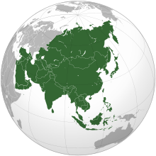
    Asia (/ˈʒə/ AY-zhə, UK also /ˈʃə/ AY-shə) is the largest continent in the world by both land area and population. It covers an area of more than 44 million square kilometers, about 30% of Earth's total land area and 8% of Earth's total surface area. The continent, which has long been home to the majority of the human population, was the site of many of the first civilizations. Its 4.7 billion people constitute roughly 60% of the world's population. (Full article...)
    Other vital articles

    Get involved

    For editor resources and to collaborate with other editors on improving Wikipedia's Geography-related articles, visit WikiProject Geography.


    Here are some tasks awaiting attention:

    Selected pictures

    Featured biography articles in geography

    Albert Henry Stanley, 1st Baron Ashfield, TD, PC (8 August 1874 – 4 November 1948), born Albert Henry Knattriess, was a British-American businessman who was managing director, then chairman of the Underground Electric Railways Company of London (UERL) from 1910 to 1933 and chairman of the London Passenger Transport Board (LPTB) from 1933 to 1947.

    Although born in Britain, his early career was in the United States, where, at a young age, he held senior positions in the developing tramway systems of Detroit and New Jersey. In 1898, he served in the United States Navy during the short Spanish–American War. (Full article...)
    More featured biographies

    Did you know

    Did you know it about Geography?

    Places around you

    You can read about interesting Wikipedia articles about places around you.

    Special:Nearby

    This following Geography-related articles is a most visited articles of WikiProject Geography, See complete list at Wikipedia:WikiProject Geography/Popular pages.

  • Image 6 Millennials, also known as Generation Y or Gen Y, are the demographic cohort following Generation X and preceding Generation Z. Researchers and popular media use the early 1980s as starting birth years and the mid-1990s to early 2000s as ending birth years, with the generation typically being defined as people born from 1981 to 1996. Most Millennials are the children of Baby Boomers and older Generation X. In turn Millennials are often the parents of Generation Alpha. (Full article...)
    Millennials, also known as Generation Y or Gen Y, are the demographic cohort following Generation X and preceding Generation Z. Researchers and popular media use the early 1980s as starting birth years and the mid-1990s to early 2000s as ending birth years, with the generation typically being defined as people born from 1981 to 1996. Most Millennials are the children of Baby Boomers and older Generation X. In turn Millennials are often the parents of Generation Alpha. (Full article...)
  • Image 7 England is a country that is part of the United Kingdom. It is located on the island of Great Britain, of which it covers approximately 62%, and over 100 smaller adjacent islands. It has land borders with Scotland to the north and Wales to the west, and is otherwise surrounded by the North Sea to the east, the English Channel to the south, the Celtic Sea to the south-west, and the Irish Sea to the west. Continental Europe lies to the south-east, and Ireland to the west. At the 2021 census, the population was 56,490,048. London is both the largest city and the capital. (Full article...)
    England is a country that is part of the United Kingdom. It is located on the island of Great Britain, of which it covers approximately 62%, and over 100 smaller adjacent islands. It has land borders with Scotland to the north and Wales to the west, and is otherwise surrounded by the North Sea to the east, the English Channel to the south, the Celtic Sea to the south-west, and the Irish Sea to the west. Continental Europe lies to the south-east, and Ireland to the west. At the 2021 census, the population was 56,490,048. London is both the largest city and the capital. (Full article...)
  • Image 8 Cartogram of the world's population in 2018; each square represents 500,000 people. This is a list of countries and dependencies by population. It includes sovereign states, inhabited dependent territories and, in some cases, constituent countries of sovereign states, with inclusion within the list being primarily based on the ISO standard ISO 3166-1. For instance, the United Kingdom is considered a single entity, while the constituent countries of the Kingdom of the Netherlands are considered separately. In addition, this list includes certain states with limited recognition not found in ISO 3166-1. Also given in a percentage is each country's population compared with the world population, which the United Nations estimates at 8.13 billion as of 2024. (Full article...)
    Cartogram of the world's population in 2018; each square represents 500,000 people.


    This is a list of countries and dependencies by population. It includes sovereign states, inhabited dependent territories and, in some cases, constituent countries of sovereign states, with inclusion within the list being primarily based on the ISO standard ISO 3166-1. For instance, the United Kingdom is considered a single entity, while the constituent countries of the Kingdom of the Netherlands are considered separately. In addition, this list includes certain states with limited recognition not found in ISO 3166-1. Also given in a percentage is each country's population compared with the world population, which the United Nations estimates at 8.13 billion as of 2024. (Full article...)
  • Image 9 Generation Alpha (often shortened to Gen Alpha) is the demographic cohort succeeding Generation Z. Researchers and popular media use the early 2010s as starting birth years to the mid-2020s as the ending birth years (see § Date and age range definitions). Named after alpha, the first letter in the Greek alphabet, Generation Alpha is the first to be born entirely in the 21st century and the third millennium. Most members of Generation Alpha are the children of Millennials. (Full article...)
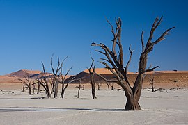
    Generation Alpha (often shortened to Gen Alpha) is the demographic cohort succeeding Generation Z. Researchers and popular media use the early 2010s as starting birth years to the mid-2020s as the ending birth years (see § Date and age range definitions). Named after alpha, the first letter in the Greek alphabet, Generation Alpha is the first to be born entirely in the 21st century and the third millennium. Most members of Generation Alpha are the children of Millennials. (Full article...)
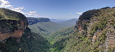
  • Image 10 River Thames and Tower Bridge with The Shard and Southwark (left), and Tower of London and City of London (right) London (/ˈlʌndən/ LUN-dən) is the capital and largest city of both England and the United Kingdom, with a population of 8,866,180 in 2022. The wider metropolitan area is the largest in Western Europe, with a population of 14.9 million. London stands on the River Thames in southeast England, at the head of a 50-mile (80 km) estuary down to the North Sea, and has been a major settlement for nearly 2,000 years. Its ancient core and financial centre, the City of London, was founded by the Romans as Londinium and has retained its medieval boundaries. The City of Westminster, to the west of the City of London, has been the centuries-long host of the national government and parliament. London grew rapidly in the 19th century, becoming the world's largest city at the time. Since the 19th century, the name "London" has referred to the metropolis around the City of London, historically split between the counties of Middlesex, Essex, Surrey, Kent, and Hertfordshire, which since 1965 has largely comprised the administrative area of Greater London, governed by 33 local authorities and the Greater London Authority. (Full article...)

    London (/ˈlʌndən/ LUN-dən) is the capital and largest city of both England and the United Kingdom, with a population of 8,866,180 in 2022. The wider metropolitan area is the largest in Western Europe, with a population of 14.9 million. London stands on the River Thames in southeast England, at the head of a 50-mile (80 km) estuary down to the North Sea, and has been a major settlement for nearly 2,000 years. Its ancient core and financial centre, the City of London, was founded by the Romans as Londinium and has retained its medieval boundaries. The City of Westminster, to the west of the City of London, has been the centuries-long host of the national government and parliament. London grew rapidly in the 19th century, becoming the world's largest city at the time. Since the 19th century, the name "London" has referred to the metropolis around the City of London, historically split between the counties of Middlesex, Essex, Surrey, Kent, and Hertfordshire, which since 1965 has largely comprised the administrative area of Greater London, governed by 33 local authorities and the Greater London Authority. (Full article...)
  • Click to enlarge and view description.

    Main articles

    CategoriesCategories

    Select [►] to view subcategories.

    Associated Wikimedia

    The following Wikimedia Foundation sister projects provide more on this subject:

    Discover Wikipedia using portals
    Retrieved from "https://en.wikipedia.org/w/index.php?title=Portal:Geography&oldid=1202464975"