Loading
  • 21 Aug, 2019

  • By, Wikipedia

Portal:Geography

The Geography Portal

Geography (from Ancient Greek γεωγραφία geōgraphía; combining 'Earth' and gráphō 'write') is the study of the lands, features, inhabitants, and phenomena of Earth. Geography is an all-encompassing discipline that seeks an understanding of Earth and its human and natural complexities—not merely where objects are, but also how they have changed and come to be. While geography is specific to Earth, many concepts can be applied more broadly to other celestial bodies in the field of planetary science. Geography has been called "a bridge between natural science and social science disciplines."

Origins of many of the concepts in geography can be traced to Greek Eratosthenes of Cyrene, who may have coined the term "geographia" (c. 276 BC – c. 195/194 BC). The first recorded use of the word γεωγραφία was as the title of a book by Greek scholar Claudius Ptolemy (100 – 170 AD). This work created the so-called "Ptolemaic tradition" of geography, which included "Ptolemaic cartographic theory." However, the concepts of geography (such as cartography) date back to the earliest attempts to understand the world spatially, with the earliest example of an attempted world map dating to the 9th century BCE in ancient Babylon. The history of geography as a discipline spans cultures and millennia, being independently developed by multiple groups, and cross-pollinated by trade between these groups. The core concepts of geography consistent between all approaches are a focus on space, place, time, and scale.

Today, geography is an extremely broad discipline with multiple approaches and modalities. There have been multiple attempts to organize the discipline, including the four traditions of geography, and into branches. Techniques employed can generally be broken down into quantitative and qualitative approaches, with many studies taking mixed-methods approaches. Common techniques include cartography, remote sensing, interviews, and surveying. (Full article...)

Featured articles are displayed here, which represent some of the best content on English Wikipedia.

  • Image 2 The Somerset Levels, seen from Glastonbury Tor The Somerset Levels are a coastal plain and wetland area of Somerset, England, running south from the Mendips to the Blackdown Hills. The Somerset Levels have an area of about 160,000 acres (650 km2) and are bisected by the Polden Hills; the areas to the south are drained by the River Parrett, and the areas to the north by the rivers Axe and Brue. The Mendip Hills separate the Somerset Levels from the North Somerset Levels. The Somerset Levels consist of marine clay "levels" along the coast and inland peat-based "moors"; agriculturally, about 70 per cent is used as grassland and the rest is arable. Willow and teazel are grown commercially and peat is extracted. (Full article...)
    The Somerset Levels, seen from Glastonbury Tor

    The Somerset Levels are a coastal plain and wetland area of Somerset, England, running south from the Mendips to the Blackdown Hills.

    The Somerset Levels have an area of about 160,000 acres (650 km) and are bisected by the Polden Hills; the areas to the south are drained by the River Parrett, and the areas to the north by the rivers Axe and Brue. The Mendip Hills separate the Somerset Levels from the North Somerset Levels. The Somerset Levels consist of marine clay "levels" along the coast and inland peat-based "moors"; agriculturally, about 70 per cent is used as grassland and the rest is arable. Willow and teazel are grown commercially and peat is extracted. (Full article...)
  • Image 3 Dam at Jordan River Narrows in 1901 The Jordan River is a 51.4-mile-long (82.7 km) river in the U.S. state of Utah. Regulated by pumps at its headwaters at Utah Lake, it flows northward through the Salt Lake Valley and empties into the Great Salt Lake. Four of Utah's six largest cities border the river: Salt Lake City, West Valley City, West Jordan, and Sandy. More than a million people live in the Jordan Subbasin, part of the Jordan River watershed that lies within Salt Lake and Utah counties. During the Pleistocene, the area was part of Lake Bonneville. Members of the Desert Archaic Culture were the earliest known inhabitants of the region; an archaeological site found along the river dates back 3,000 years. Mormon pioneers led by Brigham Young were the first European American settlers, arriving in July 1847 and establishing farms and settlements along the river and its tributaries. The growing population, needing water for drinking, irrigation, and industrial use in an arid climate, dug ditches and canals, built dams, and installed pumps to create a highly regulated river. (Full article...)

    The Jordan River is a 51.4-mile-long (82.7 km) river in the U.S. state of Utah. Regulated by pumps at its headwaters at Utah Lake, it flows northward through the Salt Lake Valley and empties into the Great Salt Lake. Four of Utah's six largest cities border the river: Salt Lake City, West Valley City, West Jordan, and Sandy. More than a million people live in the Jordan Subbasin, part of the Jordan River watershed that lies within Salt Lake and Utah counties. During the Pleistocene, the area was part of Lake Bonneville.

    Members of the Desert Archaic Culture were the earliest known inhabitants of the region; an archaeological site found along the river dates back 3,000 years. Mormon pioneers led by Brigham Young were the first European American settlers, arriving in July 1847 and establishing farms and settlements along the river and its tributaries. The growing population, needing water for drinking, irrigation, and industrial use in an arid climate, dug ditches and canals, built dams, and installed pumps to create a highly regulated river. (Full article...)
  • Image 4 A map of the Western Han dynasty in 2 AD   Principalities and centrally-administered commanderies   Protectorate of the Western Regions (Tarim Basin) The Han dynasty was an imperial dynasty of China (202 BC – 9 AD, 25–220 AD) established by Liu Bang and ruled by the House of Liu. The dynasty was preceded by the short-lived Qin dynasty (221–206 BC) and a warring interregnum known as the Chu–Han contention (206–202 BC), and it was succeeded by the Three Kingdoms period (220–280 AD). The dynasty was briefly interrupted by the Xin dynasty (9–23 AD) established by the usurping regent Wang Mang, and is thus separated into two periods—the Western Han (202 BC – 9 AD) and the Eastern Han (25–220 AD). Spanning over four centuries, the Han dynasty is considered a golden age in Chinese history, and had a permanent impact on Chinese identity in later periods. The majority ethnic group of modern China refer to themselves as the "Han people" or "Han Chinese". The spoken Sinitic language and written Chinese are referred to respectively as the "Han language" and "Han characters". The emperor was at the pinnacle of Han society and culture. He presided over the Han government but shared power with both the nobility and the appointed ministers who came largely from the scholarly gentry class. The Han Empire was divided into areas directly controlled by the central government called commanderies, as well as a number of semi-autonomous kingdoms. These kingdoms gradually lost all vestiges of their independence, particularly following the Rebellion of the Seven States. From the reign of Emperor Wu (r. 141–87 BC) onward, the Chinese court officially sponsored Confucianism in education and court politics, synthesized with the cosmology of later scholars such as Dong Zhongshu. This policy endured until the fall of the Qing dynasty in 1912. (Full article...)

    The Han dynasty was an imperial dynasty of China (202 BC – 9 AD, 25–220 AD) established by Liu Bang and ruled by the House of Liu. The dynasty was preceded by the short-lived Qin dynasty (221–206 BC) and a warring interregnum known as the Chu–Han contention (206–202 BC), and it was succeeded by the Three Kingdoms period (220–280 AD). The dynasty was briefly interrupted by the Xin dynasty (9–23 AD) established by the usurping regent Wang Mang, and is thus separated into two periods—the Western Han (202 BC – 9 AD) and the Eastern Han (25–220 AD). Spanning over four centuries, the Han dynasty is considered a golden age in Chinese history, and had a permanent impact on Chinese identity in later periods. The majority ethnic group of modern China refer to themselves as the "Han people" or "Han Chinese". The spoken Sinitic language and written Chinese are referred to respectively as the "Han language" and "Han characters".

    The emperor was at the pinnacle of Han society and culture. He presided over the Han government but shared power with both the nobility and the appointed ministers who came largely from the scholarly gentry class. The Han Empire was divided into areas directly controlled by the central government called commanderies, as well as a number of semi-autonomous kingdoms. These kingdoms gradually lost all vestiges of their independence, particularly following the Rebellion of the Seven States. From the reign of Emperor Wu (r. 141–87 BC) onward, the Chinese court officially sponsored Confucianism in education and court politics, synthesized with the cosmology of later scholars such as Dong Zhongshu. This policy endured until the fall of the Qing dynasty in 1912. (Full article...)
  • Image 5 Tumbler Ridge is a district municipality in the foothills of the B.C. Rockies in northeastern British Columbia, Canada, and a member municipality of the Peace River Regional District. With a population of 2,399 (2021) living in a townsite, the municipality encompasses an area of 1,558 km2 (602 sq mi) of mostly Crown land. The townsite is located near the confluence of the Murray River and Flatbed Creek and the intersection of Highway 52 and Highway 29 and includes the site of the Tumbler Ridge Secondary School and Tumbler Ridge Airport. It is part of the Peace River South provincial electoral district and the Prince George—Peace River—Northern Rockies federal riding. Tumbler Ridge is a planned community with the housing and infrastructure construct built simultaneously in 1981 by the provincial government to service the coal industry as part of the British Columbia Resources Investment Corporation's Northeast Coal Development. In 1981, a consortium of Japanese steel mills agreed to purchase 100 million tonnes of coal over 15 years for US$7.5 billion from two mining companies, Denison Mines Inc. and the Teck Corporation, who were to operate the Quintette mine and the Bullmoose mine respectively. Declining global coal prices after 1981, and weakening Asian markets in the late 1990s, made the town's future uncertain and kept it from achieving its projected population of 10,000 people. The uncertainty dissuaded investment and kept the economy from diversifying. When price reductions were forced onto the mines, the Quintette mine was closed in 2000 production and the town lost about half its population. Coal prices began to rise after the turn of the century, leading to the opening of the Peace River Coal Trend mine by Northern Energy & Mining Inc. (now owned by Anglo American Met Coal) and the Wolverine Mine, originally owned by Western Canadian Coal, which was purchased by Walter Energy in 2010. Walter went bankrupt in 2015, and their Canadian assets—including the Wolverine Mine—were purchased by Conuma Coal in 2016. (Full article...)
    Tumbler Ridge is a district municipality in the foothills of the B.C. Rockies in northeastern British Columbia, Canada, and a member municipality of the Peace River Regional District. With a population of 2,399 (2021) living in a townsite, the municipality encompasses an area of 1,558 km (602 sq mi) of mostly Crown land. The townsite is located near the confluence of the Murray River and Flatbed Creek and the intersection of Highway 52 and Highway 29 and includes the site of the Tumbler Ridge Secondary School and Tumbler Ridge Airport. It is part of the Peace River South provincial electoral district and the Prince George—Peace River—Northern Rockies federal riding.

    Tumbler Ridge is a planned community with the housing and infrastructure construct built simultaneously in 1981 by the provincial government to service the coal industry as part of the British Columbia Resources Investment Corporation's Northeast Coal Development. In 1981, a consortium of Japanese steel mills agreed to purchase 100 million tonnes of coal over 15 years for US$7.5 billion from two mining companies, Denison Mines Inc. and the Teck Corporation, who were to operate the Quintette mine and the Bullmoose mine respectively. Declining global coal prices after 1981, and weakening Asian markets in the late 1990s, made the town's future uncertain and kept it from achieving its projected population of 10,000 people. The uncertainty dissuaded investment and kept the economy from diversifying. When price reductions were forced onto the mines, the Quintette mine was closed in 2000 production and the town lost about half its population. Coal prices began to rise after the turn of the century, leading to the opening of the Peace River Coal Trend mine by Northern Energy & Mining Inc. (now owned by Anglo American Met Coal) and the Wolverine Mine, originally owned by Western Canadian Coal, which was purchased by Walter Energy in 2010. Walter went bankrupt in 2015, and their Canadian assets—including the Wolverine Mine—were purchased by Conuma Coal in 2016. (Full article...)
  • Image 6 The Transcaucasian Democratic Federative Republic (TDFR; 22 April – 28 May 1918) was a short-lived state in the Caucasus that included most of the territory of the present-day Armenia, Azerbaijan and Georgia, as well as parts of Russia and Turkey. The state lasted only for a month before Georgia declared independence, followed shortly after by Armenia and Azerbaijan. The region that formed the TDFR had been part of the Russian Empire. As the empire dissolved during the 1917 February Revolution and a provisional government took over, a similar body, called the Special Transcaucasian Committee (Ozakom), did the same in the Caucasus. After the October Revolution and rise of the Bolsheviks in Russia, the Transcaucasian Commissariat replaced the Ozakom. In March 1918, as the First World War continued, the Commissariat initiated peace talks with the Ottoman Empire, which had invaded the region, but the talks broke down quickly as the Ottomans refused to accept the authority of the Commissariat. The Treaty of Brest-Litovsk, which ended Russia's involvement in the war, conceded parts of the Transcaucasus to the Ottoman Empire, which pursued its invasion to take control of the territory. Faced with this imminent threat, on 22 April 1918 the Commissariat dissolved itself and established the TDFR as an independent state. A legislature, the Seim, was formed to direct negotiations with the Ottoman Empire, which had immediately recognized the state. (Full article...)

    The Transcaucasian Democratic Federative Republic (TDFR; 22 April – 28 May 1918) was a short-lived state in the Caucasus that included most of the territory of the present-day Armenia, Azerbaijan and Georgia, as well as parts of Russia and Turkey. The state lasted only for a month before Georgia declared independence, followed shortly after by Armenia and Azerbaijan.

    The region that formed the TDFR had been part of the Russian Empire. As the empire dissolved during the 1917 February Revolution and a provisional government took over, a similar body, called the Special Transcaucasian Committee (Ozakom), did the same in the Caucasus. After the October Revolution and rise of the Bolsheviks in Russia, the Transcaucasian Commissariat replaced the Ozakom. In March 1918, as the First World War continued, the Commissariat initiated peace talks with the Ottoman Empire, which had invaded the region, but the talks broke down quickly as the Ottomans refused to accept the authority of the Commissariat. The Treaty of Brest-Litovsk, which ended Russia's involvement in the war, conceded parts of the Transcaucasus to the Ottoman Empire, which pursued its invasion to take control of the territory. Faced with this imminent threat, on 22 April 1918 the Commissariat dissolved itself and established the TDFR as an independent state. A legislature, the Seim, was formed to direct negotiations with the Ottoman Empire, which had immediately recognized the state. (Full article...)
  • Image 7 Downtown Minneapolis (from the Mississippi River) Minneapolis, officially the City of Minneapolis, is a city in and the county seat of Hennepin County, Minnesota, United States. With a population of 429,954, it is the state's most populous city as of the 2020 census. It occupies both banks of the Mississippi River and adjoins Saint Paul, the state capital of Minnesota. Minneapolis, Saint Paul, and the surrounding area are collectively known as the Twin Cities, a metropolitan area with 3.69 million residents. Minneapolis is built on an artesian aquifer on flat terrain, and is known for cold, snowy winters and hot, humid summers. Nicknamed the "City of Lakes", Minneapolis is abundant in water, with thirteen lakes, wetlands, the Mississippi River, creeks, and waterfalls. The city's public park system is connected by the Grand Rounds National Scenic Byway. Dakota people originally inhabited the site of today's Minneapolis. European colonization and settlement began north of Fort Snelling along Saint Anthony Falls—the only natural waterfall on the Mississippi River. The city's early growth was attributed to its proximity to the fort and the falls providing power for industrial activity. Minneapolis was the 19th-century lumber and flour milling capital of the world, and as home to the Federal Reserve Bank of Minneapolis, it has preserved its financial clout into the 21st century. A Minneapolis Depression-era labor strike brought about federal worker protections. Work in Minneapolis contributed to the computing industry, and the city is the birthplace of General Mills, the Pillsbury brand, Target Corporation, and Thermo King mobile refrigeration. (Full article...)

    Minneapolis, officially the City of Minneapolis, is a city in and the county seat of Hennepin County, Minnesota, United States. With a population of 429,954, it is the state's most populous city as of the 2020 census. It occupies both banks of the Mississippi River and adjoins Saint Paul, the state capital of Minnesota. Minneapolis, Saint Paul, and the surrounding area are collectively known as the Twin Cities, a metropolitan area with 3.69 million residents. Minneapolis is built on an artesian aquifer on flat terrain, and is known for cold, snowy winters and hot, humid summers. Nicknamed the "City of Lakes", Minneapolis is abundant in water, with thirteen lakes, wetlands, the Mississippi River, creeks, and waterfalls. The city's public park system is connected by the Grand Rounds National Scenic Byway.

    Dakota people originally inhabited the site of today's Minneapolis. European colonization and settlement began north of Fort Snelling along Saint Anthony Falls—the only natural waterfall on the Mississippi River. The city's early growth was attributed to its proximity to the fort and the falls providing power for industrial activity. Minneapolis was the 19th-century lumber and flour milling capital of the world, and as home to the Federal Reserve Bank of Minneapolis, it has preserved its financial clout into the 21st century. A Minneapolis Depression-era labor strike brought about federal worker protections. Work in Minneapolis contributed to the computing industry, and the city is the birthplace of General Mills, the Pillsbury brand, Target Corporation, and Thermo King mobile refrigeration. (Full article...)
  • Image 8 17th- or 18th-century Hajj certificate showing the Kaaba within the Masjid al-Haram Hajj: Journey to the Heart of Islam was an exhibition held at the British Museum in London from 26 January to 15 April 2012. It was the world's first major exhibition telling the story, visually and textually, of the hajj – the pilgrimage to Mecca which is one of the five pillars of Islam. Textiles, manuscripts, historical documents, photographs, and art works from many different countries and eras were displayed to illustrate the themes of travel to Mecca, hajj rituals, and the Kaaba. More than two hundred objects were included, drawn from forty public and private collections in a total of fourteen countries. The largest contributor was David Khalili's family trust, which lent many objects that would later be part of the Khalili Collection of Hajj and the Arts of Pilgrimage. The exhibition was formally opened by Prince Charles in a ceremony attended by Prince Abdulaziz bin Abdullah, son of King Abdullah, the custodian of the Two Holy Mosques. It was popular both with Muslims and non-Muslims, attracting nearly 120,000 adult visitors and favourable press reviews. This success inspired the Museum of Islamic Art in Doha, the Arab World Institute in Paris, the National Museum of Ethnology in Leiden, and the Tropenmuseum in Amsterdam to stage their own hajj-themed exhibitions with contributions from the Khalili Collection. (Full article...)

    Hajj: Journey to the Heart of Islam was an exhibition held at the British Museum in London from 26 January to 15 April 2012. It was the world's first major exhibition telling the story, visually and textually, of the hajj – the pilgrimage to Mecca which is one of the five pillars of Islam. Textiles, manuscripts, historical documents, photographs, and art works from many different countries and eras were displayed to illustrate the themes of travel to Mecca, hajj rituals, and the Kaaba. More than two hundred objects were included, drawn from forty public and private collections in a total of fourteen countries. The largest contributor was David Khalili's family trust, which lent many objects that would later be part of the Khalili Collection of Hajj and the Arts of Pilgrimage.

    The exhibition was formally opened by Prince Charles in a ceremony attended by Prince Abdulaziz bin Abdullah, son of King Abdullah, the custodian of the Two Holy Mosques. It was popular both with Muslims and non-Muslims, attracting nearly 120,000 adult visitors and favourable press reviews. This success inspired the Museum of Islamic Art in Doha, the Arab World Institute in Paris, the National Museum of Ethnology in Leiden, and the Tropenmuseum in Amsterdam to stage their own hajj-themed exhibitions with contributions from the Khalili Collection. (Full article...)
  • Image 9 Sunset on Ganoga Lake Ganoga Lake is a natural lake in Colley Township in southeastern Sullivan County in Pennsylvania, United States. Known as Robinson's Lake and Long Pond for most of the 19th century, the lake was purchased by the Ricketts family in the early 1850s and became part of R. Bruce Ricketts' extensive holdings in the area after the American Civil War. The lake is one of the highest in Pennsylvania, which led Ricketts to name it Highland Lake by 1874 and rename it Ganoga Lake in 1881; Pennsylvania senator Charles R. Buckalew suggested the name Ganoga from the Seneca language word for "water on the mountain". The Ricketts built a stone house on the lake shore by 1852 or 1855; this served as a hunting lodge and tavern. In 1873 a large wooden addition was built north of the stone house, which became a hotel known as the North Mountain House. The hotel had one of the first summer schools in the United States in 1876 and 1877. A branch railroad line to the lake served the hotel and also hauled ice cut from the lake for refrigeration. The hotel closed in 1903, though the house remained the Ricketts family summer home. After the death of R. Bruce Ricketts in 1918, his heirs sold much of his 80,000 acres (32,000 ha) to the state for Pennsylvania State Game Lands and Ricketts Glen State Park. The state tried to purchase the lake in 1957, but was outbid by a group of investors who turned the land around it into a private housing development; as such it is "off limits" to the public. (Full article...)

    Ganoga Lake is a natural lake in Colley Township in southeastern Sullivan County in Pennsylvania, United States. Known as Robinson's Lake and Long Pond for most of the 19th century, the lake was purchased by the Ricketts family in the early 1850s and became part of R. Bruce Ricketts' extensive holdings in the area after the American Civil War. The lake is one of the highest in Pennsylvania, which led Ricketts to name it Highland Lake by 1874 and rename it Ganoga Lake in 1881; Pennsylvania senator Charles R. Buckalew suggested the name Ganoga from the Seneca language word for "water on the mountain".

    The Ricketts built a stone house on the lake shore by 1852 or 1855; this served as a hunting lodge and tavern. In 1873 a large wooden addition was built north of the stone house, which became a hotel known as the North Mountain House. The hotel had one of the first summer schools in the United States in 1876 and 1877. A branch railroad line to the lake served the hotel and also hauled ice cut from the lake for refrigeration. The hotel closed in 1903, though the house remained the Ricketts family summer home. After the death of R. Bruce Ricketts in 1918, his heirs sold much of his 80,000 acres (32,000 ha) to the state for Pennsylvania State Game Lands and Ricketts Glen State Park. The state tried to purchase the lake in 1957, but was outbid by a group of investors who turned the land around it into a private housing development; as such it is "off limits" to the public. (Full article...)
  • Image 10 Ford Island, located within Pearl Harbor, Oahu, Hawaii Ford Island (Hawaiian: Poka ʻAilana) is an islet in the center of Pearl Harbor, Oahu, in the U.S. state of Hawaii. It has been known as Rabbit Island, Marín's Island, and Little Goats Island; its native Hawaiian name is Mokuʻumeʻume. The island had an area of 334 acres (135 ha) when it was surveyed in 1825, which was increased during the 1930s to 441 acres (178 ha) with fill dredged out of Pearl Harbor by the United States Navy to deepen the harbor. The island was the site of an ancient Hawaiian fertility ritual, which was stopped by Christian missionaries during the 1830s. The island was given by Kamehameha I to Spanish deserter Francisco de Paula Marín, and later returned to the monarchy. After the island was bought at auction by James Isaac Dowsett and sold to Caroline Jackson, it became the property of Dr. Seth Porter Ford by marriage and was renamed Ford Island. After Ford's death, his son sold the island to the John Papa ʻĪʻī estate and it was converted into a sugarcane plantation. (Full article...)

    Ford Island (Hawaiian: Poka ʻAilana) is an islet in the center of Pearl Harbor, Oahu, in the U.S. state of Hawaii. It has been known as Rabbit Island, Marín's Island, and Little Goats Island; its native Hawaiian name is Mokuʻumeʻume. The island had an area of 334 acres (135 ha) when it was surveyed in 1825, which was increased during the 1930s to 441 acres (178 ha) with fill dredged out of Pearl Harbor by the United States Navy to deepen the harbor.

    The island was the site of an ancient Hawaiian fertility ritual, which was stopped by Christian missionaries during the 1830s. The island was given by Kamehameha I to Spanish deserter Francisco de Paula Marín, and later returned to the monarchy. After the island was bought at auction by James Isaac Dowsett and sold to Caroline Jackson, it became the property of Dr. Seth Porter Ford by marriage and was renamed Ford Island. After Ford's death, his son sold the island to the John Papa ʻĪʻī estate and it was converted into a sugarcane plantation. (Full article...)
  • Image 11 Looking west over the scrape, an area of shallow water and bare mud RSPB Minsmere is a nature reserve owned and managed by the Royal Society for the Protection of Birds (RSPB) at Minsmere, Suffolk. The 1,000-hectare (2,500-acre) site has been managed by the RSPB since 1947 and covers areas of reed bed, lowland heath, acid grassland, wet grassland, woodland and shingle vegetation. It lies within the Suffolk Coast and Heaths Area of Outstanding Natural Beauty and the Suffolk Heritage Coast area. It is conserved as a Site of Special Scientific Interest, Special Area of Conservation, Special Protection Area and Ramsar site. The nature reserve is managed primarily for bird conservation, particularly through control and improvement of wetland, heath and grassland habitats, with particular emphasis on encouraging nationally uncommon breeding species such as the bittern, stone-curlew, marsh harrier, nightjar and nightingale. The diversity of habitats has also led to a wide variety of other animals and plants being recorded on the site. (Full article...)

    RSPB Minsmere is a nature reserve owned and managed by the Royal Society for the Protection of Birds (RSPB) at Minsmere, Suffolk. The 1,000-hectare (2,500-acre) site has been managed by the RSPB since 1947 and covers areas of reed bed, lowland heath, acid grassland, wet grassland, woodland and shingle vegetation. It lies within the Suffolk Coast and Heaths Area of Outstanding Natural Beauty and the Suffolk Heritage Coast area. It is conserved as a Site of Special Scientific Interest, Special Area of Conservation, Special Protection Area and Ramsar site.

    The nature reserve is managed primarily for bird conservation, particularly through control and improvement of wetland, heath and grassland habitats, with particular emphasis on encouraging nationally uncommon breeding species such as the bittern, stone-curlew, marsh harrier, nightjar and nightingale. The diversity of habitats has also led to a wide variety of other animals and plants being recorded on the site. (Full article...)
  • Image 12 Mount Sylvania in Portland, Oregon, one of the major volcanoes in the field The Boring Lava Field (also known as the Boring Volcanic Field) is a Plio-Pleistocene volcanic field with cinder cones, small shield volcanoes, and lava flows in the northern Willamette Valley of the U.S. state of Oregon and adjacent southwest Washington. The field got its name from the town of Boring, Oregon, located 12 miles (20 km) southeast of downtown Portland. Boring lies southeast of the densest cluster of lava vents. The zone became volcanically active about 2.7 million years ago, with long periods of eruptive activity interspersed with quiescence. Its last eruptions took place about 57,000 years ago at the Beacon Rock cinder cone volcano; the individual volcanic vents of the field are considered extinct, but the field itself is not. The Boring Lava Field covers an area of about 1,500 square miles (4,000 km2), and has a total volume of 2.4 cubic miles (10 km3). This region sustains diverse flora and fauna within its habitat areas, which are subject to Portland's moderate climate with variable temperatures and mild precipitation. The highest elevation of the field is at Larch Mountain, which reaches a height of 4,055 feet (1,236 m). (Full article...)
    The Boring Lava Field (also known as the Boring Volcanic Field) is a Plio-Pleistocene volcanic field with cinder cones, small shield volcanoes, and lava flows in the northern Willamette Valley of the U.S. state of Oregon and adjacent southwest Washington. The field got its name from the town of Boring, Oregon, located 12 miles (20 km) southeast of downtown Portland. Boring lies southeast of the densest cluster of lava vents. The zone became volcanically active about 2.7 million years ago, with long periods of eruptive activity interspersed with quiescence. Its last eruptions took place about 57,000 years ago at the Beacon Rock cinder cone volcano; the individual volcanic vents of the field are considered extinct, but the field itself is not.

    The Boring Lava Field covers an area of about 1,500 square miles (4,000 km), and has a total volume of 2.4 cubic miles (10 km). This region sustains diverse flora and fauna within its habitat areas, which are subject to Portland's moderate climate with variable temperatures and mild precipitation. The highest elevation of the field is at Larch Mountain, which reaches a height of 4,055 feet (1,236 m). (Full article...)
  • Image 13 Kitab al-Hadi al-Muhammadi fi'l-Tibb al-Nabawi (Treatise on Prophetic Medicine) with the tughra (monogram, left) of Suleiman the Magnificent, 1520 Empire of the Sultans: Ottoman Art of the Khalili Collection was a 1995–2004 touring exhibition displaying objects from the Khalili Collection of Islamic Art. Around two hundred exhibits, including calligraphy, textiles, pottery, weapons, and metalwork, illustrated the art and daily life of six centuries of the Ottoman Empire. Many of the objects had been created for the leaders of the empire, the sultans. Two of the calligraphic pieces were the work of sultans themselves. In the 1990s, the exhibition was hosted by institutions in Switzerland, the United Kingdom, and Israel. It visited thirteen cities in the United States from 2000 to 2004, a period when Islam became especially controversial due to the September 11 attacks and the subsequent wars in the Middle East. Critics described the exhibition as wide-ranging and informative. They praised it for showing beautiful art works—naming the calligraphy in particular—and for presenting a fresh view of Islam. Catalogues were published in both English and French. (Full article...)

    Empire of the Sultans: Ottoman Art of the Khalili Collection was a 1995–2004 touring exhibition displaying objects from the Khalili Collection of Islamic Art. Around two hundred exhibits, including calligraphy, textiles, pottery, weapons, and metalwork, illustrated the art and daily life of six centuries of the Ottoman Empire. Many of the objects had been created for the leaders of the empire, the sultans. Two of the calligraphic pieces were the work of sultans themselves.

    In the 1990s, the exhibition was hosted by institutions in Switzerland, the United Kingdom, and Israel. It visited thirteen cities in the United States from 2000 to 2004, a period when Islam became especially controversial due to the September 11 attacks and the subsequent wars in the Middle East. Critics described the exhibition as wide-ranging and informative. They praised it for showing beautiful art works—naming the calligraphy in particular—and for presenting a fresh view of Islam. Catalogues were published in both English and French. (Full article...)
  • Image 14 The Willamette passing through Downtown Portland in the 1980s The Willamette River (/wɪˈlæmɪt/ ⓘ wil-AM-it) is a major tributary of the Columbia River, accounting for 12 to 15 percent of the Columbia's flow. The Willamette's main stem is 187 miles (301 km) long, lying entirely in northwestern Oregon in the United States. Flowing northward between the Oregon Coast Range and the Cascade Range, the river and its tributaries form the Willamette Valley, a basin that contains two-thirds of Oregon's population, including the state capital, Salem, and the state's largest city, Portland, which surrounds the Willamette's mouth at the Columbia. Originally created by plate tectonics about 35 million years ago and subsequently altered by volcanism and erosion, the river's drainage basin was significantly modified by the Missoula Floods at the end of the most recent ice age. Humans began living in the watershed over 10,000 years ago. There were once many tribal villages along the lower river and in the area around its mouth on the Columbia. Indigenous peoples lived throughout the upper reaches of the basin as well. (Full article...)
    The Willamette River (/wɪˈlæmɪt/ wil-AM-it) is a major tributary of the Columbia River, accounting for 12 to 15 percent of the Columbia's flow. The Willamette's main stem is 187 miles (301 km) long, lying entirely in northwestern Oregon in the United States. Flowing northward between the Oregon Coast Range and the Cascade Range, the river and its tributaries form the Willamette Valley, a basin that contains two-thirds of Oregon's population, including the state capital, Salem, and the state's largest city, Portland, which surrounds the Willamette's mouth at the Columbia.

    Originally created by plate tectonics about 35 million years ago and subsequently altered by volcanism and erosion, the river's drainage basin was significantly modified by the Missoula Floods at the end of the most recent ice age. Humans began living in the watershed over 10,000 years ago. There were once many tribal villages along the lower river and in the area around its mouth on the Columbia. Indigenous peoples lived throughout the upper reaches of the basin as well. (Full article...)
  • Image 15 Armorial of Plantagenet The House of Plantagenet (/plænˈtædʒənət/ plan-TAJ-ə-nət) was a royal house which originated in the French County of Anjou. The name Plantagenet is used by modern historians to identify four distinct royal houses: the Angevins, who were also counts of Anjou; the main line of the Plantagenets following the loss of Anjou; and the Houses of Lancaster and York, two of the Plantagenets cadet branches. The family held the English throne from 1154, with the accession of Henry II, until 1485, when Richard III died. England was transformed under the Plantagenets, although only partly intentionally. The Plantagenet kings were often forced to negotiate compromises such as Magna Carta, which constrained royal power in return for financial and military support. The king was no longer just the most powerful man in the nation, holding the prerogative of judgement, feudal tribute and warfare, but had defined duties to the realm, underpinned by a sophisticated justice system. A distinct national identity was shaped by their conflict with the French, Scots, Welsh and Irish, as well as by the establishment of Middle English as the primary language. (Full article...)
    The House of Plantagenet (/plænˈtædʒənət/ plan-TAJ-ə-nət) was a royal house which originated in the French County of Anjou. The name Plantagenet is used by modern historians to identify four distinct royal houses: the Angevins, who were also counts of Anjou; the main line of the Plantagenets following the loss of Anjou; and the Houses of Lancaster and York, two of the Plantagenets cadet branches. The family held the English throne from 1154, with the accession of Henry II, until 1485, when Richard III died.

    England was transformed under the Plantagenets, although only partly intentionally. The Plantagenet kings were often forced to negotiate compromises such as Magna Carta, which constrained royal power in return for financial and military support. The king was no longer just the most powerful man in the nation, holding the prerogative of judgement, feudal tribute and warfare, but had defined duties to the realm, underpinned by a sophisticated justice system. A distinct national identity was shaped by their conflict with the French, Scots, Welsh and Irish, as well as by the establishment of Middle English as the primary language. (Full article...)
  • More featured articles

    Vital articles Vital article

    Vital articles to understand Geography.

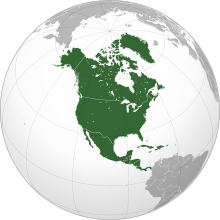
    North America is a continent in the Northern and Western Hemispheres. North America is bordered to the north by the Arctic Ocean, to the east by the Atlantic Ocean, to the southeast by South America and the Caribbean Sea, and to the west and south by the Pacific Ocean. The region includes the Bahamas, Bermuda, Canada, the Caribbean, Central America, Clipperton Island, Greenland, Mexico, Saint Pierre and Miquelon, Turks and Caicos Islands, and the United States. (Full article...)
    Other vital articles

    Get involved

    For editor resources and to collaborate with other editors on improving Wikipedia's Geography-related articles, visit WikiProject Geography.


    Here are some tasks awaiting attention:

    Selected pictures

    Featured biography articles in geography

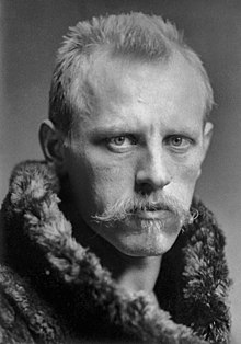
    Fridtjof Wedel-Jarlsberg Nansen (Norwegian: [ˈfrɪ̂tːjɔf ˈnɑ̀nsn̩]; 10 October 1861 – 13 May 1930) was a Norwegian polymath and Nobel Peace Prize laureate. He gained prominence at various points in his life as an explorer, scientist, diplomat, humanitarian and co-founded the Fatherland League.

    He led the team that made the first crossing of the Greenland interior in 1888, traversing the island on cross-country skis. He won international fame after reaching a record northern latitude of 86°14′ during his Fram expedition of 1893–1896. Although he retired from exploration after his return to Norway, his techniques of polar travel and his innovations in equipment and clothing influenced a generation of subsequent Arctic and Antarctic expeditions. He was elected an International Member of the American Philosophical Society in 1897. (Full article...)
    More featured biographies

    Did you know

    Did you know it about Geography?

    Places around you

    You can read about interesting Wikipedia articles about places around you.

    Special:Nearby

    This following Geography-related articles is a most visited articles of WikiProject Geography, See complete list at Wikipedia:WikiProject Geography/Popular pages.

  • Image 6 Millennials, also known as Generation Y or Gen Y, are the demographic cohort following Generation X and preceding Generation Z. Researchers and popular media use the early 1980s as starting birth years and the mid-1990s to early 2000s as ending birth years, with the generation typically being defined as people born from 1981 to 1996. Most Millennials are the children of Baby Boomers and older Generation X. In turn Millennials are often the parents of Generation Alpha. (Full article...)
    Millennials, also known as Generation Y or Gen Y, are the demographic cohort following Generation X and preceding Generation Z. Researchers and popular media use the early 1980s as starting birth years and the mid-1990s to early 2000s as ending birth years, with the generation typically being defined as people born from 1981 to 1996. Most Millennials are the children of Baby Boomers and older Generation X. In turn Millennials are often the parents of Generation Alpha. (Full article...)
  • Image 7 England is a country that is part of the United Kingdom. It is located on the island of Great Britain, of which it covers approximately 62%, and over 100 smaller adjacent islands. It has land borders with Scotland to the north and Wales to the west, and is otherwise surrounded by the North Sea to the east, the English Channel to the south, the Celtic Sea to the south-west, and the Irish Sea to the west. Continental Europe lies to the south-east, and Ireland to the west. At the 2021 census, the population was 56,490,048. London is both the largest city and the capital. (Full article...)

    England is a country that is part of the United Kingdom. It is located on the island of Great Britain, of which it covers approximately 62%, and over 100 smaller adjacent islands. It has land borders with Scotland to the north and Wales to the west, and is otherwise surrounded by the North Sea to the east, the English Channel to the south, the Celtic Sea to the south-west, and the Irish Sea to the west. Continental Europe lies to the south-east, and Ireland to the west. At the 2021 census, the population was 56,490,048. London is both the largest city and the capital. (Full article...)
  • Image 8 Cartogram of the world's population in 2018; each square represents 500,000 people.[needs update?] This is a list of countries and dependencies by population. It includes sovereign states, inhabited dependent territories and, in some cases, constituent countries of sovereign states, with inclusion within the list being primarily based on the ISO standard ISO 3166-1. For instance, the United Kingdom is considered a single entity, while the constituent countries of the Kingdom of the Netherlands are considered separately. In addition, this list includes certain states with limited recognition not found in ISO 3166-1. Also given in a percentage is each country's population compared with the world population, which the United Nations estimates at 8.12 billion as of 2024. (Full article...)
    Cartogram of the world's population in 2018; each square represents 500,000 people.


    This is a list of countries and dependencies by population. It includes sovereign states, inhabited dependent territories and, in some cases, constituent countries of sovereign states, with inclusion within the list being primarily based on the ISO standard ISO 3166-1. For instance, the United Kingdom is considered a single entity, while the constituent countries of the Kingdom of the Netherlands are considered separately. In addition, this list includes certain states with limited recognition not found in ISO 3166-1. Also given in a percentage is each country's population compared with the world population, which the United Nations estimates at 8.12 billion as of 2024. (Full article...)
  • Image 9 Greek alphabet Generation Alpha (often shortened to Gen Alpha) is the demographic cohort succeeding Generation Z. Researchers and popular media use the early 2010s as starting birth years to the mid-2020s as the ending birth years (see § Date and age range definitions). Named after alpha, the first letter in the Greek alphabet, Generation Alpha is the first to be born entirely in the 21st century and the third millennium. Most members of Generation Alpha are the children of Millennials. (Full article...)
    The 24-letter Greek alphabet with letter names in parentheses
    Greek alphabet

    Generation Alpha (often shortened to Gen Alpha) is the demographic cohort succeeding Generation Z. Researchers and popular media use the early 2010s as starting birth years to the mid-2020s as the ending birth years (see § Date and age range definitions). Named after alpha, the first letter in the Greek alphabet, Generation Alpha is the first to be born entirely in the 21st century and the third millennium. Most members of Generation Alpha are the children of Millennials. (Full article...)
  • Image 10 River Thames and Tower Bridge with The Shard and Southwark (left), and Tower of London and City of London (right) London (/ˈlʌndən/ LUN-dən) is the capital and largest city of both England and the United Kingdom, with a population of 8,866,180 in 2022. The wider metropolitan area is the largest in Western Europe, with a population of 14.9 million. London stands on the River Thames in southeast England, at the head of a 50-mile (80 km) estuary down to the North Sea, and has been a major settlement for nearly 2,000 years. Its ancient core and financial centre, the City of London, was founded by the Romans as Londinium and has retained its medieval boundaries. The City of Westminster, to the west of the City of London, has been the centuries-long host of the national government and parliament. London grew rapidly in the 19th century, becoming the world's largest city at the time. Since the 19th century, the name "London" has referred to the metropolis around the City of London, historically split between the counties of Middlesex, Essex, Surrey, Kent, and Hertfordshire, which since 1965 has largely comprised the administrative area of Greater London, governed by 33 local authorities and the Greater London Authority. (Full article...)

    London (/ˈlʌndən/ LUN-dən) is the capital and largest city of both England and the United Kingdom, with a population of 8,866,180 in 2022. The wider metropolitan area is the largest in Western Europe, with a population of 14.9 million. London stands on the River Thames in southeast England, at the head of a 50-mile (80 km) estuary down to the North Sea, and has been a major settlement for nearly 2,000 years. Its ancient core and financial centre, the City of London, was founded by the Romans as Londinium and has retained its medieval boundaries. The City of Westminster, to the west of the City of London, has been the centuries-long host of the national government and parliament. London grew rapidly in the 19th century, becoming the world's largest city at the time. Since the 19th century, the name "London" has referred to the metropolis around the City of London, historically split between the counties of Middlesex, Essex, Surrey, Kent, and Hertfordshire, which since 1965 has largely comprised the administrative area of Greater London, governed by 33 local authorities and the Greater London Authority. (Full article...)
  • Click to enlarge and view description.

    Main articles

    CategoriesCategories

    Select [►] to view subcategories.

    Associated Wikimedia

    The following Wikimedia Foundation sister projects provide more on this subject:

    Discover Wikipedia using portals
    Retrieved from "https://en.wikipedia.org/w/index.php?title=Portal:Geography&oldid=1202464975"