Loading
  • 21 Aug, 2019

  • By, Wikipedia

Portal:Geography

The Geography Portal

Geography (from Ancient Greek γεωγραφία geōgraphía; combining 'Earth' and gráphō 'write') is the study of the lands, features, inhabitants, and phenomena of Earth. Geography is an all-encompassing discipline that seeks an understanding of Earth and its human and natural complexities—not merely where objects are, but also how they have changed and come to be. While geography is specific to Earth, many concepts can be applied more broadly to other celestial bodies in the field of planetary science. Geography has been called "a bridge between natural science and social science disciplines."

Origins of many of the concepts in geography can be traced to Greek Eratosthenes of Cyrene, who may have coined the term "geographia" (c. 276 BC – c. 195/194 BC). The first recorded use of the word γεωγραφία was as the title of a book by Greek scholar Claudius Ptolemy (100 – 170 AD). This work created the so-called "Ptolemaic tradition" of geography, which included "Ptolemaic cartographic theory." However, the concepts of geography (such as cartography) date back to the earliest attempts to understand the world spatially, with the earliest example of an attempted world map dating to the 9th century BCE in ancient Babylon. The history of geography as a discipline spans cultures and millennia, being independently developed by multiple groups, and cross-pollinated by trade between these groups. The core concepts of geography consistent between all approaches are a focus on space, place, time, and scale.

Today, geography is an extremely broad discipline with multiple approaches and modalities. There have been multiple attempts to organize the discipline, including the four traditions of geography, and into branches. Techniques employed can generally be broken down into quantitative and qualitative approaches, with many studies taking mixed-methods approaches. Common techniques include cartography, remote sensing, interviews, and surveying. (Full article...)

Featured articles are displayed here, which represent some of the best content on English Wikipedia.

  • Image 2 The siege of Nice by a Franco-Ottoman fleet in 1543 (drawing by Toselli, after an engraving by Aeneas Vico) The Italian War of 1542–1546 was a conflict late in the Italian Wars, pitting Francis I of France and Suleiman I of the Ottoman Empire against the Holy Roman Emperor Charles V and Henry VIII of England. The course of the war saw extensive fighting in Italy, France, and the Low Countries, as well as attempted invasions of Spain and England. The conflict was inconclusive and ruinously expensive for the major participants. The war arose from the failure of the Truce of Nice, which ended the Italian War of 1536–1538, to resolve the long-standing conflict between Charles and Francis—particularly their conflicting claims to the Duchy of Milan. Having found a suitable pretext, Francis once again declared war against his perpetual enemy in 1542. Fighting began at once throughout the Low Countries; the following year saw the Franco-Ottoman alliance's attack on Nice, as well as a series of maneuvers in Northern Italy which culminated in the bloody Battle of Ceresole. Charles and Henry then proceeded to invade France, but the long sieges of Boulogne-sur-Mer and Saint-Dizier prevented a decisive offensive against the French. (Full article...)
    The Italian War of 1542–1546 was a conflict late in the Italian Wars, pitting Francis I of France and Suleiman I of the Ottoman Empire against the Holy Roman Emperor Charles V and Henry VIII of England. The course of the war saw extensive fighting in Italy, France, and the Low Countries, as well as attempted invasions of Spain and England. The conflict was inconclusive and ruinously expensive for the major participants.

    The war arose from the failure of the Truce of Nice, which ended the Italian War of 1536–1538, to resolve the long-standing conflict between Charles and Francis—particularly their conflicting claims to the Duchy of Milan. Having found a suitable pretext, Francis once again declared war against his perpetual enemy in 1542. Fighting began at once throughout the Low Countries; the following year saw the Franco-Ottoman alliance's attack on Nice, as well as a series of maneuvers in Northern Italy which culminated in the bloody Battle of Ceresole. Charles and Henry then proceeded to invade France, but the long sieges of Boulogne-sur-Mer and Saint-Dizier prevented a decisive offensive against the French. (Full article...)
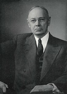
  • Image 3 William Robinson "W. R. " Brown (January 17, 1875 – August 4, 1955) was an American corporate officer of the Brown Company of Berlin, New Hampshire. He was also an influential Arabian horse breeder, the founder and owner of the Maynesboro Stud, and an authority on Arabian horses. After graduating from Williams College, Brown joined the family corporation, then known as the Berlin Mills Company, and became manager of the Woods Products Division, overseeing the company's woodlands and logging operations. He became an early advocate for sustainable forest management practices, was a member of the New Hampshire Forestry Commission from 1909 until 1952, and served on the boards of several forestry organizations. As chair of the Forestry Commission, Brown helped send sawmills to Europe during World War I to assist the war effort. He was influenced by the Progressive movement, instituting employee benefits such as company-sponsored care for injured workers that predated modern workers' compensation laws. As a Republican, he served as a presidential elector for New Hampshire in 1924. (Full article...)

    William Robinson "W. R. " Brown (January 17, 1875 – August 4, 1955) was an American corporate officer of the Brown Company of Berlin, New Hampshire. He was also an influential Arabian horse breeder, the founder and owner of the Maynesboro Stud, and an authority on Arabian horses.

    After graduating from Williams College, Brown joined the family corporation, then known as the Berlin Mills Company, and became manager of the Woods Products Division, overseeing the company's woodlands and logging operations. He became an early advocate for sustainable forest management practices, was a member of the New Hampshire Forestry Commission from 1909 until 1952, and served on the boards of several forestry organizations. As chair of the Forestry Commission, Brown helped send sawmills to Europe during World War I to assist the war effort. He was influenced by the Progressive movement, instituting employee benefits such as company-sponsored care for injured workers that predated modern workers' compensation laws. As a Republican, he served as a presidential elector for New Hampshire in 1924. (Full article...)
  • Image 4 Along Astley Road Chat Moss is a large area of peat bog that makes up part of the City of Salford, Metropolitan Borough of Wigan and Trafford in Greater Manchester, England. It also makes up part of Metropolitan Borough of St Helens in Merseyside and Warrington in Cheshire. North of the Manchester Ship Canal and River Mersey, 5 miles (8 km) to the west of Manchester, it occupies an area of about 10.6 square miles (27.5 km2). As it might be recognised today, Chat Moss is thought to be about 7,000 years old, but peat development seems to have begun there with the ending of the last ice age, about 10,000 years ago. The depth of peat ranges from 24 to 30 feet (7 to 9 m). A great deal of reclamation work has been carried out, particularly during the 19th century, but a large-scale network of drainage channels is still required to keep the land from reverting to bog. In 1958 workers extracting peat discovered the severed head of what is believed to be a Romano-British Celt, possibly a sacrificial victim, in the eastern part of the bog near Worsley. (Full article...)

    Chat Moss is a large area of peat bog that makes up part of the City of Salford, Metropolitan Borough of Wigan and Trafford in Greater Manchester, England. It also makes up part of Metropolitan Borough of St Helens in Merseyside and Warrington in Cheshire. North of the Manchester Ship Canal and River Mersey, 5 miles (8 km) to the west of Manchester, it occupies an area of about 10.6 square miles (27.5 km).

    As it might be recognised today, Chat Moss is thought to be about 7,000 years old, but peat development seems to have begun there with the ending of the last ice age, about 10,000 years ago. The depth of peat ranges from 24 to 30 feet (7 to 9 m). A great deal of reclamation work has been carried out, particularly during the 19th century, but a large-scale network of drainage channels is still required to keep the land from reverting to bog. In 1958 workers extracting peat discovered the severed head of what is believed to be a Romano-British Celt, possibly a sacrificial victim, in the eastern part of the bog near Worsley. (Full article...)
  • Image 5 Stolt Kittiwake heading toward the Mersey Estuary, 2005 The Manchester Ship Canal is a 36 mi-long (58 km) inland waterway in the North West of England linking Manchester to the Irish Sea. Starting at the Mersey Estuary at Eastham, near Ellesmere Port, Cheshire, it generally follows the original routes of the rivers Mersey and Irwell through the historic counties of Cheshire and Lancashire. Several sets of locks lift vessels about 60 ft (18 m) to the canal's terminus in Manchester. Landmarks along its route include the Barton Swing Aqueduct, the world's only swing aqueduct, and Trafford Park, the world's first planned industrial estate and still the largest in Europe. The rivers Mersey and Irwell were first made navigable in the early 18th century. Goods were also transported on the Runcorn extension of the Bridgewater Canal (from 1776) and the Liverpool and Manchester Railway (from 1830) but by the late 19th century the Mersey and Irwell Navigation had fallen into disrepair and was often unusable. Manchester's business community viewed the charges imposed by Liverpool's docks and the railway companies as excessive. A ship canal was proposed to give ocean-going vessels direct access to Manchester. The region was suffering from the Long Depression; the canal's proponents argued that the scheme would boost competition and create jobs. They gained public support for the scheme, which was first presented to Parliament as a bill in 1882. Faced with stiff opposition from Liverpool, the canal's supporters were unable to gain the necessary act of Parliament to allow the scheme to go ahead until 1885. (Full article...)

    The Manchester Ship Canal is a 36 mi-long (58 km) inland waterway in the North West of England linking Manchester to the Irish Sea. Starting at the Mersey Estuary at Eastham, near Ellesmere Port, Cheshire, it generally follows the original routes of the rivers Mersey and Irwell through the historic counties of Cheshire and Lancashire. Several sets of locks lift vessels about 60 ft (18 m) to the canal's terminus in Manchester. Landmarks along its route include the Barton Swing Aqueduct, the world's only swing aqueduct, and Trafford Park, the world's first planned industrial estate and still the largest in Europe.

    The rivers Mersey and Irwell were first made navigable in the early 18th century. Goods were also transported on the Runcorn extension of the Bridgewater Canal (from 1776) and the Liverpool and Manchester Railway (from 1830) but by the late 19th century the Mersey and Irwell Navigation had fallen into disrepair and was often unusable. Manchester's business community viewed the charges imposed by Liverpool's docks and the railway companies as excessive. A ship canal was proposed to give ocean-going vessels direct access to Manchester. The region was suffering from the Long Depression; the canal's proponents argued that the scheme would boost competition and create jobs. They gained public support for the scheme, which was first presented to Parliament as a bill in 1882. Faced with stiff opposition from Liverpool, the canal's supporters were unable to gain the necessary act of Parliament to allow the scheme to go ahead until 1885. (Full article...)
  • Image 6 Huaynaputina (/ˌwaɪnəpʊˈtiːnə/ WY-nə-puu-TEE-nə; Spanish: [wajnapuˈtina]) is a volcano in a volcanic high plateau in southern Peru. Lying in the Central Volcanic Zone of the Andes, it was formed by the subduction of the oceanic Nazca Plate under the continental South American Plate. Huaynaputina is a large volcanic crater, lacking an identifiable mountain profile, with an outer stratovolcano and three younger volcanic vents within an amphitheatre-shaped structure that is either a former caldera or a remnant of glacial erosion. The volcano has erupted dacitic magma. In the Holocene, Huaynaputina has erupted several times, including on 19 February 1600 – the largest eruption ever recorded in South America – which continued with a series of events into March. Witnessed by people in the city of Arequipa, it killed at least 1,000–1,500 people in the region, wiped out vegetation, buried the surrounding area with 2 metres (7 ft) of volcanic rock and damaged infrastructure and economic resources. The eruption had a significant impact on Earth's climate, causing a volcanic winter: temperatures in the Northern Hemisphere decreased; cold waves hit parts of Europe, Asia and the Americas; and the climate disruption may have played a role in the onset of the Little Ice Age. Floods, famines, and social upheavals resulted, including a probable link with the Russian Time of Troubles. This eruption has been computed to measure 6 on the Volcanic Explosivity Index (VEI). (Full article...)
    Huaynaputina (/ˌwnəpʊˈtnə/ WY-nə-puu-TEE-nə; Spanish: [wajnapuˈtina]) is a volcano in a volcanic high plateau in southern Peru. Lying in the Central Volcanic Zone of the Andes, it was formed by the subduction of the oceanic Nazca Plate under the continental South American Plate. Huaynaputina is a large volcanic crater, lacking an identifiable mountain profile, with an outer stratovolcano and three younger volcanic vents within an amphitheatre-shaped structure that is either a former caldera or a remnant of glacial erosion. The volcano has erupted dacitic magma.

    In the Holocene, Huaynaputina has erupted several times, including on 19 February 1600 – the largest eruption ever recorded in South America – which continued with a series of events into March. Witnessed by people in the city of Arequipa, it killed at least 1,000–1,500 people in the region, wiped out vegetation, buried the surrounding area with 2 metres (7 ft) of volcanic rock and damaged infrastructure and economic resources. The eruption had a significant impact on Earth's climate, causing a volcanic winter: temperatures in the Northern Hemisphere decreased; cold waves hit parts of Europe, Asia and the Americas; and the climate disruption may have played a role in the onset of the Little Ice Age. Floods, famines, and social upheavals resulted, including a probable link with the Russian Time of Troubles. This eruption has been computed to measure 6 on the Volcanic Explosivity Index (VEI). (Full article...)
  • Image 7 Hoodoo Mountain as seen from the Iskut River Hoodoo Mountain, sometimes referred to as Hoodoo Volcano, is a potentially active stratovolcano in the Northern Interior of British Columbia, Canada. It is located 25 kilometres (16 miles) northeast of the Alaska–British Columbia border on the north side of the Iskut River opposite of the mouth of the Craig River. With a summit elevation of 1,850 metres (6,070 feet) and a topographic prominence of 900 metres (3,000 feet), Hoodoo Mountain is one of many prominent peaks within the Boundary Ranges of the Coast Mountains. Its flat-topped summit is covered by an ice cap more than 100 metres (330 feet) thick and at least 3 kilometres (1.9 miles) in diameter. Two valley glaciers surrounding the northwestern and northeastern sides of the mountain have retreated significantly over the last hundred years. They both originate from a large icefield to the north and are the sources of two meltwater streams. These streams flow along the western and eastern sides of the volcano before draining into the Iskut River. Much of Hoodoo Mountain was formed beneath glacial ice and it has been overlain by glaciers or an ice cap throughout much of its history. The main rock types composing the volcano are phonolite and trachyte, which were deposited during six periods of eruptive activity beginning about 85,000 years ago. Most of these eruptive periods were characterized by steady flows of lava but at least one period of explosive activity occurred as indicated by the presence of pyroclastic rocks. The latest eruptive period began about 10,000 years ago with the eruption of extensive lava flows that cover the north–central, northwestern and southeastern mountain slopes. A lava flow covering the southwestern slope may have been produced by a more recent eruption within the last couple of hundred years. Although no historical eruptions are known at Hoodoo Mountain, there have been periods of seismic activity since at least the mid-1980s, indicating possible future eruptions and volcanic hazards. (Full article...)

    Hoodoo Mountain, sometimes referred to as Hoodoo Volcano, is a potentially active stratovolcano in the Northern Interior of British Columbia, Canada. It is located 25 kilometres (16 miles) northeast of the Alaska–British Columbia border on the north side of the Iskut River opposite of the mouth of the Craig River. With a summit elevation of 1,850 metres (6,070 feet) and a topographic prominence of 900 metres (3,000 feet), Hoodoo Mountain is one of many prominent peaks within the Boundary Ranges of the Coast Mountains. Its flat-topped summit is covered by an ice cap more than 100 metres (330 feet) thick and at least 3 kilometres (1.9 miles) in diameter. Two valley glaciers surrounding the northwestern and northeastern sides of the mountain have retreated significantly over the last hundred years. They both originate from a large icefield to the north and are the sources of two meltwater streams. These streams flow along the western and eastern sides of the volcano before draining into the Iskut River.

    Much of Hoodoo Mountain was formed beneath glacial ice and it has been overlain by glaciers or an ice cap throughout much of its history. The main rock types composing the volcano are phonolite and trachyte, which were deposited during six periods of eruptive activity beginning about 85,000 years ago. Most of these eruptive periods were characterized by steady flows of lava but at least one period of explosive activity occurred as indicated by the presence of pyroclastic rocks. The latest eruptive period began about 10,000 years ago with the eruption of extensive lava flows that cover the north–central, northwestern and southeastern mountain slopes. A lava flow covering the southwestern slope may have been produced by a more recent eruption within the last couple of hundred years. Although no historical eruptions are known at Hoodoo Mountain, there have been periods of seismic activity since at least the mid-1980s, indicating possible future eruptions and volcanic hazards. (Full article...)
  • Image 8 Henry in full regalia (depicted in the 11th-century Evangelion of Saint Emmeram's Abbey) Henry IV (German: Heinrich IV; 11 November 1050 – 7 August 1106) was Holy Roman Emperor from 1084 to 1105, King of Germany from 1054 to 1105, King of Italy and Burgundy from 1056 to 1105, and Duke of Bavaria from 1052 to 1054. He was the son of Henry III, Holy Roman Emperor—the second monarch of the Salian dynasty—and Agnes of Poitou. After his father's death on 5 October 1056, Henry was placed under his mother's guardianship. She made grants to German aristocrats to secure their support. Unlike her late husband, she could not control the election of the popes, thus the idea of the "liberty of the Church" strengthened during her rule. Taking advantage of her weakness, Archbishop Anno II of Cologne kidnapped Henry in April 1062. He administered Germany until Henry came of age in 1065. Henry endeavoured to recover the royal estates that had been lost during his minority. He employed low-ranking officials to carry out his new policies, causing discontent in Saxony and Thuringia. Henry crushed a riot in Saxony in 1069 and overcame the rebellion of the Saxon aristocrat Otto of Nordheim in 1071. The appointment of commoners to high office offended German aristocrats, and many of them withdrew from Henry's court. He insisted on his royal prerogative to appoint bishops and abbots, although the reformist clerics condemned this practice as simony (a forbidden sale of church offices). Pope Alexander II blamed Henry's advisors for his acts and excommunicated them in early 1073. Henry's conflicts with the Holy See and the German dukes weakened his position and the Saxons rose up in open rebellion in the summer of 1074. Taking advantage of a quarrel between the Saxon aristocrats and peasantry, he forced the rebels into submission in October 1075. (Full article...)
    Henry IV (German: Heinrich IV; 11 November 1050 – 7 August 1106) was Holy Roman Emperor from 1084 to 1105, King of Germany from 1054 to 1105, King of Italy and Burgundy from 1056 to 1105, and Duke of Bavaria from 1052 to 1054. He was the son of Henry III, Holy Roman Emperor—the second monarch of the Salian dynasty—and Agnes of Poitou. After his father's death on 5 October 1056, Henry was placed under his mother's guardianship. She made grants to German aristocrats to secure their support. Unlike her late husband, she could not control the election of the popes, thus the idea of the "liberty of the Church" strengthened during her rule. Taking advantage of her weakness, Archbishop Anno II of Cologne kidnapped Henry in April 1062. He administered Germany until Henry came of age in 1065.

    Henry endeavoured to recover the royal estates that had been lost during his minority. He employed low-ranking officials to carry out his new policies, causing discontent in Saxony and Thuringia. Henry crushed a riot in Saxony in 1069 and overcame the rebellion of the Saxon aristocrat Otto of Nordheim in 1071. The appointment of commoners to high office offended German aristocrats, and many of them withdrew from Henry's court. He insisted on his royal prerogative to appoint bishops and abbots, although the reformist clerics condemned this practice as simony (a forbidden sale of church offices). Pope Alexander II blamed Henry's advisors for his acts and excommunicated them in early 1073. Henry's conflicts with the Holy See and the German dukes weakened his position and the Saxons rose up in open rebellion in the summer of 1074. Taking advantage of a quarrel between the Saxon aristocrats and peasantry, he forced the rebels into submission in October 1075. (Full article...)
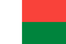
  • Image 9 Madagascar, officially the Republic of Madagascar, is an island country comprising the island of Madagascar and numerous smaller peripheral islands. Lying off the southeastern coast of Africa, it is the world's fourth largest island, the second-largest island country and the 46th largest country in the world. Its capital and largest city is Antananarivo. Following the prehistoric breakup of the supercontinent Gondwana, Madagascar split from Africa during the Early Jurassic, around 180 million years ago, and split from the Indian subcontinent around 90 million years ago, allowing native plants and animals to evolve in relative isolation; consequently, it is a biodiversity hotspot and one of the world's 17 megadiverse countries, with over 90% of wildlife being endemic. The island has a subtropical to tropical maritime climate. Madagascar was first settled during or before the mid-first millennium AD by Austronesian peoples, presumably arriving on outrigger canoes from present-day Indonesia. These were joined around the ninth century AD by Bantu migrants crossing the Mozambique Channel from East Africa. Other groups continued to settle on Madagascar over time, each one making lasting contributions to Malagasy cultural life. Consequently, there are 18 or more classified peoples of Madagascar, the most numerous being the Merina of the central highlands. (Full article...)

    Madagascar, officially the Republic of Madagascar, is an island country comprising the island of Madagascar and numerous smaller peripheral islands. Lying off the southeastern coast of Africa, it is the world's fourth largest island, the second-largest island country and the 46th largest country in the world. Its capital and largest city is Antananarivo.

    Following the prehistoric breakup of the supercontinent Gondwana, Madagascar split from Africa during the Early Jurassic, around 180 million years ago, and split from the Indian subcontinent around 90 million years ago, allowing native plants and animals to evolve in relative isolation; consequently, it is a biodiversity hotspot and one of the world's 17 megadiverse countries, with over 90% of wildlife being endemic. The island has a subtropical to tropical maritime climate. Madagascar was first settled during or before the mid-first millennium AD by Austronesian peoples, presumably arriving on outrigger canoes from present-day Indonesia. These were joined around the ninth century AD by Bantu migrants crossing the Mozambique Channel from East Africa. Other groups continued to settle on Madagascar over time, each one making lasting contributions to Malagasy cultural life. Consequently, there are 18 or more classified peoples of Madagascar, the most numerous being the Merina of the central highlands. (Full article...)
  • Image 10 Enhanced color image of Io from the Galileo spacecraft, taken in 1999. Io (/ˈaɪ.oʊ/), or Jupiter I, is the innermost and second-smallest of the four Galilean moons of the planet Jupiter. Slightly larger than Earth's moon, Io is the fourth-largest moon in the Solar System, has the highest density of any moon, the strongest surface gravity of any moon, and the lowest amount of water by atomic ratio of any known astronomical object in the Solar System. It was discovered in 1610 by Galileo Galilei and was named after the mythological character Io, a priestess of Hera who became one of Zeus's lovers. With over 400 active volcanoes, Io is the most geologically active object in the Solar System. This extreme geologic activity is the result of tidal heating from friction generated within Io's interior as it is pulled between Jupiter and the other Galilean moons—Europa, Ganymede and Callisto. Several volcanoes produce plumes of sulfur and sulfur dioxide that climb as high as 500 km (300 mi) above the surface. Io's surface is also dotted with more than 100 mountains that have been uplifted by extensive compression at the base of Io's silicate crust. Some of these peaks are taller than Mount Everest, the highest point on Earth's surface. Unlike most moons in the outer Solar System, which are mostly composed of water ice, Io is primarily composed of silicate rock surrounding a molten iron or iron sulfide core. Most of Io's surface is composed of extensive plains with a frosty coating of sulfur and sulfur dioxide. (Full article...)

    Io (/ˈ./), or Jupiter I, is the innermost and second-smallest of the four Galilean moons of the planet Jupiter. Slightly larger than Earth's moon, Io is the fourth-largest moon in the Solar System, has the highest density of any moon, the strongest surface gravity of any moon, and the lowest amount of water by atomic ratio of any known astronomical object in the Solar System. It was discovered in 1610 by Galileo Galilei and was named after the mythological character Io, a priestess of Hera who became one of Zeus's lovers.

    With over 400 active volcanoes, Io is the most geologically active object in the Solar System. This extreme geologic activity is the result of tidal heating from friction generated within Io's interior as it is pulled between Jupiter and the other Galilean moons—Europa, Ganymede and Callisto. Several volcanoes produce plumes of sulfur and sulfur dioxide that climb as high as 500 km (300 mi) above the surface. Io's surface is also dotted with more than 100 mountains that have been uplifted by extensive compression at the base of Io's silicate crust. Some of these peaks are taller than Mount Everest, the highest point on Earth's surface. Unlike most moons in the outer Solar System, which are mostly composed of water ice, Io is primarily composed of silicate rock surrounding a molten iron or iron sulfide core. Most of Io's surface is composed of extensive plains with a frosty coating of sulfur and sulfur dioxide. (Full article...)
  • Image 11 The Kingdom of Mysore was a geopolitical realm in southern India founded in around 1399 in the vicinity of the modern-day city of Mysore and prevailed until 1950. The territorial boundaries and the form of government transmuted substantially throughout the kingdom's lifetime. While originally a feudal vassal under the Vijayanagara Empire, it became a princely state in British India from 1799 to 1947, marked in-between by major political changes. The kingdom, which was founded and ruled for the most part by the Wadiyars, initially served as a fedual vassal under the Vijayanagara Empire. With the gradual decline of the Empire, the 16th-century Timmaraja Wodeyar II declared independence from it. The 17th century saw a steady expansion of its territory and, during the rule of Narasaraja Wodeyar I and Devaraja Wodeyar II, the kingdom annexed large expanses of what is now southern Karnataka and parts of Tamil Nadu, becoming a formidable power in the Deccan. (Full article...)

    The Kingdom of Mysore was a geopolitical realm in southern India founded in around 1399 in the vicinity of the modern-day city of Mysore and prevailed until 1950. The territorial boundaries and the form of government transmuted substantially throughout the kingdom's lifetime. While originally a feudal vassal under the Vijayanagara Empire, it became a princely state in British India from 1799 to 1947, marked in-between by major political changes.

    The kingdom, which was founded and ruled for the most part by the Wadiyars, initially served as a fedual vassal under the Vijayanagara Empire. With the gradual decline of the Empire, the 16th-century Timmaraja Wodeyar II declared independence from it. The 17th century saw a steady expansion of its territory and, during the rule of Narasaraja Wodeyar I and Devaraja Wodeyar II, the kingdom annexed large expanses of what is now southern Karnataka and parts of Tamil Nadu, becoming a formidable power in the Deccan. (Full article...)
  • Image 12 Lagoon-facing beach on South Islet Caroline Island (also known as Caroline Atoll or Millennium Island) is the easternmost of several uninhabited coral atolls comprising the southern Line Islands in the central Pacific Ocean nation of Kiribati. The atoll was first sighted by Europeans in 1606 and was claimed by the United Kingdom of Great Britain and Ireland in 1868. It has been part of the Republic of Kiribati since the island nation's independence in 1979. Caroline Island has remained relatively untouched and is one of the world's most pristine tropical islands, despite guano mining, copra (coconut meat) harvesting, and human habitation in the 19th and 20th centuries. It is home to one of the world's largest populations of the coconut crab and is an important breeding site for seabirds, most notably the sooty tern. (Full article...)

    Caroline Island (also known as Caroline Atoll or Millennium Island) is the easternmost of several uninhabited coral atolls comprising the southern Line Islands in the central Pacific Ocean nation of Kiribati.

    The atoll was first sighted by Europeans in 1606 and was claimed by the United Kingdom of Great Britain and Ireland in 1868. It has been part of the Republic of Kiribati since the island nation's independence in 1979. Caroline Island has remained relatively untouched and is one of the world's most pristine tropical islands, despite guano mining, copra (coconut meat) harvesting, and human habitation in the 19th and 20th centuries. It is home to one of the world's largest populations of the coconut crab and is an important breeding site for seabirds, most notably the sooty tern. (Full article...)
  • Image 13 Navenby village from the Viking Way Navenby /ˈneɪvənbi/ is a village and civil parish in the North Kesteven district of Lincolnshire, England. Lying 8 miles (13 km) south from Lincoln and 9 miles (14 km) north-northwest from Sleaford, Navenby had a population of 2,128 in the 2011 census and in March 2011, it was named as the 'Best Value Village' in England following a national survey. A Bronze Age cemetery and the remains of an Iron Age settlement have been discovered in the village. Historians also believe Navenby was a significant staging point on the Roman Ermine Street, as the Romans are reported to have maintained a small base or garrison in the village. Navenby became a market town after receiving a charter from Edward the Confessor in the 11th century. The charter was later renewed by William Rufus, Edward III and Richard II. When the market fell into disuse in the early 19th century, Navenby returned to being a village. (Full article...)

    Navenby /ˈnvənbi/ is a village and civil parish in the North Kesteven district of Lincolnshire, England. Lying 8 miles (13 km) south from Lincoln and 9 miles (14 km) north-northwest from Sleaford, Navenby had a population of 2,128 in the 2011 census and in March 2011, it was named as the 'Best Value Village' in England following a national survey.

    A Bronze Age cemetery and the remains of an Iron Age settlement have been discovered in the village. Historians also believe Navenby was a significant staging point on the Roman Ermine Street, as the Romans are reported to have maintained a small base or garrison in the village. Navenby became a market town after receiving a charter from Edward the Confessor in the 11th century. The charter was later renewed by William Rufus, Edward III and Richard II. When the market fell into disuse in the early 19th century, Navenby returned to being a village. (Full article...)
  • Image 14 Maritana Avenue, one of only two paved roads in Elcor, looking south toward Manilla Street, 1980 Elcor is a ghost town, or more properly, an extinct town, in the U.S. state of Minnesota that was inhabited between 1897 and 1956. It was built on the Mesabi Iron Range near the city of Gilbert in St. Louis County. Elcor was its own unincorporated community before it was abandoned and was never a neighborhood proper of the city of Gilbert. Not rating a figure in the national census, the people of Elcor were only generally considered to be citizens of Gilbert. The area where Elcor was located was annexed by Gilbert when its existing city boundaries were expanded after 1969. In November 1890, the seven Merritt brothers discovered ore near Mountain Iron, triggering an unparalleled iron rush to the Mesabi Range. The Elba mine was opened in 1897, and the town was platted under the direction of Don H. Bacon, president of the Minnesota Iron Company. A second nearby mine, the Corsica, was opened in 1901. The community was first called "Elba" after the name of the first underground mine (the name "Elcor" was formed later by combining the first syllables of each mine's name). The Elba and Corsica mines were both leased by Pickands Mather and Company after the formation of the United States Steel Corporation. An influx of people of many ethnicities and many nations followed, and Elcor became a microcosm of U.S. immigration, mirroring the cultural assimilation of the time. At its peak around 1920, Elcor had two churches, a post office, a general store, a primary school, a railroad station, and its own law enforcement, and housed a population of nearly 1,000. (Full article...)

    Elcor is a ghost town, or more properly, an extinct town, in the U.S. state of Minnesota that was inhabited between 1897 and 1956. It was built on the Mesabi Iron Range near the city of Gilbert in St. Louis County. Elcor was its own unincorporated community before it was abandoned and was never a neighborhood proper of the city of Gilbert. Not rating a figure in the national census, the people of Elcor were only generally considered to be citizens of Gilbert. The area where Elcor was located was annexed by Gilbert when its existing city boundaries were expanded after 1969.

    In November 1890, the seven Merritt brothers discovered ore near Mountain Iron, triggering an unparalleled iron rush to the Mesabi Range. The Elba mine was opened in 1897, and the town was platted under the direction of Don H. Bacon, president of the Minnesota Iron Company. A second nearby mine, the Corsica, was opened in 1901. The community was first called "Elba" after the name of the first underground mine (the name "Elcor" was formed later by combining the first syllables of each mine's name). The Elba and Corsica mines were both leased by Pickands Mather and Company after the formation of the United States Steel Corporation. An influx of people of many ethnicities and many nations followed, and Elcor became a microcosm of U.S. immigration, mirroring the cultural assimilation of the time. At its peak around 1920, Elcor had two churches, a post office, a general store, a primary school, a railroad station, and its own law enforcement, and housed a population of nearly 1,000. (Full article...)
  • Image 15 John William Beschter SJ (born Johann Wilhelm Beschter; German: [ˈjoːhan ˈvɪlhɛlm ˈbɛʃtɐ]; [needs Luxembourgish IPA] May 20, 1763 – January 6, 1842) was a Catholic priest and Jesuit from the Duchy of Luxembourg in the Austrian Netherlands. He emigrated to the United States as a missionary in 1807, where he ministered in rural Pennsylvania and Maryland. Beschter was the last Jesuit pastor of St. Mary's Church in Lancaster, as well as the pastor of St. John the Evangelist Church in Baltimore, Maryland. He was also a priest at several other German-speaking churches in Pennsylvania. Beschter's ministerial work was punctuated by a time as master of novices at the new Jesuit novitiate at White Marsh Manor, as well as a brief term as president of Georgetown College in 1829. While in Maryland, he aligned himself with the Continental European Jesuits in the United States, who endorsed a monarchist view of ecclesiastical leadership. After his presidency, Beschter remained at Georgetown for a year as a professor of German, before returning to Paradise, Pennsylvania, where he lived out the last twelve years of his life as a priest. (Full article...)

    John William Beschter SJ (born Johann Wilhelm Beschter; German: [ˈjoːhan ˈvɪlhɛlm ˈbɛʃtɐ]; May 20, 1763 – January 6, 1842) was a Catholic priest and Jesuit from the Duchy of Luxembourg in the Austrian Netherlands. He emigrated to the United States as a missionary in 1807, where he ministered in rural Pennsylvania and Maryland. Beschter was the last Jesuit pastor of St. Mary's Church in Lancaster, as well as the pastor of St. John the Evangelist Church in Baltimore, Maryland. He was also a priest at several other German-speaking churches in Pennsylvania.

    Beschter's ministerial work was punctuated by a time as master of novices at the new Jesuit novitiate at White Marsh Manor, as well as a brief term as president of Georgetown College in 1829. While in Maryland, he aligned himself with the Continental European Jesuits in the United States, who endorsed a monarchist view of ecclesiastical leadership. After his presidency, Beschter remained at Georgetown for a year as a professor of German, before returning to Paradise, Pennsylvania, where he lived out the last twelve years of his life as a priest. (Full article...)
  • More featured articles

    Vital articles Vital article

    Vital articles to understand Geography.

    A city is a human settlement of a notable size. The term "city" has different meanings around the world and in some places the settlement can be very small. Even where the term is limited to larger settlements, there is no universally agreed definition of the lower boundary for their size. In a more narrow sense, a city can be defined as a permanent and densely populated place with administratively defined boundaries whose members work primarily on non-agricultural tasks. Cities generally have extensive systems for housing, transportation, sanitation, utilities, land use, production of goods, and communication. Their density facilitates interaction between people, government organizations, and businesses, sometimes benefiting different parties in the process, such as improving the efficiency of goods and service distribution. (Full article...)
    Other vital articles

    Get involved

    For editor resources and to collaborate with other editors on improving Wikipedia's Geography-related articles, visit WikiProject Geography.


    Here are some tasks awaiting attention:

    Selected pictures

    Featured biography articles in geography

    Alfred Russel Wallace OM FRS (8 January 1823 – 7 November 1913) was an English naturalist, explorer, geographer, anthropologist, biologist and illustrator. He independently conceived the theory of evolution through natural selection; his 1858 paper on the subject was published that year alongside extracts from Charles Darwin's earlier writings on the topic. It spurred Darwin to set aside the "big species book" he was drafting and quickly write an abstract of it, which was published in 1859 as On the Origin of Species.

    Wallace did extensive fieldwork, starting in the Amazon River basin. He then did fieldwork in the Malay Archipelago, where he identified the faunal divide now termed the Wallace Line, which separates the Indonesian archipelago into two distinct parts: a western portion in which the animals are largely of Asian origin, and an eastern portion where the fauna reflect Australasia. He was considered the 19th century's leading expert on the geographical distribution of animal species, and is sometimes called the "father of biogeography", or more specifically of zoogeography. (Full article...)
    More featured biographies

    Did you know

    Did you know it about Geography?

    Places around you

    You can read about interesting Wikipedia articles about places around you.

    Special:Nearby

    This following Geography-related articles is a most visited articles of WikiProject Geography, See complete list at Wikipedia:WikiProject Geography/Popular pages.

  • Image 4 Generation X (often shortened to Gen X) is the demographic cohort following the Baby Boomers and preceding Millennials. Researchers and popular media often use the mid-1960s as its starting birth years and the late 1970s as its ending birth years, with the generation being generally defined as people born from 1965 to 1980. By this definition and U.S. Census data, there are 65.2 million Gen Xers in the United States as of 2019. Most of Generation X are the children of the Silent Generation and early Baby Boomers; Xers are also often the parents of Millennials and Generation Z. (Full article...)
    Generation X (often shortened to Gen X) is the demographic cohort following the Baby Boomers and preceding Millennials. Researchers and popular media often use the mid-1960s as its starting birth years and the late 1970s as its ending birth years, with the generation being generally defined as people born from 1965 to 1980. By this definition and U.S. Census data, there are 65.2 million Gen Xers in the United States as of 2019. Most of Generation X are the children of the Silent Generation and early Baby Boomers; Xers are also often the parents of Millennials and Generation Z. (Full article...)
  • Image 5 Cartogram of the world's population in 2018; each square represents 500,000 people. This is a list of countries and dependencies by population. It includes sovereign states, inhabited dependent territories and, in some cases, constituent countries of sovereign states, with inclusion within the list being primarily based on the ISO standard ISO 3166-1. For instance, the United Kingdom is considered a single entity, while the constituent countries of the Kingdom of the Netherlands are considered separately. In addition, this list includes certain states with limited recognition not found in ISO 3166-1. Also given in a percentage is each country's population compared with the world population, which the United Nations estimates at 8.13 billion as of 2024. (Full article...)
    Cartogram of the world's population in 2018; each square represents 500,000 people.


    This is a list of countries and dependencies by population. It includes sovereign states, inhabited dependent territories and, in some cases, constituent countries of sovereign states, with inclusion within the list being primarily based on the ISO standard ISO 3166-1. For instance, the United Kingdom is considered a single entity, while the constituent countries of the Kingdom of the Netherlands are considered separately. In addition, this list includes certain states with limited recognition not found in ISO 3166-1. Also given in a percentage is each country's population compared with the world population, which the United Nations estimates at 8.13 billion as of 2024. (Full article...)
  • Image 6 Hong Kong is a special administrative region of the People's Republic of China. With 7.4 million residents of various nationalities in a 1,104-square-kilometre (426 sq mi) territory, Hong Kong is the fourth most densely populated region in the world. (Full article...)

    Hong Kong is a special administrative region of the People's Republic of China. With 7.4 million residents of various nationalities in a 1,104-square-kilometre (426 sq mi) territory, Hong Kong is the fourth most densely populated region in the world. (Full article...)
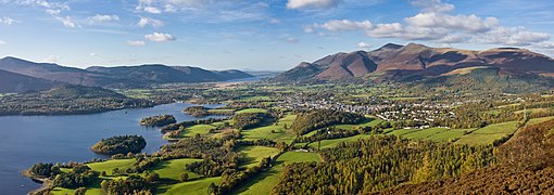
  • Image 7 Millennials, also known as Generation Y or Gen Y, are the demographic cohort following Generation X and preceding Generation Z. Researchers and popular media use the early 1980s as starting birth years and the mid-1990s to early 2000s as ending birth years, with the generation typically being defined as people born from 1981 to 1996. Most Millennials are the children of Baby Boomers and older Generation X. In turn Millennials are often the parents of Generation Alpha. (Full article...)
    Millennials, also known as Generation Y or Gen Y, are the demographic cohort following Generation X and preceding Generation Z. Researchers and popular media use the early 1980s as starting birth years and the mid-1990s to early 2000s as ending birth years, with the generation typically being defined as people born from 1981 to 1996. Most Millennials are the children of Baby Boomers and older Generation X. In turn Millennials are often the parents of Generation Alpha. (Full article...)
  • Image 8 England is a country that is part of the United Kingdom. It is located on the island of Great Britain, of which it covers approximately 62%, and over 100 smaller adjacent islands. It has land borders with Scotland to the north and Wales to the west, and is otherwise surrounded by the North Sea to the east, the English Channel to the south, the Celtic Sea to the south-west, and the Irish Sea to the west. Continental Europe lies to the south-east, and Ireland to the west. At the 2021 census, the population was 56,490,048. London is both the largest city and the capital. (Full article...)
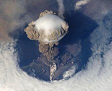
    England is a country that is part of the United Kingdom. It is located on the island of Great Britain, of which it covers approximately 62%, and over 100 smaller adjacent islands. It has land borders with Scotland to the north and Wales to the west, and is otherwise surrounded by the North Sea to the east, the English Channel to the south, the Celtic Sea to the south-west, and the Irish Sea to the west. Continental Europe lies to the south-east, and Ireland to the west. At the 2021 census, the population was 56,490,048. London is both the largest city and the capital. (Full article...)
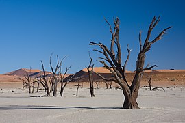
  • Image 9 Generation Alpha (often shortened to Gen Alpha) is the demographic cohort succeeding Generation Z. Researchers and popular media use the early 2010s as starting birth years to the mid-2020s as the ending birth years (see § Date and age range definitions). Named after alpha, the first letter in the Greek alphabet, Generation Alpha is the first to be born entirely in the 21st century and the third millennium. Most members of Generation Alpha are the children of Millennials. (Full article...)
    Generation Alpha (often shortened to Gen Alpha) is the demographic cohort succeeding Generation Z. Researchers and popular media use the early 2010s as starting birth years to the mid-2020s as the ending birth years (see § Date and age range definitions). Named after alpha, the first letter in the Greek alphabet, Generation Alpha is the first to be born entirely in the 21st century and the third millennium. Most members of Generation Alpha are the children of Millennials. (Full article...)
  • Image 10 Dymaxion map of the world with the 30 largest countries and territories by area This is a list of the world's countries and their dependencies by land, water, and total area, ranked by total area. (Full article...)
    Dymaxion map of the world with the 30 largest countries and territories by area

    This is a list of the world's countries and their dependencies by land, water, and total area, ranked by total area. (Full article...)
  • Click to enlarge and view description.

    Main articles

    CategoriesCategories

    Select [►] to view subcategories.

    Associated Wikimedia

    The following Wikimedia Foundation sister projects provide more on this subject:

    Discover Wikipedia using portals
    Retrieved from "https://en.wikipedia.org/w/index.php?title=Portal:Geography&oldid=1202464975"