Portal:Geography
The Geography Portal

Geography (from Ancient Greek γεωγραφία geōgraphía; combining gê 'Earth' and gráphō 'write') is the study of the lands, features, inhabitants, and phenomena of Earth. Geography is an all-encompassing discipline that seeks an understanding of Earth and its human and natural complexities—not merely where objects are, but also how they have changed and come to be. While geography is specific to Earth, many concepts can be applied more broadly to other celestial bodies in the field of planetary science. Geography has been called "a bridge between natural science and social science disciplines."
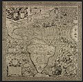
Origins of many of the concepts in geography can be traced to Greek Eratosthenes of Cyrene, who may have coined the term "geographia" (c. 276 BC – c. 195/194 BC). The first recorded use of the word γεωγραφία was as the title of a book by Greek scholar Claudius Ptolemy (100 – 170 AD). This work created the so-called "Ptolemaic tradition" of geography, which included "Ptolemaic cartographic theory." However, the concepts of geography (such as cartography) date back to the earliest attempts to understand the world spatially, with the earliest example of an attempted world map dating to the 9th century BCE in ancient Babylon. The history of geography as a discipline spans cultures and millennia, being independently developed by multiple groups, and cross-pollinated by trade between these groups. The core concepts of geography consistent between all approaches are a focus on space, place, time, and scale.
Today, geography is an extremely broad discipline with multiple approaches and modalities. There have been multiple attempts to organize the discipline, including the four traditions of geography, and into branches. Techniques employed can generally be broken down into quantitative and qualitative approaches, with many studies taking mixed-methods approaches. Common techniques include cartography, remote sensing, interviews, and surveying. (Full article...)
White Deer Hole Creek is a 20.5-mile (33.0 km) tributary of the West Branch Susquehanna River in Clinton, Lycoming and Union counties in the U.S. state of Pennsylvania. A part of the Chesapeake Bay drainage basin, the White Deer Hole Creek watershed drains parts of ten townships. The creek flows east in a valley of the Ridge-and-valley Appalachians, through sandstone, limestone, and shale from the Ordovician, Silurian, and Devonian periods.
As of 2006, the creek and its 67.2-square-mile (174 km) watershed are relatively undeveloped, with 28.4 percent of the watershed given to agriculture and 71.6 percent covered by forest, including part of Tiadaghton State Forest. The western part of White Deer Hole Creek has very high water quality and is the only major creek section in Lycoming County classified as Class A Wild Trout Waters, defined by the Pennsylvania Fish and Boat Commission as "streams which support a population of naturally produced trout of sufficient size and abundance to support a long-term and rewarding sport fishery." The rest of the creek and its major tributary (Spring Creek) are kept stocked. There are opportunities in the watershed for canoeing, hunting, and camping, and trails for hiking and horseback riding. (Full article...)
Suillus bovinus, also known as the Jersey cow mushroom or bovine bolete, is a pored mushroom of the genus Suillus in the family Suillaceae. A common fungus native to Europe and Asia, it has been introduced to North America and Australia. It was initially described as Boletus bovinus by Carl Linnaeus in 1753, and given its current binomial name by Henri François Anne de Roussel in 1806. It is an edible mushroom, though not highly regarded.
The fungus grows in coniferous forests in its native range, and pine plantations in countries where it has become naturalised. It forms symbiotic ectomycorrhizal associations with living trees by enveloping the tree's underground roots with sheaths of fungal tissue, and is sometimes parasitised by the related mushroom Gomphidius roseus. Suillus bovinus produces spore-bearing fruit bodies, often in large numbers, above ground. The mushroom has a convex grey-yellow or ochre cap reaching up to 10 cm (4 in) in diameter, which flattens with age. Like other boletes, it has tubes extending downward from the underside of the cap, rather than gills; spores escape at maturity through the tube openings, or pores. The pore surface is yellow. The stipe, more slender than those of other Suillus boletes, lacks a ring. (Full article...)
Saguaro National Park is a national park of the United States in southeastern Arizona. The 92,000-acre (37,000 ha) park consists of two separate areas—the Tucson Mountain District (TMD), about 10 miles (16 km) west of Tucson, and the Rincon Mountain District (RMD), about 10 miles (16 km) east of the city. Both districts preserve Sonoran Desert landscapes, fauna, and flora, including the giant saguaro cactus.
The volcanic rocks on the surface of the Tucson Mountain District differ greatly from the surface rocks of the Rincon Mountain District; over the past 30 million years, crustal stretching displaced rocks from beneath the Tucson Mountains of the Tucson Mountain District to form the Rincon Mountains of the Rincon Mountain District. Uplifted, domed, and eroded, the Rincon Mountains are significantly higher and wetter than the Tucson Mountains. The Rincons, as one of the Madrean Sky Islands between the southern Rocky Mountains and the Sierra Madre Oriental in Mexico, support high biodiversity and are home to many plants and animals that do not live in the Tucson Mountain District. (Full article...)
The Romney Literary Society (also known as the Literary Society of Romney) existed from January 30, 1819, to February 15, 1886, in Romney, West Virginia. Established as the Polemic Society of Romney, it became the first organization of its kind in the present-day state of West Virginia, and one of the first in the United States. The society was founded by nine prominent men of Romney with the objectives of advancing literature and science, purchasing and maintaining a library, and improving educational opportunities.
The society debated an extensive range of scientific and social topics, often violating its own rules which banned religious and political subjects. Even though its membership was relatively small, its debates and activities were frequently discussed throughout the Potomac Highlands region, and the organization greatly influenced trends of thought in the Romney community and surrounding areas. (Full article...)
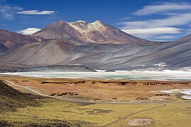
Incapillo is a Pleistocene-age caldera (a depression formed by the collapse of a volcano) in the La Rioja Province of Argentina. It is the southernmost volcanic centre in the Andean Central Volcanic Zone (CVZ) that erupted during the Pleistocene. Incapillo is one of several ignimbrite or caldera systems that, along with 44 active stratovolcanoes, comprise the CVZ.
Subduction of the Nazca Plate beneath the South American Plate is responsible for most of the volcanism in the CVZ. After activity in the volcanic arc of the western Maricunga Belt ceased six million years ago, volcanism commenced in the Incapillo region, forming the high volcanic edifices Monte Pissis, Cerro Bonete Chico and Sierra de Veladero. Later, a number of lava domes were emplaced between these volcanoes. (Full article...)
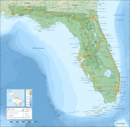
The St. Johns River (Spanish: Río San Juan) is the longest river in the U.S. state of Florida and it is the most significant one for commercial and recreational use. At 310 miles (500 km) long, it flows north and winds through or borders twelve counties. The drop in elevation from headwaters to mouth is less than 30 feet (9 m); like most Florida waterways, the St. Johns has a very slow flow speed of 0.3 mph (0.13 m/s), and is often described as "lazy".
Numerous lakes are formed by the river or flow into it, but as a river its widest point is nearly 3 miles (5 km) across. The narrowest point is in the headwaters, an unnavigable marsh in Indian River County. The St. Johns drainage basin of 8,840 square miles (22,900 km) includes some of Florida's major wetlands. It is separated into three major basins and two associated watersheds for Lake George and the Ocklawaha River, all managed by the St. Johns River Water Management District. (Full article...)


