Loading
  • 21 Aug, 2019

  • By, Wikipedia

Portal:Geography

The Geography Portal

Geography (from Ancient Greek γεωγραφία geōgraphía; combining 'Earth' and gráphō 'write') is the study of the lands, features, inhabitants, and phenomena of Earth. Geography is an all-encompassing discipline that seeks an understanding of Earth and its human and natural complexities—not merely where objects are, but also how they have changed and come to be. While geography is specific to Earth, many concepts can be applied more broadly to other celestial bodies in the field of planetary science. Geography has been called "a bridge between natural science and social science disciplines."

Origins of many of the concepts in geography can be traced to Greek Eratosthenes of Cyrene, who may have coined the term "geographia" (c. 276 BC – c. 195/194 BC). The first recorded use of the word γεωγραφία was as the title of a book by Greek scholar Claudius Ptolemy (100 – 170 AD). This work created the so-called "Ptolemaic tradition" of geography, which included "Ptolemaic cartographic theory." However, the concepts of geography (such as cartography) date back to the earliest attempts to understand the world spatially, with the earliest example of an attempted world map dating to the 9th century BCE in ancient Babylon. The history of geography as a discipline spans cultures and millennia, being independently developed by multiple groups, and cross-pollinated by trade between these groups. The core concepts of geography consistent between all approaches are a focus on space, place, time, and scale.

Today, geography is an extremely broad discipline with multiple approaches and modalities. There have been multiple attempts to organize the discipline, including the four traditions of geography, and into branches. Techniques employed can generally be broken down into quantitative and qualitative approaches, with many studies taking mixed-methods approaches. Common techniques include cartography, remote sensing, interviews, and surveying. (Full article...)

Featured articles are displayed here, which represent some of the best content on English Wikipedia.

  • Image 2 Darjeeling (/dɑːrˈdʒiːlɪŋ/, Bengali: [ˈdarˌdʒiliŋ], Nepali: [ˈdard͡ziliŋ]) is a city in the northernmost region of the Indian state of West Bengal. Located in the Eastern Himalayas, it has an average elevation of 2,045 metres (6,709 ft). To the west of Darjeeling lies the easternmost province of Nepal, to the east the Kingdom of Bhutan, to the north the Indian state of Sikkim, and farther north the Tibet Autonomous Region region of China. Bangladesh lies to the south and southeast, and most of the state of West Bengal lies to the south and southwest, connected to the Darjeeling region by a narrow tract. Kangchenjunga, the world's third-highest mountain, rises to the north and is prominently visible on clear days. In the early 19th century, during East India Company rule in India, Darjeeling was identified as a potential summer retreat for British officials, soldiers and their families. The narrow mountain ridge was leased from the Kingdom of Sikkim, and eventually annexed to British India. Experimentation with growing tea on the slopes below Darjeeling was highly successful. Thousands of labourers were recruited chiefly from Nepal to clear the forests, build European-style cottages and work in the tea plantations. The widespread deforestation displaced the indigenous peoples. Residential schools were established in and around Darjeeling for the education of children of the domiciled British in India. By the late-19th century, a novel narrow-gauge mountain railway, the Darjeeling Himalayan Railway, was bringing summer residents into the town and carrying a freight of tea out for export to the world. After India's independence in 1947, as the British left Darjeeling, its cottages were purchased by wealthy Indians from the plains and its tea plantations by out-of-town Indian business owners and conglomerates. (Full article...)

    Darjeeling (/dɑːrˈlɪŋ/, Bengali: [ˈdarˌdʒiliŋ], Nepali: [ˈdard͡ziliŋ]) is a city in the northernmost region of the Indian state of West Bengal. Located in the Eastern Himalayas, it has an average elevation of 2,045 metres (6,709 ft). To the west of Darjeeling lies the easternmost province of Nepal, to the east the Kingdom of Bhutan, to the north the Indian state of Sikkim, and farther north the Tibet Autonomous Region region of China. Bangladesh lies to the south and southeast, and most of the state of West Bengal lies to the south and southwest, connected to the Darjeeling region by a narrow tract. Kangchenjunga, the world's third-highest mountain, rises to the north and is prominently visible on clear days.

    In the early 19th century, during East India Company rule in India, Darjeeling was identified as a potential summer retreat for British officials, soldiers and their families. The narrow mountain ridge was leased from the Kingdom of Sikkim, and eventually annexed to British India. Experimentation with growing tea on the slopes below Darjeeling was highly successful. Thousands of labourers were recruited chiefly from Nepal to clear the forests, build European-style cottages and work in the tea plantations. The widespread deforestation displaced the indigenous peoples. Residential schools were established in and around Darjeeling for the education of children of the domiciled British in India. By the late-19th century, a novel narrow-gauge mountain railway, the Darjeeling Himalayan Railway, was bringing summer residents into the town and carrying a freight of tea out for export to the world. After India's independence in 1947, as the British left Darjeeling, its cottages were purchased by wealthy Indians from the plains and its tea plantations by out-of-town Indian business owners and conglomerates. (Full article...)
  • Image 3 Jameson Adams, Frank Wild and Eric Marshall (from left to right) plant the Union Jack at their southernmost position, 88° 23', on 9 January 1909. The photograph was taken by expedition leader Ernest Shackleton. The Nimrod Expedition of 1907–1909, otherwise known as the British Antarctic Expedition, was the first of three expeditions to the Antarctic led by Ernest Shackleton and his second time to the Continent. Its main target, among a range of geographical and scientific objectives, was to be first to reach the South Pole. This was not attained, but the expedition's southern march reached a Farthest South latitude of 88° 23' S, just 97.5 nautical miles (180.6 km; 112.2 mi) from the pole. This was by far the longest southern polar journey to that date and a record convergence on either Pole. A separate group led by Welsh Australian geology professor Edgeworth David reached the estimated location of the South magnetic pole, and the expedition also achieved the first ascent of Mount Erebus, Antarctica's second highest volcano. The expedition lacked governmental or institutional support, and relied on private loans and individual contributions. It was beset by financial problems and its preparations were hurried. Its ship, Nimrod, was less than half of the size of Robert Falcon Scott's 1901–1904 expedition ship Discovery, and Shackleton's crew lacked relevant experience. Controversy arose from Shackleton's decision to base the expedition in McMurdo Sound, close to Scott's old headquarters, in contravention of a promise to Scott that he would not do so. Nevertheless, although the expedition's profile was initially much lower than that of Scott's six years earlier, its achievements attracted widespread interest and made Shackleton a national hero. The scientific team, which included the future Australasian Antarctic Expedition leader Douglas Mawson, carried out extensive geological, zoological and meteorological work. Shackleton's transport arrangements, based on Manchurian ponies, motor traction, and sled dogs, were innovations which, despite limited success, were later copied by Scott for his ill-fated Terra Nova Expedition. (Full article...)
    Three men in heavy clothing stand in line on an icy surface, next to a flagstaff from which flies the flag of the United Kingdom of Great Britain and Ireland
    Jameson Adams, Frank Wild and Eric Marshall (from left to right) plant the Union Jack at their southernmost position, 88° 23', on 9 January 1909. The photograph was taken by expedition leader Ernest Shackleton.


    The Nimrod Expedition of 1907–1909, otherwise known as the British Antarctic Expedition, was the first of three expeditions to the Antarctic led by Ernest Shackleton and his second time to the Continent. Its main target, among a range of geographical and scientific objectives, was to be first to reach the South Pole. This was not attained, but the expedition's southern march reached a Farthest South latitude of 88° 23' S, just 97.5 nautical miles (180.6 km; 112.2 mi) from the pole. This was by far the longest southern polar journey to that date and a record convergence on either Pole. A separate group led by Welsh Australian geology professor Edgeworth David reached the estimated location of the South magnetic pole, and the expedition also achieved the first ascent of Mount Erebus, Antarctica's second highest volcano.

    The expedition lacked governmental or institutional support, and relied on private loans and individual contributions. It was beset by financial problems and its preparations were hurried. Its ship, Nimrod, was less than half of the size of Robert Falcon Scott's 1901–1904 expedition ship Discovery, and Shackleton's crew lacked relevant experience. Controversy arose from Shackleton's decision to base the expedition in McMurdo Sound, close to Scott's old headquarters, in contravention of a promise to Scott that he would not do so. Nevertheless, although the expedition's profile was initially much lower than that of Scott's six years earlier, its achievements attracted widespread interest and made Shackleton a national hero. The scientific team, which included the future Australasian Antarctic Expedition leader Douglas Mawson, carried out extensive geological, zoological and meteorological work. Shackleton's transport arrangements, based on Manchurian ponies, motor traction, and sled dogs, were innovations which, despite limited success, were later copied by Scott for his ill-fated Terra Nova Expedition. (Full article...)
  • Image 4 The orca (Orcinus orca), or killer whale, is a toothed whale and the largest member of the oceanic dolphin family. It is the only extant species in the genus Orcinus and is recognizable its black-and-white patterned body. A cosmopolitan species, they are found in diverse marine environments, from Arctic to Antarctic regions to tropical seas. Orcas are apex predators with a diverse diet. Individual populations often specialize in particular types of prey. This includes a variety of fish, sharks, rays, and marine mammals such as seals and other dolphins and whales. They are highly social; some populations are composed of highly stable matrilineal family groups (pods). Their sophisticated hunting techniques and vocal behaviors, often specific to a particular group and passed along from generation to generation, are considered to be manifestations of animal culture. (Full article...)

    The orca (Orcinus orca), or killer whale, is a toothed whale and the largest member of the oceanic dolphin family. It is the only extant species in the genus Orcinus and is recognizable its black-and-white patterned body. A cosmopolitan species, they are found in diverse marine environments, from Arctic to Antarctic regions to tropical seas.

    Orcas are apex predators with a diverse diet. Individual populations often specialize in particular types of prey. This includes a variety of fish, sharks, rays, and marine mammals such as seals and other dolphins and whales. They are highly social; some populations are composed of highly stable matrilineal family groups (pods). Their sophisticated hunting techniques and vocal behaviors, often specific to a particular group and passed along from generation to generation, are considered to be manifestations of animal culture. (Full article...)
  • Image 5 Aerial view of Presque Isle toward the east-northeast Presque Isle State Park (/prɛsk/ PRESK) is a 3,112-acre (1,259 ha) Pennsylvania State Park on an arching, sandy peninsula jutting into Lake Erie, 4 miles (6 km) west of the city of Erie, in Millcreek Township, Erie County, Pennsylvania, in the United States. The peninsula sweeps northeastward, surrounding Presque Isle Bay along the park's southern coast. It has 13 miles (21 km) of roads, 21 miles (34 km) of recreational trails, 13 beaches for swimming, and a marina. Popular activities at the park include swimming, boating, hiking, biking, and birdwatching. The recorded history of Presque Isle begins with the Erielhonan, a Native American tribe who gave their name to Lake Erie, and includes French, British, and American forts, as well as serving as a base for Commodore Oliver Hazard Perry's fleet in the War of 1812. With the growing importance of shipping on Lake Erie in the 19th century, Presque Isle became home to several lighthouses and what later became a United States Coast Guard station. In 1921, it became a state park, and as of 2007 it hosts over 4 million visitors per year, the most of any Pennsylvania state park. (Full article...)

    Presque Isle State Park (/prɛsk/ PRESK) is a 3,112-acre (1,259 ha) Pennsylvania State Park on an arching, sandy peninsula jutting into Lake Erie, 4 miles (6 km) west of the city of Erie, in Millcreek Township, Erie County, Pennsylvania, in the United States. The peninsula sweeps northeastward, surrounding Presque Isle Bay along the park's southern coast. It has 13 miles (21 km) of roads, 21 miles (34 km) of recreational trails, 13 beaches for swimming, and a marina. Popular activities at the park include swimming, boating, hiking, biking, and birdwatching.

    The recorded history of Presque Isle begins with the Erielhonan, a Native American tribe who gave their name to Lake Erie, and includes French, British, and American forts, as well as serving as a base for Commodore Oliver Hazard Perry's fleet in the War of 1812. With the growing importance of shipping on Lake Erie in the 19th century, Presque Isle became home to several lighthouses and what later became a United States Coast Guard station. In 1921, it became a state park, and as of 2007 it hosts over 4 million visitors per year, the most of any Pennsylvania state park. (Full article...)
  • Image 6 El Tatio geyser field El Tatio is a geothermal field with many geysers located in the Andes Mountains of northern Chile at 4,320 metres (14,170 ft) above mean sea level. It is the third-largest geyser field in the world and the largest in the Southern Hemisphere. Various meanings have been proposed for the name "El Tatio", including "oven" or "grandfather". The geothermal field has many geysers, hot springs, and associated sinter deposits. These hot springs eventually form the Rio Salado, a major tributary of the Rio Loa, and are a major source of arsenic pollution in the river. The vents are sites of populations of extremophile microorganisms such as hyperthermophiles, and El Tatio has been studied as an analogue for the early Earth and possible past life on Mars. El Tatio lies at the western foot of a series of stratovolcanoes, which runs along the border between Chile and Bolivia. This series of volcanoes is part of the Central Volcanic Zone, one of several volcanic belts in the Andes, and of the Altiplano–Puna volcanic complex (APVC). This is a system of large calderas and associated ignimbrites, which have been the sources of supereruptions between 10 and 1 million years ago. Some of these calderas may be the source of heat for the El Tatio geothermal system. There are no recorded eruptions of the Tatio volcanoes in the historical period. (Full article...)
    Bent steam plumes rising from a desolate landscape
    El Tatio geyser field

    El Tatio is a geothermal field with many geysers located in the Andes Mountains of northern Chile at 4,320 metres (14,170 ft) above mean sea level. It is the third-largest geyser field in the world and the largest in the Southern Hemisphere. Various meanings have been proposed for the name "El Tatio", including "oven" or "grandfather". The geothermal field has many geysers, hot springs, and associated sinter deposits. These hot springs eventually form the Rio Salado, a major tributary of the Rio Loa, and are a major source of arsenic pollution in the river. The vents are sites of populations of extremophile microorganisms such as hyperthermophiles, and El Tatio has been studied as an analogue for the early Earth and possible past life on Mars.

    El Tatio lies at the western foot of a series of stratovolcanoes, which runs along the border between Chile and Bolivia. This series of volcanoes is part of the Central Volcanic Zone, one of several volcanic belts in the Andes, and of the Altiplano–Puna volcanic complex (APVC). This is a system of large calderas and associated ignimbrites, which have been the sources of supereruptions between 10 and 1 million years ago. Some of these calderas may be the source of heat for the El Tatio geothermal system. There are no recorded eruptions of the Tatio volcanoes in the historical period. (Full article...)
  • Image 7 A view of Chew Stoke Chew Stoke is a small village and civil parish in the affluent Chew Valley, in Somerset, England, about 8 miles (13 km) south of Bristol and 10 miles north of Wells. It is at the northern edge of the Mendip Hills, a region designated by the United Kingdom as an Area of Outstanding Natural Beauty, and is within the Bristol and Bath green belt. The parish includes the hamlet of Breach Hill, which is approximately 2 miles (3.2 km) southwest of Chew Stoke itself. Chew Stoke has a long history, as shown by the number and range of its heritage-listed buildings. The village is at the northern end of Chew Valley Lake, which was created in the 1950s, close to a dam, pumping station, sailing club, and fishing lodge. A tributary of the River Chew, which rises in Strode, runs through the village. (Full article...)

    Chew Stoke is a small village and civil parish in the affluent Chew Valley, in Somerset, England, about 8 miles (13 km) south of Bristol and 10 miles north of Wells. It is at the northern edge of the Mendip Hills, a region designated by the United Kingdom as an Area of Outstanding Natural Beauty, and is within the Bristol and Bath green belt. The parish includes the hamlet of Breach Hill, which is approximately 2 miles (3.2 km) southwest of Chew Stoke itself.

    Chew Stoke has a long history, as shown by the number and range of its heritage-listed buildings. The village is at the northern end of Chew Valley Lake, which was created in the 1950s, close to a dam, pumping station, sailing club, and fishing lodge. A tributary of the River Chew, which rises in Strode, runs through the village. (Full article...)
  • Image 8 Aerial photo from 1991 Hudson Volcano (Spanish: Volcán Hudson, Cerro Hudson, or Monte Hudson) is the most active volcano in the southern part of the Southern Volcanic Zone of the Andes Mountains in Chile, having erupted most recently in 2011. It was formed by the subduction of the oceanic Nazca Plate under the continental South American Plate. South of Hudson is a smaller volcano, followed by a long gap without active volcanoes, then the Austral Volcanic Zone. Hudson has the form of a 10-kilometre-wide (6-mile) caldera filled with ice; the Huemules Glacier emerges from the northwestern side of the caldera. The volcano has erupted rocks ranging from basalt to rhyolite, but large parts of the caldera are formed by non-volcanic rocks. The volcano erupted numerous times in the late Pleistocene and Holocene, forming widespread tephra deposits both in the proximity of Hudson and in the wider region. Four large eruptions took place in 17,300–17,440 BP ("H0 eruption"), 7,750 BP ("H1 eruption"), 4,200 BP ("H2 eruption") and in 1991 AD ("H3 eruption"); the second is among the most intense volcanic eruptions in South America during the Holocene. A smaller eruption occurred in 1971. The 7,750 BP and 1991 eruptions had a substantial impact on the human population of Patagonia and (for the 7,750 BP eruption) Tierra del Fuego: The 7,750 BP eruption devastated the local ecosystem and may have caused substantial shifts in human settlement and lifestyle. During the 1991 eruption, volcanic ash covered a large area in Chile and neighbouring Argentina, causing high mortality in farm animals, aggravating an existing economic crisis, and reaching as far as Antarctica. (Full article...)

    Hudson Volcano (Spanish: Volcán Hudson, Cerro Hudson, or Monte Hudson) is the most active volcano in the southern part of the Southern Volcanic Zone of the Andes Mountains in Chile, having erupted most recently in 2011. It was formed by the subduction of the oceanic Nazca Plate under the continental South American Plate. South of Hudson is a smaller volcano, followed by a long gap without active volcanoes, then the Austral Volcanic Zone. Hudson has the form of a 10-kilometre-wide (6-mile) caldera filled with ice; the Huemules Glacier emerges from the northwestern side of the caldera. The volcano has erupted rocks ranging from basalt to rhyolite, but large parts of the caldera are formed by non-volcanic rocks.

    The volcano erupted numerous times in the late Pleistocene and Holocene, forming widespread tephra deposits both in the proximity of Hudson and in the wider region.
    Four large eruptions took place in 17,300–17,440 BP ("H0 eruption"), 7,750 BP ("H1 eruption"), 4,200 BP ("H2 eruption") and in 1991 AD ("H3 eruption"); the second is among the most intense volcanic eruptions in South America during the Holocene. A smaller eruption occurred in 1971. The 7,750 BP and 1991 eruptions had a substantial impact on the human population of Patagonia and (for the 7,750 BP eruption) Tierra del Fuego: The 7,750 BP eruption devastated the local ecosystem and may have caused substantial shifts in human settlement and lifestyle. During the 1991 eruption, volcanic ash covered a large area in Chile and neighbouring Argentina, causing high mortality in farm animals, aggravating an existing economic crisis, and reaching as far as Antarctica. (Full article...)
  • Image 9 View north of Pine Creek Gorge, Pine Creek, and Pine Creek Rail Trail from the Leonard Harrison State Park Leonard Harrison State Park is a 585-acre (237 ha) Pennsylvania state park in Tioga County, Pennsylvania, in the United States. It is on the east rim of the Pine Creek Gorge, also known as the Grand Canyon of Pennsylvania, which is 800 feet (240 m) deep and nearly 4,000 feet (1,200 m) across here. It also serves as headquarters for the adjoining Colton Point State Park, its sister park on the west rim of the gorge. Leonard Harrison State Park is known for its views of the Pine Creek Gorge, and offers hiking, fishing and hunting, whitewater boating, and camping. The park is in Shippen and Delmar Townships, 10 miles (16 km) west of Wellsboro at the western terminus of Pennsylvania Route 660. Pine Creek flows through the park and has carved the gorge through five major rock formations from the Devonian and Carboniferous periods. Native Americans once used the Pine Creek Path along the creek. The path was later used by lumbermen, and then became the course of a railroad from 1883 to 1988. Since 1996, the 63.4-mile (102.0 km) Pine Creek Rail Trail has followed the creek through the park. The Pine Creek Gorge was named a National Natural Landmark in 1968 and is also protected as a Pennsylvania State Natural Area and Important Bird Area, while Pine Creek is a Pennsylvania Scenic and Wild River. The gorge is home to many species of plants and animals, some of which have been reintroduced to the area. (Full article...)
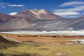
    Leonard Harrison State Park is a 585-acre (237 ha) Pennsylvania state park in Tioga County, Pennsylvania, in the United States. It is on the east rim of the Pine Creek Gorge, also known as the Grand Canyon of Pennsylvania, which is 800 feet (240 m) deep and nearly 4,000 feet (1,200 m) across here. It also serves as headquarters for the adjoining Colton Point State Park, its sister park on the west rim of the gorge. Leonard Harrison State Park is known for its views of the Pine Creek Gorge, and offers hiking, fishing and hunting, whitewater boating, and camping. The park is in Shippen and Delmar Townships, 10 miles (16 km) west of Wellsboro at the western terminus of Pennsylvania Route 660.

    Pine Creek flows through the park and has carved the gorge through five major rock formations from the Devonian and Carboniferous periods. Native Americans once used the Pine Creek Path along the creek. The path was later used by lumbermen, and then became the course of a railroad from 1883 to 1988. Since 1996, the 63.4-mile (102.0 km) Pine Creek Rail Trail has followed the creek through the park. The Pine Creek Gorge was named a National Natural Landmark in 1968 and is also protected as a Pennsylvania State Natural Area and Important Bird Area, while Pine Creek is a Pennsylvania Scenic and Wild River. The gorge is home to many species of plants and animals, some of which have been reintroduced to the area. (Full article...)
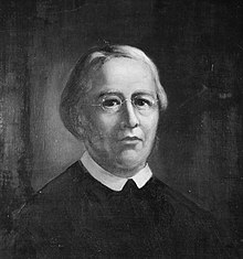
  • Image 10 William Feiner SJ (born Wilhelm Feiner; December 27, 1792 – June 9, 1829) was a German Catholic priest and Jesuit who became a missionary to the United States and eventually the president of Georgetown College, now known as Georgetown University. Born in Münster, he taught in Jesuit schools in the Russian Empire and Polish Galicia as a young member of the Society of Jesus. He then emigrated to the United States several years after the restoration of the Society, taking up pastoral work and teaching theology in Conewago, Pennsylvania, before becoming a full-time professor at Georgetown College. There, he also became the second dedicated librarian of Georgetown's library. Eventually, Feiner became president of the college in 1826. While president, he taught theology at Georgetown and ministered to the congregation at Holy Trinity Church. (Full article...)

    William Feiner SJ (born Wilhelm Feiner; December 27, 1792 – June 9, 1829) was a German Catholic priest and Jesuit who became a missionary to the United States and eventually the president of Georgetown College, now known as Georgetown University.

    Born in Münster, he taught in Jesuit schools in the Russian Empire and Polish Galicia as a young member of the Society of Jesus. He then emigrated to the United States several years after the restoration of the Society, taking up pastoral work and teaching theology in Conewago, Pennsylvania, before becoming a full-time professor at Georgetown College. There, he also became the second dedicated librarian of Georgetown's library. Eventually, Feiner became president of the college in 1826. While president, he taught theology at Georgetown and ministered to the congregation at Holy Trinity Church. (Full article...)
  • Image 11 Mountain goat, official park symbol, above Hidden Lake, with Dragons Tail in the distance Glacier National Park is a national park of the United States located in northwestern Montana, on the Canada–United States border, adjacent to Waterton Lakes National Park in Canada—the two parks are known as the Waterton-Glacier International Peace Park. The park encompasses more than 1 million acres (4,100 km2) and includes parts of two mountain ranges (sub-ranges of the Rocky Mountains), more than 130 named lakes, more than 1,000 different species of plants, and hundreds of species of animals. This vast pristine ecosystem is the centerpiece of what has been referred to as the "Crown of the Continent Ecosystem," a region of protected land encompassing 16,000 sq mi (41,000 km2). The region that became Glacier National Park was first inhabited by Native Americans. Upon the arrival of European explorers, it was dominated by the Blackfeet in the east and the Flathead in the western regions. Under pressure, the Blackfeet ceded the mountainous parts of their treaty lands in 1895 to the federal government; it later became part of the park. Soon after the establishment of the park on May 11, 1910, a number of hotels and chalets were constructed by the Great Northern Railway. These historic hotels and chalets are listed as National Historic Landmarks and a total of 350 locations are on the National Register of Historic Places. By 1932 work was completed on the Going-to-the-Sun Road, later designated a National Historic Civil Engineering Landmark, which provided motorists easier access to the heart of the park. (Full article...)

    Glacier National Park is a national park of the United States located in northwestern Montana, on the Canada–United States border, adjacent to Waterton Lakes National Park in Canada—the two parks are known as the Waterton-Glacier International Peace Park. The park encompasses more than 1 million acres (4,100 km) and includes parts of two mountain ranges (sub-ranges of the Rocky Mountains), more than 130 named lakes, more than 1,000 different species of plants, and hundreds of species of animals. This vast pristine ecosystem is the centerpiece of what has been referred to as the "Crown of the Continent Ecosystem," a region of protected land encompassing 16,000 sq mi (41,000 km).

    The region that became Glacier National Park was first inhabited by Native Americans. Upon the arrival of European explorers, it was dominated by the Blackfeet in the east and the Flathead in the western regions. Under pressure, the Blackfeet ceded the mountainous parts of their treaty lands in 1895 to the federal government; it later became part of the park. Soon after the establishment of the park on May 11, 1910, a number of hotels and chalets were constructed by the Great Northern Railway. These historic hotels and chalets are listed as National Historic Landmarks and a total of 350 locations are on the National Register of Historic Places. By 1932 work was completed on the Going-to-the-Sun Road, later designated a National Historic Civil Engineering Landmark, which provided motorists easier access to the heart of the park. (Full article...)
  • Image 12 1930s council housing on Wexford Road Knowle West is a neighbourhood in the south of Bristol, England, 2 miles (3 km) from the city centre, and mostly in the Filwood ward of Bristol City Council, although a small part of the estate lies within Knowle ward to the east. To the west are Bishopsworth and Hartcliffe, to the north Bedminster and Windmill Hill and to the south Whitchurch Park and Hengrove. In 2008, the population was 11,787. There is evidence of late Iron Age and Roman settlements in the area. At the time of the Domesday Book, Knowle was a rural area assessed at a taxable value of two geld units. Knowle West remained rural in character until the 1930s, when a council estate was developed to provide homes for people displaced by slum clearance in the centre of the city. (Full article...)

    Knowle West is a neighbourhood in the south of Bristol, England, 2 miles (3 km) from the city centre, and mostly in the Filwood ward of Bristol City Council, although a small part of the estate lies within Knowle ward to the east. To the west are Bishopsworth and Hartcliffe, to the north Bedminster and Windmill Hill and to the south Whitchurch Park and Hengrove. In 2008, the population was 11,787.

    There is evidence of late Iron Age and Roman settlements in the area. At the time of the Domesday Book, Knowle was a rural area assessed at a taxable value of two geld units. Knowle West remained rural in character until the 1930s, when a council estate was developed to provide homes for people displaced by slum clearance in the centre of the city. (Full article...)
  • Image 13 Beach viewed from board-walk through the pines Holkham National Nature Reserve is England's largest national nature reserve (NNR). It is on the Norfolk coast between Burnham Overy Staithe and Blakeney, and is managed by Natural England with the cooperation of the Holkham Estate. Its 3,900 hectares (9,600 acres) comprise a wide range of habitats, including grazing marsh, woodland, salt marsh, sand dunes and foreshore. The reserve is part of the North Norfolk Coast Site of Special Scientific Interest, and the larger area is additionally protected through Natura 2000, Special Protection Area (SPA) and Ramsar listings, and is part of both an Area of Outstanding Natural Beauty (AONB) and a World Biosphere Reserve. Holkham NNR is important for its wintering wildfowl, especially pink-footed geese, Eurasian wigeon and brant geese, but it also has breeding waders, and attracts many migrating birds in autumn. Many scarce invertebrates and plants can be found in the dunes, and the reserve is one of the only two sites in the UK to have an antlion colony. This stretch of coast originally consisted of salt marshes protected from the sea by ridges of shingle and sand, and Holkham's Iron Age fort stood at the end of a sandy spit surrounded by the tidal wetland. The Vikings navigated the creeks to establish Holkham village, but access to the former harbour was stopped by drainage and reclamation of the marshes between the coast and the shingle ridge which started in the 17th century, and was completed in 1859. The Holkham estate has been owned by the Coke family, later Earls of Leicester since 1609, and their seat at Holkham Hall is opposite the reserve's Lady Anne's Drive entrance. The 3rd Earl planted pines on the dunes to protect the pastures reclaimed by his predecessors from wind-blown sand. The national nature reserve was created in 1967 from 1,700 hectares (4,200 acres) of the Holkham Estate and 2,200 hectares (5,400 acres) of foreshore belonging to the Crown. (Full article...)

    Holkham National Nature Reserve is England's largest national nature reserve (NNR). It is on the Norfolk coast between Burnham Overy Staithe and Blakeney, and is managed by Natural England with the cooperation of the Holkham Estate. Its 3,900 hectares (9,600 acres) comprise a wide range of habitats, including grazing marsh, woodland, salt marsh, sand dunes and foreshore. The reserve is part of the North Norfolk Coast Site of Special Scientific Interest, and the larger area is additionally protected through Natura 2000, Special Protection Area (SPA) and Ramsar listings, and is part of both an Area of Outstanding Natural Beauty (AONB) and a World Biosphere Reserve. Holkham NNR is important for its wintering wildfowl, especially pink-footed geese, Eurasian wigeon and brant geese, but it also has breeding waders, and attracts many migrating birds in autumn. Many scarce invertebrates and plants can be found in the dunes, and the reserve is one of the only two sites in the UK to have an antlion colony.

    This stretch of coast originally consisted of salt marshes protected from the sea by ridges of shingle and sand, and Holkham's Iron Age fort stood at the end of a sandy spit surrounded by the tidal wetland. The Vikings navigated the creeks to establish Holkham village, but access to the former harbour was stopped by drainage and reclamation of the marshes between the coast and the shingle ridge which started in the 17th century, and was completed in 1859. The Holkham estate has been owned by the Coke family, later Earls of Leicester since 1609, and their seat at Holkham Hall is opposite the reserve's Lady Anne's Drive entrance. The 3rd Earl planted pines on the dunes to protect the pastures reclaimed by his predecessors from wind-blown sand. The national nature reserve was created in 1967 from 1,700 hectares (4,200 acres) of the Holkham Estate and 2,200 hectares (5,400 acres) of foreshore belonging to the Crown. (Full article...)
  • Image 14 View of Barren Island from Dead Horse Bay Barren Island is a peninsula and former island on the southeast shore of Brooklyn in New York City. Located on Jamaica Bay, it was geographically part of the Outer Barrier island group on the South Shore of Long Island. The island was occupied by the Lenape Native Americans prior to the arrival of Dutch settlers in the 17th century. Its name is a corruption of Beeren Eylandt, the Dutch-language term for "Bears' Island". Barren Island remained sparsely inhabited before the 19th century, mainly because of its relative isolation from the rest of the city. Starting in the 1850s, the island was developed as an industrial complex with fish rendering plants and other industries, and also as an ethnically diverse community of up to 1,500 residents. Between the mid-19th century and 1934, the island housed industrial plants that processed the carcasses of the city's dead horses, converting them into a variety of industrial products. This activity led to the still-extant waterbody on the island's western shore becoming nicknamed "Dead Horse Bay". A garbage incinerator, which became the subject of numerous complaints because of its odor, operated on the island from the 1890s to 1921. (Full article...)

    Barren Island is a peninsula and former island on the southeast shore of Brooklyn in New York City. Located on Jamaica Bay, it was geographically part of the Outer Barrier island group on the South Shore of Long Island. The island was occupied by the Lenape Native Americans prior to the arrival of Dutch settlers in the 17th century. Its name is a corruption of Beeren Eylandt, the Dutch-language term for "Bears' Island".

    Barren Island remained sparsely inhabited before the 19th century, mainly because of its relative isolation from the rest of the city. Starting in the 1850s, the island was developed as an industrial complex with fish rendering plants and other industries, and also as an ethnically diverse community of up to 1,500 residents. Between the mid-19th century and 1934, the island housed industrial plants that processed the carcasses of the city's dead horses, converting them into a variety of industrial products. This activity led to the still-extant waterbody on the island's western shore becoming nicknamed "Dead Horse Bay". A garbage incinerator, which became the subject of numerous complaints because of its odor, operated on the island from the 1890s to 1921. (Full article...)
  • Image 15 The last picture ever taken of Johnston, 13 hours before his death at the eruption site David Alexander Johnston (December 18, 1949 – May 18, 1980) was an American United States Geological Survey (USGS) volcanologist who was killed by the 1980 eruption of Mount St. Helens in the U.S. state of Washington. A principal scientist on the USGS monitoring team, Johnston was killed in the eruption while manning an observation post six miles (10 km) away on the morning of May 18, 1980. He was the first to report the eruption, transmitting "Vancouver! Vancouver! This is it!" before he was swept away by a lateral blast; despite a thorough search, Johnston's body was never found, but state highway workers discovered remnants of his USGS trailer in 1993. Johnston's career took him across the United States, where he studied the Augustine Volcano in Alaska, the San Juan volcanic field in Colorado, and long-extinct volcanoes in Michigan. Johnston was a meticulous and talented scientist, known for his analyses of volcanic gases and their relationship to eruptions. This, along with his enthusiasm and positive attitude, made him liked and respected by many co-workers. After his death, other scientists lauded his character, both verbally and in dedications and letters. Johnston felt scientists must do what is necessary, including taking risks, to help protect the public from natural disasters. His work, and that of fellow USGS scientists, convinced authorities to close Mount St. Helens to the public before the 1980 eruption. They maintained the closure despite heavy pressure to re-open the area; their work saved thousands of lives. His story became intertwined with the popular image of volcanic eruptions and their threat to society, and a part of volcanology's history. To date, Johnston, along with his mentee Harry Glicken, is one of two American volcanologists known to have died in a volcanic eruption. (Full article...)
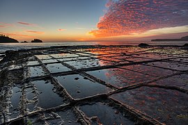
    David Alexander Johnston (December 18, 1949 – May 18, 1980) was an American United States Geological Survey (USGS) volcanologist who was killed by the 1980 eruption of Mount St. Helens in the U.S. state of Washington. A principal scientist on the USGS monitoring team, Johnston was killed in the eruption while manning an observation post six miles (10 km) away on the morning of May 18, 1980. He was the first to report the eruption, transmitting "Vancouver! Vancouver! This is it!" before he was swept away by a lateral blast; despite a thorough search, Johnston's body was never found, but state highway workers discovered remnants of his USGS trailer in 1993.

    Johnston's career took him across the United States, where he studied the Augustine Volcano in Alaska, the San Juan volcanic field in Colorado, and long-extinct volcanoes in Michigan. Johnston was a meticulous and talented scientist, known for his analyses of volcanic gases and their relationship to eruptions. This, along with his enthusiasm and positive attitude, made him liked and respected by many co-workers. After his death, other scientists lauded his character, both verbally and in dedications and letters. Johnston felt scientists must do what is necessary, including taking risks, to help protect the public from natural disasters. His work, and that of fellow USGS scientists, convinced authorities to close Mount St. Helens to the public before the 1980 eruption. They maintained the closure despite heavy pressure to re-open the area; their work saved thousands of lives. His story became intertwined with the popular image of volcanic eruptions and their threat to society, and a part of volcanology's history. To date, Johnston, along with his mentee Harry Glicken, is one of two American volcanologists known to have died in a volcanic eruption. (Full article...)
  • More featured articles

    Vital articles Vital article

    Vital articles to understand Geography.

    Oceania (UK: /ˌsiˈɑːniə, ˌʃi-, -ˈn-/ OH-s(h)ee-AH-nee-ə, -⁠AY-, US: /ˌʃiˈæniə, -ˈɑːn-/ OH-shee-A(H)N-ee-ə) is a geographical region including Australasia, Melanesia, Micronesia, and Polynesia. Outside of the English-speaking world, Oceania is generally considered a continent, while Australia is regarded as an island or a continental landmass within that continent. Spanning the Eastern and Western Hemispheres, at the centre of the water hemisphere, Oceania is estimated to have a land area of about 9,000,000 square kilometres (3,500,000 sq mi) and a population of around 44.4 million as of 2022. Oceania is the smallest continent in land area and the second-least populated after Antarctica. (Full article...)
    Other vital articles

    Get involved

    For editor resources and to collaborate with other editors on improving Wikipedia's Geography-related articles, visit WikiProject Geography.


    Here are some tasks awaiting attention:

    Selected pictures

    Featured biography articles in geography

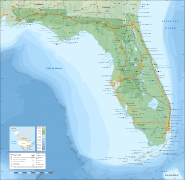
    Sir Clements Robert Markham KCB FRS FRSGS (20 July 1830 – 30 January 1916) was an English geographer, explorer and writer. He was secretary of the Royal Geographical Society (RGS) between 1863 and 1888, and later served as the Society's president for a further 12 years. In the latter capacity he was mainly responsible for organising the British National Antarctic Expedition of 1901–1904, and for launching the polar career of Robert Falcon Scott.

    Markham began his career as a Royal Navy cadet and midshipman, during which time he went to the Arctic with HMS Assistance in one of the many searches for Franklin's lost expedition. Later, Markham served as a geographer to the India Office, and was responsible for the collection of cinchona plants from their native Peruvian forests, and their transplantation in India. By this means, the Indian government acquired a home source from which quinine could be extracted. Markham also served as geographer to Sir Robert Napier's Abyssinian expeditionary force, and was present in 1868, at the fall of Magdala. (Full article...)
    More featured biographies

    Did you know

    Did you know it about Geography?

    Places around you

    You can read about interesting Wikipedia articles about places around you.

    Special:Nearby

    This following Geography-related articles is a most visited articles of WikiProject Geography, See complete list at Wikipedia:WikiProject Geography/Popular pages.

  • Image 4 Generation X (often shortened to Gen X) is the demographic cohort following the Baby Boomers and preceding Millennials. Researchers and popular media often use the mid-1960s as its starting birth years and the late 1970s as its ending birth years, with the generation being generally defined as people born from 1965 to 1980. By this definition and U.S. Census data, there are 65.2 million Gen Xers in the United States as of 2019. Most of Generation X are the children of the Silent Generation and early Baby Boomers; Xers are also often the parents of Millennials and Generation Z. (Full article...)
    Generation X (often shortened to Gen X) is the demographic cohort following the Baby Boomers and preceding Millennials. Researchers and popular media often use the mid-1960s as its starting birth years and the late 1970s as its ending birth years, with the generation being generally defined as people born from 1965 to 1980. By this definition and U.S. Census data, there are 65.2 million Gen Xers in the United States as of 2019. Most of Generation X are the children of the Silent Generation and early Baby Boomers; Xers are also often the parents of Millennials and Generation Z. (Full article...)
  • Image 5 Cartogram of the world's population in 2018; each square represents 500,000 people. This is a list of countries and dependencies by population. It includes sovereign states, inhabited dependent territories and, in some cases, constituent countries of sovereign states, with inclusion within the list being primarily based on the ISO standard ISO 3166-1. For instance, the United Kingdom is considered a single entity, while the constituent countries of the Kingdom of the Netherlands are considered separately. In addition, this list includes certain states with limited recognition not found in ISO 3166-1. Also given in a percentage is each country's population compared with the world population, which the United Nations estimates at 8.13 billion as of 2024. (Full article...)
    Cartogram of the world's population in 2018; each square represents 500,000 people.


    This is a list of countries and dependencies by population. It includes sovereign states, inhabited dependent territories and, in some cases, constituent countries of sovereign states, with inclusion within the list being primarily based on the ISO standard ISO 3166-1. For instance, the United Kingdom is considered a single entity, while the constituent countries of the Kingdom of the Netherlands are considered separately. In addition, this list includes certain states with limited recognition not found in ISO 3166-1. Also given in a percentage is each country's population compared with the world population, which the United Nations estimates at 8.13 billion as of 2024. (Full article...)
  • Image 6 Hong Kong is a special administrative region of the People's Republic of China. With 7.4 million residents of various nationalities in a 1,104-square-kilometre (426 sq mi) territory, Hong Kong is the fourth most densely populated region in the world. (Full article...)

    Hong Kong is a special administrative region of the People's Republic of China. With 7.4 million residents of various nationalities in a 1,104-square-kilometre (426 sq mi) territory, Hong Kong is the fourth most densely populated region in the world. (Full article...)
  • Image 7 Millennials, also known as Generation Y or Gen Y, are the demographic cohort following Generation X and preceding Generation Z. Researchers and popular media use the early 1980s as starting birth years and the mid-1990s to early 2000s as ending birth years, with the generation typically being defined as people born from 1981 to 1996. Most Millennials are the children of Baby Boomers and older Generation X. In turn Millennials are often the parents of Generation Alpha. (Full article...)
    Millennials, also known as Generation Y or Gen Y, are the demographic cohort following Generation X and preceding Generation Z. Researchers and popular media use the early 1980s as starting birth years and the mid-1990s to early 2000s as ending birth years, with the generation typically being defined as people born from 1981 to 1996. Most Millennials are the children of Baby Boomers and older Generation X. In turn Millennials are often the parents of Generation Alpha. (Full article...)
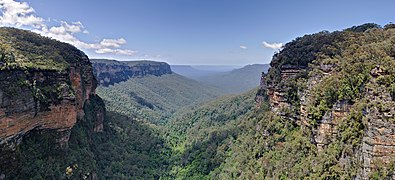
  • Image 8 England is a country that is part of the United Kingdom. It is located on the island of Great Britain, of which it covers approximately 62%, and over 100 smaller adjacent islands. It has land borders with Scotland to the north and Wales to the west, and is otherwise surrounded by the North Sea to the east, the English Channel to the south, the Celtic Sea to the south-west, and the Irish Sea to the west. Continental Europe lies to the south-east, and Ireland to the west. At the 2021 census, the population was 56,490,048. London is both the largest city and the capital. (Full article...)

    England is a country that is part of the United Kingdom. It is located on the island of Great Britain, of which it covers approximately 62%, and over 100 smaller adjacent islands. It has land borders with Scotland to the north and Wales to the west, and is otherwise surrounded by the North Sea to the east, the English Channel to the south, the Celtic Sea to the south-west, and the Irish Sea to the west. Continental Europe lies to the south-east, and Ireland to the west. At the 2021 census, the population was 56,490,048. London is both the largest city and the capital. (Full article...)
  • Image 9 Generation Alpha (often shortened to Gen Alpha) is the demographic cohort succeeding Generation Z. Researchers and popular media use the early 2010s as starting birth years to the mid-2020s as the ending birth years (see § Date and age range definitions). Named after alpha, the first letter in the Greek alphabet, Generation Alpha is the first to be born entirely in the 21st century and the third millennium. The majority of Generation Alpha are the children of Millennials. (Full article...)
    Generation Alpha (often shortened to Gen Alpha) is the demographic cohort succeeding Generation Z. Researchers and popular media use the early 2010s as starting birth years to the mid-2020s as the ending birth years (see § Date and age range definitions). Named after alpha, the first letter in the Greek alphabet, Generation Alpha is the first to be born entirely in the 21st century and the third millennium. The majority of Generation Alpha are the children of Millennials. (Full article...)
  • Image 10 Dymaxion map of the world with the 30 largest countries and territories by area This is a list of the world's countries and their dependencies by land, water, and total area, ranked by total area. (Full article...)
    Dymaxion map of the world with the 30 largest countries and territories by area

    This is a list of the world's countries and their dependencies by land, water, and total area, ranked by total area. (Full article...)
  • Click to enlarge and view description.

    Main articles

    CategoriesCategories

    Select [►] to view subcategories.

    Associated Wikimedia

    The following Wikimedia Foundation sister projects provide more on this subject:

    Discover Wikipedia using portals
    Retrieved from "https://en.wikipedia.org/w/index.php?title=Portal:Geography&oldid=1202464975"