Loading
  • 21 Aug, 2019

  • By, Wikipedia

Portal:Geography

The Geography Portal

Geography (from Ancient Greek γεωγραφία geōgraphía; combining 'Earth' and gráphō 'write') is the study of the lands, features, inhabitants, and phenomena of Earth. Geography is an all-encompassing discipline that seeks an understanding of Earth and its human and natural complexities—not merely where objects are, but also how they have changed and come to be. While geography is specific to Earth, many concepts can be applied more broadly to other celestial bodies in the field of planetary science. Geography has been called "a bridge between natural science and social science disciplines."

Origins of many of the concepts in geography can be traced to Greek Eratosthenes of Cyrene, who may have coined the term "geographia" (c. 276 BC – c. 195/194 BC). The first recorded use of the word γεωγραφία was as the title of a book by Greek scholar Claudius Ptolemy (100 – 170 AD). This work created the so-called "Ptolemaic tradition" of geography, which included "Ptolemaic cartographic theory." However, the concepts of geography (such as cartography) date back to the earliest attempts to understand the world spatially, with the earliest example of an attempted world map dating to the 9th century BCE in ancient Babylon. The history of geography as a discipline spans cultures and millennia, being independently developed by multiple groups, and cross-pollinated by trade between these groups. The core concepts of geography consistent between all approaches are a focus on space, place, time, and scale.

Today, geography is an extremely broad discipline with multiple approaches and modalities. There have been multiple attempts to organize the discipline, including the four traditions of geography, and into branches. Techniques employed can generally be broken down into quantitative and qualitative approaches, with many studies taking mixed-methods approaches. Common techniques include cartography, remote sensing, interviews, and surveying. (Full article...)

Featured articles are displayed here, which represent some of the best content on English Wikipedia.

  • Image 2 Atlantic Ocean near the Faroe Islands A sea is a large body of salty water. There are particular seas and the sea. The sea commonly refers to the World Ocean, the wider body of seawater. Particular seas are either marginal seas, second-order sections of the oceanic sea (e.g. the Mediterranean Sea), or certain large, nearly landlocked bodies of water. The salinity of water bodies varies widely, being lower near the surface and the mouths of large rivers and higher in the depths of the ocean; however, the relative proportions of dissolved salts vary little across the oceans. The most abundant solid dissolved in seawater is sodium chloride. The water also contains salts of magnesium, calcium, potassium, and mercury, amongst many other elements, some in minute concentrations. A wide variety of organisms, including bacteria, protists, algae, plants, fungi, and animals live in the seas, which offers a wide range of marine habitats and ecosystems, ranging vertically from the sunlit surface and shoreline to the great depths and pressures of the cold, dark abyssal zone, and in latitude from the cold waters under polar ice caps to the warm waters of coral reefs in tropical regions. Many of the major groups of organisms evolved in the sea and life may have started there. (Full article...)
    Atlantic Ocean near the Faroe Islands


    A sea is a large body of salty water. There are particular seas and the sea. The sea commonly refers to the World Ocean, the wider body of seawater.
    Particular seas are either marginal seas, second-order sections of the oceanic sea (e.g. the Mediterranean Sea), or certain large, nearly landlocked bodies of water.

    The salinity of water bodies varies widely, being lower near the surface and the mouths of large rivers and higher in the depths of the ocean; however, the relative proportions of dissolved salts vary little across the oceans. The most abundant solid dissolved in seawater is sodium chloride. The water also contains salts of magnesium, calcium, potassium, and mercury, amongst many other elements, some in minute concentrations. A wide variety of organisms, including bacteria, protists, algae, plants, fungi, and animals live in the seas, which offers a wide range of marine habitats and ecosystems, ranging vertically from the sunlit surface and shoreline to the great depths and pressures of the cold, dark abyssal zone, and in latitude from the cold waters under polar ice caps to the warm waters of coral reefs in tropical regions. Many of the major groups of organisms evolved in the sea and life may have started there. (Full article...)
  • Image 3 Shackleton in 1904 Sir Ernest Henry Shackleton CVO OBE FRGS FRSGS (15 February 1874 – 5 January 1922) was an Anglo-Irish Antarctic explorer who led three British expeditions to the Antarctic. He was one of the principal figures of the period known as the Heroic Age of Antarctic Exploration. Born in Kilkea, County Kildare, Ireland, Shackleton and his Anglo-Irish family moved to Sydenham in suburban south London when he was ten. Shackleton's first experience of the polar regions was as third officer on Captain Robert Falcon Scott's Discovery Expedition of 1901–1904, from which he was sent home early on health grounds, after he and his companions Scott and Edward Adrian Wilson set a new southern record by marching to latitude 82°S. During the Nimrod Expedition of 1907–1909, he and three companions established a new record Farthest South latitude of 88°23′ S, only 97 geographical miles (112 statute miles or 180 kilometres) from the South Pole, the largest advance to the pole in exploration history. Also, members of his team climbed Mount Erebus, the most active Antarctic volcano. On returning home, Shackleton was knighted for his achievements by King Edward VII. (Full article...)

    Sir Ernest Henry Shackleton CVO OBE FRGS FRSGS (15 February 1874 – 5 January 1922) was an Anglo-Irish Antarctic explorer who led three British expeditions to the Antarctic. He was one of the principal figures of the period known as the Heroic Age of Antarctic Exploration.

    Born in Kilkea, County Kildare, Ireland, Shackleton and his Anglo-Irish family moved to Sydenham in suburban south London when he was ten. Shackleton's first experience of the polar regions was as third officer on Captain Robert Falcon Scott's Discovery Expedition of 1901–1904, from which he was sent home early on health grounds, after he and his companions Scott and Edward Adrian Wilson set a new southern record by marching to latitude 82°S. During the Nimrod Expedition of 1907–1909, he and three companions established a new record Farthest South latitude of 88°23′ S, only 97 geographical miles (112 statute miles or 180 kilometres) from the South Pole, the largest advance to the pole in exploration history. Also, members of his team climbed Mount Erebus, the most active Antarctic volcano. On returning home, Shackleton was knighted for his achievements by King Edward VII. (Full article...)
  • Image 4 Amundsen's Norwegian party stand at the South Pole, 17 December 1911. They had reached 90°S two days earlier. Farthest South refers to the most southerly latitudes reached by explorers before the first successful expedition to the South Pole in 1911. Significant steps on the road to the pole were the discovery of lands south of Cape Horn in 1619, Captain James Cook's crossing of the Antarctic Circle in 1773, and the earliest confirmed sightings of the Antarctic mainland in 1820. From the late 19th century onward, the quest for Farthest South latitudes became a race to reach the pole, which culminated in Roald Amundsen's success in December 1911. (Full article...)
    In an icebound landscape four figures stand, left, facing a small pointed tent from which two triangular flags are flying.
    Amundsen's Norwegian party stand at the South Pole, 17 December 1911. They had reached 90°S two days earlier.


    Farthest South refers to the most southerly latitudes reached by explorers before the first successful expedition to the South Pole in 1911.

    Significant steps on the road to the pole were the discovery of lands south of Cape Horn in 1619, Captain James Cook's crossing of the Antarctic Circle in 1773, and the earliest confirmed sightings of the Antarctic mainland in 1820. From the late 19th century onward, the quest for Farthest South latitudes became a race to reach the pole, which culminated in Roald Amundsen's success in December 1911. (Full article...)
  • Image 5 Combe Hill is a causewayed enclosure, near Eastbourne in East Sussex, on the northern edge of the South Downs. It consists of an inner circuit of ditches and banks, incomplete where it meets a steep slope on its north side, and the remains of an outer circuit. Causewayed enclosures were built in England from shortly before 3700 BC until at least 3500 BC; they are characterized by the full or partial enclosure of an area with ditches that are interrupted by gaps, or causeways. Their purpose is not known; they may have been settlements, meeting places, or ritual sites. The historian Hadrian Allcroft included the site in his 1908 book Earthwork of England, and in 1930 E. Cecil Curwen listed it as a possible Neolithic site in a paper which attempted to provide the first list of all the causewayed enclosures in England. The enclosure has been excavated twice: in 1949, by Reginald Musson, and in 1962, by Veronica Seton-Williams, who used it as a training opportunity for volunteers. Charcoal fragments from Musson's dig were later dated to between 3500 and 3300 BC. Musson also found a large quantity of Ebbsfleet ware pottery in one of the ditches. Seton-Williams found three polished stone axes deposited in another ditch, perhaps not long after it had been dug. The site is only 800 m (870 yd) from Butts Brow, another Neolithic enclosure, and the two locations are visible from each other; both sites may have seen Neolithic activity at the same time. (Full article...)
    Combe Hill is a causewayed enclosure, near Eastbourne in East Sussex, on the northern edge of the South Downs. It consists of an inner circuit of ditches and banks, incomplete where it meets a steep slope on its north side, and the remains of an outer circuit. Causewayed enclosures were built in England from shortly before 3700 BC until at least 3500 BC; they are characterized by the full or partial enclosure of an area with ditches that are interrupted by gaps, or causeways. Their purpose is not known; they may have been settlements, meeting places, or ritual sites. The historian Hadrian Allcroft included the site in his 1908 book Earthwork of England, and in 1930 E. Cecil Curwen listed it as a possible Neolithic site in a paper which attempted to provide the first list of all the causewayed enclosures in England.

    The enclosure has been excavated twice: in 1949, by Reginald Musson, and in 1962, by Veronica Seton-Williams, who used it as a training opportunity for volunteers. Charcoal fragments from Musson's dig were later dated to between 3500 and 3300 BC. Musson also found a large quantity of Ebbsfleet ware pottery in one of the ditches. Seton-Williams found three polished stone axes deposited in another ditch, perhaps not long after it had been dug. The site is only 800 m (870 yd) from Butts Brow, another Neolithic enclosure, and the two locations are visible from each other; both sites may have seen Neolithic activity at the same time. (Full article...)
  • Image 6 The Kingdom of Mysore was a geopolitical realm in southern India founded in around 1399 in the vicinity of the modern-day city of Mysore and prevailed until 1950. The territorial boundaries and the form of government transmuted substantially throughout the kingdom's lifetime. While originally a feudal vassal under the Vijayanagara Empire, it became a princely state in British India from 1799 to 1947, marked in-between by major political changes. The kingdom, which was founded and ruled for the most part by the Wadiyars, initially served as a fedual vassal under the Vijayanagara Empire. With the gradual decline of the Empire, the 16th-century Timmaraja Wodeyar II declared independence from it. The 17th century saw a steady expansion of its territory and, during the rule of Narasaraja Wodeyar I and Devaraja Wodeyar II, the kingdom annexed large expanses of what is now southern Karnataka and parts of Tamil Nadu, becoming a formidable power in the Deccan. (Full article...)

    The Kingdom of Mysore was a geopolitical realm in southern India founded in around 1399 in the vicinity of the modern-day city of Mysore and prevailed until 1950. The territorial boundaries and the form of government transmuted substantially throughout the kingdom's lifetime. While originally a feudal vassal under the Vijayanagara Empire, it became a princely state in British India from 1799 to 1947, marked in-between by major political changes.

    The kingdom, which was founded and ruled for the most part by the Wadiyars, initially served as a fedual vassal under the Vijayanagara Empire. With the gradual decline of the Empire, the 16th-century Timmaraja Wodeyar II declared independence from it. The 17th century saw a steady expansion of its territory and, during the rule of Narasaraja Wodeyar I and Devaraja Wodeyar II, the kingdom annexed large expanses of what is now southern Karnataka and parts of Tamil Nadu, becoming a formidable power in the Deccan. (Full article...)
  • Image 7 Suillus bovinus Pine woods, Galicia Suillus bovinus, also known as the Jersey cow mushroom or bovine bolete, is a pored mushroom of the genus Suillus in the family Suillaceae. A common fungus native to Europe and Asia, it has been introduced to North America and Australia. It was initially described as Boletus bovinus by Carl Linnaeus in 1753, and given its current binomial name by Henri François Anne de Roussel in 1806. It is an edible mushroom, though not highly regarded. The fungus grows in coniferous forests in its native range, and pine plantations in countries where it has become naturalised. It forms symbiotic ectomycorrhizal associations with living trees by enveloping the tree's underground roots with sheaths of fungal tissue, and is sometimes parasitised by the related mushroom Gomphidius roseus. Suillus bovinus produces spore-bearing fruit bodies, often in large numbers, above ground. The mushroom has a convex grey-yellow or ochre cap reaching up to 10 cm (4 in) in diameter, which flattens with age. Like other boletes, it has tubes extending downward from the underside of the cap, rather than gills; spores escape at maturity through the tube openings, or pores. The pore surface is yellow. The stipe, more slender than those of other Suillus boletes, lacks a ring. (Full article...)

    Suillus bovinus, also known as the Jersey cow mushroom or bovine bolete, is a pored mushroom of the genus Suillus in the family Suillaceae. A common fungus native to Europe and Asia, it has been introduced to North America and Australia. It was initially described as Boletus bovinus by Carl Linnaeus in 1753, and given its current binomial name by Henri François Anne de Roussel in 1806. It is an edible mushroom, though not highly regarded.

    The fungus grows in coniferous forests in its native range, and pine plantations in countries where it has become naturalised. It forms symbiotic ectomycorrhizal associations with living trees by enveloping the tree's underground roots with sheaths of fungal tissue, and is sometimes parasitised by the related mushroom Gomphidius roseus. Suillus bovinus produces spore-bearing fruit bodies, often in large numbers, above ground. The mushroom has a convex grey-yellow or ochre cap reaching up to 10 cm (4 in) in diameter, which flattens with age. Like other boletes, it has tubes extending downward from the underside of the cap, rather than gills; spores escape at maturity through the tube openings, or pores. The pore surface is yellow. The stipe, more slender than those of other Suillus boletes, lacks a ring. (Full article...)
  • Image 8 Honório Hermeto Carneiro Leão, Marquis of Paraná, at age 55, 1856 Honório Hermeto Carneiro Leão, Marquis of Paraná (11 January 1801 – 3 September 1856) was a Brazilian politician, diplomat, judge and monarchist. Paraná was born to a noble family in São Carlos do Jacuí, in what was then the captaincy of Minas Gerais. After attending the University of Coimbra in Portugal and having returned to Brazil, Paraná was appointed a judge in 1826 and later elevated to appellate court justice. In 1830, he was elected to represent Minas Gerais in the Chamber of Deputies; he was re-elected in 1834 and 1838, and held the post until 1841. In the aftermath of emperor Pedro I's abdication in 1831, a regency created to govern Brazil during the minority of the former emperor's son, Pedro II, soon dissolved into chaos. Paraná formed a political party in 1837 that became known as the Reactionary Party, which evolved into the Party of Order in the early 1840s and in the mid-1850s into the Conservative Party. He and his party's stalwart and unconditional defence of constitutional order allowed the country to move beyond a regency plagued by factious disputes and rebellions that might easily have led to a dictatorship. Appointed president of Rio de Janeiro Province in 1841, Paraná helped put down a rebellion headed by the opposition Liberal Party the following year. Also in 1842, he was elected senator for Minas Gerais and appointed by Pedro II to the Council of State. In 1843, he became the de facto first president (prime minister) of the Council of Ministers, but resigned after a quarrel with the emperor. (Full article...)

    Honório Hermeto Carneiro Leão, Marquis of Paraná (11 January 1801 – 3 September 1856) was a Brazilian politician, diplomat, judge and monarchist. Paraná was born to a noble family in São Carlos do Jacuí, in what was then the captaincy of Minas Gerais. After attending the University of Coimbra in Portugal and having returned to Brazil, Paraná was appointed a judge in 1826 and later elevated to appellate court justice. In 1830, he was elected to represent Minas Gerais in the Chamber of Deputies; he was re-elected in 1834 and 1838, and held the post until 1841.

    In the aftermath of emperor Pedro I's abdication in 1831, a regency created to govern Brazil during the minority of the former emperor's son, Pedro II, soon dissolved into chaos. Paraná formed a political party in 1837 that became known as the Reactionary Party, which evolved into the Party of Order in the early 1840s and in the mid-1850s into the Conservative Party. He and his party's stalwart and unconditional defence of constitutional order allowed the country to move beyond a regency plagued by factious disputes and rebellions that might easily have led to a dictatorship. Appointed president of Rio de Janeiro Province in 1841, Paraná helped put down a rebellion headed by the opposition Liberal Party the following year. Also in 1842, he was elected senator for Minas Gerais and appointed by Pedro II to the Council of State. In 1843, he became the de facto first president (prime minister) of the Council of Ministers, but resigned after a quarrel with the emperor. (Full article...)
  • Image 9 Der Überfall bei Hochkirch am 14. Oktober 1758, Hyacinthe de la Pegna The Battle of Hochkirch took place on 14 October 1758, during the Third Silesian War (part of the Seven Years' War). After several weeks of maneuvering for position, an Austrian army of 80,000 commanded by Lieutenant Field Marshal Leopold Josef Graf Daun surprised the Prussian army of 30,000–36,000 commanded by Frederick the Great. The Austrian army overwhelmed the Prussians and forced a general retreat. The battle took place in and around the village of Hochkirch, 9 kilometers (6 mi) east of Bautzen, Saxony. Historians generally consider the battle as among Frederick's greatest blunders. Contrary to the advice of his subordinates, he refused to believe that the typically cautious Austrian commander Leopold von Daun would bring his troops into battle. The Austrian force ambushed his army in a pre-dawn attack. Over 30% of Frederick's army was defeated; five generals were killed and he lost his artillery park and a vast quantity of supplies. Although Daun had scored a complete surprise, his attempt to pursue the retreating Prussians was unsuccessful. The escaped force united with another corps in the vicinity, and regained momentum over the winter. (Full article...)
    The Battle of Hochkirch took place on 14 October 1758, during the Third Silesian War (part of the Seven Years' War). After several weeks of maneuvering for position, an Austrian army of 80,000 commanded by Lieutenant Field Marshal Leopold Josef Graf Daun surprised the Prussian army of 30,000–36,000 commanded by Frederick the Great. The Austrian army overwhelmed the Prussians and forced a general retreat. The battle took place in and around the village of Hochkirch, 9 kilometers (6 mi) east of Bautzen, Saxony.

    Historians generally consider the battle as among Frederick's greatest blunders. Contrary to the advice of his subordinates, he refused to believe that the typically cautious Austrian commander Leopold von Daun would bring his troops into battle. The Austrian force ambushed his army in a pre-dawn attack. Over 30% of Frederick's army was defeated; five generals were killed and he lost his artillery park and a vast quantity of supplies. Although Daun had scored a complete surprise, his attempt to pursue the retreating Prussians was unsuccessful. The escaped force united with another corps in the vicinity, and regained momentum over the winter. (Full article...)
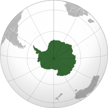
  • Image 10 Antarctica (/ænˈtɑːrktɪkə/ ⓘ) is Earth's southernmost and least-populated continent. Situated almost entirely south of the Antarctic Circle and surrounded by the Southern Ocean (also known as the Antarctic Ocean), it contains the geographic South Pole. Antarctica is the fifth-largest continent, being about 40% larger than Europe, and has an area of 14,200,000 km2 (5,500,000 sq mi). Most of Antarctica is covered by the Antarctic ice sheet, with an average thickness of 1.9 km (1.2 mi). Antarctica is, on average, the coldest, driest, and windiest of the continents, and it has the highest average elevation. It is mainly a polar desert, with annual precipitation of over 200 mm (8 in) along the coast and far less inland. About 70% of the world's freshwater reserves are frozen in Antarctica, which, if melted, would raise global sea levels by almost 60 metres (200 ft). Antarctica holds the record for the lowest measured temperature on Earth, −89.2 °C (−128.6 °F). The coastal regions can reach temperatures over 10 °C (50 °F) in the summer. Native species of animals include mites, nematodes, penguins, seals and tardigrades. Where vegetation occurs, it is mostly in the form of lichen or moss. (Full article...)

    Antarctica (/ænˈtɑːrktɪkə/ ) is Earth's southernmost and least-populated continent. Situated almost entirely south of the Antarctic Circle and surrounded by the Southern Ocean (also known as the Antarctic Ocean), it contains the geographic South Pole. Antarctica is the fifth-largest continent, being about 40% larger than Europe, and has an area of 14,200,000 km (5,500,000 sq mi). Most of Antarctica is covered by the Antarctic ice sheet, with an average thickness of 1.9 km (1.2 mi).

    Antarctica is, on average, the coldest, driest, and windiest of the continents, and it has the highest average elevation. It is mainly a polar desert, with annual precipitation of over 200 mm (8 in) along the coast and far less inland. About 70% of the world's freshwater reserves are frozen in Antarctica, which, if melted, would raise global sea levels by almost 60 metres (200 ft). Antarctica holds the record for the lowest measured temperature on Earth, −89.2 °C (−128.6 °F). The coastal regions can reach temperatures over 10 °C (50 °F) in the summer. Native species of animals include mites, nematodes, penguins, seals and tardigrades. Where vegetation occurs, it is mostly in the form of lichen or moss. (Full article...)
  • Image 11 Expedition commander Carsten Borchgrevink taking a theodolite reading in front of the Southern Cross, 1899 The Southern Cross Expedition, otherwise known as the British Antarctic Expedition, 1898–1900, was the first British venture of the Heroic Age of Antarctic Exploration, and the forerunner of the more celebrated journeys of Robert Falcon Scott and Ernest Shackleton. The brainchild of the Anglo-Norwegian explorer Carsten Borchgrevink, it was the first expedition to over-winter on the Antarctic mainland, the first to visit the Great Ice Barrier—later known as the Ross Ice Shelf—since Sir James Clark Ross's groundbreaking expedition of 1839 to 1843, and the first to effect a landing on the Barrier's surface. It also pioneered the use of dogs and sledges in Antarctic travel. The expedition was privately financed by the British magazine publisher Sir George Newnes. Borchgrevink's party sailed in the Southern Cross, and spent the southern winter of 1899 at Cape Adare, the northwest extremity of the Ross Sea coastline. Here they carried out an extensive programme of scientific observations, although opportunities for inland exploration were restricted by the mountainous and glaciated terrain surrounding the base. In January 1900, the party left Cape Adare in Southern Cross to explore the Ross Sea, following the route taken by Ross 60 years earlier. They reached the Great Ice Barrier, where a team of three made the first sledge journey on the Barrier surface, during which a new Farthest South record latitude was established at 78° 50′S. (Full article...)
    Expedition commander Carsten Borchgrevink taking a theodolite reading in front of the Southern Cross, 1899

    The Southern Cross Expedition, otherwise known as the British Antarctic Expedition, 1898–1900, was the first British venture of the Heroic Age of Antarctic Exploration, and the forerunner of the more celebrated journeys of Robert Falcon Scott and Ernest Shackleton. The brainchild of the Anglo-Norwegian explorer Carsten Borchgrevink, it was the first expedition to over-winter on the Antarctic mainland, the first to visit the Great Ice Barrier—later known as the Ross Ice Shelf—since Sir James Clark Ross's groundbreaking expedition of 1839 to 1843, and the first to effect a landing on the Barrier's surface. It also pioneered the use of dogs and sledges in Antarctic travel.

    The expedition was privately financed by the British magazine publisher Sir George Newnes. Borchgrevink's party sailed in the Southern Cross, and spent the southern winter of 1899 at Cape Adare, the northwest extremity of the Ross Sea coastline. Here they carried out an extensive programme of scientific observations, although opportunities for inland exploration were restricted by the mountainous and glaciated terrain surrounding the base. In January 1900, the party left Cape Adare in Southern Cross to explore the Ross Sea, following the route taken by Ross 60 years earlier. They reached the Great Ice Barrier, where a team of three made the first sledge journey on the Barrier surface, during which a new Farthest South record latitude was established at 78° 50′S. (Full article...)
  • Image 12 Interior of the former vegetable market, 2006 Covent Garden is a district in London, on the eastern fringes of the West End, between St Martin's Lane and Drury Lane. It is associated with the former fruit-and-vegetable market in the central square, now a popular shopping and tourist site, and with the Royal Opera House, itself known as "Covent Garden". The district is divided by the main thoroughfare of Long Acre, north of which is given over to independent shops centred on Neal's Yard and Seven Dials, while the south contains the central square with its street performers and most of the historical buildings, theatres and entertainment facilities, including the London Transport Museum and the Theatre Royal, Drury Lane. The area was fields until briefly settled in the 7th century when it became the heart of the Anglo-Saxon trading town of Lundenwic, then abandoned at the end of the 9th century after which it returned to fields. By 1200 part of it had been walled off by the Abbot of Westminster Abbey for use as arable land and orchards, later referred to as "the garden of the Abbey and Convent", and later "the Convent Garden". Following the Dissolution of the Monasteries it was granted in 1552 by the young King Edward VI to John Russell, 1st Earl of Bedford (c.1485–1555), the trusted adviser to his father King Henry VIII. The 4th Earl commissioned Inigo Jones to build some fine houses to attract wealthy tenants. Jones designed the Italianate arcaded square along with the church of St Paul's. The design of the square was new to London and had a significant influence on modern town planning, acting as the prototype for new estates as London grew. (Full article...)

    Covent Garden is a district in London, on the eastern fringes of the West End, between St Martin's Lane and Drury Lane. It is associated with the former fruit-and-vegetable market in the central square, now a popular shopping and tourist site, and with the Royal Opera House, itself known as "Covent Garden". The district is divided by the main thoroughfare of Long Acre, north of which is given over to independent shops centred on Neal's Yard and Seven Dials, while the south contains the central square with its street performers and most of the historical buildings, theatres and entertainment facilities, including the London Transport Museum and the Theatre Royal, Drury Lane.

    The area was fields until briefly settled in the 7th century when it became the heart of the Anglo-Saxon trading town of Lundenwic, then abandoned at the end of the 9th century after which it returned to fields. By 1200 part of it had been walled off by the Abbot of Westminster Abbey for use as arable land and orchards, later referred to as "the garden of the Abbey and Convent", and later "the Convent Garden". Following the Dissolution of the Monasteries it was granted in 1552 by the young King Edward VI to John Russell, 1st Earl of Bedford (c.1485–1555), the trusted adviser to his father King Henry VIII. The 4th Earl commissioned Inigo Jones to build some fine houses to attract wealthy tenants. Jones designed the Italianate arcaded square along with the church of St Paul's. The design of the square was new to London and had a significant influence on modern town planning, acting as the prototype for new estates as London grew. (Full article...)
  • Image 13 Title page of the first edition of Wright's Certaine Errors in Navigation (1599) Edward Wright (baptised 8 October 1561; died November 1615) was an English mathematician and cartographer noted for his book Certaine Errors in Navigation (1599; 2nd ed., 1610), which for the first time explained the mathematical basis of the Mercator projection by building on the works of Pedro Nunes, and set out a reference table giving the linear scale multiplication factor as a function of latitude, calculated for each minute of arc up to a latitude of 75°. This was in fact a table of values of the integral of the secant function, and was the essential step needed to make practical both the making and the navigational use of Mercator charts. Wright was born at Garveston in Norfolk and educated at Gonville and Caius College, Cambridge, where he became a fellow from 1587 to 1596. In 1589 the college granted him leave after Elizabeth I requested that he carry out navigational studies with a raiding expedition organised by the Earl of Cumberland to the Azores to capture Spanish galleons. The expedition's route was the subject of the first map to be prepared according to Wright's projection, which was published in Certaine Errors in 1599. The same year, Wright created and published the first world map produced in England and the first to use the Mercator projection since Gerardus Mercator's original 1569 map. (Full article...)

    Edward Wright (baptised 8 October 1561; died November 1615) was an English mathematician and cartographer noted for his book Certaine Errors in Navigation (1599; 2nd ed., 1610), which for the first time explained the mathematical basis of the Mercator projection by building on the works of Pedro Nunes, and set out a reference table giving the linear scale multiplication factor as a function of latitude, calculated for each minute of arc up to a latitude of 75°. This was in fact a table of values of the integral of the secant function, and was the essential step needed to make practical both the making and the navigational use of Mercator charts.

    Wright was born at Garveston in Norfolk and educated at Gonville and Caius College, Cambridge, where he became a fellow from 1587 to 1596. In 1589 the college granted him leave after Elizabeth I requested that he carry out navigational studies with a raiding expedition organised by the Earl of Cumberland to the Azores to capture Spanish galleons. The expedition's route was the subject of the first map to be prepared according to Wright's projection, which was published in Certaine Errors in 1599. The same year, Wright created and published the first world map produced in England and the first to use the Mercator projection since Gerardus Mercator's original 1569 map. (Full article...)
  • Image 14 From top, left to right: Downtown Hamilton from Sam Lawrence Park, Hamilton City Hall, Bayfront Park Harbour Front Trail, Dundurn Castle, Historic Art Deco and Gothic Revival Pigott Building complex, Webster's Falls Hamilton is a port city in the Canadian province of Ontario. Hamilton has a population of 569,353, and its census metropolitan area, which encompasses Burlington and Grimsby, has a population of 785,184. The city is situated approximately 45 kilometres (28 mi) southwest of Toronto in the Greater Toronto and Hamilton Area (GTHA). Conceived by George Hamilton when he purchased the Durand farm shortly after the War of 1812, the town of Hamilton became the centre of a densely populated and industrialized region at the west end of Lake Ontario known as the Golden Horseshoe. On January 1, 2001, the current boundaries of Hamilton were created through the amalgamation of the original city with other municipalities of the Regional Municipality of Hamilton–Wentworth. Residents of the city are known as Hamiltonians. (Full article...)

    Hamilton is a port city in the Canadian province of Ontario. Hamilton has a population of 569,353, and its census metropolitan area, which encompasses Burlington and Grimsby, has a population of 785,184. The city is situated approximately 45 kilometres (28 mi) southwest of Toronto in the Greater Toronto and Hamilton Area (GTHA).

    Conceived by George Hamilton when he purchased the Durand farm shortly after the War of 1812, the town of Hamilton became the centre of a densely populated and industrialized region at the west end of Lake Ontario known as the Golden Horseshoe. On January 1, 2001, the current boundaries of Hamilton were created through the amalgamation of the original city with other municipalities of the Regional Municipality of Hamilton–Wentworth. Residents of the city are known as Hamiltonians. (Full article...)
  • Image 15 Ireland is an island in Northern Europe in the north Atlantic Ocean. The island, of up to around 480 km (300 mi) north-south, and 275 km (171 mi) east-west, lies near the western edge of the European continental shelf, part of the Eurasian Plate. Its main geographical features include low central plains surrounded by coastal mountains. The highest peak is Carrauntoohil (Irish: Corrán Tuathail), which is 1,039 metres (3,409 ft) above sea level. The western coastline is rugged, with many islands, peninsulas, headlands and bays, while the southern and northern coasts feature a smaller number of substantial sea inlets, such as Lough Foyle and Cork Harbour; no part of the land is more than around 110 km (68 mi) from the sea. It was administratively divided into 32 counties, gathered in 4 provinces, though current arrangements, especially in Northern Ireland, differ from this model. The island is almost bisected by the River Shannon, which at 360.5 km (224 mi) with a 102.1 km (63 mi) estuary is the longest river in Ireland and flows south from County Cavan in the province of Ulster to form the boundary between Connacht and Leinster, and later Munster, and meet the Atlantic just south and west of Limerick. There are a number of sizeable lakes along Ireland's rivers, of which Lough Neagh is the largest. Politically, the island consists of the Republic of Ireland, with jurisdiction over about five-sixths of the island, and Northern Ireland, a constituent part of the United Kingdom, with jurisdiction over the remaining sixth. Located west of the island of Great Britain, Ireland lies at approximately . It has a total area of 84,421 km2 (32,595 sq mi) and is separated from Great Britain by the Irish Sea, bounded to the north and south respectively by the North Channel and St George's Channel, and from mainland Europe by the Celtic Sea. Ireland forms the second largest landmass in the British Isles, together with Great Britain and the Isle of Man. (Full article...)

    Ireland is an island in Northern Europe in the north Atlantic Ocean. The island, of up to around 480 km (300 mi) north-south, and 275 km (171 mi) east-west, lies near the western edge of the European continental shelf, part of the Eurasian Plate. Its main geographical features include low central plains surrounded by coastal mountains. The highest peak is Carrauntoohil (Irish: Corrán Tuathail), which is 1,039 metres (3,409 ft) above sea level. The western coastline is rugged, with many islands, peninsulas, headlands and bays, while the southern and northern coasts feature a smaller number of substantial sea inlets, such as Lough Foyle and Cork Harbour; no part of the land is more than around 110 km (68 mi) from the sea. It was administratively divided into 32 counties, gathered in 4 provinces, though current arrangements, especially in Northern Ireland, differ from this model. The island is almost bisected by the River Shannon, which at 360.5 km (224 mi) with a 102.1 km (63 mi) estuary is the longest river in Ireland and flows south from County Cavan in the province of Ulster to form the boundary between Connacht and Leinster, and later Munster, and meet the Atlantic just south and west of Limerick. There are a number of sizeable lakes along Ireland's rivers, of which Lough Neagh is the largest.

    Politically, the island consists of the Republic of Ireland, with jurisdiction over about five-sixths of the island, and Northern Ireland, a constituent part of the United Kingdom, with jurisdiction over the remaining sixth. Located west of the island of Great Britain, Ireland lies at approximately . It has a total area of 84,421 km (32,595 sq mi) and is separated from Great Britain by the Irish Sea, bounded to the north and south respectively by the North Channel and St George's Channel, and from mainland Europe by the Celtic Sea. Ireland forms the second largest landmass in the British Isles, together with Great Britain and the Isle of Man. (Full article...)
  • Vital articles Vital article

    Vital articles to understand Geography.

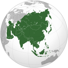
    Asia (/ˈʒə/ AY-zhə, UK also /ˈʃə/ AY-shə) is the largest continent in the world by both land area and population. It covers an area of more than 44 million square kilometers, about 30% of Earth's total land area and 8% of Earth's total surface area. The continent, which has long been home to the majority of the human population, was the site of many of the first civilizations. Its 4.7 billion people constitute roughly 60% of the world's population. (Full article...)
    Other vital articles

    Get involved

    For editor resources and to collaborate with other editors on improving Wikipedia's Geography-related articles, visit WikiProject Geography.


    Here are some tasks awaiting attention:

    Selected pictures

    Featured biography articles in geography

    Caspar David Friedrich (5 September 1774 – 7 May 1840) was a German Romantic landscape painter, generally considered the most important German artist of his generation. He is best known for his allegorical landscapes, which typically feature contemplative figures silhouetted against night skies, morning mists, barren trees or Gothic ruins. His primary interest was the contemplation of nature, and his often symbolic and anti-classical work seeks to convey a subjective, emotional response to the natural world. Friedrich's paintings characteristically set a human presence in diminished perspective amid expansive landscapes, reducing the figures to a scale that, according to the art historian Christopher John Murray, directs "the viewer's gaze towards their metaphysical dimension".

    Friedrich was born in the town of Greifswald on the Baltic Sea in what was at the time Swedish Pomerania. He studied in Copenhagen until 1798, before settling in Dresden. He came of age during a period when, across Europe, a growing disillusionment with materialistic society was giving rise to a new appreciation of spirituality. This shift in ideals was often expressed through a reevaluation of the natural world, as artists such as Friedrich, J. M. W. Turner and John Constable sought to depict nature as a "divine creation, to be set against the artifice of human civilization". (Full article...)
    More featured biographies

    Did you know

    Did you know it about Geography?

    Places around you

    You can read about interesting Wikipedia articles about places around you.

    Special:Nearby

    This following Geography-related articles is a most visited articles of WikiProject Geography, See complete list at Wikipedia:WikiProject Geography/Popular pages.

  • Image 4 Generation X (often shortened to Gen X) is the demographic cohort following the Baby Boomers and preceding Millennials. Researchers and popular media often use the mid-1960s as its starting birth years and the late 1970s as its ending birth years, with the generation being generally defined as people born from 1965 to 1980. By this definition and U.S. Census data, there are 65.2 million Gen Xers in the United States as of 2019. Most of Generation X are the children of the Silent Generation and early Baby Boomers; Xers are also often the parents of Millennials and Generation Z. (Full article...)
    Generation X (often shortened to Gen X) is the demographic cohort following the Baby Boomers and preceding Millennials. Researchers and popular media often use the mid-1960s as its starting birth years and the late 1970s as its ending birth years, with the generation being generally defined as people born from 1965 to 1980. By this definition and U.S. Census data, there are 65.2 million Gen Xers in the United States as of 2019. Most of Generation X are the children of the Silent Generation and early Baby Boomers; Xers are also often the parents of Millennials and Generation Z. (Full article...)
  • Image 5 Cartogram of the world's population in 2018; each square represents 500,000 people. This is a list of countries and dependencies by population. It includes sovereign states, inhabited dependent territories and, in some cases, constituent countries of sovereign states, with inclusion within the list being primarily based on the ISO standard ISO 3166-1. For instance, the United Kingdom is considered a single entity, while the constituent countries of the Kingdom of the Netherlands are considered separately. In addition, this list includes certain states with limited recognition not found in ISO 3166-1. Also given in a percentage is each country's population compared with the world population, which the United Nations estimates at 8.13 billion as of 2024. (Full article...)
    Cartogram of the world's population in 2018; each square represents 500,000 people.


    This is a list of countries and dependencies by population. It includes sovereign states, inhabited dependent territories and, in some cases, constituent countries of sovereign states, with inclusion within the list being primarily based on the ISO standard ISO 3166-1. For instance, the United Kingdom is considered a single entity, while the constituent countries of the Kingdom of the Netherlands are considered separately. In addition, this list includes certain states with limited recognition not found in ISO 3166-1. Also given in a percentage is each country's population compared with the world population, which the United Nations estimates at 8.13 billion as of 2024. (Full article...)
  • Image 6 Hong Kong is a special administrative region of the People's Republic of China. With 7.4 million residents of various nationalities in a 1,104-square-kilometre (426 sq mi) territory, Hong Kong is the fourth most densely populated region in the world. (Full article...)
    Hong Kong is a special administrative region of the People's Republic of China. With 7.4 million residents of various nationalities in a 1,104-square-kilometre (426 sq mi) territory, Hong Kong is the fourth most densely populated region in the world. (Full article...)
  • Image 7 Millennials, also known as Generation Y or Gen Y, are the demographic cohort following Generation X and preceding Generation Z. Researchers and popular media use the early 1980s as starting birth years and the mid-1990s to early 2000s as ending birth years, with the generation typically being defined as people born from 1981 to 1996. Most Millennials are the children of Baby Boomers and older Generation X. In turn Millennials are often the parents of Generation Alpha. (Full article...)
    Millennials, also known as Generation Y or Gen Y, are the demographic cohort following Generation X and preceding Generation Z. Researchers and popular media use the early 1980s as starting birth years and the mid-1990s to early 2000s as ending birth years, with the generation typically being defined as people born from 1981 to 1996. Most Millennials are the children of Baby Boomers and older Generation X. In turn Millennials are often the parents of Generation Alpha. (Full article...)
  • Image 8 England is a country that is part of the United Kingdom. It is located on the island of Great Britain, of which it covers approximately 62%, and over 100 smaller adjacent islands. It has land borders with Scotland to the north and Wales to the west, and is otherwise surrounded by the North Sea to the east, the English Channel to the south, the Celtic Sea to the south-west, and the Irish Sea to the west. Continental Europe lies to the south-east, and Ireland to the west. At the 2021 census, the population was 56,490,048. London is both the largest city and the capital. (Full article...)
    England is a country that is part of the United Kingdom. It is located on the island of Great Britain, of which it covers approximately 62%, and over 100 smaller adjacent islands. It has land borders with Scotland to the north and Wales to the west, and is otherwise surrounded by the North Sea to the east, the English Channel to the south, the Celtic Sea to the south-west, and the Irish Sea to the west. Continental Europe lies to the south-east, and Ireland to the west. At the 2021 census, the population was 56,490,048. London is both the largest city and the capital. (Full article...)
  • Image 9 Generation Alpha (often shortened to Gen Alpha) is the demographic cohort succeeding Generation Z. Researchers and popular media use the early 2010s as starting birth years to the mid-2020s as the ending birth years (see § Date and age range definitions). Named after alpha, the first letter in the Greek alphabet, Generation Alpha is the first to be born entirely in the 21st century and the third millennium. Most members of Generation Alpha are the children of Millennials. (Full article...)
    Generation Alpha (often shortened to Gen Alpha) is the demographic cohort succeeding Generation Z. Researchers and popular media use the early 2010s as starting birth years to the mid-2020s as the ending birth years (see § Date and age range definitions). Named after alpha, the first letter in the Greek alphabet, Generation Alpha is the first to be born entirely in the 21st century and the third millennium. Most members of Generation Alpha are the children of Millennials. (Full article...)
  • Image 10 Dymaxion map of the world with the 30 largest countries and territories by area This is a list of the world's countries and their dependencies by land, water, and total area, ranked by total area. (Full article...)
    Dymaxion map of the world with the 30 largest countries and territories by area

    This is a list of the world's countries and their dependencies by land, water, and total area, ranked by total area. (Full article...)
  • Click to enlarge and view description.

    Main articles

    CategoriesCategories

    Select [►] to view subcategories.

    Associated Wikimedia

    The following Wikimedia Foundation sister projects provide more on this subject:

    Discover Wikipedia using portals
    Retrieved from "https://en.wikipedia.org/w/index.php?title=Portal:Geography&oldid=1202464975"