Loading
  • 21 Aug, 2019

  • By, Wikipedia

Portal:Geography

The Geography Portal

Geography (from Ancient Greek γεωγραφία geōgraphía; combining 'Earth' and gráphō 'write') is the study of the lands, features, inhabitants, and phenomena of Earth. Geography is an all-encompassing discipline that seeks an understanding of Earth and its human and natural complexities—not merely where objects are, but also how they have changed and come to be. While geography is specific to Earth, many concepts can be applied more broadly to other celestial bodies in the field of planetary science. Geography has been called "a bridge between natural science and social science disciplines."

Origins of many of the concepts in geography can be traced to Greek Eratosthenes of Cyrene, who may have coined the term "geographia" (c. 276 BC – c. 195/194 BC). The first recorded use of the word γεωγραφία was as the title of a book by Greek scholar Claudius Ptolemy (100 – 170 AD). This work created the so-called "Ptolemaic tradition" of geography, which included "Ptolemaic cartographic theory." However, the concepts of geography (such as cartography) date back to the earliest attempts to understand the world spatially, with the earliest example of an attempted world map dating to the 9th century BCE in ancient Babylon. The history of geography as a discipline spans cultures and millennia, being independently developed by multiple groups, and cross-pollinated by trade between these groups. The core concepts of geography consistent between all approaches are a focus on space, place, time, and scale.

Today, geography is an extremely broad discipline with multiple approaches and modalities. There have been multiple attempts to organize the discipline, including the four traditions of geography, and into branches. Techniques employed can generally be broken down into quantitative and qualitative approaches, with many studies taking mixed-methods approaches. Common techniques include cartography, remote sensing, interviews, and surveying. (Full article...)

Featured articles are displayed here, which represent some of the best content on English Wikipedia.

  • Image 3 Surface-supplied divers riding a stage to the underwater workplace Underwater diving, as a human activity, is the practice of descending below the water's surface to interact with the environment. It is also often referred to as diving, an ambiguous term with several possible meanings, depending on context. Immersion in water and exposure to high ambient pressure have physiological effects that limit the depths and duration possible in ambient pressure diving. Humans are not physiologically and anatomically well-adapted to the environmental conditions of diving, and various equipment has been developed to extend the depth and duration of human dives, and allow different types of work to be done. In ambient pressure diving, the diver is directly exposed to the pressure of the surrounding water. The ambient pressure diver may dive on breath-hold (freediving) or use breathing apparatus for scuba diving or surface-supplied diving, and the saturation diving technique reduces the risk of decompression sickness (DCS) after long-duration deep dives. Atmospheric diving suits (ADS) may be used to isolate the diver from high ambient pressure. Crewed submersibles can extend depth range to full ocean depth, and remotely controlled or robotic machines can reduce risk to humans. (Full article...)
    Two divers wearing lightweight demand helmets stand back-to-back on an underwater platform holding on to the railings. The photo also shows the support vessel above the surface in the background.
    Surface-supplied divers riding a stage to the underwater workplace


    Underwater diving, as a human activity, is the practice of descending below the water's surface to interact with the environment. It is also often referred to as diving, an ambiguous term with several possible meanings, depending on context.
    Immersion in water and exposure to high ambient pressure have physiological effects that limit the depths and duration possible in ambient pressure diving. Humans are not physiologically and anatomically well-adapted to the environmental conditions of diving, and various equipment has been developed to extend the depth and duration of human dives, and allow different types of work to be done.

    In ambient pressure diving, the diver is directly exposed to the pressure of the surrounding water. The ambient pressure diver may dive on breath-hold (freediving) or use breathing apparatus for scuba diving or surface-supplied diving, and the saturation diving technique reduces the risk of decompression sickness (DCS) after long-duration deep dives. Atmospheric diving suits (ADS) may be used to isolate the diver from high ambient pressure. Crewed submersibles can extend depth range to full ocean depth, and remotely controlled or robotic machines can reduce risk to humans. (Full article...)
  • Image 4 Skegness clock tower and seafront amusements Skegness (/ˌskɛɡˈnɛs/ skeg-NESS) is a seaside town and civil parish in the East Lindsey District of Lincolnshire, England. On the Lincolnshire coast of the North Sea, the town is 43 miles (69 km) east of Lincoln and 22 miles (35 km) north-east of Boston. With a population of 21,128 as of 2021, it is the largest settlement in East Lindsey. It incorporates Winthorpe and Seacroft, and forms a larger built-up area with the resorts of Ingoldmells and Chapel St Leonards to the north. The town is on the A52 and A158 roads, connecting it with Boston and the East Midlands, and Lincoln respectively. Skegness railway station is on the Nottingham to Skegness (via Grantham) line. The original Skegness was situated farther east at the mouth of The Wash. Its Norse name refers to a headland which sat near the settlement. By the 14th century, it was a locally important port for coastal trade. The natural sea defences which protected the harbour eroded in the later Middle Ages, and it was lost to the sea after a storm in the 1520s. Rebuilt along the new shoreline, early modern Skegness was a small fishing and farming village, but from the late 18th century members of the local gentry visited for holidays. The arrival of the railways in 1873 transformed it into a popular seaside resort. This was the intention of The 9th Earl of Scarbrough, who owned most of the land in the vicinity; he built the infrastructure of the town and laid out plots, which he leased to speculative developers. This new Skegness quickly became a popular destination for holiday-makers and day trippers from the East Midlands factory towns. By the interwar years the town was established as one of the most popular seaside resorts in Britain. The layout of the modern seafront dates to this time and holiday camps were built around the town, including the first Butlin's holiday resort which opened in Ingoldmells in 1936. (Full article...)

    Skegness (/ˌskɛɡˈnɛs/ skeg-NESS) is a seaside town and civil parish in the East Lindsey District of Lincolnshire, England. On the Lincolnshire coast of the North Sea, the town is 43 miles (69 km) east of Lincoln and 22 miles (35 km) north-east of Boston. With a population of 21,128 as of 2021, it is the largest settlement in East Lindsey. It incorporates Winthorpe and Seacroft, and forms a larger built-up area with the resorts of Ingoldmells and Chapel St Leonards to the north. The town is on the A52 and A158 roads, connecting it with Boston and the East Midlands, and Lincoln respectively. Skegness railway station is on the Nottingham to Skegness (via Grantham) line.

    The original Skegness was situated farther east at the mouth of The Wash. Its Norse name refers to a headland which sat near the settlement. By the 14th century, it was a locally important port for coastal trade. The natural sea defences which protected the harbour eroded in the later Middle Ages, and it was lost to the sea after a storm in the 1520s. Rebuilt along the new shoreline, early modern Skegness was a small fishing and farming village, but from the late 18th century members of the local gentry visited for holidays. The arrival of the railways in 1873 transformed it into a popular seaside resort. This was the intention of The 9th Earl of Scarbrough, who owned most of the land in the vicinity; he built the infrastructure of the town and laid out plots, which he leased to speculative developers. This new Skegness quickly became a popular destination for holiday-makers and day trippers from the East Midlands factory towns. By the interwar years the town was established as one of the most popular seaside resorts in Britain. The layout of the modern seafront dates to this time and holiday camps were built around the town, including the first Butlin's holiday resort which opened in Ingoldmells in 1936. (Full article...)
  • Image 5 The history of Lithuania between 1219 and 1295 concerns the establishment and early history of the first Lithuanian state, the Grand Duchy of Lithuania. The beginning of the 13th century marks the end of the prehistory of Lithuania. From this point on the history of Lithuania is recorded in chronicles, treaties, and other written documents. In 1219, 21 Lithuanian dukes signed a peace treaty with Galicia–Volhynia. This event is widely accepted as the first proof that the Baltic tribes were uniting and consolidating. Despite continuous warfare with two Christian orders, the Livonian Order and the Teutonic Knights, the Grand Duchy of Lithuania was established and gained some control over the lands of Black Ruthenia, Polatsk, Minsk, and other territories east of modern-day Lithuania that had become weak and vulnerable after the collapse of Kievan Rus'. The first ruler to hold the title of Grand Duke was Mindaugas. Traditionally he is considered the founder of the state, the one who united the Baltic tribes and established the Duchy. Some scholars, however, challenge this perception, arguing that an organized state existed before Mindaugas, possibly as early as 1183. After quelling an internal war with his nephews, Mindaugas was baptized in 1251, and was crowned as King of Lithuania in 1253. In 1261, he broke the peace with the Livonian Order, perhaps even renouncing Christianity. His assassination in 1263 by Treniota ended the early Christian kingdom in Lithuania. For another 120 years Lithuania would remain a pagan empire, fighting against the Teutonic and Livonian Orders during the Northern Crusades during their attempts to Christianize the land. (Full article...)
    The history of Lithuania between 1219 and 1295 concerns the establishment and early history of the first Lithuanian state, the Grand Duchy of Lithuania. The beginning of the 13th century marks the end of the prehistory of Lithuania. From this point on the history of Lithuania is recorded in chronicles, treaties, and other written documents. In 1219, 21 Lithuanian dukes signed a peace treaty with Galicia–Volhynia. This event is widely accepted as the first proof that the Baltic tribes were uniting and consolidating. Despite continuous warfare with two Christian orders, the Livonian Order and the Teutonic Knights, the Grand Duchy of Lithuania was established and gained some control over the lands of Black Ruthenia, Polatsk, Minsk, and other territories east of modern-day Lithuania that had become weak and vulnerable after the collapse of Kievan Rus'.

    The first ruler to hold the title of Grand Duke was Mindaugas. Traditionally he is considered the founder of the state, the one who united the Baltic tribes and established the Duchy. Some scholars, however, challenge this perception, arguing that an organized state existed before Mindaugas, possibly as early as 1183. After quelling an internal war with his nephews, Mindaugas was baptized in 1251, and was crowned as King of Lithuania in 1253. In 1261, he broke the peace with the Livonian Order, perhaps even renouncing Christianity. His assassination in 1263 by Treniota ended the early Christian kingdom in Lithuania. For another 120 years Lithuania would remain a pagan empire, fighting against the Teutonic and Livonian Orders during the Northern Crusades during their attempts to Christianize the land. (Full article...)
  • Image 6 A Prussian infantry advance during the Battle of Hohenfriedberg, as depicted by Carl Röchling The Second Silesian War (‹See Tfd›German: Zweiter Schlesischer Krieg) was a war between Prussia and Austria that lasted from 1744 to 1745 and confirmed Prussia's control of the region of Silesia (now in south-western Poland). The war was fought mainly in Silesia, Bohemia, and Upper Saxony and formed one theatre of the wider War of the Austrian Succession. It was the second of three Silesian Wars fought between Frederick the Great's Prussia and Maria Theresa's Austria in the mid-18th century, all three of which ended in Prussian control of Silesia. The conflict has been viewed as a continuation of the First Silesian War, which had concluded only two years before. After the Treaty of Berlin ended hostilities between Austria and Prussia in 1742, the Habsburg monarchy's fortunes improved greatly in the continuing War of the Austrian Succession. As Austria expanded its alliances with the 1743 Treaty of Worms, Prussia entered a renewed alliance with Austria's enemies in the League of Frankfurt and rejoined the war, hoping to prevent a resurgent Austria from taking back Silesia. (Full article...)

    The Second Silesian War (‹See Tfd›German: Zweiter Schlesischer Krieg) was a war between Prussia and Austria that lasted from 1744 to 1745 and confirmed Prussia's control of the region of Silesia (now in south-western Poland). The war was fought mainly in Silesia, Bohemia, and Upper Saxony and formed one theatre of the wider War of the Austrian Succession. It was the second of three Silesian Wars fought between Frederick the Great's Prussia and Maria Theresa's Austria in the mid-18th century, all three of which ended in Prussian control of Silesia.

    The conflict has been viewed as a continuation of the First Silesian War, which had concluded only two years before. After the Treaty of Berlin ended hostilities between Austria and Prussia in 1742, the Habsburg monarchy's fortunes improved greatly in the continuing War of the Austrian Succession. As Austria expanded its alliances with the 1743 Treaty of Worms, Prussia entered a renewed alliance with Austria's enemies in the League of Frankfurt and rejoined the war, hoping to prevent a resurgent Austria from taking back Silesia. (Full article...)
  • Image 7 Micronations and the Search for Sovereignty is a 2021 book by Australian constitutional law specialists Harry Hobbs and George Williams about micronations and their legal status. Written from an academic perspective, it is one of few works on micronational movements and the earliest-published book to focus largely on the legal aspect of micronations. The book concerns the definition of statehood, the place of micronations within international law, people's motivations for declaring them, the micronational community and the ways by which such entities mimic sovereign states. In 2022 Hobbs and Williams published a book for a broader audience, How to Rule Your Own Country: The Weird and Wonderful World of Micronations. (Full article...)

    Micronations and the Search for Sovereignty is a 2021 book by Australian constitutional law specialists Harry Hobbs and George Williams about micronations and their legal status. Written from an academic perspective, it is one of few works on micronational movements and the earliest-published book to focus largely on the legal aspect of micronations. The book concerns the definition of statehood, the place of micronations within international law, people's motivations for declaring them, the micronational community and the ways by which such entities mimic sovereign states. In 2022 Hobbs and Williams published a book for a broader audience, How to Rule Your Own Country: The Weird and Wonderful World of Micronations. (Full article...)
  • Image 8 Ann Arbor skyline Ann Arbor is a college town and the county seat of Washtenaw County, Michigan, United States. The 2020 census recorded its population to be 123,851, making it the fifth-most populous city in Michigan. It is the principal city of the Ann Arbor metropolitan area, which encompasses all of Washtenaw County and had 372,258 residents in 2020. Ann Arbor is also included in the Detroit-Warren-Ann Arbor combined statistical area and the Great Lakes megalopolis. Ann Arbor was founded in 1824 by John Allen and Elisha Rumsey. It was named after the wives of the village's founders, both named Ann, and the stands of bur oak trees they found at the site of the town. The University of Michigan was established in Ann Arbor in 1837, and the city's population grew at a rapid rate in the early to mid-20th century. (Full article...)

    Ann Arbor is a college town and the county seat of Washtenaw County, Michigan, United States. The 2020 census recorded its population to be 123,851, making it the fifth-most populous city in Michigan. It is the principal city of the Ann Arbor metropolitan area, which encompasses all of Washtenaw County and had 372,258 residents in 2020. Ann Arbor is also included in the Detroit-Warren-Ann Arbor combined statistical area and the Great Lakes megalopolis.

    Ann Arbor was founded in 1824 by John Allen and Elisha Rumsey. It was named after the wives of the village's founders, both named Ann, and the stands of bur oak trees they found at the site of the town. The University of Michigan was established in Ann Arbor in 1837, and the city's population grew at a rapid rate in the early to mid-20th century. (Full article...)
  • Image 9 View of bog and lake from the bog trail in the Black Moshannon Bog Natural Area at Black Moshannon State Park Black Moshannon State Park is a 3,480-acre (1,410 ha) Pennsylvania state park in Rush Township, Centre County, Pennsylvania, United States. It surrounds Black Moshannon Lake, formed by a dam on Black Moshannon Creek, which has given its name to the lake and park. The park is just west of the Allegheny Front, 9 miles (14 km) east of Philipsburg on Pennsylvania Route 504, and is largely surrounded by Moshannon State Forest. A bog in the park provides a habitat for diverse wildlife not common in other areas of the state, such as carnivorous plants, orchids, and species normally found farther north. As home to the "largest reconstituted bog in Pennsylvania", it was chosen by the Pennsylvania Department of Conservation and Natural Resources for its "25 Must-see Pennsylvania State Parks" list. Humans have long used the Black Moshannon area for recreational, industrial, and subsistence purposes. The Seneca tribe used it as hunting and fishing grounds. European settlers cleared some land for farming, then clear-cut the vast stands of old-growth white pine and eastern hemlock. Black Moshannon State Park rose from the ashes of a depleted forest which had been largely destroyed by wildfire in the years following the lumber era. The forests were rehabilitated by the Civilian Conservation Corps during the Great Depression in the 1930s. Many of the buildings built by the Civilian Conservation Corps stand in the park today and are protected on the list of National Register of Historic Places in three historic districts. (Full article...)

    Black Moshannon State Park is a 3,480-acre (1,410 ha) Pennsylvania state park in Rush Township, Centre County, Pennsylvania, United States. It surrounds Black Moshannon Lake, formed by a dam on Black Moshannon Creek, which has given its name to the lake and park. The park is just west of the Allegheny Front, 9 miles (14 km) east of Philipsburg on Pennsylvania Route 504, and is largely surrounded by Moshannon State Forest. A bog in the park provides a habitat for diverse wildlife not common in other areas of the state, such as carnivorous plants, orchids, and species normally found farther north. As home to the "largest reconstituted bog in Pennsylvania", it was chosen by the Pennsylvania Department of Conservation and Natural Resources for its "25 Must-see Pennsylvania State Parks" list.

    Humans have long used the Black Moshannon area for recreational, industrial, and subsistence purposes. The Seneca tribe used it as hunting and fishing grounds. European settlers cleared some land for farming, then clear-cut the vast stands of old-growth white pine and eastern hemlock. Black Moshannon State Park rose from the ashes of a depleted forest which had been largely destroyed by wildfire in the years following the lumber era. The forests were rehabilitated by the Civilian Conservation Corps during the Great Depression in the 1930s. Many of the buildings built by the Civilian Conservation Corps stand in the park today and are protected on the list of National Register of Historic Places in three historic districts. (Full article...)
  • Image 10 Canberra viewed from Mount Ainslie Canberra (/ˈkænbərə/ ⓘ KAN-bər-ə) is the capital city of Australia. Founded following the federation of the colonies of Australia as the seat of government for the new nation, it is Australia's largest inland city and the eighth-largest Australian city overall. The city is located at the northern end of the Australian Capital Territory at the northern tip of the Australian Alps, the country's highest mountain range. As of June 2023,[update] Canberra's estimated population was 466,566. The area chosen for the capital had been inhabited by Aboriginal Australians for up to 21,000 years, by groups including the Ngunnawal and Ngambri. European settlement commenced in the first half of the 19th century, as evidenced by surviving landmarks such as St John's Anglican Church and Blundells Cottage. On 1 January 1901, federation of the colonies of Australia was achieved. Following a long dispute over whether Sydney or Melbourne should be the national capital, a compromise was reached: the new capital would be built in New South Wales, so long as it was at least 100 mi (160 km) from Sydney. The capital city was founded and formally named as Canberra in 1913. A plan by the American architects Walter Burley Griffin and Marion Mahony Griffin was selected after an international design contest, and construction commenced in 1913. Unusual among Australian cities, it is an entirely planned city. The Griffins' plan featured geometric motifs and was centred on axes aligned with significant topographical landmarks such as Black Mountain, Mount Ainslie, Capital Hill and City Hill. Canberra's mountainous location makes it the only mainland Australian city where snow-capped mountains can be seen in winter, although snow in the city itself is uncommon. (Full article...)

    Canberra (/ˈkænbərə/ KAN-bər-ə) is the capital city of Australia. Founded following the federation of the colonies of Australia as the seat of government for the new nation, it is Australia's largest inland city and the eighth-largest Australian city overall. The city is located at the northern end of the Australian Capital Territory at the northern tip of the Australian Alps, the country's highest mountain range. As of June 2023, Canberra's estimated population was 466,566.

    The area chosen for the capital had been inhabited by Aboriginal Australians for up to 21,000 years, by groups including the Ngunnawal and Ngambri. European settlement commenced in the first half of the 19th century, as evidenced by surviving landmarks such as St John's Anglican Church and Blundells Cottage. On 1 January 1901, federation of the colonies of Australia was achieved. Following a long dispute over whether Sydney or Melbourne should be the national capital, a compromise was reached: the new capital would be built in New South Wales, so long as it was at least 100 mi (160 km) from Sydney. The capital city was founded and formally named as Canberra in 1913. A plan by the American architects Walter Burley Griffin and Marion Mahony Griffin was selected after an international design contest, and construction commenced in 1913. Unusual among Australian cities, it is an entirely planned city. The Griffins' plan featured geometric motifs and was centred on axes aligned with significant topographical landmarks such as Black Mountain, Mount Ainslie, Capital Hill and City Hill. Canberra's mountainous location makes it the only mainland Australian city where snow-capped mountains can be seen in winter, although snow in the city itself is uncommon. (Full article...)
  • Image 11 Map showing Morrell's reported location of the "New South Greenland" coast (1823, red line), and "Ross's Appearance" as reported by Sir James Clark Ross in 1841. The dotted line indicates the area of Captain Johnson's 1821 voyage. New South Greenland, sometimes known as Morrell's Land, was an appearance of land recorded by the American captain Benjamin Morrell of the schooner Wasp in March 1823, during a sealing and exploration voyage in the Weddell Sea area of Antarctica. Morrell provided precise coordinates and a description of a coastline which he claimed to have sailed along for more than 300 miles (500 km). Because the Weddell Sea area was so little visited and hard to navigate due to ice conditions, the alleged land was never properly investigated before its existence was emphatically disproven during Antarctic expeditions in the early 20th century. At the time of Morrell's voyage, the geography of the then-unnamed Weddell Sea and its surrounding coasts was almost entirely unknown, making the claimed sighting initially plausible. However, obvious errors in Morrell's voyage account and his general reputation as a fabulist created scepticism about the existence of this new land. In June 1912, the German explorer Wilhelm Filchner searched for but found no traces of land after his ship Deutschland became icebound in the Weddell Sea and drifted into the locality of Morrell's observation. A line sounding of the sea bottom revealed more than 5,000 feet (1,500 m) of water, indicating no land in near proximity. Three years later, trapped in the same waters with his ship Endurance, Ernest Shackleton was able by similar means to confirm the land's implausibility. (Full article...)
    Chart shows the positions of the supposed New South Greenland coast, and Ross's Appearance, in relation to the Antarctic peninsula, the South American mainland, the South Sandwich Islands and South Georgia.
    Map showing Morrell's reported location of the "New South Greenland" coast (1823, red line), and "Ross's Appearance" as reported by Sir James Clark Ross in 1841. The dotted line indicates the area of Captain Johnson's 1821 voyage.


    New South Greenland, sometimes known as Morrell's Land, was an appearance of land recorded by the American captain Benjamin Morrell of the schooner Wasp in March 1823, during a sealing and exploration voyage in the Weddell Sea area of Antarctica. Morrell provided precise coordinates and a description of a coastline which he claimed to have sailed along for more than 300 miles (500 km). Because the Weddell Sea area was so little visited and hard to navigate due to ice conditions, the alleged land was never properly investigated before its existence was emphatically disproven during Antarctic expeditions in the early 20th century.

    At the time of Morrell's voyage, the geography of the then-unnamed Weddell Sea and its surrounding coasts was almost entirely unknown, making the claimed sighting initially plausible. However, obvious errors in Morrell's voyage account and his general reputation as a fabulist created scepticism about the existence of this new land. In June 1912, the German explorer Wilhelm Filchner searched for but found no traces of land after his ship Deutschland became icebound in the Weddell Sea and drifted into the locality of Morrell's observation. A line sounding of the sea bottom revealed more than 5,000 feet (1,500 m) of water, indicating no land in near proximity. Three years later, trapped in the same waters with his ship Endurance, Ernest Shackleton was able by similar means to confirm the land's implausibility. (Full article...)
  • Image 12 Downtown Cleveland skyline Cleveland is a major city in the U.S. state of Ohio and the county seat of Cuyahoga County. Located along the southern shore of Lake Erie, it is situated across the Canada–United States maritime border and lies approximately 60 mi (97 km) west of Pennsylvania. Cleveland is the most populous city on Lake Erie, the second-most populous city in Ohio, and the 54th-most populous city in the U.S. with a population of 372,624 in 2020. The city anchors the Cleveland metropolitan area, the 33rd-largest in the U.S. at 2.18 million residents, as well as the larger Cleveland–Akron–Canton combined statistical area with 3.63 million residents. Cleveland was founded in 1796 near the mouth of the Cuyahoga River as part of the Connecticut Western Reserve in modern-day Northeast Ohio by General Moses Cleaveland, after whom the city was named. Its location on the river and the lake shore allowed it to grow into a major commercial and industrial metropolis by the late 19th century, attracting large numbers of immigrants and migrants. It was among the top 10 largest U.S. cities by population for much of the 20th century, a period that saw the development of the city's cultural institutions. By the 1960s, Cleveland's economy began to slow down as manufacturing declined and suburbanization occurred. (Full article...)

    Cleveland is a major city in the U.S. state of Ohio and the county seat of Cuyahoga County. Located along the southern shore of Lake Erie, it is situated across the Canada–United States maritime border and lies approximately 60 mi (97 km) west of Pennsylvania. Cleveland is the most populous city on Lake Erie, the second-most populous city in Ohio, and the 54th-most populous city in the U.S. with a population of 372,624 in 2020. The city anchors the Cleveland metropolitan area, the 33rd-largest in the U.S. at 2.18 million residents, as well as the larger Cleveland–AkronCanton combined statistical area with 3.63 million residents.

    Cleveland was founded in 1796 near the mouth of the Cuyahoga River as part of the Connecticut Western Reserve in modern-day Northeast Ohio by General Moses Cleaveland, after whom the city was named. Its location on the river and the lake shore allowed it to grow into a major commercial and industrial metropolis by the late 19th century, attracting large numbers of immigrants and migrants. It was among the top 10 largest U.S. cities by population for much of the 20th century, a period that saw the development of the city's cultural institutions. By the 1960s, Cleveland's economy began to slow down as manufacturing declined and suburbanization occurred. (Full article...)
  • Image 13 Skyline of the city centre George Town is the capital of the Malaysian state of Penang. It is the core city of the George Town Conurbation, Malaysia's second largest metropolitan area with a population of 2.84 million and the second highest contributor to the country's GDP. The city proper spans an area of 306 km2 (118 sq mi) encompassing Penang Island and surrounding islets, and had a population of 794,313 as of 2020[update]. Initially established as an entrepôt by Francis Light in 1786, George Town serves as the commercial centre for northern Malaysia. According to Euromonitor International and the Economist Intelligence Unit, it has the highest potential for revenue growth among all Malaysian cities and contributed nearly 8 per cent of the country's personal disposable income in 2015, second only to the national capital, Kuala Lumpur. Its technological sector, anchored by hundreds of multinational companies, has made George Town the top exporter in the country. The Penang International Airport links George Town to several regional cities, while a ferry service and two road bridges connect the city to the rest of Peninsular Malaysia. Swettenham Pier is the busiest cruise terminal in the country. (Full article...)

    George Town is the capital of the Malaysian state of Penang. It is the core city of the George Town Conurbation, Malaysia's second largest metropolitan area with a population of 2.84 million and the second highest contributor to the country's GDP. The city proper spans an area of 306 km (118 sq mi) encompassing Penang Island and surrounding islets, and had a population of 794,313 as of 2020.

    Initially established as an entrepôt by Francis Light in 1786, George Town serves as the commercial centre for northern Malaysia. According to Euromonitor International and the Economist Intelligence Unit, it has the highest potential for revenue growth among all Malaysian cities and contributed nearly 8 per cent of the country's personal disposable income in 2015, second only to the national capital, Kuala Lumpur. Its technological sector, anchored by hundreds of multinational companies, has made George Town the top exporter in the country. The Penang International Airport links George Town to several regional cities, while a ferry service and two road bridges connect the city to the rest of Peninsular Malaysia. Swettenham Pier is the busiest cruise terminal in the country. (Full article...)
  • Image 14 Nauru (/nɑːˈuːruː/ nah-OO-roo or /ˈnaʊruː/ NOW-roo; Nauruan: Naoero), officially the Republic of Nauru (Nauruan: Repubrikin Naoero) and formerly known as Pleasant Island, is an island country and microstate in Micronesia, part of Oceania in the Central Pacific. Its nearest neighbour is Banaba of Kiribati, about 300 km (190 mi) to the east. It lies northwest of Tuvalu, 1,300 km (810 mi) northeast of the Solomon Islands, east-northeast of Papua New Guinea, southeast of the Federated States of Micronesia and south of the Marshall Islands. With an area of only 21 km2 (8.1 sq mi), Nauru is the third-smallest country in the world, larger than only Vatican City and Monaco, making it the smallest republic and island nation, as well as the smallest member state of the Commonwealth of Nations by area. Its population of about 10,800 is the world's third-smallest (not including colonies or overseas territories). Nauru is a member of the United Nations, the Commonwealth of Nations, and the Organization of African, Caribbean, and Pacific States. (Full article...)

    Nauru (/nɑːˈr/ nah-OO-roo or /ˈnr/ NOW-roo; Nauruan: Naoero), officially the Republic of Nauru (Nauruan: Repubrikin Naoero) and formerly known as Pleasant Island, is an island country and microstate in Micronesia, part of Oceania in the Central Pacific. Its nearest neighbour is Banaba of Kiribati, about 300 km (190 mi) to the east.

    It lies northwest of Tuvalu, 1,300 km (810 mi) northeast of the Solomon Islands, east-northeast of Papua New Guinea, southeast of the Federated States of Micronesia and south of the Marshall Islands. With an area of only 21 km (8.1 sq mi), Nauru is the third-smallest country in the world, larger than only Vatican City and Monaco, making it the smallest republic and island nation, as well as the smallest member state of the Commonwealth of Nations by area. Its population of about 10,800 is the world's third-smallest (not including colonies or overseas territories). Nauru is a member of the United Nations, the Commonwealth of Nations, and the Organization of African, Caribbean, and Pacific States. (Full article...)
  • Image 15 Henry in full regalia (depicted in the 11th-century Evangelion of Saint Emmeram's Abbey) Henry IV (‹See Tfd›German: Heinrich IV; 11 November 1050 – 7 August 1106) was Holy Roman Emperor from 1084 to 1105, King of Germany from 1054 to 1105, King of Italy and Burgundy from 1056 to 1105, and Duke of Bavaria from 1052 to 1054. He was the son of Henry III, Holy Roman Emperor—the second monarch of the Salian dynasty—and Agnes of Poitou. After his father's death on 5 October 1056, Henry was placed under his mother's guardianship. She made grants to German aristocrats to secure their support. Unlike her late husband, she could not control the election of the popes, thus the idea of the "liberty of the Church" strengthened during her rule. Taking advantage of her weakness, Archbishop Anno II of Cologne kidnapped Henry in April 1062. He administered Germany until Henry came of age in 1065. Henry endeavoured to recover the royal estates that had been lost during his minority. He employed low-ranking officials to carry out his new policies, causing discontent in Saxony and Thuringia. Henry crushed a riot in Saxony in 1069 and overcame the rebellion of the Saxon aristocrat Otto of Nordheim in 1071. The appointment of commoners to high office offended German aristocrats, and many of them withdrew from Henry's court. He insisted on his royal prerogative to appoint bishops and abbots, although the reformist clerics condemned this practice as simony (a forbidden sale of church offices). Pope Alexander II blamed Henry's advisors for his acts and excommunicated them in early 1073. Henry's conflicts with the Holy See and the German dukes weakened his position and the Saxons rose up in open rebellion in the summer of 1074. Taking advantage of a quarrel between the Saxon aristocrats and peasantry, he forced the rebels into submission in October 1075. (Full article...)

    Henry IV (‹See Tfd›German: Heinrich IV; 11 November 1050 – 7 August 1106) was Holy Roman Emperor from 1084 to 1105, King of Germany from 1054 to 1105, King of Italy and Burgundy from 1056 to 1105, and Duke of Bavaria from 1052 to 1054. He was the son of Henry III, Holy Roman Emperor—the second monarch of the Salian dynasty—and Agnes of Poitou. After his father's death on 5 October 1056, Henry was placed under his mother's guardianship. She made grants to German aristocrats to secure their support. Unlike her late husband, she could not control the election of the popes, thus the idea of the "liberty of the Church" strengthened during her rule. Taking advantage of her weakness, Archbishop Anno II of Cologne kidnapped Henry in April 1062. He administered Germany until Henry came of age in 1065.

    Henry endeavoured to recover the royal estates that had been lost during his minority. He employed low-ranking officials to carry out his new policies, causing discontent in Saxony and Thuringia. Henry crushed a riot in Saxony in 1069 and overcame the rebellion of the Saxon aristocrat Otto of Nordheim in 1071. The appointment of commoners to high office offended German aristocrats, and many of them withdrew from Henry's court. He insisted on his royal prerogative to appoint bishops and abbots, although the reformist clerics condemned this practice as simony (a forbidden sale of church offices). Pope Alexander II blamed Henry's advisors for his acts and excommunicated them in early 1073. Henry's conflicts with the Holy See and the German dukes weakened his position and the Saxons rose up in open rebellion in the summer of 1074. Taking advantage of a quarrel between the Saxon aristocrats and peasantry, he forced the rebels into submission in October 1075. (Full article...)
  • Vital articles Vital article

    Vital articles to understand Geography.

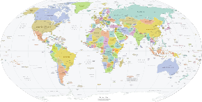
    The marked territories on this global map are mostly of countries which are sovereign states with full international recognition (brackets denote the country of a marked territory that is not a sovereign state). Some territories are countries in their own right but are not recognized as such (e.g. Taiwan), and some few marked territories are disputed about which country they belong to (e.g. Kashmir) or if they are countries in their own right (e.g. Western Sahara (territory) or the state known by the same name).

    A country is a distinct part of the world, such as a state, nation, or other political entity. When referring to a specific polity, the term "country" may refer to a sovereign state, states with limited recognition, constituent country, or a dependent territory. Most sovereign states, but not all countries, are members of the United Nations. There is no universal agreement on the number of "countries" in the world since several states have disputed sovereignty status, limited recognition and a number of non-sovereign entities are commonly called countries. (Full article...)

    Other vital articles

    Get involved

    For editor resources and to collaborate with other editors on improving Wikipedia's Geography-related articles, visit WikiProject Geography.


    Here are some tasks awaiting attention:

    Selected pictures

    Featured biography articles in geography

    Caspar David Friedrich (5 September 1774 – 7 May 1840) was a German Romantic landscape painter, generally considered the most important German artist of his generation. He is best known for his allegorical landscapes, which typically feature contemplative figures silhouetted against night skies, morning mists, barren trees or Gothic ruins. His primary interest was the contemplation of nature, and his often symbolic and anti-classical work seeks to convey a subjective, emotional response to the natural world. Friedrich's paintings characteristically set a human presence in diminished perspective amid expansive landscapes, reducing the figures to a scale that, according to the art historian Christopher John Murray, directs "the viewer's gaze towards their metaphysical dimension".

    Friedrich was born in the town of Greifswald on the Baltic Sea in what was at the time Swedish Pomerania. He studied in Copenhagen until 1798, before settling in Dresden. He came of age during a period when, across Europe, a growing disillusionment with materialistic society was giving rise to a new appreciation of spirituality. This shift in ideals was often expressed through a reevaluation of the natural world, as artists such as Friedrich, J. M. W. Turner and John Constable sought to depict nature as a "divine creation, to be set against the artifice of human civilization". (Full article...)

    More featured biographies

    Did you know

    Did you know it about Geography?

    Places around you

    You can read about interesting Wikipedia articles about places around you.

    Special:Nearby

    This following Geography-related articles is a most visited articles of WikiProject Geography, See complete list at Wikipedia:WikiProject Geography/Popular pages.

  • Image 4 Generation X (often shortened to Gen X) is the demographic cohort following the Baby Boomers and preceding Millennials. Researchers and popular media often use the mid-1960s as its starting birth years and the late 1970s as its ending birth years, with the generation being generally defined as people born from 1965 to 1980. By this definition and U.S. Census data, there are 65.2 million Gen Xers in the United States as of 2019. Most of Generation X are the children of the Silent Generation and early Baby Boomers; Xers are also often the parents of Millennials and Generation Z. (Full article...)
    Generation X (often shortened to Gen X) is the demographic cohort following the Baby Boomers and preceding Millennials. Researchers and popular media often use the mid-1960s as its starting birth years and the late 1970s as its ending birth years, with the generation being generally defined as people born from 1965 to 1980. By this definition and U.S. Census data, there are 65.2 million Gen Xers in the United States as of 2019. Most of Generation X are the children of the Silent Generation and early Baby Boomers; Xers are also often the parents of Millennials and Generation Z. (Full article...)
  • Image 5 Cartogram of the world's population in 2018; each square represents 500,000 people. This is a list of countries and dependencies by population. It includes sovereign states, inhabited dependent territories and, in some cases, constituent countries of sovereign states, with inclusion within the list being primarily based on the ISO standard ISO 3166-1. For instance, the United Kingdom is considered a single entity, while the constituent countries of the Kingdom of the Netherlands are considered separately. In addition, this list includes certain states with limited recognition not found in ISO 3166-1. Also given in a percentage is each country's population compared with the world population, which the United Nations estimates at 8.119 billion as of 2024. (Full article...)
    Cartogram of the world's population in 2018; each square represents 500,000 people.


    This is a list of countries and dependencies by population. It includes sovereign states, inhabited dependent territories and, in some cases, constituent countries of sovereign states, with inclusion within the list being primarily based on the ISO standard ISO 3166-1. For instance, the United Kingdom is considered a single entity, while the constituent countries of the Kingdom of the Netherlands are considered separately. In addition, this list includes certain states with limited recognition not found in ISO 3166-1. Also given in a percentage is each country's population compared with the world population, which the United Nations estimates at 8.119 billion as of 2024. (Full article...)
  • Image 6 Hong Kong is a special administrative region of the People's Republic of China. With 7.4 million residents of various nationalities in a 1,104-square-kilometre (426 sq mi) territory, Hong Kong is the fourth most densely populated region in the world. (Full article...)

    Hong Kong is a special administrative region of the People's Republic of China. With 7.4 million residents of various nationalities in a 1,104-square-kilometre (426 sq mi) territory, Hong Kong is the fourth most densely populated region in the world. (Full article...)
  • Image 7 Millennials, also known as Generation Y or Gen Y, are the demographic cohort following Generation X and preceding Generation Z. Researchers and popular media use the early 1980s as starting birth years and the mid-1990s to early 2000s as ending birth years, with the generation typically being defined as people born from 1981 to 1996. Most Millennials are the children of Baby Boomers and older Generation X. In turn Millennials are often the parents of Generation Alpha. (Full article...)
    Millennials, also known as Generation Y or Gen Y, are the demographic cohort following Generation X and preceding Generation Z. Researchers and popular media use the early 1980s as starting birth years and the mid-1990s to early 2000s as ending birth years, with the generation typically being defined as people born from 1981 to 1996. Most Millennials are the children of Baby Boomers and older Generation X. In turn Millennials are often the parents of Generation Alpha. (Full article...)
  • Image 8 England is a country that is part of the United Kingdom. It is located on the island of Great Britain, of which it covers approximately 62%, and over 100 smaller adjacent islands. It has land borders with Scotland to the north and Wales to the west, and is otherwise surrounded by the North Sea to the east, the English Channel to the south, the Celtic Sea to the south-west, and the Irish Sea to the west. Continental Europe lies to the south-east, and Ireland to the west. At the 2021 census, the population was 56,490,048. London is both the largest city and the capital. (Full article...)

    England is a country that is part of the United Kingdom. It is located on the island of Great Britain, of which it covers approximately 62%, and over 100 smaller adjacent islands. It has land borders with Scotland to the north and Wales to the west, and is otherwise surrounded by the North Sea to the east, the English Channel to the south, the Celtic Sea to the south-west, and the Irish Sea to the west. Continental Europe lies to the south-east, and Ireland to the west. At the 2021 census, the population was 56,490,048. London is both the largest city and the capital. (Full article...)
  • Image 9 Generation Alpha (often shortened to Gen Alpha) is the demographic cohort succeeding Generation Z. Researchers and popular media use the early 2010s as starting birth years to the mid-2020s as the ending birth years (see § Date and age range definitions). Named after alpha, the first letter in the Greek alphabet, Generation Alpha is the first to be born entirely in the 21st century and the third millennium. The majority of Generation Alpha are the children of Millennials. (Full article...)
    Generation Alpha (often shortened to Gen Alpha) is the demographic cohort succeeding Generation Z. Researchers and popular media use the early 2010s as starting birth years to the mid-2020s as the ending birth years (see § Date and age range definitions). Named after alpha, the first letter in the Greek alphabet, Generation Alpha is the first to be born entirely in the 21st century and the third millennium. The majority of Generation Alpha are the children of Millennials. (Full article...)
  • Image 10 Dymaxion map of the world with the 30 largest countries and territories by area This is a list of the world's countries and their dependencies by land, water, and total area, ranked by total area. (Full article...)
    Dymaxion map of the world with the 30 largest countries and territories by area

    This is a list of the world's countries and their dependencies by land, water, and total area, ranked by total area. (Full article...)
  • Click to enlarge and view description.

    Main articles

    CategoriesCategories

    Select [►] to view subcategories.

    Associated Wikimedia

    The following Wikimedia Foundation sister projects provide more on this subject:

    Discover Wikipedia using portals
    Retrieved from "https://en.wikipedia.org/w/index.php?title=Portal:Geography&oldid=1202464975"