Loading
  • 21 Aug, 2019

  • By, Wikipedia

Portal:Geography

The Geography Portal

Geography (from Ancient Greek γεωγραφία geōgraphía; combining 'Earth' and gráphō 'write') is the study of the lands, features, inhabitants, and phenomena of Earth. Geography is an all-encompassing discipline that seeks an understanding of Earth and its human and natural complexities—not merely where objects are, but also how they have changed and come to be. While geography is specific to Earth, many concepts can be applied more broadly to other celestial bodies in the field of planetary science. Geography has been called "a bridge between natural science and social science disciplines."

Origins of many of the concepts in geography can be traced to Greek Eratosthenes of Cyrene, who may have coined the term "geographia" (c. 276 BC – c. 195/194 BC). The first recorded use of the word γεωγραφία was as the title of a book by Greek scholar Claudius Ptolemy (100 – 170 AD). This work created the so-called "Ptolemaic tradition" of geography, which included "Ptolemaic cartographic theory." However, the concepts of geography (such as cartography) date back to the earliest attempts to understand the world spatially, with the earliest example of an attempted world map dating to the 9th century BCE in ancient Babylon. The history of geography as a discipline spans cultures and millennia, being independently developed by multiple groups, and cross-pollinated by trade between these groups. The core concepts of geography consistent between all approaches are a focus on space, place, time, and scale.

Today, geography is an extremely broad discipline with multiple approaches and modalities. There have been multiple attempts to organize the discipline, including the four traditions of geography, and into branches. Techniques employed can generally be broken down into quantitative and qualitative approaches, with many studies taking mixed-methods approaches. Common techniques include cartography, remote sensing, interviews, and surveying. (Full article...)

Featured articles are displayed here, which represent some of the best content on English Wikipedia.

  • Image 3 The Great Lakes Storm of 1913, historically referred to as the Big Blow, the Freshwater Fury and the White Hurricane, was a blizzard with hurricane-force winds that devastated the Great Lakes Basin in the Midwestern United States and Southwestern Ontario, Canada, between November 7 and 10, 1913. The storm was most powerful on November 9, battering and overturning ships on four of the five Great Lakes, particularly Lake Huron. The storm was the deadliest and most destructive natural disaster to hit the Great Lakes in recorded history. More than 250 people were killed. Shipping was hard hit; nineteen ships were destroyed, and nineteen others were stranded. About US$1 million of cargo weighing about 68,300 tons—including coal, iron ore and grain—was lost. The storm impacted many cities, including Duluth, Minnesota; Chicago, Illinois; and Cleveland, Ohio, which received 22 in (56 cm) of snow combined with winds up to 79 mph (127 km/h) and was paralyzed for days. (Full article...)

    The Great Lakes Storm of 1913, historically referred to as the Big Blow, the Freshwater Fury and the White Hurricane, was a blizzard with hurricane-force winds that devastated the Great Lakes Basin in the Midwestern United States and Southwestern Ontario, Canada, between November 7 and 10, 1913. The storm was most powerful on November 9, battering and overturning ships on four of the five Great Lakes, particularly Lake Huron.

    The storm was the deadliest and most destructive natural disaster to hit the Great Lakes in recorded history. More than 250 people were killed. Shipping was hard hit; nineteen ships were destroyed, and nineteen others were stranded. About US$1 million of cargo weighing about 68,300 tons—including coal, iron ore and grain—was lost. The storm impacted many cities, including Duluth, Minnesota; Chicago, Illinois; and Cleveland, Ohio, which received 22 in (56 cm) of snow combined with winds up to 79 mph (127 km/h) and was paralyzed for days. (Full article...)
  • Image 4 Cascade Pass and Pelton Basin North Cascades National Park is a national park of the United States in Washington. At more than 500,000 acres (200,000 ha), it is the largest of the three National Park Service units that comprise the North Cascades National Park Complex. North Cascades National Park consists of a northern and southern section, bisected by the Skagit River that flows through the reservoirs of Ross Lake National Recreation Area. Lake Chelan National Recreation Area lies on the southern border of the south unit of the park. In addition to the two national recreation areas, other protected lands including several national forests and wilderness areas, as well as Canadian provincial parks in British Columbia, nearly surround the park. North Cascades National Park features the rugged mountain peaks of the North Cascades Range, the most expansive glacial system in the contiguous United States, the headwaters of numerous waterways, and vast forests with the highest degree of flora biodiversity of any American national park. The region was first settled by Paleo-Indian Native Americans; by the time European American explorers arrived, it was inhabited by Skagit tribes. By the early 19th century, the region was visited by fur trappers and several British and American companies vied for control over the fur trade. After the Canada–United States border was set at the 49th parallel in 1846, explorers came to chart potential routes through the mountains for roads and railroads. Limited mining and logging occurred from the late 19th century to the early 20th century. The first significant human impact in the region occurred in the 1920s when several dams were built in the Skagit River valley to generate hydroelectric power. Environmentalists then campaigned to preserve the remaining wilderness, culminating on October 2, 1968, with the designation of North Cascades National Park. (Full article...)

    North Cascades National Park is a national park of the United States in Washington. At more than 500,000 acres (200,000 ha), it is the largest of the three National Park Service units that comprise the North Cascades National Park Complex. North Cascades National Park consists of a northern and southern section, bisected by the Skagit River that flows through the reservoirs of Ross Lake National Recreation Area. Lake Chelan National Recreation Area lies on the southern border of the south unit of the park. In addition to the two national recreation areas, other protected lands including several national forests and wilderness areas, as well as Canadian provincial parks in British Columbia, nearly surround the park. North Cascades National Park features the rugged mountain peaks of the North Cascades Range, the most expansive glacial system in the contiguous United States, the headwaters of numerous waterways, and vast forests with the highest degree of flora biodiversity of any American national park.

    The region was first settled by Paleo-Indian Native Americans; by the time European American explorers arrived, it was inhabited by Skagit tribes. By the early 19th century, the region was visited by fur trappers and several British and American companies vied for control over the fur trade. After the Canada–United States border was set at the 49th parallel in 1846, explorers came to chart potential routes through the mountains for roads and railroads. Limited mining and logging occurred from the late 19th century to the early 20th century. The first significant human impact in the region occurred in the 1920s when several dams were built in the Skagit River valley to generate hydroelectric power. Environmentalists then campaigned to preserve the remaining wilderness, culminating on October 2, 1968, with the designation of North Cascades National Park. (Full article...)
  • Image 5 The John Moulton Barn and the Teton Range Grand Teton National Park is a national park of the United States in northwestern Wyoming. At approximately 310,000 acres (1,300 km2), the park includes the major peaks of the 40-mile-long (64 km) Teton Range as well as most of the northern sections of the valley known as Jackson Hole. Grand Teton National Park is 10 miles (16 km) south of Yellowstone National Park, to which it is connected by the John D. Rockefeller Jr. Memorial Parkway which is managed by the National Park Service. Along with surrounding national forests, these three protected areas constitute the almost 22-million-acre (89,000-square-kilometer) Greater Yellowstone Ecosystem, one of the world's largest intact mid-latitude temperate ecosystems. The human history of the Grand Teton region dates back at least 11,000 years when the first nomadic hunter-gatherer Paleo-Indians began migrating into the region during warmer months to pursue food and supplies. In the early 19th century, the first explorers encountered the eastern Shoshone people. Between 1810 and 1840, the region attracted fur trading companies that vied for control of the lucrative beaver pelt trade. U.S. government expeditions to the region commenced in the mid-19th century as an offshoot of exploration in Yellowstone, with the first permanent white settlers in Jackson Hole arriving in the 1880s. (Full article...)
    Grand Teton National Park is a national park of the United States in northwestern Wyoming. At approximately 310,000 acres (1,300 km), the park includes the major peaks of the 40-mile-long (64 km) Teton Range as well as most of the northern sections of the valley known as Jackson Hole. Grand Teton National Park is 10 miles (16 km) south of Yellowstone National Park, to which it is connected by the John D. Rockefeller Jr. Memorial Parkway which is managed by the National Park Service. Along with surrounding national forests, these three protected areas constitute the almost 22-million-acre (89,000-square-kilometer) Greater Yellowstone Ecosystem, one of the world's largest intact mid-latitude temperate ecosystems.

    The human history of the Grand Teton region dates back at least 11,000 years when the first nomadic hunter-gatherer Paleo-Indians began migrating into the region during warmer months to pursue food and supplies. In the early 19th century, the first explorers encountered the eastern Shoshone people. Between 1810 and 1840, the region attracted fur trading companies that vied for control of the lucrative beaver pelt trade. U.S. government expeditions to the region commenced in the mid-19th century as an offshoot of exploration in Yellowstone, with the first permanent white settlers in Jackson Hole arriving in the 1880s. (Full article...)
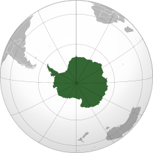
  • Image 6 Antarctica (/ænˈtɑːrktɪkə/ ⓘ) is Earth's southernmost and least-populated continent. Situated almost entirely south of the Antarctic Circle and surrounded by the Southern Ocean (also known as the Antarctic Ocean), it contains the geographic South Pole. Antarctica is the fifth-largest continent, being about 40% larger than Europe, and has an area of 14,200,000 km2 (5,500,000 sq mi). Most of Antarctica is covered by the Antarctic ice sheet, with an average thickness of 1.9 km (1.2 mi). Antarctica is, on average, the coldest, driest, and windiest of the continents, and it has the highest average elevation. It is mainly a polar desert, with annual precipitation of over 200 mm (8 in) along the coast and far less inland. About 70% of the world's freshwater reserves are frozen in Antarctica, which, if melted, would raise global sea levels by almost 60 metres (200 ft). Antarctica holds the record for the lowest measured temperature on Earth, −89.2 °C (−128.6 °F). The coastal regions can reach temperatures over 10 °C (50 °F) in the summer. Native species of animals include mites, nematodes, penguins, seals and tardigrades. Where vegetation occurs, it is mostly in the form of lichen or moss. (Full article...)

    Antarctica (/ænˈtɑːrktɪkə/ ) is Earth's southernmost and least-populated continent. Situated almost entirely south of the Antarctic Circle and surrounded by the Southern Ocean (also known as the Antarctic Ocean), it contains the geographic South Pole. Antarctica is the fifth-largest continent, being about 40% larger than Europe, and has an area of 14,200,000 km (5,500,000 sq mi). Most of Antarctica is covered by the Antarctic ice sheet, with an average thickness of 1.9 km (1.2 mi).

    Antarctica is, on average, the coldest, driest, and windiest of the continents, and it has the highest average elevation. It is mainly a polar desert, with annual precipitation of over 200 mm (8 in) along the coast and far less inland. About 70% of the world's freshwater reserves are frozen in Antarctica, which, if melted, would raise global sea levels by almost 60 metres (200 ft). Antarctica holds the record for the lowest measured temperature on Earth, −89.2 °C (−128.6 °F). The coastal regions can reach temperatures over 10 °C (50 °F) in the summer. Native species of animals include mites, nematodes, penguins, seals and tardigrades. Where vegetation occurs, it is mostly in the form of lichen or moss. (Full article...)
  • Image 7 Coropuna is a dormant compound volcano located in the Andes mountains of southeast-central Peru. The upper reaches of Coropuna consist of several perennially snowbound conical summits, lending it the name Nevado Coropuna in Spanish. The complex extends over an area of 240 square kilometres (93 sq mi) and its highest summit reaches an altitude of 6,377 metres (20,922 ft) above sea level. This makes the Coropuna complex the third-highest of Peru. Its thick ice cap is the most extensive in Earth's tropical zone, with several outlet glaciers stretching out to lower altitudes. Below an elevation of 5,000 metres (16,000 ft), there are various vegetation belts which include trees, peat bogs, grasses and also agricultural areas and pastures. The Coropuna complex consists of several stratovolcanoes. These are composed chiefly of ignimbrites and lava flows on a basement formed by Middle Miocene ignimbrites and lava flows. The Coropuna complex has been active for at least five million years, with the bulk of the current cone having been formed during the Quaternary. Coropuna has had two or three Holocene eruptions 2,100 ± 200 and either 1,100 ± 100 or 700 ± 200 years ago which generated lava flows, plus an additional eruption which may have taken place some 6,000 years ago. Current activity occurs exclusively in the form of hot springs. (Full article...)

    Coropuna is a dormant compound volcano located in the Andes mountains of southeast-central Peru. The upper reaches of Coropuna consist of several perennially snowbound conical summits, lending it the name Nevado Coropuna in Spanish. The complex extends over an area of 240 square kilometres (93 sq mi) and its highest summit reaches an altitude of 6,377 metres (20,922 ft) above sea level. This makes the Coropuna complex the third-highest of Peru. Its thick ice cap is the most extensive in Earth's tropical zone, with several outlet glaciers stretching out to lower altitudes. Below an elevation of 5,000 metres (16,000 ft), there are various vegetation belts which include trees, peat bogs, grasses and also agricultural areas and pastures.

    The Coropuna complex consists of several stratovolcanoes. These are composed chiefly of ignimbrites and lava flows on a basement formed by Middle Miocene ignimbrites and lava flows. The Coropuna complex has been active for at least five million years, with the bulk of the current cone having been formed during the Quaternary. Coropuna has had two or three Holocene eruptions 2,100 ± 200 and either 1,100 ± 100 or 700 ± 200 years ago which generated lava flows, plus an additional eruption which may have taken place some 6,000 years ago. Current activity occurs exclusively in the form of hot springs. (Full article...)
  • Image 8 William Speirs Bruce FRSE (1 August 1867 – 28 October 1921) was a British naturalist, polar scientist and oceanographer who organised and led the Scottish National Antarctic Expedition (SNAE, 1902–04) to the South Orkney Islands and the Weddell Sea. Among other achievements, the expedition established the first permanent weather station in Antarctica. Bruce later founded the Scottish Oceanographical Laboratory in Edinburgh, but his plans for a transcontinental Antarctic march via the South Pole were abandoned because of lack of public and financial support. In 1892 Bruce gave up his medical studies at the University of Edinburgh and joined the Dundee Whaling Expedition to Antarctica as a scientific assistant. This was followed by Arctic voyages to Novaya Zemlya, Spitsbergen and Franz Josef Land. In 1899 Bruce, by then Britain's most experienced polar scientist, applied for a post on Robert Falcon Scott's Discovery Expedition, but delays over this appointment and clashes with Royal Geographical Society (RGS) president Sir Clements Markham led him instead to organise his own expedition, and earned him the permanent enmity of the geographical establishment in London. Although Bruce received various awards for his polar work, including an honorary doctorate from the University of Aberdeen, neither he nor any of his SNAE colleagues were recommended by the RGS for the prestigious Polar Medal. (Full article...)

    William Speirs Bruce FRSE (1 August 1867 – 28 October 1921) was a British naturalist, polar scientist and oceanographer who organised and led the Scottish National Antarctic Expedition (SNAE, 1902–04) to the South Orkney Islands and the Weddell Sea. Among other achievements, the expedition established the first permanent weather station in Antarctica. Bruce later founded the Scottish Oceanographical Laboratory in Edinburgh, but his plans for a transcontinental Antarctic march via the South Pole were abandoned because of lack of public and financial support.

    In 1892 Bruce gave up his medical studies at the University of Edinburgh and joined the Dundee Whaling Expedition to Antarctica as a scientific assistant. This was followed by Arctic voyages to Novaya Zemlya, Spitsbergen and Franz Josef Land. In 1899 Bruce, by then Britain's most experienced polar scientist, applied for a post on Robert Falcon Scott's Discovery Expedition, but delays over this appointment and clashes with Royal Geographical Society (RGS) president Sir Clements Markham led him instead to organise his own expedition, and earned him the permanent enmity of the geographical establishment in London. Although Bruce received various awards for his polar work, including an honorary doctorate from the University of Aberdeen, neither he nor any of his SNAE colleagues were recommended by the RGS for the prestigious Polar Medal. (Full article...)
  • Image 9 One of T4's sister ships, T3 T4 was a seagoing torpedo boat operated by the Royal Yugoslav Navy between 1921 and 1932. Originally 79 T, a 250t-class torpedo boat of the Austro-Hungarian Navy built in 1914, she was armed with two 66 mm (2.6 in) guns and four 450 mm (17.7 in) torpedo tubes, and could carry 10–12 naval mines. She saw active service during World War I, performing convoy, patrol, escort and minesweeping tasks, anti-submarine operations and shore bombardment missions. In 1917 the suffixes of all Austro-Hungarian torpedo boats were removed, and thereafter she was referred to as 79. Underway during the short-lived mutiny by Austro-Hungarian sailors in early February 1918, her captain realised the danger and put her crew ashore. She was part of the escort force for the Austro-Hungarian dreadnought Szent István during the action that resulted in the sinking of that ship by Italian torpedo boats in June 1918. Following Austria-Hungary's defeat in 1918, 79 was allocated to the Navy of the Kingdom of Serbs, Croats and Slovenes, which later became the Royal Yugoslav Navy, and was renamed T4. At the time, she and the seven other 250t-class boats were the only modern sea-going vessels of the fledgling maritime force. During the interwar period, T4 and the rest of the navy were involved in training exercises and cruises to friendly ports, but activity was limited by reduced naval budgets. In 1932, she ran aground on the island of Drvenik Mali off the central Dalmatian coast and the hull broke in half. The bow remained on the island, and the stern was towed to the Tivat Arsenal in the Bay of Kotor. As a result, it became a standing joke among Yugoslav sailors that this made T4 the "world's longest torpedo boat". Eventually both sections were scrapped where they were. (Full article...)

    T4 was a seagoing torpedo boat operated by the Royal Yugoslav Navy between 1921 and 1932. Originally 79 T, a 250t-class torpedo boat of the Austro-Hungarian Navy built in 1914, she was armed with two 66 mm (2.6 in) guns and four 450 mm (17.7 in) torpedo tubes, and could carry 10–12 naval mines. She saw active service during World War I, performing convoy, patrol, escort and minesweeping tasks, anti-submarine operations and shore bombardment missions. In 1917 the suffixes of all Austro-Hungarian torpedo boats were removed, and thereafter she was referred to as 79. Underway during the short-lived mutiny by Austro-Hungarian sailors in early February 1918, her captain realised the danger and put her crew ashore. She was part of the escort force for the Austro-Hungarian dreadnought Szent István during the action that resulted in the sinking of that ship by Italian torpedo boats in June 1918.

    Following Austria-Hungary's defeat in 1918, 79 was allocated to the Navy of the Kingdom of Serbs, Croats and Slovenes, which later became the Royal Yugoslav Navy, and was renamed T4. At the time, she and the seven other 250t-class boats were the only modern sea-going vessels of the fledgling maritime force. During the interwar period, T4 and the rest of the navy were involved in training exercises and cruises to friendly ports, but activity was limited by reduced naval budgets. In 1932, she ran aground on the island of Drvenik Mali off the central Dalmatian coast and the hull broke in half. The bow remained on the island, and the stern was towed to the Tivat Arsenal in the Bay of Kotor. As a result, it became a standing joke among Yugoslav sailors that this made T4 the "world's longest torpedo boat". Eventually both sections were scrapped where they were. (Full article...)
  • Image 10 View inside the caldera Incapillo is a Pleistocene-age caldera (a depression formed by the collapse of a volcano) in the La Rioja Province of Argentina. It is the southernmost volcanic centre in the Andean Central Volcanic Zone (CVZ) that erupted during the Pleistocene. Incapillo is one of several ignimbrite or caldera systems that, along with 44 active stratovolcanoes, comprise the CVZ. Subduction of the Nazca Plate beneath the South American Plate is responsible for most of the volcanism in the CVZ. After activity in the volcanic arc of the western Maricunga Belt ceased six million years ago, volcanism commenced in the Incapillo region, forming the high volcanic edifices Monte Pissis, Cerro Bonete Chico and Sierra de Veladero. Later, a number of lava domes were emplaced between these volcanoes. (Full article...)

    Incapillo is a Pleistocene-age caldera (a depression formed by the collapse of a volcano) in the La Rioja Province of Argentina. It is the southernmost volcanic centre in the Andean Central Volcanic Zone (CVZ) that erupted during the Pleistocene. Incapillo is one of several ignimbrite or caldera systems that, along with 44 active stratovolcanoes, comprise the CVZ.

    Subduction of the Nazca Plate beneath the South American Plate is responsible for most of the volcanism in the CVZ. After activity in the volcanic arc of the western Maricunga Belt ceased six million years ago, volcanism commenced in the Incapillo region, forming the high volcanic edifices Monte Pissis, Cerro Bonete Chico and Sierra de Veladero. Later, a number of lava domes were emplaced between these volcanoes. (Full article...)
  • Image 11 Fanno Creek in Greenway Park, Beaverton Fanno Creek is a 15-mile (24 km) tributary of the Tualatin River in the U.S. state of Oregon. Part of the drainage basin of the Columbia River, its watershed covers about 32 square miles (83 km2) in Multnomah, Washington, and Clackamas counties, including about 7 square miles (18 km2) within the Portland city limits. From its headwaters in the Tualatin Mountains (West Hills) in southwest Portland, the creek flows generally west and south through the cities of Portland, Beaverton, Tigard and Durham, and unincorporated areas of Washington County. It enters the Tualatin River about 9 miles (14 km) above the Tualatin's confluence with the Willamette River at West Linn. (Full article...)

    Fanno Creek is a 15-mile (24 km) tributary of the Tualatin River in the U.S. state of Oregon. Part of the drainage basin of the Columbia River, its watershed covers about 32 square miles (83 km) in Multnomah, Washington, and Clackamas counties, including about 7 square miles (18 km) within the Portland city limits.

    From its headwaters in the Tualatin Mountains (West Hills) in southwest Portland, the creek flows generally west and south through the cities of Portland, Beaverton, Tigard and Durham, and unincorporated areas of Washington County. It enters the Tualatin River about 9 miles (14 km) above the Tualatin's confluence with the Willamette River at West Linn. (Full article...)
  • Image 12 Female near Kaktovik, Barter Island, Alaska, United States The polar bear (Ursus maritimus) is a large bear native to the Arctic and nearby areas. It is closely related to the brown bear, and the two species can interbreed. The polar bear is the largest extant species of bear and land carnivore, with adult males weighing 300–800 kg (660–1,760 lb). The species is sexually dimorphic, as adult females are much smaller. The polar bear is white- or yellowish-furred with black skin and a thick layer of fat. It is more slender than the brown bear, with a narrower skull, longer neck and lower shoulder hump. Its teeth are sharper and more adapted to cutting meat. The paws are large and allow the bear to walk on ice and paddle in the water. Polar bears are both terrestrial and pagophilic (ice-living) and are considered marine mammals because of their dependence on marine ecosystems. They prefer the annual sea ice but live on land when the ice melts in the summer. They are mostly carnivorous and specialized for preying on seals, particularly ringed seals. Such prey is typically taken by ambush; the bear may stalk its prey on the ice or in the water, but also will stay at a breathing hole or ice edge to wait for prey to swim by. The bear primarily feeds on the seal's energy-rich blubber. Other prey include walruses, beluga whales and some terrestrial animals. Polar bears are usually solitary but can be found in groups when on land. During the breeding season, male bears guard females and defend them from rivals. Mothers give birth to cubs in maternity dens during the winter. Young stay with their mother for up to two and a half years. (Full article...)

    The polar bear (Ursus maritimus) is a large bear native to the Arctic and nearby areas. It is closely related to the brown bear, and the two species can interbreed. The polar bear is the largest extant species of bear and land carnivore, with adult males weighing 300–800 kg (660–1,760 lb). The species is sexually dimorphic, as adult females are much smaller. The polar bear is white- or yellowish-furred with black skin and a thick layer of fat. It is more slender than the brown bear, with a narrower skull, longer neck and lower shoulder hump. Its teeth are sharper and more adapted to cutting meat. The paws are large and allow the bear to walk on ice and paddle in the water.

    Polar bears are both terrestrial and pagophilic (ice-living) and are considered marine mammals because of their dependence on marine ecosystems. They prefer the annual sea ice but live on land when the ice melts in the summer. They are mostly carnivorous and specialized for preying on seals, particularly ringed seals. Such prey is typically taken by ambush; the bear may stalk its prey on the ice or in the water, but also will stay at a breathing hole or ice edge to wait for prey to swim by. The bear primarily feeds on the seal's energy-rich blubber. Other prey include walruses, beluga whales and some terrestrial animals. Polar bears are usually solitary but can be found in groups when on land. During the breeding season, male bears guard females and defend them from rivals. Mothers give birth to cubs in maternity dens during the winter. Young stay with their mother for up to two and a half years. (Full article...)
  • Image 13 Allison Guyot (formerly known as Navoceano Guyot) is a tablemount (guyot) in the underwater Mid-Pacific Mountains of the Pacific Ocean. It is a trapezoidal flat mountain rising 1,500 metres (4,900 ft) above the seafloor to a depth of less than 1,500 metres (4,900 ft), with a summit platform 35 by 70 kilometres (22 by 43 mi) wide. The Mid-Pacific Mountains lie west of Hawaii and northeast of the Marshall Islands, but at the time of their formation were located in the Southern Hemisphere. The tablemount was probably formed by a hotspot in the present-day Southern Pacific before plate tectonics moved it to its current location. Several hotspots, including the Easter, Marquesas and Society hotspots, may have been involved in the formation of the Mid-Pacific Mountains. Volcanic activity is dated to have occurred circa 111–85 million years ago and formed a volcanic island. Subsequently, carbonate deposition commenced as Allison Guyot subsided and eventually buried the island, forming an atoll-like structure and a carbonate platform. Among other animals, crocodilians lived on Allison Guyot. (Full article...)
    Allison Guyot (formerly known as Navoceano Guyot) is a tablemount (guyot) in the underwater Mid-Pacific Mountains of the Pacific Ocean. It is a trapezoidal flat mountain rising 1,500 metres (4,900 ft) above the seafloor to a depth of less than 1,500 metres (4,900 ft), with a summit platform 35 by 70 kilometres (22 by 43 mi) wide. The Mid-Pacific Mountains lie west of Hawaii and northeast of the Marshall Islands, but at the time of their formation were located in the Southern Hemisphere.

    The tablemount was probably formed by a hotspot in the present-day Southern Pacific before plate tectonics moved it to its current location. Several hotspots, including the Easter, Marquesas and Society hotspots, may have been involved in the formation of the Mid-Pacific Mountains. Volcanic activity is dated to have occurred circa 111–85 million years ago and formed a volcanic island. Subsequently, carbonate deposition commenced as Allison Guyot subsided and eventually buried the island, forming an atoll-like structure and a carbonate platform. Among other animals, crocodilians lived on Allison Guyot. (Full article...)
  • Image 14 The Han Dynasty in 60 AD at its greatest extent   Principalities and centrally-administered commanderies   Protectorate of the Western Regions (now Tarim Basin of Xinjiang) The Han dynasty was an imperial dynasty of China (202 BC – 9 AD, 25–220 AD) established by Liu Bang and ruled by the House of Liu. The dynasty was preceded by the short-lived Qin dynasty (221–206 BC) and a warring interregnum known as the Chu–Han Contention (206–202 BC), and it was succeeded by the Three Kingdoms period (220–280 AD). The dynasty was briefly interrupted by the Xin dynasty (9–23 AD) established by the usurping regent Wang Mang, and is thus separated into two periods—the Western Han (202 BC – 9 AD) and the Eastern Han (25–220 AD). Spanning over four centuries, the Han dynasty is considered a golden age in Chinese history, and had a permanent impact on Chinese identity in later periods. The majority ethnic group of modern China refer to themselves as the "Han people" or "Han Chinese". The spoken Chinese and written Chinese are referred to respectively as the "Han language" and "Han characters". The Han emperor was at the pinnacle of Han society and culture. He presided over the Han government but shared power with both the nobility and the appointed ministers who came largely from the scholarly gentry class. The Han Empire was divided into areas directly controlled by the central government called commanderies, as well as a number of semi-autonomous kingdoms. These kingdoms gradually lost all vestiges of their independence, particularly following the Rebellion of the Seven States. From the reign of Emperor Wu (r. 141–87 BC) onward, the Chinese court officially sponsored Confucianism in education and court politics, synthesized with the cosmology of later scholars such as Dong Zhongshu. (Full article...)

    The Han dynasty was an imperial dynasty of China (202 BC – 9 AD, 25–220 AD) established by Liu Bang and ruled by the House of Liu. The dynasty was preceded by the short-lived Qin dynasty (221–206 BC) and a warring interregnum known as the Chu–Han Contention (206–202 BC), and it was succeeded by the Three Kingdoms period (220–280 AD). The dynasty was briefly interrupted by the Xin dynasty (9–23 AD) established by the usurping regent Wang Mang, and is thus separated into two periods—the Western Han (202 BC – 9 AD) and the Eastern Han (25–220 AD). Spanning over four centuries, the Han dynasty is considered a golden age in Chinese history, and had a permanent impact on Chinese identity in later periods. The majority ethnic group of modern China refer to themselves as the "Han people" or "Han Chinese". The spoken Chinese and written Chinese are referred to respectively as the "Han language" and "Han characters".

    The Han emperor was at the pinnacle of Han society and culture. He presided over the Han government but shared power with both the nobility and the appointed ministers who came largely from the scholarly gentry class. The Han Empire was divided into areas directly controlled by the central government called commanderies, as well as a number of semi-autonomous kingdoms. These kingdoms gradually lost all vestiges of their independence, particularly following the Rebellion of the Seven States. From the reign of Emperor Wu (r. 141–87 BC) onward, the Chinese court officially sponsored Confucianism in education and court politics, synthesized with the cosmology of later scholars such as Dong Zhongshu. (Full article...)
  • Image 15 Enhanced color image of Io from the Galileo spacecraft, taken in 1999. Io (/ˈaɪ.oʊ/), or Jupiter I, is the innermost and second-smallest of the four Galilean moons of the planet Jupiter. Slightly larger than Earth's moon, Io is the fourth-largest moon in the Solar System, has the highest density of any moon, the strongest surface gravity of any moon, and the lowest amount of water by atomic ratio of any known astronomical object in the Solar System. It was discovered in 1610 by Galileo Galilei and was named after the mythological character Io, a priestess of Hera who became one of Zeus's lovers. With over 400 active volcanoes, Io is the most geologically active object in the Solar System. This extreme geologic activity is the result of tidal heating from friction generated within Io's interior as it is pulled between Jupiter and the other Galilean moons—Europa, Ganymede and Callisto. Several volcanoes produce plumes of sulfur and sulfur dioxide that climb as high as 500 km (300 mi) above the surface. Io's surface is also dotted with more than 100 mountains that have been uplifted by extensive compression at the base of Io's silicate crust. Some of these peaks are taller than Mount Everest, the highest point on Earth's surface. Unlike most moons in the outer Solar System, which are mostly composed of water ice, Io is primarily composed of silicate rock surrounding a molten iron or iron sulfide core. Most of Io's surface is composed of extensive plains with a frosty coating of sulfur and sulfur dioxide. (Full article...)

    Io (/ˈ./), or Jupiter I, is the innermost and second-smallest of the four Galilean moons of the planet Jupiter. Slightly larger than Earth's moon, Io is the fourth-largest moon in the Solar System, has the highest density of any moon, the strongest surface gravity of any moon, and the lowest amount of water by atomic ratio of any known astronomical object in the Solar System. It was discovered in 1610 by Galileo Galilei and was named after the mythological character Io, a priestess of Hera who became one of Zeus's lovers.

    With over 400 active volcanoes, Io is the most geologically active object in the Solar System. This extreme geologic activity is the result of tidal heating from friction generated within Io's interior as it is pulled between Jupiter and the other Galilean moons—Europa, Ganymede and Callisto. Several volcanoes produce plumes of sulfur and sulfur dioxide that climb as high as 500 km (300 mi) above the surface. Io's surface is also dotted with more than 100 mountains that have been uplifted by extensive compression at the base of Io's silicate crust. Some of these peaks are taller than Mount Everest, the highest point on Earth's surface. Unlike most moons in the outer Solar System, which are mostly composed of water ice, Io is primarily composed of silicate rock surrounding a molten iron or iron sulfide core. Most of Io's surface is composed of extensive plains with a frosty coating of sulfur and sulfur dioxide. (Full article...)
  • More featured articles

    Vital articles Vital article

    Vital articles to understand Geography.

    Atlantic Ocean near the Faroe Islands

    A sea is a large body of salt water. There are particular seas and the sea. The sea commonly refers to the ocean, the interconnected body of seawaters that spans most of Earth. Particular seas are either marginal seas, second-order sections of the oceanic sea (e.g. the Mediterranean Sea), or certain large, nearly landlocked bodies of water. (Full article...)

    Other vital articles

    Get involved

    For editor resources and to collaborate with other editors on improving Wikipedia's Geography-related articles, visit WikiProject Geography.


    Here are some tasks awaiting attention:

    Selected pictures

    Featured biography articles in geography

    Zhang Heng (Chinese: ; AD 78–139), formerly romanized Chang Heng, was a Chinese polymathic scientist and statesman who lived during the Eastern Han dynasty. Educated in the capital cities of Luoyang and Chang'an, he achieved success as an astronomer, mathematician, seismologist, hydraulic engineer, inventor, geographer, cartographer, ethnographer, artist, poet, philosopher, politician, and literary scholar.

    Zhang Heng began his career as a minor civil servant in Nanyang. Eventually, he became Chief Astronomer, Prefect of the Majors for Official Carriages, and then Palace Attendant at the imperial court. His uncompromising stance on historical and calendrical issues led to his becoming a controversial figure, preventing him from rising to the status of Grand Historian. His political rivalry with the palace eunuchs during the reign of Emperor Shun (r. 125–144) led to his decision to retire from the central court to serve as an administrator of Hejian Kingdom in present-day Hebei. Zhang returned home to Nanyang for a short time, before being recalled to serve in the capital once more in 138. He died there a year later, in 139. (Full article...)

    More featured biographies

    Did you know

    Did you know it about Geography?

    No recent additions

    Places around you

    You can read about interesting Wikipedia articles about places around you.

    Special:Nearby

    This following Geography-related articles is a most visited articles of WikiProject Geography, See complete list at Wikipedia:WikiProject Geography/Popular pages.

  • Image 3 Generation Z (often shortened to Gen Z), also known as Zoomers, is the demographic cohort succeeding Millennials and preceding Generation Alpha. Researchers and popular media use the mid-to-late 1990s as starting birth years and the early 2010s as ending birth years, with the generation most frequently being defined as people born from 1997 to 2012. Most members of Generation Z are the children of younger baby boomers or Generation X. (Full article...)
    Generation Z (often shortened to Gen Z), also known as Zoomers, is the demographic cohort succeeding Millennials and preceding Generation Alpha. Researchers and popular media use the mid-to-late 1990s as starting birth years and the early 2010s as ending birth years, with the generation most frequently being defined as people born from 1997 to 2012. Most members of Generation Z are the children of younger baby boomers or Generation X. (Full article...)
  • Image 4 The Blue Marble, Apollo 17, December 1972 Earth is the third planet from the Sun and the only astronomical object known to harbor life. This is enabled by Earth being an ocean world, the only one in the Solar System sustaining liquid surface water. Almost all of Earth's water is contained in its global ocean, covering 70.8% of Earth's crust. The remaining 29.2% of Earth's crust is land, most of which is located in the form of continental landmasses within Earth's land hemisphere. Most of Earth's land is at least somewhat humid and covered by vegetation, while large sheets of ice at Earth's polar deserts retain more water than Earth's groundwater, lakes, rivers and atmospheric water combined. Earth's crust consists of slowly moving tectonic plates, which interact to produce mountain ranges, volcanoes, and earthquakes. Earth has a liquid outer core that generates a magnetosphere capable of deflecting most of the destructive solar winds and cosmic radiation. (Full article...)

    Earth is the third planet from the Sun and the only astronomical object known to harbor life. This is enabled by Earth being an ocean world, the only one in the Solar System sustaining liquid surface water. Almost all of Earth's water is contained in its global ocean, covering 70.8% of Earth's crust. The remaining 29.2% of Earth's crust is land, most of which is located in the form of continental landmasses within Earth's land hemisphere. Most of Earth's land is at least somewhat humid and covered by vegetation, while large sheets of ice at Earth's polar deserts retain more water than Earth's groundwater, lakes, rivers and atmospheric water combined. Earth's crust consists of slowly moving tectonic plates, which interact to produce mountain ranges, volcanoes, and earthquakes. Earth has a liquid outer core that generates a magnetosphere capable of deflecting most of the destructive solar winds and cosmic radiation. (Full article...)
  • Image 5 River Thames and Tower Bridge with The Shard and Southwark (left), and Tower of London and City of London (right) London is the capital and largest city of both England and the United Kingdom, with a population of 8,866,180 in 2022. Its wider metropolitan area is the largest in Western Europe, with a population of 14.9 million. London stands on the River Thames in southeast England, at the head of a 50-mile (80 km) tidal estuary down to the North Sea, and has been a major settlement for nearly 2,000 years. Its ancient core and financial centre, the City of London, was founded by the Romans as Londinium and has retained its medieval boundaries. The City of Westminster, to the west of the City of London, has been the centuries-long host of the national government and parliament. London grew rapidly in the 19th century, becoming the world's largest city at the time. Since the 19th century, the name "London" has referred to the metropolis around the City of London, historically split between the counties of Middlesex, Essex, Surrey, Kent, and Hertfordshire, which since 1965 has largely comprised the administrative area of Greater London, governed by 33 local authorities and the Greater London Authority. (Full article...)

    London is the capital and largest city of both England and the United Kingdom, with a population of 8,866,180 in 2022. Its wider metropolitan area is the largest in Western Europe, with a population of 14.9 million. London stands on the River Thames in southeast England, at the head of a 50-mile (80 km) tidal estuary down to the North Sea, and has been a major settlement for nearly 2,000 years. Its ancient core and financial centre, the City of London, was founded by the Romans as Londinium and has retained its medieval boundaries. The City of Westminster, to the west of the City of London, has been the centuries-long host of the national government and parliament. London grew rapidly in the 19th century, becoming the world's largest city at the time. Since the 19th century, the name "London" has referred to the metropolis around the City of London, historically split between the counties of Middlesex, Essex, Surrey, Kent, and Hertfordshire, which since 1965 has largely comprised the administrative area of Greater London, governed by 33 local authorities and the Greater London Authority. (Full article...)
  • Image 6 Capitol Hill, National Mall, Downtown (right) and Southwest Federal Center (left), aerial view from above Lincoln Park Washington, D.C., formally the District of Columbia and commonly known as Washington or D.C., is the capital city and federal district of the United States. The city is on the Potomac River, across from Virginia, and shares land borders with Maryland to its north and east. It was named after George Washington, the first president of the United States. The district is named for Columbia, the female personification of the nation. (Full article...)

    Washington, D.C., formally the District of Columbia and commonly known as Washington or D.C., is the capital city and federal district of the United States. The city is on the Potomac River, across from Virginia, and shares land borders with Maryland to its north and east. It was named after George Washington, the first president of the United States. The district is named for Columbia, the female personification of the nation. (Full article...)
  • Image 7 Cartogram of the world's population in 2018; each square represents 500,000 people. This is a list of countries and dependencies by population. It includes sovereign states, inhabited dependent territories and, in some cases, constituent countries of sovereign states, with inclusion within the list being primarily based on the ISO standard ISO 3166-1. For instance, the United Kingdom is considered a single entity, while the constituent countries of the Kingdom of the Netherlands are considered separately. In addition, this list includes certain states with limited recognition not found in ISO 3166-1. Also given in a percentage is each country's population compared with the world population, which the United Nations estimates at 8.119 billion as of 2024. (Full article...)
    Cartogram of the world's population in 2018; each square represents 500,000 people.


    This is a list of countries and dependencies by population. It includes sovereign states, inhabited dependent territories and, in some cases, constituent countries of sovereign states, with inclusion within the list being primarily based on the ISO standard ISO 3166-1. For instance, the United Kingdom is considered a single entity, while the constituent countries of the Kingdom of the Netherlands are considered separately. In addition, this list includes certain states with limited recognition not found in ISO 3166-1. Also given in a percentage is each country's population compared with the world population, which the United Nations estimates at 8.119 billion as of 2024. (Full article...)
  • Image 8 Dymaxion map of the world with the 30 largest countries and territories by area This is a list of the world's countries and their dependencies, ranked by total area, including land and water. (Full article...)
    Dymaxion map of the world with the 30 largest countries and territories by area


    This is a list of the world's countries and their dependencies, ranked by total area, including land and water. (Full article...)
  • Image 9 An azimuthal projection showing the Arctic Ocean and the North Pole. The map also shows the 75th parallel north and 60th parallel north. The North Pole, also known as the Geographic North Pole or Terrestrial North Pole, is the point in the Northern Hemisphere where the Earth's axis of rotation meets its surface. It is called the True North Pole to distinguish from the Magnetic North Pole. (Full article...)
    An azimuthal projection showing the Arctic Ocean and the North Pole. The map also shows the 75th parallel north and 60th parallel north.

    The North Pole, also known as the Geographic North Pole or Terrestrial North Pole, is the point in the Northern Hemisphere where the Earth's axis of rotation meets its surface. It is called the True North Pole to distinguish from the Magnetic North Pole. (Full article...)
  • Image 10 The United Nations uses three definitions for what constitutes a city, as not all cities in all jurisdictions are classified using the same criteria. Cities may be defined as the cities proper, the extent of their urban area, or their metropolitan regions. (Full article...)
    The United Nations uses three definitions for what constitutes a city, as not all cities in all jurisdictions are classified using the same criteria. Cities may be defined as the cities proper, the extent of their urban area, or their metropolitan regions. (Full article...)
  • Click to enlarge and view description.

    Main articles

    CategoriesCategories

    Select [►] to view subcategories.

    Associated Wikimedia

    The following Wikimedia Foundation sister projects provide more on this subject:

    Discover Wikipedia using portals
    Retrieved from "https://en.wikipedia.org/w/index.php?title=Portal:Geography&oldid=1202464975"