Loading
  • 21 Aug, 2019

  • By, Wikipedia

Portal:Geography

The Geography Portal

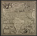
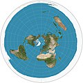
Geography (from Ancient Greek γεωγραφία geōgraphía; combining 'Earth' and gráphō 'write') is the study of the lands, features, inhabitants, and phenomena of Earth. Geography is an all-encompassing discipline that seeks an understanding of Earth and its human and natural complexities—not merely where objects are, but also how they have changed and come to be. While geography is specific to Earth, many concepts can be applied more broadly to other celestial bodies in the field of planetary science. Geography has been called "a bridge between natural science and social science disciplines."

Origins of many of the concepts in geography can be traced to Greek Eratosthenes of Cyrene, who may have coined the term "geographia" (c. 276 BC – c. 195/194 BC). The first recorded use of the word γεωγραφία was as the title of a book by Greek scholar Claudius Ptolemy (100 – 170 AD). This work created the so-called "Ptolemaic tradition" of geography, which included "Ptolemaic cartographic theory." However, the concepts of geography (such as cartography) date back to the earliest attempts to understand the world spatially, with the earliest example of an attempted world map dating to the 9th century BCE in ancient Babylon. The history of geography as a discipline spans cultures and millennia, being independently developed by multiple groups, and cross-pollinated by trade between these groups. The core concepts of geography consistent between all approaches are a focus on space, place, time, and scale.

Today, geography is an extremely broad discipline with multiple approaches and modalities. There have been multiple attempts to organize the discipline, including the four traditions of geography, and into branches. Techniques employed can generally be broken down into quantitative and qualitative approaches, with many studies taking mixed-methods approaches. Common techniques include cartography, remote sensing, interviews, and surveying. (Full article...)
Featured articles are displayed here, which represent some of the best content on English Wikipedia.

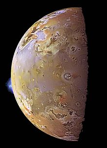
  • Image 2 Io, with two plumes erupting from its surface, Galileo image, June 1997 Volcanism on Io, a moon of Jupiter, is represented by the presence of volcanoes, volcanic pits and lava flows on the surface. Io's volcanic activity was discovered in 1979 by Linda Morabito, an imaging scientist working on Voyager 1. Observations of Io by passing spacecraft and Earth-based astronomers have revealed more than 150 active volcanoes. As of 2024[update], up to 400 such volcanoes are predicted to exist based on these observations. Io's volcanism makes the satellite one of only four known currently volcanically or cryovolcanically active worlds in the Solar System (the others being Earth, Saturn's moon Enceladus, and Neptune's moon Triton.) First predicted shortly before the Voyager 1 flyby, the heat source for Io's volcanism comes from tidal heating produced by its forced orbital eccentricity. This differs from Earth's internal heating, which is derived primarily from radioactive isotope decay and primordial heat of accretion. Io's eccentric orbit leads to a slight difference in Jupiter's gravitational pull on the satellite between its closest and farthest points on its orbit, causing a varying tidal bulge. This variation in the shape of Io causes frictional heating in its interior. Without this tidal heating, Io might have been similar to the Moon, a world of similar size and mass, geologically dead and covered with numerous impact craters. (Full article...)
    Io, with two plumes erupting from its surface, Galileo image, June 1997

    Volcanism on Io, a moon of Jupiter, is represented by the presence of volcanoes, volcanic pits and lava flows on the surface. Io's volcanic activity was discovered in 1979 by Linda Morabito, an imaging scientist working on Voyager 1. Observations of Io by passing spacecraft and Earth-based astronomers have revealed more than 150 active volcanoes. As of 2024, up to 400 such volcanoes are predicted to exist based on these observations. Io's volcanism makes the satellite one of only four known currently volcanically or cryovolcanically active worlds in the Solar System (the others being Earth, Saturn's moon Enceladus, and Neptune's moon Triton.)

    First predicted shortly before the Voyager 1 flyby, the heat source for Io's volcanism comes from tidal heating produced by its forced orbital eccentricity. This differs from Earth's internal heating, which is derived primarily from radioactive isotope decay and primordial heat of accretion. Io's eccentric orbit leads to a slight difference in Jupiter's gravitational pull on the satellite between its closest and farthest points on its orbit, causing a varying tidal bulge. This variation in the shape of Io causes frictional heating in its interior. Without this tidal heating, Io might have been similar to the Moon, a world of similar size and mass, geologically dead and covered with numerous impact craters. (Full article...)
  • Image 3 Omayra Sánchez Garzón (August 28, 1972 – November 16, 1985) was a Colombian girl trapped and killed by a landslide when she was 13 years old. The landslide was caused by the 1985 eruption of the volcano Nevado del Ruiz in Armero, Tolima. Volcanic debris mixed with ice to form massive lahars (volcanically induced mudflows, landslides, and debris flows), which rushed into the river valleys below the mountain, killing about 25,000 people and destroying Armero and 13 other villages. (Full article...)
    Omayra Sánchez Garzón (August 28, 1972 – November 16, 1985) was a Colombian girl trapped and killed by a landslide when she was 13 years old.

    The landslide was caused by the 1985 eruption of the volcano Nevado del Ruiz in Armero, Tolima. Volcanic debris mixed with ice to form massive lahars (volcanically induced mudflows, landslides, and debris flows), which rushed into the river valleys below the mountain, killing about 25,000 people and destroying Armero and 13 other villages. (Full article...)
  • Image 4 Stolt Kittiwake heading toward the Mersey Estuary, 2005 The Manchester Ship Canal is a 36 mi-long (58 km) inland waterway in the North West of England linking Manchester to the Irish Sea. Starting at the Mersey Estuary at Eastham, near Ellesmere Port, Cheshire, it generally follows the original routes of the rivers Mersey and Irwell through the historic counties of Cheshire and Lancashire. Several sets of locks lift vessels about 60 ft (18 m) to the canal's terminus in Manchester. Landmarks along its route include the Barton Swing Aqueduct, the world's only swing aqueduct, and Trafford Park, the world's first planned industrial estate and still the largest in Europe. The rivers Mersey and Irwell were first made navigable in the early 18th century. Goods were also transported on the Runcorn extension of the Bridgewater Canal (from 1776) and the Liverpool and Manchester Railway (from 1830) but by the late 19th century the Mersey and Irwell Navigation had fallen into disrepair and was often unusable. Manchester's business community viewed the charges imposed by Liverpool's docks and the railway companies as excessive. A ship canal was proposed to give ocean-going vessels direct access to Manchester. The region was suffering from the Long Depression; the canal's proponents argued that the scheme would boost competition and create jobs. They gained public support for the scheme, which was first presented to Parliament as a bill in 1882. Faced with stiff opposition from Liverpool, the canal's supporters were unable to gain the necessary act of Parliament to allow the scheme to go ahead until 1885. (Full article...)

    The Manchester Ship Canal is a 36 mi-long (58 km) inland waterway in the North West of England linking Manchester to the Irish Sea. Starting at the Mersey Estuary at Eastham, near Ellesmere Port, Cheshire, it generally follows the original routes of the rivers Mersey and Irwell through the historic counties of Cheshire and Lancashire. Several sets of locks lift vessels about 60 ft (18 m) to the canal's terminus in Manchester. Landmarks along its route include the Barton Swing Aqueduct, the world's only swing aqueduct, and Trafford Park, the world's first planned industrial estate and still the largest in Europe.

    The rivers Mersey and Irwell were first made navigable in the early 18th century. Goods were also transported on the Runcorn extension of the Bridgewater Canal (from 1776) and the Liverpool and Manchester Railway (from 1830) but by the late 19th century the Mersey and Irwell Navigation had fallen into disrepair and was often unusable. Manchester's business community viewed the charges imposed by Liverpool's docks and the railway companies as excessive. A ship canal was proposed to give ocean-going vessels direct access to Manchester. The region was suffering from the Long Depression; the canal's proponents argued that the scheme would boost competition and create jobs. They gained public support for the scheme, which was first presented to Parliament as a bill in 1882. Faced with stiff opposition from Liverpool, the canal's supporters were unable to gain the necessary act of Parliament to allow the scheme to go ahead until 1885. (Full article...)
  • Image 5 Truman near his lodge in 1980, a few months before his death Harry R. Truman (October 1896 – May 18, 1980) was an American businessman, bootlegger, and prospector. He lived near Mount St. Helens, an active volcano in the state of Washington, and was the owner and caretaker of Mount St. Helens Lodge at Spirit Lake near the base of the mountain. Truman came to fame as a folk hero in the weeks leading up to the volcano's 1980 eruption after refusing to leave his home despite evacuation orders. He was killed by a pyroclastic flow that overtook his lodge and buried the site under 150 ft (46 m) of volcanic debris. After Truman's death, his family and friends reflected on his love for the mountain. In 1981, Art Carney portrayed Truman in the docudrama film St. Helens. He was commemorated in a book by his niece, and also in various pieces of music, including songs by Headgear, Billy Jonas, and Shawn Wright and the Brothers Band. (Full article...)

    Harry R. Truman (October 1896 – May 18, 1980) was an American businessman, bootlegger, and prospector. He
    lived near Mount St. Helens, an active volcano in the state of Washington, and was the owner and caretaker of Mount St. Helens Lodge at Spirit Lake near the base of the mountain. Truman came to fame as a folk hero in the weeks leading up to the volcano's 1980 eruption after refusing to leave his home despite evacuation orders. He was killed by a pyroclastic flow that overtook his lodge and buried the site under 150 ft (46 m) of volcanic debris.

    After Truman's death, his family and friends reflected on his love for the mountain. In 1981, Art Carney portrayed Truman in the docudrama film St. Helens. He was commemorated in a book by his niece, and also in various pieces of music, including songs by Headgear, Billy Jonas, and Shawn Wright and the Brothers Band. (Full article...)
  • Image 6 Robert Falcon Scott in 1905 Captain Robert Falcon Scott CVO (6 June 1868 – c. 29 March 1912) was a British Royal Navy officer and explorer who led two expeditions to the Antarctic regions: the Discovery expedition of 1901–04 and the Terra Nova expedition of 1910–13. On the first expedition, he set a new southern record by marching to latitude 82°S and discovered the Antarctic Plateau, on which the South Pole is located. On the second venture, Scott led a party of five which reached the South Pole on 17 January 1912, less than five weeks after Amundsen's South Pole expedition. On the return journey from the Pole, a planned meeting with supporting dog teams from the base camp failed, despite Scott's written instructions, and at a distance of 162 miles (261 km) from their base camp at Hut Point and approximately 12.5 miles (20.1 km) from the next depot, Scott and his companions died. When Scott and his party's bodies were discovered, they had in their possession the first Antarctic fossils discovered. The fossils were determined to be from the Glossopteris tree and proved that Antarctica was once forested and joined to other continents. (Full article...)

    Captain Robert Falcon Scott CVO (6 June 1868 – c. 29 March 1912) was a British Royal Navy officer and explorer who led two expeditions to the Antarctic regions: the Discovery expedition of 1901–04 and the Terra Nova expedition of 1910–13.

    On the first expedition, he set a new southern record by marching to latitude 82°S and discovered the Antarctic Plateau, on which the South Pole is located. On the second venture, Scott led a party of five which reached the South Pole on 17 January 1912, less than five weeks after Amundsen's South Pole expedition. On the return journey from the Pole, a planned meeting with supporting dog teams from the base camp failed, despite Scott's written instructions, and at a distance of 162 miles (261 km) from their base camp at Hut Point and approximately 12.5 miles (20.1 km) from the next depot, Scott and his companions died. When Scott and his party's bodies were discovered, they had in their possession the first Antarctic fossils discovered. The fossils were determined to be from the Glossopteris tree and proved that Antarctica was once forested and joined to other continents. (Full article...)
  • Image 7 Bulgaria, officially the Republic of Bulgaria, is a country in Southeast Europe. It is situated on the eastern portion of the Balkans directly south of the Danube river and west of the Black Sea. Bulgaria is bordered by Greece and Turkey to the south, Serbia and North Macedonia to the west, and Romania to the north. It covers a territory of 110,994 square kilometres (42,855 sq mi) and is the sixteenth-largest country in Europe. Sofia is the nation's capital and largest city; other major cities include Burgas, Plovdiv, and Varna. One of the earliest societies in the lands of modern-day Bulgaria was the Karanovo culture (6,500 BC). In the 6th to 3rd century BC, the region was a battleground for ancient Thracians, Persians, Celts and Macedonians; stability came when the Roman Empire conquered the region in AD 45. After the Roman state splintered, tribal invasions in the region resumed. Around the 6th century, these territories were settled by the early Slavs. The Bulgars, led by Asparuh, attacked from the lands of Old Great Bulgaria and permanently invaded the Balkans in the late 7th century. They established the First Bulgarian Empire, victoriously recognised by treaty in 681 AD by the Byzantine Empire. It dominated most of the Balkans and significantly influenced Slavic cultures by developing the Cyrillic script. The First Bulgarian Empire lasted until the early 11th century, when Byzantine emperor Basil II conquered and dismantled it. A successful Bulgarian revolt in 1185 established a Second Bulgarian Empire, which reached its apex under Ivan Asen II (1218–1241). After numerous exhausting wars and feudal strife, the empire disintegrated and in 1396 fell under Ottoman rule for nearly five centuries. (Full article...)

    Bulgaria, officially the Republic of Bulgaria, is a country in Southeast Europe. It is situated on the eastern portion of the Balkans directly south of the Danube river and west of the Black Sea. Bulgaria is bordered by Greece and Turkey to the south, Serbia and North Macedonia to the west, and Romania to the north. It covers a territory of 110,994 square kilometres (42,855 sq mi) and is the sixteenth-largest country in Europe. Sofia is the nation's capital and largest city; other major cities include Burgas, Plovdiv, and Varna.

    One of the earliest societies in the lands of modern-day Bulgaria was the Karanovo culture (6,500 BC). In the 6th to 3rd century BC, the region was a battleground for ancient Thracians, Persians, Celts and Macedonians; stability came when the Roman Empire conquered the region in AD 45. After the Roman state splintered, tribal invasions in the region resumed. Around the 6th century, these territories were settled by the early Slavs. The Bulgars, led by Asparuh, attacked from the lands of Old Great Bulgaria and permanently invaded the Balkans in the late 7th century. They established the First Bulgarian Empire, victoriously recognised by treaty in 681 AD by the Byzantine Empire. It dominated most of the Balkans and significantly influenced Slavic cultures by developing the Cyrillic script. The First Bulgarian Empire lasted until the early 11th century, when Byzantine emperor Basil II conquered and dismantled it. A successful Bulgarian revolt in 1185 established a Second Bulgarian Empire, which reached its apex under Ivan Asen II (1218–1241). After numerous exhausting wars and feudal strife, the empire disintegrated and in 1396 fell under Ottoman rule for nearly five centuries. (Full article...)
  • Image 8 The original letter from Balfour to Rothschild; the declaration reads: His Majesty's Government view with favour the establishment in Palestine of a national home for the Jewish people, and will use their best endeavours to facilitate the achievement of this object, it being clearly understood that nothing shall be done which may prejudice the civil and religious rights of existing non-Jewish communities in Palestine, or the rights and political status enjoyed by Jews in any other country. The Balfour Declaration was a public statement issued by the British Government in 1917 during the First World War announcing its support for the establishment of a "national home for the Jewish people" in Palestine, then an Ottoman region with a small minority Jewish population. The declaration was contained in a letter dated 2 November 1917 from the United Kingdom's Foreign Secretary Arthur Balfour to Lord Rothschild, a leader of the British Jewish community, for transmission to the Zionist Federation of Great Britain and Ireland. The text of the declaration was published in the press on 9 November 1917. Immediately following Britain's declaration of war on the Ottoman Empire in November 1914, it began to consider the future of Palestine. Within two months a memorandum was circulated to the War Cabinet by a Zionist member, Herbert Samuel, proposing the support of Zionist ambitions in order to enlist the support of Jews in the wider war. A committee was established in April 1915 by British Prime Minister H. H. Asquith to determine their policy towards the Ottoman Empire including Palestine. Asquith, who had favoured post-war reform of the Ottoman Empire, resigned in December 1916; his replacement David Lloyd George favoured partition of the Empire. The first negotiations between the British and the Zionists took place at a conference on 7 February 1917 that included Sir Mark Sykes and the Zionist leadership. Subsequent discussions led to Balfour's request, on 19 June, that Rothschild and Chaim Weizmann submit a draft of a public declaration. Further drafts were discussed by the British Cabinet during September and October, with input from Zionist and anti-Zionist Jews but with no representation from the local population in Palestine. (Full article...)

    The Balfour Declaration was a public statement issued by the British Government in 1917 during the First World War announcing its support for the establishment of a "national home for the Jewish people" in Palestine, then an Ottoman region with a small minority Jewish population. The declaration was contained in a letter dated 2 November 1917 from the United Kingdom's Foreign Secretary Arthur Balfour to Lord Rothschild, a leader of the British Jewish community, for transmission to the Zionist Federation of Great Britain and Ireland. The text of the declaration was published in the press on 9 November 1917.

    Immediately following Britain's declaration of war on the Ottoman Empire in November 1914, it began to consider the future of Palestine. Within two months a memorandum was circulated to the War Cabinet by a Zionist member, Herbert Samuel, proposing the support of Zionist ambitions in order to enlist the support of Jews in the wider war. A committee was established in April 1915 by British Prime Minister H. H. Asquith to determine their policy towards the Ottoman Empire including Palestine. Asquith, who had favoured post-war reform of the Ottoman Empire, resigned in December 1916; his replacement David Lloyd George favoured partition of the Empire. The first negotiations between the British and the Zionists took place at a conference on 7 February 1917 that included Sir Mark Sykes and the Zionist leadership. Subsequent discussions led to Balfour's request, on 19 June, that Rothschild and Chaim Weizmann submit a draft of a public declaration. Further drafts were discussed by the British Cabinet during September and October, with input from Zionist and anti-Zionist Jews but with no representation from the local population in Palestine. (Full article...)
  • Image 9 View from south-west Abberton Reservoir is a pumped storage freshwater reservoir in eastern England near the Essex coast, with an area of 700 hectares (1,700 acres). Most of its water is pumped from the River Stour. It is the largest body of freshwater in Essex. Constructed between 1935 and 1939, Abberton Reservoir is owned and managed by Essex and Suffolk Water, part of Northumbrian Water Group, and lies 6 km (3.7 mi) south-west of Colchester near the village of Layer de la Haye. In World War II, the reservoir was mined to deter invading seaplanes, and it was used by the RAF's No. 617 Squadron ("The Dam Busters") for practice runs for the bombing of the German dams in the Ruhr. A project to increase the capacity of Abberton Reservoir to 41,000 megalitres (9.0×10⁹ imp gal) by raising its bank height was completed in 2013, along with a new link to transfer water from Norfolk's River Ouse to the Stour. (Full article...)

    Abberton Reservoir is a pumped storage freshwater reservoir in eastern England near the Essex coast, with an area of 700 hectares (1,700 acres). Most of its water is pumped from the River Stour. It is the largest body of freshwater in Essex.

    Constructed between 1935 and 1939, Abberton Reservoir is owned and managed by Essex and Suffolk Water, part of Northumbrian Water Group, and lies 6 km (3.7 mi) south-west of Colchester near the village of Layer de la Haye. In World War II, the reservoir was mined to deter invading seaplanes, and it was used by the RAF's No. 617 Squadron ("The Dam Busters") for practice runs for the bombing of the German dams in the Ruhr. A project to increase the capacity of Abberton Reservoir to 41,000 megalitres (9.0×10 imp gal) by raising its bank height was completed in 2013, along with a new link to transfer water from Norfolk's River Ouse to the Stour. (Full article...)
  • Image 10 Little Thetford looking north-east. Ely is north—top-left. The A10 road at Thetford corner is west and the River Great Ouse is east. The south-west block of housing is where the Iron Age settlement and Romano-British tile kiln were found Little Thetford /ˈθɛtfɔːrd/ is a small village in the civil parish of Thetford, 3 miles (5 km) south of Ely in Cambridgeshire, England, about 76 miles (122 km) by road from London. The village is built on a boulder clay island surrounded by flat fenland countryside, typical of settlements in this part of the East of England. During the Mesolithic era, the fenland basin was mostly dry and forested, although subject to salt and fresh water incursions. The marshes and meres of this fenland may therefore have been difficult to occupy, other than seasonally, but there is evidence of human settlement on the island since the late Neolithic Age; a Bronze Age causeway linked the village with the nearby Barway, to the south-east. An investigation, prior to a 1995 development in the village, discovered a farm and large tile-kiln of Romano-British origin; further investigations uncovered an earlier settlement of the Pre-Roman Iron Age. The Roman road Akeman Street passed through the north-west corner of the parish, and the lost 7th century Anglo-Saxon village of Cratendune may be nearby. (Full article...)

    Little Thetford /ˈθɛtfɔːrd/ is a small village in the civil parish of Thetford, 3 miles (5 km) south of Ely in Cambridgeshire, England, about 76 miles (122 km) by road from London. The village is built on a boulder clay island surrounded by flat fenland countryside, typical of settlements in this part of the East of England.

    During the Mesolithic era, the fenland basin was mostly dry and forested, although subject to salt and fresh water incursions. The marshes and meres of this fenland may therefore have been difficult to occupy, other than seasonally, but there is evidence of human settlement on the island since the late Neolithic Age; a Bronze Age causeway linked the village with the nearby Barway, to the south-east. An investigation, prior to a 1995 development in the village, discovered a farm and large tile-kiln of Romano-British origin; further investigations uncovered an earlier settlement of the Pre-Roman Iron Age. The Roman road Akeman Street passed through the north-west corner of the parish, and the lost 7th century Anglo-Saxon village of Cratendune may be nearby. (Full article...)
  • Image 11 One of T4's sister ships, T3 T4 was a seagoing torpedo boat operated by the Royal Yugoslav Navy between 1921 and 1932. Originally 79 T, a 250t-class torpedo boat of the Austro-Hungarian Navy built in 1914, she was armed with two 66 mm (2.6 in) guns and four 450 mm (17.7 in) torpedo tubes, and could carry 10–12 naval mines. She saw active service during World War I, performing convoy, patrol, escort and minesweeping tasks, anti-submarine operations and shore bombardment missions. In 1917 the suffixes of all Austro-Hungarian torpedo boats were removed, and thereafter she was referred to as 79. Underway during the short-lived mutiny by Austro-Hungarian sailors in early February 1918, her captain realised the danger and put her crew ashore. She was part of the escort force for the Austro-Hungarian dreadnought Szent István during the action that resulted in the sinking of that ship by Italian torpedo boats in June 1918. Following Austria-Hungary's defeat in 1918, 79 was allocated to the Navy of the Kingdom of Serbs, Croats and Slovenes, which later became the Royal Yugoslav Navy, and was renamed T4. At the time, she and the seven other 250t-class boats were the only modern sea-going vessels of the fledgling maritime force. During the interwar period, T4 and the rest of the navy were involved in training exercises and cruises to friendly ports, but activity was limited by reduced naval budgets. In 1932, she ran aground on the island of Drvenik Mali off the central Dalmatian coast and the hull broke in half. The bow remained on the island, and the stern was towed to the Tivat Arsenal in the Bay of Kotor. As a result, it became a standing joke among Yugoslav sailors that this made T4 the "world's longest torpedo boat". Eventually both sections were scrapped where they were. (Full article...)

    T4 was a seagoing torpedo boat operated by the Royal Yugoslav Navy between 1921 and 1932. Originally 79 T, a 250t-class torpedo boat of the Austro-Hungarian Navy built in 1914, she was armed with two 66 mm (2.6 in) guns and four 450 mm (17.7 in) torpedo tubes, and could carry 10–12 naval mines. She saw active service during World War I, performing convoy, patrol, escort and minesweeping tasks, anti-submarine operations and shore bombardment missions. In 1917 the suffixes of all Austro-Hungarian torpedo boats were removed, and thereafter she was referred to as 79. Underway during the short-lived mutiny by Austro-Hungarian sailors in early February 1918, her captain realised the danger and put her crew ashore. She was part of the escort force for the Austro-Hungarian dreadnought Szent István during the action that resulted in the sinking of that ship by Italian torpedo boats in June 1918.

    Following Austria-Hungary's defeat in 1918, 79 was allocated to the Navy of the Kingdom of Serbs, Croats and Slovenes, which later became the Royal Yugoslav Navy, and was renamed T4. At the time, she and the seven other 250t-class boats were the only modern sea-going vessels of the fledgling maritime force. During the interwar period, T4 and the rest of the navy were involved in training exercises and cruises to friendly ports, but activity was limited by reduced naval budgets. In 1932, she ran aground on the island of Drvenik Mali off the central Dalmatian coast and the hull broke in half. The bow remained on the island, and the stern was towed to the Tivat Arsenal in the Bay of Kotor. As a result, it became a standing joke among Yugoslav sailors that this made T4 the "world's longest torpedo boat". Eventually both sections were scrapped where they were. (Full article...)
  • Image 12 Typical moorland scenery on Exmoor Exmoor is loosely defined as an area of hilly open moorland in west Somerset and north Devon in South West England. It is named after the River Exe, the source of which is situated in the centre of the area, two miles north-west of Simonsbath. Exmoor is more precisely defined as the area of the former ancient royal hunting forest, also called Exmoor, which was officially surveyed 1815–1818 as 18,810 acres (7,610 ha) in extent. The moor has given its name to a National Park, which includes the Brendon Hills, the East Lyn Valley, the Vale of Porlock and 55 km (34 mi) of the Bristol Channel coast. The total area of the Exmoor National Park is 692.8 km2 (267.5 sq mi), of which 71% is in Somerset and 29% in Devon. The upland area is underlain by sedimentary rocks dating from the Devonian and early Carboniferous periods with Triassic and Jurassic age rocks on lower slopes. Where these reach the coast, cliffs are formed which are cut with ravines and waterfalls. It was recognised as a heritage coast in 1991. The highest point on Exmoor is Dunkery Beacon; at 519 metres (1,703 ft) it is also the highest point in Somerset. The terrain supports lowland heath communities, ancient woodland and blanket mire which provide habitats for scarce flora and fauna. There have also been reports of the Beast of Exmoor, a cryptozoological cat roaming Exmoor. Several areas have been designated as Nature Conservation Review and Geological Conservation Review sites. (Full article...)

    Exmoor is loosely defined as an area of hilly open moorland in west Somerset and north Devon in South West England. It is named after the River Exe, the source of which is situated in the centre of the area, two miles north-west of Simonsbath. Exmoor is more precisely defined as the area of the former ancient royal hunting forest, also called Exmoor, which was officially surveyed 1815–1818 as 18,810 acres (7,610 ha) in extent. The moor has given its name to a National Park, which includes the Brendon Hills, the East Lyn Valley, the Vale of Porlock and 55 km (34 mi) of the Bristol Channel coast. The total area of the Exmoor National Park is 692.8 km (267.5 sq mi), of which 71% is in Somerset and 29% in Devon.

    The upland area is underlain by sedimentary rocks dating from the Devonian and early Carboniferous periods with Triassic and Jurassic age rocks on lower slopes. Where these reach the coast, cliffs are formed which are cut with ravines and waterfalls. It was recognised as a heritage coast in 1991. The highest point on Exmoor is Dunkery Beacon; at 519 metres (1,703 ft) it is also the highest point in Somerset. The terrain supports lowland heath communities, ancient woodland and blanket mire which provide habitats for scarce flora and fauna. There have also been reports of the Beast of Exmoor, a cryptozoological cat roaming Exmoor. Several areas have been designated as Nature Conservation Review and Geological Conservation Review sites. (Full article...)
  • Image 13 The air-tractor sledge in 1912 The air-tractor sledge was a converted fixed-wing aircraft taken on the 1911–1914 Australasian Antarctic Expedition, the first plane to be taken to the Antarctic. Expedition leader Douglas Mawson had planned to use the Vickers R.E.P. Type Monoplane as a reconnaissance and search and rescue tool, and to assist in publicity, but the aircraft crashed heavily during a test flight in Adelaide, only two months before Mawson's scheduled departure date. The plane was nevertheless sent south with the expedition, after having been stripped of its wings and metal sheathing from the fuselage. (Full article...)
    The air-tractor sledge in 1912

    The air-tractor sledge was a converted fixed-wing aircraft taken on the 1911–1914 Australasian Antarctic Expedition, the first plane to be taken to the Antarctic.

    Expedition leader Douglas Mawson had planned to use the Vickers R.E.P. Type Monoplane as a reconnaissance and search and rescue tool, and to assist in publicity, but the aircraft crashed heavily during a test flight in Adelaide, only two months before Mawson's scheduled departure date. The plane was nevertheless sent south with the expedition, after having been stripped of its wings and metal sheathing from the fuselage. (Full article...)
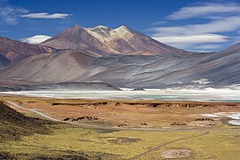
  • Image 14 Mount Price behind Garibaldi Lake from Panorama Ridge Mount Price is a small stratovolcano in the Garibaldi Ranges of the Pacific Ranges in southwestern British Columbia, Canada. It has an elevation of 2,049 metres (6,722 feet) and rises above the surrounding landscape on the western side of Garibaldi Lake in New Westminster Land District. The mountain contains a number of subfeatures, including Clinker Peak on its western flank, which was the source of two thick lava flows between 15,000 and 8,000 years ago that ponded against glacial ice. These lava flows are structurally unstable, having produced large landslides as recently as the 1850s. A large provincial park surrounds Mount Price and other volcanoes in its vicinity. It lies within an ecological region that surrounds much of the Pacific Ranges. Mount Price is associated with a small group of volcanoes called the Garibaldi Lake volcanic field. This forms part of the larger Garibaldi Volcanic Belt, a north−south trending volcanic zone that represents a portion of the Canadian Cascade Arc. Mount Price began its formation 1.2 million years ago and continued intermittently until sometime in the last 15,000 years. Although the mountain is not known to have been volcanically active for thousands of years, it could erupt again, which would potentially endanger the nearby populace. If this were to happen, relief efforts could be organized by teams such as the Interagency Volcanic Event Notification Plan who are prepared to notify people threatened by volcanic eruptions in Canada. (Full article...)
    Mount Price is a small stratovolcano in the Garibaldi Ranges of the Pacific Ranges in southwestern British Columbia, Canada. It has an elevation of 2,049 metres (6,722 feet) and rises above the surrounding landscape on the western side of Garibaldi Lake in New Westminster Land District. The mountain contains a number of subfeatures, including Clinker Peak on its western flank, which was the source of two thick lava flows between 15,000 and 8,000 years ago that ponded against glacial ice. These lava flows are structurally unstable, having produced large landslides as recently as the 1850s. A large provincial park surrounds Mount Price and other volcanoes in its vicinity. It lies within an ecological region that surrounds much of the Pacific Ranges.

    Mount Price is associated with a small group of volcanoes called the Garibaldi Lake volcanic field. This forms part of the larger Garibaldi Volcanic Belt, a north−south trending volcanic zone that represents a portion of the Canadian Cascade Arc. Mount Price began its formation 1.2 million years ago and continued intermittently until sometime in the last 15,000 years. Although the mountain is not known to have been volcanically active for thousands of years, it could erupt again, which would potentially endanger the nearby populace. If this were to happen, relief efforts could be organized by teams such as the Interagency Volcanic Event Notification Plan who are prepared to notify people threatened by volcanic eruptions in Canada. (Full article...)
  • Image 15 The frontispiece of the 1920 edition of Tod's Annals and Antiquities of Rajast'han Lieutenant-Colonel James Tod (20 March 1782 – 18 November 1835) was an officer of the British East India Company and an Oriental scholar. He combined his official role and his amateur interests to create a series of works about the history and geography of India, and in particular the area then known as Rajputana that corresponds to the present day state of Rajasthan, and which Tod referred to as Rajast'han. Tod was born in London and educated in Scotland. He joined the East India Company as a military officer and travelled to India in 1799 as a cadet in the Bengal Army. He rose quickly in rank, eventually becoming captain of an escort for an envoy in a Sindian royal court. After the Third Anglo-Maratha War, during which Tod was involved in the intelligence department, he was appointed Political Agent for some areas of Rajputana. His task was to help unify the region under the control of the East India Company. During this period Tod conducted most of the research that he would later publish. Tod was initially successful in his official role, but his methods were questioned by other members of the East India Company. Over time, his work was restricted and his areas of oversight were significantly curtailed. In 1823, owing to declining health and reputation, Tod resigned his post as Political Agent and returned to England. (Full article...)
    Lieutenant-Colonel James Tod (20 March 1782 – 18 November 1835) was an officer of the British East India Company and an Oriental scholar. He combined his official role and his amateur interests to create a series of works about the history and geography of India, and in particular the area then known as Rajputana that corresponds to the present day state of Rajasthan, and which Tod referred to as Rajast'han.

    Tod was born in London and educated in Scotland. He joined the East India Company as a military officer and travelled to India in 1799 as a cadet in the Bengal Army. He rose quickly in rank, eventually becoming captain of an escort for an envoy in a Sindian royal court. After the Third Anglo-Maratha War, during which Tod was involved in the intelligence department, he was appointed Political Agent for some areas of Rajputana. His task was to help unify the region under the control of the East India Company. During this period Tod conducted most of the research that he would later publish. Tod was initially successful in his official role, but his methods were questioned by other members of the East India Company. Over time, his work was restricted and his areas of oversight were significantly curtailed. In 1823, owing to declining health and reputation, Tod resigned his post as Political Agent and returned to England. (Full article...)
  • More featured articles

    Vital articles Vital article

    Vital articles to understand Geography.

    Atlantic Ocean near the Faroe Islands

    A sea is a large body of salty water. There are particular seas and the sea. The sea commonly refers to the World Ocean, the wider body of seawater.

    Particular seas are either marginal seas, second-order sections of the oceanic sea (e.g. the Mediterranean Sea), or certain large, nearly landlocked bodies of water. (Full article...)
    Other vital articles

    Get involved

    For editor resources and to collaborate with other editors on improving Wikipedia's Geography-related articles, visit WikiProject Geography.


    Here are some tasks awaiting attention:

    Selected pictures

    Featured biography articles in geography

    Shen Kuo (Chinese: 沈括; 1031–1095) or Shen Gua, courtesy name Cunzhong (存中) and pseudonym Mengqi (now usually given as Mengxi) Weng (夢溪翁), was a Chinese polymath, scientist, and statesman of the Song dynasty (960–1279). Shen was a master in many fields of study including mathematics, optics, and horology. In his career as a civil servant, he became a finance minister, governmental state inspector, head official for the Bureau of Astronomy in the Song court, Assistant Minister of Imperial Hospitality, and also served as an academic chancellor. At court his political allegiance was to the Reformist faction known as the New Policies Group, headed by Chancellor Wang Anshi (1021–1085).

    In his Dream Pool Essays or Dream Torrent Essays (夢溪筆談; Mengxi Bitan) of 1088, Shen was the first to describe the magnetic needle compass, which would be used for navigation (first described in Europe by Alexander Neckam in 1187). Shen discovered the concept of true north in terms of magnetic declination towards the north pole, with experimentation of suspended magnetic needles and "the improved meridian determined by Shen's [astronomical] measurement of the distance between the pole star and true north". This was the decisive step in human history to make compasses more useful for navigation, and may have been a concept unknown in Europe for another four hundred years (evidence of German sundials made circa 1450 show markings similar to Chinese geomancers' compasses in regard to declination). (Full article...)
    More featured biographies

    Did you know

    Did you know it about Geography?

    Places around you

    You can read about interesting Wikipedia articles about places around you.

    Special:Nearby

    This following Geography-related articles is a most visited articles of WikiProject Geography, See complete list at Wikipedia:WikiProject Geography/Popular pages.

  • Image 4 Generation X (often shortened to Gen X) is the demographic cohort following the Baby Boomers and preceding Millennials. Researchers and popular media often use the mid-1960s as its starting birth years and the late 1970s as its ending birth years, with the generation being generally defined as people born from 1965 to 1980. By this definition and U.S. Census data, there are 65.2 million Gen Xers in the United States as of 2019. Most of Generation X are the children of the Silent Generation and early Baby Boomers; Xers are also often the parents of Millennials and Generation Z. (Full article...)
    Generation X (often shortened to Gen X) is the demographic cohort following the Baby Boomers and preceding Millennials. Researchers and popular media often use the mid-1960s as its starting birth years and the late 1970s as its ending birth years, with the generation being generally defined as people born from 1965 to 1980. By this definition and U.S. Census data, there are 65.2 million Gen Xers in the United States as of 2019. Most of Generation X are the children of the Silent Generation and early Baby Boomers; Xers are also often the parents of Millennials and Generation Z. (Full article...)
  • Image 5 Cartogram of the world's population in 2018; each square represents 500,000 people. This is a list of countries and dependencies by population. It includes sovereign states, inhabited dependent territories and, in some cases, constituent countries of sovereign states, with inclusion within the list being primarily based on the ISO standard ISO 3166-1. For instance, the United Kingdom is considered a single entity, while the constituent countries of the Kingdom of the Netherlands are considered separately. In addition, this list includes certain states with limited recognition not found in ISO 3166-1. Also given in a percentage is each country's population compared with the world population, which the United Nations estimates at 8.13 billion as of 2024. (Full article...)
    Cartogram of the world's population in 2018; each square represents 500,000 people.


    This is a list of countries and dependencies by population. It includes sovereign states, inhabited dependent territories and, in some cases, constituent countries of sovereign states, with inclusion within the list being primarily based on the ISO standard ISO 3166-1. For instance, the United Kingdom is considered a single entity, while the constituent countries of the Kingdom of the Netherlands are considered separately. In addition, this list includes certain states with limited recognition not found in ISO 3166-1. Also given in a percentage is each country's population compared with the world population, which the United Nations estimates at 8.13 billion as of 2024. (Full article...)
  • Image 6 Hong Kong is a special administrative region of the People's Republic of China. With 7.4 million residents of various nationalities in a 1,104-square-kilometre (426 sq mi) territory, Hong Kong is the fourth most densely populated region in the world. (Full article...)
    Hong Kong is a special administrative region of the People's Republic of China. With 7.4 million residents of various nationalities in a 1,104-square-kilometre (426 sq mi) territory, Hong Kong is the fourth most densely populated region in the world. (Full article...)
  • Image 7 Millennials, also known as Generation Y or Gen Y, are the demographic cohort following Generation X and preceding Generation Z. Researchers and popular media use the early 1980s as starting birth years and the mid-1990s to early 2000s as ending birth years, with the generation typically being defined as people born from 1981 to 1996. Most Millennials are the children of Baby Boomers and older Generation X. In turn Millennials are often the parents of Generation Alpha. (Full article...)
    Millennials, also known as Generation Y or Gen Y, are the demographic cohort following Generation X and preceding Generation Z. Researchers and popular media use the early 1980s as starting birth years and the mid-1990s to early 2000s as ending birth years, with the generation typically being defined as people born from 1981 to 1996. Most Millennials are the children of Baby Boomers and older Generation X. In turn Millennials are often the parents of Generation Alpha. (Full article...)
  • Image 8 England is a country that is part of the United Kingdom. It is located on the island of Great Britain, of which it covers approximately 62%, and over 100 smaller adjacent islands. It has land borders with Scotland to the north and Wales to the west, and is otherwise surrounded by the North Sea to the east, the English Channel to the south, the Celtic Sea to the south-west, and the Irish Sea to the west. Continental Europe lies to the south-east, and Ireland to the west. At the 2021 census, the population was 56,490,048. London is both the largest city and the capital. (Full article...)

    England is a country that is part of the United Kingdom. It is located on the island of Great Britain, of which it covers approximately 62%, and over 100 smaller adjacent islands. It has land borders with Scotland to the north and Wales to the west, and is otherwise surrounded by the North Sea to the east, the English Channel to the south, the Celtic Sea to the south-west, and the Irish Sea to the west. Continental Europe lies to the south-east, and Ireland to the west. At the 2021 census, the population was 56,490,048. London is both the largest city and the capital. (Full article...)
  • Image 9 Generation Alpha (often shortened to Gen Alpha) is the demographic cohort succeeding Generation Z. Researchers and popular media use the early 2010s as starting birth years to the mid-2020s as the ending birth years (see § Date and age range definitions). Named after alpha, the first letter in the Greek alphabet, Generation Alpha is the first to be born entirely in the 21st century and the third millennium. Most members of Generation Alpha are the children of Millennials. (Full article...)
    Generation Alpha (often shortened to Gen Alpha) is the demographic cohort succeeding Generation Z. Researchers and popular media use the early 2010s as starting birth years to the mid-2020s as the ending birth years (see § Date and age range definitions). Named after alpha, the first letter in the Greek alphabet, Generation Alpha is the first to be born entirely in the 21st century and the third millennium. Most members of Generation Alpha are the children of Millennials. (Full article...)
  • Image 10 Dymaxion map of the world with the 30 largest countries and territories by area This is a list of the world's countries and their dependencies by land, water, and total area, ranked by total area. (Full article...)
    Dymaxion map of the world with the 30 largest countries and territories by area

    This is a list of the world's countries and their dependencies by land, water, and total area, ranked by total area. (Full article...)
  • Click to enlarge and view description.

    Main articles

    CategoriesCategories

    Select [►] to view subcategories.

    Associated Wikimedia

    The following Wikimedia Foundation sister projects provide more on this subject:

    Discover Wikipedia using portals
    Retrieved from "https://en.wikipedia.org/w/index.php?title=Portal:Geography&oldid=1202464975"