Loading
  • 21 Aug, 2019

  • By, Wikipedia

Portal:Geography

The Geography Portal

Geography (from Ancient Greek γεωγραφία geōgraphía; combining 'Earth' and gráphō 'write') is the study of the lands, features, inhabitants, and phenomena of Earth. Geography is an all-encompassing discipline that seeks an understanding of Earth and its human and natural complexities—not merely where objects are, but also how they have changed and come to be. While geography is specific to Earth, many concepts can be applied more broadly to other celestial bodies in the field of planetary science. Geography has been called "a bridge between natural science and social science disciplines."

Origins of many of the concepts in geography can be traced to Greek Eratosthenes of Cyrene, who may have coined the term "geographia" (c. 276 BC – c. 195/194 BC). The first recorded use of the word γεωγραφία was as the title of a book by Greek scholar Claudius Ptolemy (100 – 170 AD). This work created the so-called "Ptolemaic tradition" of geography, which included "Ptolemaic cartographic theory." However, the concepts of geography (such as cartography) date back to the earliest attempts to understand the world spatially, with the earliest example of an attempted world map dating to the 9th century BCE in ancient Babylon. The history of geography as a discipline spans cultures and millennia, being independently developed by multiple groups, and cross-pollinated by trade between these groups. The core concepts of geography consistent between all approaches are a focus on space, place, time, and scale.

Today, geography is an extremely broad discipline with multiple approaches and modalities. There have been multiple attempts to organize the discipline, including the four traditions of geography, and into branches. Techniques employed can generally be broken down into quantitative and qualitative approaches, with many studies taking mixed-methods approaches. Common techniques include cartography, remote sensing, interviews, and surveying. (Full article...)

Featured articles are displayed here, which represent some of the best content on English Wikipedia.

  • Image 2 Brownhills is a historic market and industrial town in the Metropolitan Borough of Walsall of the West Midlands, England. The town is located south of Cannock Chase and close to the large Chasewater reservoir, it is 6 miles (9.7 km) northeast of Walsall, a similar distance southwest of Lichfield and 13 miles (20.9 km) miles north-northwest of Birmingham. It is part of the Aldridge-Brownhills parliamentary constituency and neighbours the village of Pelsall and the suburban area of Walsall Wood. It lies within the boundaries of the historic county of Staffordshire. The town lies close to the route of the ancient Watling Street, and although there is no record of its existence before the 17th century, Ogley Hay – a district of the town today – is recorded as a settlement in the Domesday Book. Brownhills quickly grew around the coal-mining industry, especially after the town became linked to the canal and railway networks in the mid-19th century. By the end of the century, Brownhills had grown from a hamlet of only 300 inhabitants to a town of more than 13,000, of whom the vast majority were employed in the coal industry. Mining remained the town's principal industry until the 1950s; the subsequent closure of the pits led to a severe economic decline that has continued until now. The local authority instituted a regeneration programme in 2007, which was hoped would revive the town's fortunes, but there has been little subsequent development. (Full article...)
    Brownhills is a historic market and industrial town in the Metropolitan Borough of Walsall of the West Midlands, England. The town is located south of Cannock Chase and close to the large Chasewater reservoir, it is 6 miles (9.7 km) northeast of Walsall, a similar distance southwest of Lichfield and 13 miles (20.9 km) miles north-northwest of Birmingham. It is part of the Aldridge-Brownhills parliamentary constituency and neighbours the village of Pelsall and the suburban area of Walsall Wood. It lies within the boundaries of the historic county of Staffordshire.

    The town lies close to the route of the ancient Watling Street, and although there is no record of its existence before the 17th century, Ogley Hay – a district of the town today – is recorded as a settlement in the Domesday Book. Brownhills quickly grew around the coal-mining industry, especially after the town became linked to the canal and railway networks in the mid-19th century. By the end of the century, Brownhills had grown from a hamlet of only 300 inhabitants to a town of more than 13,000, of whom the vast majority were employed in the coal industry. Mining remained the town's principal industry until the 1950s; the subsequent closure of the pits led to a severe economic decline that has continued until now. The local authority instituted a regeneration programme in 2007, which was hoped would revive the town's fortunes, but there has been little subsequent development. (Full article...)
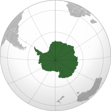
  • Image 3 Antarctica (/ænˈtɑːrktɪkə/ ⓘ) is Earth's southernmost and least-populated continent. Situated almost entirely south of the Antarctic Circle and surrounded by the Southern Ocean (also known as the Antarctic Ocean), it contains the geographic South Pole. Antarctica is the fifth-largest continent, being about 40% larger than Europe, and has an area of 14,200,000 km2 (5,500,000 sq mi). Most of Antarctica is covered by the Antarctic ice sheet, with an average thickness of 1.9 km (1.2 mi). Antarctica is, on average, the coldest, driest, and windiest of the continents, and it has the highest average elevation. It is mainly a polar desert, with annual precipitation of over 200 mm (8 in) along the coast and far less inland. About 70% of the world's freshwater reserves are frozen in Antarctica, which, if melted, would raise global sea levels by almost 60 metres (200 ft). Antarctica holds the record for the lowest measured temperature on Earth, −89.2 °C (−128.6 °F). The coastal regions can reach temperatures over 10 °C (50 °F) in the summer. Native species of animals include mites, nematodes, penguins, seals and tardigrades. Where vegetation occurs, it is mostly in the form of lichen or moss. (Full article...)

    Antarctica (/ænˈtɑːrktɪkə/ ) is Earth's southernmost and least-populated continent. Situated almost entirely south of the Antarctic Circle and surrounded by the Southern Ocean (also known as the Antarctic Ocean), it contains the geographic South Pole. Antarctica is the fifth-largest continent, being about 40% larger than Europe, and has an area of 14,200,000 km (5,500,000 sq mi). Most of Antarctica is covered by the Antarctic ice sheet, with an average thickness of 1.9 km (1.2 mi).

    Antarctica is, on average, the coldest, driest, and windiest of the continents, and it has the highest average elevation. It is mainly a polar desert, with annual precipitation of over 200 mm (8 in) along the coast and far less inland. About 70% of the world's freshwater reserves are frozen in Antarctica, which, if melted, would raise global sea levels by almost 60 metres (200 ft). Antarctica holds the record for the lowest measured temperature on Earth, −89.2 °C (−128.6 °F). The coastal regions can reach temperatures over 10 °C (50 °F) in the summer. Native species of animals include mites, nematodes, penguins, seals and tardigrades. Where vegetation occurs, it is mostly in the form of lichen or moss. (Full article...)
  • Image 4 Skeleton at the Finnish Museum of Natural History Steller's sea cow (Hydrodamalis gigas) is an extinct sirenian described by Georg Wilhelm Steller in 1741. At that time, it was found only around the Commander Islands in the Bering Sea between Alaska and Russia; its range extended across the North Pacific during the Pleistocene epoch, and likely contracted to such an extreme degree due to the glacial cycle. It is possible indigenous populations interacted with the animal before Europeans. Steller first encountered it on Vitus Bering's Great Northern Expedition when the crew became shipwrecked on Bering Island. Much of what is known about its behavior comes from Steller's observations on the island, documented in his posthumous publication On the Beasts of the Sea. Within 27 years of its discovery by Europeans, the slow-moving and easily-caught mammal was hunted into extinction for its meat, fat, and hide. Some 18th-century adults would have reached weights of 8–10 t (8.8–11.0 short tons) and lengths up to 9 m (30 ft). It was a member of the family Dugongidae, of which the 3 m (9.8 ft) long dugong (Dugong dugon) is the sole living member. It had a thicker layer of blubber than other members of the order, an adaptation to the cold waters of its environment. Its tail was forked, like that of whales or dugongs. Lacking true teeth, it had an array of white bristles on its upper lip and two keratinous plates within its mouth for chewing. It fed mainly on kelp, and communicated with sighs and snorting sounds. Steller believed it was a monogamous and social animal living in small family groups and raising its young, similar to modern sirenians. (Full article...)

    Steller's sea cow (Hydrodamalis gigas) is an extinct sirenian described by Georg Wilhelm Steller in 1741. At that time, it was found only around the Commander Islands in the Bering Sea between Alaska and Russia; its range extended across the North Pacific during the Pleistocene epoch, and likely contracted to such an extreme degree due to the glacial cycle. It is possible indigenous populations interacted with the animal before Europeans. Steller first encountered it on Vitus Bering's Great Northern Expedition when the crew became shipwrecked on Bering Island. Much of what is known about its behavior comes from Steller's observations on the island, documented in his posthumous publication On the Beasts of the Sea. Within 27 years of its discovery by Europeans, the slow-moving and easily-caught mammal was hunted into extinction for its meat, fat, and hide.

    Some 18th-century adults would have reached weights of 8–10 t (8.8–11.0 short tons) and lengths up to 9 m (30 ft). It was a member of the family Dugongidae, of which the 3 m (9.8 ft) long dugong (Dugong dugon) is the sole living member. It had a thicker layer of blubber than other members of the order, an adaptation to the cold waters of its environment. Its tail was forked, like that of whales or dugongs. Lacking true teeth, it had an array of white bristles on its upper lip and two keratinous plates within its mouth for chewing. It fed mainly on kelp, and communicated with sighs and snorting sounds. Steller believed it was a monogamous and social animal living in small family groups and raising its young, similar to modern sirenians. (Full article...)
  • Image 5 Canada is a country in North America. Its ten provinces and three territories extend from the Atlantic Ocean to the Pacific Ocean and northward into the Arctic Ocean, making it the world's second-largest country by total area, with the world's longest coastline. Its border with the United States is the world's longest international land border. The country is characterized by a wide range of both meteorologic and geological regions. With a population of just over 41 million people, it has widely varying population densities, with the majority residing in urban areas and large areas of the country being sparsely populated. Canada's capital is Ottawa and its three largest metropolitan areas are Toronto, Montreal, and Vancouver. Indigenous peoples have continuously inhabited what is now Canada for thousands of years. Beginning in the 16th century, British and French expeditions explored and later settled along the Atlantic coast. As a consequence of various armed conflicts, France ceded nearly all of its colonies in North America in 1763. In 1867, with the union of three British North American colonies through Confederation, Canada was formed as a federal dominion of four provinces. This began an accretion of provinces and territories resulting in the displacement of Indigenous populations, and a process of increasing autonomy from the United Kingdom. This increased sovereignty was highlighted by the Statute of Westminster, 1931, and culminating in the Canada Act 1982, which severed the vestiges of legal dependence on the Parliament of the United Kingdom. (Full article...)

    Canada is a country in North America. Its ten provinces and three territories extend from the Atlantic Ocean to the Pacific Ocean and northward into the Arctic Ocean, making it the world's second-largest country by total area, with the world's longest coastline. Its border with the United States is the world's longest international land border. The country is characterized by a wide range of both meteorologic and geological regions. With a population of just over 41 million people, it has widely varying population densities, with the majority residing in urban areas and large areas of the country being sparsely populated. Canada's capital is Ottawa and its three largest metropolitan areas are Toronto, Montreal, and Vancouver.

    Indigenous peoples have continuously inhabited what is now Canada for thousands of years. Beginning in the 16th century, British and French expeditions explored and later settled along the Atlantic coast. As a consequence of various armed conflicts, France ceded nearly all of its colonies in North America in 1763. In 1867, with the union of three British North American colonies through Confederation, Canada was formed as a federal dominion of four provinces. This began an accretion of provinces and territories resulting in the displacement of Indigenous populations, and a process of increasing autonomy from the United Kingdom. This increased sovereignty was highlighted by the Statute of Westminster, 1931, and culminating in the Canada Act 1982, which severed the vestiges of legal dependence on the Parliament of the United Kingdom. (Full article...)
  • Image 6 Robert Marshall (January 2, 1901 – November 11, 1939) was an American forester, writer and wilderness activist who is best remembered as the person who spearheaded the 1935 founding of the Wilderness Society in the United States. Marshall developed a love for the outdoors as a young child. He was an avid hiker and climber who visited the Adirondack Mountains frequently during his youth, ultimately becoming one of the first Adirondack Forty-Sixers. He also traveled to the Brooks Range of the far northern Alaskan wilderness. He wrote numerous articles and books about his travels, including the bestselling 1933 book Arctic Village. A scientist with a PhD in plant physiology, Marshall became independently wealthy after the death of his father in 1929. He had started his outdoor career in 1925 as forester with the U.S. Forest Service. He used his financial independence for expeditions to Alaska and other wilderness areas. Later he held two significant public appointed posts: chief of forestry in the Bureau of Indian Affairs, from 1933 to 1937, and head of recreation management in the Forest Service, from 1937 to 1939, both during the administration of President Franklin D. Roosevelt. During this period, he directed the promulgation of regulations to preserve large areas of roadless land that were under federal management. Many years after his death, some of those areas were permanently protected from development, exploitation, and mechanization with the passage of the Wilderness Act of 1964. (Full article...)
    Robert Marshall (January 2, 1901 – November 11, 1939) was an American forester, writer and wilderness activist who is best remembered as the person who spearheaded the 1935 founding of the Wilderness Society in the United States. Marshall developed a love for the outdoors as a young child. He was an avid hiker and climber who visited the Adirondack Mountains frequently during his youth, ultimately becoming one of the first Adirondack Forty-Sixers. He also traveled to the Brooks Range of the far northern Alaskan wilderness. He wrote numerous articles and books about his travels, including the bestselling 1933 book Arctic Village.

    A scientist with a PhD in plant physiology, Marshall became independently wealthy after the death of his father in 1929. He had started his outdoor career in 1925 as forester with the U.S. Forest Service. He used his financial independence for expeditions to Alaska and other wilderness areas. Later he held two significant public appointed posts: chief of forestry in the Bureau of Indian Affairs, from 1933 to 1937, and head of recreation management in the Forest Service, from 1937 to 1939, both during the administration of President Franklin D. Roosevelt. During this period, he directed the promulgation of regulations to preserve large areas of roadless land that were under federal management. Many years after his death, some of those areas were permanently protected from development, exploitation, and mechanization with the passage of the Wilderness Act of 1964. (Full article...)
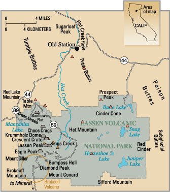
  • Image 7 Eruptions in the Lassen volcanic area in the last 70,000 years. Circle shows base of Mount Tehama. See timeline image. The Lassen volcanic area presents a geological record of sedimentation and volcanic activity in and around Lassen Volcanic National Park in Northern California, U.S. The park is located in the southernmost part of the Cascade Mountain Range in the Pacific Northwest region of the United States. Pacific Oceanic tectonic plates have plunged below the North American Plate in this part of North America for hundreds of millions of years. Heat and molten rock from these subducting plates has fed scores of volcanoes in California, Oregon, Washington and British Columbia over at least the past 30 million years, including these in the Lassen volcanic areas. Between 3 and 4 million years ago, volcanic-derived mud flows called lahars streamed down several major mountains that included nearby but now extinct Mount Yana and Mount Maidu to become the Tuscan Formation. Basaltic and later andesitic to dacitic flows of lava covered increasingly larger areas of this formation to eventually form the lava plateau upon which the park is situated. About 600,000 years ago, Mount Tehama started to rise as a stratovolcano in the southwestern corner of the park, eventually reaching an estimated 11,000 ft (3,400 m) in height. (Full article...)
    Map with large green area marked as Lassen Volcanic National Park with a circle is on the lower left corner. Other features, such as Chaos Crags, Brokeoff Mountain, Bumpass Hell and Cinder Cone are also labelled.
    Eruptions in the Lassen volcanic area in the last 70,000 years. Circle shows base of Mount Tehama. See timeline image.


    The Lassen volcanic area presents a geological record of sedimentation and volcanic activity in and around Lassen Volcanic National Park in Northern California, U.S. The park is located in the southernmost part of the Cascade Mountain Range in the Pacific Northwest region of the United States. Pacific Oceanic tectonic plates have plunged below the North American Plate in this part of North America for hundreds of millions of years. Heat and molten rock from these subducting plates has fed scores of volcanoes in California, Oregon, Washington and British Columbia over at least the past 30 million years, including these in the Lassen volcanic areas.

    Between 3 and 4 million years ago, volcanic-derived mud flows called lahars streamed down several major mountains that included nearby but now extinct Mount Yana and Mount Maidu to become the Tuscan Formation. Basaltic and later andesitic to dacitic flows of lava covered increasingly larger areas of this formation to eventually form the lava plateau upon which the park is situated. About 600,000 years ago, Mount Tehama started to rise as a stratovolcano in the southwestern corner of the park, eventually reaching an estimated 11,000 ft (3,400 m) in height. (Full article...)
  • Image 8 St Giles’ Church, Wormshill Wormshill (/wɜːrmzˈhɪl/ wurmz-HIL), historically Wormsell, is a small village and civil parish within the Borough of Maidstone, Kent, England. The parish is approximately 7 miles (11 km) south of the Swale and 8 mi (13 km) east of Maidstone. The village of Frinsted lies 0.6 mi (1 km) to the east and Bicknor 1+1⁄2 miles (2.4 km) to the north-west; while Hollingbourne is 3 mi (5 km) to the south-west. The village lies on an exposed high point of the North Downs, within the Kent Downs Area of Outstanding Natural Beauty. Archaeological and toponymic evidence of Wormshill's existence predates its appearance in the Domesday Book of 1086. The village contains a number of heritage-listed buildings, which include a Norman church, a public house and one of the oldest surviving post office buildings in the United Kingdom. The fields and woodland surrounding Wormshill have changed little in the past 500 years, and the village itself remains rural with a low population density compared to the national average. The population of 200 is a mixture of agricultural workers employed by local farms, and professional residents who commute to nearby towns. (Full article...)

    Wormshill (/wɜːrmzˈhɪl/ wurmz-HIL), historically Wormsell, is a small village and civil parish within the Borough of Maidstone, Kent, England. The parish is approximately 7 miles (11 km) south of the Swale and 8 mi (13 km) east of Maidstone. The village of Frinsted lies 0.6 mi (1 km) to the east and Bicknor 1+12 miles (2.4 km) to the north-west; while Hollingbourne is 3 mi (5 km) to the south-west. The village lies on an exposed high point of the North Downs, within the Kent Downs Area of Outstanding Natural Beauty.

    Archaeological and toponymic evidence of Wormshill's existence predates its appearance in the Domesday Book of 1086. The village contains a number of heritage-listed buildings, which include a Norman church, a public house and one of the oldest surviving post office buildings in the United Kingdom. The fields and woodland surrounding Wormshill have changed little in the past 500 years, and the village itself remains rural with a low population density compared to the national average. The population of 200 is a mixture of agricultural workers employed by local farms, and professional residents who commute to nearby towns. (Full article...)
  • Image 9 Bust of Shen at the Beijing Ancient Observatory Shen Kuo (Chinese: 沈括; 1031–1095) or Shen Gua, courtesy name Cunzhong (存中) and pseudonym Mengqi (now usually given as Mengxi) Weng (夢溪翁), was a Chinese polymath, scientist, and statesman of the Song dynasty (960–1279). Shen was a master in many fields of study including mathematics, optics, and horology. In his career as a civil servant, he became a finance minister, governmental state inspector, head official for the Bureau of Astronomy in the Song court, Assistant Minister of Imperial Hospitality, and also served as an academic chancellor. At court his political allegiance was to the Reformist faction known as the New Policies Group, headed by Chancellor Wang Anshi (1021–1085). In his Dream Pool Essays or Dream Torrent Essays (夢溪筆談; Mengxi Bitan) of 1088, Shen was the first to describe the magnetic needle compass, which would be used for navigation (first described in Europe by Alexander Neckam in 1187). Shen discovered the concept of true north in terms of magnetic declination towards the north pole, with experimentation of suspended magnetic needles and "the improved meridian determined by Shen's [astronomical] measurement of the distance between the pole star and true north". This was the decisive step in human history to make compasses more useful for navigation, and may have been a concept unknown in Europe for another four hundred years (evidence of German sundials made circa 1450 show markings similar to Chinese geomancers' compasses in regard to declination). (Full article...)

    Shen Kuo (Chinese: 沈括; 1031–1095) or Shen Gua, courtesy name Cunzhong (存中) and pseudonym Mengqi (now usually given as Mengxi) Weng (夢溪翁), was a Chinese polymath, scientist, and statesman of the Song dynasty (960–1279). Shen was a master in many fields of study including mathematics, optics, and horology. In his career as a civil servant, he became a finance minister, governmental state inspector, head official for the Bureau of Astronomy in the Song court, Assistant Minister of Imperial Hospitality, and also served as an academic chancellor. At court his political allegiance was to the Reformist faction known as the New Policies Group, headed by Chancellor Wang Anshi (1021–1085).

    In his Dream Pool Essays or Dream Torrent Essays (夢溪筆談; Mengxi Bitan) of 1088, Shen was the first to describe the magnetic needle compass, which would be used for navigation (first described in Europe by Alexander Neckam in 1187). Shen discovered the concept of true north in terms of magnetic declination towards the north pole, with experimentation of suspended magnetic needles and "the improved meridian determined by Shen's [astronomical] measurement of the distance between the pole star and true north". This was the decisive step in human history to make compasses more useful for navigation, and may have been a concept unknown in Europe for another four hundred years (evidence of German sundials made circa 1450 show markings similar to Chinese geomancers' compasses in regard to declination). (Full article...)
  • Image 10 Sunset over the Everglades river of grass, January 2013 Everglades National Park is a national park of the United States that protects the southern twenty percent of the original Everglades in Florida. The park is the largest tropical wilderness in the United States and the largest wilderness of any kind east of the Mississippi River. An average of one million people visit the park each year. Everglades is the third-largest national park in the contiguous United States after Death Valley and Yellowstone. UNESCO declared the Everglades & Dry Tortugas Biosphere Reserve in 1976 and listed the park as a World Heritage Site in 1979, and the Ramsar Convention included the park on its list of Wetlands of International Importance in 1987. Everglades is one of only three locations in the world to appear on all three lists. Most national parks preserve unique geographic features; Everglades National Park was the first created to protect a fragile ecosystem. The Everglades are a network of wetlands and forests fed by a river flowing 0.25 miles (0.40 km) per day out of Lake Okeechobee, southwest into Florida Bay. The park is the most significant breeding ground for tropical wading birds in North America and contains the largest mangrove ecosystem in the Western Hemisphere. Thirty-six threatened or protected species inhabit the park, including the Florida panther, the American crocodile, and the West Indian manatee, along with 350 species of birds, 300 species of fresh and saltwater fish, 40 species of mammals, and 50 species of reptiles. The majority of South Florida's fresh water, which is stored in the Biscayne Aquifer, is recharged in the park. (Full article...)

    Everglades National Park is a national park of the United States that protects the southern twenty percent of the original Everglades in Florida. The park is the largest tropical wilderness in the United States and the largest wilderness of any kind east of the Mississippi River. An average of one million people visit the park each year. Everglades is the third-largest national park in the contiguous United States after Death Valley and Yellowstone. UNESCO declared the Everglades & Dry Tortugas Biosphere Reserve in 1976 and listed the park as a World Heritage Site in 1979, and the Ramsar Convention included the park on its list of Wetlands of International Importance in 1987. Everglades is one of only three locations in the world to appear on all three lists.

    Most national parks preserve unique geographic features; Everglades National Park was the first created to protect a fragile ecosystem. The Everglades are a network of wetlands and forests fed by a river flowing 0.25 miles (0.40 km) per day out of Lake Okeechobee, southwest into Florida Bay. The park is the most significant breeding ground for tropical wading birds in North America and contains the largest mangrove ecosystem in the Western Hemisphere. Thirty-six threatened or protected species inhabit the park, including the Florida panther, the American crocodile, and the West Indian manatee, along with 350 species of birds, 300 species of fresh and saltwater fish, 40 species of mammals, and 50 species of reptiles. The majority of South Florida's fresh water, which is stored in the Biscayne Aquifer, is recharged in the park. (Full article...)
  • Image 11 Steam on the mountain in July 2007 Nevado del Ruiz (Spanish pronunciation: [neβaðo ðel ˈrwis]), also known as La Mesa de Herveo (English: Mesa of Herveo, the name of the nearby town) is a volcano on the border of the departments of Caldas and Tolima in Colombia, being the highest point of both. It is located about 130 km (81 mi) west of the capital city Bogotá. It is a stratovolcano composed of many layers of lava alternating with hardened volcanic ash and other pyroclastic rocks. Volcanic activity at Nevado del Ruiz began about two million years ago, during the Early Pleistocene or Late Pliocene, with three major eruptive periods. The current volcanic cone formed during the present eruptive period, which began 150,000 years ago. The volcano usually generates Vulcanian to Plinian eruptions, which produce swift-moving currents of hot gas and rock called pyroclastic flows. These eruptions often cause massive lahars (mud and debris flows), which pose a threat to human life and the environment. The impact of such an eruption is increased as the hot gas and lava melt the mountain's snowcap, adding large quantities of water to the flow. On November 13, 1985, a small eruption produced an enormous lahar that buried and destroyed the town of Armero in Tolima, causing an estimated 25,000 deaths. This event later became known as the Armero tragedy—the deadliest lahar in recorded history. Similar but less deadly incidents occurred in 1595 and 1845, consisting of a small explosive eruption followed by a large lahar. (Full article...)

    Nevado del Ruiz (Spanish pronunciation: [neβaðo ðel ˈrwis]), also known as La Mesa de Herveo (English: Mesa of Herveo, the name of the nearby town) is a volcano on the border of the departments of Caldas and Tolima in Colombia, being the highest point of both. It is located about 130 km (81 mi) west of the capital city Bogotá. It is a stratovolcano composed of many layers of lava alternating with hardened volcanic ash and other pyroclastic rocks. Volcanic activity at Nevado del Ruiz began about two million years ago, during the Early Pleistocene or Late Pliocene, with three major eruptive periods. The current volcanic cone formed during the present eruptive period, which began 150,000 years ago.

    The volcano usually generates Vulcanian to Plinian eruptions, which produce swift-moving currents of hot gas and rock called pyroclastic flows. These eruptions often cause massive lahars (mud and debris flows), which pose a threat to human life and the environment. The impact of such an eruption is increased as the hot gas and lava melt the mountain's snowcap, adding large quantities of water to the flow. On November 13, 1985, a small eruption produced an enormous lahar that buried and destroyed the town of Armero in Tolima, causing an estimated 25,000 deaths. This event later became known as the Armero tragedy—the deadliest lahar in recorded history. Similar but less deadly incidents occurred in 1595 and 1845, consisting of a small explosive eruption followed by a large lahar. (Full article...)
  • Image 12 Aliso Creek flows underneath the Aliso Creek Road bridge before it enters Aliso and Wood Canyons Wilderness Park. Aliso Creek is a 19.8-mile (31.9 km)-long, mostly urban stream in south Orange County, California. Originating in the Cleveland National Forest in the Santa Ana Mountains, it flows generally southwest and empties into the Pacific Ocean at Laguna Beach. The creek's watershed drains 34.9 square miles (90 km2), and it is joined by seven main tributaries. As of 2018, the watershed had a population of 144,000 divided among seven incorporated cities. Aliso Creek flows over highly erosive marine sedimentary rock of late Eocene to Pliocene age. What would become the Aliso Creek watershed originally lay at the bottom of the Pacific Ocean, before being uplifted as recently as 10 million years ago. About 1.2 million years ago, the San Joaquin Hills began to uplift in the path of Aliso Creek. Occasionally swollen by wetter climates during glacial periods, the creek carved the deep water gap known today as Aliso Canyon, the main feature of Aliso and Wood Canyons Wilderness Park. (Full article...)

    Aliso Creek is a 19.8-mile (31.9 km)-long, mostly urban stream in south Orange County, California. Originating in the Cleveland National Forest in the Santa Ana Mountains, it flows generally southwest and empties into the Pacific Ocean at Laguna Beach. The creek's watershed drains 34.9 square miles (90 km), and it is joined by seven main tributaries. As of 2018, the watershed had a population of 144,000 divided among seven incorporated cities.

    Aliso Creek flows over highly erosive marine sedimentary rock of late Eocene to Pliocene age. What would become the Aliso Creek watershed originally lay at the bottom of the Pacific Ocean, before being uplifted as recently as 10 million years ago. About 1.2 million years ago, the San Joaquin Hills began to uplift in the path of Aliso Creek. Occasionally swollen by wetter climates during glacial periods, the creek carved the deep water gap known today as Aliso Canyon, the main feature of Aliso and Wood Canyons Wilderness Park. (Full article...)
  • Image 13 Formations resembling drapery in a dome-shaped pit in Oregon Caves Oregon Caves National Monument and Preserve is a protected area in the northern Siskiyou Mountains of southwestern Oregon in the United States. The 4,554-acre (1,843 ha) park, including the marble cave, is 20 miles (32 km) east of Cave Junction, on Oregon Route 46. The protected area, managed by the National Park Service (NPS), is in southwestern Josephine County, near the Oregon–California border. Elijah Davidson, a resident of nearby Williams, discovered the cave in 1874. Over the next two decades, private investors failed in efforts to run successful tourist ventures at the publicly owned site. After passage of the Antiquities Act by the United States Congress, in 1909 President William Howard Taft established Oregon Caves National Monument, to be managed by the United States Forest Service (USFS). The growing usage of the automobile, construction of paved highways, and promotion of tourism by boosters from Grants Pass led to large increases in cave visitation during the late 1920s and thereafter. Among the attractions at the remote monument is the Oregon Caves Chateau, a six-story hotel built in a rustic style in 1934. It is a National Historic Landmark and is part of the Oregon Caves Historic District within the monument. The NPS, which assumed control of the monument in 1933, offers tours of the cave from mid-April through early November. In 2014, the protected area was expanded by about 4,000 acres (1,600 ha) and re-designated a National Monument and Preserve. At the same time, the segment of the creek that flows through the cave was renamed for the mythological Styx and added to the National Wild and Scenic Rivers System. (Full article...)

    Oregon Caves National Monument and Preserve is a protected area in the northern Siskiyou Mountains of southwestern Oregon in the United States. The 4,554-acre (1,843 ha) park, including the marble cave, is 20 miles (32 km) east of Cave Junction, on Oregon Route 46. The protected area, managed by the National Park Service (NPS), is in southwestern Josephine County, near the Oregon–California border.

    Elijah Davidson, a resident of nearby Williams, discovered the cave in 1874. Over the next two decades, private investors failed in efforts to run successful tourist ventures at the publicly owned site. After passage of the Antiquities Act by the United States Congress, in 1909 President William Howard Taft established Oregon Caves National Monument, to be managed by the United States Forest Service (USFS). The growing usage of the automobile, construction of paved highways, and promotion of tourism by boosters from Grants Pass led to large increases in cave visitation during the late 1920s and thereafter. Among the attractions at the remote monument is the Oregon Caves Chateau, a six-story hotel built in a rustic style in 1934. It is a National Historic Landmark and is part of the Oregon Caves Historic District within the monument. The NPS, which assumed control of the monument in 1933, offers tours of the cave from mid-April through early November. In 2014, the protected area was expanded by about 4,000 acres (1,600 ha) and re-designated a National Monument and Preserve. At the same time, the segment of the creek that flows through the cave was renamed for the mythological Styx and added to the National Wild and Scenic Rivers System. (Full article...)
  • Image 14 Robert Falcon Scott in 1905 Captain Robert Falcon Scott CVO (6 June 1868 – c. 29 March 1912) was a British Royal Navy officer and explorer who led two expeditions to the Antarctic regions: the Discovery expedition of 1901–04 and the Terra Nova expedition of 1910–13. On the first expedition, he set a new southern record by marching to latitude 82°S and discovered the Antarctic Plateau, on which the South Pole is located. On the second venture, Scott led a party of five which reached the South Pole on 17 January 1912, less than five weeks after Amundsen's South Pole expedition. On the return journey from the Pole, a planned meeting with supporting dog teams from the base camp failed, despite Scott's written instructions, and at a distance of 162 miles (261 km) from their base camp at Hut Point and approximately 12.5 miles (20.1 km) from the next depot, Scott and his companions died. When Scott and his party's bodies were discovered, they had in their possession the first Antarctic fossils discovered. The fossils were determined to be from the Glossopteris tree and proved that Antarctica was once forested and joined to other continents. (Full article...)

    Captain Robert Falcon Scott CVO (6 June 1868 – c. 29 March 1912) was a British Royal Navy officer and explorer who led two expeditions to the Antarctic regions: the Discovery expedition of 1901–04 and the Terra Nova expedition of 1910–13.

    On the first expedition, he set a new southern record by marching to latitude 82°S and discovered the Antarctic Plateau, on which the South Pole is located. On the second venture, Scott led a party of five which reached the South Pole on 17 January 1912, less than five weeks after Amundsen's South Pole expedition. On the return journey from the Pole, a planned meeting with supporting dog teams from the base camp failed, despite Scott's written instructions, and at a distance of 162 miles (261 km) from their base camp at Hut Point and approximately 12.5 miles (20.1 km) from the next depot, Scott and his companions died. When Scott and his party's bodies were discovered, they had in their possession the first Antarctic fossils discovered. The fossils were determined to be from the Glossopteris tree and proved that Antarctica was once forested and joined to other continents. (Full article...)
  • Image 15 Honório Hermeto Carneiro Leão, Marquis of Paraná, at age 55, 1856 Honório Hermeto Carneiro Leão, Marquis of Paraná (11 January 1801 – 3 September 1856) was a Brazilian politician, diplomat, judge and monarchist. Paraná was born to a noble family in São Carlos do Jacuí, in what was then the captaincy of Minas Gerais. After attending the University of Coimbra in Portugal and having returned to Brazil, Paraná was appointed a judge in 1826 and later elevated to appellate court justice. In 1830, he was elected to represent Minas Gerais in the Chamber of Deputies; he was re-elected in 1834 and 1838, and held the post until 1841. In the aftermath of emperor Pedro I's abdication in 1831, a regency created to govern Brazil during the minority of the former emperor's son, Pedro II, soon dissolved into chaos. Paraná formed a political party in 1837 that became known as the Reactionary Party, which evolved into the Party of Order in the early 1840s and in the mid-1850s into the Conservative Party. He and his party's stalwart and unconditional defence of constitutional order allowed the country to move beyond a regency plagued by factious disputes and rebellions that might easily have led to a dictatorship. Appointed president of Rio de Janeiro Province in 1841, Paraná helped put down a rebellion headed by the opposition Liberal Party the following year. Also in 1842, he was elected senator for Minas Gerais and appointed by Pedro II to the Council of State. In 1843, he became the de facto first president (prime minister) of the Council of Ministers, but resigned after a quarrel with the emperor. (Full article...)
    Honório Hermeto Carneiro Leão, Marquis of Paraná (11 January 1801 – 3 September 1856) was a Brazilian politician, diplomat, judge and monarchist. Paraná was born to a noble family in São Carlos do Jacuí, in what was then the captaincy of Minas Gerais. After attending the University of Coimbra in Portugal and having returned to Brazil, Paraná was appointed a judge in 1826 and later elevated to appellate court justice. In 1830, he was elected to represent Minas Gerais in the Chamber of Deputies; he was re-elected in 1834 and 1838, and held the post until 1841.

    In the aftermath of emperor Pedro I's abdication in 1831, a regency created to govern Brazil during the minority of the former emperor's son, Pedro II, soon dissolved into chaos. Paraná formed a political party in 1837 that became known as the Reactionary Party, which evolved into the Party of Order in the early 1840s and in the mid-1850s into the Conservative Party. He and his party's stalwart and unconditional defence of constitutional order allowed the country to move beyond a regency plagued by factious disputes and rebellions that might easily have led to a dictatorship. Appointed president of Rio de Janeiro Province in 1841, Paraná helped put down a rebellion headed by the opposition Liberal Party the following year. Also in 1842, he was elected senator for Minas Gerais and appointed by Pedro II to the Council of State. In 1843, he became the de facto first president (prime minister) of the Council of Ministers, but resigned after a quarrel with the emperor. (Full article...)
  • More featured articles

    Vital articles Vital article

    Vital articles to understand Geography.

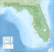
    Earth is the third planet from the Sun and the only astronomical object known to harbor life. This is enabled by Earth being an ocean world, the only one in the Solar System sustaining liquid surface water. Almost all of Earth's water is contained in its global ocean, covering 70.8% of Earth's crust. The remaining 29.2% of Earth's crust is land, most of which is located in the form of continental landmasses within Earth's land hemisphere. Most of Earth's land is somewhat humid and covered by vegetation, while large sheets of ice at Earth's polar deserts retain more water than Earth's groundwater, lakes, rivers and atmospheric water combined. Earth's crust consists of slowly moving tectonic plates, which interact to produce mountain ranges, volcanoes, and earthquakes. Earth has a liquid outer core that generates a magnetosphere capable of deflecting most of the destructive solar winds and cosmic radiation. (Full article...)
    Other vital articles

    Get involved

    For editor resources and to collaborate with other editors on improving Wikipedia's Geography-related articles, visit WikiProject Geography.


    Here are some tasks awaiting attention:

    Selected pictures

    Featured biography articles in geography

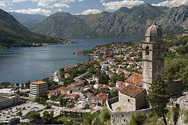
    Caspar David Friedrich (5 September 1774 – 7 May 1840) was a German Romantic landscape painter, generally considered the most important German artist of his generation. He is best known for his allegorical landscapes, which typically feature contemplative figures silhouetted against night skies, morning mists, barren trees or Gothic ruins. His primary interest was the contemplation of nature, and his often symbolic and anti-classical work seeks to convey a subjective, emotional response to the natural world. Friedrich's paintings characteristically set a human presence in diminished perspective amid expansive landscapes, reducing the figures to a scale that, according to the art historian Christopher John Murray, directs "the viewer's gaze towards their metaphysical dimension".

    Friedrich was born in the town of Greifswald on the Baltic Sea in what was at the time Swedish Pomerania. He studied in Copenhagen until 1798, before settling in Dresden. He came of age during a period when, across Europe, a growing disillusionment with materialistic society was giving rise to a new appreciation of spirituality. This shift in ideals was often expressed through a reevaluation of the natural world, as artists such as Friedrich, J. M. W. Turner and John Constable sought to depict nature as a "divine creation, to be set against the artifice of human civilization". (Full article...)
    More featured biographies

    Did you know

    Did you know it about Geography?

    No recent additions

    Places around you

    You can read about interesting Wikipedia articles about places around you.

    Special:Nearby

    This following Geography-related articles is a most visited articles of WikiProject Geography, See complete list at Wikipedia:WikiProject Geography/Popular pages.

  • Image 5 Map of the Chagos Archipelago The Chagos Archipelago (/ˈtʃɑːɡəs, -ɡoʊs/) or Chagos Islands (formerly the Bassas de Chagas, and later the Oil Islands) is a group of seven atolls comprising more than 60 islands in the Indian Ocean about 500 kilometres (310 mi) south of the Maldives archipelago. This chain of islands is the southernmost archipelago of the Chagos–Laccadive Ridge, a long submarine mountain range in the Indian Ocean. In its north are the Salomon Islands, Nelsons Island and Peros Banhos; towards its south-west are the Three Brothers, Eagle Islands, Egmont Islands and Danger Island; southeast of these is Diego Garcia, by far the largest island. All are low-lying atolls, save for a few extremely small instances, set around lagoons. (Full article...)

    The Chagos Archipelago (/ˈɑːɡəs, -ɡs/) or Chagos Islands (formerly the Bassas de Chagas, and later the Oil Islands) is a group of seven atolls comprising more than 60 islands in the Indian Ocean about 500 kilometres (310 mi) south of the Maldives archipelago. This chain of islands is the southernmost archipelago of the Chagos–Laccadive Ridge, a long submarine mountain range in the Indian Ocean. In its north are the Salomon Islands, Nelsons Island and Peros Banhos; towards its south-west are the Three Brothers, Eagle Islands, Egmont Islands and Danger Island; southeast of these is Diego Garcia, by far the largest island. All are low-lying atolls, save for a few extremely small instances, set around lagoons. (Full article...)
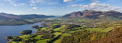
  • Image 6 River Thames and Tower Bridge with The Shard and Southwark (left), and Tower of London and City of London (right) London is the capital and largest city of both England and the United Kingdom, with a population of 8,866,180 in 2022. The wider metropolitan area is the largest in Western Europe, with a population of 14.9 million. London stands on the River Thames in southeast England, at the head of a 50-mile (80 km) estuary down to the North Sea, and has been a major settlement for nearly 2,000 years. Its ancient core and financial centre, the City of London, was founded by the Romans as Londinium and has retained its medieval boundaries. The City of Westminster, to the west of the City of London, has been the centuries-long host of the national government and parliament. London grew rapidly in the 19th century, becoming the world's largest city at the time. Since the 19th century, the name "London" has referred to the metropolis around the City of London, historically split between the counties of Middlesex, Essex, Surrey, Kent, and Hertfordshire, which since 1965 has largely comprised the administrative area of Greater London, governed by 33 local authorities and the Greater London Authority. (Full article...)

    London is the capital and largest city of both England and the United Kingdom, with a population of 8,866,180 in 2022. The wider metropolitan area is the largest in Western Europe, with a population of 14.9 million. London stands on the River Thames in southeast England, at the head of a 50-mile (80 km) estuary down to the North Sea, and has been a major settlement for nearly 2,000 years. Its ancient core and financial centre, the City of London, was founded by the Romans as Londinium and has retained its medieval boundaries. The City of Westminster, to the west of the City of London, has been the centuries-long host of the national government and parliament. London grew rapidly in the 19th century, becoming the world's largest city at the time. Since the 19th century, the name "London" has referred to the metropolis around the City of London, historically split between the counties of Middlesex, Essex, Surrey, Kent, and Hertfordshire, which since 1965 has largely comprised the administrative area of Greater London, governed by 33 local authorities and the Greater London Authority. (Full article...)
  • Image 7 National Mall Washington, D.C., formally the District of Columbia and commonly known as Washington or D.C., is the capital city and federal district of the United States. The city is on the Potomac River, across from Virginia, and shares land borders with Maryland to its north and east. It was named after George Washington, the first president of the United States. The district is named after Columbia, the female personification of the nation. (Full article...)
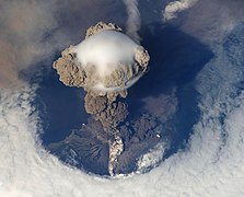
    Washington, D.C., formally the District of Columbia and commonly known as Washington or D.C., is the capital city and federal district of the United States. The city is on the Potomac River, across from Virginia, and shares land borders with Maryland to its north and east. It was named after George Washington, the first president of the United States. The district is named after Columbia, the female personification of the nation. (Full article...)
  • Image 8 Cartogram of the world's population in 2018; each square represents 500,000 people. This is a list of countries and dependencies by population. It includes sovereign states, inhabited dependent territories and, in some cases, constituent countries of sovereign states, with inclusion within the list being primarily based on the ISO standard ISO 3166-1. For instance, the United Kingdom is considered a single entity, while the constituent countries of the Kingdom of the Netherlands are considered separately. In addition, this list includes certain states with limited recognition not found in ISO 3166-1. Also given in a percentage is each country's population compared with the world population, which the United Nations estimates at 8.119 billion as of 2024. (Full article...)
    Cartogram of the world's population in 2018; each square represents 500,000 people.


    This is a list of countries and dependencies by population. It includes sovereign states, inhabited dependent territories and, in some cases, constituent countries of sovereign states, with inclusion within the list being primarily based on the ISO standard ISO 3166-1. For instance, the United Kingdom is considered a single entity, while the constituent countries of the Kingdom of the Netherlands are considered separately. In addition, this list includes certain states with limited recognition not found in ISO 3166-1. Also given in a percentage is each country's population compared with the world population, which the United Nations estimates at 8.119 billion as of 2024. (Full article...)
  • Image 9 Dymaxion map of the world with the 30 largest countries and territories by area This is a list of the world's countries and their dependencies by land, water, and total area, ranked by total area. (Full article...)
    Dymaxion map of the world with the 30 largest countries and territories by area

    This is a list of the world's countries and their dependencies by land, water, and total area, ranked by total area. (Full article...)
  • Image 10 Generation X (often shortened to Gen X) is the demographic cohort following the Baby Boomers and preceding Millennials. Researchers and popular media often use the mid-1960s as its starting birth years and the late 1970s as its ending birth years, with the generation being generally defined as people born from 1965 to 1980. By this definition and U.S. Census data, there are 65.2 million Gen Xers in the United States as of 2019. Most of Generation X are the children of the Silent Generation and early Baby Boomers; Xers are also often the parents of Millennials and Generation Z. (Full article...)
    Generation X (often shortened to Gen X) is the demographic cohort following the Baby Boomers and preceding Millennials. Researchers and popular media often use the mid-1960s as its starting birth years and the late 1970s as its ending birth years, with the generation being generally defined as people born from 1965 to 1980. By this definition and U.S. Census data, there are 65.2 million Gen Xers in the United States as of 2019. Most of Generation X are the children of the Silent Generation and early Baby Boomers; Xers are also often the parents of Millennials and Generation Z. (Full article...)
  • Click to enlarge and view description.

    Main articles

    CategoriesCategories

    Select [►] to view subcategories.

    Associated Wikimedia

    The following Wikimedia Foundation sister projects provide more on this subject:

    Discover Wikipedia using portals
    Retrieved from "https://en.wikipedia.org/w/index.php?title=Portal:Geography&oldid=1202464975"