Loading
  • 21 Aug, 2019

  • By, Wikipedia

Portal:Geography

The Geography Portal

Geography (from Ancient Greek γεωγραφία geōgraphía; combining 'Earth' and gráphō 'write') is the study of the lands, features, inhabitants, and phenomena of Earth. Geography is an all-encompassing discipline that seeks an understanding of Earth and its human and natural complexities—not merely where objects are, but also how they have changed and come to be. While geography is specific to Earth, many concepts can be applied more broadly to other celestial bodies in the field of planetary science. Geography has been called "a bridge between natural science and social science disciplines."

Origins of many of the concepts in geography can be traced to Greek Eratosthenes of Cyrene, who may have coined the term "geographia" (c. 276 BC – c. 195/194 BC). The first recorded use of the word γεωγραφία was as the title of a book by Greek scholar Claudius Ptolemy (100 – 170 AD). This work created the so-called "Ptolemaic tradition" of geography, which included "Ptolemaic cartographic theory." However, the concepts of geography (such as cartography) date back to the earliest attempts to understand the world spatially, with the earliest example of an attempted world map dating to the 9th century BCE in ancient Babylon. The history of geography as a discipline spans cultures and millennia, being independently developed by multiple groups, and cross-pollinated by trade between these groups. The core concepts of geography consistent between all approaches are a focus on space, place, time, and scale.

Today, geography is an extremely broad discipline with multiple approaches and modalities. There have been multiple attempts to organize the discipline, including the four traditions of geography, and into branches. Techniques employed can generally be broken down into quantitative and qualitative approaches, with many studies taking mixed-methods approaches. Common techniques include cartography, remote sensing, interviews, and surveying. (Full article...)

Featured articles are displayed here, which represent some of the best content on English Wikipedia.

  • Image 2 River Parrett near Burrowbridge The River Parrett flows through the counties of Dorset and Somerset in South West England, from its source in the Thorney Mills springs in the hills around Chedington in Dorset. Flowing northwest through Somerset and the Somerset Levels to its mouth at Burnham-on-Sea, into the Bridgwater Bay nature reserve on the Bristol Channel, the Parrett and its tributaries drain an area of 660 square miles (1,700 km2) – about 50 per cent of Somerset's land area, with a population of 300,000. The Parrett's main tributaries include the Rivers Tone, Isle, and Yeo, and the River Cary via the King's Sedgemoor Drain. The 37-mile (60 km) long river is tidal for 19 miles (31 km) up to Oath. The fall of the river between Langport and Bridgwater is only 1 foot per mile (0.2 m/km), so it is prone to frequent flooding in winter and during high tides. Many approaches have been tried since at least the medieval period to reduce the incidence and effect of floods and to drain the surrounding fields. (Full article...)

    The River Parrett flows through the counties of Dorset and Somerset in South West England, from its source in the Thorney Mills springs in the hills around Chedington in Dorset. Flowing northwest through Somerset and the Somerset Levels to its mouth at Burnham-on-Sea, into the Bridgwater Bay nature reserve on the Bristol Channel, the Parrett and its tributaries drain an area of 660 square miles (1,700 km) – about 50 per cent of Somerset's land area, with a population of 300,000.

    The Parrett's main tributaries include the Rivers Tone, Isle, and Yeo, and the River Cary via the King's Sedgemoor Drain. The 37-mile (60 km) long river is tidal for 19 miles (31 km) up to Oath. The fall of the river between Langport and Bridgwater is only 1 foot per mile (0.2 m/km), so it is prone to frequent flooding in winter and during high tides. Many approaches have been tried since at least the medieval period to reduce the incidence and effect of floods and to drain the surrounding fields. (Full article...)
  • Image 3 Yellow iron oxide-covered lava rock on the flank of Kamaʻehuakanaloa Kamaʻehuakanaloa Seamount (previously known as Lōʻihi) is an active submarine volcano about 22 mi (35 km) off the southeast coast of the island of Hawaii. The top of the seamount is about 3,200 ft (975 m) below sea level. This seamount is on the flank of Mauna Loa, the largest active subaerial shield volcano on Earth. Kamaʻehuakanaloa is the newest volcano in the Hawaiian–Emperor seamount chain, a string of volcanoes that stretches about 3,900 mi (6,200 km) northwest of Kamaʻehuakanaloa. Unlike most active volcanoes in the Pacific Ocean that make up the active plate margins on the Pacific Ring of Fire, Kamaʻehuakanaloa and the other volcanoes of the Hawaiian–Emperor seamount chain are hotspot volcanoes and formed well away from the nearest plate boundary. Volcanoes in the Hawaiian Islands arise from the Hawaii hotspot, and as the youngest volcano in the chain, Kamaʻehuakanaloa is the only Hawaiian volcano in the deep submarine preshield stage of development. Kamaʻehuakanaloa began forming around 400,000 years ago and is expected to begin emerging above sea level about 10,000–100,000 years from now. At its summit, Kamaʻehuakanaloa Seamount stands more than 10,000 ft (3,000 m) above the seafloor, making it taller than Mount St. Helens was before its catastrophic 1980 eruption. A diverse microbial community resides around Kamaʻehuakanaloa many hydrothermal vents. (Full article...)

    Kamaʻehuakanaloa Seamount (previously known as Lōʻihi) is an active submarine volcano about 22 mi (35 km) off the southeast coast of the island of Hawaii. The top of the seamount is about 3,200 ft (975 m) below sea level. This seamount is on the flank of Mauna Loa, the largest active subaerial shield volcano on Earth. Kamaʻehuakanaloa is the newest volcano in the Hawaiian–Emperor seamount chain, a string of volcanoes that stretches about 3,900 mi (6,200 km) northwest of Kamaʻehuakanaloa. Unlike most active volcanoes in the Pacific Ocean that make up the active plate margins on the Pacific Ring of Fire, Kamaʻehuakanaloa and the other volcanoes of the Hawaiian–Emperor seamount chain are hotspot volcanoes and formed well away from the nearest plate boundary. Volcanoes in the Hawaiian Islands arise from the Hawaii hotspot, and as the youngest volcano in the chain, Kamaʻehuakanaloa is the only Hawaiian volcano in the deep submarine preshield stage of development.

    Kamaʻehuakanaloa began forming around 400,000 years ago and is expected to begin emerging above sea level about 10,000–100,000 years from now. At its summit, Kamaʻehuakanaloa Seamount stands more than 10,000 ft (3,000 m) above the seafloor, making it taller than Mount St. Helens was before its catastrophic 1980 eruption. A diverse microbial community resides around Kamaʻehuakanaloa many hydrothermal vents. (Full article...)
  • Image 4 Sunset in the Rincon Mountain District of the park Saguaro National Park is a national park of the United States in southeastern Arizona. The 92,000-acre (37,000 ha) park consists of two separate areas—the Tucson Mountain District (TMD), about 10 miles (16 km) west of Tucson, and the Rincon Mountain District (RMD), about 10 miles (16 km) east of the city. Both districts preserve Sonoran Desert landscapes, fauna, and flora, including the giant saguaro cactus. The volcanic rocks on the surface of the Tucson Mountain District differ greatly from the surface rocks of the Rincon Mountain District; over the past 30 million years, crustal stretching displaced rocks from beneath the Tucson Mountains of the Tucson Mountain District to form the Rincon Mountains of the Rincon Mountain District. Uplifted, domed, and eroded, the Rincon Mountains are significantly higher and wetter than the Tucson Mountains. The Rincons, as one of the Madrean Sky Islands between the southern Rocky Mountains and the Sierra Madre Oriental in Mexico, support high biodiversity and are home to many plants and animals that do not live in the Tucson Mountain District. (Full article...)

    Saguaro National Park is a national park of the United States in southeastern Arizona. The 92,000-acre (37,000 ha) park consists of two separate areas—the Tucson Mountain District (TMD), about 10 miles (16 km) west of Tucson, and the Rincon Mountain District (RMD), about 10 miles (16 km) east of the city. Both districts preserve Sonoran Desert landscapes, fauna, and flora, including the giant saguaro cactus.

    The volcanic rocks on the surface of the Tucson Mountain District differ greatly from the surface rocks of the Rincon Mountain District; over the past 30 million years, crustal stretching displaced rocks from beneath the Tucson Mountains of the Tucson Mountain District to form the Rincon Mountains of the Rincon Mountain District. Uplifted, domed, and eroded, the Rincon Mountains are significantly higher and wetter than the Tucson Mountains. The Rincons, as one of the Madrean Sky Islands between the southern Rocky Mountains and the Sierra Madre Oriental in Mexico, support high biodiversity and are home to many plants and animals that do not live in the Tucson Mountain District. (Full article...)
  • Image 5 Intersection of Routes 11 and 277 in the center of town Stephens City (/ˈstiːvənz/ STEE-vənz) is an incorporated town in the southern part of Frederick County, Virginia, United States, with a population of 2,016 at the time of the 2020 census, and an estimated population of 2,096 in 2022. Founded by Peter Stephens in the 1730s, the colonial town was chartered and named for Lewis Stephens (Peter's only son) in October 1758. It was originally settled by German Protestants from Heidelberg. Stephens City is the second-oldest municipality in the Shenandoah Valley after nearby Winchester, which is about 5 mi (8 km) to the north. "Crossroads", the first free black community in the Valley in the pre-Civil War years, was founded east of town in the 1850s. Crossroads remained until the beginning of the Civil War when the freed African Americans either escaped or were recaptured. Stephens City was saved from intentional burning in 1864 by Union Major Joseph K. Stearns. The town has gone through several name changes in its history, starting as "Stephensburg", then "Newtown", and finally winding up as "Stephens City", though it nearly became "Pantops". Interstate 81 and U.S. Route 11 pass close to and through the town, respectively. (Full article...)

    Stephens City (/ˈstvənz/ STEE-vənz) is an incorporated town in the southern part of Frederick County, Virginia, United States, with a population of 2,016 at the time of the 2020 census, and an estimated population of 2,096 in 2022. Founded by Peter Stephens in the 1730s, the colonial town was chartered and named for Lewis Stephens (Peter's only son) in October 1758. It was originally settled by German Protestants from Heidelberg.

    Stephens City is the second-oldest municipality in the Shenandoah Valley after nearby Winchester, which is about 5 mi (8 km) to the north. "Crossroads", the first free black community in the Valley in the pre-Civil War years, was founded east of town in the 1850s. Crossroads remained until the beginning of the Civil War when the freed African Americans either escaped or were recaptured. Stephens City was saved from intentional burning in 1864 by Union Major Joseph K. Stearns. The town has gone through several name changes in its history, starting as "Stephensburg", then "Newtown", and finally winding up as "Stephens City", though it nearly became "Pantops". Interstate 81 and U.S. Route 11 pass close to and through the town, respectively. (Full article...)
  • Image 6 Column of Armenian deportees guarded by gendarmes in Harput vilayet The Armenian genocide was the systematic destruction of the Armenian people and identity in the Ottoman Empire during World War I. Spearheaded by the ruling Committee of Union and Progress (CUP), it was implemented primarily through the mass murder of around one million Armenians during death marches to the Syrian Desert and the forced Islamization of others, primarily women and children. Before World War I, Armenians occupied a somewhat protected, but subordinate, place in Ottoman society. Large-scale massacres of Armenians had occurred in the 1890s and 1909. The Ottoman Empire suffered a series of military defeats and territorial losses—especially during the 1912–1913 Balkan Wars—leading to fear among CUP leaders that the Armenians would seek independence. During their invasion of Russian and Persian territory in 1914, Ottoman paramilitaries massacred local Armenians. Ottoman leaders took isolated instances of Armenian resistance as evidence of a widespread rebellion, though no such rebellion existed. Mass deportation was intended to permanently forestall the possibility of Armenian autonomy or independence. (Full article...)

    The Armenian genocide was the systematic destruction of the Armenian people and identity in the Ottoman Empire during World War I. Spearheaded by the ruling Committee of Union and Progress (CUP), it was implemented primarily through the mass murder of around one million Armenians during death marches to the Syrian Desert and the forced Islamization of others, primarily women and children.

    Before World War I, Armenians occupied a somewhat protected, but subordinate, place in Ottoman society. Large-scale massacres of Armenians had occurred in the 1890s and 1909. The Ottoman Empire suffered a series of military defeats and territorial losses—especially during the 1912–1913 Balkan Wars—leading to fear among CUP leaders that the Armenians would seek independence. During their invasion of Russian and Persian territory in 1914, Ottoman paramilitaries massacred local Armenians. Ottoman leaders took isolated instances of Armenian resistance as evidence of a widespread rebellion, though no such rebellion existed. Mass deportation was intended to permanently forestall the possibility of Armenian autonomy or independence. (Full article...)
  • Image 7 Trinity Mountains in Boise National Forest Boise National Forest is a National Forest covering 2,203,703 acres (8,918.07 km2) of the U.S. state of Idaho. Created on July 1, 1908, from part of Sawtooth National Forest, it is managed by the U.S. Forest Service as five units: the Cascade, Emmett, Idaho City, Lowman, and Mountain Home ranger districts. The Idaho Batholith underlies most of Boise National Forest, forming the forest's Boise, Salmon River, and West mountain ranges; the forest reaches a maximum elevation of 9,730 feet (2,970 m) on Steel Mountain. Common land cover includes sagebrush steppe and spruce-fir forests; there are 9,600 miles (15,400 km) of streams and rivers and 15,400 acres (62 km2) of lakes and reservoirs. Boise National Forest contains 75 percent of the known populations of Sacajawea's bitterroot, a flowering plant endemic to Idaho. (Full article...)

    Boise National Forest is a National Forest covering 2,203,703 acres (8,918.07 km) of the U.S. state of Idaho. Created on July 1, 1908, from part of Sawtooth National Forest, it is managed by the U.S. Forest Service as five units: the Cascade, Emmett, Idaho City, Lowman, and Mountain Home ranger districts.

    The Idaho Batholith underlies most of Boise National Forest, forming the forest's Boise, Salmon River, and West mountain ranges; the forest reaches a maximum elevation of 9,730 feet (2,970 m) on Steel Mountain. Common land cover includes sagebrush steppe and spruce-fir forests; there are 9,600 miles (15,400 km) of streams and rivers and 15,400 acres (62 km) of lakes and reservoirs. Boise National Forest contains 75 percent of the known populations of Sacajawea's bitterroot, a flowering plant endemic to Idaho. (Full article...)
  • Image 8 Aerial photo from 1991 Hudson Volcano (Spanish: Volcán Hudson, Cerro Hudson, or Monte Hudson) is the most active volcano in the southern part of the Southern Volcanic Zone of the Andes Mountains in Chile, having erupted most recently in 2011. It was formed by the subduction of the oceanic Nazca Plate under the continental South American Plate. South of Hudson is a smaller volcano, followed by a long gap without active volcanoes, then the Austral Volcanic Zone. Hudson has the form of a 10-kilometre-wide (6-mile) caldera filled with ice; the Huemules Glacier emerges from the northwestern side of the caldera. The volcano has erupted rocks ranging from basalt to rhyolite, but large parts of the caldera are formed by non-volcanic rocks. The volcano erupted numerous times in the late Pleistocene and Holocene, forming widespread tephra deposits both in the proximity of Hudson and in the wider region. Four large eruptions took place in 17,300–17,440 BP ("H0 eruption"), 7,750 BP ("H1 eruption"), 4,200 BP ("H2 eruption") and in 1991 AD ("H3 eruption"); the second is among the most intense volcanic eruptions in South America during the Holocene. A smaller eruption occurred in 1971. The 7,750 BP and 1991 eruptions had a substantial impact on the human population of Patagonia and (for the 7,750 BP eruption) Tierra del Fuego: The 7,750 BP eruption devastated the local ecosystem and may have caused substantial shifts in human settlement and lifestyle. During the 1991 eruption, volcanic ash covered a large area in Chile and neighbouring Argentina, causing high mortality in farm animals, aggravating an existing economic crisis, and reaching as far as Antarctica. (Full article...)

    Hudson Volcano (Spanish: Volcán Hudson, Cerro Hudson, or Monte Hudson) is the most active volcano in the southern part of the Southern Volcanic Zone of the Andes Mountains in Chile, having erupted most recently in 2011. It was formed by the subduction of the oceanic Nazca Plate under the continental South American Plate. South of Hudson is a smaller volcano, followed by a long gap without active volcanoes, then the Austral Volcanic Zone. Hudson has the form of a 10-kilometre-wide (6-mile) caldera filled with ice; the Huemules Glacier emerges from the northwestern side of the caldera. The volcano has erupted rocks ranging from basalt to rhyolite, but large parts of the caldera are formed by non-volcanic rocks.

    The volcano erupted numerous times in the late Pleistocene and Holocene, forming widespread tephra deposits both in the proximity of Hudson and in the wider region.
    Four large eruptions took place in 17,300–17,440 BP ("H0 eruption"), 7,750 BP ("H1 eruption"), 4,200 BP ("H2 eruption") and in 1991 AD ("H3 eruption"); the second is among the most intense volcanic eruptions in South America during the Holocene. A smaller eruption occurred in 1971. The 7,750 BP and 1991 eruptions had a substantial impact on the human population of Patagonia and (for the 7,750 BP eruption) Tierra del Fuego: The 7,750 BP eruption devastated the local ecosystem and may have caused substantial shifts in human settlement and lifestyle. During the 1991 eruption, volcanic ash covered a large area in Chile and neighbouring Argentina, causing high mortality in farm animals, aggravating an existing economic crisis, and reaching as far as Antarctica. (Full article...)
  • Image 9 The Thing is a 1982 American science fiction horror film directed by John Carpenter from a screenplay by Bill Lancaster. Based on the 1938 John W. Campbell Jr. novella Who Goes There?, it tells the story of a group of American researchers in Antarctica who encounter the eponymous "Thing", an extraterrestrial life-form that assimilates, then imitates, other organisms. The group is overcome by paranoia and conflict as they learn that they can no longer trust each other and that any of them could be the Thing. The film stars Kurt Russell as the team's helicopter pilot R.J. MacReady, with A. Wilford Brimley, T. K. Carter, David Clennon, Keith David, Richard Dysart, Charles Hallahan, Peter Maloney, Richard Masur, Donald Moffat, Joel Polis, and Thomas G. Waites in supporting roles. Production began in the mid-1970s as a faithful adaptation of the novella, following 1951's The Thing from Another World. The Thing went through several directors and writers, each with different ideas on how to approach the story. Filming lasted roughly twelve weeks, beginning in August 1981, and took place on refrigerated sets in Los Angeles as well as in Juneau, Alaska, and Stewart, British Columbia. Of the film's $15 million budget, $1.5 million was spent on Rob Bottin's creature effects, a mixture of chemicals, food products, rubber, and mechanical parts turned by his large team into an alien capable of taking on any form. (Full article...)
    The Thing is a 1982 American science fiction horror film directed by John Carpenter from a screenplay by Bill Lancaster. Based on the 1938 John W. Campbell Jr. novella Who Goes There?, it tells the story of a group of American researchers in Antarctica who encounter the eponymous "Thing", an extraterrestrial life-form that assimilates, then imitates, other organisms. The group is overcome by paranoia and conflict as they learn that they can no longer trust each other and that any of them could be the Thing. The film stars Kurt Russell as the team's helicopter pilot R.J. MacReady, with A. Wilford Brimley, T. K. Carter, David Clennon, Keith David, Richard Dysart, Charles Hallahan, Peter Maloney, Richard Masur, Donald Moffat, Joel Polis, and Thomas G. Waites in supporting roles.

    Production began in the mid-1970s as a faithful adaptation of the novella, following 1951's The Thing from Another World. The Thing went through several directors and writers, each with different ideas on how to approach the story. Filming lasted roughly twelve weeks, beginning in August 1981, and took place on refrigerated sets in Los Angeles as well as in Juneau, Alaska, and Stewart, British Columbia. Of the film's $15 million budget, $1.5 million was spent on Rob Bottin's creature effects, a mixture of chemicals, food products, rubber, and mechanical parts turned by his large team into an alien capable of taking on any form. (Full article...)
  • Image 10 William Franklin Raynolds (March 17, 1820 – October 18, 1894) was an American explorer, engineer and U.S. army officer who served in the Mexican–American War and American Civil War. He is best known for leading the 1859–60 Raynolds Expedition while serving as a member of the U.S. Army Corps of Topographical Engineers. During the 1850s and again after his participation in the Civil War, Raynolds was the head engineer on numerous lighthouse construction projects. He oversaw riverway and harbor dredging projects intended to improve accessibility and navigation for shipping. As a cartographer, Raynolds surveyed and mapped the islands and shorelines on the Great Lakes and other regions. At least six lighthouses whose construction he oversaw are still standing. Some are still in use and of these, several are listed on the National Register of Historic Places. (Full article...)

    William Franklin Raynolds (March 17, 1820 – October 18, 1894) was an American explorer, engineer and U.S. army officer who served in the Mexican–American War and American Civil War. He is best known for leading the 1859–60 Raynolds Expedition while serving as a member of the U.S. Army Corps of Topographical Engineers.

    During the 1850s and again after his participation in the Civil War, Raynolds was the head engineer on numerous lighthouse construction projects. He oversaw riverway and harbor dredging projects intended to improve accessibility and navigation for shipping. As a cartographer, Raynolds surveyed and mapped the islands and shorelines on the Great Lakes and other regions. At least six lighthouses whose construction he oversaw are still standing. Some are still in use and of these, several are listed on the National Register of Historic Places. (Full article...)
  • Image 11 One of T2's sister ships, T3 T2 was a seagoing torpedo boat operated by the Royal Yugoslav Navy between 1923 and 1939. Originally 77 T, a 250t-class torpedo boat of the Austro-Hungarian Navy built in 1914, she was armed with two 66 mm (2.6 in) guns and four 450 mm (17.7 in) torpedo tubes, and could carry 10–12 naval mines. She saw active service during World War I, performing convoy, patrol, escort, minesweeping and minelaying tasks, anti-submarine operations, and shore bombardment missions. In 1917, the suffixes of all Austro-Hungarian torpedo boats were removed, and thereafter she was referred to as 77. The vessel was in the Bocche di Cattaro during the short-lived mutiny by Austro-Hungarian sailors in early February 1918; members of her crew raised the red flag but undertook no other mutinous actions. 77 was part of the escort force for the Austro-Hungarian dreadnought Szent István during the action that resulted in the sinking of that ship by Italian torpedo boats in June 1918. Following Austria-Hungary's defeat in 1918, 77 was allocated to the Navy of the Kingdom of Serbs, Croats and Slovenes, which later became the Royal Yugoslav Navy, and was renamed T2 and had her armament upgraded. At the time, she and seven other 250t-class boats were the only modern sea-going vessels of the fledgling maritime force. During the interwar period, the navy was involved in training exercises and cruises to friendly ports, but activity was limited by reduced naval budgets. Worn out after twenty-five years of service, T2 was stricken from the naval register and scrapped in 1939. (Full article...)

    T2 was a seagoing torpedo boat operated by the Royal Yugoslav Navy between 1923 and 1939. Originally 77 T, a 250t-class torpedo boat of the Austro-Hungarian Navy built in 1914, she was armed with two 66 mm (2.6 in) guns and four 450 mm (17.7 in) torpedo tubes, and could carry 10–12 naval mines. She saw active service during World War I, performing convoy, patrol, escort, minesweeping and minelaying tasks, anti-submarine operations, and shore bombardment missions. In 1917, the suffixes of all Austro-Hungarian torpedo boats were removed, and thereafter she was referred to as 77. The vessel was in the Bocche di Cattaro during the short-lived mutiny by Austro-Hungarian sailors in early February 1918; members of her crew raised the red flag but undertook no other mutinous actions. 77 was part of the escort force for the Austro-Hungarian dreadnought Szent István during the action that resulted in the sinking of that ship by Italian torpedo boats in June 1918.

    Following Austria-Hungary's defeat in 1918, 77 was allocated to the Navy of the Kingdom of Serbs, Croats and Slovenes, which later became the Royal Yugoslav Navy, and was renamed T2 and had her armament upgraded. At the time, she and seven other 250t-class boats were the only modern sea-going vessels of the fledgling maritime force. During the interwar period, the navy was involved in training exercises and cruises to friendly ports, but activity was limited by reduced naval budgets. Worn out after twenty-five years of service, T2 was stricken from the naval register and scrapped in 1939. (Full article...)
  • Image 12 Edward Adrian Wilson, Robert Falcon Scott, Lawrence Oates, Henry Robertson Bowers and Edgar Evans at the South Pole The Terra Nova Expedition, officially the British Antarctic Expedition, was an expedition to Antarctica which took place between 1910 and 1913. Led by Captain Robert Falcon Scott, the expedition had various scientific and geographical objectives. Scott wished to continue the scientific work that he had begun when leading the Discovery Expedition from 1901 to 1904, and wanted to be the first to reach the geographic South Pole. He and four companions attained the pole on 17 January 1912, where they found that a Norwegian team led by Roald Amundsen had preceded them by 34 days. Scott's party of five died on the return journey from the pole; some of their bodies, journals, and photographs were found by a search party eight months later. The expedition, named after its supply ship, was a private venture financed by public contributions and a government grant. It had further backing from the Admiralty, which released experienced seamen to the expedition, and from the Royal Geographical Society. The expedition's team of scientists carried out a comprehensive scientific programme, while other parties explored Victoria Land and the Western Mountains. An attempted landing and exploration of King Edward VII Land was unsuccessful. A journey to Cape Crozier in June and July 1911 was the first extended sledging journey in the depths of the Antarctic winter. (Full article...)
    Five men in heavy clothing and headgear; three are standing and two seated on the ground. The standing men carry flags; all five have dejected expressions
    Edward Adrian Wilson, Robert Falcon Scott, Lawrence Oates, Henry Robertson Bowers and Edgar Evans at the South Pole

    The Terra Nova Expedition, officially the British Antarctic Expedition, was an expedition to Antarctica which took place between 1910 and 1913. Led by Captain Robert Falcon Scott, the expedition had various scientific and geographical objectives. Scott wished to continue the scientific work that he had begun when leading the Discovery Expedition from 1901 to 1904, and wanted to be the first to reach the geographic South Pole.

    He and four companions attained the pole on 17 January 1912, where they found that a Norwegian team led by Roald Amundsen had preceded them by 34 days. Scott's party of five died on the return journey from the pole; some of their bodies, journals, and photographs were found by a search party eight months later.
    The expedition, named after its supply ship, was a private venture financed by public contributions and a government grant. It had further backing from the Admiralty, which released experienced seamen to the expedition, and from the Royal Geographical Society. The expedition's team of scientists carried out a comprehensive scientific programme, while other parties explored Victoria Land and the Western Mountains. An attempted landing and exploration of King Edward VII Land was unsuccessful. A journey to Cape Crozier in June and July 1911 was the first extended sledging journey in the depths of the Antarctic winter. (Full article...)
  • Image 13 Hillsboro (/ˈhɪlzbəroʊ/ HILZ-burr-oh) is a city in the U.S. state of Oregon and is the county seat of Washington County. Situated in the Tualatin Valley on the west side of the Portland metropolitan area, the city hosts many high-technology companies, such as Intel, locally known as the Silicon Forest. The population was 106,447 at the 2020 census, making Hillsboro the fifth-most populous city in Oregon. Settlers founded a community here in 1842, later named after David Hill, an Oregon politician. Transportation by riverboat on the Tualatin River was part of Hillsboro's settler economy. A railroad reached the area in the early 1870s and an interurban electric railway about four decades later. These railways, as well as highways, aided the slow growth of the city to about 2,000 people by 1910 and about 5,000 by 1950, before the arrival of high-tech companies in the 1980s. (Full article...)

    Hillsboro (/ˈhɪlzbər/ HILZ-burr-oh) is a city in the U.S. state of Oregon and is the county seat of Washington County. Situated in the Tualatin Valley on the west side of the Portland metropolitan area, the city hosts many high-technology companies, such as Intel, locally known as the Silicon Forest. The population was 106,447 at the 2020 census, making Hillsboro the fifth-most populous city in Oregon.

    Settlers founded a community here in 1842, later named after David Hill, an Oregon politician. Transportation by riverboat on the Tualatin River was part of Hillsboro's settler economy. A railroad reached the area in the early 1870s and an interurban electric railway about four decades later. These railways, as well as highways, aided the slow growth of the city to about 2,000 people by 1910 and about 5,000 by 1950, before the arrival of high-tech companies in the 1980s. (Full article...)
  • Image 14 National Mall Washington, D.C., formally the District of Columbia and commonly known as Washington or D.C., is the capital city and federal district of the United States. The city is on the Potomac River, across from Virginia, and shares land borders with Maryland to its north and east. It was named for George Washington, the first president of the United States. The district is named for Columbia, the female personification of the nation. The U.S. Constitution in 1789 called for the creation of a federal district under the exclusive jurisdiction of the U.S. Congress. As such, Washington, D.C., is not part of any state, and is not one itself. The Residence Act, adopted on July 16, 1790, approved the creation of the capital district along the Potomac River. The city was founded in 1791, and the 6th Congress held the first session in the unfinished Capitol Building in 1800 after the capital moved from Philadelphia. In 1801, the District of Columbia, formerly part of Maryland and Virginia and including the existing settlements of Georgetown and Alexandria, was officially recognized as the federal district; initially, the city was a separate settlement within the larger district. In 1846, Congress returned the land originally ceded by Virginia, including the city of Alexandria. In 1871, it created a single municipality for the remaining portion of the district. There have been several unsuccessful efforts to make the district into a state since the 1880s; a statehood bill passed the House of Representatives in 2021 but was not adopted by the U.S. Senate. (Full article...)
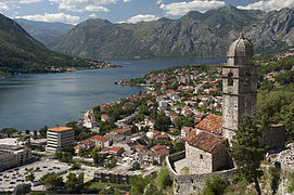
    Washington, D.C., formally the District of Columbia and commonly known as Washington or D.C., is the capital city and federal district of the United States. The city is on the Potomac River, across from Virginia, and shares land borders with Maryland to its north and east. It was named for George Washington, the first president of the United States. The district is named for Columbia, the female personification of the nation.

    The U.S. Constitution in 1789 called for the creation of a federal district under the exclusive jurisdiction of the U.S. Congress. As such, Washington, D.C., is not part of any state, and is not one itself. The Residence Act, adopted on July 16, 1790, approved the creation of the capital district along the Potomac River. The city was founded in 1791, and the 6th Congress held the first session in the unfinished Capitol Building in 1800 after the capital moved from Philadelphia. In 1801, the District of Columbia, formerly part of Maryland and Virginia and including the existing settlements of Georgetown and Alexandria, was officially recognized as the federal district; initially, the city was a separate settlement within the larger district. In 1846, Congress returned the land originally ceded by Virginia, including the city of Alexandria. In 1871, it created a single municipality for the remaining portion of the district. There have been several unsuccessful efforts to make the district into a state since the 1880s; a statehood bill passed the House of Representatives in 2021 but was not adopted by the U.S. Senate. (Full article...)
  • Image 15 Robert Marshall (January 2, 1901 – November 11, 1939) was an American forester, writer and wilderness activist who is best remembered as the person who spearheaded the 1935 founding of the Wilderness Society in the United States. Marshall developed a love for the outdoors as a young child. He was an avid hiker and climber who visited the Adirondack Mountains frequently during his youth, ultimately becoming one of the first Adirondack Forty-Sixers. He also traveled to the Brooks Range of the far northern Alaskan wilderness. He wrote numerous articles and books about his travels, including the bestselling 1933 book Arctic Village. A scientist with a PhD in plant physiology, Marshall became independently wealthy after the death of his father in 1929. He had started his outdoor career in 1925 as forester with the U.S. Forest Service. He used his financial independence for expeditions to Alaska and other wilderness areas. Later he held two significant public appointed posts: chief of forestry in the Bureau of Indian Affairs, from 1933 to 1937, and head of recreation management in the Forest Service, from 1937 to 1939, both during the administration of President Franklin D. Roosevelt. During this period, he directed the promulgation of regulations to preserve large areas of roadless land that were under federal management. Many years after his death, some of those areas were permanently protected from development, exploitation, and mechanization with the passage of the Wilderness Act of 1964. (Full article...)
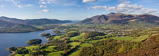
    Robert Marshall (January 2, 1901 – November 11, 1939) was an American forester, writer and wilderness activist who is best remembered as the person who spearheaded the 1935 founding of the Wilderness Society in the United States. Marshall developed a love for the outdoors as a young child. He was an avid hiker and climber who visited the Adirondack Mountains frequently during his youth, ultimately becoming one of the first Adirondack Forty-Sixers. He also traveled to the Brooks Range of the far northern Alaskan wilderness. He wrote numerous articles and books about his travels, including the bestselling 1933 book Arctic Village.

    A scientist with a PhD in plant physiology, Marshall became independently wealthy after the death of his father in 1929. He had started his outdoor career in 1925 as forester with the U.S. Forest Service. He used his financial independence for expeditions to Alaska and other wilderness areas. Later he held two significant public appointed posts: chief of forestry in the Bureau of Indian Affairs, from 1933 to 1937, and head of recreation management in the Forest Service, from 1937 to 1939, both during the administration of President Franklin D. Roosevelt. During this period, he directed the promulgation of regulations to preserve large areas of roadless land that were under federal management. Many years after his death, some of those areas were permanently protected from development, exploitation, and mechanization with the passage of the Wilderness Act of 1964. (Full article...)
  • More featured articles

    Vital articles Vital article

    Vital articles to understand Geography.

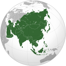
    Asia (/ˈʒə/ AY-zhə, UK also /ˈʃə/ AY-shə) is the largest continent in the world by both land area and population. It covers an area of more than 44 million square kilometers, about 30% of Earth's total land area and 8% of Earth's total surface area. The continent, which has long been home to the majority of the human population, was the site of many of the first civilizations. Its 4.7 billion people constitute roughly 60% of the world's population. (Full article...)

    Other vital articles

    Get involved

    For editor resources and to collaborate with other editors on improving Wikipedia's Geography-related articles, visit WikiProject Geography.


    Here are some tasks awaiting attention:

    Selected pictures

    Featured biography articles in geography

    Emery Molyneux (/ˈɛməri ˈmɒlɪn/ EM-ər-ee MOL-in-oh; died June 1598) was an English Elizabethan maker of globes, mathematical instruments and ordnance. His terrestrial and celestial globes, first published in 1592, were the first to be made in England and the first to be made by an Englishman.

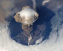
    Molyneux was known as a mathematician and maker of mathematical instruments such as compasses and hourglasses. He became acquainted with many prominent men of the day, including the writer Richard Hakluyt and the mathematicians Robert Hues and Edward Wright. He also knew the explorers Thomas Cavendish, Francis Drake, Walter Raleigh and John Davis. Davis probably introduced Molyneux to his own patron, the London merchant William Sanderson, who largely financed the construction of the globes. When completed, the globes were presented to Elizabeth I. Larger globes were acquired by royalty, noblemen and academic institutions, while smaller ones were purchased as practical navigation aids for sailors and students. The globes were the first to be made in such a way that they were unaffected by the humidity at sea, and they came into general use on ships. (Full article...)
    More featured biographies

    Did you know

    Did you know it about Geography?

    Places around you

    You can read about interesting Wikipedia articles about places around you.

    Special:Nearby

    This following Geography-related articles is a most visited articles of WikiProject Geography, See complete list at Wikipedia:WikiProject Geography/Popular pages.

  • Image 4 Generation X (often shortened to Gen X) is the demographic cohort following the Baby Boomers and preceding Millennials. Researchers and popular media often use the mid-1960s as its starting birth years and the late 1970s as its ending birth years, with the generation being generally defined as people born from 1965 to 1980. By this definition and U.S. Census data, there are 65.2 million Gen Xers in the United States as of 2019. Most of Generation X are the children of the Silent Generation and early Baby Boomers; Xers are also often the parents of Millennials and Generation Z. (Full article...)
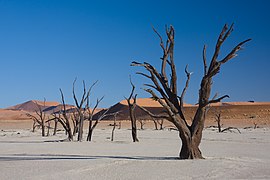
    Generation X (often shortened to Gen X) is the demographic cohort following the Baby Boomers and preceding Millennials. Researchers and popular media often use the mid-1960s as its starting birth years and the late 1970s as its ending birth years, with the generation being generally defined as people born from 1965 to 1980. By this definition and U.S. Census data, there are 65.2 million Gen Xers in the United States as of 2019. Most of Generation X are the children of the Silent Generation and early Baby Boomers; Xers are also often the parents of Millennials and Generation Z. (Full article...)
  • Image 5 Cartogram of the world's population in 2018; each square represents 500,000 people. This is a list of countries and dependencies by population. It includes sovereign states, inhabited dependent territories and, in some cases, constituent countries of sovereign states, with inclusion within the list being primarily based on the ISO standard ISO 3166-1. For instance, the United Kingdom is considered a single entity, while the constituent countries of the Kingdom of the Netherlands are considered separately. In addition, this list includes certain states with limited recognition not found in ISO 3166-1. Also given in a percentage is each country's population compared with the world population, which the United Nations estimates at 8.119 billion as of 2024. (Full article...)
    Cartogram of the world's population in 2018; each square represents 500,000 people.


    This is a list of countries and dependencies by population. It includes sovereign states, inhabited dependent territories and, in some cases, constituent countries of sovereign states, with inclusion within the list being primarily based on the ISO standard ISO 3166-1. For instance, the United Kingdom is considered a single entity, while the constituent countries of the Kingdom of the Netherlands are considered separately. In addition, this list includes certain states with limited recognition not found in ISO 3166-1. Also given in a percentage is each country's population compared with the world population, which the United Nations estimates at 8.119 billion as of 2024. (Full article...)
  • Image 6 Hong Kong is a special administrative region of the People's Republic of China. With 7.4 million residents of various nationalities in a 1,104-square-kilometre (426 sq mi) territory, Hong Kong is the fourth most densely populated region in the world. (Full article...)

    Hong Kong is a special administrative region of the People's Republic of China. With 7.4 million residents of various nationalities in a 1,104-square-kilometre (426 sq mi) territory, Hong Kong is the fourth most densely populated region in the world. (Full article...)
  • Image 7 Millennials, also known as Generation Y or Gen Y, are the demographic cohort following Generation X and preceding Generation Z. Researchers and popular media use the early 1980s as starting birth years and the mid-1990s to early 2000s as ending birth years, with the generation typically being defined as people born from 1981 to 1996. Most Millennials are the children of Baby Boomers and older Generation X. In turn Millennials are often the parents of Generation Alpha. (Full article...)
    Millennials, also known as Generation Y or Gen Y, are the demographic cohort following Generation X and preceding Generation Z. Researchers and popular media use the early 1980s as starting birth years and the mid-1990s to early 2000s as ending birth years, with the generation typically being defined as people born from 1981 to 1996. Most Millennials are the children of Baby Boomers and older Generation X. In turn Millennials are often the parents of Generation Alpha. (Full article...)
  • Image 8 England is a country that is part of the United Kingdom. It is located on the island of Great Britain, of which it covers approximately 62%, and over 100 smaller adjacent islands. It has land borders with Scotland to the north and Wales to the west, and is otherwise surrounded by the North Sea to the east, the English Channel to the south, the Celtic Sea to the south-west, and the Irish Sea to the west. Continental Europe lies to the south-east, and Ireland to the west. At the 2021 census, the population was 56,490,048. London is both the largest city and the capital. (Full article...)

    England is a country that is part of the United Kingdom. It is located on the island of Great Britain, of which it covers approximately 62%, and over 100 smaller adjacent islands. It has land borders with Scotland to the north and Wales to the west, and is otherwise surrounded by the North Sea to the east, the English Channel to the south, the Celtic Sea to the south-west, and the Irish Sea to the west. Continental Europe lies to the south-east, and Ireland to the west. At the 2021 census, the population was 56,490,048. London is both the largest city and the capital. (Full article...)
  • Image 9 Generation Alpha (often shortened to Gen Alpha) is the demographic cohort succeeding Generation Z. Researchers and popular media use the early 2010s as starting birth years to the mid-2020s as the ending birth years (see § Date and age range definitions). Named after alpha, the first letter in the Greek alphabet, Generation Alpha is the first to be born entirely in the 21st century and the third millennium. The majority of Generation Alpha are the children of Millennials. (Full article...)
    Generation Alpha (often shortened to Gen Alpha) is the demographic cohort succeeding Generation Z. Researchers and popular media use the early 2010s as starting birth years to the mid-2020s as the ending birth years (see § Date and age range definitions). Named after alpha, the first letter in the Greek alphabet, Generation Alpha is the first to be born entirely in the 21st century and the third millennium. The majority of Generation Alpha are the children of Millennials. (Full article...)
  • Image 10 Dymaxion map of the world with the 30 largest countries and territories by area This is a list of the world's countries and their dependencies by land, water, and total area, ranked by total area. (Full article...)
    Dymaxion map of the world with the 30 largest countries and territories by area

    This is a list of the world's countries and their dependencies by land, water, and total area, ranked by total area. (Full article...)
  • Click to enlarge and view description.

    Main articles

    CategoriesCategories

    Select [►] to view subcategories.

    Associated Wikimedia

    The following Wikimedia Foundation sister projects provide more on this subject:

    Discover Wikipedia using portals
    Retrieved from "https://en.wikipedia.org/w/index.php?title=Portal:Geography&oldid=1202464975"