Loading
  • 21 Aug, 2019

  • By, Wikipedia

Portal:Geography

The Geography Portal

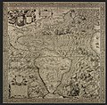
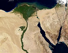
Geography (from Ancient Greek γεωγραφία geōgraphía; combining 'Earth' and gráphō 'write') is the study of the lands, features, inhabitants, and phenomena of Earth. Geography is an all-encompassing discipline that seeks an understanding of Earth and its human and natural complexities—not merely where objects are, but also how they have changed and come to be. While geography is specific to Earth, many concepts can be applied more broadly to other celestial bodies in the field of planetary science. Geography has been called "a bridge between natural science and social science disciplines."

Origins of many of the concepts in geography can be traced to Greek Eratosthenes of Cyrene, who may have coined the term "geographia" (c. 276 BC – c. 195/194 BC). The first recorded use of the word γεωγραφία was as the title of a book by Greek scholar Claudius Ptolemy (100 – 170 AD). This work created the so-called "Ptolemaic tradition" of geography, which included "Ptolemaic cartographic theory." However, the concepts of geography (such as cartography) date back to the earliest attempts to understand the world spatially, with the earliest example of an attempted world map dating to the 9th century BCE in ancient Babylon. The history of geography as a discipline spans cultures and millennia, being independently developed by multiple groups, and cross-pollinated by trade between these groups. The core concepts of geography consistent between all approaches are a focus on space, place, time, and scale.

Today, geography is an extremely broad discipline with multiple approaches and modalities. There have been multiple attempts to organize the discipline, including the four traditions of geography, and into branches. Techniques employed can generally be broken down into quantitative and qualitative approaches, with many studies taking mixed-methods approaches. Common techniques include cartography, remote sensing, interviews, and surveying. (Full article...)

Featured articles are displayed here, which represent some of the best content on English Wikipedia.

  • Image 2 North and west sides of Capon Chapel viewed from the northwest lawn Capon Chapel ( /ˈkeɪpən/ KAY-pən), also historically known as Capon Baptist Chapel and Capon Chapel Church, is a mid-19th century United Methodist church located near to the town of Capon Bridge, West Virginia, in the United States. Capon Chapel is one of the oldest existing log churches in Hampshire County, along with Mount Bethel Church and Old Pine Church. A Baptist congregation was gathering at the site of the present-day church by at least 1756. Primitive Baptist minister John Monroe (1750–1824) is credited for establishing a place of worship at this site; he is interred in the church's cemetery. The land on which Capon Chapel was built originally belonged to William C. Nixon (1789–1869), a member of the Virginia House of Delegates; later, it was transferred to the Pugh family. The first documented mention of a church at the Capon Chapel site was in March 1852, when Joseph Pugh allocated the land to three trustees for the construction of a church and cemetery. (Full article...)

    Capon Chapel ( /ˈkpən/ KAY-pən), also historically known as Capon Baptist Chapel and Capon Chapel Church, is a mid-19th century United Methodist church located near to the town of Capon Bridge, West Virginia, in the United States. Capon Chapel is one of the oldest existing log churches in Hampshire County, along with Mount Bethel Church and Old Pine Church.

    A Baptist congregation was gathering at the site of the present-day church by at least 1756. Primitive Baptist minister John Monroe (1750–1824) is credited for establishing a place of worship at this site; he is interred in the church's cemetery. The land on which Capon Chapel was built originally belonged to William C. Nixon (1789–1869), a member of the Virginia House of Delegates; later, it was transferred to the Pugh family. The first documented mention of a church at the Capon Chapel site was in March 1852, when Joseph Pugh allocated the land to three trustees for the construction of a church and cemetery. (Full article...)
  • Image 3 Cannon decorate the quayside of Balfour Harbour on Shapinsay, the round tower in the background is The Douche Shapinsay (/ˈʃæpɪnziː/, Scots: Shapinsee) is one of the Orkney Islands off the north coast of mainland Scotland. With an area of 29.5 square kilometres (11.4 sq mi), it is the eighth largest island in the Orkney archipelago. It is low-lying and, with a bedrock formed from Old Red Sandstone overlain by boulder clay, fertile, causing most of the area to be used for farming. Shapinsay has two nature reserves and is notable for its bird life. Balfour Castle, built in the Scottish Baronial style, is one of the island's most prominent features, a reminder of the Balfour family's domination of Shapinsay during the 18th and 19th centuries; the Balfours transformed life on the island by introducing new agricultural techniques. Other landmarks include a standing stone, an Iron Age broch, a souterrain and a salt-water shower. There is one village on the island, Balfour, from which roll-on/roll-off car ferries sail to Kirkwall on the Orkney Mainland. At the 2011 census, Shapinsay had a population of 307. The economy of the island is primarily based on agriculture with the exception of a few small businesses that are largely tourism-related. A community-owned wind turbine was constructed in 2011. The island has a primary school but, in part due to improving transport links with mainland Orkney, no longer has a secondary school. Shapinsay's long history has given rise to various folk tales. (Full article...)

    Shapinsay (/ˈʃæpɪnz/, Scots: Shapinsee) is one of the Orkney Islands off the north coast of mainland Scotland. With an area of 29.5 square kilometres (11.4 sq mi), it is the eighth largest island in the Orkney archipelago. It is low-lying and, with a bedrock formed from Old Red Sandstone overlain by boulder clay, fertile, causing most of the area to be used for farming. Shapinsay has two nature reserves and is notable for its bird life. Balfour Castle, built in the Scottish Baronial style, is one of the island's most prominent features, a reminder of the Balfour family's domination of Shapinsay during the 18th and 19th centuries; the Balfours transformed life on the island by introducing new agricultural techniques. Other landmarks include a standing stone, an Iron Age broch, a souterrain and a salt-water shower.

    There is one village on the island, Balfour, from which roll-on/roll-off car ferries sail to Kirkwall on the Orkney Mainland. At the 2011 census, Shapinsay had a population of 307. The economy of the island is primarily based on agriculture with the exception of a few small businesses that are largely tourism-related. A community-owned wind turbine was constructed in 2011. The island has a primary school but, in part due to improving transport links with mainland Orkney, no longer has a secondary school. Shapinsay's long history has given rise to various folk tales. (Full article...)
  • Image 4 Mauna Kea in December 2007, with its seasonal snow cap visible Mauna Kea (/ˌmɔːnə ˈkeɪə, ˌmaʊnə -/, Hawaiian: [ˈmɐwnə ˈkɛjə]; abbreviation for Mauna a Wākea) is dormant shield volcano on the island of Hawaiʻi. Its peak is 4,207.3 m (13,803 ft) above sea level, making it the highest point in Hawaii and the island with the second highest high point, behind New Guinea, the world's largest tropical island with multiple peaks that are higher. The peak is about 38 m (125 ft) higher than Mauna Loa, its more massive neighbor. Mauna Kea is unusually topographically prominent for its height: its prominence from sea level is fifteenth in the world among mountains, at 4,207.3 m (13,803 ft); its prominence from under the ocean is 9,330 m (30,610 ft), rivaled only by Mount Everest. This dry prominence is greater than Everest's height above sea level of 8,848.86 m (29,032 ft), and some authorities have labeled Mauna Kea the tallest mountain in the world, from its underwater base. Mauna Kea is ranked 8th by topographic isolation. It is about one million years old and thus passed the most active shield stage of life hundreds of thousands of years ago. In its current post-shield state, its lava is more viscous, resulting in a steeper profile. Late volcanism has also given it a much rougher appearance than its neighboring volcanoes due to construction of cinder cones, decentralization of its rift zones, glaciation on its peak, and weathering by the prevailing trade winds. Mauna Kea last erupted 6,000 to 4,000 years ago and is now thought to be dormant. (Full article...)

    Mauna Kea (/ˌmɔːnə ˈkə, ˌmnə -/, Hawaiian: [ˈmɐwnə ˈkɛjə]; abbreviation for Mauna a Wākea) is dormant shield volcano on the island of Hawaiʻi. Its peak is 4,207.3 m (13,803 ft) above sea level, making it the highest point in Hawaii and the island with the second highest high point, behind New Guinea, the world's largest tropical island with multiple peaks that are higher. The peak is about 38 m (125 ft) higher than Mauna Loa, its more massive neighbor. Mauna Kea is unusually topographically prominent for its height: its prominence from sea level is fifteenth in the world among mountains, at 4,207.3 m (13,803 ft); its prominence from under the ocean is 9,330 m (30,610 ft), rivaled only by Mount Everest. This dry prominence is greater than Everest's height above sea level of 8,848.86 m (29,032 ft), and some authorities have labeled Mauna Kea the tallest mountain in the world, from its underwater base. Mauna Kea is ranked 8th by topographic isolation.

    It is about one million years old and thus passed the most active shield stage of life hundreds of thousands of years ago. In its current post-shield state, its lava is more viscous, resulting in a steeper profile. Late volcanism has also given it a much rougher appearance than its neighboring volcanoes due to construction of cinder cones, decentralization of its rift zones, glaciation on its peak, and weathering by the prevailing trade winds. Mauna Kea last erupted 6,000 to 4,000 years ago and is now thought to be dormant. (Full article...)
  • Image 5 T5's sister ship, T3, the only significant external difference was that T5 had two funnels T5 was a sea-going torpedo boat operated by the Royal Yugoslav Navy between 1921 and 1941. Originally 87 F, a 250t-class torpedo boat of the Austro-Hungarian Navy built in 1914–1915, she was armed with two 66 mm (2.6 in) guns and four 450 mm (17.7 in) torpedo tubes, and could carry 10–12 naval mines. She saw active service during World War I, performing convoy, patrol, escort and minesweeping tasks, anti-submarine operations and shore bombardment missions. In 1917 the suffixes of all Austro-Hungarian torpedo boats were removed, and thereafter she was referred to as 87. She was part of the escort force for the Austro-Hungarian dreadnought Szent István during the action that resulted in the sinking of that ship by Italian torpedo boats in June 1918, and rescued many of her crew. Following Austria-Hungary's defeat in 1918, 87 was allocated to the Navy of the Kingdom of Serbs, Croats and Slovenes, which later became the Royal Yugoslav Navy, and was renamed T5. At the time, she and the seven other 250t-class boats were the only modern sea-going vessels of the fledgling maritime force. During the interwar period, T5 and the rest of the navy were involved in exercises of training and cruises to friendly ports, but activity was limited by reduced naval budgets. The boat was captured by the Italians during the German-led Axis invasion of Yugoslavia in April 1941. After her main armament was modernised, she served with the Royal Italian Navy under her Yugoslav designation, conducting coastal and second-line escort duties in the Adriatic Sea. Following the Italian capitulation in September 1943, she was returned to the Royal Yugoslav Navy-in-exile and continued serving as T5. At the end of the war, she was transferred to the new Yugoslav Navy and served as Cer in guard ship, patrol ship and training ship roles until she was stricken off the naval register in 1963 and scrapped soon after. (Full article...)

    T5 was a sea-going torpedo boat operated by the Royal Yugoslav Navy between 1921 and 1941. Originally 87 F, a 250t-class torpedo boat of the Austro-Hungarian Navy built in 1914–1915, she was armed with two 66 mm (2.6 in) guns and four 450 mm (17.7 in) torpedo tubes, and could carry 10–12 naval mines. She saw active service during World War I, performing convoy, patrol, escort and minesweeping tasks, anti-submarine operations and shore bombardment missions. In 1917 the suffixes of all Austro-Hungarian torpedo boats were removed, and thereafter she was referred to as 87. She was part of the escort force for the Austro-Hungarian dreadnought Szent István during the action that resulted in the sinking of that ship by Italian torpedo boats in June 1918, and rescued many of her crew.

    Following Austria-Hungary's defeat in 1918, 87 was allocated to the Navy of the Kingdom of Serbs, Croats and Slovenes, which later became the Royal Yugoslav Navy, and was renamed T5. At the time, she and the seven other 250t-class boats were the only modern sea-going vessels of the fledgling maritime force. During the interwar period, T5 and the rest of the navy were involved in exercises of training and cruises to friendly ports, but activity was limited by reduced naval budgets. The boat was captured by the Italians during the German-led Axis invasion of Yugoslavia in April 1941. After her main armament was modernised, she served with the Royal Italian Navy under her Yugoslav designation, conducting coastal and second-line escort duties in the Adriatic Sea. Following the Italian capitulation in September 1943, she was returned to the Royal Yugoslav Navy-in-exile and continued serving as T5. At the end of the war, she was transferred to the new Yugoslav Navy and served as Cer in guard ship, patrol ship and training ship roles until she was stricken off the naval register in 1963 and scrapped soon after. (Full article...)
  • Image 6 Location in Allerdale Keswick (/ˈkɛzɪk/ KEZ-ik) is a market town and civil parish in the Cumberland unitary authority area of Cumbria, England. Historically, until 1974, it was part of the county of Cumberland. It lies within the Lake District National Park, just north of Derwentwater and four miles (six kilometres) from Bassenthwaite Lake. The parish had a population of 5,243 at the 2011 census. There is evidence of prehistoric occupation of the area, but the first recorded mention of the town dates from the 13th century, when Edward I of England granted a charter for Keswick's market, which has maintained a continuous 700-year existence. The town was an important mining area, and from the 18th century has been known as a holiday centre; tourism has been its principal industry for more than 150 years. Its features include the Moot Hall; a modern theatre, the Theatre by the Lake; one of Britain's oldest surviving cinemas, the Alhambra; and the Keswick Museum and Art Gallery in the town's largest open space, Fitz Park. Among the town's annual events is the Keswick Convention, an Evangelical gathering attracting visitors from many countries. (Full article...)

    Keswick (/ˈkɛzɪk/ KEZ-ik) is a market town and civil parish in the Cumberland unitary authority area of Cumbria, England. Historically, until 1974, it was part of the county of Cumberland. It lies within the Lake District National Park, just north of Derwentwater and four miles (six kilometres) from Bassenthwaite Lake. The parish had a population of 5,243 at the 2011 census.

    There is evidence of prehistoric occupation of the area, but the first recorded mention of the town dates from the 13th century, when Edward I of England granted a charter for Keswick's market, which has maintained a continuous 700-year existence. The town was an important mining area, and from the 18th century has been known as a holiday centre; tourism has been its principal industry for more than 150 years. Its features include the Moot Hall; a modern theatre, the Theatre by the Lake; one of Britain's oldest surviving cinemas, the Alhambra; and the Keswick Museum and Art Gallery in the town's largest open space, Fitz Park. Among the town's annual events is the Keswick Convention, an Evangelical gathering attracting visitors from many countries. (Full article...)
  • Image 7 Truman near his lodge in 1980, a few months before his death Harry R. Truman (October 1896 – May 18, 1980) was an American businessman, bootlegger, and prospector. He lived near Mount St. Helens, an active volcano in the state of Washington, and was the owner and caretaker of Mount St. Helens Lodge at Spirit Lake near the base of the mountain. Truman came to fame as a folk hero in the weeks leading up to the volcano's 1980 eruption after refusing to leave his home despite evacuation orders. He was killed by a pyroclastic flow that overtook his lodge and buried the site under 150 ft (46 m) of volcanic debris. After Truman's death, his family and friends reflected on his love for the mountain. In 1981, Art Carney portrayed Truman in the docudrama film St. Helens. He was commemorated in a book by his niece, and also in various pieces of music, including songs by Headgear, Billy Jonas, and Shawn Wright and the Brothers Band. (Full article...)

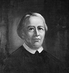
    Harry R. Truman (October 1896 – May 18, 1980) was an American businessman, bootlegger, and prospector. He
    lived near Mount St. Helens, an active volcano in the state of Washington, and was the owner and caretaker of Mount St. Helens Lodge at Spirit Lake near the base of the mountain. Truman came to fame as a folk hero in the weeks leading up to the volcano's 1980 eruption after refusing to leave his home despite evacuation orders. He was killed by a pyroclastic flow that overtook his lodge and buried the site under 150 ft (46 m) of volcanic debris.

    After Truman's death, his family and friends reflected on his love for the mountain. In 1981, Art Carney portrayed Truman in the docudrama film St. Helens. He was commemorated in a book by his niece, and also in various pieces of music, including songs by Headgear, Billy Jonas, and Shawn Wright and the Brothers Band. (Full article...)
  • Image 8 Southern right whale breaching Right whales are three species of large baleen whales of the genus Eubalaena: the North Atlantic right whale (E. glacialis), the North Pacific right whale (E. japonica) and the Southern right whale (E. australis). They are classified in the family Balaenidae with the bowhead whale. Right whales have rotund bodies with arching rostrums, V-shaped blowholes and dark gray or black skin. The most distinguishing feature of a right whale is the rough patches of skin on its head, which appear white due to parasitism by whale lice. Right whales are typically 13–17 m (43–56 ft) long and weigh up to 100 short tons (91 t; 89 long tons) or more. All three species are migratory, moving seasonally to feed or give birth. The warm equatorial waters form a barrier that isolates the northern and southern species from one another although the southern species, at least, has been known to cross the equator. In the Northern Hemisphere, right whales tend to avoid open waters and stay close to peninsulas and bays and on continental shelves, as these areas offer greater shelter and an abundance of their preferred foods. In the Southern Hemisphere, right whales feed far offshore in summer, but a large portion of the population occur in near-shore waters in winter. Right whales feed mainly on copepods but also consume krill and pteropods. They may forage the surface, underwater or even the ocean bottom. During courtship, males gather into large groups to compete for a single female, suggesting that sperm competition is an important factor in mating behavior. Gestation tends to last a year, and calves are weaned at eight months old. (Full article...)

    Right whales are three species of large baleen whales of the genus Eubalaena: the North Atlantic right whale (E. glacialis), the North Pacific right whale (E. japonica) and the Southern right whale (E. australis). They are classified in the family Balaenidae with the bowhead whale. Right whales have rotund bodies with arching rostrums, V-shaped blowholes and dark gray or black skin. The most distinguishing feature of a right whale is the rough patches of skin on its head, which appear white due to parasitism by whale lice. Right whales are typically 13–17 m (43–56 ft) long and weigh up to 100 short tons (91 t; 89 long tons) or more.

    All three species are migratory, moving seasonally to feed or give birth. The warm equatorial waters form a barrier that isolates the northern and southern species from one another although the southern species, at least, has been known to cross the equator. In the Northern Hemisphere, right whales tend to avoid open waters and stay close to peninsulas and bays and on continental shelves, as these areas offer greater shelter and an abundance of their preferred foods. In the Southern Hemisphere, right whales feed far offshore in summer, but a large portion of the population occur in near-shore waters in winter. Right whales feed mainly on copepods but also consume krill and pteropods. They may forage the surface, underwater or even the ocean bottom. During courtship, males gather into large groups to compete for a single female, suggesting that sperm competition is an important factor in mating behavior. Gestation tends to last a year, and calves are weaned at eight months old. (Full article...)
  • Image 9 Rogue River from Hellgate Canyon The Rogue River (Tolowa: yan-shuu-chit’ taa-ghii~-li~’, Takelma: tak-elam) in southwestern Oregon in the United States flows about 215 miles (346 km) in a generally westward direction from the Cascade Range to the Pacific Ocean. Known for its salmon runs, whitewater rafting, and rugged scenery, it was one of the original eight rivers named in the Wild and Scenic Rivers Act of 1968. Beginning near Crater Lake, which occupies the caldera left by the explosive volcanic eruption and collapse of Mount Mazama, the river flows through the geologically young High Cascades and the older Western Cascades, another volcanic province. Further west, the river passes through multiple exotic terranes of the more ancient Klamath Mountains. In the Kalmiopsis Wilderness section of the Rogue basin are some of the world's best examples of rocks that form the Earth's mantle. Near the mouth of the river, the only dinosaur fragments ever discovered in Oregon were found in the Otter Point Formation, along the coast of Curry County. People have lived along the Rogue River and its tributaries for at least 8,500 years. European explorers made first contact with Native Americans (Indians) toward the end of the 18th century and began beaver trapping and other activities in the region. Clashes, sometimes deadly, occurred between the natives and the trappers and later between the natives and European-American miners and settlers. These struggles culminated with the Rogue River Wars of 1855–56 and removal of most of the natives to reservations outside the basin. After the war, settlers expanded into remote areas of the watershed and established small farms along the river between Grave Creek and the mouth of the Illinois River. They were relatively isolated from the outside world until 1895, when the Post Office Department added mail boat service along the lower Rogue. As of 2010, the Rogue has one of the two remaining rural mail-boat routes in the United States. (Full article...)
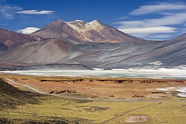
    The Rogue River (Tolowa: yan-shuu-chit’ taa-ghii~-li~’, Takelma: tak-elam) in southwestern Oregon in the United States flows about 215 miles (346 km) in a generally westward direction from the Cascade Range to the Pacific Ocean. Known for its salmon runs, whitewater rafting, and rugged scenery, it was one of the original eight rivers named in the Wild and Scenic Rivers Act of 1968. Beginning near Crater Lake, which occupies the caldera left by the explosive volcanic eruption and collapse of Mount Mazama, the river flows through the geologically young High Cascades and the older Western Cascades, another volcanic province. Further west, the river passes through multiple exotic terranes of the more ancient Klamath Mountains. In the Kalmiopsis Wilderness section of the Rogue basin are some of the world's best examples of rocks that form the Earth's mantle. Near the mouth of the river, the only dinosaur fragments ever discovered in Oregon were found in the Otter Point Formation, along the coast of Curry County.

    People have lived along the Rogue River and its tributaries for at least 8,500 years. European explorers made first contact with Native Americans (Indians) toward the end of the 18th century and began beaver trapping and other activities in the region. Clashes, sometimes deadly, occurred between the natives and the trappers and later between the natives and European-American miners and settlers. These struggles culminated with the Rogue River Wars of 1855–56 and removal of most of the natives to reservations outside the basin. After the war, settlers expanded into remote areas of the watershed and established small farms along the river between Grave Creek and the mouth of the Illinois River. They were relatively isolated from the outside world until 1895, when the Post Office Department added mail boat service along the lower Rogue. As of 2010, the Rogue has one of the two remaining rural mail-boat routes in the United States. (Full article...)
  • Image 10 Fanno Creek in Greenway Park, Beaverton Fanno Creek is a 15-mile (24 km) tributary of the Tualatin River in the U.S. state of Oregon. Part of the drainage basin of the Columbia River, its watershed covers about 32 square miles (83 km2) in Multnomah, Washington, and Clackamas counties, including about 7 square miles (18 km2) within the Portland city limits. From its headwaters in the Tualatin Mountains (West Hills) in southwest Portland, the creek flows generally west and south through the cities of Portland, Beaverton, Tigard and Durham, and unincorporated areas of Washington County. It enters the Tualatin River about 9 miles (14 km) above the Tualatin's confluence with the Willamette River at West Linn. (Full article...)

    Fanno Creek is a 15-mile (24 km) tributary of the Tualatin River in the U.S. state of Oregon. Part of the drainage basin of the Columbia River, its watershed covers about 32 square miles (83 km) in Multnomah, Washington, and Clackamas counties, including about 7 square miles (18 km) within the Portland city limits.

    From its headwaters in the Tualatin Mountains (West Hills) in southwest Portland, the creek flows generally west and south through the cities of Portland, Beaverton, Tigard and Durham, and unincorporated areas of Washington County. It enters the Tualatin River about 9 miles (14 km) above the Tualatin's confluence with the Willamette River at West Linn. (Full article...)
  • Image 11 Portrait by Ferdinand Krumholz, 1850 Dom Pedro Afonso (19 July 1848 – 10 January 1850) was the Prince Imperial and heir apparent to the throne of the Empire of Brazil. Born at the Palace of São Cristóvão in Rio de Janeiro, he was the second son and youngest child of Emperor Dom Pedro II and Dona Teresa Cristina of the Two Sicilies, and thus a member of the Brazilian branch of the House of Braganza. Pedro Afonso was seen as vital to the future viability of the monarchy, which had been put in jeopardy by the death of his older brother Dom Afonso almost three years earlier. Pedro Afonso's death from fever at the age of one devastated the Emperor, and the imperial couple had no further children. Pedro Afonso's older sister Dona Isabel became heiress, but Pedro II was unconvinced that a woman could ever be accepted as monarch by the ruling elite. He excluded Isabel from matters of state and failed to provide training for her possible role as empress. With no surviving male children, the Emperor came to understand that the imperial line was destined to end with his own death. (Full article...)

    Dom Pedro Afonso (19 July 1848 – 10 January 1850) was the Prince Imperial and heir apparent to the throne of the Empire of Brazil. Born at the Palace of São Cristóvão in Rio de Janeiro, he was the second son and youngest child of Emperor Dom Pedro II and Dona Teresa Cristina of the Two Sicilies, and thus a member of the Brazilian branch of the House of Braganza. Pedro Afonso was seen as vital to the future viability of the monarchy, which had been put in jeopardy by the death of his older brother Dom Afonso almost three years earlier.

    Pedro Afonso's death from fever at the age of one devastated the Emperor, and the imperial couple had no further children. Pedro Afonso's older sister Dona Isabel became heiress, but Pedro II was unconvinced that a woman could ever be accepted as monarch by the ruling elite. He excluded Isabel from matters of state and failed to provide training for her possible role as empress. With no surviving male children, the Emperor came to understand that the imperial line was destined to end with his own death. (Full article...)
  • Image 12 William Feiner SJ (born Wilhelm Feiner; December 27, 1792 – June 9, 1829) was a German Catholic priest and Jesuit who became a missionary to the United States and eventually the president of Georgetown College, now known as Georgetown University. Born in Münster, he taught in Jesuit schools in the Russian Empire and Polish Galicia as a young member of the Society of Jesus. He then emigrated to the United States several years after the restoration of the Society, taking up pastoral work and teaching theology in Conewago, Pennsylvania, before becoming a full-time professor at Georgetown College. There, he also became the second dedicated librarian of Georgetown's library. Eventually, Feiner became president of the college in 1826. While president, he taught theology at Georgetown and ministered to the congregation at Holy Trinity Church. (Full article...)
    William Feiner SJ (born Wilhelm Feiner; December 27, 1792 – June 9, 1829) was a German Catholic priest and Jesuit who became a missionary to the United States and eventually the president of Georgetown College, now known as Georgetown University.

    Born in Münster, he taught in Jesuit schools in the Russian Empire and Polish Galicia as a young member of the Society of Jesus. He then emigrated to the United States several years after the restoration of the Society, taking up pastoral work and teaching theology in Conewago, Pennsylvania, before becoming a full-time professor at Georgetown College. There, he also became the second dedicated librarian of Georgetown's library. Eventually, Feiner became president of the college in 1826. While president, he taught theology at Georgetown and ministered to the congregation at Holy Trinity Church. (Full article...)
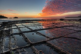
  • Image 13 Darjeeling (/dɑːrˈdʒiːlɪŋ/, Bengali: [ˈdarˌdʒiliŋ], Nepali: [ˈdard͡ziliŋ]) is a city in the northernmost region of the Indian state of West Bengal. Located in the Eastern Himalayas, it has an average elevation of 2,045 metres (6,709 ft). To the west of Darjeeling lies the easternmost province of Nepal, to the east the Kingdom of Bhutan, to the north the Indian state of Sikkim, and farther north the Tibet Autonomous Region region of China. Bangladesh lies to the south and southeast, and most of the state of West Bengal lies to the south and southwest, connected to the Darjeeling region by a narrow tract. Kangchenjunga, the world's third-highest mountain, rises to the north and is prominently visible on clear days. In the early 19th century, during East India Company rule in India, Darjeeling was identified as a potential summer retreat for British officials, soldiers and their families. The narrow mountain ridge was leased from the Kingdom of Sikkim, and eventually annexed to British India. Experimentation with growing tea on the slopes below Darjeeling was highly successful. Thousands of labourers were recruited chiefly from Nepal to clear the forests, build European-style cottages and work in the tea plantations. The widespread deforestation displaced the indigenous peoples. Residential schools were established in and around Darjeeling for the education of children of the domiciled British in India. By the late-19th century, a novel narrow-gauge mountain railway, the Darjeeling Himalayan Railway, was bringing summer residents into the town and carrying a freight of tea out for export to the world. After India's independence in 1947, as the British left Darjeeling, its cottages were purchased by wealthy Indians from the plains and its tea plantations by out-of-town Indian business owners and conglomerates. (Full article...)

    Darjeeling (/dɑːrˈlɪŋ/, Bengali: [ˈdarˌdʒiliŋ], Nepali: [ˈdard͡ziliŋ]) is a city in the northernmost region of the Indian state of West Bengal. Located in the Eastern Himalayas, it has an average elevation of 2,045 metres (6,709 ft). To the west of Darjeeling lies the easternmost province of Nepal, to the east the Kingdom of Bhutan, to the north the Indian state of Sikkim, and farther north the Tibet Autonomous Region region of China. Bangladesh lies to the south and southeast, and most of the state of West Bengal lies to the south and southwest, connected to the Darjeeling region by a narrow tract. Kangchenjunga, the world's third-highest mountain, rises to the north and is prominently visible on clear days.

    In the early 19th century, during East India Company rule in India, Darjeeling was identified as a potential summer retreat for British officials, soldiers and their families. The narrow mountain ridge was leased from the Kingdom of Sikkim, and eventually annexed to British India. Experimentation with growing tea on the slopes below Darjeeling was highly successful. Thousands of labourers were recruited chiefly from Nepal to clear the forests, build European-style cottages and work in the tea plantations. The widespread deforestation displaced the indigenous peoples. Residential schools were established in and around Darjeeling for the education of children of the domiciled British in India. By the late-19th century, a novel narrow-gauge mountain railway, the Darjeeling Himalayan Railway, was bringing summer residents into the town and carrying a freight of tea out for export to the world. After India's independence in 1947, as the British left Darjeeling, its cottages were purchased by wealthy Indians from the plains and its tea plantations by out-of-town Indian business owners and conglomerates. (Full article...)
  • Image 14 A gold half stater of Philip II of Macedon produced at the government mint of Pella, bearing the head of a young Heracles wearing the Nemean Lion's skin on the obverse and on the reverse the lion's forepart The first government of ancient Macedonia was established by the Argead dynasty of Macedonian kings during the Archaic period (8th–5th centuries BC). The early history of the ancient kingdom of Macedonia is obscure because of shortcomings in the historical record; little is known of governmental institutions before the reign of Philip II during the late Classical period (480–336 BC). These bureaucratic organizations evolved in complexity under his successor Alexander the Great and the subsequent Antipatrid and Antigonid dynasties of Hellenistic Greece (336–146 BC). Following the Roman victory in the Third Macedonian War over Perseus of Macedon in 168 BC, the Macedonian monarchy was abolished and replaced by four client state republics. After a brief revival of the monarchy in 150–148 BC, the Fourth Macedonian War resulted in another Roman victory and the establishment of the Roman province of Macedonia. It is unclear if there was a formally established constitution dictating the laws, organization, and divisions of power in ancient Macedonia's government, although some tangential evidence suggests this. The king (basileus) served as the head of state and was assisted by his noble companions and royal pages. Kings served as the chief judges of the kingdom, although little is known about Macedonia's judiciary. The kings were also expected to serve as high priests of the nation, using their wealth to sponsor various religious cults. The Macedonian kings had command over certain natural resources such as gold from mining and timber from logging. The right to mint gold, silver, and bronze coins was shared by the central and local governments. (Full article...)
    Two sides of a gold coin, with the obverse (left) showing a profile of Philip II wearing a lion skin, and the reverse (right) depicting a lion's forepart.
    A gold half stater of Philip II of Macedon produced at the government mint of Pella, bearing the head of a young Heracles wearing the Nemean Lion's skin on the obverse and on the reverse the lion's forepart


    The first government of ancient Macedonia was established by the Argead dynasty of Macedonian kings during the Archaic period (8th–5th centuries BC). The early history of the ancient kingdom of Macedonia is obscure because of shortcomings in the historical record; little is known of governmental institutions before the reign of Philip II during the late Classical period (480–336 BC). These bureaucratic organizations evolved in complexity under his successor Alexander the Great and the subsequent Antipatrid and Antigonid dynasties of Hellenistic Greece (336–146 BC). Following the Roman victory in the Third Macedonian War over Perseus of Macedon in 168 BC, the Macedonian monarchy was abolished and replaced by four client state republics. After a brief revival of the monarchy in 150–148 BC, the Fourth Macedonian War resulted in another Roman victory and the establishment of the Roman province of Macedonia.

    It is unclear if there was a formally established constitution dictating the laws, organization, and divisions of power in ancient Macedonia's government, although some tangential evidence suggests this. The king (basileus) served as the head of state and was assisted by his noble companions and royal pages. Kings served as the chief judges of the kingdom, although little is known about Macedonia's judiciary. The kings were also expected to serve as high priests of the nation, using their wealth to sponsor various religious cults. The Macedonian kings had command over certain natural resources such as gold from mining and timber from logging. The right to mint gold, silver, and bronze coins was shared by the central and local governments. (Full article...)
  • Image 15 Crean on the Endurance Expedition, February 1915 Thomas Crean (Irish: Tomás Ó Cuirín; c. 16 February 1877 – 27 July 1938) was an Irish seaman and Antarctic explorer who was awarded the Albert Medal for Lifesaving (AM). Crean was a member of three major expeditions to Antarctica during the Heroic Age of Antarctic Exploration, including Robert Falcon Scott's 1911–1913 Terra Nova Expedition. This saw the race to reach the South Pole lost to Roald Amundsen and ended in the deaths of Scott and his party. During the expedition, Crean's 35-statute-mile (56 km) solo walk across the Ross Ice Shelf to save the life of Edward Evans led to him receiving the Albert Medal. (Full article...)
    Thomas Crean (Irish: Tomás Ó Cuirín; c. 16 February 1877 – 27 July 1938) was an Irish seaman and Antarctic explorer who was awarded the Albert Medal for Lifesaving (AM).

    Crean was a member of three major expeditions to Antarctica during the Heroic Age of Antarctic Exploration, including Robert Falcon Scott's 1911–1913 Terra Nova Expedition. This saw the race to reach the South Pole lost to Roald Amundsen and ended in the deaths of Scott and his party. During the expedition, Crean's 35-statute-mile (56 km) solo walk across the Ross Ice Shelf to save the life of Edward Evans led to him receiving the Albert Medal. (Full article...)
  • More featured articles

    Vital articles Vital article

    Vital articles to understand Geography.

    A grassy isthmus running between two bodies of water.
    Land between bodies of water at Point Reyes National Seashore, California
    Land, also known as dry land, ground, or earth, is the solid terrestrial surface of Earth not submerged by the ocean or another body of water. It makes up 29.2% of Earth's surface and includes all continents and islands. Earth's land surface is almost entirely covered by regolith, a layer of rock, soil, and minerals that forms the outer part of the crust. Land plays an important role in Earth's climate system, being involved in the carbon cycle, nitrogen cycle, and water cycle. One-third of land is covered in trees, another third is used for agriculture, and one-tenth is covered in permanent snow and glaciers. The remainder consists of desert, savannah, and prairie. (Full article...)
    Other vital articles

    Get involved

    For editor resources and to collaborate with other editors on improving Wikipedia's Geography-related articles, visit WikiProject Geography.


    Here are some tasks awaiting attention:

    Selected pictures

    Featured biography articles in geography

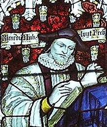
    Richard Hakluyt (/ˈhæklʊt, ˈhæklət, ˈhækəlwɪt/; 1553 – 23 November 1616) was an English writer. He is known for promoting the English colonization of North America through his works, notably Divers Voyages Touching the Discoverie of America (1582) and The Principal Navigations, Voyages, Traffiques and Discoveries of the English Nation (1589–1600).

    Hakluyt was educated at Westminster School and Christ Church, Oxford. Between 1583 and 1588 he was chaplain and secretary to Sir Edward Stafford, English ambassador at the French court. An ordained priest, Hakluyt held important positions at Bristol Cathedral and Westminster Abbey and was personal chaplain to Robert Cecil, 1st Earl of Salisbury, principal Secretary of State to Elizabeth I and James I. He was the chief promoter of a petition to James I for letters patent to colonize Virginia, which were granted to the London Company and Plymouth Company (referred to collectively as the Virginia Company) in 1606. The Hakluyt Society, which publishes scholarly editions of primary records of voyages and travels, was named after him in its 1846 formation. (Full article...)
    More featured biographies

    Did you know

    Did you know it about Geography?

    Places around you

    You can read about interesting Wikipedia articles about places around you.

    Special:Nearby

    This following Geography-related articles is a most visited articles of WikiProject Geography, See complete list at Wikipedia:WikiProject Geography/Popular pages.

  • Image 4 Generation X (often shortened to Gen X) is the demographic cohort following the Baby Boomers and preceding Millennials. Researchers and popular media often use the mid-1960s as its starting birth years and the late 1970s as its ending birth years, with the generation being generally defined as people born from 1965 to 1980. By this definition and U.S. Census data, there are 65.2 million Gen Xers in the United States as of 2019. Most of Generation X are the children of the Silent Generation and early Baby Boomers; Xers are also often the parents of Millennials and Generation Z. (Full article...)
    Generation X (often shortened to Gen X) is the demographic cohort following the Baby Boomers and preceding Millennials. Researchers and popular media often use the mid-1960s as its starting birth years and the late 1970s as its ending birth years, with the generation being generally defined as people born from 1965 to 1980. By this definition and U.S. Census data, there are 65.2 million Gen Xers in the United States as of 2019. Most of Generation X are the children of the Silent Generation and early Baby Boomers; Xers are also often the parents of Millennials and Generation Z. (Full article...)
  • Image 5 Cartogram of the world's population in 2018; each square represents 500,000 people. This is a list of countries and dependencies by population. It includes sovereign states, inhabited dependent territories and, in some cases, constituent countries of sovereign states, with inclusion within the list being primarily based on the ISO standard ISO 3166-1. For instance, the United Kingdom is considered a single entity, while the constituent countries of the Kingdom of the Netherlands are considered separately. In addition, this list includes certain states with limited recognition not found in ISO 3166-1. Also given in a percentage is each country's population compared with the world population, which the United Nations estimates at 8.13 billion as of 2024. (Full article...)
    Cartogram of the world's population in 2018; each square represents 500,000 people.


    This is a list of countries and dependencies by population. It includes sovereign states, inhabited dependent territories and, in some cases, constituent countries of sovereign states, with inclusion within the list being primarily based on the ISO standard ISO 3166-1. For instance, the United Kingdom is considered a single entity, while the constituent countries of the Kingdom of the Netherlands are considered separately. In addition, this list includes certain states with limited recognition not found in ISO 3166-1. Also given in a percentage is each country's population compared with the world population, which the United Nations estimates at 8.13 billion as of 2024. (Full article...)
  • Image 6 Hong Kong is a special administrative region of the People's Republic of China. With 7.4 million residents of various nationalities in a 1,104-square-kilometre (426 sq mi) territory, Hong Kong is the fourth most densely populated region in the world. (Full article...)

    Hong Kong is a special administrative region of the People's Republic of China. With 7.4 million residents of various nationalities in a 1,104-square-kilometre (426 sq mi) territory, Hong Kong is the fourth most densely populated region in the world. (Full article...)
  • Image 7 Millennials, also known as Generation Y or Gen Y, are the demographic cohort following Generation X and preceding Generation Z. Researchers and popular media use the early 1980s as starting birth years and the mid-1990s to early 2000s as ending birth years, with the generation typically being defined as people born from 1981 to 1996. Most Millennials are the children of Baby Boomers and older Generation X. In turn Millennials are often the parents of Generation Alpha. (Full article...)
    Millennials, also known as Generation Y or Gen Y, are the demographic cohort following Generation X and preceding Generation Z. Researchers and popular media use the early 1980s as starting birth years and the mid-1990s to early 2000s as ending birth years, with the generation typically being defined as people born from 1981 to 1996. Most Millennials are the children of Baby Boomers and older Generation X. In turn Millennials are often the parents of Generation Alpha. (Full article...)
  • Image 8 England is a country that is part of the United Kingdom. It is located on the island of Great Britain, of which it covers approximately 62%, and over 100 smaller adjacent islands. It has land borders with Scotland to the north and Wales to the west, and is otherwise surrounded by the North Sea to the east, the English Channel to the south, the Celtic Sea to the south-west, and the Irish Sea to the west. Continental Europe lies to the south-east, and Ireland to the west. At the 2021 census, the population was 56,490,048. London is both the largest city and the capital. (Full article...)

    England is a country that is part of the United Kingdom. It is located on the island of Great Britain, of which it covers approximately 62%, and over 100 smaller adjacent islands. It has land borders with Scotland to the north and Wales to the west, and is otherwise surrounded by the North Sea to the east, the English Channel to the south, the Celtic Sea to the south-west, and the Irish Sea to the west. Continental Europe lies to the south-east, and Ireland to the west. At the 2021 census, the population was 56,490,048. London is both the largest city and the capital. (Full article...)
  • Image 9 Generation Alpha (often shortened to Gen Alpha) is the demographic cohort succeeding Generation Z. Researchers and popular media use the early 2010s as starting birth years to the mid-2020s as the ending birth years (see § Date and age range definitions). Named after alpha, the first letter in the Greek alphabet, Generation Alpha is the first to be born entirely in the 21st century and the third millennium. Most members of Generation Alpha are the children of Millennials. (Full article...)
    Generation Alpha (often shortened to Gen Alpha) is the demographic cohort succeeding Generation Z. Researchers and popular media use the early 2010s as starting birth years to the mid-2020s as the ending birth years (see § Date and age range definitions). Named after alpha, the first letter in the Greek alphabet, Generation Alpha is the first to be born entirely in the 21st century and the third millennium. Most members of Generation Alpha are the children of Millennials. (Full article...)
  • Image 10 Dymaxion map of the world with the 30 largest countries and territories by area This is a list of the world's countries and their dependencies by land, water, and total area, ranked by total area. (Full article...)
    Dymaxion map of the world with the 30 largest countries and territories by area

    This is a list of the world's countries and their dependencies by land, water, and total area, ranked by total area. (Full article...)
  • Click to enlarge and view description.

    Main articles

    CategoriesCategories

    Select [►] to view subcategories.

    Associated Wikimedia

    The following Wikimedia Foundation sister projects provide more on this subject:

    Discover Wikipedia using portals
    Retrieved from "https://en.wikipedia.org/w/index.php?title=Portal:Geography&oldid=1202464975"