Portal:Geography
The Geography Portal

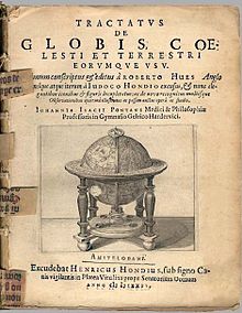
Geography (from Ancient Greek γεωγραφία geōgraphía; combining gê 'Earth' and gráphō 'write') is the study of the lands, features, inhabitants, and phenomena of Earth. Geography is an all-encompassing discipline that seeks an understanding of Earth and its human and natural complexities—not merely where objects are, but also how they have changed and come to be. While geography is specific to Earth, many concepts can be applied more broadly to other celestial bodies in the field of planetary science. Geography has been called "a bridge between natural science and social science disciplines."
Origins of many of the concepts in geography can be traced to Greek Eratosthenes of Cyrene, who may have coined the term "geographia" (c. 276 BC – c. 195/194 BC). The first recorded use of the word γεωγραφία was as the title of a book by Greek scholar Claudius Ptolemy (100 – 170 AD). This work created the so-called "Ptolemaic tradition" of geography, which included "Ptolemaic cartographic theory." However, the concepts of geography (such as cartography) date back to the earliest attempts to understand the world spatially, with the earliest example of an attempted world map dating to the 9th century BCE in ancient Babylon. The history of geography as a discipline spans cultures and millennia, being independently developed by multiple groups, and cross-pollinated by trade between these groups. The core concepts of geography consistent between all approaches are a focus on space, place, time, and scale.
Today, geography is an extremely broad discipline with multiple approaches and modalities. There have been multiple attempts to organize the discipline, including the four traditions of geography, and into branches. Techniques employed can generally be broken down into quantitative and qualitative approaches, with many studies taking mixed-methods approaches. Common techniques include cartography, remote sensing, interviews, and surveying. (Full article...)
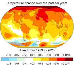
Present-day climate change includes both global warming—the ongoing increase in global average temperature—and its wider effects on Earth's climate. Climate change in a broader sense also includes previous long-term changes to Earth's climate. The current rise in global temperatures is driven by human activities, especially fossil fuel burning since the Industrial Revolution. Fossil fuel use, deforestation, and some agricultural and industrial practices release greenhouse gases. These gases absorb some of the heat that the Earth radiates after it warms from sunlight, warming the lower atmosphere. Carbon dioxide, the primary greenhouse gas driving global warming, has grown by about 50% and is at levels unseen for millions of years.
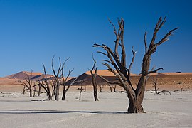
Climate change has an increasingly large impact on the environment. Deserts are expanding, while heat waves and wildfires are becoming more common. Amplified warming in the Arctic has contributed to thawing permafrost, retreat of glaciers and sea ice decline. Higher temperatures are also causing more intense storms, droughts, and other weather extremes. Rapid environmental change in mountains, coral reefs, and the Arctic is forcing many species to relocate or become extinct. Even if efforts to minimize future warming are successful, some effects will continue for centuries. These include ocean heating, ocean acidification and sea level rise. (Full article...)
Alien vs. Predator was theatrically released on 12 August 2004. It received generally negative reviews and grossed $177.4 million worldwide against a production budget of $60–70 million. A direct sequel, Aliens vs. Predator: Requiem, was released in 2007. (Full article...)
Lock Haven is the county seat of Clinton County, in the U.S. state of Pennsylvania. Located near the confluence of the West Branch Susquehanna River and Bald Eagle Creek, it is the principal city of the Lock Haven Micropolitan Statistical Area, itself part of the Williamsport–Lock Haven combined statistical area. At the 2020 census, Lock Haven's population was 8,108.
Built on a site long favored by pre-Columbian peoples, Lock Haven began in 1833 as a timber town and a haven for loggers, boatmen, and other travelers on the river or the West Branch Canal. Resource extraction and efficient transportation financed much of the city's growth through the end of the 19th century. In the 20th century, a light-aircraft factory, a college, and a paper mill, along with many smaller enterprises, drove the economy. Frequent floods, especially in 1972, damaged local industry and led to a high rate of unemployment in the 1980s. (Full article...)

The Scottish National Antarctic Expedition (SNAE), 1902–1904, was organised and led by William Speirs Bruce, a natural scientist and former medical student from the University of Edinburgh. Although overshadowed in terms of prestige by Robert Falcon Scott's concurrent Discovery Expedition, the SNAE completed a full programme of exploration and scientific work. Its achievements included the establishment of a staffed meteorological station, the first in Antarctic territory, and the discovery of new land to the east of the Weddell Sea. Its large collection of biological and geological specimens, together with those from Bruce's earlier travels, led to the establishment of the Scottish Oceanographical Laboratory in 1906.
Bruce had spent most of the 1890s engaged on expeditions to the Antarctic and Arctic regions, and by 1899 was Britain's most experienced polar scientist. In March of that year, he applied to join the Discovery Expedition; however, his proposal to extend that expedition's field of work into the Weddell Sea quadrant, using a second ship, was dismissed as "mischievous rivalry" by Royal Geographical Society (RGS) president Sir Clements Markham. Bruce reacted by obtaining independent finance; his venture was supported and promoted by the Royal Scottish Geographical Society. (Full article...)
Payún Matrú is a shield volcano in the Reserva Provincial La Payunia of the Malargüe Department, south of the Mendoza Province in Argentina. It lies in the back-arc region of the Andean Volcanic Belt, and was formed by the subduction of the Nazca Plate beneath the South American Plate. Payún Matrú, along with the Llancanelo, Nevado and Salado Basin volcanic fields, form the Payenia province. It has been proposed as a World Heritage Site since 2011.
Payún Matrú developed on sediment and volcanic rocks ageing from the Mesoproterozoic to the Tertiary periods. It consists of a large shield volcano capped by a caldera, formed during a major eruption between 168,000 and 82,000 years ago, a high compound volcano (known as Payun or Payun Liso), and two groups of scoria cones and lava flows. The Pleistocene Pampas Onduladas lava flow reaches a length of 167–181 km (104–112 mi) and is the world's longest Quaternary lava flow. (Full article...)

Brownhills is a historic market and industrial town in the Metropolitan Borough of Walsall of the West Midlands, England. The town is located south of Cannock Chase and close to the large Chasewater reservoir, it is 6 miles (9.7 km) northeast of Walsall, a similar distance southwest of Lichfield and 13 miles (20.9 km) miles north-northwest of Birmingham. It is part of the Aldridge-Brownhills parliamentary constituency and neighbours the village of Pelsall and the suburban area of Walsall Wood. It lies within the boundaries of the historic county of Staffordshire.
The town lies close to the route of the ancient Watling Street, and although there is no record of its existence before the 17th century, Ogley Hay – a district of the town today – is recorded as a settlement in the Domesday Book. Brownhills quickly grew around the coal-mining industry, especially after the town became linked to the canal and railway networks in the mid-19th century. By the end of the century, Brownhills had grown from a hamlet of only 300 inhabitants to a town of more than 13,000, of whom the vast majority were employed in the coal industry. Mining remained the town's principal industry until the 1950s; the subsequent closure of the pits led to a severe economic decline that has continued until now. The local authority instituted a regeneration programme in 2007, which was hoped would revive the town's fortunes, but there has been little subsequent development. (Full article...)

The Nimrod Expedition of 1907–1909, otherwise known as the British Antarctic Expedition, was the first of three expeditions to the Antarctic led by Ernest Shackleton and his second time to the Continent. Its main target, among a range of geographical and scientific objectives, was to be first to reach the South Pole. This was not attained, but the expedition's southern march reached a Farthest South latitude of 88° 23' S, just 97.5 nautical miles (180.6 km; 112.2 mi) from the pole. This was by far the longest southern polar journey to that date and a record convergence on either Pole. A separate group led by Welsh Australian geology professor Edgeworth David reached the estimated location of the South magnetic pole, and the expedition also achieved the first ascent of Mount Erebus, Antarctica's second highest volcano.
The expedition lacked governmental or institutional support, and relied on private loans and individual contributions. It was beset by financial problems and its preparations were hurried. Its ship, Nimrod, was less than half of the size of Robert Falcon Scott's 1901–1904 expedition ship Discovery, and Shackleton's crew lacked relevant experience. Controversy arose from Shackleton's decision to base the expedition in McMurdo Sound, close to Scott's old headquarters, in contravention of a promise to Scott that he would not do so. Nevertheless, although the expedition's profile was initially much lower than that of Scott's six years earlier, its achievements attracted widespread interest and made Shackleton a national hero. The scientific team, which included the future Australasian Antarctic Expedition leader Douglas Mawson, carried out extensive geological, zoological and meteorological work. Shackleton's transport arrangements, based on Manchurian ponies, motor traction, and sled dogs, were innovations which, despite limited success, were later copied by Scott for his ill-fated Terra Nova Expedition. (Full article...)

Kent is a city in the U.S. state of Ohio and the largest city in Portage County. It is located along the Cuyahoga River in Northeast Ohio on the western edge of the county. The population was 28,215 at the 2020 Census. The city is counted as part of the Akron metropolitan area and the larger Cleveland–Akron–Canton combined statistical area.
Part of the Connecticut Western Reserve, Kent was settled in 1805 and was known for many years as Franklin Mills. Settlers were attracted to the area due to its location along the Cuyahoga River as a place for water-powered mills. Later development came in the 1830s and 1840s as a result of the settlement's position along the route of the Pennsylvania and Ohio Canal. Leading up to the American Civil War, Franklin Mills was noted for its activity in the Underground Railroad. With the decline of the canal and the emergence of the railroad, the town became the home of the Atlantic and Great Western Railroad maintenance shops through the influence of Marvin Kent. In 1864 the town was renamed Kent in honor of and in gratitude for Marvin Kent's efforts. It was incorporated as a village in 1867 and became a city after the 1920 Census. Today Kent is a college town best known as the home of the main campus of Kent State University, founded in 1910, and as the site of the May 4, 1970 Kent State shootings. (Full article...)
Holkham National Nature Reserve is England's largest national nature reserve (NNR). It is on the Norfolk coast between Burnham Overy Staithe and Blakeney, and is managed by Natural England with the cooperation of the Holkham Estate. Its 3,900 hectares (9,600 acres) comprise a wide range of habitats, including grazing marsh, woodland, salt marsh, sand dunes and foreshore. The reserve is part of the North Norfolk Coast Site of Special Scientific Interest, and the larger area is additionally protected through Natura 2000, Special Protection Area (SPA) and Ramsar listings, and is part of both an Area of Outstanding Natural Beauty (AONB) and a World Biosphere Reserve. Holkham NNR is important for its wintering wildfowl, especially pink-footed geese, Eurasian wigeon and brant geese, but it also has breeding waders, and attracts many migrating birds in autumn. Many scarce invertebrates and plants can be found in the dunes, and the reserve is one of the only two sites in the UK to have an antlion colony.
This stretch of coast originally consisted of salt marshes protected from the sea by ridges of shingle and sand, and Holkham's Iron Age fort stood at the end of a sandy spit surrounded by the tidal wetland. The Vikings navigated the creeks to establish Holkham village, but access to the former harbour was stopped by drainage and reclamation of the marshes between the coast and the shingle ridge which started in the 17th century, and was completed in 1859. The Holkham estate has been owned by the Coke family, later Earls of Leicester since 1609, and their seat at Holkham Hall is opposite the reserve's Lady Anne's Drive entrance. The 3rd Earl planted pines on the dunes to protect the pastures reclaimed by his predecessors from wind-blown sand. The national nature reserve was created in 1967 from 1,700 hectares (4,200 acres) of the Holkham Estate and 2,200 hectares (5,400 acres) of foreshore belonging to the Crown. (Full article...)
Empire of the Sultans: Ottoman Art of the Khalili Collection was a 1995–2004 touring exhibition displaying objects from the Khalili Collection of Islamic Art. Around two hundred exhibits, including calligraphy, textiles, pottery, weapons, and metalwork, illustrated the art and daily life of six centuries of the Ottoman Empire. Many of the objects had been created for the leaders of the empire, the sultans. Two of the calligraphic pieces were the work of sultans themselves.
In the 1990s, the exhibition was hosted by institutions in Switzerland, the United Kingdom, and Israel. It visited thirteen cities in the United States from 2000 to 2004, a period when Islam became especially controversial due to the September 11 attacks and the subsequent wars in the Middle East. Critics described the exhibition as wide-ranging and informative. They praised it for showing beautiful art works—naming the calligraphy in particular—and for presenting a fresh view of Islam. Catalogues were published in both English and French. (Full article...)
The Columbia River (Upper Chinook: Wimahl or Wimal; Sahaptin: Nch’i-Wàna or Nchi wana; Sinixt dialect swah'netk'qhu) is the largest river in the Pacific Northwest region of North America. The river forms in the Rocky Mountains of British Columbia, Canada. It flows northwest and then south into the U.S. state of Washington, then turns west to form most of the border between Washington and the state of Oregon before emptying into the Pacific Ocean. The river is 1,243 mi (2,000 km) long, and its largest tributary is the Snake River. Its drainage basin is roughly the size of France and extends into seven states of the United States and one Canadian province. The fourth-largest river in the United States by flow, the Columbia has the greatest flow of any river into the eastern Pacific.
The Columbia and its tributaries have been central to the region's culture and economy for thousands of years. They have been used for transportation since ancient times, linking the region's many cultural groups. The river system hosts many species of anadromous fish, which migrate between freshwater habitats and the saline waters of the Pacific Ocean. These fish—especially the salmon species—provided the core subsistence for native peoples. (Full article...)
Fridtjof Wedel-Jarlsberg Nansen (Norwegian: [ˈfrɪ̂tːjɔf ˈnɑ̀nsn̩]; 10 October 1861 – 13 May 1930) was a Norwegian polymath and Nobel Peace Prize laureate. He gained prominence at various points in his life as an explorer, scientist, diplomat, humanitarian and co-founded the Fatherland League.
He led the team that made the first crossing of the Greenland interior in 1888, traversing the island on cross-country skis. He won international fame after reaching a record northern latitude of 86°14′ during his Fram expedition of 1893–1896. Although he retired from exploration after his return to Norway, his techniques of polar travel and his innovations in equipment and clothing influenced a generation of subsequent Arctic and Antarctic expeditions. He was elected an International Member of the American Philosophical Society in 1897. (Full article...)


