Loading
  • 21 Aug, 2019

  • By, Wikipedia

Portal:Geography

The Geography Portal

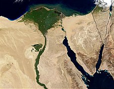
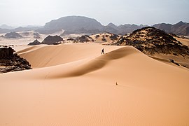
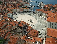
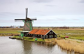
Geography (from Ancient Greek γεωγραφία geōgraphía; combining 'Earth' and gráphō 'write') is the study of the lands, features, inhabitants, and phenomena of Earth. Geography is an all-encompassing discipline that seeks an understanding of Earth and its human and natural complexities—not merely where objects are, but also how they have changed and come to be. While geography is specific to Earth, many concepts can be applied more broadly to other celestial bodies in the field of planetary science. Geography has been called "a bridge between natural science and social science disciplines."

Origins of many of the concepts in geography can be traced to Greek Eratosthenes of Cyrene, who may have coined the term "geographia" (c. 276 BC – c. 195/194 BC). The first recorded use of the word γεωγραφία was as the title of a book by Greek scholar Claudius Ptolemy (100 – 170 AD). This work created the so-called "Ptolemaic tradition" of geography, which included "Ptolemaic cartographic theory." However, the concepts of geography (such as cartography) date back to the earliest attempts to understand the world spatially, with the earliest example of an attempted world map dating to the 9th century BCE in ancient Babylon. The history of geography as a discipline spans cultures and millennia, being independently developed by multiple groups, and cross-pollinated by trade between these groups. The core concepts of geography consistent between all approaches are a focus on space, place, time, and scale.

Today, geography is an extremely broad discipline with multiple approaches and modalities. There have been multiple attempts to organize the discipline, including the four traditions of geography, and into branches. Techniques employed can generally be broken down into quantitative and qualitative approaches, with many studies taking mixed-methods approaches. Common techniques include cartography, remote sensing, interviews, and surveying. (Full article...)
Featured articles are displayed here, which represent some of the best content on English Wikipedia.

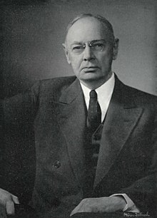
  • Image 2 William Robinson "W. R. " Brown (January 17, 1875 – August 4, 1955) was an American corporate officer of the Brown Company of Berlin, New Hampshire. He was also an influential Arabian horse breeder, the founder and owner of the Maynesboro Stud, and an authority on Arabian horses. After graduating from Williams College, Brown joined the family corporation, then known as the Berlin Mills Company, and became manager of the Woods Products Division, overseeing the company's woodlands and logging operations. He became an early advocate for sustainable forest management practices, was a member of the New Hampshire Forestry Commission from 1909 until 1952, and served on the boards of several forestry organizations. As chair of the Forestry Commission, Brown helped send sawmills to Europe during World War I to assist the war effort. He was influenced by the Progressive movement, instituting employee benefits such as company-sponsored care for injured workers that predated modern workers' compensation laws. As a Republican, he served as a presidential elector for New Hampshire in 1924. (Full article...)

    William Robinson "W. R. " Brown (January 17, 1875 – August 4, 1955) was an American corporate officer of the Brown Company of Berlin, New Hampshire. He was also an influential Arabian horse breeder, the founder and owner of the Maynesboro Stud, and an authority on Arabian horses.

    After graduating from Williams College, Brown joined the family corporation, then known as the Berlin Mills Company, and became manager of the Woods Products Division, overseeing the company's woodlands and logging operations. He became an early advocate for sustainable forest management practices, was a member of the New Hampshire Forestry Commission from 1909 until 1952, and served on the boards of several forestry organizations. As chair of the Forestry Commission, Brown helped send sawmills to Europe during World War I to assist the war effort. He was influenced by the Progressive movement, instituting employee benefits such as company-sponsored care for injured workers that predated modern workers' compensation laws. As a Republican, he served as a presidential elector for New Hampshire in 1924. (Full article...)
  • Image 3 Mount Price behind Garibaldi Lake from Panorama Ridge Mount Price is a small stratovolcano in the Garibaldi Ranges of the Pacific Ranges in southwestern British Columbia, Canada. It has an elevation of 2,049 metres (6,722 feet) and rises above the surrounding landscape on the western side of Garibaldi Lake in New Westminster Land District. The mountain contains a number of subfeatures, including Clinker Peak on its western flank, which was the source of two thick lava flows between 15,000 and 8,000 years ago that ponded against glacial ice. These lava flows are structurally unstable, having produced large landslides as recently as the 1850s. A large provincial park surrounds Mount Price and other volcanoes in its vicinity. It lies within an ecological region that surrounds much of the Pacific Ranges. Mount Price is associated with a small group of volcanoes called the Garibaldi Lake volcanic field. This forms part of the larger Garibaldi Volcanic Belt, a north−south trending volcanic zone that represents a portion of the Canadian Cascade Arc. Mount Price began its formation 1.2 million years ago and continued intermittently until sometime in the last 15,000 years. Although the mountain is not known to have been volcanically active for thousands of years, it could erupt again, which would potentially endanger the nearby populace. If this were to happen, relief efforts could be organized by teams such as the Interagency Volcanic Event Notification Plan who are prepared to notify people threatened by volcanic eruptions in Canada. (Full article...)
    Mount Price is a small stratovolcano in the Garibaldi Ranges of the Pacific Ranges in southwestern British Columbia, Canada. It has an elevation of 2,049 metres (6,722 feet) and rises above the surrounding landscape on the western side of Garibaldi Lake in New Westminster Land District. The mountain contains a number of subfeatures, including Clinker Peak on its western flank, which was the source of two thick lava flows between 15,000 and 8,000 years ago that ponded against glacial ice. These lava flows are structurally unstable, having produced large landslides as recently as the 1850s. A large provincial park surrounds Mount Price and other volcanoes in its vicinity. It lies within an ecological region that surrounds much of the Pacific Ranges.

    Mount Price is associated with a small group of volcanoes called the Garibaldi Lake volcanic field. This forms part of the larger Garibaldi Volcanic Belt, a north−south trending volcanic zone that represents a portion of the Canadian Cascade Arc. Mount Price began its formation 1.2 million years ago and continued intermittently until sometime in the last 15,000 years. Although the mountain is not known to have been volcanically active for thousands of years, it could erupt again, which would potentially endanger the nearby populace. If this were to happen, relief efforts could be organized by teams such as the Interagency Volcanic Event Notification Plan who are prepared to notify people threatened by volcanic eruptions in Canada. (Full article...)
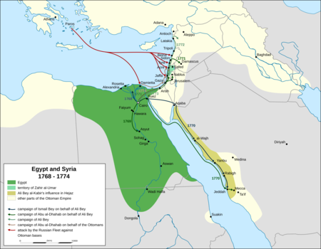
  • Image 4 Extent of Ali Bey and Zahir's territory between 1768 and 1774 and Russian naval movements in the Levant, based on the accounts of Sauveur Lusignan, a contemporary historian Beirut was twice occupied during the Russo-Turkish War of 1768–1774 by squadrons of the Imperial Russian Navy's Mediterranean Fleet, first in June 1772 and second from October 1773 to early 1774, as part of its Levant campaign. Russia's main objective in this campaign was to assist local forces led by Egypt's autonomous ruler, Ali Bey al-Kabir, who was in open rebellion against the Ottoman Empire. Russia, led by Catherine the Great, was pressing the Ottomans in Europe. Ali took advantage of the Empire's preoccupation with Russia to declare Egypt's independence; in 1771 he sent an army led by Muhammad Bey Abu al-Dhahab to occupy Ottoman territory in the Levant. Abu al-Dhahab unexpectedly returned to challenge Ali for control of Egypt. Ali requested Russian military assistance against both his rival and the Ottomans. When this aid, in the form of a small Russian squadron, arrived in the region, Ali had already fled Egypt and taken refuge in Acre, the power base of his ally, Zahir al-Umar. After helping repel an Ottoman offensive on Sidon, the Russian squadron sailed for Beirut. They bombarded the town in June 1772 and occupied it from June 23 to 28. (Full article...)
    Map of Egypt and Syria showing local troop movements and Russian naval operations between 1768 and 1774, during the revolt of Ali Bey and the Russo-Turkish War
    Extent of Ali Bey and Zahir's territory between 1768 and 1774 and Russian naval movements in the Levant, based on the accounts of Sauveur Lusignan, a contemporary historian

    Beirut was twice occupied during the Russo-Turkish War of 1768–1774 by squadrons of the Imperial Russian Navy's Mediterranean Fleet, first in June 1772 and second from October 1773 to early 1774, as part of its Levant campaign. Russia's main objective in this campaign was to assist local forces led by Egypt's autonomous ruler, Ali Bey al-Kabir, who was in open rebellion against the Ottoman Empire.

    Russia, led by Catherine the Great, was pressing the Ottomans in Europe. Ali took advantage of the Empire's preoccupation with Russia to declare Egypt's independence; in 1771 he sent an army led by Muhammad Bey Abu al-Dhahab to occupy Ottoman territory in the Levant. Abu al-Dhahab unexpectedly returned to challenge Ali for control of Egypt. Ali requested Russian military assistance against both his rival and the Ottomans. When this aid, in the form of a small Russian squadron, arrived in the region, Ali had already fled Egypt and taken refuge in Acre, the power base of his ally, Zahir al-Umar. After helping repel an Ottoman offensive on Sidon, the Russian squadron sailed for Beirut. They bombarded the town in June 1772 and occupied it from June 23 to 28. (Full article...)
  • Image 5 India, officially the Republic of India (ISO: Bhārat Gaṇarājya), is a country in South Asia. It is the seventh-largest country by area; the most populous country from June 2023 and from the time of its independence in 1947, the world's most populous democracy. Bounded by the Indian Ocean on the south, the Arabian Sea on the southwest, and the Bay of Bengal on the southeast, it shares land borders with Pakistan to the west; China, Nepal, and Bhutan to the north; and Bangladesh and Myanmar to the east. In the Indian Ocean, India is in the vicinity of Sri Lanka and the Maldives; its Andaman and Nicobar Islands share a maritime border with Thailand, Myanmar, and Indonesia. Modern humans arrived on the Indian subcontinent from Africa no later than 55,000 years ago. Their long occupation, initially in varying forms of isolation as hunter-gatherers, has made the region highly diverse, second only to Africa in human genetic diversity. Settled life emerged on the subcontinent in the western margins of the Indus river basin 9,000 years ago, evolving gradually into the Indus Valley Civilisation of the third millennium BCE. By 1200 BCE, an archaic form of Sanskrit, an Indo-European language, had diffused into India from the northwest. Its evidence today is found in the hymns of the Rigveda. Preserved by an oral tradition that was resolutely vigilant, the Rigveda records the dawning of Hinduism in India. The Dravidian languages of India were supplanted in the northern and western regions. By 400 BCE, stratification and exclusion by caste had emerged within Hinduism, and Buddhism and Jainism had arisen, proclaiming social orders unlinked to heredity. Early political consolidations gave rise to the loose-knit Maurya and Gupta Empires based in the Ganges Basin. Their collective era was suffused with wide-ranging creativity, but also marked by the declining status of women, and the incorporation of untouchability into an organised system of belief. In South India, the Middle kingdoms exported Dravidian-languages scripts and religious cultures to the kingdoms of Southeast Asia. (Full article...)
    India, officially the Republic of India (ISO: Bhārat Gaṇarājya), is a country in South Asia. It is the seventh-largest country by area; the most populous country from June 2023 and from the time of its independence in 1947, the world's most populous democracy. Bounded by the Indian Ocean on the south, the Arabian Sea on the southwest, and the Bay of Bengal on the southeast, it shares land borders with Pakistan to the west; China, Nepal, and Bhutan to the north; and Bangladesh and Myanmar to the east. In the Indian Ocean, India is in the vicinity of Sri Lanka and the Maldives; its Andaman and Nicobar Islands share a maritime border with Thailand, Myanmar, and Indonesia.

    Modern humans arrived on the Indian subcontinent from Africa no later than 55,000 years ago.
    Their long occupation, initially in varying forms of isolation as hunter-gatherers, has made the region highly diverse, second only to Africa in human genetic diversity. Settled life emerged on the subcontinent in the western margins of the Indus river basin 9,000 years ago, evolving gradually into the Indus Valley Civilisation of the third millennium BCE.
    By 1200 BCE, an archaic form of Sanskrit, an Indo-European language, had diffused into India from the northwest. Its evidence today is found in the hymns of the Rigveda. Preserved by an oral tradition that was resolutely vigilant, the Rigveda records the dawning of Hinduism in India. The Dravidian languages of India were supplanted in the northern and western regions. By 400 BCE, stratification and exclusion by caste had emerged within Hinduism, and Buddhism and Jainism had arisen, proclaiming social orders unlinked to heredity.
    Early political consolidations gave rise to the loose-knit Maurya and Gupta Empires based in the Ganges Basin.
    Their collective era was suffused with wide-ranging creativity, but also marked by the declining status of women, and the incorporation of untouchability into an organised system of belief. In South India, the Middle kingdoms exported Dravidian-languages scripts and religious cultures to the kingdoms of Southeast Asia. (Full article...)
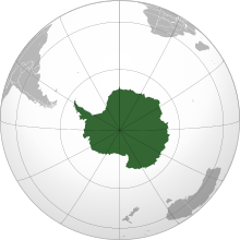
  • Image 6 Antarctica (/ænˈtɑːrktɪkə/ ⓘ) is Earth's southernmost and least-populated continent. Situated almost entirely south of the Antarctic Circle and surrounded by the Southern Ocean (also known as the Antarctic Ocean), it contains the geographic South Pole. Antarctica is the fifth-largest continent, being about 40% larger than Europe, and has an area of 14,200,000 km2 (5,500,000 sq mi). Most of Antarctica is covered by the Antarctic ice sheet, with an average thickness of 1.9 km (1.2 mi). Antarctica is, on average, the coldest, driest, and windiest of the continents, and it has the highest average elevation. It is mainly a polar desert, with annual precipitation of over 200 mm (8 in) along the coast and far less inland. About 70% of the world's freshwater reserves are frozen in Antarctica, which, if melted, would raise global sea levels by almost 60 metres (200 ft). Antarctica holds the record for the lowest measured temperature on Earth, −89.2 °C (−128.6 °F). The coastal regions can reach temperatures over 10 °C (50 °F) in the summer. Native species of animals include mites, nematodes, penguins, seals and tardigrades. Where vegetation occurs, it is mostly in the form of lichen or moss. (Full article...)

    Antarctica (/ænˈtɑːrktɪkə/ ) is Earth's southernmost and least-populated continent. Situated almost entirely south of the Antarctic Circle and surrounded by the Southern Ocean (also known as the Antarctic Ocean), it contains the geographic South Pole. Antarctica is the fifth-largest continent, being about 40% larger than Europe, and has an area of 14,200,000 km (5,500,000 sq mi). Most of Antarctica is covered by the Antarctic ice sheet, with an average thickness of 1.9 km (1.2 mi).

    Antarctica is, on average, the coldest, driest, and windiest of the continents, and it has the highest average elevation. It is mainly a polar desert, with annual precipitation of over 200 mm (8 in) along the coast and far less inland. About 70% of the world's freshwater reserves are frozen in Antarctica, which, if melted, would raise global sea levels by almost 60 metres (200 ft). Antarctica holds the record for the lowest measured temperature on Earth, −89.2 °C (−128.6 °F). The coastal regions can reach temperatures over 10 °C (50 °F) in the summer. Native species of animals include mites, nematodes, penguins, seals and tardigrades. Where vegetation occurs, it is mostly in the form of lichen or moss. (Full article...)
  • Image 7 Portrait attributed to Simplício de Sá, c. 1830 Dom Pedro I (12 October 1798 – 24 September 1834) was the founder and first ruler of the Empire of Brazil, where he was known as "the Liberator". As King Dom Pedro IV, he reigned briefly over Portugal, where he also became known as "the Liberator" as well as "the Soldier King". Born in Lisbon, Pedro I was the fourth child of King Dom John VI of Portugal and Queen Carlota Joaquina, and thus a member of the House of Braganza. When the country was invaded by French troops in 1807, he and his family fled to Portugal's largest and wealthiest colony, Brazil. The outbreak of the Liberal Revolution of 1820 in Lisbon compelled Pedro I's father to return to Portugal in April 1821, leaving him to rule Brazil as regent. He had to deal with challenges from revolutionaries and insubordination by Portuguese troops, all of which he subdued. The Portuguese government's threat to revoke the political autonomy that Brazil had enjoyed since 1808 was met with widespread discontent in Brazil. Pedro I chose the Brazilian side and declared Brazil's independence from Portugal on 7 September 1822. On 12 October, he was acclaimed Brazilian emperor and by March 1824 had defeated all armies loyal to Portugal. A few months later, Pedro I crushed the short-lived Confederation of the Equator, a failed secession attempt by provincial rebels in Brazil's northeast. (Full article...)

    Dom Pedro I (12 October 1798 – 24 September 1834) was the founder and first ruler of the Empire of Brazil, where he was known as "the Liberator". As King Dom Pedro IV, he reigned briefly over Portugal, where he also became known as "the Liberator" as well as "the Soldier King". Born in Lisbon, Pedro I was the fourth child of King Dom John VI of Portugal and Queen Carlota Joaquina, and thus a member of the House of Braganza. When the country was invaded by French troops in 1807, he and his family fled to Portugal's largest and wealthiest colony, Brazil.

    The outbreak of the Liberal Revolution of 1820 in Lisbon compelled Pedro I's father to return to Portugal in April 1821, leaving him to rule Brazil as regent. He had to deal with challenges from revolutionaries and insubordination by Portuguese troops, all of which he subdued. The Portuguese government's threat to revoke the political autonomy that Brazil had enjoyed since 1808 was met with widespread discontent in Brazil. Pedro I chose the Brazilian side and declared Brazil's independence from Portugal on 7 September 1822. On 12 October, he was acclaimed Brazilian emperor and by March 1824 had defeated all armies loyal to Portugal. A few months later, Pedro I crushed the short-lived Confederation of the Equator, a failed secession attempt by provincial rebels in Brazil's northeast. (Full article...)
  • Image 8 Princess Dona Maria Amélia around age 17, c. 1849 Dona Maria Amélia (1 December 1831 – 4 February 1853) was a princess of the Empire of Brazil and a member of the Brazilian branch of the House of Braganza. Her parents were Emperor Dom Pedro I, the first ruler of Brazil, and Amélie of Leuchtenberg. The only child of her father's second marriage, Maria Amélia was born in France after Pedro I abdicated the Brazilian throne in favor of his son Dom Pedro II. Before Maria Amélia was a month old, Pedro I went to Portugal to restore the crown of the eldest daughter of his first marriage, Dona Maria II. He fought a successful war against his brother Miguel I, who had usurped Maria II's throne. Only a few months after his victory, Pedro I died from tuberculosis. Maria Amélia's mother took her to Portugal, where she remained for most of her life without ever visiting Brazil. The Brazilian government refused to recognize Maria Amélia as a member of Brazil's Imperial House because she was foreign-born, but when her elder half-brother Pedro II was declared of age in 1840, he successfully intervened on her behalf. (Full article...)

    Dona Maria Amélia (1 December 1831 – 4 February 1853) was a princess of the Empire of Brazil and a member of the Brazilian branch of the House of Braganza. Her parents were Emperor Dom Pedro I, the first ruler of Brazil, and Amélie of Leuchtenberg. The only child of her father's second marriage, Maria Amélia was born in France after Pedro I abdicated the Brazilian throne in favor of his son Dom Pedro II. Before Maria Amélia was a month old, Pedro I went to Portugal to restore the crown of the eldest daughter of his first marriage, Dona Maria II. He fought a successful war against his brother Miguel I, who had usurped Maria II's throne.

    Only a few months after his victory, Pedro I died from tuberculosis. Maria Amélia's mother took her to Portugal, where she remained for most of her life without ever visiting Brazil. The Brazilian government refused to recognize Maria Amélia as a member of Brazil's Imperial House because she was foreign-born, but when her elder half-brother Pedro II was declared of age in 1840, he successfully intervened on her behalf. (Full article...)
  • Image 9 Johnson Creek near Regner Road in Gresham Johnson Creek is a 25-mile (40 km) tributary of the Willamette River in the Portland metropolitan area of the U.S. state of Oregon. Part of the drainage basin of the Columbia River, its catchment consists of 54 square miles (140 km2) of mostly urban land occupied by about 180,000 people as of 2012. Passing through the cities of Gresham, Portland, and Milwaukie, the creek flows generally west from the foothills of the Cascade Range through sediments deposited by glacial floods on a substrate of basalt. Though polluted, it is free-flowing along its main stem and provides habitat for salmon and other migrating fish. Prior to European settlement, the watershed was heavily forested and was used by Native Americans of the Chinook band for fishing and hunting. In the 19th century, non-Native American settlers cleared much of the land for farming, and the stream is named for one of these newcomers, William Johnson, who in 1846 built a water-powered sawmill along the creek. By the early 20th century, a rail line parallel to the stream encouraged further residential and commercial development. As urban density increased in the floodplain, seasonal floods grew more damaging. In the 1930s the Works Progress Administration of the federal government lined the lower 15 miles (24 km) of Johnson Creek with rock to control the floods. Despite this, the creek flooded 37 times between 1941 and 2006. Since the 1990s, regional planners have tried to reduce flooding by controlling stormwater runoff, creating stream meanders, reducing erosion, replacing impervious surfaces, and protecting riparian buffers. (Full article...)

    Johnson Creek is a 25-mile (40 km) tributary of the Willamette River in the Portland metropolitan area of the U.S. state of Oregon. Part of the drainage basin of the Columbia River, its catchment consists of 54 square miles (140 km) of mostly urban land occupied by about 180,000 people as of 2012. Passing through the cities of Gresham, Portland, and Milwaukie, the creek flows generally west from the foothills of the Cascade Range through sediments deposited by glacial floods on a substrate of basalt. Though polluted, it is free-flowing along its main stem and provides habitat for salmon and other migrating fish.

    Prior to European settlement, the watershed was heavily forested and was used by Native Americans of the Chinook band for fishing and hunting. In the 19th century, non-Native American settlers cleared much of the land for farming, and the stream is named for one of these newcomers, William Johnson, who in 1846 built a water-powered sawmill along the creek. By the early 20th century, a rail line parallel to the stream encouraged further residential and commercial development. As urban density increased in the floodplain, seasonal floods grew more damaging. In the 1930s the Works Progress Administration of the federal government lined the lower 15 miles (24 km) of Johnson Creek with rock to control the floods. Despite this, the creek flooded 37 times between 1941 and 2006. Since the 1990s, regional planners have tried to reduce flooding by controlling stormwater runoff, creating stream meanders, reducing erosion, replacing impervious surfaces, and protecting riparian buffers. (Full article...)
  • Image 10 Location in the Marshall Islands Limalok (formerly known as Harrie or Harriet) is a Cretaceous-Paleocene guyot/tablemount in the southeastern Marshall Islands, one of a number of seamounts (a type of underwater volcanic mountain) in the Pacific Ocean. It was probably formed by a volcanic hotspot in present-day French Polynesia. Limalok lies southeast of Mili Atoll and Knox Atoll, which rise above sea level, and is joined to each of them through a volcanic ridge. It is located at a depth of 1,255 metres (4,117 ft) and has a summit platform with an area of 636 square kilometres (246 sq mi). Limalok is formed by basaltic rocks and was probably a shield volcano at first; the Macdonald, Rarotonga, Rurutu and Society hotspots may have been involved in its formation. After volcanic activity ceased, the volcano was eroded and thereby flattened, and a carbonate platform formed on it during the Paleocene and Eocene. These carbonates were chiefly produced by red algae, forming an atoll or atoll-like structure with reefs. (Full article...)

    Limalok (formerly known as Harrie or Harriet) is a Cretaceous-Paleocene guyot/tablemount in the southeastern Marshall Islands, one of a number of seamounts (a type of underwater volcanic mountain) in the Pacific Ocean. It was probably formed by a volcanic hotspot in present-day French Polynesia. Limalok lies southeast of Mili Atoll and Knox Atoll, which rise above sea level, and is joined to each of them through a volcanic ridge. It is located at a depth of 1,255 metres (4,117 ft) and has a summit platform with an area of 636 square kilometres (246 sq mi).

    Limalok is formed by basaltic rocks and was probably a shield volcano at first; the Macdonald, Rarotonga, Rurutu and Society hotspots may have been involved in its formation. After volcanic activity ceased, the volcano was eroded and thereby flattened, and a carbonate platform formed on it during the Paleocene and Eocene. These carbonates were chiefly produced by red algae, forming an atoll or atoll-like structure with reefs. (Full article...)
  • Image 11 The ruins of Palmyra in 2010 Palmyra (/pælˈmaɪrə/ pal-MY-rə; Palmyrene: 𐡶𐡣𐡬𐡥𐡴‎ (), romanized: Tadmor; Arabic: تَدْمُر, romanized: Tadmur) is an ancient city in the eastern part of the Levant, now in the center of modern Syria. Archaeological finds date back to the Neolithic period, and documents first mention the city in the early second millennium BC. Palmyra changed hands on a number of occasions between different empires before becoming a subject of the Roman Empire in the first century AD. (Full article...)

    Palmyra (/pælˈmrə/ pal-MY-rə; Palmyrene: 𐡶𐡣𐡬𐡥𐡴‎ (), romanized: Tadmor; Arabic: تَدْمُر, romanizedTadmur) is an ancient city in the eastern part of the Levant, now in the center of modern Syria. Archaeological finds date back to the Neolithic period, and documents first mention the city in the early second millennium BC. Palmyra changed hands on a number of occasions between different empires before becoming a subject of the Roman Empire in the first century AD. (Full article...)
  • Image 12 The eastern city wall of Thessalonica, with the Thermaic Gulf in the background (2012) The siege of Thessalonica between 1422 and 1430 saw the Ottoman Empire, under Sultan Murad II, capture the city of Thessalonica. Afterwards, the city remained in Ottoman hands for the next five centuries until it became part of the Kingdom of Greece in 1912. Thessalonica had already been under Ottoman control from 1387 to 1403 before returning to Byzantine rule in the aftermath of the Battle of Ankara. In 1422, after the Byzantines supported Mustafa Çelebi as a rival pretender against him, Murad attacked Thessalonica. Unable to provide manpower or resources for the city's defence, its ruler, Andronikos Palaiologos, handed it over to the Republic of Venice in September 1423. The Venetians attempted to persuade the Sultan to recognise their possession, but failed as Murad considered the city his by right and the Venetians to be interlopers. This impasse led to an Ottoman blockade of Thessalonica, which occasionally flared up with direct attacks on the city. At the same time, the conflict was mostly fought as a series of raids by both sides against the other's territories in the Balkans and the Aegean Islands. The Venetians repeatedly tried to apply pressure by blocking the passage of the Dardanelles at Gallipoli, with little success. (Full article...)

    The siege of Thessalonica between 1422 and 1430 saw the Ottoman Empire, under Sultan Murad II, capture the city of Thessalonica. Afterwards, the city remained in Ottoman hands for the next five centuries until it became part of the Kingdom of Greece in 1912.

    Thessalonica had already been under Ottoman control from 1387 to 1403 before returning to Byzantine rule in the aftermath of the Battle of Ankara. In 1422, after the Byzantines supported Mustafa Çelebi as a rival pretender against him, Murad attacked Thessalonica. Unable to provide manpower or resources for the city's defence, its ruler, Andronikos Palaiologos, handed it over to the Republic of Venice in September 1423. The Venetians attempted to persuade the Sultan to recognise their possession, but failed as Murad considered the city his by right and the Venetians to be interlopers. This impasse led to an Ottoman blockade of Thessalonica, which occasionally flared up with direct attacks on the city. At the same time, the conflict was mostly fought as a series of raids by both sides against the other's territories in the Balkans and the Aegean Islands. The Venetians repeatedly tried to apply pressure by blocking the passage of the Dardanelles at Gallipoli, with little success. (Full article...)
  • Image 13 Weymouth harbour and bay Weymouth (/ˈweɪməθ/ WAY-məth) is a seaside town and civil parish in the Dorset district, in the ceremonial county of Dorset, England. Situated on a sheltered bay at the mouth of the River Wey, 7 miles (11 km) south of the county town of Dorchester, Weymouth had a population of 53,427 in 2021. It is the third-largest settlement in Dorset after Bournemouth and Poole. The greater Weymouth urban area has a population of 72,802. The history of the town stretches back to the 12th century and includes roles in the spread of the Black Death, the settlement of the Americas and the development of Georgian architecture. It was a major departure point for the Normandy Landings during World War II. Prior to local government reorganisation in April 2019, Weymouth formed a borough with the neighbouring Isle of Portland. Since then the area has been governed by Dorset Council. Weymouth, Portland and the Purbeck district are in the South Dorset parliamentary constituency. (Full article...)

    Weymouth (/ˈwməθ/ WAY-məth) is a seaside town and civil parish in the Dorset district, in the ceremonial county of Dorset, England. Situated on a sheltered bay at the mouth of the River Wey, 7 miles (11 km) south of the county town of Dorchester, Weymouth had a population of 53,427 in 2021. It is the third-largest settlement in Dorset after Bournemouth and Poole. The greater Weymouth urban area has a population of 72,802.

    The history of the town stretches back to the 12th century and includes roles in the spread of the Black Death, the settlement of the Americas and the development of Georgian architecture. It was a major departure point for the Normandy Landings during World War II. Prior to local government reorganisation in April 2019, Weymouth formed a borough with the neighbouring Isle of Portland. Since then the area has been governed by Dorset Council. Weymouth, Portland and the Purbeck district are in the South Dorset parliamentary constituency. (Full article...)
  • Image 14 The church at Waltham Abbey, where Hugh de Neville was buried Hugh de Neville (died 1234) was the Chief Forester under the kings Richard I, John and Henry III of England; he was the sheriff for a number of counties. Related to a number of other royal officials as well as a bishop, Neville was a member of Prince Richard's household. After Richard became king in 1189, Neville continued in his service and accompanied him on the Third Crusade. Neville remained in the royal service following Richard's death in 1199 and the accession of King John to the throne, becoming one of the new king's favourites and often gambling with him. He was named in Magna Carta as one of John's principal advisers, and considered by a medieval chronicler to be one of King John's "evil counsellors". He deserted John after the French invasion of England in 1216 but returned to pledge his loyalty to John's son Henry III after the latter's accession to the throne later that year. Neville's royal service continued until his death in 1234, though by then he was a less significant figure than he had been at the height of his powers. (Full article...)
    Hugh de Neville (died 1234) was the Chief Forester under the kings Richard I, John and Henry III of England; he was the sheriff for a number of counties. Related to a number of other royal officials as well as a bishop, Neville was a member of Prince Richard's household. After Richard became king in 1189, Neville continued in his service and accompanied him on the Third Crusade. Neville remained in the royal service following Richard's death in 1199 and the accession of King John to the throne, becoming one of the new king's favourites and often gambling with him. He was named in Magna Carta as one of John's principal advisers, and considered by a medieval chronicler to be one of King John's "evil counsellors". He deserted John after the French invasion of England in 1216 but returned to pledge his loyalty to John's son Henry III after the latter's accession to the throne later that year. Neville's royal service continued until his death in 1234, though by then he was a less significant figure than he had been at the height of his powers. (Full article...)
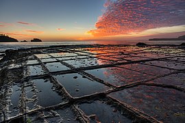
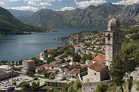
  • Image 15 One of T1's sister ships, T3 T1 was a seagoing torpedo boat that was operated by the Royal Yugoslav Navy between 1921 and 1941. Originally 76 T, a 250t-class torpedo boat of the Austro-Hungarian Navy built in 1914, she was armed with two 66 mm (2.6 in) guns and four 450 mm (17.7 in) torpedo tubes, and could carry 10–12 naval mines. She saw active service during World War I, performing convoy, escort and minesweeping tasks, anti-submarine operations and shore bombardment missions. In 1917 the suffixes of all Austro-Hungarian torpedo boats were removed, and thereafter she was referred to as 76. She was part of the escort force for the Austro-Hungarian dreadnought Szent István during the action that resulted in the sinking of that ship by Italian torpedo boats in June 1918. Following Austria-Hungary's defeat later that year, 76 was allocated to the Navy of the Kingdom of Serbs, Croats and Slovenes, which became the Royal Yugoslav Navy, and was renamed T1. At the time, she and seven other 250t-class boats were the only modern sea-going vessels of the fledgling maritime force. During the interwar period, T1 and the rest of the navy were involved in training exercises, but activity was limited by reduced naval budgets. The boat was captured by the Italians during the German-led Axis invasion of Yugoslavia in April 1941. After her main armament was modernised, she served with the Royal Italian Navy under her Yugoslav designation. Having escaped capture by German forces following the Italian capitulation in September 1943, she was returned to the Royal Yugoslav Navy-in-exile. She was commissioned by the Yugoslav Navy after World War II, and after a refit which included replacement of her armament, she served as Golešnica until 1955. She was sunk as a target in Žanjica Bay near the western entrance to the Bay of Kotor, and is now a recreational dive site. (Full article...)

    T1 was a seagoing torpedo boat that was operated by the Royal Yugoslav Navy between 1921 and 1941. Originally 76 T, a 250t-class torpedo boat of the Austro-Hungarian Navy built in 1914, she was armed with two 66 mm (2.6 in) guns and four 450 mm (17.7 in) torpedo tubes, and could carry 10–12 naval mines. She saw active service during World War I, performing convoy, escort and minesweeping tasks, anti-submarine operations and shore bombardment missions. In 1917 the suffixes of all Austro-Hungarian torpedo boats were removed, and thereafter she was referred to as 76. She was part of the escort force for the Austro-Hungarian dreadnought Szent István during the action that resulted in the sinking of that ship by Italian torpedo boats in June 1918.

    Following Austria-Hungary's defeat later that year, 76 was allocated to the Navy of the Kingdom of Serbs, Croats and Slovenes, which became the Royal Yugoslav Navy, and was renamed T1. At the time, she and seven other 250t-class boats were the only modern sea-going vessels of the fledgling maritime force. During the interwar period, T1 and the rest of the navy were involved in training exercises, but activity was limited by reduced naval budgets. The boat was captured by the Italians during the German-led Axis invasion of Yugoslavia in April 1941. After her main armament was modernised, she served with the Royal Italian Navy under her Yugoslav designation. Having escaped capture by German forces following the Italian capitulation in September 1943, she was returned to the Royal Yugoslav Navy-in-exile. She was commissioned by the Yugoslav Navy after World War II, and after a refit which included replacement of her armament, she served as Golešnica until 1955. She was sunk as a target in Žanjica Bay near the western entrance to the Bay of Kotor, and is now a recreational dive site. (Full article...)
  • More featured articles

    Vital articles Vital article

    Vital articles to understand Geography.

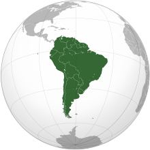
    South America is a continent entirely in the Western Hemisphere and mostly in the Southern Hemisphere, with a considerably smaller portion in the Northern Hemisphere. It can also be described as the southern subregion of the Americas. (Full article...)
    Other vital articles

    Get involved

    For editor resources and to collaborate with other editors on improving Wikipedia's Geography-related articles, visit WikiProject Geography.


    Here are some tasks awaiting attention:

    Selected pictures

    Featured biography articles in geography

    Sir Clements Robert Markham KCB FRS FRSGS (20 July 1830 – 30 January 1916) was an English geographer, explorer and writer. He was secretary of the Royal Geographical Society (RGS) between 1863 and 1888, and later served as the Society's president for a further 12 years. In the latter capacity he was mainly responsible for organising the British National Antarctic Expedition of 1901–1904, and for launching the polar career of Robert Falcon Scott.

    Markham began his career as a Royal Navy cadet and midshipman, during which time he went to the Arctic with HMS Assistance in one of the many searches for Franklin's lost expedition. Later, Markham served as a geographer to the India Office, and was responsible for the collection of cinchona plants from their native Peruvian forests, and their transplantation in India. By this means, the Indian government acquired a home source from which quinine could be extracted. Markham also served as geographer to Sir Robert Napier's Abyssinian expeditionary force, and was present in 1868, at the fall of Magdala. (Full article...)
    More featured biographies

    Did you know

    Did you know it about Geography?

    Places around you

    You can read about interesting Wikipedia articles about places around you.

    Special:Nearby

    This following Geography-related articles is a most visited articles of WikiProject Geography, See complete list at Wikipedia:WikiProject Geography/Popular pages.

  • Image 4 Generation X (often shortened to Gen X) is the demographic cohort following the Baby Boomers and preceding Millennials. Researchers and popular media often use the mid-1960s as its starting birth years and the late 1970s as its ending birth years, with the generation being generally defined as people born from 1965 to 1980. By this definition and U.S. Census data, there are 65.2 million Gen Xers in the United States as of 2019. Most of Generation X are the children of the Silent Generation and early Baby Boomers; Xers are also often the parents of Millennials and Generation Z. (Full article...)
    Generation X (often shortened to Gen X) is the demographic cohort following the Baby Boomers and preceding Millennials. Researchers and popular media often use the mid-1960s as its starting birth years and the late 1970s as its ending birth years, with the generation being generally defined as people born from 1965 to 1980. By this definition and U.S. Census data, there are 65.2 million Gen Xers in the United States as of 2019. Most of Generation X are the children of the Silent Generation and early Baby Boomers; Xers are also often the parents of Millennials and Generation Z. (Full article...)
  • Image 5 Cartogram of the world's population in 2018; each square represents 500,000 people. This is a list of countries and dependencies by population. It includes sovereign states, inhabited dependent territories and, in some cases, constituent countries of sovereign states, with inclusion within the list being primarily based on the ISO standard ISO 3166-1. For instance, the United Kingdom is considered a single entity, while the constituent countries of the Kingdom of the Netherlands are considered separately. In addition, this list includes certain states with limited recognition not found in ISO 3166-1. Also given in a percentage is each country's population compared with the world population, which the United Nations estimates at 8.13 billion as of 2024. (Full article...)
    Cartogram of the world's population in 2018; each square represents 500,000 people.


    This is a list of countries and dependencies by population. It includes sovereign states, inhabited dependent territories and, in some cases, constituent countries of sovereign states, with inclusion within the list being primarily based on the ISO standard ISO 3166-1. For instance, the United Kingdom is considered a single entity, while the constituent countries of the Kingdom of the Netherlands are considered separately. In addition, this list includes certain states with limited recognition not found in ISO 3166-1. Also given in a percentage is each country's population compared with the world population, which the United Nations estimates at 8.13 billion as of 2024. (Full article...)
  • Image 6 Hong Kong is a special administrative region of the People's Republic of China. With 7.4 million residents of various nationalities in a 1,104-square-kilometre (426 sq mi) territory, Hong Kong is the fourth most densely populated region in the world. (Full article...)
    Hong Kong is a special administrative region of the People's Republic of China. With 7.4 million residents of various nationalities in a 1,104-square-kilometre (426 sq mi) territory, Hong Kong is the fourth most densely populated region in the world. (Full article...)
  • Image 7 Millennials, also known as Generation Y or Gen Y, are the demographic cohort following Generation X and preceding Generation Z. Researchers and popular media use the early 1980s as starting birth years and the mid-1990s to early 2000s as ending birth years, with the generation typically being defined as people born from 1981 to 1996. Most Millennials are the children of Baby Boomers and older Generation X. In turn Millennials are often the parents of Generation Alpha. (Full article...)
    Millennials, also known as Generation Y or Gen Y, are the demographic cohort following Generation X and preceding Generation Z. Researchers and popular media use the early 1980s as starting birth years and the mid-1990s to early 2000s as ending birth years, with the generation typically being defined as people born from 1981 to 1996. Most Millennials are the children of Baby Boomers and older Generation X. In turn Millennials are often the parents of Generation Alpha. (Full article...)
  • Image 8 England is a country that is part of the United Kingdom. It is located on the island of Great Britain, of which it covers approximately 62%, and over 100 smaller adjacent islands. It has land borders with Scotland to the north and Wales to the west, and is otherwise surrounded by the North Sea to the east, the English Channel to the south, the Celtic Sea to the south-west, and the Irish Sea to the west. Continental Europe lies to the south-east, and Ireland to the west. At the 2021 census, the population was 56,490,048. London is both the largest city and the capital. (Full article...)

    England is a country that is part of the United Kingdom. It is located on the island of Great Britain, of which it covers approximately 62%, and over 100 smaller adjacent islands. It has land borders with Scotland to the north and Wales to the west, and is otherwise surrounded by the North Sea to the east, the English Channel to the south, the Celtic Sea to the south-west, and the Irish Sea to the west. Continental Europe lies to the south-east, and Ireland to the west. At the 2021 census, the population was 56,490,048. London is both the largest city and the capital. (Full article...)
  • Image 9 Generation Alpha (often shortened to Gen Alpha) is the demographic cohort succeeding Generation Z. Researchers and popular media use the early 2010s as starting birth years to the mid-2020s as the ending birth years (see § Date and age range definitions). Named after alpha, the first letter in the Greek alphabet, Generation Alpha is the first to be born entirely in the 21st century and the third millennium. Most members of Generation Alpha are the children of Millennials. (Full article...)
    Generation Alpha (often shortened to Gen Alpha) is the demographic cohort succeeding Generation Z. Researchers and popular media use the early 2010s as starting birth years to the mid-2020s as the ending birth years (see § Date and age range definitions). Named after alpha, the first letter in the Greek alphabet, Generation Alpha is the first to be born entirely in the 21st century and the third millennium. Most members of Generation Alpha are the children of Millennials. (Full article...)
  • Image 10 Dymaxion map of the world with the 30 largest countries and territories by area This is a list of the world's countries and their dependencies by land, water, and total area, ranked by total area. (Full article...)
    Dymaxion map of the world with the 30 largest countries and territories by area

    This is a list of the world's countries and their dependencies by land, water, and total area, ranked by total area. (Full article...)
  • Click to enlarge and view description.

    Main articles

    CategoriesCategories

    Select [►] to view subcategories.

    Associated Wikimedia

    The following Wikimedia Foundation sister projects provide more on this subject:

    Discover Wikipedia using portals
    Retrieved from "https://en.wikipedia.org/w/index.php?title=Portal:Geography&oldid=1202464975"