Portal:Geography
The Geography Portal

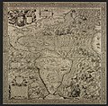
Geography (from Ancient Greek γεωγραφία geōgraphía; combining gê 'Earth' and gráphō 'write') is the study of the lands, features, inhabitants, and phenomena of Earth. Geography is an all-encompassing discipline that seeks an understanding of Earth and its human and natural complexities—not merely where objects are, but also how they have changed and come to be. While geography is specific to Earth, many concepts can be applied more broadly to other celestial bodies in the field of planetary science. Geography has been called "a bridge between natural science and social science disciplines."
Origins of many of the concepts in geography can be traced to Greek Eratosthenes of Cyrene, who may have coined the term "geographia" (c. 276 BC – c. 195/194 BC). The first recorded use of the word γεωγραφία was as the title of a book by Greek scholar Claudius Ptolemy (100 – 170 AD). This work created the so-called "Ptolemaic tradition" of geography, which included "Ptolemaic cartographic theory." However, the concepts of geography (such as cartography) date back to the earliest attempts to understand the world spatially, with the earliest example of an attempted world map dating to the 9th century BCE in ancient Babylon. The history of geography as a discipline spans cultures and millennia, being independently developed by multiple groups, and cross-pollinated by trade between these groups. The core concepts of geography consistent between all approaches are a focus on space, place, time, and scale.
Today, geography is an extremely broad discipline with multiple approaches and modalities. There have been multiple attempts to organize the discipline, including the four traditions of geography, and into branches. Techniques employed can generally be broken down into quantitative and qualitative approaches, with many studies taking mixed-methods approaches. Common techniques include cartography, remote sensing, interviews, and surveying. (Full article...)

The Maya civilization (/ˈmaɪə/) was a Mesoamerican civilization that existed from antiquity to the early modern period. It is known by its ancient temples and glyphs (script). The Maya script is the most sophisticated and highly developed writing system in the pre-Columbian Americas. The civilization is also noted for its art, architecture, mathematics, calendar, and astronomical system.
The Maya civilization developed in the Maya Region, an area that today comprises southeastern Mexico, all of Guatemala and Belize, and the western portions of Honduras and El Salvador. It includes the northern lowlands of the Yucatán Peninsula and the Guatemalan Highlands of the Sierra Madre, the Mexican state of Chiapas, southern Guatemala, El Salvador, and the southern lowlands of the Pacific littoral plain. Today, their descendants, known collectively as the Maya, number well over 6 million individuals, speak more than twenty-eight surviving Mayan languages, and reside in nearly the same area as their ancestors. (Full article...)
Captain Robert Falcon Scott CVO (6 June 1868 – c. 29 March 1912) was a British Royal Navy officer and explorer who led two expeditions to the Antarctic regions: the Discovery expedition of 1901–04 and the Terra Nova expedition of 1910–13.
On the first expedition, he set a new southern record by marching to latitude 82°S and discovered the Antarctic Plateau, on which the South Pole is located. On the second venture, Scott led a party of five which reached the South Pole on 17 January 1912, less than five weeks after Amundsen's South Pole expedition. On the return journey from the Pole, a planned meeting with supporting dog teams from the base camp failed, despite Scott's written instructions, and at a distance of 162 miles (261 km) from their base camp at Hut Point and approximately 12.5 miles (20.1 km) from the next depot, Scott and his companions died. When Scott and his party's bodies were discovered, they had in their possession the first Antarctic fossils discovered. The fossils were determined to be from the Glossopteris tree and proved that Antarctica was once forested and joined to other continents. (Full article...)
The Second Silesian War (German: Zweiter Schlesischer Krieg) was a war between Prussia and Austria that lasted from 1744 to 1745 and confirmed Prussia's control of the region of Silesia (now in south-western Poland). The war was fought mainly in Silesia, Bohemia, and Upper Saxony and formed one theatre of the wider War of the Austrian Succession. It was the second of three Silesian Wars fought between Frederick the Great's Prussia and Maria Theresa's Austria in the mid-18th century, all three of which ended in Prussian control of Silesia.
The conflict has been viewed as a continuation of the First Silesian War, which had concluded only two years before. After the Treaty of Berlin ended hostilities between Austria and Prussia in 1742, the Habsburg monarchy's fortunes improved greatly in the continuing War of the Austrian Succession. As Austria expanded its alliances with the 1743 Treaty of Worms, Prussia entered a renewed alliance with Austria's enemies in the League of Frankfurt and rejoined the war, hoping to prevent a resurgent Austria from taking back Silesia. (Full article...)
Washington, D.C., formally the District of Columbia and commonly known as Washington or D.C., is the capital city and federal district of the United States. The city is on the Potomac River, across from Virginia, and shares land borders with Maryland to its north and east. It was named after George Washington, the first president of the United States. The district is named after Columbia, the female personification of the nation.
The U.S. Constitution in 1789 called for the creation of a federal district under the exclusive jurisdiction of the U.S. Congress. As such, Washington, D.C., is not part of any state, and is not one itself. The Residence Act, adopted on July 16, 1790, approved the creation of the capital district along the Potomac River. The city was founded in 1791, and the 6th Congress held the first session in the unfinished Capitol Building in 1800 after the capital moved from Philadelphia. In 1801, the District of Columbia, formerly part of Maryland and Virginia and including the existing settlements of Georgetown and Alexandria, was officially recognized as the federal district; initially, the city was a separate settlement within the larger district. In 1846, Congress returned the land originally ceded by Virginia, including the city of Alexandria. In 1871, it created a single municipality for the remaining portion of the district. There have been several unsuccessful efforts to make the district into a state since the 1880s; a statehood bill passed the House of Representatives in 2021 but was not adopted by the U.S. Senate. (Full article...)
During World War II, the Kingdom of Hungary engaged in the military occupation, then annexation, of the Bačka, Baranja, Međimurje and Prekmurje regions of the Kingdom of Yugoslavia. These territories had all been under Hungarian rule prior to 1920, and had been transferred to Yugoslavia as part of the post-World War I Treaty of Trianon. They now form part of several states: Yugoslav Bačka is now part of Vojvodina, an autonomous province of Serbia, Yugoslav Baranja and Međimurje are part of modern-day Croatia, and Yugoslav Prekmurje is part of modern-day Slovenia. The occupation began on 11 April 1941 when 80,000 Hungarian troops crossed the Yugoslav border in support of the German-led Axis invasion of Yugoslavia that had commenced five days earlier. There was some resistance to the Hungarian forces from Serb Chetnik irregulars, but the defences of the Royal Yugoslav Army had collapsed by this time. The Hungarian forces were indirectly aided by the local Volksdeutsche, the German minority, which had formed a militia and disarmed around 90,000 Yugoslav troops. Despite only sporadic resistance, Hungarian troops killed many civilians during these initial operations, including some Volksdeutsche. The government of the newly formed Axis puppet state, the Independent State of Croatia, subsequently consented to the Hungarian annexation of the Međimurje area, which dismayed the Croat population of the region.
The occupation authorities immediately classified the population of Bačka and Baranja into those that had lived in those regions when they had last been under Hungarian rule in 1920 and the mostly Serb settlers who had arrived since the areas had been part of Yugoslavia. They then began herding thousands of local Serbs into concentration camps and expelled them to the Independent State of Croatia, Italian-occupied Montenegro, and the German-occupied territory of Serbia. Ultimately, tens of thousands of Serbs were deported from the occupied territories. This was followed by the implementation of a policy of "magyarisation" of the political, social and economic life of the occupied territories, which included the re-settlement of Hungarians and Székelys from other parts of Hungary. "Magyarisation" did not impact the Volksdeutsche, who received special status under Hungarian rule, and in Prekmurje the Hungarian authorities were more permissive towards ethnic Slovenes. (Full article...)
Shoshone National Forest (/ʃoʊˈʃoʊni/ shoh-SHOH-nee) is the first federally protected National Forest in the United States and covers nearly 2,500,000 acres (1,000,000 ha) in the state of Wyoming. Originally a part of the Yellowstone Timberland Reserve, the forest is managed by the United States Forest Service and was created by an act of Congress and signed into law by U.S. President Benjamin Harrison in 1891. Shoshone National Forest is one of the first nationally protected land areas anywhere. Native Americans have lived in the region for at least 10,000 years, and when the region was first explored by European adventurers, forestlands were occupied by several different tribes. Never heavily settled or exploited, the forest has retained most of its wildness. Shoshone National Forest is a part of the Greater Yellowstone Ecosystem, a nearly unbroken expanse of federally protected lands encompassing an estimated 20,000,000 acres (8,100,000 ha).
The Absaroka and Beartooth Mountains are partly in the northern section of the forest. The Wind River Range is in the southern portion and contains Gannett Peak, the tallest mountain in Wyoming. Yellowstone National Park forms part of the boundary to the west; south of Yellowstone, the Continental Divide separates the forest from its neighbor Bridger-Teton National Forest to the west. The eastern boundary includes privately owned property, lands managed by the U.S. Bureau of Land Management and the Wind River Indian Reservation, which belongs to the Shoshone and Arapahoe Indians. Custer National Forest along the Montana border is on the northern frontier. The Oregon Trail, the 19th century covered wagon route, passes just south of the forest, where broad and gentle South Pass allowed the migrants to bypass the rugged mountains to the north. (Full article...)
The Armero tragedy (Spanish: Tragedia de Armero [tɾaˈxeðja ðe aɾˈmeɾo]) occurred following the eruption of the Nevado del Ruiz stratovolcano in Tolima, Colombia, on November 13, 1985. The volcano's eruption after 69 years of dormancy caught nearby towns unprepared, even though volcanological organizations had warned the government to evacuate the area after they detected volcanic activity two months earlier.
As pyroclastic flows erupted from the volcano's crater, they melted the mountain's glaciers, sending four enormous lahars (volcanically induced mudflows, landslides, and debris flows) down its slopes at 50 km/h (30 mph). The lahars picked up speed in gullies and engulfed the town of Armero, killing more than 20,000 of its almost 29,000 inhabitants. Casualties in other towns, particularly Chinchiná, brought the overall death toll to 23,000. Footage and photographs of Omayra Sánchez, a young victim of the disaster, were published around the world. Other photographs of the lahars and the impact of the disaster captured attention worldwide and led to controversy over the degree to which the Colombian government was responsible for the disaster. A banner at a mass funeral in Ibagué read, "The volcano didn't kill 22,000 people. The government killed them." (Full article...)
![Image 1 Skyline of the city centre George Town is the capital of the Malaysian state of Penang. It is the core city of the George Town Conurbation, Malaysia's second largest metropolitan area with a population of 2.84 million and the second highest contributor to the country's GDP. The city proper spans an area of 306 km2 (118 sq mi) encompassing Penang Island and surrounding islets, and had a population of 794,313 as of 2020[update]. Initially established as an entrepôt by Francis Light in 1786, George Town serves as the commercial centre for northern Malaysia. According to Euromonitor International and the Economist Intelligence Unit, it has the highest potential for revenue growth among all Malaysian cities and contributed nearly 8 per cent of the country's personal disposable income in 2015, second only to the national capital, Kuala Lumpur. Its technological sector, anchored by hundreds of multinational companies, has made George Town the top exporter in the country. The Penang International Airport links George Town to several regional cities, while a ferry service and two road bridges connect the city to the rest of Peninsular Malaysia. Swettenham Pier is the busiest cruise terminal in the country. (Full article...)](http://upload.wikimedia.org/wikipedia/en/d/d2/Blank.png)


