Loading
  • 21 Aug, 2019

  • By, Wikipedia

Portal:Geography

The Geography Portal

Geography (from Ancient Greek γεωγραφία geōgraphía; combining 'Earth' and gráphō 'write') is the study of the lands, features, inhabitants, and phenomena of Earth. Geography is an all-encompassing discipline that seeks an understanding of Earth and its human and natural complexities—not merely where objects are, but also how they have changed and come to be. While geography is specific to Earth, many concepts can be applied more broadly to other celestial bodies in the field of planetary science. Geography has been called "a bridge between natural science and social science disciplines."

Origins of many of the concepts in geography can be traced to Greek Eratosthenes of Cyrene, who may have coined the term "geographia" (c. 276 BC – c. 195/194 BC). The first recorded use of the word γεωγραφία was as the title of a book by Greek scholar Claudius Ptolemy (100 – 170 AD). This work created the so-called "Ptolemaic tradition" of geography, which included "Ptolemaic cartographic theory." However, the concepts of geography (such as cartography) date back to the earliest attempts to understand the world spatially, with the earliest example of an attempted world map dating to the 9th century BCE in ancient Babylon. The history of geography as a discipline spans cultures and millennia, being independently developed by multiple groups and cross-pollinated by trade between these groups. The core concepts of geography consistent between all approaches are a focus on space, place, time and scale.

Today, geography is an extremely broad discipline with multiple approaches and modalities. There have been multiple attempts to organize the discipline, including the four traditions of geography, and into branches. Techniques employed can generally be broken down into quantitative and qualitative approaches, with many studies taking mixed-methods approaches. Common techniques include cartography, remote sensing, interviews and surveying. (Full article...)

Featured articles are displayed here, which represent some of the best content on English Wikipedia.

  • Image 3 Prussian and Austrian cavalry fighting at the Battle of Mollwitz, by August Heinrich Ferdinand Tegetmeyer The First Silesian War (German: Erster Schlesischer Krieg) was a war between Prussia and Austria that lasted from 1740 to 1742 and resulted in Prussia's seizing most of the region of Silesia (now in south-western Poland) from Austria. The war was fought mainly in Silesia, Moravia and Bohemia (the lands of the Bohemian Crown) and formed one theatre of the wider War of the Austrian Succession. It was the first of three Silesian Wars fought between Frederick the Great's Prussia and Maria Theresa's Austria in the mid-18th century, all three of which ended in Prussian control of Silesia. No particular triggering event started the war. Prussia cited its centuries-old dynastic claims on parts of Silesia as a casus belli, but Realpolitik and geostrategic factors also played a role in provoking the conflict. Maria Theresa's contested succession to the Habsburg monarchy provided an opportunity for Prussia to strengthen itself relative to regional rivals such as Saxony and Bavaria. (Full article...)

    The First Silesian War (German: Erster Schlesischer Krieg) was a war between Prussia and Austria that lasted from 1740 to 1742 and resulted in Prussia's seizing most of the region of Silesia (now in south-western Poland) from Austria. The war was fought mainly in Silesia, Moravia and Bohemia (the lands of the Bohemian Crown) and formed one theatre of the wider War of the Austrian Succession. It was the first of three Silesian Wars fought between Frederick the Great's Prussia and Maria Theresa's Austria in the mid-18th century, all three of which ended in Prussian control of Silesia.

    No particular triggering event started the war. Prussia cited its centuries-old dynastic claims on parts of Silesia as a casus belli, but Realpolitik and geostrategic factors also played a role in provoking the conflict. Maria Theresa's contested succession to the Habsburg monarchy provided an opportunity for Prussia to strengthen itself relative to regional rivals such as Saxony and Bavaria. (Full article...)
  • Image 4 Ubinas in August 2015 Ubinas is an active stratovolcano in the Moquegua Region of southern Peru, approximately 60 kilometres (37 mi) east of the city of Arequipa. Part of the Central Volcanic Zone of the Andes, it rises 5,672 metres (18,609 ft) above sea level. The volcano's summit is cut by a 1.4-kilometre-wide (0.87 mi) and 150-metre-deep (490 ft) caldera, which itself contains a smaller crater. Below the summit, Ubinas has the shape of an upwards-steepening cone with a prominent notch on the southern side. The gently sloping lower part of the volcano is also known as Ubinas I and the steeper upper part as Ubinas II; they represent different stages in the volcano's geological history. The most active volcano in Peru, Ubinas has a history of small to moderate explosive eruptions as well as a few larger eruptions, such as in 1667, along with persistent degassing and ash emissions. Activity at the volcano began in the Pleistocene epoch, and led to the growth of the current mountain in two phases. Among the recent eruptions was the 2006–2007 event, which produced eruption columns and led to ash fall in the region, resulting in health issues and evacuations. During the most recent activity, from 2013 to 2017, a lava flow formed inside the crater, and further ash falls led to renewed evacuations of surrounding towns. Ubinas is monitored by the Peruvian geological service INGEMMET, which has published a volcano hazard map for Ubinas and regular volcanic activity reports. (Full article...)

    Ubinas is an active stratovolcano in the Moquegua Region of southern Peru, approximately 60 kilometres (37 mi) east of the city of Arequipa. Part of the Central Volcanic Zone of the Andes, it rises 5,672 metres (18,609 ft) above sea level. The volcano's summit is cut by a 1.4-kilometre-wide (0.87 mi) and 150-metre-deep (490 ft) caldera, which itself contains a smaller crater. Below the summit, Ubinas has the shape of an upwards-steepening cone with a prominent notch on the southern side. The gently sloping lower part of the volcano is also known as Ubinas I and the steeper upper part as Ubinas II; they represent different stages in the volcano's geological history.

    The most active volcano in Peru, Ubinas has a history of small to moderate explosive eruptions as well as a few larger eruptions, such as in 1667, along with persistent degassing and ash emissions. Activity at the volcano began in the Pleistocene epoch, and led to the growth of the current mountain in two phases. Among the recent eruptions was the 2006–2007 event, which produced eruption columns and led to ash fall in the region, resulting in health issues and evacuations. During the most recent activity, from 2013 to 2017, a lava flow formed inside the crater, and further ash falls led to renewed evacuations of surrounding towns. Ubinas is monitored by the Peruvian geological service INGEMMET, which has published a volcano hazard map for Ubinas and regular volcanic activity reports. (Full article...)
  • Image 5 The canal at Bathampton, near Bath The Kennet and Avon Canal is a waterway in southern England with an overall length of 87 miles (140 km), made up of two lengths of navigable river linked by a canal. The name is used to refer to the entire length of the navigation rather than solely to the central canal section. From Bristol to Bath the waterway follows the natural course of the River Avon before the canal links it to the River Kennet at Newbury, and from there to Reading on the River Thames. In all, the waterway incorporates 105 locks. The two river stretches were made navigable in the early 18th century, and the 57-mile (92 km) canal section was constructed between 1794 and 1810. In the late 19th and early 20th centuries, the canal gradually fell into disuse after the opening of the Great Western Railway. In the latter half of the 20th century the canal was restored in stages, largely by volunteers. After decades of dereliction and much restoration work, it was fully reopened in 1990. The Kennet and Avon Canal has been developed as a popular heritage tourism destination for boating, canoeing, fishing, walking and cycling, and is also important for wildlife conservation. (Full article...)

    The Kennet and Avon Canal is a waterway in southern England with an overall length of 87 miles (140 km), made up of two lengths of navigable river linked by a canal. The name is used to refer to the entire length of the navigation rather than solely to the central canal section. From Bristol to Bath the waterway follows the natural course of the River Avon before the canal links it to the River Kennet at Newbury, and from there to Reading on the River Thames. In all, the waterway incorporates 105 locks.

    The two river stretches were made navigable in the early 18th century, and the 57-mile (92 km) canal section was constructed between 1794 and 1810. In the late 19th and early 20th centuries, the canal gradually fell into disuse after the opening of the Great Western Railway. In the latter half of the 20th century the canal was restored in stages, largely by volunteers. After decades of dereliction and much restoration work, it was fully reopened in 1990. The Kennet and Avon Canal has been developed as a popular heritage tourism destination for boating, canoeing, fishing, walking and cycling, and is also important for wildlife conservation. (Full article...)
  • Image 6 View of Cerro Tuzgle from the southeast Cerro Tuzgle (Spanish pronunciation: [ˈse.ro ˈtus.ɡle]) is a dormant stratovolcano in the Susques Department of Jujuy Province in northwestern Argentina. Tuzgle is a prominent volcano of the back arc of the Andes and lies about 280 kilometres (170 mi) east of the main volcanic arc. Part of the Central Volcanic Zone of the Andes, its summit is 5,486 metres (17,999 ft) above sea level and it grew during different stages over a caldera and lava domes. Some major lava flows emanate from the summit crater, and one confirmed and one possible flank collapse unit as well as an ignimbrite sheet are associated with Tuzgle. The first volcanic activity at Tuzgle occurred 650,000 years ago and formed the Tuzgle Ignimbrite. Subsequently, lava domes and several lava flows were erupted; scientists have proposed two different schemes of naming the units. The most recent lava flows are dated at 300,000 years ago and volcanic activity may have continued into the Holocene. Several thermal springs are associated with the volcano, and some have been investigated for possible geothermal energy production. Sulfur was formerly mined on the mountain. (Full article...)

    Cerro Tuzgle (Spanish pronunciation: [ˈse.ro ˈtus.ɡle]) is a dormant stratovolcano in the Susques Department of Jujuy Province in northwestern Argentina. Tuzgle is a prominent volcano of the back arc of the Andes and lies about 280 kilometres (170 mi) east of the main volcanic arc. Part of the Central Volcanic Zone of the Andes, its summit is 5,486 metres (17,999 ft) above sea level and it grew during different stages over a caldera and lava domes. Some major lava flows emanate from the summit crater, and one confirmed and one possible flank collapse unit as well as an ignimbrite sheet are associated with Tuzgle.

    The first volcanic activity at Tuzgle occurred 650,000 years ago and formed the Tuzgle Ignimbrite. Subsequently, lava domes and several lava flows were erupted; scientists have proposed two different schemes of naming the units. The most recent lava flows are dated at 300,000 years ago and volcanic activity may have continued into the Holocene. Several thermal springs are associated with the volcano, and some have been investigated for possible geothermal energy production. Sulfur was formerly mined on the mountain. (Full article...)
  • Image 7 Stone commemorative marker at Literary Hall in Romney, West Virginia The Romney Literary Society (also known as the Literary Society of Romney) existed from January 30, 1819, to February 15, 1886, in Romney, West Virginia. Established as the Polemic Society of Romney, it became the first organization of its kind in the present-day state of West Virginia, and one of the first in the United States. The society was founded by nine prominent men of Romney with the objectives of advancing literature and science, purchasing and maintaining a library, and improving educational opportunities. The society debated an extensive range of scientific and social topics, often violating its own rules which banned religious and political subjects. Even though its membership was relatively small, its debates and activities were frequently discussed throughout the Potomac Highlands region, and the organization greatly influenced trends of thought in the Romney community and surrounding areas. (Full article...)

    The Romney Literary Society (also known as the Literary Society of Romney) existed from January 30, 1819, to February 15, 1886, in Romney, West Virginia. Established as the Polemic Society of Romney, it became the first organization of its kind in the present-day state of West Virginia, and one of the first in the United States. The society was founded by nine prominent men of Romney with the objectives of advancing literature and science, purchasing and maintaining a library, and improving educational opportunities.

    The society debated an extensive range of scientific and social topics, often violating its own rules which banned religious and political subjects. Even though its membership was relatively small, its debates and activities were frequently discussed throughout the Potomac Highlands region, and the organization greatly influenced trends of thought in the Romney community and surrounding areas. (Full article...)
  • Image 8 Voight, 1955 yearbook photo from Archbishop Stepinac High School Barry Voight (/vɔɪt/; born 1937) is an American geologist, volcanologist, author, and engineer. After earning his Ph.D. at Columbia University, Voight worked as a professor of geology at several universities, including Pennsylvania State University, where he taught from 1964 until his retirement in 2005. He remains an emeritus professor there and still conducts research, focusing on rock mechanics, plate tectonics, disaster prevention, and geotechnical engineering. In April 1980, Voight's publications on landslides, avalanches, and other mass movements attracted the attention of Rocky Crandell of the United States Geological Survey (USGS), who asked him to look at a growing bulge on the Mount St. Helens volcano in the state of Washington. Voight foresaw the collapse of the mountain's north flank as well as a powerful eruption. His predictions came true when St. Helens erupted in May 1980; Voight was then hired by the USGS to investigate the debris avalanche that initiated the eruption. After his work at Mount St. Helens brought him international recognition, Voight continued researching and guiding monitoring efforts at several active volcanoes throughout his career, including Nevado del Ruiz in Colombia, Mount Merapi in Indonesia, and Soufrière Hills, a volcano on the Caribbean island of Montserrat. For his research, publications, and disaster prevention work as a volcanologist and engineer, Voight has been honored with numerous awards, appointments, and medals. (Full article...)

    Barry Voight (/vɔɪt/; born 1937) is an American geologist, volcanologist, author, and engineer. After earning his Ph.D. at Columbia University, Voight worked as a professor of geology at several universities, including Pennsylvania State University, where he taught from 1964 until his retirement in 2005. He remains an emeritus professor there and still conducts research, focusing on rock mechanics, plate tectonics, disaster prevention, and geotechnical engineering.

    In April 1980, Voight's publications on landslides, avalanches, and other mass movements attracted the attention of Rocky Crandell of the United States Geological Survey (USGS), who asked him to look at a growing bulge on the Mount St. Helens volcano in the state of Washington. Voight foresaw the collapse of the mountain's north flank as well as a powerful eruption. His predictions came true when St. Helens erupted in May 1980; Voight was then hired by the USGS to investigate the debris avalanche that initiated the eruption. After his work at Mount St. Helens brought him international recognition, Voight continued researching and guiding monitoring efforts at several active volcanoes throughout his career, including Nevado del Ruiz in Colombia, Mount Merapi in Indonesia, and Soufrière Hills, a volcano on the Caribbean island of Montserrat. For his research, publications, and disaster prevention work as a volcanologist and engineer, Voight has been honored with numerous awards, appointments, and medals. (Full article...)
  • Image 9 Sand dunes in Death Valley National Park Death Valley National Park is a national park of the United States that straddles the California–Nevada border, east of the Sierra Nevada. The park boundaries include Death Valley, the northern section of Panamint Valley, the southern section of Eureka Valley and most of Saline Valley. The park occupies an interface zone between the arid Great Basin and Mojave deserts, protecting the northwest corner of the Mojave Desert and its diverse environment of salt-flats, sand dunes, badlands, valleys, canyons and mountains. (Full article...)

    Death Valley National Park is a national park of the United States that straddles the CaliforniaNevada border, east of the Sierra Nevada. The park boundaries include Death Valley, the northern section of Panamint Valley, the southern section of Eureka Valley and most of Saline Valley.

    The park occupies an interface zone between the arid Great Basin and Mojave deserts, protecting the northwest corner of the Mojave Desert and its diverse environment of salt-flats, sand dunes, badlands, valleys, canyons and mountains. (Full article...)
  • Image 10 The John Moulton Barn and the Teton Range Grand Teton National Park is a national park of the United States in northwestern Wyoming. At approximately 310,000 acres (1,300 km2), the park includes the major peaks of the 40-mile-long (64 km) Teton Range as well as most of the northern sections of the valley known as Jackson Hole. Grand Teton National Park is 10 miles (16 km) south of Yellowstone National Park, to which it is connected by the John D. Rockefeller Jr. Memorial Parkway which is managed by the National Park Service. Along with surrounding national forests, these three protected areas constitute the almost 22-million-acre (89,000-square-kilometer) Greater Yellowstone Ecosystem, one of the world's largest intact mid-latitude temperate ecosystems. The human history of the Grand Teton region dates back at least 11,000 years when the first nomadic hunter-gatherer Paleo-Indians began migrating into the region during warmer months to pursue food and supplies. In the early 19th century, the first explorers encountered the eastern Shoshone people. Between 1810 and 1840, the region attracted fur trading companies that vied for control of the lucrative beaver pelt trade. U.S. government expeditions to the region commenced in the mid-19th century as an offshoot of exploration in Yellowstone, with the first permanent white settlers in Jackson Hole arriving in the 1880s. (Full article...)

    Grand Teton National Park is a national park of the United States in northwestern Wyoming. At approximately 310,000 acres (1,300 km), the park includes the major peaks of the 40-mile-long (64 km) Teton Range as well as most of the northern sections of the valley known as Jackson Hole. Grand Teton National Park is 10 miles (16 km) south of Yellowstone National Park, to which it is connected by the John D. Rockefeller Jr. Memorial Parkway which is managed by the National Park Service. Along with surrounding national forests, these three protected areas constitute the almost 22-million-acre (89,000-square-kilometer) Greater Yellowstone Ecosystem, one of the world's largest intact mid-latitude temperate ecosystems.

    The human history of the Grand Teton region dates back at least 11,000 years when the first nomadic hunter-gatherer Paleo-Indians began migrating into the region during warmer months to pursue food and supplies. In the early 19th century, the first explorers encountered the eastern Shoshone people. Between 1810 and 1840, the region attracted fur trading companies that vied for control of the lucrative beaver pelt trade. U.S. government expeditions to the region commenced in the mid-19th century as an offshoot of exploration in Yellowstone, with the first permanent white settlers in Jackson Hole arriving in the 1880s. (Full article...)
  • Image 11 The last picture ever taken of Johnston, 13 hours before his death at the eruption site David Alexander Johnston (December 18, 1949 – May 18, 1980) was an American United States Geological Survey (USGS) volcanologist who was killed by the 1980 eruption of Mount St. Helens in the U.S. state of Washington. A principal scientist on the USGS monitoring team, Johnston was killed in the eruption while manning an observation post six miles (10 km) away on the morning of May 18, 1980. He was the first to report the eruption, transmitting "Vancouver! Vancouver! This is it!" before he was swept away by a lateral blast; despite a thorough search, Johnston's body was never found, but state highway workers discovered remnants of his USGS trailer in 1993. Johnston's career took him across the United States, where he studied the Augustine Volcano in Alaska, the San Juan volcanic field in Colorado, and long-extinct volcanoes in Michigan. Johnston was a meticulous and talented scientist, known for his analyses of volcanic gases and their relationship to eruptions. This, along with his enthusiasm and positive attitude, made him liked and respected by many co-workers. After his death, other scientists lauded his character, both verbally and in dedications and letters. Johnston felt scientists must do what is necessary, including taking risks, to help protect the public from natural disasters. His work, and that of fellow USGS scientists, convinced authorities to close Mount St. Helens to the public before the 1980 eruption. They maintained the closure despite heavy pressure to re-open the area; their work saved thousands of lives. His story became intertwined with the popular image of volcanic eruptions and their threat to society, and a part of volcanology's history. To date, Johnston, along with his mentee Harry Glicken, is one of two American volcanologists known to have died in a volcanic eruption. (Full article...)

    David Alexander Johnston (December 18, 1949 – May 18, 1980) was an American United States Geological Survey (USGS) volcanologist who was killed by the 1980 eruption of Mount St. Helens in the U.S. state of Washington. A principal scientist on the USGS monitoring team, Johnston was killed in the eruption while manning an observation post six miles (10 km) away on the morning of May 18, 1980. He was the first to report the eruption, transmitting "Vancouver! Vancouver! This is it!" before he was swept away by a lateral blast; despite a thorough search, Johnston's body was never found, but state highway workers discovered remnants of his USGS trailer in 1993.

    Johnston's career took him across the United States, where he studied the Augustine Volcano in Alaska, the San Juan volcanic field in Colorado, and long-extinct volcanoes in Michigan. Johnston was a meticulous and talented scientist, known for his analyses of volcanic gases and their relationship to eruptions. This, along with his enthusiasm and positive attitude, made him liked and respected by many co-workers. After his death, other scientists lauded his character, both verbally and in dedications and letters. Johnston felt scientists must do what is necessary, including taking risks, to help protect the public from natural disasters. His work, and that of fellow USGS scientists, convinced authorities to close Mount St. Helens to the public before the 1980 eruption. They maintained the closure despite heavy pressure to re-open the area; their work saved thousands of lives. His story became intertwined with the popular image of volcanic eruptions and their threat to society, and a part of volcanology's history. To date, Johnston, along with his mentee Harry Glicken, is one of two American volcanologists known to have died in a volcanic eruption. (Full article...)
  • Image 12 View of Mount Berlin from the surrounding ice sheet Mount Berlin is a glacier-covered volcano in Marie Byrd Land, Antarctica, 100 kilometres (62 mi) from the Amundsen Sea. It is a roughly 20-kilometre-wide (12 mi) mountain with parasitic vents that consists of two coalesced volcanoes: Berlin proper with the 2-kilometre-wide (1.2 mi) Berlin Crater and Merrem Peak with a 2.5-by-1-kilometre-wide (1.55 mi × 0.62 mi) crater, 3.5 kilometres (2.2 mi) away from Berlin. The summit of the volcano is 3,478 metres (11,411 ft) above sea level. It has a volume of 200 cubic kilometres (48 cu mi) and rises from the West Antarctic Ice Sheet. It is part of the Marie Byrd Land Volcanic Province. Trachyte is the dominant volcanic rock and occurs in the form of lava flows and pyroclastic rocks. The volcano began erupting during the Pliocene and was active into the late Pleistocene and the Holocene. Several tephra layers encountered in ice cores all over Antarctica – but in particular at Mount Moulton – have been linked to Mount Berlin, which is the most important source of such tephras in the region. The tephra layers were formed by explosive eruptions that generated high eruption columns. Presently, fumarolic activity occurs at Mount Berlin and forms ice towers from freezing steam. (Full article...)
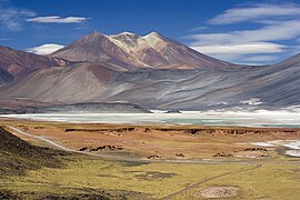
    Mount Berlin is a glacier-covered volcano in Marie Byrd Land, Antarctica, 100 kilometres (62 mi) from the Amundsen Sea. It is a roughly 20-kilometre-wide (12 mi) mountain with parasitic vents that consists of two coalesced volcanoes: Berlin proper with the 2-kilometre-wide (1.2 mi) Berlin Crater and Merrem Peak with a 2.5-by-1-kilometre-wide (1.55 mi × 0.62 mi) crater, 3.5 kilometres (2.2 mi) away from Berlin. The summit of the volcano is 3,478 metres (11,411 ft) above sea level. It has a volume of 200 cubic kilometres (48 cu mi) and rises from the West Antarctic Ice Sheet. It is part of the Marie Byrd Land Volcanic Province. Trachyte is the dominant volcanic rock and occurs in the form of lava flows and pyroclastic rocks.

    The volcano began erupting during the Pliocene and was active into the late Pleistocene and the Holocene. Several tephra layers encountered in ice cores all over Antarctica – but in particular at Mount Moulton – have been linked to Mount Berlin, which is the most important source of such tephras in the region. The tephra layers were formed by explosive eruptions that generated high eruption columns. Presently, fumarolic activity occurs at Mount Berlin and forms ice towers from freezing steam. (Full article...)
  • Image 13 The Viscount of Inhaúma around the age of 56, c. 1864 Joaquim José Inácio, Viscount of Inhaúma (Portuguese: [iɲaˈũmɐ]; 1 August 1808 – 8 March 1869), was a naval officer, politician and monarchist of the Empire of Brazil. He was born in the Kingdom of Portugal, and his family moved to Brazil two years later. After Brazilian independence in 1822, Inhaúma enlisted in the Brazilian navy. Early in his career during the latter half of the 1820s, he participated in the subduing of secessionist rebellions: first the Confederation of the Equator, and then the Cisplatine War, which precipitated a long international armed conflict with the United Provinces of the Río de la Plata. Throughout the chaos that characterized the years when Emperor Dom Pedro II was a minor, Inhaúma remained loyal to the government. He helped quell a military mutiny in 1831 and was involved in suppressing some of the other rebellions that erupted during that troubled period. He saw action in the Sabinada between 1837 and 1838, followed by the Ragamuffin War from 1840 until 1844. In 1849, after spending two years in Great Britain, Inhaúma was given command of the fleet that was instrumental in subduing the Praieira revolt, the last rebellion in imperial Brazil. (Full article...)

    Joaquim José Inácio, Viscount of Inhaúma (Portuguese: [iɲaˈũmɐ]; 1 August 1808 – 8 March 1869), was a naval officer, politician and monarchist of the Empire of Brazil. He was born in the Kingdom of Portugal, and his family moved to Brazil two years later. After Brazilian independence in 1822, Inhaúma enlisted in the Brazilian navy. Early in his career during the latter half of the 1820s, he participated in the subduing of secessionist rebellions: first the Confederation of the Equator, and then the Cisplatine War, which precipitated a long international armed conflict with the United Provinces of the Río de la Plata.

    Throughout the chaos that characterized the years when Emperor Dom Pedro II was a minor, Inhaúma remained loyal to the government. He helped quell a military mutiny in 1831 and was involved in suppressing some of the other rebellions that erupted during that troubled period. He saw action in the Sabinada between 1837 and 1838, followed by the Ragamuffin War from 1840 until 1844. In 1849, after spending two years in Great Britain, Inhaúma was given command of the fleet that was instrumental in subduing the Praieira revolt, the last rebellion in imperial Brazil. (Full article...)
  • Image 14 The Empire of Brazil was a 19th-century state that broadly comprised the territories which form modern Brazil and Uruguay until the latter achieved independence in 1828. The empire's government was a representative parliamentary constitutional monarchy under the rule of Emperors Pedro I and his son Pedro II. A colony of the Kingdom of Portugal, Brazil became the seat of the Portuguese Empire in 1808, when the Portuguese Prince regent, later King Dom John VI, fled from Napoleon's invasion of Portugal and established himself and his government in the Brazilian city of Rio de Janeiro. John VI later returned to Portugal, leaving his eldest son and heir-apparent, Pedro, to rule the Kingdom of Brazil as regent. On 7 September 1822, Pedro declared the independence of Brazil and, after waging a successful war against his father's kingdom, was acclaimed on 12 October as Pedro I, the first Emperor of Brazil. The new country was huge, sparsely populated, and ethnically diverse. Unlike most of the neighboring Hispanic American republics, Brazil had political stability, vibrant economic growth, constitutionally guaranteed freedom of speech, and respect for civil rights of its subjects, albeit with legal restrictions on women and slaves, the latter regarded as property and not citizens. The Empire's bicameral parliament was elected under comparatively democratic methods for the era, as were the provincial and local legislatures. This led to a long ideological conflict between Pedro I and a sizable parliamentary faction over the role of the monarch in the government. He also had to face other obstacles. The unsuccessful Cisplatine War against the neighboring United Provinces of the Río de la Plata in 1828 led to the secession of the province of Cisplatina (later to become Uruguay). In 1826, despite his role in Brazilian independence, he became the king of Portugal; he abdicated the Portuguese throne in favor of his eldest daughter. Two years later, she was usurped by Pedro I's younger brother Miguel. Unable to deal with both Brazilian and Portuguese affairs, Pedro I abdicated his Brazilian throne on 7 April 1831 and immediately departed for Europe to restore his daughter to the Portuguese throne. (Full article...)
    The Empire of Brazil was a 19th-century state that broadly comprised the territories which form modern Brazil and Uruguay until the latter achieved independence in 1828. The empire's government was a representative parliamentary constitutional monarchy under the rule of Emperors Pedro I and his son Pedro II. A colony of the Kingdom of Portugal, Brazil became the seat of the Portuguese Empire in 1808, when the Portuguese Prince regent, later King Dom John VI, fled from Napoleon's invasion of Portugal and established himself and his government in the Brazilian city of Rio de Janeiro. John VI later returned to Portugal, leaving his eldest son and heir-apparent, Pedro, to rule the Kingdom of Brazil as regent. On 7 September 1822, Pedro declared the independence of Brazil and, after waging a successful war against his father's kingdom, was acclaimed on 12 October as Pedro I, the first Emperor of Brazil. The new country was huge, sparsely populated, and ethnically diverse.

    Unlike most of the neighboring Hispanic American republics, Brazil had political stability, vibrant economic growth, constitutionally guaranteed freedom of speech, and respect for civil rights of its subjects, albeit with legal restrictions on women and slaves, the latter regarded as property and not citizens. The Empire's bicameral parliament was elected under comparatively democratic methods for the era, as were the provincial and local legislatures. This led to a long ideological conflict between Pedro I and a sizable parliamentary faction over the role of the monarch in the government. He also had to face other obstacles. The unsuccessful Cisplatine War against the neighboring United Provinces of the Río de la Plata in 1828 led to the secession of the province of Cisplatina (later to become Uruguay). In 1826, despite his role in Brazilian independence, he became the king of Portugal; he abdicated the Portuguese throne in favor of his eldest daughter. Two years later, she was usurped by Pedro I's younger brother Miguel. Unable to deal with both Brazilian and Portuguese affairs, Pedro I abdicated his Brazilian throne on 7 April 1831 and immediately departed for Europe to restore his daughter to the Portuguese throne. (Full article...)
  • Image 15 The orca (Orcinus orca), or killer whale, is a toothed whale and the largest member of the oceanic dolphin family. It is the only extant species in the genus Orcinus and is recognizable by its black-and-white patterned body. A cosmopolitan species, it is found in diverse marine environments, from Arctic to Antarctic regions to tropical seas. Orcas are apex predators with a diverse diet. Individual populations often specialize in particular types of prey. This includes a variety of fish, sharks, rays, and marine mammals such as seals and other dolphins and whales. They are highly social; some populations are composed of highly stable matrilineal family groups (pods). Their sophisticated hunting techniques and vocal behaviors, often specific to a particular group and passed along from generation to generation, are considered to be manifestations of animal culture. (Full article...)
    The orca (Orcinus orca), or killer whale, is a toothed whale and the largest member of the oceanic dolphin family. It is the only extant species in the genus Orcinus and is recognizable by its black-and-white patterned body. A cosmopolitan species, it is found in diverse marine environments, from Arctic to Antarctic regions to tropical seas.

    Orcas are apex predators with a diverse diet. Individual populations often specialize in particular types of prey. This includes a variety of fish, sharks, rays, and marine mammals such as seals and other dolphins and whales. They are highly social; some populations are composed of highly stable matrilineal family groups (pods). Their sophisticated hunting techniques and vocal behaviors, often specific to a particular group and passed along from generation to generation, are considered to be manifestations of animal culture. (Full article...)
  • More featured articles

    Vital articles Vital article

    Vital articles to understand Geography.

    Earth is the third planet from the Sun and the only astronomical object known to harbor life. This is enabled by Earth being an ocean world, the only one in the Solar System sustaining liquid surface water. Almost all of Earth's water is contained in its global ocean, covering 70.8% of Earth's crust. The remaining 29.2% of Earth's crust is land, most of which is located in the form of continental landmasses within Earth's land hemisphere. Most of Earth's land is at least somewhat humid and covered by vegetation, while large sheets of ice at Earth's polar deserts retain more water than Earth's groundwater, lakes, rivers, and atmospheric water combined. Earth's crust consists of slowly moving tectonic plates, which interact to produce mountain ranges, volcanoes, and earthquakes. Earth has a liquid outer core that generates a magnetosphere capable of deflecting most of the destructive solar winds and cosmic radiation. (Full article...)

    Other vital articles

    Get involved

    For editor resources and to collaborate with other editors on improving Wikipedia's Geography-related articles, visit WikiProject Geography.


    Here are some tasks awaiting attention:

    Selected pictures

    Featured biography articles in geography

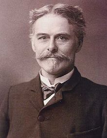
    Edward Drinker Cope (July 28, 1840 – April 12, 1897) was an American zoologist, paleontologist, comparative anatomist, herpetologist, and ichthyologist. Born to a wealthy Quaker family, he distinguished himself as a child prodigy interested in science, publishing his first scientific paper at the age of 19. Though his father tried to raise Cope as a gentleman farmer, he eventually acquiesced to his son's scientific aspirations.

    Cope had little formal scientific training, and he eschewed a teaching position for field work. He made regular trips to the American West, prospecting in the 1870s and 1880s, often as a member of U.S. Geological Survey teams. A personal feud between Cope and paleontologist Othniel Charles Marsh led to a period of intense fossil-finding competition now known as the Bone Wars. Cope's financial fortunes soured after failed mining ventures in the 1880s, forcing him to sell off much of his fossil collection. He experienced a resurgence in his career toward the end of his life before dying on April 12, 1897. (Full article...)
    More featured biographies

    Did you know

    Did you know it about Geography?

    No recent additions

    Places around you

    You can read about interesting Wikipedia articles about places around you.

    Special:Nearby

    This following Geography-related articles is a most visited articles of WikiProject Geography, See complete list at Wikipedia:WikiProject Geography/Popular pages.

  • Image 3 Generation Z (often shortened to Gen Z), also known as Zoomers, is the demographic cohort succeeding Millennials and preceding Generation Alpha. Researchers and popular media use the mid-to-late 1990s as starting birth years and the early 2010s as ending birth years, with the generation most frequently being defined as people born from 1997 to 2012. Most members of Generation Z are the children of younger baby boomers or Generation X. (Full article...)
    Generation Z (often shortened to Gen Z), also known as Zoomers, is the demographic cohort succeeding Millennials and preceding Generation Alpha. Researchers and popular media use the mid-to-late 1990s as starting birth years and the early 2010s as ending birth years, with the generation most frequently being defined as people born from 1997 to 2012. Most members of Generation Z are the children of younger baby boomers or Generation X. (Full article...)
  • Image 4 The Blue Marble, Apollo 17, December 1972 Earth is the third planet from the Sun and the only astronomical object known to harbor life. This is enabled by Earth being an ocean world, the only one in the Solar System sustaining liquid surface water. Almost all of Earth's water is contained in its global ocean, covering 70.8% of Earth's crust. The remaining 29.2% of Earth's crust is land, most of which is located in the form of continental landmasses within Earth's land hemisphere. Most of Earth's land is at least somewhat humid and covered by vegetation, while large sheets of ice at Earth's polar deserts retain more water than Earth's groundwater, lakes, rivers, and atmospheric water combined. Earth's crust consists of slowly moving tectonic plates, which interact to produce mountain ranges, volcanoes, and earthquakes. Earth has a liquid outer core that generates a magnetosphere capable of deflecting most of the destructive solar winds and cosmic radiation. (Full article...)

    Earth is the third planet from the Sun and the only astronomical object known to harbor life. This is enabled by Earth being an ocean world, the only one in the Solar System sustaining liquid surface water. Almost all of Earth's water is contained in its global ocean, covering 70.8% of Earth's crust. The remaining 29.2% of Earth's crust is land, most of which is located in the form of continental landmasses within Earth's land hemisphere. Most of Earth's land is at least somewhat humid and covered by vegetation, while large sheets of ice at Earth's polar deserts retain more water than Earth's groundwater, lakes, rivers, and atmospheric water combined. Earth's crust consists of slowly moving tectonic plates, which interact to produce mountain ranges, volcanoes, and earthquakes. Earth has a liquid outer core that generates a magnetosphere capable of deflecting most of the destructive solar winds and cosmic radiation. (Full article...)
  • Image 5 River Thames and Tower Bridge with The Shard and Southwark (left), and Tower of London and City of London (right) London is the capital and largest city of both England and the United Kingdom, with a population of 8,866,180 in 2022. Its wider metropolitan area is the largest in Western Europe, with a population of 14.9 million. London stands on the River Thames in southeast England, at the head of a 50-mile (80 km) tidal estuary down to the North Sea, and has been a major settlement for nearly 2,000 years. Its ancient core and financial centre, the City of London, was founded by the Romans as Londinium and has retained its medieval boundaries. The City of Westminster, to the west of the City of London, has been the centuries-long host of the national government and parliament. London grew rapidly in the 19th century, becoming the world's largest city at the time. Since the 19th century, the name "London" has referred to the metropolis around the City of London, historically split between the counties of Middlesex, Essex, Surrey, Kent, and Hertfordshire, which since 1965 has largely comprised the administrative area of Greater London, governed by 33 local authorities and the Greater London Authority. (Full article...)

    London is the capital and largest city of both England and the United Kingdom, with a population of 8,866,180 in 2022. Its wider metropolitan area is the largest in Western Europe, with a population of 14.9 million. London stands on the River Thames in southeast England, at the head of a 50-mile (80 km) tidal estuary down to the North Sea, and has been a major settlement for nearly 2,000 years. Its ancient core and financial centre, the City of London, was founded by the Romans as Londinium and has retained its medieval boundaries. The City of Westminster, to the west of the City of London, has been the centuries-long host of the national government and parliament. London grew rapidly in the 19th century, becoming the world's largest city at the time. Since the 19th century, the name "London" has referred to the metropolis around the City of London, historically split between the counties of Middlesex, Essex, Surrey, Kent, and Hertfordshire, which since 1965 has largely comprised the administrative area of Greater London, governed by 33 local authorities and the Greater London Authority. (Full article...)
  • Image 6 Capitol Hill, National Mall, Downtown (right) and Southwest Federal Center (left), aerial view from above Lincoln Park Washington, D.C., formally the District of Columbia and commonly known as Washington or D.C., is the capital city and federal district of the United States. The city is on the Potomac River, across from Virginia, and shares land borders with Maryland to its north and east. It was named after George Washington, the first president of the United States. The district is named for Columbia, the female personification of the nation. (Full article...)

    Washington, D.C., formally the District of Columbia and commonly known as Washington or D.C., is the capital city and federal district of the United States. The city is on the Potomac River, across from Virginia, and shares land borders with Maryland to its north and east. It was named after George Washington, the first president of the United States. The district is named for Columbia, the female personification of the nation. (Full article...)
  • Image 7 Cartogram of the world's population in 2018; each square represents 500,000 people. This is a list of countries and dependencies by population. It includes sovereign states, inhabited dependent territories and, in some cases, constituent countries of sovereign states, with inclusion within the list being primarily based on the ISO standard ISO 3166-1. For instance, the United Kingdom is considered a single entity, while the constituent countries of the Kingdom of the Netherlands are considered separately. In addition, this list includes certain states with limited recognition not found in ISO 3166-1. Also given in a percentage is each country's population compared with the world population, which the United Nations estimates at 8.119 billion as of 2024. (Full article...)
    Cartogram of the world's population in 2018; each square represents 500,000 people.


    This is a list of countries and dependencies by population. It includes sovereign states, inhabited dependent territories and, in some cases, constituent countries of sovereign states, with inclusion within the list being primarily based on the ISO standard ISO 3166-1. For instance, the United Kingdom is considered a single entity, while the constituent countries of the Kingdom of the Netherlands are considered separately. In addition, this list includes certain states with limited recognition not found in ISO 3166-1. Also given in a percentage is each country's population compared with the world population, which the United Nations estimates at 8.119 billion as of 2024. (Full article...)
  • Image 8 Dymaxion map of the world with the 30 largest countries and territories by area This is a list of the world's countries and their dependencies, ranked by total area, including land and water. (Full article...)
    Dymaxion map of the world with the 30 largest countries and territories by area


    This is a list of the world's countries and their dependencies, ranked by total area, including land and water. (Full article...)
  • Image 9 An azimuthal projection showing the Arctic Ocean and the North Pole. The map also shows the 75th parallel north and 60th parallel north. The North Pole, also known as the Geographic North Pole or Terrestrial North Pole, is the point in the Northern Hemisphere where the Earth's axis of rotation meets its surface. It is called the True North Pole to distinguish from the Magnetic North Pole. (Full article...)
    An azimuthal projection showing the Arctic Ocean and the North Pole. The map also shows the 75th parallel north and 60th parallel north.

    The North Pole, also known as the Geographic North Pole or Terrestrial North Pole, is the point in the Northern Hemisphere where the Earth's axis of rotation meets its surface. It is called the True North Pole to distinguish from the Magnetic North Pole. (Full article...)
  • Image 10 The United Nations (UN) uses three definitions for what constitutes a city, as not all cities in all jurisdictions are classified using the same criteria. Cities may be defined as the cities proper, the extent of their urban area, or their metropolitan regions. (Full article...)
    The United Nations (UN) uses three definitions for what constitutes a city, as not all cities in all jurisdictions are classified using the same criteria. Cities may be defined as the cities proper, the extent of their urban area, or their metropolitan regions. (Full article...)
  • Click to enlarge and view description.

    Main articles

    CategoriesCategories

    Select [►] to view subcategories.

    Associated Wikimedia

    The following Wikimedia Foundation sister projects provide more on this subject:

    Discover Wikipedia using portals
    Retrieved from "https://en.wikipedia.org/w/index.php?title=Portal:Geography&oldid=1202464975"