Loading
  • 21 Aug, 2019

  • By, Wikipedia

Portal:Geography

The Geography Portal

Geography (from Ancient Greek γεωγραφία geōgraphía; combining 'Earth' and gráphō 'write') is the study of the lands, features, inhabitants, and phenomena of Earth. Geography is an all-encompassing discipline that seeks an understanding of Earth and its human and natural complexities—not merely where objects are, but also how they have changed and come to be. While geography is specific to Earth, many concepts can be applied more broadly to other celestial bodies in the field of planetary science. Geography has been called "a bridge between natural science and social science disciplines."

Origins of many of the concepts in geography can be traced to Greek Eratosthenes of Cyrene, who may have coined the term "geographia" (c. 276 BC – c. 195/194 BC). The first recorded use of the word γεωγραφία was as the title of a book by Greek scholar Claudius Ptolemy (100 – 170 AD). This work created the so-called "Ptolemaic tradition" of geography, which included "Ptolemaic cartographic theory." However, the concepts of geography (such as cartography) date back to the earliest attempts to understand the world spatially, with the earliest example of an attempted world map dating to the 9th century BCE in ancient Babylon. The history of geography as a discipline spans cultures and millennia, being independently developed by multiple groups, and cross-pollinated by trade between these groups. The core concepts of geography consistent between all approaches are a focus on space, place, time, and scale.

Today, geography is an extremely broad discipline with multiple approaches and modalities. There have been multiple attempts to organize the discipline, including the four traditions of geography, and into branches. Techniques employed can generally be broken down into quantitative and qualitative approaches, with many studies taking mixed-methods approaches. Common techniques include cartography, remote sensing, interviews, and surveying. (Full article...)

Featured articles are displayed here, which represent some of the best content on English Wikipedia.

  • Image 2 Waves breaking on the Doom Bar at high water The Doom Bar (previously known as Dunbar sands, Dune-bar, and similar names) is a sandbar at the mouth of the estuary of the River Camel, where it meets the Atlantic Ocean on the north coast of Cornwall, England. Like two other permanent sandbanks further up the estuary, the Doom Bar is composed mainly of marine sand that is continually being carried up from the seabed. More than 60 percent of the sand is derived from marine shells, making it an important source of agricultural lime, which has been collected for hundreds of years; an estimated 10 million tons of sand or more has been removed from the estuary since the early nineteenth century, mainly by dredging. The estuary mouth, exposed to the Atlantic Ocean, is a highly dynamic environment, and the sands have been prone to dramatic shifts during storms. According to tradition, the Doom Bar formed in the reign of Henry VIII, damaging the prosperity of the port of Padstow a mile up the estuary. (Full article...)

    The Doom Bar (previously known as Dunbar sands, Dune-bar, and similar names) is a sandbar at the mouth of the estuary of the River Camel, where it meets the Atlantic Ocean on the north coast of Cornwall, England. Like two other permanent sandbanks further up the estuary, the Doom Bar is composed mainly of marine sand that is continually being carried up from the seabed. More than 60 percent of the sand is derived from marine shells, making it an important source of agricultural lime, which has been collected for hundreds of years; an estimated 10 million tons of sand or more has been removed from the estuary since the early nineteenth century, mainly by dredging.

    The estuary mouth, exposed to the Atlantic Ocean, is a highly dynamic environment, and the sands have been prone to dramatic shifts during storms. According to tradition, the Doom Bar formed in the reign of Henry VIII, damaging the prosperity of the port of Padstow a mile up the estuary. (Full article...)
  • Image 3 A view of the MCVF, with Mount Cayley obscured by clouds on the left. Mount Fee is the relatively small jagged peak to the far right. The Mount Cayley volcanic field (MCVF) is a remote volcanic zone on the South Coast of British Columbia, Canada, stretching 31 km (19 mi) from the Pemberton Icefield to the Squamish River. It forms a segment of the Garibaldi Volcanic Belt, the Canadian portion of the Cascade Volcanic Arc, which extends from Northern California to southwestern British Columbia. Most of the MCVF volcanoes were formed during periods of volcanism under sheets of glacial ice throughout the last glacial period. These subglacial eruptions formed steep, flat-topped volcanoes and subglacial lava domes, most of which have been entirely exposed by deglaciation. However, at least two volcanoes predate the last glacial period and both are highly eroded. The field gets its name from Mount Cayley, a volcanic peak located at the southern end of the Powder Mountain Icefield. This icefield covers much of the central portion of the volcanic field and is one of the several glacial fields in the Pacific Ranges of the Coast Mountains. Eruptions along the length of the MCVF began between 1.6 and 5.3 million years ago. At least 23 eruptions have occurred throughout its eruptive history. This volcanic activity ranged from effusive to explosive, with magma compositions ranging from basaltic to rhyolitic. Because the MCVF has a high elevation and consists of a cluster of mostly high altitude, non-overlapping volcanoes, subglacial activity is likely to have occurred under less than 800 m (2,600 ft) of glacial ice. The style of this glaciation promoted meltwater escape during eruptions. The steep profile of the volcanic field and its subglacial landforms support this hypothesis. As a result, volcanic features in the MCVF that interacted with glacial ice lack rocks that display evidence of abundant water during eruption, such as hyaloclastite and pillow lava. (Full article...)

    The Mount Cayley volcanic field (MCVF) is a remote volcanic zone on the South Coast of British Columbia, Canada, stretching 31 km (19 mi) from the Pemberton Icefield to the Squamish River. It forms a segment of the Garibaldi Volcanic Belt, the Canadian portion of the Cascade Volcanic Arc, which extends from Northern California to southwestern British Columbia. Most of the MCVF volcanoes were formed during periods of volcanism under sheets of glacial ice throughout the last glacial period. These subglacial eruptions formed steep, flat-topped volcanoes and subglacial lava domes, most of which have been entirely exposed by deglaciation. However, at least two volcanoes predate the last glacial period and both are highly eroded. The field gets its name from Mount Cayley, a volcanic peak located at the southern end of the Powder Mountain Icefield. This icefield covers much of the central portion of the volcanic field and is one of the several glacial fields in the Pacific Ranges of the Coast Mountains.

    Eruptions along the length of the MCVF began between 1.6 and 5.3 million years ago. At least 23 eruptions have occurred throughout its eruptive history. This volcanic activity ranged from effusive to explosive, with magma compositions ranging from basaltic to rhyolitic. Because the MCVF has a high elevation and consists of a cluster of mostly high altitude, non-overlapping volcanoes, subglacial activity is likely to have occurred under less than 800 m (2,600 ft) of glacial ice. The style of this glaciation promoted meltwater escape during eruptions. The steep profile of the volcanic field and its subglacial landforms support this hypothesis. As a result, volcanic features in the MCVF that interacted with glacial ice lack rocks that display evidence of abundant water during eruption, such as hyaloclastite and pillow lava. (Full article...)
  • Image 4 Main façade (northwestern elevation) of Hebron Church, 2015 Hebron Church (also historically known as Great Capon Church, Hebron Lutheran Church, and Hebron Evangelical Lutheran Church) is a mid-19th-century Lutheran church in Intermont, Hampshire County, in the U.S. state of West Virginia. Hebron Church was founded in 1786 by German settlers in the Cacapon River Valley, making it the first Lutheran church west of the Shenandoah Valley. The congregation worshiped in a log church, which initially served both Lutheran and Reformed denominations. Its congregation was originally German-speaking; the church's documents and religious services were in German until 1821, when records and sermons transitioned to English. The church's congregation built the present Greek Revival-style 1+1⁄2-story church building in 1849, when it was renamed Hebron on the Cacapon. The original log church was moved across the road and subsequently used as a sexton's house, Sunday school classroom, and public schoolhouse (attended by future West Virginia governor Herman G. Kump). (Full article...)

    Hebron Church (also historically known as Great Capon Church, Hebron Lutheran Church, and Hebron Evangelical Lutheran Church) is a mid-19th-century Lutheran church in Intermont, Hampshire County, in the U.S. state of West Virginia. Hebron Church was founded in 1786 by German settlers in the Cacapon River Valley, making it the first Lutheran church west of the Shenandoah Valley. The congregation worshiped in a log church, which initially served both Lutheran and Reformed denominations. Its congregation was originally German-speaking; the church's documents and religious services were in German until 1821, when records and sermons transitioned to English.

    The church's congregation built the present Greek Revival-style 1+12-story church building in 1849, when it was renamed Hebron on the Cacapon. The original log church was moved across the road and subsequently used as a sexton's house, Sunday school classroom, and public schoolhouse (attended by future West Virginia governor Herman G. Kump). (Full article...)
  • Image 5 Moraine Lake, and the Valley of the Ten Peaks Banff National Park is Canada's oldest national park, established in 1885 as Rocky Mountains Park. Located in Alberta's Rocky Mountains, 110–180 kilometres (68–112 mi) west of Calgary, Banff encompasses 6,641 square kilometres (2,564 sq mi) of mountainous terrain, with many glaciers and ice fields, dense coniferous forest, and alpine landscapes. Provincial forests and Yoho National Park are neighbours to the west, while Kootenay National Park is located to the south and Kananaskis Country to the southeast. The main commercial centre of the park is the town of Banff, in the Bow River valley. The Canadian Pacific Railway was instrumental in Banff's early years, building the Banff Springs Hotel and Chateau Lake Louise, and attracting tourists through extensive advertising. In the early 20th century, roads were built in Banff, at times by war internees from World War I, and through Great Depression-era public works projects. The Icefields Parkway extends from Lake Louise, connecting to Jasper National Park in the north. (Full article...)
    Banff National Park is Canada's oldest national park, established in 1885 as Rocky Mountains Park. Located in Alberta's Rocky Mountains, 110–180 kilometres (68–112 mi) west of Calgary, Banff encompasses 6,641 square kilometres (2,564 sq mi) of mountainous terrain, with many glaciers and ice fields, dense coniferous forest, and alpine landscapes. Provincial forests and Yoho National Park are neighbours to the west, while Kootenay National Park is located to the south and Kananaskis Country to the southeast. The main commercial centre of the park is the town of Banff, in the Bow River valley.
    The Canadian Pacific Railway was instrumental in Banff's early years, building the Banff Springs Hotel and Chateau Lake Louise, and attracting tourists through extensive advertising. In the early 20th century, roads were built in Banff, at times by war internees from World War I, and through Great Depression-era public works projects. The Icefields Parkway extends from Lake Louise, connecting to Jasper National Park in the north. (Full article...)
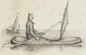
  • Image 6 A Halkett boat-cloak in use A Halkett boat is a type of lightweight inflatable boat designed by Lt Peter Halkett (1820–1885) during the 1840s. Halkett had long been interested in the difficulties of travelling in the Canadian Arctic, and the problems involved in designing boats light enough to be carried over arduous terrain, but robust enough to be used in extreme weather conditions. Halkett's first design was a collapsible and inflatable boat made of rubber-impregnated cloth. When deflated, the hull of the boat could be worn as a cloak, the oar used as a walking stick, and the sail as an umbrella. This was followed by a two-man craft that was small enough to fit into a knapsack, and when deflated served as a waterproof blanket. (Full article...)
    A lone figure wearing a top hat and overcoat, sitting in a small inflatable dinghy in open water with a large ship in the background. He holds an oar in one hand, and a large umbrella held horizontally in the other.
    A Halkett boat-cloak in use

    A Halkett boat is a type of lightweight inflatable boat designed by Lt Peter Halkett (1820–1885) during the 1840s. Halkett had long been interested in the difficulties of travelling in the Canadian Arctic, and the problems involved in designing boats light enough to be carried over arduous terrain, but robust enough to be used in extreme weather conditions.

    Halkett's first design was a collapsible and inflatable boat made of rubber-impregnated cloth. When deflated, the hull of the boat could be worn as a cloak, the oar used as a walking stick, and the sail as an umbrella. This was followed by a two-man craft that was small enough to fit into a knapsack, and when deflated served as a waterproof blanket. (Full article...)
  • Image 7 View of bog and lake from the bog trail in the Black Moshannon Bog Natural Area at Black Moshannon State Park Black Moshannon State Park is a 3,480-acre (1,410 ha) Pennsylvania state park in Rush Township, Centre County, Pennsylvania, United States. It surrounds Black Moshannon Lake, formed by a dam on Black Moshannon Creek, which has given its name to the lake and park. The park is just west of the Allegheny Front, 9 miles (14 km) east of Philipsburg on Pennsylvania Route 504, and is largely surrounded by Moshannon State Forest. A bog in the park provides a habitat for diverse wildlife not common in other areas of the state, such as carnivorous plants, orchids, and species normally found farther north. As home to the "largest reconstituted bog in Pennsylvania", it was chosen by the Pennsylvania Department of Conservation and Natural Resources for its "25 Must-see Pennsylvania State Parks" list. Humans have long used the Black Moshannon area for recreational, industrial, and subsistence purposes. The Seneca tribe used it as hunting and fishing grounds. European settlers cleared some land for farming, then clear-cut the vast stands of old-growth white pine and eastern hemlock. Black Moshannon State Park rose from the ashes of a depleted forest which had been largely destroyed by wildfire in the years following the lumber era. The forests were rehabilitated by the Civilian Conservation Corps during the Great Depression in the 1930s. Many of the buildings built by the Civilian Conservation Corps stand in the park today and are protected on the list of National Register of Historic Places in three historic districts. (Full article...)

    Black Moshannon State Park is a 3,480-acre (1,410 ha) Pennsylvania state park in Rush Township, Centre County, Pennsylvania, United States. It surrounds Black Moshannon Lake, formed by a dam on Black Moshannon Creek, which has given its name to the lake and park. The park is just west of the Allegheny Front, 9 miles (14 km) east of Philipsburg on Pennsylvania Route 504, and is largely surrounded by Moshannon State Forest. A bog in the park provides a habitat for diverse wildlife not common in other areas of the state, such as carnivorous plants, orchids, and species normally found farther north. As home to the "largest reconstituted bog in Pennsylvania", it was chosen by the Pennsylvania Department of Conservation and Natural Resources for its "25 Must-see Pennsylvania State Parks" list.

    Humans have long used the Black Moshannon area for recreational, industrial, and subsistence purposes. The Seneca tribe used it as hunting and fishing grounds. European settlers cleared some land for farming, then clear-cut the vast stands of old-growth white pine and eastern hemlock. Black Moshannon State Park rose from the ashes of a depleted forest which had been largely destroyed by wildfire in the years following the lumber era. The forests were rehabilitated by the Civilian Conservation Corps during the Great Depression in the 1930s. Many of the buildings built by the Civilian Conservation Corps stand in the park today and are protected on the list of National Register of Historic Places in three historic districts. (Full article...)
  • Image 8 Maritana Avenue, one of only two paved roads in Elcor, looking south toward Manilla Street, 1980 Elcor is a ghost town, or more properly, an extinct town, in the U.S. state of Minnesota that was inhabited between 1897 and 1956. It was built on the Mesabi Iron Range near the city of Gilbert in St. Louis County. Elcor was its own unincorporated community before it was abandoned and was never a neighborhood proper of the city of Gilbert. Not rating a figure in the national census, the people of Elcor were only generally considered to be citizens of Gilbert. The area where Elcor was located was annexed by Gilbert when its existing city boundaries were expanded after 1969. In November 1890, the seven Merritt brothers discovered ore near Mountain Iron, triggering an unparalleled iron rush to the Mesabi Range. The Elba mine was opened in 1897, and the town was platted under the direction of Don H. Bacon, president of the Minnesota Iron Company. A second nearby mine, the Corsica, was opened in 1901. The community was first called "Elba" after the name of the first underground mine (the name "Elcor" was formed later by combining the first syllables of each mine's name). The Elba and Corsica mines were both leased by Pickands Mather and Company after the formation of the United States Steel Corporation. An influx of people of many ethnicities and many nations followed, and Elcor became a microcosm of U.S. immigration, mirroring the cultural assimilation of the time. At its peak around 1920, Elcor had two churches, a post office, a general store, a primary school, a railroad station, and its own law enforcement, and housed a population of nearly 1,000. (Full article...)

    Elcor is a ghost town, or more properly, an extinct town, in the U.S. state of Minnesota that was inhabited between 1897 and 1956. It was built on the Mesabi Iron Range near the city of Gilbert in St. Louis County. Elcor was its own unincorporated community before it was abandoned and was never a neighborhood proper of the city of Gilbert. Not rating a figure in the national census, the people of Elcor were only generally considered to be citizens of Gilbert. The area where Elcor was located was annexed by Gilbert when its existing city boundaries were expanded after 1969.

    In November 1890, the seven Merritt brothers discovered ore near Mountain Iron, triggering an unparalleled iron rush to the Mesabi Range. The Elba mine was opened in 1897, and the town was platted under the direction of Don H. Bacon, president of the Minnesota Iron Company. A second nearby mine, the Corsica, was opened in 1901. The community was first called "Elba" after the name of the first underground mine (the name "Elcor" was formed later by combining the first syllables of each mine's name). The Elba and Corsica mines were both leased by Pickands Mather and Company after the formation of the United States Steel Corporation. An influx of people of many ethnicities and many nations followed, and Elcor became a microcosm of U.S. immigration, mirroring the cultural assimilation of the time. At its peak around 1920, Elcor had two churches, a post office, a general store, a primary school, a railroad station, and its own law enforcement, and housed a population of nearly 1,000. (Full article...)
  • Image 9 The Parthian Empire in 94 BC at its greatest extent, during the reign of Mithridates II (r. 124–91 BC) The Parthian Empire (/ˈpɑːrθiən/), also known as the Arsacid Empire (/ˈɑːrsəsɪd/), was a major Iranian political and cultural power centered in ancient Iran from 247 BC to 224 AD. Its latter name comes from its founder, Arsaces I, who led the Parni tribe in conquering the region of Parthia in Iran's northeast, then a satrapy (province) under Andragoras, who was rebelling against the Seleucid Empire. Mithridates I (r. c. 171 – 132 BC) greatly expanded the empire by seizing Media and Mesopotamia from the Seleucids. At its height, the Parthian Empire stretched from the northern reaches of the Euphrates, in what is now central-eastern Turkey, to present-day Afghanistan and western Pakistan. The empire, located on the Silk Road trade route between the Roman Empire in the Mediterranean Basin and the Han dynasty of China, became a center of trade and commerce. The Parthians largely adopted the art, architecture, religious beliefs, and royal insignia of their culturally heterogeneous empire, which encompassed Persian, Hellenistic, and regional cultures. For about the first half of its existence, the Arsacid court adopted elements of Greek culture, though it eventually saw a gradual revival of Iranian traditions. The Arsacid rulers were titled the "King of Kings", as a claim to be the heirs to the Achaemenid Empire; indeed, they accepted many local kings as vassals where the Achaemenids would have had centrally appointed, albeit largely autonomous, satraps. The court did appoint a small number of satraps, largely outside Iran, but these satrapies were smaller and less powerful than the Achaemenid potentates. With the expansion of Arsacid power, the seat of central government shifted from Nisa to Ctesiphon along the Tigris (south of Baghdad), although several other sites also served as capitals. (Full article...)

    The Parthian Empire (/ˈpɑːrθiən/), also known as the Arsacid Empire (/ˈɑːrsəsɪd/), was a major Iranian political and cultural power centered in ancient Iran from 247 BC to 224 AD. Its latter name comes from its founder, Arsaces I, who led the Parni tribe in conquering the region of Parthia in Iran's northeast, then a satrapy (province) under Andragoras, who was rebelling against the Seleucid Empire. Mithridates I (r.c. 171 – 132 BC) greatly expanded the empire by seizing Media and Mesopotamia from the Seleucids. At its height, the Parthian Empire stretched from the northern reaches of the Euphrates, in what is now central-eastern Turkey, to present-day Afghanistan and western Pakistan. The empire, located on the Silk Road trade route between the Roman Empire in the Mediterranean Basin and the Han dynasty of China, became a center of trade and commerce.

    The Parthians largely adopted the art, architecture, religious beliefs, and royal insignia of their culturally heterogeneous empire, which encompassed Persian, Hellenistic, and regional cultures. For about the first half of its existence, the Arsacid court adopted elements of Greek culture, though it eventually saw a gradual revival of Iranian traditions. The Arsacid rulers were titled the "King of Kings", as a claim to be the heirs to the Achaemenid Empire; indeed, they accepted many local kings as vassals where the Achaemenids would have had centrally appointed, albeit largely autonomous, satraps. The court did appoint a small number of satraps, largely outside Iran, but these satrapies were smaller and less powerful than the Achaemenid potentates. With the expansion of Arsacid power, the seat of central government shifted from Nisa to Ctesiphon along the Tigris (south of Baghdad), although several other sites also served as capitals. (Full article...)
  • Image 10 1763 portrait Frederick II (German: Friedrich II.; 24 January 1712 – 17 August 1786) was the monarch of Prussia from 1740 until 1786. He was the last Hohenzollern monarch titled King in Prussia, declaring himself King of Prussia after annexing Royal Prussia from the Polish–Lithuanian Commonwealth in 1772. His most significant accomplishments include his military successes in the Silesian wars, his reorganisation of the Prussian Army, the First Partition of Poland, and his patronage of the arts and the Enlightenment. Prussia greatly increased its territories and became a major military power in Europe under his rule. He became known as Frederick the Great (German: Friedrich der Große) and was nicknamed "Old Fritz" (German: der Alte Fritz). In his youth, Frederick was more interested in music and philosophy than war, which led to clashes with his authoritarian father, Frederick William I of Prussia. However, upon ascending to the throne, he attacked and annexed the rich Austrian province of Silesia in 1742, winning military acclaim. He became an influential military theorist, whose analyses emerged from his extensive personal battlefield experience and covered issues of strategy, tactics, mobility and logistics. (Full article...)

    Frederick II (German: Friedrich II.; 24 January 1712 – 17 August 1786) was the monarch of Prussia from 1740 until 1786. He was the last Hohenzollern monarch titled King in Prussia, declaring himself King of Prussia after annexing Royal Prussia from the Polish–Lithuanian Commonwealth in 1772. His most significant accomplishments include his military successes in the Silesian wars, his reorganisation of the Prussian Army, the First Partition of Poland, and his patronage of the arts and the Enlightenment. Prussia greatly increased its territories and became a major military power in Europe under his rule. He became known as Frederick the Great (German: Friedrich der Große) and was nicknamed "Old Fritz" (German: der Alte Fritz).

    In his youth, Frederick was more interested in music and philosophy than war, which led to clashes with his authoritarian father, Frederick William I of Prussia. However, upon ascending to the throne, he attacked and annexed the rich Austrian province of Silesia in 1742, winning military acclaim. He became an influential military theorist, whose analyses emerged from his extensive personal battlefield experience and covered issues of strategy, tactics, mobility and logistics. (Full article...)
  • Image 11 The empire in 555 under Justinian the Great, at its greatest extent since the fall of the Western Roman Empire (its vassals in pink) The Byzantine Empire, also referred to as the Eastern Roman Empire, was the continuation of the Roman Empire centred in Constantinople during Late Antiquity and the Middle Ages. The eastern half of the Empire survived the conditions that caused the fall of the West in the 5th century AD, and continued to exist until the fall of Constantinople to the Ottoman Empire in 1453. During most of its existence, the empire remained the most powerful economic, cultural, and military force in the Mediterranean world. The term "Byzantine Empire" was only coined following the empire's demise; its citizens referred to the polity as the "Roman Empire" and to themselves as "Romans". Due to the imperial seat's move from Rome to Byzantium, the adoption of state Christianity, and the predominance of Greek instead of Latin, modern historians continue to make a distinction between the earlier Roman Empire and the later Byzantine Empire. During the earlier Pax Romana period, the western parts of the empire became increasingly Latinised, while the eastern parts largely retained their preexisting Hellenistic culture. This created a dichotomy between the Greek East and Latin West. These cultural spheres continued to diverge after Constantine I (r. 324–337) moved the capital to Constantinople and legalised Christianity. Under Theodosius I (r. 379–395), Christianity became the state religion, and other religious practices were proscribed. Greek gradually replaced Latin for official use as Latin fell into disuse. (Full article...)

    The Byzantine Empire, also referred to as the Eastern Roman Empire, was the continuation of the Roman Empire centred in Constantinople during Late Antiquity and the Middle Ages. The eastern half of the Empire survived the conditions that caused the fall of the West in the 5th century AD, and continued to exist until the fall of Constantinople to the Ottoman Empire in 1453. During most of its existence, the empire remained the most powerful economic, cultural, and military force in the Mediterranean world. The term "Byzantine Empire" was only coined following the empire's demise; its citizens referred to the polity as the "Roman Empire" and to themselves as "Romans". Due to the imperial seat's move from Rome to Byzantium, the adoption of state Christianity, and the predominance of Greek instead of Latin, modern historians continue to make a distinction between the earlier Roman Empire and the later Byzantine Empire.

    During the earlier Pax Romana period, the western parts of the empire became increasingly Latinised, while the eastern parts largely retained their preexisting Hellenistic culture. This created a dichotomy between the Greek East and Latin West. These cultural spheres continued to diverge after Constantine I (r. 324–337) moved the capital to Constantinople and legalised Christianity. Under Theodosius I (r. 379–395), Christianity became the state religion, and other religious practices were proscribed. Greek gradually replaced Latin for official use as Latin fell into disuse. (Full article...)
  • Image 12 Lagoon-facing beach on South Islet Caroline Island (also known as Caroline Atoll or Millennium Island) is the easternmost of several uninhabited coral atolls comprising the southern Line Islands in the central Pacific Ocean nation of Kiribati. The atoll was first sighted by Europeans in 1606 and was claimed by the United Kingdom of Great Britain and Ireland in 1868. It has been part of the Republic of Kiribati since the island nation's independence in 1979. Caroline Island has remained relatively untouched and is one of the world's most pristine tropical islands, despite guano mining, copra (coconut meat) harvesting, and human habitation in the 19th and 20th centuries. It is home to one of the world's largest populations of the coconut crab and is an important breeding site for seabirds, most notably the sooty tern. (Full article...)
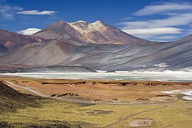
    Caroline Island (also known as Caroline Atoll or Millennium Island) is the easternmost of several uninhabited coral atolls comprising the southern Line Islands in the central Pacific Ocean nation of Kiribati.

    The atoll was first sighted by Europeans in 1606 and was claimed by the United Kingdom of Great Britain and Ireland in 1868. It has been part of the Republic of Kiribati since the island nation's independence in 1979. Caroline Island has remained relatively untouched and is one of the world's most pristine tropical islands, despite guano mining, copra (coconut meat) harvesting, and human habitation in the 19th and 20th centuries. It is home to one of the world's largest populations of the coconut crab and is an important breeding site for seabirds, most notably the sooty tern. (Full article...)
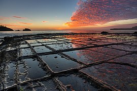
  • Image 13 Kent is a city in the U.S. state of Ohio and the largest city in Portage County. It is located along the Cuyahoga River in Northeast Ohio on the western edge of the county. The population was 28,215 at the 2020 Census. The city is counted as part of the Akron metropolitan area and the larger Cleveland–Akron–Canton combined statistical area. Part of the Connecticut Western Reserve, Kent was settled in 1805 and was known for many years as Franklin Mills. Settlers were attracted to the area due to its location along the Cuyahoga River as a place for water-powered mills. Later development came in the 1830s and 1840s as a result of the settlement's position along the route of the Pennsylvania and Ohio Canal. Leading up to the American Civil War, Franklin Mills was noted for its activity in the Underground Railroad. With the decline of the canal and the emergence of the railroad, the town became the home of the Atlantic and Great Western Railroad maintenance shops through the influence of Marvin Kent. In 1864 the town was renamed Kent in honor of and in gratitude for Marvin Kent's efforts. It was incorporated as a village in 1867 and became a city after the 1920 Census. Today Kent is a college town best known as the home of the main campus of Kent State University, founded in 1910, and as the site of the May 4, 1970 Kent State shootings. (Full article...)

    Kent is a city in the U.S. state of Ohio and the largest city in Portage County. It is located along the Cuyahoga River in Northeast Ohio on the western edge of the county. The population was 28,215 at the 2020 Census. The city is counted as part of the Akron metropolitan area and the larger Cleveland–Akron–Canton combined statistical area.

    Part of the Connecticut Western Reserve, Kent was settled in 1805 and was known for many years as Franklin Mills. Settlers were attracted to the area due to its location along the Cuyahoga River as a place for water-powered mills. Later development came in the 1830s and 1840s as a result of the settlement's position along the route of the Pennsylvania and Ohio Canal. Leading up to the American Civil War, Franklin Mills was noted for its activity in the Underground Railroad. With the decline of the canal and the emergence of the railroad, the town became the home of the Atlantic and Great Western Railroad maintenance shops through the influence of Marvin Kent. In 1864 the town was renamed Kent in honor of and in gratitude for Marvin Kent's efforts. It was incorporated as a village in 1867 and became a city after the 1920 Census. Today Kent is a college town best known as the home of the main campus of Kent State University, founded in 1910, and as the site of the May 4, 1970 Kent State shootings. (Full article...)
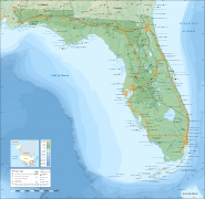
  • Image 14 False colour image of Laguna del Maule Laguna del Maule is a volcanic field in the Andes mountain range of Chile, close to, and partly overlapping, the Argentina–Chile border. The bulk of the volcanic field is in the Talca Province of Chile's Maule Region. It is a segment of the Southern Volcanic Zone, part of the Andean Volcanic Belt. The volcanic field covers an area of 500 km2 (190 sq mi) and features at least 130 volcanic vents. Volcanic activity has generated cones, lava domes, lava coulees and lava flows, which surround the Laguna del Maule lake. The field gets its name from the lake, which is also the source of the Maule River. The field's volcanic activity began 1.5 million years ago during the Pleistocene epoch; such activity has continued into the postglacial and Holocene epoch after glaciers retreated from the area. Postglacial volcanic activity has included eruptions with simultaneous explosive and effusive components, as well as eruptions with only one component. In the postglacial era, volcanic activity has increased at Laguna del Maule, with the volcanic field rapidly inflating during the Holocene. Three major caldera-forming eruptions took place in the volcanic field prior to the last glacial period. The most recent eruptions in the volcanic field took place 2,500 ± 700, 1,400 ± 600 and 800 ± 600 years ago and generated lava flows; today geothermal phenomena occur at Laguna del Maule. Volcanic rocks in the field include basalt, andesite, dacite and rhyolite; the latter along with rhyodacite makes up most of the Holocene rocks. In pre-Columbian times, the field was a regionally important source of obsidian. (Full article...)
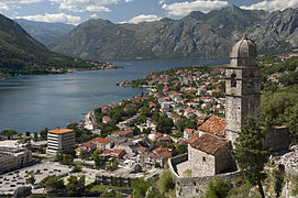
    Laguna del Maule is a volcanic field in the Andes mountain range of Chile, close to, and partly overlapping, the Argentina–Chile border. The bulk of the volcanic field is in the Talca Province of Chile's Maule Region. It is a segment of the Southern Volcanic Zone, part of the Andean Volcanic Belt. The volcanic field covers an area of 500 km (190 sq mi) and features at least 130 volcanic vents. Volcanic activity has generated cones, lava domes, lava coulees and lava flows, which surround the Laguna del Maule lake. The field gets its name from the lake, which is also the source of the Maule River.

    The field's volcanic activity began 1.5 million years ago during the Pleistocene epoch; such activity has continued into the postglacial and Holocene epoch after glaciers retreated from the area. Postglacial volcanic activity has included eruptions with simultaneous explosive and effusive components, as well as eruptions with only one component. In the postglacial era, volcanic activity has increased at Laguna del Maule, with the volcanic field rapidly inflating during the Holocene. Three major caldera-forming eruptions took place in the volcanic field prior to the last glacial period. The most recent eruptions in the volcanic field took place 2,500 ± 700, 1,400 ± 600 and 800 ± 600 years ago and generated lava flows; today geothermal phenomena occur at Laguna del Maule. Volcanic rocks in the field include basalt, andesite, dacite and rhyolite; the latter along with rhyodacite makes up most of the Holocene rocks. In pre-Columbian times, the field was a regionally important source of obsidian. (Full article...)
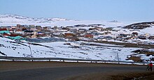
  • Image 15 Michael was born near Apex, Iqaluit. Simonie Michael (Inuktitut: ᓴᐃᒨᓂ ᒪᐃᑯᓪ; first name also spelled Simonee, alternative surnames Michel or E7-551; March 2, 1933 – November 15, 2008) was a Canadian politician from the eastern Northwest Territories (now Nunavut) who was the first Inuk elected to a legislature in Canada. Before becoming involved in politics, Michael worked as a carpenter and business owner, and was one of very few translators between Inuktitut and English. He became a prominent member of the Inuit co-operative housing movement and a community activist in Iqaluit, and was appointed to a series of governing bodies, including the precursor to the Iqaluit City Council. After becoming the first elected Inuk member of the Northwest Territories Legislative Council, in 1966, Michael worked on infrastructural and public health initiatives. He is credited with bringing public attention to the dehumanizing effects of the disc number system that was used in place of surnames for Inuit, and with prompting the government to authorise Project Surname to replace the numbers with names. (Full article...)
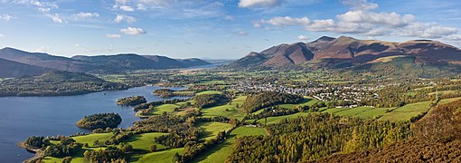
    Michael was born near Apex, Iqaluit.

    Simonie Michael (Inuktitut: ᓴᐃᒨᓂ ᒪᐃᑯᓪ; first name also spelled Simonee, alternative surnames Michel or E7-551; March 2, 1933 – November 15, 2008) was a Canadian politician from the eastern Northwest Territories (now Nunavut) who was the first Inuk elected to a legislature in Canada. Before becoming involved in politics, Michael worked as a carpenter and business owner, and was one of very few translators between Inuktitut and English. He became a prominent member of the Inuit co-operative housing movement and a community activist in Iqaluit, and was appointed to a series of governing bodies, including the precursor to the Iqaluit City Council.

    After becoming the first elected Inuk member of the Northwest Territories Legislative Council, in 1966, Michael worked on infrastructural and public health initiatives. He is credited with bringing public attention to the dehumanizing effects of the disc number system that was used in place of surnames for Inuit, and with prompting the government to authorise Project Surname to replace the numbers with names. (Full article...)
  • More featured articles

    Vital articles Vital article

    Vital articles to understand Geography.

    The size of Africa compared to other continents
    Africa is the world's second-largest and second-most populous continent after Asia. At about 30.3 million km (11.7 million square miles) including adjacent islands, it covers 20% of Earth's land area and 6% of its total surface area. With nearly 1.4 billion people as of 2021, it accounts for about 18% of the world's human population. Africa's population is the youngest among all the continents; the median age in 2012 was 19.7, when the worldwide median age was 30.4. Despite a wide range of natural resources, Africa is the least wealthy continent per capita and second-least wealthy by total wealth, ahead of Oceania. Scholars have attributed this to different factors including geography, climate, corruption, colonialism, the Cold War, and neocolonialism. Despite this low concentration of wealth, recent economic expansion and the large and young population make Africa an important economic market in the broader global context. Africa has a large quantity of natural resources and food resources, including diamonds, sugar, salt, gold, iron, cobalt, uranium, copper, bauxite, silver, petroleum, natural gas, cocoa beans, and. (Full article...)
    Other vital articles

    Get involved

    For editor resources and to collaborate with other editors on improving Wikipedia's Geography-related articles, visit WikiProject Geography.


    Here are some tasks awaiting attention:

    Selected pictures

    Featured biography articles in geography

    Daniel Boone (November 2 [O.S. October 22], 1734 – September 26, 1820) was an American pioneer and frontiersman whose exploits made him one of the first folk heroes of the United States. He became famous for his exploration and settlement of Kentucky, which was then beyond the western borders of the Thirteen Colonies. In 1775, Boone blazed the Wilderness Road through the Cumberland Gap and into Kentucky, in the face of resistance from Native Americans. He founded Boonesborough, one of the first English-speaking settlements west of the Appalachian Mountains. By the end of the 18th century, more than 200,000 emigrated people had entered Kentucky by following the route marked by Boone.

    Boone served as a militia officer during the Revolutionary War (1775–1783), which was fought in Kentucky primarily between American settlers and British-allied Indians. Boone was taken in by Shawnees in 1778 and adopted into the tribe, but he resigned and continued to help protect the Kentucky settlements from the tribes they belonged to. He allegedly also left due to the Shawnee Indians torturing and killing one of his sons. He was elected to the first of his three terms in the Virginia General Assembly during the war and fought in the Battle of Blue Licks in 1782, one of the last battles of the American Revolution. He worked as a surveyor and merchant after the war, but went deep into debt as a Kentucky land speculator. He resettled in Missouri in 1799, where he spent most of the last two decades of his life, frustrated with legal problems resulting from his land claims. (Full article...)
    More featured biographies

    Did you know

    Did you know it about Geography?

    Places around you

    You can read about interesting Wikipedia articles about places around you.

    Special:Nearby

    This following Geography-related articles is a most visited articles of WikiProject Geography, See complete list at Wikipedia:WikiProject Geography/Popular pages.

  • Image 4 Generation X (often shortened to Gen X) is the demographic cohort following the Baby Boomers and preceding Millennials. Researchers and popular media often use the mid-1960s as its starting birth years and the late 1970s as its ending birth years, with the generation being generally defined as people born from 1965 to 1980. By this definition and U.S. Census data, there are 65.2 million Gen Xers in the United States as of 2019. Most of Generation X are the children of the Silent Generation and early Baby Boomers; Xers are also often the parents of Millennials and Generation Z. (Full article...)
    Generation X (often shortened to Gen X) is the demographic cohort following the Baby Boomers and preceding Millennials. Researchers and popular media often use the mid-1960s as its starting birth years and the late 1970s as its ending birth years, with the generation being generally defined as people born from 1965 to 1980. By this definition and U.S. Census data, there are 65.2 million Gen Xers in the United States as of 2019. Most of Generation X are the children of the Silent Generation and early Baby Boomers; Xers are also often the parents of Millennials and Generation Z. (Full article...)
  • Image 5 Cartogram of the world's population in 2018; each square represents 500,000 people. This is a list of countries and dependencies by population. It includes sovereign states, inhabited dependent territories and, in some cases, constituent countries of sovereign states, with inclusion within the list being primarily based on the ISO standard ISO 3166-1. For instance, the United Kingdom is considered a single entity, while the constituent countries of the Kingdom of the Netherlands are considered separately. In addition, this list includes certain states with limited recognition not found in ISO 3166-1. Also given in a percentage is each country's population compared with the world population, which the United Nations estimates at 8.13 billion as of 2024. (Full article...)
    Cartogram of the world's population in 2018; each square represents 500,000 people.


    This is a list of countries and dependencies by population. It includes sovereign states, inhabited dependent territories and, in some cases, constituent countries of sovereign states, with inclusion within the list being primarily based on the ISO standard ISO 3166-1. For instance, the United Kingdom is considered a single entity, while the constituent countries of the Kingdom of the Netherlands are considered separately. In addition, this list includes certain states with limited recognition not found in ISO 3166-1. Also given in a percentage is each country's population compared with the world population, which the United Nations estimates at 8.13 billion as of 2024. (Full article...)
  • Image 6 Hong Kong is a special administrative region of the People's Republic of China. With 7.4 million residents of various nationalities in a 1,104-square-kilometre (426 sq mi) territory, Hong Kong is the fourth most densely populated region in the world. (Full article...)

    Hong Kong is a special administrative region of the People's Republic of China. With 7.4 million residents of various nationalities in a 1,104-square-kilometre (426 sq mi) territory, Hong Kong is the fourth most densely populated region in the world. (Full article...)
  • Image 7 Millennials, also known as Generation Y or Gen Y, are the demographic cohort following Generation X and preceding Generation Z. Researchers and popular media use the early 1980s as starting birth years and the mid-1990s to early 2000s as ending birth years, with the generation typically being defined as people born from 1981 to 1996. Most Millennials are the children of Baby Boomers and older Generation X. In turn Millennials are often the parents of Generation Alpha. (Full article...)
    Millennials, also known as Generation Y or Gen Y, are the demographic cohort following Generation X and preceding Generation Z. Researchers and popular media use the early 1980s as starting birth years and the mid-1990s to early 2000s as ending birth years, with the generation typically being defined as people born from 1981 to 1996. Most Millennials are the children of Baby Boomers and older Generation X. In turn Millennials are often the parents of Generation Alpha. (Full article...)
  • Image 8 England is a country that is part of the United Kingdom. It is located on the island of Great Britain, of which it covers approximately 62%, and over 100 smaller adjacent islands. It has land borders with Scotland to the north and Wales to the west, and is otherwise surrounded by the North Sea to the east, the English Channel to the south, the Celtic Sea to the south-west, and the Irish Sea to the west. Continental Europe lies to the south-east, and Ireland to the west. At the 2021 census, the population was 56,490,048. London is both the largest city and the capital. (Full article...)

    England is a country that is part of the United Kingdom. It is located on the island of Great Britain, of which it covers approximately 62%, and over 100 smaller adjacent islands. It has land borders with Scotland to the north and Wales to the west, and is otherwise surrounded by the North Sea to the east, the English Channel to the south, the Celtic Sea to the south-west, and the Irish Sea to the west. Continental Europe lies to the south-east, and Ireland to the west. At the 2021 census, the population was 56,490,048. London is both the largest city and the capital. (Full article...)
  • Image 9 Generation Alpha (often shortened to Gen Alpha) is the demographic cohort succeeding Generation Z. Researchers and popular media use the early 2010s as starting birth years to the mid-2020s as the ending birth years (see § Date and age range definitions). Named after alpha, the first letter in the Greek alphabet, Generation Alpha is the first to be born entirely in the 21st century and the third millennium. Most members of Generation Alpha are the children of Millennials. (Full article...)
    Generation Alpha (often shortened to Gen Alpha) is the demographic cohort succeeding Generation Z. Researchers and popular media use the early 2010s as starting birth years to the mid-2020s as the ending birth years (see § Date and age range definitions). Named after alpha, the first letter in the Greek alphabet, Generation Alpha is the first to be born entirely in the 21st century and the third millennium. Most members of Generation Alpha are the children of Millennials. (Full article...)
  • Image 10 Dymaxion map of the world with the 30 largest countries and territories by area This is a list of the world's countries and their dependencies by land, water, and total area, ranked by total area. (Full article...)
    Dymaxion map of the world with the 30 largest countries and territories by area

    This is a list of the world's countries and their dependencies by land, water, and total area, ranked by total area. (Full article...)
  • Click to enlarge and view description.

    Main articles

    CategoriesCategories

    Select [►] to view subcategories.

    Associated Wikimedia

    The following Wikimedia Foundation sister projects provide more on this subject:

    Discover Wikipedia using portals
    Retrieved from "https://en.wikipedia.org/w/index.php?title=Portal:Geography&oldid=1202464975"