Loading
  • 21 Aug, 2019

  • By, Wikipedia

Portal:Geography

The Geography Portal

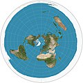
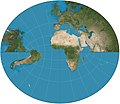
Geography (from Ancient Greek γεωγραφία geōgraphía; combining 'Earth' and gráphō 'write') is the study of the lands, features, inhabitants, and phenomena of Earth. Geography is an all-encompassing discipline that seeks an understanding of Earth and its human and natural complexities—not merely where objects are, but also how they have changed and come to be. While geography is specific to Earth, many concepts can be applied more broadly to other celestial bodies in the field of planetary science. Geography has been called "a bridge between natural science and social science disciplines."

Origins of many of the concepts in geography can be traced to Greek Eratosthenes of Cyrene, who may have coined the term "geographia" (c. 276 BC – c. 195/194 BC). The first recorded use of the word γεωγραφία was as the title of a book by Greek scholar Claudius Ptolemy (100 – 170 AD). This work created the so-called "Ptolemaic tradition" of geography, which included "Ptolemaic cartographic theory." However, the concepts of geography (such as cartography) date back to the earliest attempts to understand the world spatially, with the earliest example of an attempted world map dating to the 9th century BCE in ancient Babylon. The history of geography as a discipline spans cultures and millennia, being independently developed by multiple groups, and cross-pollinated by trade between these groups. The core concepts of geography consistent between all approaches are a focus on space, place, time, and scale.

Today, geography is an extremely broad discipline with multiple approaches and modalities. There have been multiple attempts to organize the discipline, including the four traditions of geography, and into branches. Techniques employed can generally be broken down into quantitative and qualitative approaches, with many studies taking mixed-methods approaches. Common techniques include cartography, remote sensing, interviews, and surveying. (Full article...)

Featured articles are displayed here, which represent some of the best content on English Wikipedia.

  • Image 3 Johnson Creek near Regner Road in Gresham Johnson Creek is a 25-mile (40 km) tributary of the Willamette River in the Portland metropolitan area of the U.S. state of Oregon. Part of the drainage basin of the Columbia River, its catchment consists of 54 square miles (140 km2) of mostly urban land occupied by about 180,000 people as of 2012. Passing through the cities of Gresham, Portland, and Milwaukie, the creek flows generally west from the foothills of the Cascade Range through sediments deposited by glacial floods on a substrate of basalt. Though polluted, it is free-flowing along its main stem and provides habitat for salmon and other migrating fish. Prior to European settlement, the watershed was heavily forested and was used by Native Americans of the Chinook band for fishing and hunting. In the 19th century, non-Native American settlers cleared much of the land for farming, and the stream is named for one of these newcomers, William Johnson, who in 1846 built a water-powered sawmill along the creek. By the early 20th century, a rail line parallel to the stream encouraged further residential and commercial development. As urban density increased in the floodplain, seasonal floods grew more damaging. In the 1930s the Works Progress Administration of the federal government lined the lower 15 miles (24 km) of Johnson Creek with rock to control the floods. Despite this, the creek flooded 37 times between 1941 and 2006. Since the 1990s, regional planners have tried to reduce flooding by controlling stormwater runoff, creating stream meanders, reducing erosion, replacing impervious surfaces, and protecting riparian buffers. (Full article...)

    Johnson Creek is a 25-mile (40 km) tributary of the Willamette River in the Portland metropolitan area of the U.S. state of Oregon. Part of the drainage basin of the Columbia River, its catchment consists of 54 square miles (140 km) of mostly urban land occupied by about 180,000 people as of 2012. Passing through the cities of Gresham, Portland, and Milwaukie, the creek flows generally west from the foothills of the Cascade Range through sediments deposited by glacial floods on a substrate of basalt. Though polluted, it is free-flowing along its main stem and provides habitat for salmon and other migrating fish.

    Prior to European settlement, the watershed was heavily forested and was used by Native Americans of the Chinook band for fishing and hunting. In the 19th century, non-Native American settlers cleared much of the land for farming, and the stream is named for one of these newcomers, William Johnson, who in 1846 built a water-powered sawmill along the creek. By the early 20th century, a rail line parallel to the stream encouraged further residential and commercial development. As urban density increased in the floodplain, seasonal floods grew more damaging. In the 1930s the Works Progress Administration of the federal government lined the lower 15 miles (24 km) of Johnson Creek with rock to control the floods. Despite this, the creek flooded 37 times between 1941 and 2006. Since the 1990s, regional planners have tried to reduce flooding by controlling stormwater runoff, creating stream meanders, reducing erosion, replacing impervious surfaces, and protecting riparian buffers. (Full article...)
  • Image 4 Near the Tower of London, England The common raven (Corvus corax) is a large all-black passerine bird. It is the most widely distributed of all corvids, found across the Northern Hemisphere. It is a raven known by many names at the subspecies level; there are at least eight subspecies with little variation in appearance, although recent research has demonstrated significant genetic differences among populations from various regions. It is one of the two largest corvids, alongside the thick-billed raven, and is possibly the heaviest passerine bird; at maturity, the common raven averages 63 centimetres (25 inches) in length and 1.47 kilograms (3.2 pounds) in mass. Although their typical lifespan is considerably shorter, common ravens can live more than 23 years in the wild. Young birds may travel in flocks but later mate for life, with each mated pair defending a territory. Common ravens have coexisted with humans for thousands of years and in some areas have been so numerous that people have regarded them as pests. Part of their success as a species is due to their omnivorous diet; they are extremely versatile and opportunistic in finding sources of nutrition, feeding on carrion, insects, cereal grains, berries, fruit, small animals, nesting birds, and food waste. Some notable feats of problem-solving provide evidence that the common raven is unusually intelligent. (Full article...)

    The common raven (Corvus corax) is a large all-black passerine bird. It is the most widely distributed of all corvids, found across the Northern Hemisphere. It is a raven known by many names at the subspecies level; there are at least eight subspecies with little variation in appearance, although recent research has demonstrated significant genetic differences among populations from various regions. It is one of the two largest corvids, alongside the thick-billed raven, and is possibly the heaviest passerine bird; at maturity, the common raven averages 63 centimetres (25 inches) in length and 1.47 kilograms (3.2 pounds) in mass. Although their typical lifespan is considerably shorter, common ravens can live more than 23 years in the wild. Young birds may travel in flocks but later mate for life, with each mated pair defending a territory.

    Common ravens have coexisted with humans for thousands of years and in some areas have been so numerous that people have regarded them as pests. Part of their success as a species is due to their omnivorous diet; they are extremely versatile and opportunistic in finding sources of nutrition, feeding on carrion, insects, cereal grains, berries, fruit, small animals, nesting birds, and food waste. Some notable feats of problem-solving provide evidence that the common raven is unusually intelligent. (Full article...)
  • Image 5 Terrain of the Table Rocks. Upper Table Rock is on the right, Lower Table Rock is on the left. Upper Table Rock and Lower Table Rock are two prominent volcanic plateaus located just north of the Rogue River in Jackson County, Oregon, U.S. Created by an andesitic lava flow approximately seven million years ago and shaped by erosion, they now stand about 800 feet (240 m) above the surrounding Rogue Valley. The Table Rocks are jointly owned; The Nature Conservancy is responsible for 3,591 acres (1,453 ha), while the Bureau of Land Management is responsible for 1,280 acres (520 ha). Native Americans have inhabited the Table Rocks area for at least 15,000 years before European-American settlement. Starting in the mid-19th century during a gold rush, the settlers forced the Takelma tribe away from the Table Rocks and into reservations. The surrounding area was quickly developed. The Table Rock post office was established in 1872, an airstrip was built atop Lower Table Rock in 1948, and a very high frequency omni-directional range (VOR) aviation tower was constructed on Upper Table Rock in the 1960s. The Table Rocks were not protected until the 1970s. (Full article...)

    Upper Table Rock and Lower Table Rock are two prominent volcanic plateaus located just north of the Rogue River in Jackson County, Oregon, U.S. Created by an andesitic lava flow approximately seven million years ago and shaped by erosion, they now stand about 800 feet (240 m) above the surrounding Rogue Valley. The Table Rocks are jointly owned; The Nature Conservancy is responsible for 3,591 acres (1,453 ha), while the Bureau of Land Management is responsible for 1,280 acres (520 ha).

    Native Americans have inhabited the Table Rocks area for at least 15,000 years before European-American settlement. Starting in the mid-19th century during a gold rush, the settlers forced the Takelma tribe away from the Table Rocks and into reservations. The surrounding area was quickly developed. The Table Rock post office was established in 1872, an airstrip was built atop Lower Table Rock in 1948, and a very high frequency omni-directional range (VOR) aviation tower was constructed on Upper Table Rock in the 1960s. The Table Rocks were not protected until the 1970s. (Full article...)
  • Image 6 Skyline of the city centre George Town is the capital of the Malaysian state of Penang. It is the core city of the George Town Conurbation, Malaysia's second largest metropolitan area with a population of 2.84 million and the second highest contributor to the country's GDP. The city proper spans an area of 306 km2 (118 sq mi) encompassing Penang Island and surrounding islets, and had a population of 794,313 as of 2020[update]. Initially established as an entrepôt by Francis Light in 1786, George Town serves as the commercial centre for northern Malaysia. According to Euromonitor International and the Economist Intelligence Unit, it has the highest potential for revenue growth among all Malaysian cities and contributed nearly 8 per cent of the country's personal disposable income in 2015, second only to the national capital, Kuala Lumpur. Its technological sector, anchored by hundreds of multinational companies, has made George Town the top exporter in the country. The Penang International Airport links George Town to several regional cities, while a ferry service and two road bridges connect the city to the rest of Peninsular Malaysia. Swettenham Pier is the busiest cruise terminal in the country. (Full article...)

    George Town is the capital of the Malaysian state of Penang. It is the core city of the George Town Conurbation, Malaysia's second largest metropolitan area with a population of 2.84 million and the second highest contributor to the country's GDP. The city proper spans an area of 306 km (118 sq mi) encompassing Penang Island and surrounding islets, and had a population of 794,313 as of 2020.

    Initially established as an entrepôt by Francis Light in 1786, George Town serves as the commercial centre for northern Malaysia. According to Euromonitor International and the Economist Intelligence Unit, it has the highest potential for revenue growth among all Malaysian cities and contributed nearly 8 per cent of the country's personal disposable income in 2015, second only to the national capital, Kuala Lumpur. Its technological sector, anchored by hundreds of multinational companies, has made George Town the top exporter in the country. The Penang International Airport links George Town to several regional cities, while a ferry service and two road bridges connect the city to the rest of Peninsular Malaysia. Swettenham Pier is the busiest cruise terminal in the country. (Full article...)
  • Image 7 The Viscount of Inhaúma around the age of 56, c. 1864 Joaquim José Inácio, Viscount of Inhaúma (Portuguese: [iɲaˈũmɐ]; 1 August 1808 – 8 March 1869), was a naval officer, politician and monarchist of the Empire of Brazil. He was born in the Kingdom of Portugal, and his family moved to Brazil two years later. After Brazilian independence in 1822, Inhaúma enlisted in the Brazilian navy. Early in his career during the latter half of the 1820s, he participated in the subduing of secessionist rebellions: first the Confederation of the Equator, and then the Cisplatine War, which precipitated a long international armed conflict with the United Provinces of the Río de la Plata. Throughout the chaos that characterized the years when Emperor Dom Pedro II was a minor, Inhaúma remained loyal to the government. He helped quell a military mutiny in 1831 and was involved in suppressing some of the other rebellions that erupted during that troubled period. He saw action in the Sabinada between 1837 and 1838, followed by the Ragamuffin War from 1840 until 1844. In 1849, after spending two years in Great Britain, Inhaúma was given command of the fleet that was instrumental in subduing the Praieira revolt, the last rebellion in imperial Brazil. (Full article...)

    Joaquim José Inácio, Viscount of Inhaúma (Portuguese: [iɲaˈũmɐ]; 1 August 1808 – 8 March 1869), was a naval officer, politician and monarchist of the Empire of Brazil. He was born in the Kingdom of Portugal, and his family moved to Brazil two years later. After Brazilian independence in 1822, Inhaúma enlisted in the Brazilian navy. Early in his career during the latter half of the 1820s, he participated in the subduing of secessionist rebellions: first the Confederation of the Equator, and then the Cisplatine War, which precipitated a long international armed conflict with the United Provinces of the Río de la Plata.

    Throughout the chaos that characterized the years when Emperor Dom Pedro II was a minor, Inhaúma remained loyal to the government. He helped quell a military mutiny in 1831 and was involved in suppressing some of the other rebellions that erupted during that troubled period. He saw action in the Sabinada between 1837 and 1838, followed by the Ragamuffin War from 1840 until 1844. In 1849, after spending two years in Great Britain, Inhaúma was given command of the fleet that was instrumental in subduing the Praieira revolt, the last rebellion in imperial Brazil. (Full article...)
  • Image 8 Ubinas in August 2015 Ubinas is an active stratovolcano in the Moquegua Region of southern Peru, approximately 60 kilometres (37 mi) east of the city of Arequipa. Part of the Central Volcanic Zone of the Andes, it rises 5,672 metres (18,609 ft) above sea level. The volcano's summit is cut by a 1.4-kilometre-wide (0.87 mi) and 150-metre-deep (490 ft) caldera, which itself contains a smaller crater. Below the summit, Ubinas has the shape of an upwards-steepening cone with a prominent notch on the southern side. The gently sloping lower part of the volcano is also known as Ubinas I and the steeper upper part as Ubinas II; they represent different stages in the volcano's geological history. The most active volcano in Peru, Ubinas has a history of small to moderate explosive eruptions as well as a few larger eruptions, such as in 1667, along with persistent degassing and ash emissions. Activity at the volcano began in the Pleistocene epoch, and led to the growth of the current mountain in two phases. Among the recent eruptions was the 2006–2007 event, which produced eruption columns and led to ash fall in the region, resulting in health issues and evacuations. During the most recent activity, from 2013 to 2017, a lava flow formed inside the crater, and further ash falls led to renewed evacuations of surrounding towns. Ubinas is monitored by the Peruvian geological service INGEMMET, which has published a volcano hazard map for Ubinas and regular volcanic activity reports. (Full article...)

    Ubinas is an active stratovolcano in the Moquegua Region of southern Peru, approximately 60 kilometres (37 mi) east of the city of Arequipa. Part of the Central Volcanic Zone of the Andes, it rises 5,672 metres (18,609 ft) above sea level. The volcano's summit is cut by a 1.4-kilometre-wide (0.87 mi) and 150-metre-deep (490 ft) caldera, which itself contains a smaller crater. Below the summit, Ubinas has the shape of an upwards-steepening cone with a prominent notch on the southern side. The gently sloping lower part of the volcano is also known as Ubinas I and the steeper upper part as Ubinas II; they represent different stages in the volcano's geological history.

    The most active volcano in Peru, Ubinas has a history of small to moderate explosive eruptions as well as a few larger eruptions, such as in 1667, along with persistent degassing and ash emissions. Activity at the volcano began in the Pleistocene epoch, and led to the growth of the current mountain in two phases. Among the recent eruptions was the 2006–2007 event, which produced eruption columns and led to ash fall in the region, resulting in health issues and evacuations. During the most recent activity, from 2013 to 2017, a lava flow formed inside the crater, and further ash falls led to renewed evacuations of surrounding towns. Ubinas is monitored by the Peruvian geological service INGEMMET, which has published a volcano hazard map for Ubinas and regular volcanic activity reports. (Full article...)
  • Image 9 The eastern city wall of Thessalonica, with the Thermaic Gulf in the background (2012) The siege of Thessalonica between 1422 and 1430 saw the Ottoman Empire, under Sultan Murad II, capture the city of Thessalonica. Afterwards, the city remained in Ottoman hands for the next five centuries until it became part of the Kingdom of Greece in 1912. Thessalonica had already been under Ottoman control from 1387 to 1403 before returning to Byzantine rule in the aftermath of the Battle of Ankara. In 1422, after the Byzantines supported Mustafa Çelebi as a rival pretender against him, Murad attacked Thessalonica. Unable to provide manpower or resources for the city's defence, its ruler, Andronikos Palaiologos, handed it over to the Republic of Venice in September 1423. The Venetians attempted to persuade the Sultan to recognise their possession, but failed as Murad considered the city his by right and the Venetians to be interlopers. This impasse led to an Ottoman blockade of Thessalonica, which occasionally flared up with direct attacks on the city. At the same time, the conflict was mostly fought as a series of raids by both sides against the other's territories in the Balkans and the Aegean Islands. The Venetians repeatedly tried to apply pressure by blocking the passage of the Dardanelles at Gallipoli, with little success. (Full article...)

    The siege of Thessalonica between 1422 and 1430 saw the Ottoman Empire, under Sultan Murad II, capture the city of Thessalonica. Afterwards, the city remained in Ottoman hands for the next five centuries until it became part of the Kingdom of Greece in 1912.

    Thessalonica had already been under Ottoman control from 1387 to 1403 before returning to Byzantine rule in the aftermath of the Battle of Ankara. In 1422, after the Byzantines supported Mustafa Çelebi as a rival pretender against him, Murad attacked Thessalonica. Unable to provide manpower or resources for the city's defence, its ruler, Andronikos Palaiologos, handed it over to the Republic of Venice in September 1423. The Venetians attempted to persuade the Sultan to recognise their possession, but failed as Murad considered the city his by right and the Venetians to be interlopers. This impasse led to an Ottoman blockade of Thessalonica, which occasionally flared up with direct attacks on the city. At the same time, the conflict was mostly fought as a series of raids by both sides against the other's territories in the Balkans and the Aegean Islands. The Venetians repeatedly tried to apply pressure by blocking the passage of the Dardanelles at Gallipoli, with little success. (Full article...)
  • Image 10 Volubilis ruins Volubilis (Latin pronunciation: [wɔˈɫuːbɪlɪs]; Arabic: وليلي, romanized: walīlī; Berber languages: ⵡⵍⵉⵍⵉ, romanized: wlili) is a partly-excavated Berber-Roman city in Morocco situated near the city of Meknes that may have been the capital of the Kingdom of Mauretania, at least from the time of King Juba II. Before Volubilis, the capital of the kingdom may have been at Gilda. Built in a fertile agricultural area, it developed from the 3rd century BC onward as a Berber, then proto-Carthaginian, settlement before being the capital of the kingdom of Mauretania. It grew rapidly under Roman rule from the 1st century AD onward and expanded to cover about 42 hectares (100 acres) with a 2.6 km (1.6 mi) circuit of walls. The city gained a number of major public buildings in the 2nd century, including a basilica, temple and triumphal arch. Its prosperity, which was derived principally from olive growing, prompted the construction of many fine town-houses with large mosaic floors. (Full article...)

    Volubilis (Latin pronunciation: [wɔˈɫuːbɪlɪs]; Arabic: وليلي, romanizedwalīlī; Berber languages: ⵡⵍⵉⵍⵉ, romanized: wlili) is a partly-excavated Berber-Roman city in Morocco situated near the city of Meknes that may have been the capital of the Kingdom of Mauretania, at least from the time of King Juba II. Before Volubilis, the capital of the kingdom may have been at Gilda.

    Built in a fertile agricultural area, it developed from the 3rd century BC onward as a Berber, then proto-Carthaginian, settlement before being the capital of the kingdom of Mauretania. It grew rapidly under Roman rule from the 1st century AD onward and expanded to cover about 42 hectares (100 acres) with a 2.6 km (1.6 mi) circuit of walls. The city gained a number of major public buildings in the 2nd century, including a basilica, temple and triumphal arch. Its prosperity, which was derived principally from olive growing, prompted the construction of many fine town-houses with large mosaic floors. (Full article...)
  • Image 11 Torpedo Boat No. 38 (ex-Kranich) underway The Schichau class consisted of 22 torpedo boats built for the Austro-Hungarian Navy between 1885 and 1891. The class was one of the first torpedo boat classes built for the Austro-Hungarian Navy, and they were initially powered by steam from a single locomotive boiler and were armed with two 37 mm (1.5 in) Hotchkiss guns and two 356 mm (14 in) torpedo tubes. The entire class was reconstructed between 1900 and 1910, when they received two Yarrow boilers and a second funnel. Ten of the class were converted into minesweepers between 1911 and 1913. One boat was discarded in 1911, with the rest seeing active service as part of local defence forces for the Adriatic naval bases during World War I, with one being lost in the early days of the war. The remaining ten torpedo boats were also converted to minesweepers in 1917, although five still carried torpedoes. After the war, sixteen of the boats were allocated to Italy and four were allocated to the navy of the newly created Kingdom of the Serbs, Croats and Slovenes (later Yugoslavia). Two were commissioned while the other two were used for spare parts. Except for one of the Yugoslav boats which was retained as a training vessel, all of the boats had been discarded by 1929. After capture during the April 1941 Axis invasion of Yugoslavia in World War II, the remaining boat saw service with the Italians and then the Germans. She was lost while in German hands sometime after September 1943. (Full article...)

    The Schichau class consisted of 22 torpedo boats built for the Austro-Hungarian Navy between 1885 and 1891. The class was one of the first torpedo boat classes built for the Austro-Hungarian Navy, and they were initially powered by steam from a single locomotive boiler and were armed with two 37 mm (1.5 in) Hotchkiss guns and two 356 mm (14 in) torpedo tubes. The entire class was reconstructed between 1900 and 1910, when they received two Yarrow boilers and a second funnel.

    Ten of the class were converted into minesweepers between 1911 and 1913. One boat was discarded in 1911, with the rest seeing active service as part of local defence forces for the Adriatic naval bases during World War I, with one being lost in the early days of the war. The remaining ten torpedo boats were also converted to minesweepers in 1917, although five still carried torpedoes. After the war, sixteen of the boats were allocated to Italy and four were allocated to the navy of the newly created Kingdom of the Serbs, Croats and Slovenes (later Yugoslavia). Two were commissioned while the other two were used for spare parts. Except for one of the Yugoslav boats which was retained as a training vessel, all of the boats had been discarded by 1929. After capture during the April 1941 Axis invasion of Yugoslavia in World War II, the remaining boat saw service with the Italians and then the Germans. She was lost while in German hands sometime after September 1943. (Full article...)
  • Image 12 The Song dynasty at its greatest extent in 1111 The Song dynasty (/sʊŋ/) was an imperial dynasty of China that ruled from 960 to 1279. The dynasty was founded by Emperor Taizu of Song, who usurped the throne of the Later Zhou dynasty and went on to conquer the rest of the Ten Kingdoms, ending the Five Dynasties and Ten Kingdoms period. The Song often came into conflict with the contemporaneous Liao, Western Xia and Jin dynasties in northern China. After retreating to southern China following attacks by the Jin dynasty, the Song was eventually conquered by the Mongol-led Yuan dynasty. The dynasty's history is divided into two periods: during the Northern Song (北宋; 960–1127), the capital was in the northern city of Bianjing (now Kaifeng) and the dynasty controlled most of what is now Eastern China. The Southern Song (南宋; 1127–1279) comprise the period following the loss of control over the northern half of Song territory to the Jurchen-led Jin dynasty in the Jin–Song Wars. At that time, the Song court retreated south of the Yangtze and established its capital at Lin'an (now Hangzhou). Although the Song dynasty had lost control of the traditional Chinese heartlands around the Yellow River, the Southern Song Empire contained a large population and productive agricultural land, sustaining a robust economy. In 1234, the Jin dynasty was conquered by the Mongols, who took control of northern China, maintaining uneasy relations with the Southern Song. Möngke Khan, the fourth Great Khan of the Mongol Empire, died in 1259 while besieging the mountain castle Diaoyucheng in Chongqing. His younger brother Kublai Khan was proclaimed the new Great Khan and in 1271 founded the Yuan dynasty. After two decades of sporadic warfare, Kublai Khan's armies conquered the Song dynasty in 1279 after defeating the Southern Song in the Battle of Yamen, and reunited China under the Yuan dynasty. (Full article...)
    The Song dynasty (/sʊŋ/) was an imperial dynasty of China that ruled from 960 to 1279. The dynasty was founded by Emperor Taizu of Song, who usurped the throne of the Later Zhou dynasty and went on to conquer the rest of the Ten Kingdoms, ending the Five Dynasties and Ten Kingdoms period. The Song often came into conflict with the contemporaneous Liao, Western Xia and Jin dynasties in northern China. After retreating to southern China following attacks by the Jin dynasty, the Song was eventually conquered by the Mongol-led Yuan dynasty.

    The dynasty's history is divided into two periods: during the Northern Song (北宋; 960–1127), the capital was in the northern city of Bianjing (now Kaifeng) and the dynasty controlled most of what is now Eastern China. The Southern Song (南宋; 1127–1279) comprise the period following the loss of control over the northern half of Song territory to the Jurchen-led Jin dynasty in the Jin–Song Wars. At that time, the Song court retreated south of the Yangtze and established its capital at Lin'an (now Hangzhou). Although the Song dynasty had lost control of the traditional Chinese heartlands around the Yellow River, the Southern Song Empire contained a large population and productive agricultural land, sustaining a robust economy. In 1234, the Jin dynasty was conquered by the Mongols, who took control of northern China, maintaining uneasy relations with the Southern Song. Möngke Khan, the fourth Great Khan of the Mongol Empire, died in 1259 while besieging the mountain castle Diaoyucheng in Chongqing. His younger brother Kublai Khan was proclaimed the new Great Khan and in 1271 founded the Yuan dynasty. After two decades of sporadic warfare, Kublai Khan's armies conquered the Song dynasty in 1279 after defeating the Southern Song in the Battle of Yamen, and reunited China under the Yuan dynasty. (Full article...)
  • Image 13 Caxias in 1878 Luís Alves de Lima e Silva, Duke of Caxias (pronounced [kaˈʃi.ɐs]; 25 August 1803 – 7 May 1880), nicknamed "the Peacemaker" and "the Iron Duke", was an army officer, politician and monarchist of the Empire of Brazil. Like his father and uncles, Caxias pursued a military career. In 1823 he fought as a young officer in the Brazilian War for Independence against Portugal, then spent three years in Brazil's southernmost province, Cisplatina, as the government unsuccessfully resisted that province's secession in the Cisplatine War. Though his own father and uncles renounced Emperor Dom Pedro I during the protests of 1831, Caxias remained loyal. Pedro I abdicated in favor of his young son Dom Pedro II, whom Caxias instructed in swordsmanship and horsemanship and eventually befriended. During Pedro II's minority the governing regency faced countless rebellions throughout the country. Again breaking with his father and other relatives sympathetic to the rebels, from 1839 to 1845 Caxias commanded loyalist forces suppressing such uprisings as the Balaiada, the Liberal rebellions of 1842 and the Ragamuffin War. In 1851, under his command, the Brazilian army prevailed against the Argentine Confederation in the Platine War; a decade later Caxias, as army marshal (the army's highest rank), led Brazilian forces to victory in the Paraguayan War. As a reward he was raised to the titled nobility, becoming successively a baron, count, and marquis, finally becoming the only person created duke during Pedro II's 58-year reign. (Full article...)
    Luís Alves de Lima e Silva, Duke of Caxias (pronounced [kaˈʃi.ɐs]; 25 August 1803 – 7 May 1880), nicknamed "the Peacemaker" and "the Iron Duke", was an army officer, politician and monarchist of the Empire of Brazil. Like his father and uncles, Caxias pursued a military career. In 1823 he fought as a young officer in the Brazilian War for Independence against Portugal, then spent three years in Brazil's southernmost province, Cisplatina, as the government unsuccessfully resisted that province's secession in the Cisplatine War. Though his own father and uncles renounced Emperor Dom Pedro I during the protests of 1831, Caxias remained loyal. Pedro I abdicated in favor of his young son Dom Pedro II, whom Caxias instructed in swordsmanship and horsemanship and eventually befriended.

    During Pedro II's minority the governing regency faced countless rebellions throughout the country. Again breaking with his father and other relatives sympathetic to the rebels, from 1839 to 1845 Caxias commanded loyalist forces suppressing such uprisings as the Balaiada, the Liberal rebellions of 1842 and the Ragamuffin War. In 1851, under his command, the Brazilian army prevailed against the Argentine Confederation in the Platine War; a decade later Caxias, as army marshal (the army's highest rank), led Brazilian forces to victory in the Paraguayan War. As a reward he was raised to the titled nobility, becoming successively a baron, count, and marquis, finally becoming the only person created duke during Pedro II's 58-year reign. (Full article...)
  • Image 14 Screenshot of gameplay (1977 version) Colossal Cave Adventure (also known as Adventure or ADVENT) is a text-based adventure game, released in 1976 by developer Will Crowther for the PDP-10 mainframe computer. It was expanded upon in 1977 by Don Woods. In the game, the player explores a cave system rumored to be filled with treasure and gold. The game is composed of dozens of locations, and the player moves between these locations and interacts with objects in them by typing one- or two-word commands which are interpreted by the game's natural language input system. The program acts as a narrator, describing the player's location and the results of the player's attempted actions. It is the first well-known example of interactive fiction, as well as the first well-known adventure game, for which it was also the namesake. The original game, written in 1975 and 1976, was based on Crowther's maps and experiences caving in Mammoth Cave in Kentucky, the longest cave system in the world; further, it was intended, in part, to be accessible to non-technical players, such as his two daughters. Woods's version expanded the game in size and increased the number of fantasy elements present in it, such as a dragon and magic spells. Both versions, typically played over teleprinters connected to mainframe computers, were spread around the nascent ARPANET, the precursor to the Internet, which Crowther was involved in developing. (Full article...)

    Colossal Cave Adventure (also known as Adventure or ADVENT) is a text-based adventure game, released in 1976 by developer Will Crowther for the PDP-10 mainframe computer. It was expanded upon in 1977 by Don Woods. In the game, the player explores a cave system rumored to be filled with treasure and gold. The game is composed of dozens of locations, and the player moves between these locations and interacts with objects in them by typing one- or two-word commands which are interpreted by the game's natural language input system. The program acts as a narrator, describing the player's location and the results of the player's attempted actions. It is the first well-known example of interactive fiction, as well as the first well-known adventure game, for which it was also the namesake.

    The original game, written in 1975 and 1976, was based on Crowther's maps and experiences caving in Mammoth Cave in Kentucky, the longest cave system in the world; further, it was intended, in part, to be accessible to non-technical players, such as his two daughters. Woods's version expanded the game in size and increased the number of fantasy elements present in it, such as a dragon and magic spells. Both versions, typically played over teleprinters connected to mainframe computers, were spread around the nascent ARPANET, the precursor to the Internet, which Crowther was involved in developing. (Full article...)
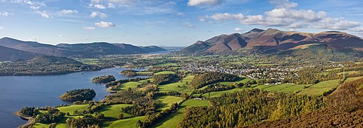
  • Image 15 Photo of McNish cropped from the 1914–1917 Imperial Trans-Antarctic Expedition crew photo. Henry McNish (11 September 1858 – 24 September 1930), often referred to as Harry McNish or by the nickname Chippy, was the carpenter on Sir Ernest Shackleton's Imperial Trans-Antarctic Expedition of 1914–1917. He was responsible for much of the work that ensured the crew's survival after their ship, the Endurance, was destroyed when it became trapped in pack ice in the Weddell Sea. He modified the small boat, James Caird, that allowed Shackleton and five men (including McNish) to make a voyage of hundreds of miles to fetch help for the rest of the crew. After the expedition he returned to work in the Merchant Navy and eventually emigrated to New Zealand, where he worked on the docks in Wellington until poor health forced his retirement. He died destitute in the Ohiro Benevolent Home in Wellington. (Full article...)

    Henry McNish (11 September 1858 – 24 September 1930), often referred to as Harry McNish or by the nickname Chippy, was the carpenter on Sir Ernest Shackleton's Imperial Trans-Antarctic Expedition of 1914–1917. He was responsible for much of the work that ensured the crew's survival after their ship, the Endurance, was destroyed when it became trapped in pack ice in the Weddell Sea. He modified the small boat, James Caird, that allowed Shackleton and five men (including McNish) to make a voyage of hundreds of miles to fetch help for the rest of the crew.

    After the expedition he returned to work in the Merchant Navy and eventually emigrated to New Zealand, where he worked on the docks in Wellington until poor health forced his retirement. He died destitute in the Ohiro Benevolent Home in Wellington. (Full article...)
  • More featured articles

    Vital articles Vital article

    Vital articles to understand Geography.

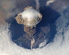
    Europe is a continent located entirely in the Northern Hemisphere and mostly in the Eastern Hemisphere. It is bordered by the Arctic Ocean to the north, the Atlantic Ocean to the west, the Mediterranean Sea to the south, and Asia to the east. Europe shares the landmass of Eurasia with Asia, and of Afro-Eurasia with both Asia and Africa. Europe is commonly considered to be separated from Asia by the watershed of the Ural Mountains, the Ural River, the Caspian Sea, the Greater Caucasus, the Black Sea, and the waterway of the Bosporus Strait. (Full article...)
    Other vital articles

    Get involved

    For editor resources and to collaborate with other editors on improving Wikipedia's Geography-related articles, visit WikiProject Geography.


    Here are some tasks awaiting attention:

    Selected pictures

    Featured biography articles in geography

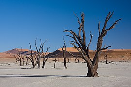
    Richard Hakluyt (/ˈhæklʊt, ˈhæklət, ˈhækəlwɪt/; 1553 – 23 November 1616) was an English writer. He is known for promoting the English colonization of North America through his works, notably Divers Voyages Touching the Discoverie of America (1582) and The Principal Navigations, Voyages, Traffiques and Discoveries of the English Nation (1589–1600).

    Hakluyt was educated at Westminster School and Christ Church, Oxford. Between 1583 and 1588 he was chaplain and secretary to Sir Edward Stafford, English ambassador at the French court. An ordained priest, Hakluyt held important positions at Bristol Cathedral and Westminster Abbey and was personal chaplain to Robert Cecil, 1st Earl of Salisbury, principal Secretary of State to Elizabeth I and James I. He was the chief promoter of a petition to James I for letters patent to colonize Virginia, which were granted to the London Company and Plymouth Company (referred to collectively as the Virginia Company) in 1606. The Hakluyt Society, which publishes scholarly editions of primary records of voyages and travels, was named after him in its 1846 formation. (Full article...)
    More featured biographies

    Did you know

    Did you know it about Geography?

    Places around you

    You can read about interesting Wikipedia articles about places around you.

    Special:Nearby

    This following Geography-related articles is a most visited articles of WikiProject Geography, See complete list at Wikipedia:WikiProject Geography/Popular pages.

  • Image 4 Generation X (often shortened to Gen X) is the demographic cohort following the Baby Boomers and preceding Millennials. Researchers and popular media often use the mid-1960s as its starting birth years and the late 1970s as its ending birth years, with the generation being generally defined as people born from 1965 to 1980. By this definition and U.S. Census data, there are 65.2 million Gen Xers in the United States as of 2019. Most of Generation X are the children of the Silent Generation and early Baby Boomers; Xers are also often the parents of Millennials and Generation Z. (Full article...)
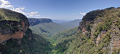
    Generation X (often shortened to Gen X) is the demographic cohort following the Baby Boomers and preceding Millennials. Researchers and popular media often use the mid-1960s as its starting birth years and the late 1970s as its ending birth years, with the generation being generally defined as people born from 1965 to 1980. By this definition and U.S. Census data, there are 65.2 million Gen Xers in the United States as of 2019. Most of Generation X are the children of the Silent Generation and early Baby Boomers; Xers are also often the parents of Millennials and Generation Z. (Full article...)
  • Image 5 Cartogram of the world's population in 2018; each square represents 500,000 people. This is a list of countries and dependencies by population. It includes sovereign states, inhabited dependent territories and, in some cases, constituent countries of sovereign states, with inclusion within the list being primarily based on the ISO standard ISO 3166-1. For instance, the United Kingdom is considered a single entity, while the constituent countries of the Kingdom of the Netherlands are considered separately. In addition, this list includes certain states with limited recognition not found in ISO 3166-1. Also given in a percentage is each country's population compared with the world population, which the United Nations estimates at 8.13 billion as of 2024. (Full article...)
    Cartogram of the world's population in 2018; each square represents 500,000 people.


    This is a list of countries and dependencies by population. It includes sovereign states, inhabited dependent territories and, in some cases, constituent countries of sovereign states, with inclusion within the list being primarily based on the ISO standard ISO 3166-1. For instance, the United Kingdom is considered a single entity, while the constituent countries of the Kingdom of the Netherlands are considered separately. In addition, this list includes certain states with limited recognition not found in ISO 3166-1. Also given in a percentage is each country's population compared with the world population, which the United Nations estimates at 8.13 billion as of 2024. (Full article...)
  • Image 6 Hong Kong is a special administrative region of the People's Republic of China. With 7.4 million residents of various nationalities in a 1,104-square-kilometre (426 sq mi) territory, Hong Kong is the fourth most densely populated region in the world. (Full article...)

    Hong Kong is a special administrative region of the People's Republic of China. With 7.4 million residents of various nationalities in a 1,104-square-kilometre (426 sq mi) territory, Hong Kong is the fourth most densely populated region in the world. (Full article...)
  • Image 7 Millennials, also known as Generation Y or Gen Y, are the demographic cohort following Generation X and preceding Generation Z. Researchers and popular media use the early 1980s as starting birth years and the mid-1990s to early 2000s as ending birth years, with the generation typically being defined as people born from 1981 to 1996. Most Millennials are the children of Baby Boomers and older Generation X. In turn Millennials are often the parents of Generation Alpha. (Full article...)
    Millennials, also known as Generation Y or Gen Y, are the demographic cohort following Generation X and preceding Generation Z. Researchers and popular media use the early 1980s as starting birth years and the mid-1990s to early 2000s as ending birth years, with the generation typically being defined as people born from 1981 to 1996. Most Millennials are the children of Baby Boomers and older Generation X. In turn Millennials are often the parents of Generation Alpha. (Full article...)
  • Image 8 England is a country that is part of the United Kingdom. It is located on the island of Great Britain, of which it covers approximately 62%, and over 100 smaller adjacent islands. It has land borders with Scotland to the north and Wales to the west, and is otherwise surrounded by the North Sea to the east, the English Channel to the south, the Celtic Sea to the south-west, and the Irish Sea to the west. Continental Europe lies to the south-east, and Ireland to the west. At the 2021 census, the population was 56,490,048. London is both the largest city and the capital. (Full article...)

    England is a country that is part of the United Kingdom. It is located on the island of Great Britain, of which it covers approximately 62%, and over 100 smaller adjacent islands. It has land borders with Scotland to the north and Wales to the west, and is otherwise surrounded by the North Sea to the east, the English Channel to the south, the Celtic Sea to the south-west, and the Irish Sea to the west. Continental Europe lies to the south-east, and Ireland to the west. At the 2021 census, the population was 56,490,048. London is both the largest city and the capital. (Full article...)
  • Image 9 Generation Alpha (often shortened to Gen Alpha) is the demographic cohort succeeding Generation Z. Researchers and popular media use the early 2010s as starting birth years to the mid-2020s as the ending birth years (see § Date and age range definitions). Named after alpha, the first letter in the Greek alphabet, Generation Alpha is the first to be born entirely in the 21st century and the third millennium. Most members of Generation Alpha are the children of Millennials. (Full article...)
    Generation Alpha (often shortened to Gen Alpha) is the demographic cohort succeeding Generation Z. Researchers and popular media use the early 2010s as starting birth years to the mid-2020s as the ending birth years (see § Date and age range definitions). Named after alpha, the first letter in the Greek alphabet, Generation Alpha is the first to be born entirely in the 21st century and the third millennium. Most members of Generation Alpha are the children of Millennials. (Full article...)
  • Image 10 Dymaxion map of the world with the 30 largest countries and territories by area This is a list of the world's countries and their dependencies by land, water, and total area, ranked by total area. (Full article...)
    Dymaxion map of the world with the 30 largest countries and territories by area

    This is a list of the world's countries and their dependencies by land, water, and total area, ranked by total area. (Full article...)
  • Click to enlarge and view description.

    Main articles

    CategoriesCategories

    Select [►] to view subcategories.

    Associated Wikimedia

    The following Wikimedia Foundation sister projects provide more on this subject:

    Discover Wikipedia using portals
    Retrieved from "https://en.wikipedia.org/w/index.php?title=Portal:Geography&oldid=1202464975"