Loading
  • 21 Aug, 2019

  • By, Wikipedia

Portal:Geography

The Geography Portal

Geography (from Ancient Greek γεωγραφία geōgraphía; combining 'Earth' and gráphō 'write') is the study of the lands, features, inhabitants, and phenomena of Earth. Geography is an all-encompassing discipline that seeks an understanding of Earth and its human and natural complexities—not merely where objects are, but also how they have changed and come to be. While geography is specific to Earth, many concepts can be applied more broadly to other celestial bodies in the field of planetary science. Geography has been called "a bridge between natural science and social science disciplines."

Origins of many of the concepts in geography can be traced to Greek Eratosthenes of Cyrene, who may have coined the term "geographia" (c. 276 BC – c. 195/194 BC). The first recorded use of the word γεωγραφία was as the title of a book by Greek scholar Claudius Ptolemy (100 – 170 AD). This work created the so-called "Ptolemaic tradition" of geography, which included "Ptolemaic cartographic theory." However, the concepts of geography (such as cartography) date back to the earliest attempts to understand the world spatially, with the earliest example of an attempted world map dating to the 9th century BCE in ancient Babylon. The history of geography as a discipline spans cultures and millennia, being independently developed by multiple groups, and cross-pollinated by trade between these groups. The core concepts of geography consistent between all approaches are a focus on space, place, time, and scale.

Today, geography is an extremely broad discipline with multiple approaches and modalities. There have been multiple attempts to organize the discipline, including the four traditions of geography, and into branches. Techniques employed can generally be broken down into quantitative and qualitative approaches, with many studies taking mixed-methods approaches. Common techniques include cartography, remote sensing, interviews, and surveying. (Full article...)

Featured articles are displayed here, which represent some of the best content on English Wikipedia.

  • Image 2 The Empire of Brazil was a 19th-century state that broadly comprised the territories which form modern Brazil and Uruguay until the latter achieved independence in 1828. The empire's government was a representative parliamentary constitutional monarchy under the rule of Emperors Pedro I and his son Pedro II. A colony of the Kingdom of Portugal, Brazil became the seat of the Portuguese Empire in 1808, when the Portuguese Prince regent, later King Dom John VI, fled from Napoleon's invasion of Portugal and established himself and his government in the Brazilian city of Rio de Janeiro. John VI later returned to Portugal, leaving his eldest son and heir-apparent, Pedro, to rule the Kingdom of Brazil as regent. On 7 September 1822, Pedro declared the independence of Brazil and, after waging a successful war against his father's kingdom, was acclaimed on 12 October as Pedro I, the first Emperor of Brazil. The new country was huge, sparsely populated, and ethnically diverse. Unlike most of the neighboring Hispanic American republics, Brazil had political stability, vibrant economic growth, constitutionally guaranteed freedom of speech, and respect for civil rights of its subjects, albeit with legal restrictions on women and slaves, the latter regarded as property and not citizens. The Empire's bicameral parliament was elected under comparatively democratic methods for the era, as were the provincial and local legislatures. This led to a long ideological conflict between Pedro I and a sizable parliamentary faction over the role of the monarch in the government. He also had to face other obstacles. The unsuccessful Cisplatine War against the neighboring United Provinces of the Río de la Plata in 1828 led to the secession of the province of Cisplatina (later to become Uruguay). In 1826, despite his role in Brazilian independence, he became the king of Portugal; he abdicated the Portuguese throne in favor of his eldest daughter. Two years later, she was usurped by Pedro I's younger brother Miguel. Unable to deal with both Brazilian and Portuguese affairs, Pedro I abdicated his Brazilian throne on 7 April 1831 and immediately departed for Europe to restore his daughter to the Portuguese throne. (Full article...)

    The Empire of Brazil was a 19th-century state that broadly comprised the territories which form modern Brazil and Uruguay until the latter achieved independence in 1828. The empire's government was a representative parliamentary constitutional monarchy under the rule of Emperors Pedro I and his son Pedro II. A colony of the Kingdom of Portugal, Brazil became the seat of the Portuguese Empire in 1808, when the Portuguese Prince regent, later King Dom John VI, fled from Napoleon's invasion of Portugal and established himself and his government in the Brazilian city of Rio de Janeiro. John VI later returned to Portugal, leaving his eldest son and heir-apparent, Pedro, to rule the Kingdom of Brazil as regent. On 7 September 1822, Pedro declared the independence of Brazil and, after waging a successful war against his father's kingdom, was acclaimed on 12 October as Pedro I, the first Emperor of Brazil. The new country was huge, sparsely populated, and ethnically diverse.

    Unlike most of the neighboring Hispanic American republics, Brazil had political stability, vibrant economic growth, constitutionally guaranteed freedom of speech, and respect for civil rights of its subjects, albeit with legal restrictions on women and slaves, the latter regarded as property and not citizens. The Empire's bicameral parliament was elected under comparatively democratic methods for the era, as were the provincial and local legislatures. This led to a long ideological conflict between Pedro I and a sizable parliamentary faction over the role of the monarch in the government. He also had to face other obstacles. The unsuccessful Cisplatine War against the neighboring United Provinces of the Río de la Plata in 1828 led to the secession of the province of Cisplatina (later to become Uruguay). In 1826, despite his role in Brazilian independence, he became the king of Portugal; he abdicated the Portuguese throne in favor of his eldest daughter. Two years later, she was usurped by Pedro I's younger brother Miguel. Unable to deal with both Brazilian and Portuguese affairs, Pedro I abdicated his Brazilian throne on 7 April 1831 and immediately departed for Europe to restore his daughter to the Portuguese throne. (Full article...)
  • Image 3 Lithograph of Weissenburg in 1902 SMS Weissenburg was one of the first ocean-going battleships of the Imperial German Navy. She was the third pre-dreadnought of the Brandenburg class, which also included her sister ships Brandenburg, Wörth, and Kurfürst Friedrich Wilhelm. Weissenburg was laid down in 1890 in the AG Vulcan dockyard in Stettin, launched in 1891, and completed in 1894. The Brandenburg-class battleships were unique for their era in that they carried six large-caliber guns in three twin turrets, as opposed to four guns in two turrets, as was the standard in other navies. Weissenburg served with I Division during the first decade of her service with the fleet. This period was generally limited to training exercises and goodwill visits to foreign ports. These training maneuvers were nevertheless very important to developing German naval tactical doctrine in the two decades before World War I, especially under the direction of Alfred von Tirpitz. Weissenburg, along with her three sisters, saw only one major overseas deployment during this period, to China in 1900–1901, during the Boxer Uprising. The ship underwent a major modernization in 1904–1905. (Full article...)

    SMS Weissenburg was one of the first ocean-going battleships of the Imperial German Navy. She was the third pre-dreadnought of the Brandenburg class, which also included her sister ships Brandenburg, Wörth, and Kurfürst Friedrich Wilhelm. Weissenburg was laid down in 1890 in the AG Vulcan dockyard in Stettin, launched in 1891, and completed in 1894. The Brandenburg-class battleships were unique for their era in that they carried six large-caliber guns in three twin turrets, as opposed to four guns in two turrets, as was the standard in other navies.
    Weissenburg served with I Division during the first decade of her service with the fleet. This period was generally limited to training exercises and goodwill visits to foreign ports. These training maneuvers were nevertheless very important to developing German naval tactical doctrine in the two decades before World War I, especially under the direction of Alfred von Tirpitz. Weissenburg, along with her three sisters, saw only one major overseas deployment during this period, to China in 1900–1901, during the Boxer Uprising. The ship underwent a major modernization in 1904–1905. (Full article...)
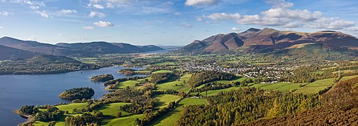
  • Image 4 Keswick (/ˈkɛzɪk/ KEZ-ik) is a market town and civil parish in the Cumberland unitary authority area of Cumbria, England. Historically, until 1974, it was part of the county of Cumberland. It lies within the Lake District National Park, just north of Derwentwater and four miles (six kilometres) from Bassenthwaite Lake. The parish had a population of 5,243 at the 2011 census. There is evidence of prehistoric occupation of the area, but the first recorded mention of the town dates from the 13th century, when Edward I of England granted a charter for Keswick's market, which has maintained a continuous 700-year existence. The town was an important mining area, and from the 18th century has been known as a holiday centre; tourism has been its principal industry for more than 150 years. Its features include the Moot Hall; a modern theatre, the Theatre by the Lake; one of Britain's oldest surviving cinemas, the Alhambra; and the Keswick Museum and Art Gallery in the town's largest open space, Fitz Park. Among the town's annual events is the Keswick Convention, an Evangelical gathering attracting visitors from many countries. (Full article...)

    Keswick (/ˈkɛzɪk/ KEZ-ik) is a market town and civil parish in the Cumberland unitary authority area of Cumbria, England. Historically, until 1974, it was part of the county of Cumberland. It lies within the Lake District National Park, just north of Derwentwater and four miles (six kilometres) from Bassenthwaite Lake. The parish had a population of 5,243 at the 2011 census.

    There is evidence of prehistoric occupation of the area, but the first recorded mention of the town dates from the 13th century, when Edward I of England granted a charter for Keswick's market, which has maintained a continuous 700-year existence. The town was an important mining area, and from the 18th century has been known as a holiday centre; tourism has been its principal industry for more than 150 years. Its features include the Moot Hall; a modern theatre, the Theatre by the Lake; one of Britain's oldest surviving cinemas, the Alhambra; and the Keswick Museum and Art Gallery in the town's largest open space, Fitz Park. Among the town's annual events is the Keswick Convention, an Evangelical gathering attracting visitors from many countries. (Full article...)
  • Image 5 Ireland is an island in Northern Europe in the north Atlantic Ocean. The island, of up to around 480 km (300 mi) north-south, and 275 km (171 mi) east-west, lies near the western edge of the European continental shelf, part of the Eurasian Plate. Its main geographical features include low central plains surrounded by coastal mountains. The highest peak is Carrauntoohil (Irish: Corrán Tuathail), which is 1,039 metres (3,409 ft) above sea level. The western coastline is rugged, with many islands, peninsulas, headlands and bays, while the southern and northern coasts feature a smaller number of substantial sea inlets, such as Lough Foyle and Cork Harbour; no part of the land is more than around 110 km (68 mi) from the sea. It was administratively divided into 32 counties, gathered in 4 provinces, though current arrangements, especially in Northern Ireland, differ from this model. The island is almost bisected by the River Shannon, which at 360.5 km (224 mi) with a 102.1 km (63 mi) estuary is the longest river in Ireland and flows south from County Cavan in the province of Ulster to form the boundary between Connacht and Leinster, and later Munster, and meet the Atlantic just south and west of Limerick. There are a number of sizeable lakes along Ireland's rivers, of which Lough Neagh is the largest. Politically, the island consists of the Republic of Ireland, with jurisdiction over about five-sixths of the island, and Northern Ireland, a constituent part of the United Kingdom, with jurisdiction over the remaining sixth. Located west of the island of Great Britain, Ireland lies at approximately . It has a total area of 84,421 km2 (32,595 sq mi) and is separated from Great Britain by the Irish Sea, bounded to the north and south respectively by the North Channel and St George's Channel, and from mainland Europe by the Celtic Sea. Ireland forms the second largest landmass in the British Isles, together with Great Britain and the Isle of Man. (Full article...)

    Ireland is an island in Northern Europe in the north Atlantic Ocean. The island, of up to around 480 km (300 mi) north-south, and 275 km (171 mi) east-west, lies near the western edge of the European continental shelf, part of the Eurasian Plate. Its main geographical features include low central plains surrounded by coastal mountains. The highest peak is Carrauntoohil (Irish: Corrán Tuathail), which is 1,039 metres (3,409 ft) above sea level. The western coastline is rugged, with many islands, peninsulas, headlands and bays, while the southern and northern coasts feature a smaller number of substantial sea inlets, such as Lough Foyle and Cork Harbour; no part of the land is more than around 110 km (68 mi) from the sea. It was administratively divided into 32 counties, gathered in 4 provinces, though current arrangements, especially in Northern Ireland, differ from this model. The island is almost bisected by the River Shannon, which at 360.5 km (224 mi) with a 102.1 km (63 mi) estuary is the longest river in Ireland and flows south from County Cavan in the province of Ulster to form the boundary between Connacht and Leinster, and later Munster, and meet the Atlantic just south and west of Limerick. There are a number of sizeable lakes along Ireland's rivers, of which Lough Neagh is the largest.

    Politically, the island consists of the Republic of Ireland, with jurisdiction over about five-sixths of the island, and Northern Ireland, a constituent part of the United Kingdom, with jurisdiction over the remaining sixth. Located west of the island of Great Britain, Ireland lies at approximately . It has a total area of 84,421 km (32,595 sq mi) and is separated from Great Britain by the Irish Sea, bounded to the north and south respectively by the North Channel and St George's Channel, and from mainland Europe by the Celtic Sea. Ireland forms the second largest landmass in the British Isles, together with Great Britain and the Isle of Man. (Full article...)
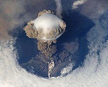
  • Image 6 Steam on the mountain in July 2007 Nevado del Ruiz (Spanish pronunciation: [neβaðo ðel ˈrwis]), also known as La Mesa de Herveo (English: Mesa of Herveo, the name of the nearby town) is a volcano on the border of the departments of Caldas and Tolima in Colombia, being the highest point of both. It is located about 130 km (81 mi) west of the capital city Bogotá. It is a stratovolcano composed of many layers of lava alternating with hardened volcanic ash and other pyroclastic rocks. Volcanic activity at Nevado del Ruiz began about two million years ago, during the Early Pleistocene or Late Pliocene, with three major eruptive periods. The current volcanic cone formed during the present eruptive period, which began 150,000 years ago. The volcano usually generates Vulcanian to Plinian eruptions, which produce swift-moving currents of hot gas and rock called pyroclastic flows. These eruptions often cause massive lahars (mud and debris flows), which pose a threat to human life and the environment. The impact of such an eruption is increased as the hot gas and lava melt the mountain's snowcap, adding large quantities of water to the flow. On November 13, 1985, a small eruption produced an enormous lahar that buried and destroyed the town of Armero in Tolima, causing an estimated 25,000 deaths. This event later became known as the Armero tragedy—the deadliest lahar in recorded history. Similar but less deadly incidents occurred in 1595 and 1845, consisting of a small explosive eruption followed by a large lahar. (Full article...)

    Nevado del Ruiz (Spanish pronunciation: [neβaðo ðel ˈrwis]), also known as La Mesa de Herveo (English: Mesa of Herveo, the name of the nearby town) is a volcano on the border of the departments of Caldas and Tolima in Colombia, being the highest point of both. It is located about 130 km (81 mi) west of the capital city Bogotá. It is a stratovolcano composed of many layers of lava alternating with hardened volcanic ash and other pyroclastic rocks. Volcanic activity at Nevado del Ruiz began about two million years ago, during the Early Pleistocene or Late Pliocene, with three major eruptive periods. The current volcanic cone formed during the present eruptive period, which began 150,000 years ago.

    The volcano usually generates Vulcanian to Plinian eruptions, which produce swift-moving currents of hot gas and rock called pyroclastic flows. These eruptions often cause massive lahars (mud and debris flows), which pose a threat to human life and the environment. The impact of such an eruption is increased as the hot gas and lava melt the mountain's snowcap, adding large quantities of water to the flow. On November 13, 1985, a small eruption produced an enormous lahar that buried and destroyed the town of Armero in Tolima, causing an estimated 25,000 deaths. This event later became known as the Armero tragedy—the deadliest lahar in recorded history. Similar but less deadly incidents occurred in 1595 and 1845, consisting of a small explosive eruption followed by a large lahar. (Full article...)
  • Image 7 Princess Dona Maria Amélia around age 17, c. 1849 Dona Maria Amélia (1 December 1831 – 4 February 1853) was a princess of the Empire of Brazil and a member of the Brazilian branch of the House of Braganza. Her parents were Emperor Dom Pedro I, the first ruler of Brazil, and Amélie of Leuchtenberg. The only child of her father's second marriage, Maria Amélia was born in France after Pedro I abdicated the Brazilian throne in favor of his son Dom Pedro II. Before Maria Amélia was a month old, Pedro I went to Portugal to restore the crown of the eldest daughter of his first marriage, Dona Maria II. He fought a successful war against his brother Miguel I, who had usurped Maria II's throne. Only a few months after his victory, Pedro I died from tuberculosis. Maria Amélia's mother took her to Portugal, where she remained for most of her life without ever visiting Brazil. The Brazilian government refused to recognize Maria Amélia as a member of Brazil's Imperial House because she was foreign-born, but when her elder half-brother Pedro II was declared of age in 1840, he successfully intervened on her behalf. (Full article...)

    Dona Maria Amélia (1 December 1831 – 4 February 1853) was a princess of the Empire of Brazil and a member of the Brazilian branch of the House of Braganza. Her parents were Emperor Dom Pedro I, the first ruler of Brazil, and Amélie of Leuchtenberg. The only child of her father's second marriage, Maria Amélia was born in France after Pedro I abdicated the Brazilian throne in favor of his son Dom Pedro II. Before Maria Amélia was a month old, Pedro I went to Portugal to restore the crown of the eldest daughter of his first marriage, Dona Maria II. He fought a successful war against his brother Miguel I, who had usurped Maria II's throne.

    Only a few months after his victory, Pedro I died from tuberculosis. Maria Amélia's mother took her to Portugal, where she remained for most of her life without ever visiting Brazil. The Brazilian government refused to recognize Maria Amélia as a member of Brazil's Imperial House because she was foreign-born, but when her elder half-brother Pedro II was declared of age in 1840, he successfully intervened on her behalf. (Full article...)
  • Image 8 T3 underway in 1931 T3 was a sea-going torpedo boat that was operated by the Royal Yugoslav Navy between 1921 and 1941. Originally 78 T, a 250t-class torpedo boat of the Austro-Hungarian Navy built in 1914, she was armed with two 66 mm (2.6 in) guns, four 450 mm (17.7 in) torpedo tubes, and could carry 10–12 naval mines. She saw active service during World War I, performing convoy, escort and minesweeping tasks, anti-submarine operations and shore bombardment missions. In 1917 the suffixes of all Austro-Hungarian torpedo boats were removed, and thereafter she was referred to as 78. She was part of the escort force for the Austro-Hungarian dreadnought Szent István during the action that resulted in the sinking of that ship by Italian torpedo boats in June 1918. Following Austria-Hungary's defeat in 1918, she was allocated to the Navy of the Kingdom of Serbs, Croats and Slovenes, which later became the Royal Yugoslav Navy, and was renamed T3. At the time, she and the seven other 250t-class boats were the only modern sea-going vessels of the fledgling maritime force. During the interwar period, T3 and the rest of the navy were involved in training exercises and cruises to friendly ports, but activity was limited by reduced naval budgets. The ship was captured by the Italians during the Axis invasion of Yugoslavia in April 1941. After her main armament was modernised and her crew increased to 62, she served with the Royal Italian Navy under her Yugoslav designation, although she was only used for coastal and second-line tasks. Following the Italian capitulation in September 1943, she was captured by Germany and, after being fitted with additional anti-aircraft guns, served with the German Navy or the Navy of the Independent State of Croatia as TA48. In German/Croatian service her crew of 52 consisted entirely of Croatian officers and enlisted men. She was sunk by Allied aircraft in February 1945 while in the port of Trieste, where she had been built. (Full article...)

    T3 was a sea-going torpedo boat that was operated by the Royal Yugoslav Navy between 1921 and 1941. Originally 78 T, a 250t-class torpedo boat of the Austro-Hungarian Navy built in 1914, she was armed with two 66 mm (2.6 in) guns, four 450 mm (17.7 in) torpedo tubes, and could carry 10–12 naval mines. She saw active service during World War I, performing convoy, escort and minesweeping tasks, anti-submarine operations and shore bombardment missions. In 1917 the suffixes of all Austro-Hungarian torpedo boats were removed, and thereafter she was referred to as 78. She was part of the escort force for the Austro-Hungarian dreadnought Szent István during the action that resulted in the sinking of that ship by Italian torpedo boats in June 1918.

    Following Austria-Hungary's defeat in 1918, she was allocated to the Navy of the Kingdom of Serbs, Croats and Slovenes, which later became the Royal Yugoslav Navy, and was renamed T3. At the time, she and the seven other 250t-class boats were the only modern sea-going vessels of the fledgling maritime force. During the interwar period, T3 and the rest of the navy were involved in training exercises and cruises to friendly ports, but activity was limited by reduced naval budgets. The ship was captured by the Italians during the Axis invasion of Yugoslavia in April 1941. After her main armament was modernised and her crew increased to 62, she served with the Royal Italian Navy under her Yugoslav designation, although she was only used for coastal and second-line tasks. Following the Italian capitulation in September 1943, she was captured by Germany and, after being fitted with additional anti-aircraft guns, served with the German Navy or the Navy of the Independent State of Croatia as TA48. In German/Croatian service her crew of 52 consisted entirely of Croatian officers and enlisted men. She was sunk by Allied aircraft in February 1945 while in the port of Trieste, where she had been built. (Full article...)
  • Image 9 View of Ambohimanga Ambohimanga is a hill and traditional fortified royal settlement (rova) in Madagascar, located approximately 24 kilometers (15 mi) northeast of the capital city of Antananarivo. It is situated in the commune of Ambohimanga Rova. The hill and the rova that stands on top are considered the most significant symbol of the cultural identity of the Merina people and the most important and best-preserved monument of the precolonial Merina Kingdom. The walled historic village includes residences and burial sites of several key monarchs. The site, one of the twelve sacred hills of Imerina, is associated with strong feelings of national identity and has maintained its spiritual and sacred character both in ritual practice and the popular imagination for at least four hundred years. It remains a place of worship to which pilgrims come from Madagascar and elsewhere. (Full article...)

    Ambohimanga is a hill and traditional fortified royal settlement (rova) in Madagascar, located approximately 24 kilometers (15 mi) northeast of the capital city of Antananarivo. It is situated in the commune of Ambohimanga Rova.

    The hill and the rova that stands on top are considered the most significant symbol of the cultural identity of the Merina people and the most important and best-preserved monument of the precolonial Merina Kingdom. The walled historic village includes residences and burial sites of several key monarchs. The site, one of the twelve sacred hills of Imerina, is associated with strong feelings of national identity and has maintained its spiritual and sacred character both in ritual practice and the popular imagination for at least four hundred years. It remains a place of worship to which pilgrims come from Madagascar and elsewhere. (Full article...)
  • Image 10 Upper Tryon Creek in Marshall Park Tryon Creek is a 4.85-mile (7.81 km) tributary of the Willamette River in the U.S. state of Oregon. Part of the drainage basin of the Columbia River, its watershed covers about 6.5 square miles (16.8 km2) in Multnomah and Clackamas counties. The stream flows southeast from the Tualatin Mountains (West Hills) through the Multnomah Village neighborhood of Portland and the Tryon Creek State Natural Area to the Willamette in the city of Lake Oswego. Parks and open spaces cover about 21 percent of the watershed, while single-family homes dominate most of the remainder. The largest of the parks is the state natural area, which straddles the border between the two cities and counties. The bedrock under the watershed includes part of the last exotic terrane, a chain of seamounts, acquired by the North American Plate as it moved west during the Eocene. Known as the Waverly Hills Formation, it lies buried under ash and lava from later volcanic eruptions, sediments from flooding and erosion, and layers of wind-blown silt. Two dormant volcanoes from the Boring Lava Field are in the Tryon Creek watershed. (Full article...)

    Tryon Creek is a 4.85-mile (7.81 km) tributary of the Willamette River in the U.S. state of Oregon. Part of the drainage basin of the Columbia River, its watershed covers about 6.5 square miles (16.8 km) in Multnomah and Clackamas counties. The stream flows southeast from the Tualatin Mountains (West Hills) through the Multnomah Village neighborhood of Portland and the Tryon Creek State Natural Area to the Willamette in the city of Lake Oswego. Parks and open spaces cover about 21 percent of the watershed, while single-family homes dominate most of the remainder. The largest of the parks is the state natural area, which straddles the border between the two cities and counties.

    The bedrock under the watershed includes part of the last exotic terrane, a chain of seamounts, acquired by the North American Plate as it moved west during the Eocene. Known as the Waverly Hills Formation, it lies buried under ash and lava from later volcanic eruptions, sediments from flooding and erosion, and layers of wind-blown silt. Two dormant volcanoes from the Boring Lava Field are in the Tryon Creek watershed. (Full article...)
  • Image 11 White Deer Hole Creek near the Fourth Gap of South White Deer Ridge White Deer Hole Creek is a 20.5-mile (33.0 km) tributary of the West Branch Susquehanna River in Clinton, Lycoming and Union counties in the U.S. state of Pennsylvania. A part of the Chesapeake Bay drainage basin, the White Deer Hole Creek watershed drains parts of ten townships. The creek flows east in a valley of the Ridge-and-valley Appalachians, through sandstone, limestone, and shale from the Ordovician, Silurian, and Devonian periods. As of 2006, the creek and its 67.2-square-mile (174 km2) watershed are relatively undeveloped, with 28.4 percent of the watershed given to agriculture and 71.6 percent covered by forest, including part of Tiadaghton State Forest. The western part of White Deer Hole Creek has very high water quality and is the only major creek section in Lycoming County classified as Class A Wild Trout Waters, defined by the Pennsylvania Fish and Boat Commission as "streams which support a population of naturally produced trout of sufficient size and abundance to support a long-term and rewarding sport fishery." The rest of the creek and its major tributary (Spring Creek) are kept stocked. There are opportunities in the watershed for canoeing, hunting, and camping, and trails for hiking and horseback riding. (Full article...)

    White Deer Hole Creek is a 20.5-mile (33.0 km) tributary of the West Branch Susquehanna River in Clinton, Lycoming and Union counties in the U.S. state of Pennsylvania. A part of the Chesapeake Bay drainage basin, the White Deer Hole Creek watershed drains parts of ten townships. The creek flows east in a valley of the Ridge-and-valley Appalachians, through sandstone, limestone, and shale from the Ordovician, Silurian, and Devonian periods.

    As of 2006, the creek and its 67.2-square-mile (174 km) watershed are relatively undeveloped, with 28.4 percent of the watershed given to agriculture and 71.6 percent covered by forest, including part of Tiadaghton State Forest. The western part of White Deer Hole Creek has very high water quality and is the only major creek section in Lycoming County classified as Class A Wild Trout Waters, defined by the Pennsylvania Fish and Boat Commission as "streams which support a population of naturally produced trout of sufficient size and abundance to support a long-term and rewarding sport fishery." The rest of the creek and its major tributary (Spring Creek) are kept stocked. There are opportunities in the watershed for canoeing, hunting, and camping, and trails for hiking and horseback riding. (Full article...)
  • Image 12 The Central European borders of Brandenburg–Prussia (blue-green) and the Habsburg monarchy (red) in 1756, after Prussia's seizure of Silesia in the First Silesian War The Silesian Wars (‹See Tfd›German: Schlesische Kriege) were three wars fought in the mid-18th century between Prussia (under King Frederick the Great) and Habsburg Austria (under Empress Maria Theresa) for control of the Central European region of Silesia (now in south-western Poland). The First (1740–1742) and Second (1744–1745) Silesian Wars formed parts of the wider War of the Austrian Succession, in which Prussia was a member of a coalition seeking territorial gain at Austria's expense. The Third Silesian War (1756–1763) was a theatre of the global Seven Years' War, in which Austria in turn led a coalition of powers aiming to seize Prussian territory. No particular event triggered the wars. Prussia cited its centuries-old dynastic claims on parts of Silesia as a casus belli, but Realpolitik and geostrategic factors also played a role in provoking the conflict. Maria Theresa's contested succession to the Habsburg monarchy under the Pragmatic Sanction of 1713 provided an opportunity for Prussia to strengthen itself relative to regional rivals such as Saxony and Bavaria. (Full article...)

    The Silesian Wars (‹See Tfd›German: Schlesische Kriege) were three wars fought in the mid-18th century between Prussia (under King Frederick the Great) and Habsburg Austria (under Empress Maria Theresa) for control of the Central European region of Silesia (now in south-western Poland). The First (1740–1742) and Second (1744–1745) Silesian Wars formed parts of the wider War of the Austrian Succession, in which Prussia was a member of a coalition seeking territorial gain at Austria's expense. The Third Silesian War (1756–1763) was a theatre of the global Seven Years' War, in which Austria in turn led a coalition of powers aiming to seize Prussian territory.

    No particular event triggered the wars. Prussia cited its centuries-old dynastic claims on parts of Silesia as a casus belli, but Realpolitik and geostrategic factors also played a role in provoking the conflict. Maria Theresa's contested succession to the Habsburg monarchy under the Pragmatic Sanction of 1713 provided an opportunity for Prussia to strengthen itself relative to regional rivals such as Saxony and Bavaria. (Full article...)
  • Image 13 Robert Falcon Scott in 1905 Captain Robert Falcon Scott CVO (6 June 1868 – c. 29 March 1912) was a British Royal Navy officer and explorer who led two expeditions to the Antarctic regions: the Discovery expedition of 1901–04 and the Terra Nova expedition of 1910–13. On the first expedition, he set a new southern record by marching to latitude 82°S and discovered the Antarctic Plateau, on which the South Pole is located. On the second venture, Scott led a party of five which reached the South Pole on 17 January 1912, less than five weeks after Amundsen's South Pole expedition. On the return journey from the Pole, a planned meeting with supporting dog teams from the base camp failed, despite Scott's written instructions, and at a distance of 162 miles (261 km) from their base camp at Hut Point and approximately 12.5 miles (20.1 km) from the next depot, Scott and his companions died. When Scott and his party's bodies were discovered, they had in their possession the first Antarctic fossils discovered. The fossils were determined to be from the Glossopteris tree and proved that Antarctica was once forested and joined to other continents. (Full article...)

    Captain Robert Falcon Scott CVO (6 June 1868 – c. 29 March 1912) was a British Royal Navy officer and explorer who led two expeditions to the Antarctic regions: the Discovery expedition of 1901–04 and the Terra Nova expedition of 1910–13.

    On the first expedition, he set a new southern record by marching to latitude 82°S and discovered the Antarctic Plateau, on which the South Pole is located. On the second venture, Scott led a party of five which reached the South Pole on 17 January 1912, less than five weeks after Amundsen's South Pole expedition. On the return journey from the Pole, a planned meeting with supporting dog teams from the base camp failed, despite Scott's written instructions, and at a distance of 162 miles (261 km) from their base camp at Hut Point and approximately 12.5 miles (20.1 km) from the next depot, Scott and his companions died. When Scott and his party's bodies were discovered, they had in their possession the first Antarctic fossils discovered. The fossils were determined to be from the Glossopteris tree and proved that Antarctica was once forested and joined to other continents. (Full article...)
  • Image 14 The sky at Cherry Springs State Park, the second International Dark Sky Park and the first in the eastern US, is so dark that the Milky Way casts a visible shadow. Cherry Springs State Park is an 82-acre (33 ha)[a] Pennsylvania state park in Potter County, Pennsylvania, United States. The park was created from land within the Susquehannock State Forest, and is on Pennsylvania Route 44 in West Branch Township. Cherry Springs, named for a large stand of Black Cherry trees in the park, is atop the dissected Allegheny Plateau at an elevation of 2,300 feet (701 m). It is popular with astronomers and stargazers for having "some of the darkest night skies on the east coast" of the United States, and was chosen by the Pennsylvania Department of Conservation and Natural Resources (DCNR) and its Bureau of Parks as one of "25 Must-See Pennsylvania State Parks". The earliest recorded inhabitants of the area were the Susquehannocks, followed by the Seneca nation, who hunted there. The first settlement within the park was a log tavern built in 1818 along a trail; the trail became a turnpike by 1834 and a hotel replaced the tavern in 1874, then burned in 1897. In the late 19th and early 20th centuries the old-growth forests were clearcut; the state forest was established in 1901 and contains second growth woodlands. "Cherry Springs Scenic Drive" was established in 1922, and the Civilian Conservation Corps built much of Cherry Springs State Park during the Great Depression, including a picnic pavilion listed on the National Register of Historic Places (NRHP). An annual "Woodsmen's Show" has been held in the park each August since 1952. (Full article...)

    Cherry Springs State Park is an 82-acre (33 ha) Pennsylvania state park in Potter County, Pennsylvania, United States. The park was created from land within the Susquehannock State Forest, and is on Pennsylvania Route 44 in West Branch Township. Cherry Springs, named for a large stand of Black Cherry trees in the park, is atop the dissected Allegheny Plateau at an elevation of 2,300 feet (701 m). It is popular with astronomers and stargazers for having "some of the darkest night skies on the east coast" of the United States, and was chosen by the Pennsylvania Department of Conservation and Natural Resources (DCNR) and its Bureau of Parks as one of "25 Must-See Pennsylvania State Parks".

    The earliest recorded inhabitants of the area were the Susquehannocks, followed by the Seneca nation, who hunted there. The first settlement within the park was a log tavern built in 1818 along a trail; the trail became a turnpike by 1834 and a hotel replaced the tavern in 1874, then burned in 1897. In the late 19th and early 20th centuries the old-growth forests were clearcut; the state forest was established in 1901 and contains second growth woodlands. "Cherry Springs Scenic Drive" was established in 1922, and the Civilian Conservation Corps built much of Cherry Springs State Park during the Great Depression, including a picnic pavilion listed on the National Register of Historic Places (NRHP). An annual "Woodsmen's Show" has been held in the park each August since 1952. (Full article...)
  • Image 15 Storming of the breach by Prussian grenadiers, Carl Röchling The Battle of Leuthen /ˈlɔɪtən/ was fought on 5 December 1757 between Frederick the Great's Prussian Army and an Austrian army commanded by Prince Charles of Lorraine and Count Leopold Joseph von Daun. Frederick used maneuver warfare and knowledge of the terrain to rout the larger Austrian force completely. The victory ensured Prussian control of Silesia during the Third Silesian War, which was part of the Seven Years' War. The battle was fought in the town of Leuthen (now Lutynia, Poland), 10 km (6 mi) northwest of Breslau, (now Wrocław, Poland), in Prussian (formerly Austrian) Silesia. By exploiting the training of his troops and his superior knowledge of the terrain, Frederick created a diversion at one end of the battlefield and moved most of his smaller army behind a series of low hillocks. The surprise attack in oblique order on the unsuspecting Austrian flank baffled Prince Charles, who took several hours to realize that the main action was to his left, not his right. Within seven hours, the Prussians had destroyed the Austrians and erased any advantage that the Austrians had gained throughout the campaigning in the preceding summer and autumn. Within 48 hours, Frederick had laid siege to Breslau, which resulted in the city's surrender on 19–20 December. (Full article...)

    The Battle of Leuthen /ˈlɔɪtən/ was fought on 5 December 1757 between Frederick the Great's Prussian Army and an Austrian army commanded by Prince Charles of Lorraine and Count Leopold Joseph von Daun. Frederick used maneuver warfare and knowledge of the terrain to rout the larger Austrian force completely. The victory ensured Prussian control of Silesia during the Third Silesian War, which was part of the Seven Years' War.

    The battle was fought in the town of Leuthen (now Lutynia, Poland), 10 km (6 mi) northwest of Breslau, (now Wrocław, Poland), in Prussian (formerly Austrian) Silesia. By exploiting the training of his troops and his superior knowledge of the terrain, Frederick created a diversion at one end of the battlefield and moved most of his smaller army behind a series of low hillocks. The surprise attack in oblique order on the unsuspecting Austrian flank baffled Prince Charles, who took several hours to realize that the main action was to his left, not his right. Within seven hours, the Prussians had destroyed the Austrians and erased any advantage that the Austrians had gained throughout the campaigning in the preceding summer and autumn. Within 48 hours, Frederick had laid siege to Breslau, which resulted in the city's surrender on 19–20 December. (Full article...)
  • More featured articles

    Vital articles Vital article

    Vital articles to understand Geography.

    Europe is a continent located entirely in the Northern Hemisphere and mostly in the Eastern Hemisphere. It is bordered by the Arctic Ocean to the north, the Atlantic Ocean to the west, the Mediterranean Sea to the south, and Asia to the east. Europe shares the landmass of Eurasia with Asia, and of Afro-Eurasia with both Asia and Africa. Europe is commonly considered to be separated from Asia by the watershed of the Ural Mountains, the Ural River, the Caspian Sea, the Greater Caucasus, the Black Sea, and the waterway of the Bosporus Strait. (Full article...)

    Other vital articles

    Get involved

    For editor resources and to collaborate with other editors on improving Wikipedia's Geography-related articles, visit WikiProject Geography.


    Here are some tasks awaiting attention:

    Selected pictures

    Featured biography articles in geography

    Alfred Russel Wallace OM FRS (8 January 1823 – 7 November 1913) was an English naturalist, explorer, geographer, anthropologist, biologist and illustrator. He independently conceived the theory of evolution through natural selection; his 1858 paper on the subject was published that year alongside extracts from Charles Darwin's earlier writings on the topic. It spurred Darwin to set aside the "big species book" he was drafting and quickly write an abstract of it, which was published in 1859 as On the Origin of Species.

    Wallace did extensive fieldwork, starting in the Amazon River basin. He then did fieldwork in the Malay Archipelago, where he identified the faunal divide now termed the Wallace Line, which separates the Indonesian archipelago into two distinct parts: a western portion in which the animals are largely of Asian origin, and an eastern portion where the fauna reflect Australasia. He was considered the 19th century's leading expert on the geographical distribution of animal species, and is sometimes called the "father of biogeography", or more specifically of zoogeography. (Full article...)

    More featured biographies

    Did you know

    Did you know it about Geography?

    Places around you

    You can read about interesting Wikipedia articles about places around you.

    Special:Nearby

    This following Geography-related articles is a most visited articles of WikiProject Geography, See complete list at Wikipedia:WikiProject Geography/Popular pages.

  • Image 4 Generation X (often shortened to Gen X) is the demographic cohort following the Baby Boomers and preceding Millennials. Researchers and popular media often use the mid-1960s as its starting birth years and the late 1970s as its ending birth years, with the generation being generally defined as people born from 1965 to 1980. By this definition and U.S. Census data, there are 65.2 million Gen Xers in the United States as of 2019. Most of Generation X are the children of the Silent Generation and early Baby Boomers; Xers are also often the parents of Millennials and Generation Z. (Full article...)
    Generation X (often shortened to Gen X) is the demographic cohort following the Baby Boomers and preceding Millennials. Researchers and popular media often use the mid-1960s as its starting birth years and the late 1970s as its ending birth years, with the generation being generally defined as people born from 1965 to 1980. By this definition and U.S. Census data, there are 65.2 million Gen Xers in the United States as of 2019. Most of Generation X are the children of the Silent Generation and early Baby Boomers; Xers are also often the parents of Millennials and Generation Z. (Full article...)
  • Image 5 Cartogram of the world's population in 2018; each square represents 500,000 people. This is a list of countries and dependencies by population. It includes sovereign states, inhabited dependent territories and, in some cases, constituent countries of sovereign states, with inclusion within the list being primarily based on the ISO standard ISO 3166-1. For instance, the United Kingdom is considered a single entity, while the constituent countries of the Kingdom of the Netherlands are considered separately. In addition, this list includes certain states with limited recognition not found in ISO 3166-1. Also given in a percentage is each country's population compared with the world population, which the United Nations estimates at 8.119 billion as of 2024. (Full article...)
    Cartogram of the world's population in 2018; each square represents 500,000 people.


    This is a list of countries and dependencies by population. It includes sovereign states, inhabited dependent territories and, in some cases, constituent countries of sovereign states, with inclusion within the list being primarily based on the ISO standard ISO 3166-1. For instance, the United Kingdom is considered a single entity, while the constituent countries of the Kingdom of the Netherlands are considered separately. In addition, this list includes certain states with limited recognition not found in ISO 3166-1. Also given in a percentage is each country's population compared with the world population, which the United Nations estimates at 8.119 billion as of 2024. (Full article...)
  • Image 6 Hong Kong is a special administrative region of the People's Republic of China. With 7.4 million residents of various nationalities in a 1,104-square-kilometre (426 sq mi) territory, Hong Kong is the fourth most densely populated region in the world. (Full article...)

    Hong Kong is a special administrative region of the People's Republic of China. With 7.4 million residents of various nationalities in a 1,104-square-kilometre (426 sq mi) territory, Hong Kong is the fourth most densely populated region in the world. (Full article...)
  • Image 7 Millennials, also known as Generation Y or Gen Y, are the demographic cohort following Generation X and preceding Generation Z. Researchers and popular media use the early 1980s as starting birth years and the mid-1990s to early 2000s as ending birth years, with the generation typically being defined as people born from 1981 to 1996. Most Millennials are the children of Baby Boomers and older Generation X. In turn Millennials are often the parents of Generation Alpha. (Full article...)
    Millennials, also known as Generation Y or Gen Y, are the demographic cohort following Generation X and preceding Generation Z. Researchers and popular media use the early 1980s as starting birth years and the mid-1990s to early 2000s as ending birth years, with the generation typically being defined as people born from 1981 to 1996. Most Millennials are the children of Baby Boomers and older Generation X. In turn Millennials are often the parents of Generation Alpha. (Full article...)
  • Image 8 England is a country that is part of the United Kingdom. It is located on the island of Great Britain, of which it covers approximately 62%, and over 100 smaller adjacent islands. It has land borders with Scotland to the north and Wales to the west, and is otherwise surrounded by the North Sea to the east, the English Channel to the south, the Celtic Sea to the south-west, and the Irish Sea to the west. Continental Europe lies to the south-east, and Ireland to the west. At the 2021 census, the population was 56,490,048. London is both the largest city and the capital. (Full article...)
    England is a country that is part of the United Kingdom. It is located on the island of Great Britain, of which it covers approximately 62%, and over 100 smaller adjacent islands. It has land borders with Scotland to the north and Wales to the west, and is otherwise surrounded by the North Sea to the east, the English Channel to the south, the Celtic Sea to the south-west, and the Irish Sea to the west. Continental Europe lies to the south-east, and Ireland to the west. At the 2021 census, the population was 56,490,048. London is both the largest city and the capital. (Full article...)
  • Image 9 Generation Alpha (often shortened to Gen Alpha) is the demographic cohort succeeding Generation Z. Researchers and popular media use the early 2010s as starting birth years to the mid-2020s as the ending birth years (see § Date and age range definitions). Named after alpha, the first letter in the Greek alphabet, Generation Alpha is the first to be born entirely in the 21st century and the third millennium. The majority of Generation Alpha are the children of Millennials. (Full article...)
    Generation Alpha (often shortened to Gen Alpha) is the demographic cohort succeeding Generation Z. Researchers and popular media use the early 2010s as starting birth years to the mid-2020s as the ending birth years (see § Date and age range definitions). Named after alpha, the first letter in the Greek alphabet, Generation Alpha is the first to be born entirely in the 21st century and the third millennium. The majority of Generation Alpha are the children of Millennials. (Full article...)
  • Image 10 Dymaxion map of the world with the 30 largest countries and territories by area This is a list of the world's countries and their dependencies by land, water, and total area, ranked by total area. (Full article...)
    Dymaxion map of the world with the 30 largest countries and territories by area

    This is a list of the world's countries and their dependencies by land, water, and total area, ranked by total area. (Full article...)
  • Click to enlarge and view description.

    Main articles

    CategoriesCategories

    Select [►] to view subcategories.

    Associated Wikimedia

    The following Wikimedia Foundation sister projects provide more on this subject:

    Discover Wikipedia using portals
    Retrieved from "https://en.wikipedia.org/w/index.php?title=Portal:Geography&oldid=1202464975"