Loading
  • 21 Aug, 2019

  • By, Wikipedia

Portal:Geography

The Geography Portal

Geography (from Ancient Greek γεωγραφία geōgraphía; combining 'Earth' and gráphō 'write') is the study of the lands, features, inhabitants, and phenomena of Earth. Geography is an all-encompassing discipline that seeks an understanding of Earth and its human and natural complexities—not merely where objects are, but also how they have changed and come to be. While geography is specific to Earth, many concepts can be applied more broadly to other celestial bodies in the field of planetary science. Geography has been called "a bridge between natural science and social science disciplines."

Origins of many of the concepts in geography can be traced to Greek Eratosthenes of Cyrene, who may have coined the term "geographia" (c. 276 BC – c. 195/194 BC). The first recorded use of the word γεωγραφία was as the title of a book by Greek scholar Claudius Ptolemy (100 – 170 AD). This work created the so-called "Ptolemaic tradition" of geography, which included "Ptolemaic cartographic theory." However, the concepts of geography (such as cartography) date back to the earliest attempts to understand the world spatially, with the earliest example of an attempted world map dating to the 9th century BCE in ancient Babylon. The history of geography as a discipline spans cultures and millennia, being independently developed by multiple groups, and cross-pollinated by trade between these groups. The core concepts of geography consistent between all approaches are a focus on space, place, time, and scale.

Today, geography is an extremely broad discipline with multiple approaches and modalities. There have been multiple attempts to organize the discipline, including the four traditions of geography, and into branches. Techniques employed can generally be broken down into quantitative and qualitative approaches, with many studies taking mixed-methods approaches. Common techniques include cartography, remote sensing, interviews, and surveying. (Full article...)

Featured articles are displayed here, which represent some of the best content on English Wikipedia.

  • Image 2 A map of the Western Han dynasty in 2 AD   Principalities and centrally-administered commanderies   Protectorate of the Western Regions (Tarim Basin) The Han dynasty was an imperial dynasty of China (202 BC – 9 AD, 25–220 AD) established by Liu Bang and ruled by the House of Liu. The dynasty was preceded by the short-lived Qin dynasty (221–206 BC) and a warring interregnum known as the Chu–Han contention (206–202 BC), and it was succeeded by the Three Kingdoms period (220–280 AD). The dynasty was briefly interrupted by the Xin dynasty (9–23 AD) established by the usurping regent Wang Mang, and is thus separated into two periods—the Western Han (202 BC – 9 AD) and the Eastern Han (25–220 AD). Spanning over four centuries, the Han dynasty is considered a golden age in Chinese history, and had a permanent impact on Chinese identity in later periods. The majority ethnic group of modern China refer to themselves as the "Han people" or "Han Chinese". The spoken Sinitic language and written Chinese are referred to respectively as the "Han language" and "Han characters". The emperor was at the pinnacle of Han society and culture. He presided over the Han government but shared power with both the nobility and the appointed ministers who came largely from the scholarly gentry class. The Han Empire was divided into areas directly controlled by the central government called commanderies, as well as a number of semi-autonomous kingdoms. These kingdoms gradually lost all vestiges of their independence, particularly following the Rebellion of the Seven States. From the reign of Emperor Wu (r. 141–87 BC) onward, the Chinese court officially sponsored Confucianism in education and court politics, synthesized with the cosmology of later scholars such as Dong Zhongshu. This policy endured until the fall of the Qing dynasty in 1912. (Full article...)

    The Han dynasty was an imperial dynasty of China (202 BC – 9 AD, 25–220 AD) established by Liu Bang and ruled by the House of Liu. The dynasty was preceded by the short-lived Qin dynasty (221–206 BC) and a warring interregnum known as the Chu–Han contention (206–202 BC), and it was succeeded by the Three Kingdoms period (220–280 AD). The dynasty was briefly interrupted by the Xin dynasty (9–23 AD) established by the usurping regent Wang Mang, and is thus separated into two periods—the Western Han (202 BC – 9 AD) and the Eastern Han (25–220 AD). Spanning over four centuries, the Han dynasty is considered a golden age in Chinese history, and had a permanent impact on Chinese identity in later periods. The majority ethnic group of modern China refer to themselves as the "Han people" or "Han Chinese". The spoken Sinitic language and written Chinese are referred to respectively as the "Han language" and "Han characters".

    The emperor was at the pinnacle of Han society and culture. He presided over the Han government but shared power with both the nobility and the appointed ministers who came largely from the scholarly gentry class. The Han Empire was divided into areas directly controlled by the central government called commanderies, as well as a number of semi-autonomous kingdoms. These kingdoms gradually lost all vestiges of their independence, particularly following the Rebellion of the Seven States. From the reign of Emperor Wu (r. 141–87 BC) onward, the Chinese court officially sponsored Confucianism in education and court politics, synthesized with the cosmology of later scholars such as Dong Zhongshu. This policy endured until the fall of the Qing dynasty in 1912. (Full article...)
  • Image 3 Altrincham Town Centre Altrincham (/ˈɒltrɪŋəm/ ⓘ OL-tring-əm, locally /ˈɒltrɪŋɡəm/) is a market town in Trafford, Greater Manchester, England, south of the River Mersey. It is 8 miles (13 km) southwest of Manchester, 3 miles (5 km) southwest of Sale and 10 miles (16 km) east of Warrington. At the 2011 census, it had a population of 52,419. Within the boundaries of the historic county of Cheshire, Altrincham was established as a market town in 1290, a time when the economy of most communities was based on agriculture rather than trade, and there is still a market in the town. Further socioeconomic development came with the extension of the Bridgewater Canal to Altrincham in 1765 and the arrival of the railway in 1849, stimulating industrial activity in the town. Outlying villages were absorbed by Altrincham's subsequent growth, along with the grounds of Dunham Massey Hall, formerly the home of the Earl of Stamford, and now a tourist attraction with three Grade I Listed Buildings and a deer park. (Full article...)

    Altrincham (/ˈɒltrɪŋəm/ OL-tring-əm, locally /ˈɒltrɪŋɡəm/) is a market town in Trafford, Greater Manchester, England, south of the River Mersey. It is 8 miles (13 km) southwest of Manchester, 3 miles (5 km) southwest of Sale and 10 miles (16 km) east of Warrington. At the 2011 census, it had a population of 52,419.

    Within the boundaries of the historic county of Cheshire, Altrincham was established as a market town in 1290, a time when the economy of most communities was based on agriculture rather than trade, and there is still a market in the town. Further socioeconomic development came with the extension of the Bridgewater Canal to Altrincham in 1765 and the arrival of the railway in 1849, stimulating industrial activity in the town. Outlying villages were absorbed by Altrincham's subsequent growth, along with the grounds of Dunham Massey Hall, formerly the home of the Earl of Stamford, and now a tourist attraction with three Grade I Listed Buildings and a deer park. (Full article...)
  • Image 4 Civic Building in 2013 Jerome is a town in the Black Hills of Yavapai County in the U.S. state of Arizona. Founded in the late 19th century on Cleopatra Hill overlooking the Verde Valley, Jerome is more than 5,000 feet (1,500 m) above sea level. It is about 100 miles (160 km) north of Phoenix along State Route 89A between Sedona and Prescott. Supported in its heyday by rich copper mines, it was home to more than 10,000 people in the 1920s. As of the 2020 census, its population was 464. The town owes its existence mainly to two ore bodies that formed about 1.75 billion years ago along a ring fault in the caldera of an undersea volcano. Tectonic plate movements, plate collisions, uplift, deposition, erosion, and other geologic processes eventually exposed the tip of one of the ore bodies and pushed the other close to the surface, both near Jerome. In the late 19th century, the United Verde Mine, developed by William A. Clark, extracted ore bearing copper, gold, silver, and other metals from the larger of the two. The United Verde Extension UVX Mine, owned by James Douglas Jr., depended on the other huge deposit. In total, the copper deposits discovered in Jerome's vicinity were among the richest ever found. (Full article...)

    Jerome is a town in the Black Hills of Yavapai County in the U.S. state of Arizona. Founded in the late 19th century on Cleopatra Hill overlooking the Verde Valley, Jerome is more than 5,000 feet (1,500 m) above sea level. It is about 100 miles (160 km) north of Phoenix along State Route 89A between Sedona and Prescott. Supported in its heyday by rich copper mines, it was home to more than 10,000 people in the 1920s. As of the 2020 census, its population was 464.

    The town owes its existence mainly to two ore bodies that formed about 1.75 billion years ago along a ring fault in the caldera of an undersea volcano. Tectonic plate movements, plate collisions, uplift, deposition, erosion, and other geologic processes eventually exposed the tip of one of the ore bodies and pushed the other close to the surface, both near Jerome. In the late 19th century, the United Verde Mine, developed by William A. Clark, extracted ore bearing copper, gold, silver, and other metals from the larger of the two. The United Verde Extension UVX Mine, owned by James Douglas Jr., depended on the other huge deposit. In total, the copper deposits discovered in Jerome's vicinity were among the richest ever found. (Full article...)
  • Image 5 Afonso at age 2 wearing the blue band of the Order of the Southern Cross, 1846 Dom Afonso (23 February 1845 – 11 June 1847) was the Prince Imperial and heir apparent to the throne of the Empire of Brazil. Born in Rio de Janeiro, he was the eldest child of Emperor Dom Pedro II and Dona Teresa Cristina of the Two Sicilies, and thus a member of the Brazilian branch of the House of Braganza. Afonso died from epilepsy at the age of two, devastating the emperor. The following year, Pedro and Teresa Cristina had another son, Pedro Afonso, but he too died in infancy. After the loss of his second son, doubts grew in Pedro II's mind that the imperial system could be viable. He still had an heir in his daughter Isabel, but he was unconvinced that a female would prove to be a suitable successor. He showed less concern about the effects his policies had on the monarchy, provided his daughter Isabel with no training for her role as potential empress, and failed to cultivate her acceptance within the country's political class. Pedro II's lack of interest in protecting the imperial system ultimately led to its downfall. (Full article...)

    Dom Afonso (23 February 1845 – 11 June 1847) was the Prince Imperial and heir apparent to the throne of the Empire of Brazil. Born in Rio de Janeiro, he was the eldest child of Emperor Dom Pedro II and Dona Teresa Cristina of the Two Sicilies, and thus a member of the Brazilian branch of the House of Braganza.

    Afonso died from epilepsy at the age of two, devastating the emperor. The following year, Pedro and Teresa Cristina had another son, Pedro Afonso, but he too died in infancy. After the loss of his second son, doubts grew in Pedro II's mind that the imperial system could be viable. He still had an heir in his daughter Isabel, but he was unconvinced that a female would prove to be a suitable successor. He showed less concern about the effects his policies had on the monarchy, provided his daughter Isabel with no training for her role as potential empress, and failed to cultivate her acceptance within the country's political class. Pedro II's lack of interest in protecting the imperial system ultimately led to its downfall. (Full article...)
  • Image 6 Maritana Avenue, one of only two paved roads in Elcor, looking south toward Manilla Street, 1980 Elcor is a ghost town, or more properly, an extinct town, in the U.S. state of Minnesota that was inhabited between 1897 and 1956. It was built on the Mesabi Iron Range near the city of Gilbert in St. Louis County. Elcor was its own unincorporated community before it was abandoned and was never a neighborhood proper of the city of Gilbert. Not rating a figure in the national census, the people of Elcor were only generally considered to be citizens of Gilbert. The area where Elcor was located was annexed by Gilbert when its existing city boundaries were expanded after 1969. In November 1890, the seven Merritt brothers discovered ore near Mountain Iron, triggering an unparalleled iron rush to the Mesabi Range. The Elba mine was opened in 1897, and the town was platted under the direction of Don H. Bacon, president of the Minnesota Iron Company. A second nearby mine, the Corsica, was opened in 1901. The community was first called "Elba" after the name of the first underground mine (the name "Elcor" was formed later by combining the first syllables of each mine's name). The Elba and Corsica mines were both leased by Pickands Mather and Company after the formation of the United States Steel Corporation. An influx of people of many ethnicities and many nations followed, and Elcor became a microcosm of U.S. immigration, mirroring the cultural assimilation of the time. At its peak around 1920, Elcor had two churches, a post office, a general store, a primary school, a railroad station, and its own law enforcement, and housed a population of nearly 1,000. (Full article...)

    Elcor is a ghost town, or more properly, an extinct town, in the U.S. state of Minnesota that was inhabited between 1897 and 1956. It was built on the Mesabi Iron Range near the city of Gilbert in St. Louis County. Elcor was its own unincorporated community before it was abandoned and was never a neighborhood proper of the city of Gilbert. Not rating a figure in the national census, the people of Elcor were only generally considered to be citizens of Gilbert. The area where Elcor was located was annexed by Gilbert when its existing city boundaries were expanded after 1969.

    In November 1890, the seven Merritt brothers discovered ore near Mountain Iron, triggering an unparalleled iron rush to the Mesabi Range. The Elba mine was opened in 1897, and the town was platted under the direction of Don H. Bacon, president of the Minnesota Iron Company. A second nearby mine, the Corsica, was opened in 1901. The community was first called "Elba" after the name of the first underground mine (the name "Elcor" was formed later by combining the first syllables of each mine's name). The Elba and Corsica mines were both leased by Pickands Mather and Company after the formation of the United States Steel Corporation. An influx of people of many ethnicities and many nations followed, and Elcor became a microcosm of U.S. immigration, mirroring the cultural assimilation of the time. At its peak around 1920, Elcor had two churches, a post office, a general store, a primary school, a railroad station, and its own law enforcement, and housed a population of nearly 1,000. (Full article...)
  • Image 7 National Mall Washington, D.C., formally the District of Columbia and commonly known as Washington or D.C., is the capital city and federal district of the United States. The city is on the Potomac River, across from Virginia, and shares land borders with Maryland to its north and east. It was named for George Washington, the first president of the United States. The district is named for Columbia, the female personification of the nation. The U.S. Constitution in 1789 called for the creation of a federal district under the exclusive jurisdiction of the U.S. Congress. As such, Washington, D.C., is not part of any state, and is not one itself. The Residence Act, adopted on July 16, 1790, approved the creation of the capital district along the Potomac River. The city was founded in 1791, and the 6th Congress held the first session in the unfinished Capitol Building in 1800 after the capital moved from Philadelphia. In 1801, the District of Columbia, formerly part of Maryland and Virginia and including the existing settlements of Georgetown and Alexandria, was officially recognized as the federal district; initially, the city was a separate settlement within the larger district. In 1846, Congress returned the land originally ceded by Virginia, including the city of Alexandria. In 1871, it created a single municipality for the remaining portion of the district. There have been several unsuccessful efforts to make the district into a state since the 1880s; a statehood bill passed the House of Representatives in 2021 but was not adopted by the U.S. Senate. (Full article...)

    Washington, D.C., formally the District of Columbia and commonly known as Washington or D.C., is the capital city and federal district of the United States. The city is on the Potomac River, across from Virginia, and shares land borders with Maryland to its north and east. It was named for George Washington, the first president of the United States. The district is named for Columbia, the female personification of the nation.

    The U.S. Constitution in 1789 called for the creation of a federal district under the exclusive jurisdiction of the U.S. Congress. As such, Washington, D.C., is not part of any state, and is not one itself. The Residence Act, adopted on July 16, 1790, approved the creation of the capital district along the Potomac River. The city was founded in 1791, and the 6th Congress held the first session in the unfinished Capitol Building in 1800 after the capital moved from Philadelphia. In 1801, the District of Columbia, formerly part of Maryland and Virginia and including the existing settlements of Georgetown and Alexandria, was officially recognized as the federal district; initially, the city was a separate settlement within the larger district. In 1846, Congress returned the land originally ceded by Virginia, including the city of Alexandria. In 1871, it created a single municipality for the remaining portion of the district. There have been several unsuccessful efforts to make the district into a state since the 1880s; a statehood bill passed the House of Representatives in 2021 but was not adopted by the U.S. Senate. (Full article...)
  • Image 8 The sky at Cherry Springs State Park, the second International Dark Sky Park and the first in the eastern US, is so dark that the Milky Way casts a visible shadow. Cherry Springs State Park is an 82-acre (33 ha)[a] Pennsylvania state park in Potter County, Pennsylvania, United States. The park was created from land within the Susquehannock State Forest, and is on Pennsylvania Route 44 in West Branch Township. Cherry Springs, named for a large stand of Black Cherry trees in the park, is atop the dissected Allegheny Plateau at an elevation of 2,300 feet (701 m). It is popular with astronomers and stargazers for having "some of the darkest night skies on the east coast" of the United States, and was chosen by the Pennsylvania Department of Conservation and Natural Resources (DCNR) and its Bureau of Parks as one of "25 Must-See Pennsylvania State Parks". The earliest recorded inhabitants of the area were the Susquehannocks, followed by the Seneca nation, who hunted there. The first settlement within the park was a log tavern built in 1818 along a trail; the trail became a turnpike by 1834 and a hotel replaced the tavern in 1874, then burned in 1897. In the late 19th and early 20th centuries the old-growth forests were clearcut; the state forest was established in 1901 and contains second growth woodlands. "Cherry Springs Scenic Drive" was established in 1922, and the Civilian Conservation Corps built much of Cherry Springs State Park during the Great Depression, including a picnic pavilion listed on the National Register of Historic Places (NRHP). An annual "Woodsmen's Show" has been held in the park each August since 1952. (Full article...)

    Cherry Springs State Park is an 82-acre (33 ha) Pennsylvania state park in Potter County, Pennsylvania, United States. The park was created from land within the Susquehannock State Forest, and is on Pennsylvania Route 44 in West Branch Township. Cherry Springs, named for a large stand of Black Cherry trees in the park, is atop the dissected Allegheny Plateau at an elevation of 2,300 feet (701 m). It is popular with astronomers and stargazers for having "some of the darkest night skies on the east coast" of the United States, and was chosen by the Pennsylvania Department of Conservation and Natural Resources (DCNR) and its Bureau of Parks as one of "25 Must-See Pennsylvania State Parks".

    The earliest recorded inhabitants of the area were the Susquehannocks, followed by the Seneca nation, who hunted there. The first settlement within the park was a log tavern built in 1818 along a trail; the trail became a turnpike by 1834 and a hotel replaced the tavern in 1874, then burned in 1897. In the late 19th and early 20th centuries the old-growth forests were clearcut; the state forest was established in 1901 and contains second growth woodlands. "Cherry Springs Scenic Drive" was established in 1922, and the Civilian Conservation Corps built much of Cherry Springs State Park during the Great Depression, including a picnic pavilion listed on the National Register of Historic Places (NRHP). An annual "Woodsmen's Show" has been held in the park each August since 1952. (Full article...)
  • Image 9 India, officially the Republic of India (ISO: Bhārat Gaṇarājya), is a country in South Asia. It is the seventh-largest country by area; the most populous country since April 2023; and from the time of its independence in 1947, the world's most populous democracy. Bounded by the Indian Ocean on the south, the Arabian Sea on the southwest, and the Bay of Bengal on the southeast, it shares land borders with Pakistan to the west; China, Nepal, and Bhutan to the north; and Bangladesh and Myanmar to the east. In the Indian Ocean, India is in the vicinity of Sri Lanka and the Maldives; its Andaman and Nicobar Islands share a maritime border with Thailand, Myanmar, and Indonesia. Modern humans arrived on the Indian subcontinent from Africa no later than 55,000 years ago. Their long occupation, initially in varying forms of isolation as hunter-gatherers, has made the region highly diverse, second only to Africa in human genetic diversity. Settled life emerged on the subcontinent in the western margins of the Indus river basin 9,000 years ago, evolving gradually into the Indus Valley Civilisation of the third millennium BCE. Between 2000 BCE and 1500 BCE, Indo-Aryans migrated into India from the northwest, bringing with them Sanskrit, an Indo-European language. Its evidence today is found in the hymns of the Rigveda. Preserved by an oral tradition that was resolutely vigilant, the Rigveda records the dawning of Hinduism in India. The Dravidian languages of India were supplanted in the northern and western regions. By 400 BCE, stratification and exclusion by caste had emerged within Hinduism, and Buddhism and Jainism had arisen, proclaiming social orders unlinked to heredity. Early political consolidations gave rise to the loose-knit Maurya and Gupta Empires based in the Ganges Basin. Their collective era was suffused with wide-ranging creativity, but also marked by the declining status of women, and the incorporation of untouchability into an organised system of belief. In South India, the Middle kingdoms exported Dravidian-languages scripts and religious cultures to the kingdoms of Southeast Asia. (Full article...)

    India, officially the Republic of India (ISO: Bhārat Gaṇarājya), is a country in South Asia. It is the seventh-largest country by area; the most populous country since April 2023; and from the time of its independence in 1947, the world's most populous democracy. Bounded by the Indian Ocean on the south, the Arabian Sea on the southwest, and the Bay of Bengal on the southeast, it shares land borders with Pakistan to the west; China, Nepal, and Bhutan to the north; and Bangladesh and Myanmar to the east. In the Indian Ocean, India is in the vicinity of Sri Lanka and the Maldives; its Andaman and Nicobar Islands share a maritime border with Thailand, Myanmar, and Indonesia.

    Modern humans arrived on the Indian subcontinent from Africa no later than 55,000 years ago.
    Their long occupation, initially in varying forms of isolation as hunter-gatherers, has made the region highly diverse, second only to Africa in human genetic diversity. Settled life emerged on the subcontinent in the western margins of the Indus river basin 9,000 years ago, evolving gradually into the Indus Valley Civilisation of the third millennium BCE.
    Between 2000 BCE and 1500 BCE, Indo-Aryans migrated into India from the northwest, bringing with them Sanskrit, an Indo-European language. Its evidence today is found in the hymns of the Rigveda. Preserved by an oral tradition that was resolutely vigilant, the Rigveda records the dawning of Hinduism in India. The Dravidian languages of India were supplanted in the northern and western regions.
    By 400 BCE, stratification and exclusion by caste had emerged within Hinduism,
    and Buddhism and Jainism had arisen, proclaiming social orders unlinked to heredity.
    Early political consolidations gave rise to the loose-knit Maurya and Gupta Empires based in the Ganges Basin.
    Their collective era was suffused with wide-ranging creativity, but also marked by the declining status of women, and the incorporation of untouchability into an organised system of belief. In South India, the Middle kingdoms exported Dravidian-languages scripts and religious cultures to the kingdoms of Southeast Asia. (Full article...)
  • Image 10 Main façade (northwestern elevation) of Hebron Church, 2015 Hebron Church (also historically known as Great Capon Church, Hebron Lutheran Church, and Hebron Evangelical Lutheran Church) is a mid-19th-century Lutheran church in Intermont, Hampshire County, in the U.S. state of West Virginia. Hebron Church was founded in 1786 by German settlers in the Cacapon River Valley, making it the first Lutheran church west of the Shenandoah Valley. The congregation worshiped in a log church, which initially served both Lutheran and Reformed denominations. Its congregation was originally German-speaking; the church's documents and religious services were in German until 1821, when records and sermons transitioned to English. The church's congregation built the present Greek Revival-style 1+1⁄2-story church building in 1849, when it was renamed Hebron on the Cacapon. The original log church was moved across the road and subsequently used as a sexton's house, Sunday school classroom, and public schoolhouse (attended by future West Virginia governor Herman G. Kump). (Full article...)
    Hebron Church (also historically known as Great Capon Church, Hebron Lutheran Church, and Hebron Evangelical Lutheran Church) is a mid-19th-century Lutheran church in Intermont, Hampshire County, in the U.S. state of West Virginia. Hebron Church was founded in 1786 by German settlers in the Cacapon River Valley, making it the first Lutheran church west of the Shenandoah Valley. The congregation worshiped in a log church, which initially served both Lutheran and Reformed denominations. Its congregation was originally German-speaking; the church's documents and religious services were in German until 1821, when records and sermons transitioned to English.

    The church's congregation built the present Greek Revival-style 1+12-story church building in 1849, when it was renamed Hebron on the Cacapon. The original log church was moved across the road and subsequently used as a sexton's house, Sunday school classroom, and public schoolhouse (attended by future West Virginia governor Herman G. Kump). (Full article...)
  • Image 11 Wildwood Trail in June 2008 Forest Park is a public municipal park in the Tualatin Mountains west of downtown Portland, Oregon, United States. Stretching for more than 8 miles (13 km) on hillsides overlooking the Willamette River, it is one of the country's largest urban forest reserves. The park, a major component of a regional system of parks and trails, covers more than 5,100 acres (2,064 ha) of mostly second-growth forest with a few patches of old growth. More than 80 miles (130 km) of recreational trails, including the Wildwood Trail segment of the city's 40-Mile Loop system, crisscross the park. As early as the 1860s, civic leaders sought to create a natural preserve in the woods near Portland. Their efforts led to the creation of a municipal park commission that in 1903 hired the Olmsted Brothers landscape architectural firm to develop a plan for Portland's parks. Acquiring land through donations, transfers from Multnomah County, and delinquent tax foreclosures, the city eventually acted on a proposal by the City Club of Portland and combined parcels totaling about 4,000 acres (1,600 ha) to create the reserve. Formally dedicated in 1948, it ranks 19th in size among parks within U.S. cities, according to the Trust for Public Land. (Full article...)
    Forest Park is a public municipal park in the Tualatin Mountains west of downtown Portland, Oregon, United States. Stretching for more than 8 miles (13 km) on hillsides overlooking the Willamette River, it is one of the country's largest urban forest reserves. The park, a major component of a regional system of parks and trails, covers more than 5,100 acres (2,064 ha) of mostly second-growth forest with a few patches of old growth. More than 80 miles (130 km) of recreational trails, including the Wildwood Trail segment of the city's 40-Mile Loop system, crisscross the park.

    As early as the 1860s, civic leaders sought to create a natural preserve in the woods near Portland. Their efforts led to the creation of a municipal park commission that in 1903 hired the Olmsted Brothers landscape architectural firm to develop a plan for Portland's parks. Acquiring land through donations, transfers from Multnomah County, and delinquent tax foreclosures, the city eventually acted on a proposal by the City Club of Portland and combined parcels totaling about 4,000 acres (1,600 ha) to create the reserve. Formally dedicated in 1948, it ranks 19th in size among parks within U.S. cities, according to the Trust for Public Land. (Full article...)
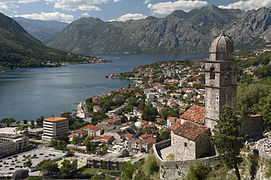
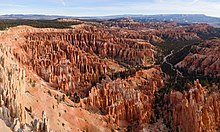
  • Image 12 Bryce Canyon National Park (/braɪs/) is an American national park located in southwestern Utah. The major feature of the park is Bryce Canyon, which despite its name, is not a canyon, but a collection of giant natural amphitheaters along the eastern side of the Paunsaugunt Plateau. Bryce is distinctive due to geological structures called hoodoos, formed by frost weathering and stream erosion of the river and lake bed sedimentary rock. The red, orange, and white colors of the rocks provide spectacular views for park visitors. Bryce Canyon National Park is much smaller and sits at a much higher elevation than nearby Zion National Park. The rim at Bryce varies from 8,000 to 9,000 feet (2,400 to 2,700 m). The Bryce Canyon area was settled by Mormon pioneers in the 1850s and was named after Ebenezer Bryce, who homesteaded in the area in 1874. The area was originally designated as a national monument by President Warren G. Harding in 1923 and was redesignated as a national park by Congress in 1928. The park covers 35,835 acres (55.992 sq mi; 14,502 ha; 145.02 km2) and receives substantially fewer visitors than Zion National Park (nearly 4.3 million in 2016) or Grand Canyon National Park (almost 6 million in 2016), largely due to Bryce's more remote location. In 2023, Bryce Canyon received 2,461,269. (Full article...)

    Bryce Canyon National Park (/brs/) is an American national park located in southwestern Utah. The major feature of the park is Bryce Canyon, which despite its name, is not a canyon, but a collection of giant natural amphitheaters along the eastern side of the Paunsaugunt Plateau. Bryce is distinctive due to geological structures called hoodoos, formed by frost weathering and stream erosion of the river and lake bed sedimentary rock. The red, orange, and white colors of the rocks provide spectacular views for park visitors. Bryce Canyon National Park is much smaller and sits at a much higher elevation than nearby Zion National Park. The rim at Bryce varies from 8,000 to 9,000 feet (2,400 to 2,700 m).

    The Bryce Canyon area was settled by Mormon pioneers in the 1850s and was named after Ebenezer Bryce, who homesteaded in the area in 1874. The area was originally designated as a national monument by President Warren G. Harding in 1923 and was redesignated as a national park by Congress in 1928. The park covers 35,835 acres (55.992 sq mi; 14,502 ha; 145.02 km) and receives substantially fewer visitors than Zion National Park (nearly 4.3 million in 2016) or Grand Canyon National Park (almost 6 million in 2016), largely due to Bryce's more remote location. In 2023, Bryce Canyon received 2,461,269. (Full article...)
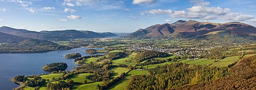
  • Image 13 Storming of the breach by Prussian grenadiers, Carl Röchling The Battle of Leuthen /ˈlɔɪtən/ was fought on 5 December 1757 between Frederick the Great's Prussian Army and an Austrian army commanded by Prince Charles of Lorraine and Count Leopold Joseph von Daun. Frederick used maneuver warfare and knowledge of the terrain to rout the larger Austrian force completely. The victory ensured Prussian control of Silesia during the Third Silesian War, which was part of the Seven Years' War. The battle was fought in the town of Leuthen (now Lutynia, Poland), 10 km (6 mi) northwest of Breslau, (now Wrocław, Poland), in Prussian (formerly Austrian) Silesia. By exploiting the training of his troops and his superior knowledge of the terrain, Frederick created a diversion at one end of the battlefield and moved most of his smaller army behind a series of low hillocks. The surprise attack in oblique order on the unsuspecting Austrian flank baffled Prince Charles, who took several hours to realize that the main action was to his left, not his right. Within seven hours, the Prussians had destroyed the Austrians and erased any advantage that the Austrians had gained throughout the campaigning in the preceding summer and autumn. Within 48 hours, Frederick had laid siege to Breslau, which resulted in the city's surrender on 19–20 December. (Full article...)

    The Battle of Leuthen /ˈlɔɪtən/ was fought on 5 December 1757 between Frederick the Great's Prussian Army and an Austrian army commanded by Prince Charles of Lorraine and Count Leopold Joseph von Daun. Frederick used maneuver warfare and knowledge of the terrain to rout the larger Austrian force completely. The victory ensured Prussian control of Silesia during the Third Silesian War, which was part of the Seven Years' War.

    The battle was fought in the town of Leuthen (now Lutynia, Poland), 10 km (6 mi) northwest of Breslau, (now Wrocław, Poland), in Prussian (formerly Austrian) Silesia. By exploiting the training of his troops and his superior knowledge of the terrain, Frederick created a diversion at one end of the battlefield and moved most of his smaller army behind a series of low hillocks. The surprise attack in oblique order on the unsuspecting Austrian flank baffled Prince Charles, who took several hours to realize that the main action was to his left, not his right. Within seven hours, the Prussians had destroyed the Austrians and erased any advantage that the Austrians had gained throughout the campaigning in the preceding summer and autumn. Within 48 hours, Frederick had laid siege to Breslau, which resulted in the city's surrender on 19–20 December. (Full article...)
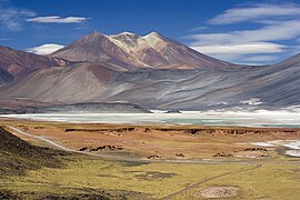
  • Image 14 Satellite image of Cerro Blanco volcano. The black area on the upper edge is Carachipampa volcano. Cerro Blanco caldera is located slightly left and below the centre of the image and is the grey-yellow area. Top of image is to the north-northeast. Cerro Blanco (Spanish: [ˈsero ˈβlaŋko], "White Hill") is a caldera in the Andes of the Catamarca Province in Argentina. Part of the Central Volcanic Zone of the Andes, it is a volcano collapse structure located at an altitude of 4,670 metres (15,320 ft) in a depression. The caldera is associated with a less well-defined caldera to the south and several lava domes. The caldera has been active for the last eight million years, and eruptions have created several ignimbrites. An eruption occurred 73,000 years ago and formed the Campo de la Piedra Pómez ignimbrite layer. About 2,300 ± 160 BCE, the largest known volcanic eruption of the Central Andes, with a VEI-7, occurred at Cerro Blanco, forming the most recent caldera as well as thick ignimbrite layers. About 170 cubic kilometres (41 cu mi) of tephra were erupted then. The volcano has been dormant since then with some deformation and geothermal activity. A major future eruption would put nearby communities to the south at risk. (Full article...)
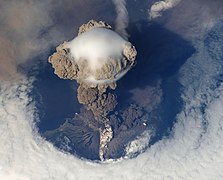
    Cerro Blanco (Spanish: [ˈsero ˈβlaŋko], "White Hill") is a caldera in the Andes of the Catamarca Province in Argentina. Part of the Central Volcanic Zone of the Andes, it is a volcano collapse structure located at an altitude of 4,670 metres (15,320 ft) in a depression. The caldera is associated with a less well-defined caldera to the south and several lava domes.

    The caldera has been active for the last eight million years, and eruptions have created several ignimbrites. An eruption occurred 73,000 years ago and formed the Campo de la Piedra Pómez ignimbrite layer. About 2,300 ± 160 BCE, the largest known volcanic eruption of the Central Andes, with a VEI-7, occurred at Cerro Blanco, forming the most recent caldera as well as thick ignimbrite layers. About 170 cubic kilometres (41 cu mi) of tephra were erupted then. The volcano has been dormant since then with some deformation and geothermal activity. A major future eruption would put nearby communities to the south at risk. (Full article...)
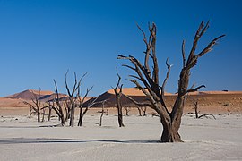
  • Image 15 Harrison Wright Falls, 27 feet (8.2 m), at Ricketts Glen State Park Ricketts Glen State Park is a Pennsylvania state park on 13,193 acres (5,280 ha) in Columbia, Luzerne, and Sullivan counties in Pennsylvania in the United States. Ricketts Glen is a National Natural Landmark known for its old-growth forest and 24 named waterfalls along Kitchen Creek, which flows down the Allegheny Front escarpment from the Allegheny Plateau to the Ridge-and-Valley Appalachians. The park is near the borough of Benton on Pennsylvania Route 118 and Pennsylvania Route 487, and is in five townships: Sugarloaf in Columbia County, Fairmount and Ross in Luzerne County, and Colley and Davidson in Sullivan County. Ricketts Glen's land was once home to Native Americans. From 1822 to 1827, a turnpike was built along the course of PA 487 in what is now the park, where two squatters harvested cherry trees to make bed frames from about 1830 to 1860. The park's waterfalls were one of the main attractions for a hotel from 1873 to 1903; the park is named for the hotel's proprietor, R. Bruce Ricketts, who built the trail along the waterfalls. By the 1890s Ricketts owned or controlled over 80,000 acres (320 km2; 120 sq mi) and made his fortune clearcutting almost all of that land, including much of what is now the park; however he preserved about 2,000 acres (810 ha) of virgin forest in the creek's three glens. The sawmill was at the village of Ricketts, which was mostly north of the park. After his death in 1918, Ricketts' heirs began selling land to the state for Pennsylvania State Game Lands. (Full article...)
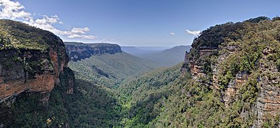
    Ricketts Glen State Park is a Pennsylvania state park on 13,193 acres (5,280 ha) in Columbia, Luzerne, and Sullivan counties in Pennsylvania in the United States. Ricketts Glen is a National Natural Landmark known for its old-growth forest and 24 named waterfalls along Kitchen Creek, which flows down the Allegheny Front escarpment from the Allegheny Plateau to the Ridge-and-Valley Appalachians. The park is near the borough of Benton on Pennsylvania Route 118 and Pennsylvania Route 487, and is in five townships: Sugarloaf in Columbia County, Fairmount and Ross in Luzerne County, and Colley and Davidson in Sullivan County.

    Ricketts Glen's land was once home to Native Americans. From 1822 to 1827, a turnpike was built along the course of PA 487 in what is now the park, where two squatters harvested cherry trees to make bed frames from about 1830 to 1860. The park's waterfalls were one of the main attractions for a hotel from 1873 to 1903; the park is named for the hotel's proprietor, R. Bruce Ricketts, who built the trail along the waterfalls. By the 1890s Ricketts owned or controlled over 80,000 acres (320 km; 120 sq mi) and made his fortune clearcutting almost all of that land, including much of what is now the park; however he preserved about 2,000 acres (810 ha) of virgin forest in the creek's three glens. The sawmill was at the village of Ricketts, which was mostly north of the park. After his death in 1918, Ricketts' heirs began selling land to the state for Pennsylvania State Game Lands. (Full article...)
  • More featured articles

    Vital articles Vital article

    Vital articles to understand Geography.

    A city is a human settlement of a notable size. The term "city" has different meanings around the world and in some places the settlement can be very small. Even where the term is limited to larger settlements, there is no universally agreed definition of the lower boundary for their size. In a more narrow sense, a city can be defined as a permanent and densely populated place with administratively defined boundaries whose members work primarily on non-agricultural tasks. Cities generally have extensive systems for housing, transportation, sanitation, utilities, land use, production of goods, and communication. Their density facilitates interaction between people, government organizations, and businesses, sometimes benefiting different parties in the process, such as improving the efficiency of goods and service distribution. (Full article...)
    Other vital articles

    Related portals

    Get involved

    For editor resources and to collaborate with other editors on improving Wikipedia's Geography-related articles, visit WikiProject Geography.


    Here are some tasks awaiting attention:

    Selected pictures

    Featured articles Featured biography

    Featured biography articles in geography

    Daniel Boone (November 2 [O.S. October 22], 1734 – September 26, 1820) was an American pioneer and frontiersman whose exploits made him one of the first folk heroes of the United States. He became famous for his exploration and settlement of Kentucky, which was then beyond the western borders of the Thirteen Colonies. In 1775, Boone blazed the Wilderness Road through the Cumberland Gap and into Kentucky, in the face of resistance from American Indians. He founded Boonesborough, one of the first English-speaking settlements west of the Appalachian Mountains. By the end of the 18th century, more than 200,000 people had entered Kentucky by following the route marked by Boone.

    Boone served as a militia officer during the Revolutionary War (1775–1783), which was fought in Kentucky primarily between American settlers and British-allied Indians. Boone was taken in by Shawnees in 1778 and adopted into the tribe, but he resigned and continued to help protect the Kentucky settlements. He also left due to the Shawnee Indians torturing and killing one of his sons. He was elected to the first of his three terms in the Virginia General Assembly during the war and fought in the Battle of Blue Licks in 1782, one of the last battles of the American Revolution. He worked as a surveyor and merchant after the war, but went deep into debt as a Kentucky land speculator. He resettled in Missouri in 1799, where he spent most of the last two decades of his life, frustrated with legal problems resulting from his land claims. (Full article...)
    More featured biographies

    Did you know

    Did you know it about Geography?

    Places around you

    You can read about interesting Wikipedia articles about places around you.

    Special:Nearby

    Top 10 WikiProject Geography Popular articles of the month

    This following Geography-related articles is a most visited articles of WikiProject Geography, See complete list at Wikipedia:WikiProject Geography/Popular pages.

  • Image 4 Generation X (often shortened to Gen X) is the demographic cohort following the Baby Boomers and preceding Millennials. Researchers and popular media often use the mid-1960s as its starting birth years and the late 1970s as its ending birth years, with the generation being generally defined as people born from 1965 to 1980. By this definition and U.S. Census data, there are 65.2 million Gen Xers in the United States as of 2019. Most of Generation X are the children of the Silent Generation and early Baby Boomers; Xers are also often the parents of Millennials and Generation Z. (Full article...)
    Generation X (often shortened to Gen X) is the demographic cohort following the Baby Boomers and preceding Millennials. Researchers and popular media often use the mid-1960s as its starting birth years and the late 1970s as its ending birth years, with the generation being generally defined as people born from 1965 to 1980. By this definition and U.S. Census data, there are 65.2 million Gen Xers in the United States as of 2019. Most of Generation X are the children of the Silent Generation and early Baby Boomers; Xers are also often the parents of Millennials and Generation Z. (Full article...)
  • Image 5 England is a country that is part of the United Kingdom. It is located on the island of Great Britain, of which it covers approximately 62%, and over 100 smaller adjacent islands. It has land borders with Scotland to the north and Wales to the west, and is otherwise surrounded by the North Sea to the east, the English Channel to the south, the Celtic Sea to the south-west, and the Irish Sea to the west. Continental Europe lies to the south-east, and Ireland to the west. At the 2021 census, the population was 56,490,048. London is both the largest city and the capital. (Full article...)

    England is a country that is part of the United Kingdom. It is located on the island of Great Britain, of which it covers approximately 62%, and over 100 smaller adjacent islands. It has land borders with Scotland to the north and Wales to the west, and is otherwise surrounded by the North Sea to the east, the English Channel to the south, the Celtic Sea to the south-west, and the Irish Sea to the west. Continental Europe lies to the south-east, and Ireland to the west. At the 2021 census, the population was 56,490,048. London is both the largest city and the capital. (Full article...)
  • Image 6 River Thames and Tower Bridge with The Shard and Southwark (left), and Tower of London and City of London (right) London (/ˈlʌndən/ LUN-dən) is the capital and largest city of both England and the United Kingdom, with a population of 8,866,180 in 2022. The wider metropolitan area is the largest in Western Europe, with a population of 14.9 million. London stands on the River Thames in southeast England, at the head of a 50-mile (80 km) estuary down to the North Sea, and has been a major settlement for nearly 2,000 years. Its ancient core and financial centre, the City of London, was founded by the Romans as Londinium and has retained its medieval boundaries. The City of Westminster, to the west of the City of London, has been the centuries-long host of the national government and parliament. London grew rapidly in the 19th century, becoming the world's largest city at the time as it expanded and absorbed the surrounding county of Middlesex alongside parts of Surrey and Kent. In 1965, it was combined with parts of Essex and Hertfordshire to create the administrative area of Greater London, which is governed by 33 local authorities and the Greater London Authority. (Full article...)

    London (/ˈlʌndən/ LUN-dən) is the capital and largest city of both England and the United Kingdom, with a population of 8,866,180 in 2022. The wider metropolitan area is the largest in Western Europe, with a population of 14.9 million. London stands on the River Thames in southeast England, at the head of a 50-mile (80 km) estuary down to the North Sea, and has been a major settlement for nearly 2,000 years. Its ancient core and financial centre, the City of London, was founded by the Romans as Londinium and has retained its medieval boundaries. The City of Westminster, to the west of the City of London, has been the centuries-long host of the national government and parliament. London grew rapidly in the 19th century, becoming the world's largest city at the time as it expanded and absorbed the surrounding county of Middlesex alongside parts of Surrey and Kent. In 1965, it was combined with parts of Essex and Hertfordshire to create the administrative area of Greater London, which is governed by 33 local authorities and the Greater London Authority. (Full article...)
  • Image 7 Cartogram of the world's population in 2018; each square represents 500,000 people.[needs update?] This is a list of countries and dependencies by population. It includes sovereign states, inhabited dependent territories and, in some cases, constituent countries of sovereign states, with inclusion within the list being primarily based on the ISO standard ISO 3166-1. For instance, the United Kingdom is considered a single entity, while the constituent countries of the Kingdom of the Netherlands are considered separately. In addition, this list includes certain states with limited recognition not found in ISO 3166-1. Also given in a percentage is each country's population compared with the world population, which the United Nations estimates at 8.12 billion as of 2024. (Full article...)
    Cartogram of the world's population in 2018; each square represents 500,000 people.


    This is a list of countries and dependencies by population. It includes sovereign states, inhabited dependent territories and, in some cases, constituent countries of sovereign states, with inclusion within the list being primarily based on the ISO standard ISO 3166-1. For instance, the United Kingdom is considered a single entity, while the constituent countries of the Kingdom of the Netherlands are considered separately. In addition, this list includes certain states with limited recognition not found in ISO 3166-1. Also given in a percentage is each country's population compared with the world population, which the United Nations estimates at 8.12 billion as of 2024. (Full article...)
  • Image 8 Europe is a continent located entirely in the Northern Hemisphere and mostly in the Eastern Hemisphere. It is bordered by the Arctic Ocean to the north, the Atlantic Ocean to the west, the Mediterranean Sea to the south, and Asia to the east. Europe shares the landmass of Eurasia with Asia, and of Afro-Eurasia with both Asia and Africa. Europe is commonly considered to be separated from Asia by the watershed of the Ural Mountains, the Ural River, the Caspian Sea, the Greater Caucasus, the Black Sea, and the waterway of the Bosporus Strait. (Full article...)
    Europe is a continent located entirely in the Northern Hemisphere and mostly in the Eastern Hemisphere. It is bordered by the Arctic Ocean to the north, the Atlantic Ocean to the west, the Mediterranean Sea to the south, and Asia to the east. Europe shares the landmass of Eurasia with Asia, and of Afro-Eurasia with both Asia and Africa. Europe is commonly considered to be separated from Asia by the watershed of the Ural Mountains, the Ural River, the Caspian Sea, the Greater Caucasus, the Black Sea, and the waterway of the Bosporus Strait. (Full article...)
  • Image 9 Millennials, also known as Generation Y or Gen Y, are the demographic cohort following Generation X and preceding Generation Z. Researchers and popular media use the early 1980s as starting birth years and the mid-1990s to early 2000s as ending birth years, with the generation typically being defined as people born from 1981 to 1996. Most Millennials are the children of Baby Boomers and older Generation X. In turn Millennials are often the parents of Generation Alpha. (Full article...)
    Millennials, also known as Generation Y or Gen Y, are the demographic cohort following Generation X and preceding Generation Z. Researchers and popular media use the early 1980s as starting birth years and the mid-1990s to early 2000s as ending birth years, with the generation typically being defined as people born from 1981 to 1996. Most Millennials are the children of Baby Boomers and older Generation X. In turn Millennials are often the parents of Generation Alpha. (Full article...)
  • Image 10 Hong Kong is a special administrative region of the People's Republic of China. With 7.4 million residents of various nationalities in a 1,104-square-kilometre (426 sq mi) territory, Hong Kong is one of the most densely populated territories in the world. (Full article...)

    Hong Kong is a special administrative region of the People's Republic of China. With 7.4 million residents of various nationalities in a 1,104-square-kilometre (426 sq mi) territory, Hong Kong is one of the most densely populated territories in the world. (Full article...)
  • Featured pictures

    Click to enlarge and view description.

    Main articles

    CategoriesCategories

    Select [►] to view subcategories.

    Associated Wikimedia

    The following Wikimedia Foundation sister projects provide more on this subject:

    Discover Wikipedia using portals
    Retrieved from "https://en.wikipedia.org/w/index.php?title=Portal:Geography&oldid=1202464975"