Loading
  • 21 Aug, 2019

  • By, Wikipedia

Portal:Geography

The Geography Portal

Geography (from Ancient Greek γεωγραφία geōgraphía; combining 'Earth' and gráphō 'write') is the study of the lands, features, inhabitants, and phenomena of Earth. Geography is an all-encompassing discipline that seeks an understanding of Earth and its human and natural complexities—not merely where objects are, but also how they have changed and come to be. While geography is specific to Earth, many concepts can be applied more broadly to other celestial bodies in the field of planetary science. Geography has been called "a bridge between natural science and social science disciplines."

Origins of many of the concepts in geography can be traced to Greek Eratosthenes of Cyrene, who may have coined the term "geographia" (c. 276 BC – c. 195/194 BC). The first recorded use of the word γεωγραφία was as the title of a book by Greek scholar Claudius Ptolemy (100 – 170 AD). This work created the so-called "Ptolemaic tradition" of geography, which included "Ptolemaic cartographic theory." However, the concepts of geography (such as cartography) date back to the earliest attempts to understand the world spatially, with the earliest example of an attempted world map dating to the 9th century BCE in ancient Babylon. The history of geography as a discipline spans cultures and millennia, being independently developed by multiple groups, and cross-pollinated by trade between these groups. The core concepts of geography consistent between all approaches are a focus on space, place, time, and scale.

Today, geography is an extremely broad discipline with multiple approaches and modalities. There have been multiple attempts to organize the discipline, including the four traditions of geography, and into branches. Techniques employed can generally be broken down into quantitative and qualitative approaches, with many studies taking mixed-methods approaches. Common techniques include cartography, remote sensing, interviews, and surveying. (Full article...)

Featured articles are displayed here, which represent some of the best content on English Wikipedia.

  • Image 2 The Kingdom of Mysore was a geopolitical realm in southern India founded in around 1399 in the vicinity of the modern-day city of Mysore and prevailed until 1950. The territorial boundaries and the form of government transmuted substantially throughout the kingdom's lifetime. While originally a feudal vassal under the Vijayanagara Empire, it became a princely state in British India from 1799 to 1947, marked in-between by major political changes. The kingdom, which was founded and ruled for the most part by the Wadiyars, initially served as a fedual vassal under the Vijayanagara Empire. With the gradual decline of the Empire, the 16th-century Timmaraja Wodeyar II declared independence from it. The 17th century saw a steady expansion of its territory and, during the rule of Narasaraja Wodeyar I and Devaraja Wodeyar II, the kingdom annexed large expanses of what is now southern Karnataka and parts of Tamil Nadu, becoming a formidable power in the Deccan. (Full article...)

    The Kingdom of Mysore was a geopolitical realm in southern India founded in around 1399 in the vicinity of the modern-day city of Mysore and prevailed until 1950. The territorial boundaries and the form of government transmuted substantially throughout the kingdom's lifetime. While originally a feudal vassal under the Vijayanagara Empire, it became a princely state in British India from 1799 to 1947, marked in-between by major political changes.

    The kingdom, which was founded and ruled for the most part by the Wadiyars, initially served as a fedual vassal under the Vijayanagara Empire. With the gradual decline of the Empire, the 16th-century Timmaraja Wodeyar II declared independence from it. The 17th century saw a steady expansion of its territory and, during the rule of Narasaraja Wodeyar I and Devaraja Wodeyar II, the kingdom annexed large expanses of what is now southern Karnataka and parts of Tamil Nadu, becoming a formidable power in the Deccan. (Full article...)
  • Image 3 Freshwater lagoon seen from west bank, with Island Hide in the foreground, and the Parrinder wall and hides further back Titchwell Marsh is an English nature reserve owned and managed by the Royal Society for the Protection of Birds (RSPB). Located on the north coast of the county of Norfolk, between the villages of Titchwell and Thornham, about 8 km (5.0 mi) east of the seaside resort of Hunstanton, its 171 hectares (420 acres) include reed beds, saltmarshes, a freshwater lagoon and sandy beach, with a small woodland area near the car park. This internationally important reserve is part of the North Norfolk Coast Site of Special Scientific Interest (SSSI) and the Norfolk Coast Area of Outstanding Natural Beauty (AONB), and is also protected through Natura 2000, Special Protection Area (SPA) and Ramsar listings. The reserve is important for some scarce breeding birds, such as pied avocets on the islands, and western marsh harriers, Eurasian bitterns and bearded reedlings in the reeds. To encourage bitterns to breed, the reed beds have been improved to make them wetter, and the lagoon has been stocked with the common rudd. Typical wetland birds such as the water rail, reed warbler and sedge warbler also appear, and little egrets are common. The reserve has regularly attracted rarities, as its location is important for migrating birds. Ducks and geese winter at Titchwell in considerable numbers, and the reserve shelters the endangered European water vole. (Full article...)

    Titchwell Marsh is an English nature reserve owned and managed by the Royal Society for the Protection of Birds (RSPB). Located on the north coast of the county of Norfolk, between the villages of Titchwell and Thornham, about 8 km (5.0 mi) east of the seaside resort of Hunstanton, its 171 hectares (420 acres) include reed beds, saltmarshes, a freshwater lagoon and sandy beach, with a small woodland area near the car park. This internationally important reserve is part of the North Norfolk Coast Site of Special Scientific Interest (SSSI) and the Norfolk Coast Area of Outstanding Natural Beauty (AONB), and is also protected through Natura 2000, Special Protection Area (SPA) and Ramsar listings.

    The reserve is important for some scarce breeding birds, such as pied avocets on the islands, and western marsh harriers, Eurasian bitterns and bearded reedlings in the reeds. To encourage bitterns to breed, the reed beds have been improved to make them wetter, and the lagoon has been stocked with the common rudd. Typical wetland birds such as the water rail, reed warbler and sedge warbler also appear, and little egrets are common. The reserve has regularly attracted rarities, as its location is important for migrating birds. Ducks and geese winter at Titchwell in considerable numbers, and the reserve shelters the endangered European water vole. (Full article...)
  • Image 4 Shackleton in 1904 Sir Ernest Henry Shackleton CVO OBE FRGS FRSGS (15 February 1874 – 5 January 1922) was an Anglo-Irish Antarctic explorer who led three British expeditions to the Antarctic. He was one of the principal figures of the period known as the Heroic Age of Antarctic Exploration. Born in Kilkea, County Kildare, Ireland, Shackleton and his Anglo-Irish family moved to Sydenham in suburban south London when he was ten. Shackleton's first experience of the polar regions was as third officer on Captain Robert Falcon Scott's Discovery Expedition of 1901–1904, from which he was sent home early on health grounds, after he and his companions Scott and Edward Adrian Wilson set a new southern record by marching to latitude 82°S. During the Nimrod Expedition of 1907–1909, he and three companions established a new record Farthest South latitude of 88°23′ S, only 97 geographical miles (112 statute miles or 180 kilometres) from the South Pole, the largest advance to the pole in exploration history. Also, members of his team climbed Mount Erebus, the most active Antarctic volcano. On returning home, Shackleton was knighted for his achievements by King Edward VII. (Full article...)

    Sir Ernest Henry Shackleton CVO OBE FRGS FRSGS (15 February 1874 – 5 January 1922) was an Anglo-Irish Antarctic explorer who led three British expeditions to the Antarctic. He was one of the principal figures of the period known as the Heroic Age of Antarctic Exploration.

    Born in Kilkea, County Kildare, Ireland, Shackleton and his Anglo-Irish family moved to Sydenham in suburban south London when he was ten. Shackleton's first experience of the polar regions was as third officer on Captain Robert Falcon Scott's Discovery Expedition of 1901–1904, from which he was sent home early on health grounds, after he and his companions Scott and Edward Adrian Wilson set a new southern record by marching to latitude 82°S. During the Nimrod Expedition of 1907–1909, he and three companions established a new record Farthest South latitude of 88°23′ S, only 97 geographical miles (112 statute miles or 180 kilometres) from the South Pole, the largest advance to the pole in exploration history. Also, members of his team climbed Mount Erebus, the most active Antarctic volcano. On returning home, Shackleton was knighted for his achievements by King Edward VII. (Full article...)
  • Image 5 Zion Canyon from Angels Landing at sunset Zion National Park is an American national park located in southwestern Utah near the town of Springdale. Located at the junction of the Colorado Plateau, Great Basin, and Mojave Desert regions, the park has a unique geography and a variety of life zones that allow for unusual plant and animal diversity. Numerous plant species as well as 289 species of birds, 75 mammals (including 19 species of bat), and 32 reptiles inhabit the park's four life zones: desert, riparian, woodland, and coniferous forest. Zion National Park includes mountains, canyons, buttes, mesas, monoliths, rivers, slot canyons, and natural arches. The lowest point in the park is 3,666 ft (1,117 m) at Coalpits Wash and the highest peak is 8,726 ft (2,660 m) at Horse Ranch Mountain. A prominent feature of the 229-square-mile (590 km2) park is Zion Canyon, which is 15 miles (24 km) long and up to 2,640 ft (800 m) deep. The canyon walls are reddish and tan-colored Navajo Sandstone eroded by the North Fork of the Virgin River. The park attracted 5 million visitors in 2023. Human habitation of the area started about 8,000 years ago with small family groups of Native Americans, one of which was the semi-nomadic Basketmaker Ancestral Puebloans (who used to be called Anasazi by early non-indigenous archeologists) (c. 300 CE). Subsequently, what has been called the Virgin Anasazi culture (c. 500) and the Parowan Fremont group developed as the Basketmakers settled in permanent communities. Both groups moved away by 1300 and were replaced by the Parrusits and several other Southern Paiute subtribes. Mormons came into the area in 1858 and settled there in the early 1860s. (Full article...)

    Zion National Park is an American national park located in southwestern Utah near the town of Springdale. Located at the junction of the Colorado Plateau, Great Basin, and Mojave Desert regions, the park has a unique geography and a variety of life zones that allow for unusual plant and animal diversity. Numerous plant species as well as 289 species of birds, 75 mammals (including 19 species of bat), and 32 reptiles inhabit the park's four life zones: desert, riparian, woodland, and coniferous forest. Zion National Park includes mountains, canyons, buttes, mesas, monoliths, rivers, slot canyons, and natural arches. The lowest point in the park is 3,666 ft (1,117 m) at Coalpits Wash and the highest peak is 8,726 ft (2,660 m) at Horse Ranch Mountain. A prominent feature of the 229-square-mile (590 km) park is Zion Canyon, which is 15 miles (24 km) long and up to 2,640 ft (800 m) deep. The canyon walls are reddish and tan-colored Navajo Sandstone eroded by the North Fork of the Virgin River. The park attracted 5 million visitors in 2023.

    Human habitation of the area started about 8,000 years ago with small family groups of Native Americans, one of which was the semi-nomadic Basketmaker Ancestral Puebloans (who used to be called Anasazi by early non-indigenous archeologists) (c. 300 CE). Subsequently, what has been called the Virgin Anasazi culture (c. 500) and the Parowan Fremont group developed as the Basketmakers settled in permanent communities. Both groups moved away by 1300 and were replaced by the Parrusits and several other Southern Paiute subtribes. Mormons came into the area in 1858 and settled there in the early 1860s. (Full article...)
  • Image 6 Micronations and the Search for Sovereignty is a 2021 book by Australian constitutional law specialists Harry Hobbs and George Williams about micronations and their legal status. Written from an academic perspective, it is one of few works on micronational movements and the earliest-published book to focus largely on the legal aspect of micronations. The book concerns the definition of statehood, the place of micronations within international law, people's motivations for declaring them, the micronational community and the ways by which such entities mimic sovereign states. In 2022 Hobbs and Williams published a book for a broader audience, How to Rule Your Own Country: The Weird and Wonderful World of Micronations. (Full article...)

    Micronations and the Search for Sovereignty is a 2021 book by Australian constitutional law specialists Harry Hobbs and George Williams about micronations and their legal status. Written from an academic perspective, it is one of few works on micronational movements and the earliest-published book to focus largely on the legal aspect of micronations. The book concerns the definition of statehood, the place of micronations within international law, people's motivations for declaring them, the micronational community and the ways by which such entities mimic sovereign states. In 2022 Hobbs and Williams published a book for a broader audience, How to Rule Your Own Country: The Weird and Wonderful World of Micronations. (Full article...)
  • Image 7 Suillus bovinus Pine woods, Galicia Suillus bovinus, also known as the Jersey cow mushroom or bovine bolete, is a pored mushroom of the genus Suillus in the family Suillaceae. A common fungus native to Europe and Asia, it has been introduced to North America and Australia. It was initially described as Boletus bovinus by Carl Linnaeus in 1753, and given its current binomial name by Henri François Anne de Roussel in 1806. It is an edible mushroom, though not highly regarded. The fungus grows in coniferous forests in its native range, and pine plantations in countries where it has become naturalised. It forms symbiotic ectomycorrhizal associations with living trees by enveloping the tree's underground roots with sheaths of fungal tissue, and is sometimes parasitised by the related mushroom Gomphidius roseus. Suillus bovinus produces spore-bearing fruit bodies, often in large numbers, above ground. The mushroom has a convex grey-yellow or ochre cap reaching up to 10 cm (4 in) in diameter, which flattens with age. Like other boletes, it has tubes extending downward from the underside of the cap, rather than gills; spores escape at maturity through the tube openings, or pores. The pore surface is yellow. The stipe, more slender than those of other Suillus boletes, lacks a ring. (Full article...)

    Suillus bovinus, also known as the Jersey cow mushroom or bovine bolete, is a pored mushroom of the genus Suillus in the family Suillaceae. A common fungus native to Europe and Asia, it has been introduced to North America and Australia. It was initially described as Boletus bovinus by Carl Linnaeus in 1753, and given its current binomial name by Henri François Anne de Roussel in 1806. It is an edible mushroom, though not highly regarded.

    The fungus grows in coniferous forests in its native range, and pine plantations in countries where it has become naturalised. It forms symbiotic ectomycorrhizal associations with living trees by enveloping the tree's underground roots with sheaths of fungal tissue, and is sometimes parasitised by the related mushroom Gomphidius roseus. Suillus bovinus produces spore-bearing fruit bodies, often in large numbers, above ground. The mushroom has a convex grey-yellow or ochre cap reaching up to 10 cm (4 in) in diameter, which flattens with age. Like other boletes, it has tubes extending downward from the underside of the cap, rather than gills; spores escape at maturity through the tube openings, or pores. The pore surface is yellow. The stipe, more slender than those of other Suillus boletes, lacks a ring. (Full article...)
  • Image 8 A map of the position of the former shorelines of Lake Estancia Lake Estancia was a lake formed in the Estancia Valley, central New Mexico, which left various coastal landforms in the valley. The lake was mostly fed by creek and groundwater from the Manzano Mountains, and fluctuated between freshwater stages and saltier stages. The lake had a diverse fauna, including cutthroat trout; they may have reached it during a possible past stage where it was overflowing. Lake Estancia appears to have formed between the Pliocene and Pleistocene, when a previous river system broke up. It reached a maximum water level ("highstand") presumably during the Illinoian glaciation and subsequently fluctuated between fuller stages and a desiccated basin. Around the Last Glacial Maximum (LGM) time interval, several highstands and a low water level state occurred during the "Big Dry" climate interval. Between 16,100 and 14,500 years ago the lake reached its highest stand of the last 30,000 years before drying up again during the Bølling-Allerød climate interval. The lake briefly returned during the Younger Dryas climate interval and eventually desiccated during the Holocene, after about 8,500 years ago. Wind-driven erosion has excavated depressions in the former lakebed that are in part filled with playas (dry lake beds). (Full article...)

    Lake Estancia was a lake formed in the Estancia Valley, central New Mexico, which left various coastal landforms in the valley. The lake was mostly fed by creek and groundwater from the Manzano Mountains, and fluctuated between freshwater stages and saltier stages. The lake had a diverse fauna, including cutthroat trout; they may have reached it during a possible past stage where it was overflowing.

    Lake Estancia appears to have formed between the Pliocene and Pleistocene, when a previous river system broke up. It reached a maximum water level ("highstand") presumably during the Illinoian glaciation and subsequently fluctuated between fuller stages and a desiccated basin. Around the Last Glacial Maximum (LGM) time interval, several highstands and a low water level state occurred during the "Big Dry" climate interval. Between 16,100 and 14,500 years ago the lake reached its highest stand of the last 30,000 years before drying up again during the Bølling-Allerød climate interval. The lake briefly returned during the Younger Dryas climate interval and eventually desiccated during the Holocene, after about 8,500 years ago. Wind-driven erosion has excavated depressions in the former lakebed that are in part filled with playas (dry lake beds). (Full article...)
  • Image 9 Prussian grenadiers advancing at the Battle of Leuthen, as depicted by Carl Röchling The Third Silesian War (German: Dritter Schlesischer Krieg) was a war between Prussia and Austria (together with its allies) that lasted from 1756 to 1763 and confirmed Prussia's control of the region of Silesia (now in south-western Poland). The war was fought mainly in Silesia, Bohemia and Upper Saxony and formed one theatre of the Seven Years' War. It was the last of three Silesian Wars fought between Frederick the Great's Prussia and Maria Theresa's Austria in the mid-18th century, all three of which ended in Prussian control of Silesia. This conflict can be viewed as a continuation of the First and Second Silesian Wars of the previous decade. After the Treaty of Aix-la-Chapelle ended the War of the Austrian Succession, Austria enacted broad reforms and upended its traditional diplomatic policy to prepare for renewed war with Prussia. As with the previous Silesian Wars, no particular triggering event initiated the conflict; rather, Prussia struck opportunistically to disrupt its enemies' plans. The war's cost in blood and treasure was high on both sides, and it ended inconclusively when neither of the main belligerents could sustain the conflict any longer. (Full article...)

    The Third Silesian War (German: Dritter Schlesischer Krieg) was a war between Prussia and Austria (together with its allies) that lasted from 1756 to 1763 and confirmed Prussia's control of the region of Silesia (now in south-western Poland). The war was fought mainly in Silesia, Bohemia and Upper Saxony and formed one theatre of the Seven Years' War. It was the last of three Silesian Wars fought between Frederick the Great's Prussia and Maria Theresa's Austria in the mid-18th century, all three of which ended in Prussian control of Silesia.

    This conflict can be viewed as a continuation of the First and Second Silesian Wars of the previous decade. After the Treaty of Aix-la-Chapelle ended the War of the Austrian Succession, Austria enacted broad reforms and upended its traditional diplomatic policy to prepare for renewed war with Prussia. As with the previous Silesian Wars, no particular triggering event initiated the conflict; rather, Prussia struck opportunistically to disrupt its enemies' plans. The war's cost in blood and treasure was high on both sides, and it ended inconclusively when neither of the main belligerents could sustain the conflict any longer. (Full article...)
  • Image 10 Enhanced color image of Io from the Galileo spacecraft, taken in 1999. Io (⫽ˈaɪ.oʊ⫽), or Jupiter I, is the innermost and second-smallest of the four Galilean moons of the planet Jupiter. Slightly larger than Earth's moon, Io is the fourth-largest moon in the Solar System, has the highest density of any moon, the strongest surface gravity of any moon, and the lowest amount of water by atomic ratio of any known astronomical object in the Solar System. It was discovered in 1610 by Galileo Galilei and was named after the mythological character Io, a priestess of Hera who became one of Zeus's lovers. With over 400 active volcanoes, Io is the most geologically active object in the Solar System. This extreme geologic activity is the result of tidal heating from friction generated within Io's interior as it is pulled between Jupiter and the other Galilean moons—Europa, Ganymede and Callisto. Several volcanoes produce plumes of sulfur and sulfur dioxide that climb as high as 500 km (300 mi) above the surface. Io's surface is also dotted with more than 100 mountains that have been uplifted by extensive compression at the base of Io's silicate crust. Some of these peaks are taller than Mount Everest, the highest point on Earth's surface. Unlike most moons in the outer Solar System, which are mostly composed of water ice, Io is primarily composed of silicate rock surrounding a molten iron or iron sulfide core. Most of Io's surface is composed of extensive plains with a frosty coating of sulfur and sulfur dioxide. (Full article...)

    Io (ˈ.), or Jupiter I, is the innermost and second-smallest of the four Galilean moons of the planet Jupiter. Slightly larger than Earth's moon, Io is the fourth-largest moon in the Solar System, has the highest density of any moon, the strongest surface gravity of any moon, and the lowest amount of water by atomic ratio of any known astronomical object in the Solar System. It was discovered in 1610 by Galileo Galilei and was named after the mythological character Io, a priestess of Hera who became one of Zeus's lovers.

    With over 400 active volcanoes, Io is the most geologically active object in the Solar System. This extreme geologic activity is the result of tidal heating from friction generated within Io's interior as it is pulled between Jupiter and the other Galilean moons—Europa, Ganymede and Callisto. Several volcanoes produce plumes of sulfur and sulfur dioxide that climb as high as 500 km (300 mi) above the surface. Io's surface is also dotted with more than 100 mountains that have been uplifted by extensive compression at the base of Io's silicate crust. Some of these peaks are taller than Mount Everest, the highest point on Earth's surface. Unlike most moons in the outer Solar System, which are mostly composed of water ice, Io is primarily composed of silicate rock surrounding a molten iron or iron sulfide core. Most of Io's surface is composed of extensive plains with a frosty coating of sulfur and sulfur dioxide. (Full article...)
  • Image 11 St Giles’ Church, Wormshill Wormshill (⫽wɜːrmzˈhɪl⫽ wurmz-HIL), historically Wormsell, is a small village and civil parish within the Borough of Maidstone, Kent, England. The parish is approximately 7 miles (11 km) south of the Swale and 8 mi (13 km) east of Maidstone. The village of Frinsted lies 0.6 mi (1 km) to the east and Bicknor 1+1⁄2 mi (2.4 km) to the north-west; while Hollingbourne is 3 mi (5 km) to the south-west. The village lies on an exposed high point of the North Downs, within the Kent Downs Area of Outstanding Natural Beauty. Archaeological and toponymic evidence of Wormshill's existence predates its appearance in the Domesday Book of 1086. The village contains a number of heritage-listed buildings, which include a Norman church, a public house and one of the oldest surviving post office buildings in the United Kingdom. The fields and woodland surrounding Wormshill have changed little in the past 500 years, and the village itself remains rural with a low population density compared to the national average. The population of 200 is a mixture of agricultural workers employed by local farms, and professional residents who commute to nearby towns. (Full article...)

    Wormshill (wɜːrmzˈhɪl wurmz-HIL), historically Wormsell, is a small village and civil parish within the Borough of Maidstone, Kent, England. The parish is approximately 7 miles (11 km) south of the Swale and 8 mi (13 km) east of Maidstone. The village of Frinsted lies 0.6 mi (1 km) to the east and Bicknor 1+12 mi (2.4 km) to the north-west; while Hollingbourne is 3 mi (5 km) to the south-west. The village lies on an exposed high point of the North Downs, within the Kent Downs Area of Outstanding Natural Beauty.

    Archaeological and toponymic evidence of Wormshill's existence predates its appearance in the Domesday Book of 1086. The village contains a number of heritage-listed buildings, which include a Norman church, a public house and one of the oldest surviving post office buildings in the United Kingdom. The fields and woodland surrounding Wormshill have changed little in the past 500 years, and the village itself remains rural with a low population density compared to the national average. The population of 200 is a mixture of agricultural workers employed by local farms, and professional residents who commute to nearby towns. (Full article...)
  • Image 12 White birches in Marion Brooks Natural Area within Quehanna Wild Area Quehanna Wild Area (⫽kwəˈhænə⫽) is a wildlife area within parts of Cameron, Clearfield and Elk counties in the U.S. state of Pennsylvania; with a total area of 50,000 acres (78 sq mi; 202 km2), it covers parts of Elk and Moshannon State Forests. Founded in the 1950s as a nuclear research center, Quehanna has a legacy of radioactive and toxic waste contamination, while also being the largest state forest wild area in Pennsylvania, with herds of elk. The wild area is bisected by the Quehanna Highway and is home to second growth forest with mixed hardwoods and evergreens. Quehanna has two state forest natural areas: the 1,215-acre (492 ha) M.K. Goddard/Wykoff Run Natural Area, and the 917-acre (371 ha) Marion Brooks Natural Area. The latter has the largest stand of white birch in Pennsylvania and the eastern United States. The land that became Quehanna Wild Area was home to Native Americans, including the Susquehannock and Iroquois, before it was purchased by the United States in 1784. Settlers soon moved into the region and, in the 19th and early 20th centuries, the logging industry cut the virgin forests; clearcutting and forest fires transformed the once verdant land into the "Pennsylvania Desert". Pennsylvania bought this land for its state forests, and in the 1930s the Civilian Conservation Corps worked to improve them. In 1955 the Curtiss-Wright Corporation bought 80 square miles (210 km2) of state forest to focus on developing nuclear-powered jet engines. They named their facility Quehanna for the nearby West Branch Susquehanna River, itself named for the Susquehannocks. (Full article...)

    Quehanna Wild Area (kwəˈhænə) is a wildlife area within parts of Cameron, Clearfield and Elk counties in the U.S. state of Pennsylvania; with a total area of 50,000 acres (78 sq mi; 202 km), it covers parts of Elk and Moshannon State Forests. Founded in the 1950s as a nuclear research center, Quehanna has a legacy of radioactive and toxic waste contamination, while also being the largest state forest wild area in Pennsylvania, with herds of elk. The wild area is bisected by the Quehanna Highway and is home to second growth forest with mixed hardwoods and evergreens. Quehanna has two state forest natural areas: the 1,215-acre (492 ha) M.K. Goddard/Wykoff Run Natural Area, and the 917-acre (371 ha) Marion Brooks Natural Area. The latter has the largest stand of white birch in Pennsylvania and the eastern United States.

    The land that became Quehanna Wild Area was home to Native Americans, including the Susquehannock and Iroquois, before it was purchased by the United States in 1784. Settlers soon moved into the region and, in the 19th and early 20th centuries, the logging industry cut the virgin forests; clearcutting and forest fires transformed the once verdant land into the "Pennsylvania Desert". Pennsylvania bought this land for its state forests, and in the 1930s the Civilian Conservation Corps worked to improve them. In 1955 the Curtiss-Wright Corporation bought 80 square miles (210 km) of state forest to focus on developing nuclear-powered jet engines. They named their facility Quehanna for the nearby West Branch Susquehanna River, itself named for the Susquehannocks. (Full article...)
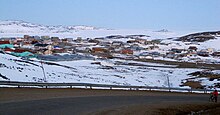
  • Image 13 Michael was born near Apex, Iqaluit. Simonie Michael (Inuktitut: ᓴᐃᒨᓂ ᒪᐃᑯᓪ; first name also spelled Simonee, alternative surnames Michel or E7-551; March 2, 1933 – November 15, 2008) was a Canadian politician from the eastern Northwest Territories (now Nunavut) who was the first Inuk elected to a legislature in Canada. Before becoming involved in politics, Michael worked as a carpenter and business owner, and was one of very few translators between Inuktitut and English. He became a prominent member of the Inuit co-operative housing movement and a community activist in Iqaluit, and was appointed to a series of governing bodies, including the precursor to the Iqaluit City Council. After becoming the first elected Inuk member of the Northwest Territories Legislative Council, in 1966, Michael worked on infrastructural and public health initiatives. He is credited with bringing public attention to the dehumanizing effects of the disc number system that was used in place of surnames for Inuit, and with prompting the government to authorise Project Surname to replace the numbers with names. (Full article...)
    Michael was born near Apex, Iqaluit.

    Simonie Michael (Inuktitut: ᓴᐃᒨᓂ ᒪᐃᑯᓪ; first name also spelled Simonee, alternative surnames Michel or E7-551; March 2, 1933 – November 15, 2008) was a Canadian politician from the eastern Northwest Territories (now Nunavut) who was the first Inuk elected to a legislature in Canada. Before becoming involved in politics, Michael worked as a carpenter and business owner, and was one of very few translators between Inuktitut and English. He became a prominent member of the Inuit co-operative housing movement and a community activist in Iqaluit, and was appointed to a series of governing bodies, including the precursor to the Iqaluit City Council.

    After becoming the first elected Inuk member of the Northwest Territories Legislative Council, in 1966, Michael worked on infrastructural and public health initiatives. He is credited with bringing public attention to the dehumanizing effects of the disc number system that was used in place of surnames for Inuit, and with prompting the government to authorise Project Surname to replace the numbers with names. (Full article...)
  • Image 14 Atlantic Ocean near the Faroe Islands A sea is a large body of salty water. There are particular seas and the sea. The sea commonly refers to the ocean, the wider body of seawater. Particular seas are either marginal seas, second-order sections of the oceanic sea (e.g. the Mediterranean Sea), or certain large, nearly landlocked bodies of water. The salinity of water bodies varies widely, being lower near the surface and the mouths of large rivers and higher in the depths of the ocean; however, the relative proportions of dissolved salts vary little across the oceans. The most abundant solid dissolved in seawater is sodium chloride. The water also contains salts of magnesium, calcium, potassium, and mercury, amongst many other elements, some in minute concentrations. A wide variety of organisms, including bacteria, protists, algae, plants, fungi, and animals live in the seas, which offers a wide range of marine habitats and ecosystems, ranging vertically from the sunlit surface and shoreline to the great depths and pressures of the cold, dark abyssal zone, and in latitude from the cold waters under polar ice caps to the warm waters of coral reefs in tropical regions. Many of the major groups of organisms evolved in the sea and life may have started there. (Full article...)
    Atlantic Ocean near the Faroe Islands


    A sea is a large body of salty water. There are particular seas and the sea. The sea commonly refers to the ocean, the wider body of seawater.
    Particular seas are either marginal seas, second-order sections of the oceanic sea (e.g. the Mediterranean Sea), or certain large, nearly landlocked bodies of water.

    The salinity of water bodies varies widely, being lower near the surface and the mouths of large rivers and higher in the depths of the ocean; however, the relative proportions of dissolved salts vary little across the oceans. The most abundant solid dissolved in seawater is sodium chloride. The water also contains salts of magnesium, calcium, potassium, and mercury, amongst many other elements, some in minute concentrations. A wide variety of organisms, including bacteria, protists, algae, plants, fungi, and animals live in the seas, which offers a wide range of marine habitats and ecosystems, ranging vertically from the sunlit surface and shoreline to the great depths and pressures of the cold, dark abyssal zone, and in latitude from the cold waters under polar ice caps to the warm waters of coral reefs in tropical regions. Many of the major groups of organisms evolved in the sea and life may have started there. (Full article...)
  • Image 15 Skegness clock tower and seafront amusements Skegness (⫽ˌskɛɡˈnɛs⫽ skeg-NESS) is a seaside town and civil parish in the East Lindsey District of Lincolnshire, England. On the Lincolnshire coast of the North Sea, the town is 43 miles (69 km) east of Lincoln and 22 miles (35 km) north-east of Boston. With a population of 21,128 as of 2021, it is the largest settlement in East Lindsey. It incorporates Winthorpe and Seacroft, and forms a larger built-up area with the resorts of Ingoldmells and Chapel St Leonards to the north. The town is on the A52 and A158 roads, connecting it with Boston and the East Midlands, and Lincoln respectively. Skegness railway station is on the Nottingham to Skegness (via Grantham) line. The original Skegness was situated farther east at the mouth of The Wash. Its Norse name refers to a headland which sat near the settlement. By the 14th century, it was a locally important port for coastal trade. The natural sea defences which protected the harbour eroded in the later Middle Ages, and it was lost to the sea after a storm in the 1520s. Rebuilt along the new shoreline, early modern Skegness was a small fishing and farming village, but from the late 18th century members of the local gentry visited for holidays. The arrival of the railways in 1873 transformed it into a popular seaside resort. This was the intention of The 9th Earl of Scarbrough, who owned most of the land in the vicinity; he built the infrastructure of the town and laid out plots, which he leased to speculative developers. This new Skegness quickly became a popular destination for holiday-makers and day trippers from the East Midlands factory towns. By the interwar years the town was established as one of the most popular seaside resorts in Britain. The layout of the modern seafront dates to this time and holiday camps were built around the town, including the first Butlin's holiday resort which opened in Ingoldmells in 1936. (Full article...)

    Skegness (ˌskɛɡˈnɛs skeg-NESS) is a seaside town and civil parish in the East Lindsey District of Lincolnshire, England. On the Lincolnshire coast of the North Sea, the town is 43 miles (69 km) east of Lincoln and 22 miles (35 km) north-east of Boston. With a population of 21,128 as of 2021, it is the largest settlement in East Lindsey. It incorporates Winthorpe and Seacroft, and forms a larger built-up area with the resorts of Ingoldmells and Chapel St Leonards to the north. The town is on the A52 and A158 roads, connecting it with Boston and the East Midlands, and Lincoln respectively. Skegness railway station is on the Nottingham to Skegness (via Grantham) line.

    The original Skegness was situated farther east at the mouth of The Wash. Its Norse name refers to a headland which sat near the settlement. By the 14th century, it was a locally important port for coastal trade. The natural sea defences which protected the harbour eroded in the later Middle Ages, and it was lost to the sea after a storm in the 1520s. Rebuilt along the new shoreline, early modern Skegness was a small fishing and farming village, but from the late 18th century members of the local gentry visited for holidays. The arrival of the railways in 1873 transformed it into a popular seaside resort. This was the intention of The 9th Earl of Scarbrough, who owned most of the land in the vicinity; he built the infrastructure of the town and laid out plots, which he leased to speculative developers. This new Skegness quickly became a popular destination for holiday-makers and day trippers from the East Midlands factory towns. By the interwar years the town was established as one of the most popular seaside resorts in Britain. The layout of the modern seafront dates to this time and holiday camps were built around the town, including the first Butlin's holiday resort which opened in Ingoldmells in 1936. (Full article...)
  • More featured articles

    Vital articles Vital article

    Vital articles to understand Geography.

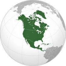
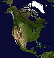
    North America is a continent in the Northern and Western Hemispheres. North America is bordered to the north by the Arctic Ocean, to the east by the Atlantic Ocean, to the southeast by South America and the Caribbean Sea, and to the west and south by the Pacific Ocean. The region includes the Bahamas, Bermuda, Canada, the Caribbean, Central America, Clipperton Island, Greenland, Mexico, Saint Pierre and Miquelon, Turks and Caicos Islands, and the United States. (Full article...)
    Other vital articles

    Related portals

    Get involved

    For editor resources and to collaborate with other editors on improving Wikipedia's Geography-related articles, visit WikiProject Geography.


    Here are some tasks awaiting attention:

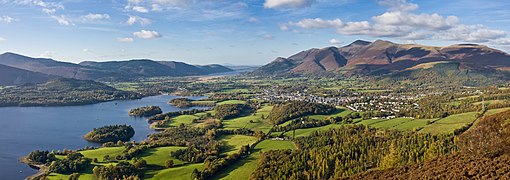
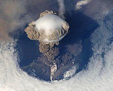
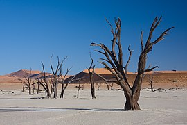
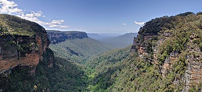
    Selected pictures

    Featured articles Featured biography

    Featured biography articles in geography

    David Alexander Johnston (December 18, 1949 – May 18, 1980) was an American United States Geological Survey (USGS) volcanologist who was killed by the 1980 eruption of Mount St. Helens in the U.S. state of Washington. A principal scientist on the USGS monitoring team, Johnston was killed in the eruption while manning an observation post six miles (10 km) away on the morning of May 18, 1980. He was the first to report the eruption, transmitting "Vancouver! Vancouver! This is it!" before he was swept away by a lateral blast; despite a thorough search, Johnston's body was never found, but state highway workers discovered remnants of his USGS trailer in 1993.

    Johnston's career took him across the United States, where he studied the Augustine Volcano in Alaska, the San Juan volcanic field in Colorado, and long-extinct volcanoes in Michigan. Johnston was a meticulous and talented scientist, known for his analyses of volcanic gases and their relationship to eruptions. This, along with his enthusiasm and positive attitude, made him liked and respected by many co-workers. After his death, other scientists lauded his character, both verbally and in dedications and letters. Johnston felt scientists must do what is necessary, including taking risks, to help protect the public from natural disasters. His work, and that of fellow USGS scientists, convinced authorities to close Mount St. Helens to the public before the 1980 eruption. They maintained the closure despite heavy pressure to re-open the area; their work saved thousands of lives. His story became intertwined with the popular image of volcanic eruptions and their threat to society, and a part of volcanology's history. To date, Johnston, along with his mentee Harry Glicken, is one of two American volcanologists known to have died in a volcanic eruption. (Full article...)
    More featured biographies

    Did you know

    Did you know it about Geography?

    Places around you

    You can read about interesting Wikipedia articles about places around you.

    Special:Nearby

    Top 10 WikiProject Geography Popular articles of the month

    This following Geography-related articles is a most visited articles of WikiProject Geography, See complete list at Wikipedia:WikiProject Geography/Popular pages.

  • Image 4 Generation X (often shortened to Gen X) is the demographic cohort following the Baby Boomers and preceding Millennials. Researchers and popular media often use the mid-1960s as its starting birth years and the late 1970s as its ending birth years, with the generation being generally defined as people born from 1965 to 1980. By this definition and U.S. Census data, there are 65.2 million Gen Xers in the United States as of 2019. Most of Generation X are the children of the Silent Generation and early Baby Boomers; Xers are also often the parents of Millennials and Generation Z. (Full article...)
    Generation X (often shortened to Gen X) is the demographic cohort following the Baby Boomers and preceding Millennials. Researchers and popular media often use the mid-1960s as its starting birth years and the late 1970s as its ending birth years, with the generation being generally defined as people born from 1965 to 1980. By this definition and U.S. Census data, there are 65.2 million Gen Xers in the United States as of 2019. Most of Generation X are the children of the Silent Generation and early Baby Boomers; Xers are also often the parents of Millennials and Generation Z. (Full article...)
  • Image 5 England is a country that is part of the United Kingdom. It is located on the island of Great Britain, of which it covers approximately 62%, and over 100 smaller adjacent islands. It has land borders with Scotland to the north and Wales to the west, and is otherwise surrounded by the North Sea to the east, the English Channel to the south, the Celtic Sea to the south-west, and the Irish Sea to the west. Continental Europe lies to the south-east, and Ireland to the west. At the 2021 census, the population was 56,490,048. London is both the largest city and the capital. (Full article...)

    England is a country that is part of the United Kingdom. It is located on the island of Great Britain, of which it covers approximately 62%, and over 100 smaller adjacent islands. It has land borders with Scotland to the north and Wales to the west, and is otherwise surrounded by the North Sea to the east, the English Channel to the south, the Celtic Sea to the south-west, and the Irish Sea to the west. Continental Europe lies to the south-east, and Ireland to the west. At the 2021 census, the population was 56,490,048. London is both the largest city and the capital. (Full article...)
  • Image 6 River Thames and Tower Bridge with The Shard and Southwark (left), and Tower of London and City of London (right) London (⫽ˈlʌndən⫽ LUN-dən) is the capital and largest city of both England and the United Kingdom, with a population of around 8.8 million. The wider metropolitan area is the largest in Western Europe, with a population of 14.9 million. London stands on the River Thames in southeast England, at the head of a 50-mile (80 km) estuary down to the North Sea, and has been a major settlement for nearly 2,000 years. Its ancient core and financial centre, the City of London, was founded by the Romans as Londinium and has retained its medieval boundaries. The City of Westminster, to the west of the City of London, has been the centuries-long host of the national government and parliament. London grew rapidly in the 19th century, becoming the world's largest city at the time as it expanded and absorbed the surrounding county of Middlesex alongside parts of Surrey and Kent. In 1965, it was combined with parts of Essex and Hertfordshire to create the administrative area of Greater London, which is governed by 33 local authorities and the Greater London Authority. (Full article...)

    London (ˈlʌndən LUN-dən) is the capital and largest city of both England and the United Kingdom, with a population of around 8.8 million. The wider metropolitan area is the largest in Western Europe, with a population of 14.9 million. London stands on the River Thames in southeast England, at the head of a 50-mile (80 km) estuary down to the North Sea, and has been a major settlement for nearly 2,000 years. Its ancient core and financial centre, the City of London, was founded by the Romans as Londinium and has retained its medieval boundaries. The City of Westminster, to the west of the City of London, has been the centuries-long host of the national government and parliament. London grew rapidly in the 19th century, becoming the world's largest city at the time as it expanded and absorbed the surrounding county of Middlesex alongside parts of Surrey and Kent. In 1965, it was combined with parts of Essex and Hertfordshire to create the administrative area of Greater London, which is governed by 33 local authorities and the Greater London Authority. (Full article...)
  • Image 7 Cartogram of the world's population in 2018; each square represents 500,000 people.[needs update?] This is a list of countries and dependencies by population. It includes sovereign states, inhabited dependent territories and, in some cases, constituent countries of sovereign states, with inclusion within the list being primarily based on the ISO standard ISO 3166-1. For instance, the United Kingdom is considered a single entity, while the constituent countries of the Kingdom of the Netherlands are considered separately. In addition, this list includes certain states with limited recognition not found in ISO 3166-1. Also given in a percentage is each country's population compared with the world population, which the United Nations estimates at 8.12 billion as of 2024. (Full article...)
    Cartogram of the world's population in 2018; each square represents 500,000 people.


    This is a list of countries and dependencies by population. It includes sovereign states, inhabited dependent territories and, in some cases, constituent countries of sovereign states, with inclusion within the list being primarily based on the ISO standard ISO 3166-1. For instance, the United Kingdom is considered a single entity, while the constituent countries of the Kingdom of the Netherlands are considered separately. In addition, this list includes certain states with limited recognition not found in ISO 3166-1. Also given in a percentage is each country's population compared with the world population, which the United Nations estimates at 8.12 billion as of 2024. (Full article...)
  • Image 8 Europe is a continent located entirely in the Northern Hemisphere and mostly in the Eastern Hemisphere. It is bordered by the Arctic Ocean to the north, the Atlantic Ocean to the west, the Mediterranean Sea to the south, and Asia to the east. Europe shares the landmass of Eurasia with Asia, and of Afro-Eurasia with both Asia and Africa. Europe is commonly considered to be separated from Asia by the watershed of the Ural Mountains, the Ural River, the Caspian Sea, the Greater Caucasus, the Black Sea, and the waterway of the Bosporus Strait. (Full article...)
    Europe is a continent located entirely in the Northern Hemisphere and mostly in the Eastern Hemisphere. It is bordered by the Arctic Ocean to the north, the Atlantic Ocean to the west, the Mediterranean Sea to the south, and Asia to the east. Europe shares the landmass of Eurasia with Asia, and of Afro-Eurasia with both Asia and Africa. Europe is commonly considered to be separated from Asia by the watershed of the Ural Mountains, the Ural River, the Caspian Sea, the Greater Caucasus, the Black Sea, and the waterway of the Bosporus Strait. (Full article...)
  • Image 9 Millennials, also known as Generation Y or Gen Y, are the demographic cohort following Generation X and preceding Generation Z. Researchers and popular media use the early 1980s as starting birth years and the mid-1990s to early 2000s as ending birth years, with the generation typically being defined as people born from 1981 to 1996. Most Millennials are the children of Baby Boomers and older Generation X. In turn Millennials are often the parents of Generation Alpha. (Full article...)
    Millennials, also known as Generation Y or Gen Y, are the demographic cohort following Generation X and preceding Generation Z. Researchers and popular media use the early 1980s as starting birth years and the mid-1990s to early 2000s as ending birth years, with the generation typically being defined as people born from 1981 to 1996. Most Millennials are the children of Baby Boomers and older Generation X. In turn Millennials are often the parents of Generation Alpha. (Full article...)
  • Image 10 Hong Kong is a special administrative region of the People's Republic of China. With 7.4 million residents of various nationalities in a 1,104-square-kilometre (426 sq mi) territory, Hong Kong is one of the most densely populated territories in the world. (Full article...)

    Hong Kong is a special administrative region of the People's Republic of China. With 7.4 million residents of various nationalities in a 1,104-square-kilometre (426 sq mi) territory, Hong Kong is one of the most densely populated territories in the world. (Full article...)
  • Featured pictures

    Click to enlarge and view description.

    Main articles

    CategoriesCategories

    Select [►] to view subcategories.

    Associated Wikimedia

    The following Wikimedia Foundation sister projects provide more on this subject:

    Discover Wikipedia using portals
    Retrieved from "https://en.wikipedia.org/w/index.php?title=Portal:Geography&oldid=1202464975"