Loading
  • 21 Aug, 2019

  • By, Wikipedia

Portal:Geography

The Geography Portal

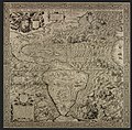
Geography (from Ancient Greek γεωγραφία geōgraphía; combining 'Earth' and gráphō 'write') is the study of the lands, features, inhabitants, and phenomena of Earth. Geography is an all-encompassing discipline that seeks an understanding of Earth and its human and natural complexities—not merely where objects are, but also how they have changed and come to be. While geography is specific to Earth, many concepts can be applied more broadly to other celestial bodies in the field of planetary science. Geography has been called "a bridge between natural science and social science disciplines."

Origins of many of the concepts in geography can be traced to Greek Eratosthenes of Cyrene, who may have coined the term "geographia" (c. 276 BC – c. 195/194 BC). The first recorded use of the word γεωγραφία was as the title of a book by Greek scholar Claudius Ptolemy (100 – 170 AD). This work created the so-called "Ptolemaic tradition" of geography, which included "Ptolemaic cartographic theory." However, the concepts of geography (such as cartography) date back to the earliest attempts to understand the world spatially, with the earliest example of an attempted world map dating to the 9th century BCE in ancient Babylon. The history of geography as a discipline spans cultures and millennia, being independently developed by multiple groups, and cross-pollinated by trade between these groups. The core concepts of geography consistent between all approaches are a focus on space, place, time, and scale.

Today, geography is an extremely broad discipline with multiple approaches and modalities. There have been multiple attempts to organize the discipline, including the four traditions of geography, and into branches. Techniques employed can generally be broken down into quantitative and qualitative approaches, with many studies taking mixed-methods approaches. Common techniques include cartography, remote sensing, interviews, and surveying. (Full article...)

Featured articles are displayed here, which represent some of the best content on English Wikipedia.

  • Image 2 Prussian and Austrian cavalry fighting at the Battle of Mollwitz, by August Heinrich Ferdinand Tegetmeyer The First Silesian War (German: Erster Schlesischer Krieg) was a war between Prussia and Austria that lasted from 1740 to 1742 and resulted in Prussia's seizing most of the region of Silesia (now in south-western Poland) from Austria. The war was fought mainly in Silesia, Moravia and Bohemia (the lands of the Bohemian Crown) and formed one theatre of the wider War of the Austrian Succession. It was the first of three Silesian Wars fought between Frederick the Great's Prussia and Maria Theresa's Austria in the mid-18th century, all three of which ended in Prussian control of Silesia. No particular triggering event started the war. Prussia cited its centuries-old dynastic claims on parts of Silesia as a casus belli, but Realpolitik and geostrategic factors also played a role in provoking the conflict. Maria Theresa's contested succession to the Habsburg monarchy provided an opportunity for Prussia to strengthen itself relative to regional rivals such as Saxony and Bavaria. (Full article...)

    The First Silesian War (German: Erster Schlesischer Krieg) was a war between Prussia and Austria that lasted from 1740 to 1742 and resulted in Prussia's seizing most of the region of Silesia (now in south-western Poland) from Austria. The war was fought mainly in Silesia, Moravia and Bohemia (the lands of the Bohemian Crown) and formed one theatre of the wider War of the Austrian Succession. It was the first of three Silesian Wars fought between Frederick the Great's Prussia and Maria Theresa's Austria in the mid-18th century, all three of which ended in Prussian control of Silesia.

    No particular triggering event started the war. Prussia cited its centuries-old dynastic claims on parts of Silesia as a casus belli, but Realpolitik and geostrategic factors also played a role in provoking the conflict. Maria Theresa's contested succession to the Habsburg monarchy provided an opportunity for Prussia to strengthen itself relative to regional rivals such as Saxony and Bavaria. (Full article...)
  • Image 3 National Mall Washington, D.C., formally the District of Columbia and commonly known as Washington or D.C., is the capital city and federal district of the United States. The city is on the Potomac River, across from Virginia, and shares land borders with Maryland to its north and east. It was named for George Washington, the first president of the United States. The district is named for Columbia, the female personification of the nation. The U.S. Constitution in 1789 called for the creation of a federal district under the exclusive jurisdiction of the U.S. Congress. As such, Washington, D.C., is not part of any state, and is not one itself. The Residence Act, adopted on July 16, 1790, approved the creation of the capital district along the Potomac River. The city was founded in 1791, and the 6th Congress held the first session in the unfinished Capitol Building in 1800 after the capital moved from Philadelphia. In 1801, the District of Columbia, formerly part of Maryland and Virginia and including the existing settlements of Georgetown and Alexandria, was officially recognized as the federal district; initially, the city was a separate settlement within the larger district. In 1846, Congress returned the land originally ceded by Virginia, including the city of Alexandria. In 1871, it created a single municipality for the remaining portion of the district. There have been several unsuccessful efforts to make the district into a state since the 1880s; a statehood bill passed the House of Representatives in 2021 but was not adopted by the U.S. Senate. (Full article...)

    Washington, D.C., formally the District of Columbia and commonly known as Washington or D.C., is the capital city and federal district of the United States. The city is on the Potomac River, across from Virginia, and shares land borders with Maryland to its north and east. It was named for George Washington, the first president of the United States. The district is named for Columbia, the female personification of the nation.

    The U.S. Constitution in 1789 called for the creation of a federal district under the exclusive jurisdiction of the U.S. Congress. As such, Washington, D.C., is not part of any state, and is not one itself. The Residence Act, adopted on July 16, 1790, approved the creation of the capital district along the Potomac River. The city was founded in 1791, and the 6th Congress held the first session in the unfinished Capitol Building in 1800 after the capital moved from Philadelphia. In 1801, the District of Columbia, formerly part of Maryland and Virginia and including the existing settlements of Georgetown and Alexandria, was officially recognized as the federal district; initially, the city was a separate settlement within the larger district. In 1846, Congress returned the land originally ceded by Virginia, including the city of Alexandria. In 1871, it created a single municipality for the remaining portion of the district. There have been several unsuccessful efforts to make the district into a state since the 1880s; a statehood bill passed the House of Representatives in 2021 but was not adopted by the U.S. Senate. (Full article...)
  • Image 4 The Ming dynasty (/mɪŋ/ MING), officially the Great Ming, was an imperial dynasty of China, ruling from 1368 to 1644 following the collapse of the Mongol-led Yuan dynasty. The Ming dynasty was the last imperial dynasty of China ruled by the Han people, the majority ethnic group in China. Although the primary capital of Beijing fell in 1644 to a rebellion led by Li Zicheng (who established the short-lived Shun dynasty), numerous rump regimes ruled by remnants of the Ming imperial family—collectively called the Southern Ming—survived until 1662. The Ming dynasty's founder, the Hongwu Emperor (r. 1368–1398), attempted to create a society of self-sufficient rural communities ordered in a rigid, immobile system that would guarantee and support a permanent class of soldiers for his dynasty: the empire's standing army exceeded one million troops and the navy's dockyards in Nanjing were the largest in the world. He also took great care breaking the power of the court eunuchs and unrelated magnates, enfeoffing his many sons throughout China and attempting to guide these princes through the Huang-Ming Zuxun, a set of published dynastic instructions. This failed when his teenage successor, the Jianwen Emperor, attempted to curtail his uncles' power, prompting the Jingnan campaign, an uprising that placed the Prince of Yan upon the throne as the Yongle Emperor in 1402. The Yongle Emperor established Yan as a secondary capital and renamed it Beijing, constructed the Forbidden City, and restored the Grand Canal and the primacy of the imperial examinations in official appointments. He rewarded his eunuch supporters and employed them as a counterweight against the Confucian scholar-bureaucrats. One eunuch, Zheng He, led seven enormous voyages of exploration into the Indian Ocean as far as Arabia and the eastern coasts of Africa. Hongwu and Yongle emperors had also expanded the empire's rule into Inner Asia. (Full article...)

    The Ming dynasty (/mɪŋ/ MING), officially the Great Ming, was an imperial dynasty of China, ruling from 1368 to 1644 following the collapse of the Mongol-led Yuan dynasty. The Ming dynasty was the last imperial dynasty of China ruled by the Han people, the majority ethnic group in China. Although the primary capital of Beijing fell in 1644 to a rebellion led by Li Zicheng (who established the short-lived Shun dynasty), numerous rump regimes ruled by remnants of the Ming imperial family—collectively called the Southern Ming—survived until 1662.

    The Ming dynasty's founder, the Hongwu Emperor (r.1368–1398), attempted to create a society of self-sufficient rural communities ordered in a rigid, immobile system that would guarantee and support a permanent class of soldiers for his dynasty: the empire's standing army exceeded one million troops and the navy's dockyards in Nanjing were the largest in the world. He also took great care breaking the power of the court eunuchs and unrelated magnates, enfeoffing his many sons throughout China and attempting to guide these princes through the Huang-Ming Zuxun, a set of published dynastic instructions. This failed when his teenage successor, the Jianwen Emperor, attempted to curtail his uncles' power, prompting the Jingnan campaign, an uprising that placed the Prince of Yan upon the throne as the Yongle Emperor in 1402. The Yongle Emperor established Yan as a secondary capital and renamed it Beijing, constructed the Forbidden City, and restored the Grand Canal and the primacy of the imperial examinations in official appointments. He rewarded his eunuch supporters and employed them as a counterweight against the Confucian scholar-bureaucrats. One eunuch, Zheng He, led seven enormous voyages of exploration into the Indian Ocean as far as Arabia and the eastern coasts of Africa. Hongwu and Yongle emperors had also expanded the empire's rule into Inner Asia. (Full article...)
  • Image 5 A forest of coast redwoods in fog The Redwood National and State Parks (RNSP) are a complex of one national park and three California state parks located in the United States along the coast of northern California. The combined RNSP contain Redwood National Park, Del Norte Coast Redwoods State Park, Jedediah Smith Redwoods State Park, and Prairie Creek Redwoods State Park. The parks' 139,000 acres (560 km2) preserve 45 percent of all remaining old-growth coast redwood forests. Located in Del Norte and Humboldt counties, the four parks protect the endangered coast redwood (Sequoia sempervirens)—the tallest, among the oldest, and one of the most massive tree species on Earth—which thrives in the humid temperate rainforest. The park region is highly seismically active and prone to tsunamis. The parks preserve 37 miles (60 km) of pristine coastline, indigenous flora, fauna, grassland prairie, cultural resources, waterways, as well as threatened animal species, such as the Chinook salmon, northern spotted owl, and Steller's sea lion. (Full article...)

    The Redwood National and State Parks (RNSP) are a complex of one national park and three California state parks located in the United States along the coast of northern California. The combined RNSP contain Redwood National Park, Del Norte Coast Redwoods State Park, Jedediah Smith Redwoods State Park, and Prairie Creek Redwoods State Park. The parks' 139,000 acres (560 km) preserve 45 percent of all remaining old-growth coast redwood forests.

    Located in Del Norte and Humboldt counties, the four parks protect the endangered coast redwood (Sequoia sempervirens)—the tallest, among the oldest, and one of the most massive tree species on Earth—which thrives in the humid temperate rainforest. The park region is highly seismically active and prone to tsunamis. The parks preserve 37 miles (60 km) of pristine coastline, indigenous flora, fauna, grassland prairie, cultural resources, waterways, as well as threatened animal species, such as the Chinook salmon, northern spotted owl, and Steller's sea lion. (Full article...)
  • Image 6 Map of the restored Byzantine Empire of Michael VIII Palaiologos and the surrounding states in 1265 The Battle of Settepozzi was fought in the first half of 1263 off the Greek island of Settepozzi (the medieval Italian name for Spetses) between a Genoese–Byzantine fleet and a smaller Venetian fleet. Genoa and the Byzantines had been allied against Venice since the Treaty of Nymphaeum in 1261, while Genoa, in particular, had been engaged in the War of Saint Sabas against Venice from 1256. In 1263, a Genoese fleet of 48 ships, which was sailing to the Byzantine stronghold of Monemvasia, encountered a Venetian fleet of 32 ships. The Genoese decided to attack, but only two of the four admirals of the Genoese fleet and 14 of its ships took part in the engagement, and were easily routed by the Venetians, who captured four vessels and inflicted considerable casualties. (Full article...)

    The Battle of Settepozzi was fought in the first half of 1263 off the Greek island of Settepozzi (the medieval Italian name for Spetses) between a GenoeseByzantine fleet and a smaller Venetian fleet.

    Genoa and the Byzantines had been allied against Venice since the Treaty of Nymphaeum in 1261, while Genoa, in particular, had been engaged in the War of Saint Sabas against Venice from 1256. In 1263, a Genoese fleet of 48 ships, which was sailing to the Byzantine stronghold of Monemvasia, encountered a Venetian fleet of 32 ships. The Genoese decided to attack, but only two of the four admirals of the Genoese fleet and 14 of its ships took part in the engagement, and were easily routed by the Venetians, who captured four vessels and inflicted considerable casualties. (Full article...)
  • Image 7 Fanno Creek in Greenway Park, Beaverton Fanno Creek is a 15-mile (24 km) tributary of the Tualatin River in the U.S. state of Oregon. Part of the drainage basin of the Columbia River, its watershed covers about 32 square miles (83 km2) in Multnomah, Washington, and Clackamas counties, including about 7 square miles (18 km2) within the Portland city limits. From its headwaters in the Tualatin Mountains (West Hills) in southwest Portland, the creek flows generally west and south through the cities of Portland, Beaverton, Tigard and Durham, and unincorporated areas of Washington County. It enters the Tualatin River about 9 miles (14 km) above the Tualatin's confluence with the Willamette River at West Linn. (Full article...)

    Fanno Creek is a 15-mile (24 km) tributary of the Tualatin River in the U.S. state of Oregon. Part of the drainage basin of the Columbia River, its watershed covers about 32 square miles (83 km) in Multnomah, Washington, and Clackamas counties, including about 7 square miles (18 km) within the Portland city limits.

    From its headwaters in the Tualatin Mountains (West Hills) in southwest Portland, the creek flows generally west and south through the cities of Portland, Beaverton, Tigard and Durham, and unincorporated areas of Washington County. It enters the Tualatin River about 9 miles (14 km) above the Tualatin's confluence with the Willamette River at West Linn. (Full article...)
  • Image 8 The Shackleton–Rowett Expedition (1921–22) was Sir Ernest Shackleton's last Antarctic project, and the final episode in the Heroic Age of Antarctic Exploration. The venture, financed by John Quiller Rowett, is sometimes referred to as the Quest Expedition after its ship Quest, a converted Norwegian sealer. Shackleton had originally intended to go to the Arctic and explore the Beaufort Sea, but this plan was abandoned when the Canadian government withheld financial support; Shackleton thereupon switched his attention to the Antarctic. Quest, smaller than any recent Antarctic exploration vessel, soon proved inadequate for the task, and progress south was delayed by her poor sailing performance and frequent engine problems. Before the expedition's work could properly begin, Shackleton died on board the ship, just after arriving at the sub-Antarctic island of South Georgia. (Full article...)
    The Shackleton–Rowett Expedition (1921–22) was Sir Ernest Shackleton's last Antarctic project, and the final episode in the Heroic Age of Antarctic Exploration.

    The venture, financed by John Quiller Rowett, is sometimes referred to as the Quest Expedition after its ship Quest, a converted Norwegian sealer. Shackleton had originally intended to go to the Arctic and explore the Beaufort Sea, but this plan was abandoned when the Canadian government withheld financial support; Shackleton thereupon switched his attention to the Antarctic. Quest, smaller than any recent Antarctic exploration vessel, soon proved inadequate for the task, and progress south was delayed by her poor sailing performance and frequent engine problems. Before the expedition's work could properly begin, Shackleton died on board the ship, just after arriving at the sub-Antarctic island of South Georgia. (Full article...)
  • Image 9 Interior of the former vegetable market, 2006 Covent Garden is a district in London, on the eastern fringes of the West End, between St Martin's Lane and Drury Lane. It is associated with the former fruit-and-vegetable market in the central square, now a popular shopping and tourist site, and with the Royal Opera House, itself known as "Covent Garden". The district is divided by the main thoroughfare of Long Acre, north of which is given over to independent shops centred on Neal's Yard and Seven Dials, while the south contains the central square with its street performers and most of the historical buildings, theatres and entertainment facilities, including the London Transport Museum and the Theatre Royal, Drury Lane. The area was fields until briefly settled in the 7th century when it became the heart of the Anglo-Saxon trading town of Lundenwic, then abandoned at the end of the 9th century after which it returned to fields. By 1200 part of it had been walled off by the Abbot of Westminster Abbey for use as arable land and orchards, later referred to as "the garden of the Abbey and Convent", and later "the Convent Garden". Following the Dissolution of the Monasteries it was granted in 1552 by the young King Edward VI to John Russell, 1st Earl of Bedford (c.1485–1555), the trusted adviser to his father King Henry VIII. The 4th Earl commissioned Inigo Jones to build some fine houses to attract wealthy tenants. Jones designed the Italianate arcaded square along with the church of St Paul's. The design of the square was new to London and had a significant influence on modern town planning, acting as the prototype for new estates as London grew. (Full article...)

    Covent Garden is a district in London, on the eastern fringes of the West End, between St Martin's Lane and Drury Lane. It is associated with the former fruit-and-vegetable market in the central square, now a popular shopping and tourist site, and with the Royal Opera House, itself known as "Covent Garden". The district is divided by the main thoroughfare of Long Acre, north of which is given over to independent shops centred on Neal's Yard and Seven Dials, while the south contains the central square with its street performers and most of the historical buildings, theatres and entertainment facilities, including the London Transport Museum and the Theatre Royal, Drury Lane.

    The area was fields until briefly settled in the 7th century when it became the heart of the Anglo-Saxon trading town of Lundenwic, then abandoned at the end of the 9th century after which it returned to fields. By 1200 part of it had been walled off by the Abbot of Westminster Abbey for use as arable land and orchards, later referred to as "the garden of the Abbey and Convent", and later "the Convent Garden". Following the Dissolution of the Monasteries it was granted in 1552 by the young King Edward VI to John Russell, 1st Earl of Bedford (c.1485–1555), the trusted adviser to his father King Henry VIII. The 4th Earl commissioned Inigo Jones to build some fine houses to attract wealthy tenants. Jones designed the Italianate arcaded square along with the church of St Paul's. The design of the square was new to London and had a significant influence on modern town planning, acting as the prototype for new estates as London grew. (Full article...)
  • Image 10 Mount Mazama collapsed into a caldera, which filled with water to form Crater Lake Mount Mazama (Tum-sum-ne in the Native American language Klamath) is a complex volcano in the western U.S. state of Oregon, in a segment of the Cascade Volcanic Arc and Cascade Range. A volcanic peak once existed, but it collapsed following a major eruption approximately 7,700 years ago, to be replaced by a caldera. The volcano is in Klamath County, in the southern Cascades, 60 miles (97 km) north of the Oregon–California border. Its collapse, due to the eruption of magma emptying the underlying magma chamber, formed a caldera that holds Crater Lake (Giiwas in the Native American language Klamath). Mount Mazama originally had an elevation of 12,000 feet (3,700 m), but following its climactic eruption this was reduced to 8,157 feet (2,486 m). Crater Lake is 1,943 feet (592 m) deep, the deepest freshwater body in the U.S. and the second deepest in North America after Great Slave Lake in Canada. Mount Mazama formed as a group of overlapping volcanic edifices such as shield volcanoes and small composite cones, becoming active intermittently until its climactic eruption 7,700 years ago. This eruption, the largest known within the Cascade Volcanic Arc in a million years, destroyed Mazama's summit, reducing its approximate 12,000-foot (3,700 m) height by about 1 mile (1,600 m). Much of the edifice fell into the volcano's partially emptied neck and magma chamber, creating a caldera. The region's volcanic activity results from the subduction of the offshore oceanic plate, and is influenced by local extensional faulting. Mazama is dormant, but the U.S. Geological Survey says eruptions on a smaller scale are likely, which would pose a threat to its surroundings. (Full article...)

    Mount Mazama (Tum-sum-ne in the Native American language Klamath) is a complex volcano in the western U.S. state of Oregon, in a segment of the Cascade Volcanic Arc and Cascade Range. A volcanic peak once existed, but it collapsed following a major eruption approximately 7,700 years ago, to be replaced by a caldera. The volcano is in Klamath County, in the southern Cascades, 60 miles (97 km) north of the Oregon–California border. Its collapse, due to the eruption of magma emptying the underlying magma chamber, formed a caldera that holds Crater Lake (Giiwas in the Native American language Klamath). Mount Mazama originally had an elevation of 12,000 feet (3,700 m), but following its climactic eruption this was reduced to 8,157 feet (2,486 m). Crater Lake is 1,943 feet (592 m) deep, the deepest freshwater body in the U.S. and the second deepest in North America after Great Slave Lake in Canada.

    Mount Mazama formed as a group of overlapping volcanic edifices such as shield volcanoes and small composite cones, becoming active intermittently until its climactic eruption 7,700 years ago. This eruption, the largest known within the Cascade Volcanic Arc in a million years, destroyed Mazama's summit, reducing its approximate 12,000-foot (3,700 m) height by about 1 mile (1,600 m). Much of the edifice fell into the volcano's partially emptied neck and magma chamber, creating a caldera. The region's volcanic activity results from the subduction of the offshore oceanic plate, and is influenced by local extensional faulting. Mazama is dormant, but the U.S. Geological Survey says eruptions on a smaller scale are likely, which would pose a threat to its surroundings. (Full article...)
  • Image 11 Valley View from the southeast, with Mill Creek Mountain in the background Valley View is a mid-19th-century Greek Revival residence and farm overlooking the South Branch Potomac River northwest of Romney, West Virginia. The house is atop a promontory where Depot Valley joins the South Branch Potomac River valley. The Valley View property was part of the South Branch Survey of the Northern Neck Proprietary, a large tract that was inherited by Thomas Fairfax, 6th Lord Fairfax of Cameron, in 1719. It was settled by John Collins and his family in 1749, and acquired by the Parsons family before 1772. The Valley View house was built by James Parsons Jr. in 1855. After the Civil War, Parsons' widow sold the farm to Charles Harmison. His wife, Elizabeth Harmison, inspired by her childhood Virginia home, Western View, and the scenic South Branch Potomac River views, named the farm Valley View. The most recent of a series of owners, the Mayhew family, bought the property in 1979. Valley View's current proprietors, Robert and Kim Mayhew, have restored the historic residence and grounds. (Full article...)

    Valley View is a mid-19th-century Greek Revival residence and farm overlooking the South Branch Potomac River northwest of Romney, West Virginia. The house is atop a promontory where Depot Valley joins the South Branch Potomac River valley.

    The Valley View property was part of the South Branch Survey of the Northern Neck Proprietary, a large tract that was inherited by Thomas Fairfax, 6th Lord Fairfax of Cameron, in 1719. It was settled by John Collins and his family in 1749, and acquired by the Parsons family before 1772. The Valley View house was built by James Parsons Jr. in 1855. After the Civil War, Parsons' widow sold the farm to Charles Harmison. His wife, Elizabeth Harmison, inspired by her childhood Virginia home, Western View, and the scenic South Branch Potomac River views, named the farm Valley View. The most recent of a series of owners, the Mayhew family, bought the property in 1979. Valley View's current proprietors, Robert and Kim Mayhew, have restored the historic residence and grounds. (Full article...)
  • Image 12 Farne Islands The Arctic tern (Sterna paradisaea) is a tern in the family Laridae. This bird has a circumpolar breeding distribution covering the Arctic and sub-Arctic regions of Europe (as far south as Brittany), Asia, and North America (as far south as Massachusetts). The species is strongly migratory, seeing two summers each year as it migrates along a convoluted route from its northern breeding grounds to the Antarctic coast for the southern summer and back again about six months later. Recent studies have shown average annual round-trip lengths of about 70,900 km (44,100 mi) for birds nesting in Iceland and Greenland and about 48,700 km (30,300 mi) for birds nesting in the Netherlands. These are by far the longest migrations known in the animal kingdom. The Arctic tern nests once every one to three years (depending on its mating cycle). Arctic terns are medium-sized birds. They have a length of 28–39 cm (11–15 in) and a wingspan of 65–75 cm (26–30 in). They are mainly grey and white plumaged, with a red/orange beak and feet, white forehead, a black nape and crown (streaked white), and white cheeks. The grey mantle is 305 mm (12.0 in), and the scapulae are fringed brown, some tipped white. The upper wing is grey with a white leading edge, and the collar is completely white, as is the rump. The deeply forked tail is whitish, with grey outer webs. (Full article...)
    The Arctic tern (Sterna paradisaea) is a tern in the family Laridae. This bird has a circumpolar breeding distribution covering the Arctic and sub-Arctic regions of Europe (as far south as Brittany), Asia, and North America (as far south as Massachusetts). The species is strongly migratory, seeing two summers each year as it migrates along a convoluted route from its northern breeding grounds to the Antarctic coast for the southern summer and back again about six months later. Recent studies have shown average annual round-trip lengths of about 70,900 km (44,100 mi) for birds nesting in Iceland and Greenland and about 48,700 km (30,300 mi) for birds nesting in the Netherlands. These are by far the longest migrations known in the animal kingdom. The Arctic tern nests once every one to three years (depending on its mating cycle).

    Arctic terns are medium-sized birds. They have a length of 28–39 cm (11–15 in) and a wingspan of 65–75 cm (26–30 in). They are mainly grey and white plumaged, with a red/orange beak and feet, white forehead, a black nape and crown (streaked white), and white cheeks. The grey mantle is 305 mm (12.0 in), and the scapulae are fringed brown, some tipped white. The upper wing is grey with a white leading edge, and the collar is completely white, as is the rump. The deeply forked tail is whitish, with grey outer webs. (Full article...)
  • Image 13 Tumbler Ridge is a district municipality in the foothills of the B.C. Rockies in northeastern British Columbia, Canada, and a member municipality of the Peace River Regional District. With a population of 2,399 (2021) living in a townsite, the municipality encompasses an area of 1,558 km2 (602 sq mi) of mostly Crown land. The townsite is located near the confluence of the Murray River and Flatbed Creek and the intersection of Highway 52 and Highway 29 and includes the site of the Tumbler Ridge Secondary School and Tumbler Ridge Airport. It is part of the Peace River South provincial electoral district and the Prince George—Peace River—Northern Rockies federal riding. Tumbler Ridge is a planned community with the housing and infrastructure construct built simultaneously in 1981 by the provincial government to service the coal industry as part of the British Columbia Resources Investment Corporation's Northeast Coal Development. In 1981, a consortium of Japanese steel mills agreed to purchase 100 million tonnes of coal over 15 years for US$7.5 billion from two mining companies, Denison Mines Inc. and the Teck Corporation, who were to operate the Quintette mine and the Bullmoose mine respectively. Declining global coal prices after 1981, and weakening Asian markets in the late 1990s, made the town's future uncertain and kept it from achieving its projected population of 10,000 people. The uncertainty dissuaded investment and kept the economy from diversifying. When price reductions were forced onto the mines, the Quintette mine was closed in 2000 production and the town lost about half its population. Coal prices began to rise after the turn of the century, leading to the opening of the Peace River Coal Trend mine by Northern Energy & Mining Inc. (now owned by Anglo American Met Coal) and the Wolverine Mine, originally owned by Western Canadian Coal, which was purchased by Walter Energy in 2010. Walter went bankrupt in 2015, and their Canadian assets—including the Wolverine Mine—were purchased by Conuma Coal in 2016. (Full article...)
    Tumbler Ridge is a district municipality in the foothills of the B.C. Rockies in northeastern British Columbia, Canada, and a member municipality of the Peace River Regional District. With a population of 2,399 (2021) living in a townsite, the municipality encompasses an area of 1,558 km (602 sq mi) of mostly Crown land. The townsite is located near the confluence of the Murray River and Flatbed Creek and the intersection of Highway 52 and Highway 29 and includes the site of the Tumbler Ridge Secondary School and Tumbler Ridge Airport. It is part of the Peace River South provincial electoral district and the Prince George—Peace River—Northern Rockies federal riding.

    Tumbler Ridge is a planned community with the housing and infrastructure construct built simultaneously in 1981 by the provincial government to service the coal industry as part of the British Columbia Resources Investment Corporation's Northeast Coal Development. In 1981, a consortium of Japanese steel mills agreed to purchase 100 million tonnes of coal over 15 years for US$7.5 billion from two mining companies, Denison Mines Inc. and the Teck Corporation, who were to operate the Quintette mine and the Bullmoose mine respectively. Declining global coal prices after 1981, and weakening Asian markets in the late 1990s, made the town's future uncertain and kept it from achieving its projected population of 10,000 people. The uncertainty dissuaded investment and kept the economy from diversifying. When price reductions were forced onto the mines, the Quintette mine was closed in 2000 production and the town lost about half its population. Coal prices began to rise after the turn of the century, leading to the opening of the Peace River Coal Trend mine by Northern Energy & Mining Inc. (now owned by Anglo American Met Coal) and the Wolverine Mine, originally owned by Western Canadian Coal, which was purchased by Walter Energy in 2010. Walter went bankrupt in 2015, and their Canadian assets—including the Wolverine Mine—were purchased by Conuma Coal in 2016. (Full article...)
  • Image 14 Rear Admiral Uriel Sebree Uriel Sebree (February 20, 1848 – August 6, 1922) was a career officer in the United States Navy. He entered the Naval Academy during the Civil War and served until 1910, retiring as a rear admiral. He is best remembered for his two expeditions into the Arctic and for serving as acting governor of American Samoa. He was also commander-in-chief of the Pacific Fleet. After graduating from the U.S. Naval Academy in 1867, Sebree was posted to a number of vessels before being assigned to a rescue mission to find the remaining crew of the missing Polaris expedition in the Navy's first mission to the Arctic. This attempt was only a partial success—the Polaris crew was rescued by a British ship rather than the US Navy—but this led to Sebree's selection eleven years later for a second expedition to the Arctic. That mission to rescue Adolphus Greely and the survivors of the Lady Franklin Bay expedition was a success. Sebree was subsequently appointed as the second acting governor of American Samoa. He served in this position for only a year before returning to the United States. In 1907, he was promoted to rear admiral and given command of the Pathfinder Expedition around the South American coast before being appointed commander of the 2nd Division of the Pacific Fleet and then commander-in-chief of the entire fleet. He retired in 1910 and died in Coronado, California, in 1922. Two geographical features in Alaska—Sebree Peak and Sebree Island—are named for Admiral Sebree. (Full article...)

    Uriel Sebree (February 20, 1848 – August 6, 1922) was a career officer in the United States Navy. He entered the Naval Academy during the Civil War and served until 1910, retiring as a rear admiral. He is best remembered for his two expeditions into the Arctic and for serving as acting governor of American Samoa. He was also commander-in-chief of the Pacific Fleet.

    After graduating from the U.S. Naval Academy in 1867, Sebree was posted to a number of vessels before being assigned to a rescue mission to find the remaining crew of the missing Polaris expedition in the Navy's first mission to the Arctic. This attempt was only a partial success—the Polaris crew was rescued by a British ship rather than the US Navy—but this led to Sebree's selection eleven years later for a second expedition to the Arctic. That mission to rescue Adolphus Greely and the survivors of the Lady Franklin Bay expedition was a success. Sebree was subsequently appointed as the second acting governor of American Samoa. He served in this position for only a year before returning to the United States. In 1907, he was promoted to rear admiral and given command of the Pathfinder Expedition around the South American coast before being appointed commander of the 2nd Division of the Pacific Fleet and then commander-in-chief of the entire fleet. He retired in 1910 and died in Coronado, California, in 1922. Two geographical features in AlaskaSebree Peak and Sebree Island—are named for Admiral Sebree. (Full article...)
  • Image 15 The Chalukya dynasty ([tʃaːɭukjə]) was a Classical Indian dynasty that ruled large parts of southern and central India between the 6th and the 12th centuries. During this period, they ruled as three related yet individual dynasties. The earliest dynasty, known as the "Badami Chalukyas", ruled from Vatapi (modern Badami) from the middle of the 6th century. The Badami Chalukyas began to assert their independence at the decline of the Kadamba kingdom of Banavasi and rapidly rose to prominence during the reign of Pulakeshin II. After the death of Pulakeshin II, the Eastern Chalukyas became an independent kingdom in the eastern Deccan. They ruled from Vengi until about the 11th century. In the western Deccan, the rise of the Rashtrakutas in the middle of the 8th century eclipsed the Chalukyas of Badami before being revived by their descendants, the Western Chalukyas, in the late 10th century. These Western Chalukyas ruled from Kalyani (modern Basavakalyan) until the end of the 12th century. The rule of the Chalukyas marks an important milestone in the history of South India and a golden age in the history of Karnataka. The political atmosphere in South India shifted from smaller kingdoms to large empires with the ascendancy of Badami Chalukyas. A Southern India-based kingdom took control and consolidated the entire region between the Kaveri and the Narmada rivers. The rise of this empire saw the birth of efficient administration, overseas trade and commerce and the development of new style of architecture called "Chalukyan architecture". Kannada literature, which had enjoyed royal support in the 9th century Rashtrakuta court found eager patronage from the Western Chalukyas in the Jain and Veerashaiva traditions. The 11th century saw the patronage of Telugu literature under the Eastern Chalukyas. (Full article...)

    The Chalukya dynasty ([tʃaːɭukjə]) was a Classical Indian dynasty that ruled large parts of southern and central India between the 6th and the 12th centuries. During this period, they ruled as three related yet individual dynasties. The earliest dynasty, known as the "Badami Chalukyas", ruled from Vatapi (modern Badami) from the middle of the 6th century. The Badami Chalukyas began to assert their independence at the decline of the Kadamba kingdom of Banavasi and rapidly rose to prominence during the reign of Pulakeshin II. After the death of Pulakeshin II, the Eastern Chalukyas became an independent kingdom in the eastern Deccan. They ruled from Vengi until about the 11th century. In the western Deccan, the rise of the Rashtrakutas in the middle of the 8th century eclipsed the Chalukyas of Badami before being revived by their descendants, the Western Chalukyas, in the late 10th century. These Western Chalukyas ruled from Kalyani (modern Basavakalyan) until the end of the 12th century.

    The rule of the Chalukyas marks an important milestone in the history of South India and a golden age in the history of Karnataka. The political atmosphere in South India shifted from smaller kingdoms to large empires with the ascendancy of Badami Chalukyas. A Southern India-based kingdom took control and consolidated the entire region between the Kaveri and the Narmada rivers. The rise of this empire saw the birth of efficient administration, overseas trade and commerce and the development of new style of architecture called "Chalukyan architecture". Kannada literature, which had enjoyed royal support in the 9th century Rashtrakuta court found eager patronage from the Western Chalukyas in the Jain and Veerashaiva traditions. The 11th century saw the patronage of Telugu literature under the Eastern Chalukyas. (Full article...)
  • More featured articles

    Vital articles Vital article

    Vital articles to understand Geography.

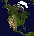
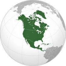
    North America is a continent in the Northern and Western Hemispheres. North America is bordered to the north by the Arctic Ocean, to the east by the Atlantic Ocean, to the southeast by South America and the Caribbean Sea, and to the west and south by the Pacific Ocean. The region includes the Bahamas, Bermuda, Canada, the Caribbean, Central America, Clipperton Island, Greenland, Mexico, Saint Pierre and Miquelon, Turks and Caicos Islands, and the United States. (Full article...)
    Other vital articles

    Related portals

    Get involved

    For editor resources and to collaborate with other editors on improving Wikipedia's Geography-related articles, visit WikiProject Geography.


    Here are some tasks awaiting attention:

    Selected pictures

    Featured articles Featured biography

    Featured biography articles in geography

    David Alexander Johnston (December 18, 1949 – May 18, 1980) was an American United States Geological Survey (USGS) volcanologist who was killed by the 1980 eruption of Mount St. Helens in the U.S. state of Washington. A principal scientist on the USGS monitoring team, Johnston was killed in the eruption while manning an observation post six miles (10 km) away on the morning of May 18, 1980. He was the first to report the eruption, transmitting "Vancouver! Vancouver! This is it!" before he was swept away by a lateral blast; despite a thorough search, Johnston's body was never found, but state highway workers discovered remnants of his USGS trailer in 1993.

    Johnston's career took him across the United States, where he studied the Augustine Volcano in Alaska, the San Juan volcanic field in Colorado, and long-extinct volcanoes in Michigan. Johnston was a meticulous and talented scientist, known for his analyses of volcanic gases and their relationship to eruptions. This, along with his enthusiasm and positive attitude, made him liked and respected by many co-workers. After his death, other scientists lauded his character, both verbally and in dedications and letters. Johnston felt scientists must do what is necessary, including taking risks, to help protect the public from natural disasters. His work, and that of fellow USGS scientists, convinced authorities to close Mount St. Helens to the public before the 1980 eruption. They maintained the closure despite heavy pressure to re-open the area; their work saved thousands of lives. His story became intertwined with the popular image of volcanic eruptions and their threat to society, and a part of volcanology's history. To date, Johnston, along with his mentee Harry Glicken, is one of two American volcanologists known to have died in a volcanic eruption. (Full article...)
    More featured biographies

    Did you know

    Did you know it about Geography?

    Places around you

    You can read about interesting Wikipedia articles about places around you.

    Special:Nearby

    Top 10 WikiProject Geography Popular articles of the month

    This following Geography-related articles is a most visited articles of WikiProject Geography, See complete list at Wikipedia:WikiProject Geography/Popular pages.

  • Image 4 Generation X (often shortened to Gen X) is the demographic cohort following the Baby Boomers and preceding Millennials. Researchers and popular media often use the mid-1960s as its starting birth years and the late 1970s as its ending birth years, with the generation being generally defined as people born from 1965 to 1980. By this definition and U.S. Census data, there are 65.2 million Gen Xers in the United States as of 2019. Most of Generation X are the children of the Silent Generation and early Baby Boomers; Xers are also often the parents of Millennials and Generation Z. (Full article...)
    Generation X (often shortened to Gen X) is the demographic cohort following the Baby Boomers and preceding Millennials. Researchers and popular media often use the mid-1960s as its starting birth years and the late 1970s as its ending birth years, with the generation being generally defined as people born from 1965 to 1980. By this definition and U.S. Census data, there are 65.2 million Gen Xers in the United States as of 2019. Most of Generation X are the children of the Silent Generation and early Baby Boomers; Xers are also often the parents of Millennials and Generation Z. (Full article...)
  • Image 5 River Thames and Tower Bridge with The Shard and Southwark (left), and Tower of London and City of London (right) London (/ˈlʌndən/ LUN-dən) is the capital and largest city of both England and the United Kingdom, with a population of around 8.8 million. The wider metropolitan area is the largest in Western Europe, with a population of 14.9 million. London stands on the River Thames in southeast England, at the head of a 50-mile (80 km) estuary down to the North Sea, and has been a major settlement for nearly 2,000 years. Its ancient core and financial centre, the City of London, was founded by the Romans as Londinium and has retained its medieval boundaries. The City of Westminster, to the west of the City of London, has been the centuries-long host of the national government and parliament. London grew rapidly in the 19th century, becoming the world's largest city at the time as it expanded and absorbed the surrounding county of Middlesex alongside parts of Surrey and Kent. In 1965, it was combined with parts of Essex and Hertfordshire to create the administrative area of Greater London, which is governed by 33 local authorities and the Greater London Authority. (Full article...)

    London (/ˈlʌndən/ LUN-dən) is the capital and largest city of both England and the United Kingdom, with a population of around 8.8 million. The wider metropolitan area is the largest in Western Europe, with a population of 14.9 million. London stands on the River Thames in southeast England, at the head of a 50-mile (80 km) estuary down to the North Sea, and has been a major settlement for nearly 2,000 years. Its ancient core and financial centre, the City of London, was founded by the Romans as Londinium and has retained its medieval boundaries. The City of Westminster, to the west of the City of London, has been the centuries-long host of the national government and parliament. London grew rapidly in the 19th century, becoming the world's largest city at the time as it expanded and absorbed the surrounding county of Middlesex alongside parts of Surrey and Kent. In 1965, it was combined with parts of Essex and Hertfordshire to create the administrative area of Greater London, which is governed by 33 local authorities and the Greater London Authority. (Full article...)
  • Image 6 Millennials, also known as Generation Y or Gen Y, are the demographic cohort following Generation X and preceding Generation Z. Researchers and popular media use the early 1980s as starting birth years and the mid-1990s to early 2000s as ending birth years, with the generation typically being defined as people born from 1981 to 1996. Most Millennials are the children of Baby Boomers and older Generation X. In turn Millennials are often the parents of Generation Alpha. (Full article...)
    Millennials, also known as Generation Y or Gen Y, are the demographic cohort following Generation X and preceding Generation Z. Researchers and popular media use the early 1980s as starting birth years and the mid-1990s to early 2000s as ending birth years, with the generation typically being defined as people born from 1981 to 1996. Most Millennials are the children of Baby Boomers and older Generation X. In turn Millennials are often the parents of Generation Alpha. (Full article...)
  • Image 7 Cartogram of the world's population in 2018; each square represents 500,000 people.[needs update?] This is a list of countries and dependencies by population. It includes sovereign states, inhabited dependent territories and, in some cases, constituent countries of sovereign states, with inclusion within the list being primarily based on the ISO standard ISO 3166-1. For instance, the United Kingdom is considered a single entity, while the constituent countries of the Kingdom of the Netherlands are considered separately. In addition, this list includes certain states with limited recognition not found in ISO 3166-1. Also given in a percentage is each country's population compared with the world population, which the United Nations estimates at 8.12 billion as of 2024. (Full article...)
    Cartogram of the world's population in 2018; each square represents 500,000 people.


    This is a list of countries and dependencies by population. It includes sovereign states, inhabited dependent territories and, in some cases, constituent countries of sovereign states, with inclusion within the list being primarily based on the ISO standard ISO 3166-1. For instance, the United Kingdom is considered a single entity, while the constituent countries of the Kingdom of the Netherlands are considered separately. In addition, this list includes certain states with limited recognition not found in ISO 3166-1. Also given in a percentage is each country's population compared with the world population, which the United Nations estimates at 8.12 billion as of 2024. (Full article...)
  • Image 8 Hong Kong is a special administrative region of the People's Republic of China. With 7.4 million residents of various nationalities in a 1,104-square-kilometre (426 sq mi) territory, Hong Kong is one of the most densely populated territories in the world. (Full article...)

    Hong Kong is a special administrative region of the People's Republic of China. With 7.4 million residents of various nationalities in a 1,104-square-kilometre (426 sq mi) territory, Hong Kong is one of the most densely populated territories in the world. (Full article...)
  • Image 9 Europe is a continent located entirely in the Northern Hemisphere and mostly in the Eastern Hemisphere. It is bordered by the Arctic Ocean to the north, the Atlantic Ocean to the west, the Mediterranean Sea to the south, and Asia to the east. Europe shares the landmass of Eurasia with Asia, and of Afro-Eurasia with both Asia and Africa. Europe is commonly considered to be separated from Asia by the watershed of the Ural Mountains, the Ural River, the Caspian Sea, the Greater Caucasus, the Black Sea, and the waterway of the Bosporus Strait. (Full article...)
    Europe is a continent located entirely in the Northern Hemisphere and mostly in the Eastern Hemisphere. It is bordered by the Arctic Ocean to the north, the Atlantic Ocean to the west, the Mediterranean Sea to the south, and Asia to the east. Europe shares the landmass of Eurasia with Asia, and of Afro-Eurasia with both Asia and Africa. Europe is commonly considered to be separated from Asia by the watershed of the Ural Mountains, the Ural River, the Caspian Sea, the Greater Caucasus, the Black Sea, and the waterway of the Bosporus Strait. (Full article...)
  • Image 10 The United Nations uses three definitions for what constitutes a city, as not all cities in all jurisdictions are classified using the same criteria. Cities may be defined as the cities proper, the extent of their urban area, or their metropolitan regions. (Full article...)
    The United Nations uses three definitions for what constitutes a city, as not all cities in all jurisdictions are classified using the same criteria. Cities may be defined as the cities proper, the extent of their urban area, or their metropolitan regions. (Full article...)
  • Featured pictures

    Click to enlarge and view description.

    Main articles

    CategoriesCategories

    Select [►] to view subcategories.

    Associated Wikimedia

    The following Wikimedia Foundation sister projects provide more on this subject:

    Discover Wikipedia using portals
    Retrieved from "https://en.wikipedia.org/w/index.php?title=Portal:Geography&oldid=1202464975"