Wensu County
Etymology
The toponym Wensu (温宿) had appeared in historical records of the Western Han Dynasty as one of the 36 states in the Western Regions. The name 'Onsu' (Wensu) means "ten water" in Uyghur and other Turkic languages. The name is similar to that of the nearby Zhetysu region which means "seven rivers"- both names consist of a number followed by 'su' (river; water). The name Aksu is Turkic for 'white water'.
In Uyghur, the county is called Aksu Konaxahar (阿克苏阔纳协海尔) meaning 'the old city of Aksu'.
History
Onsu County was established in 1902.
On May 29, 1958, Onsu County was eliminated and its territory made part of Aksu County. In 1962, Onsu County was restored.
In a Radio Free Asia interview, a Han Chinese staffer in the Onsu County local government said that in July 2017, a policy to affix QR codes to all knives belonging to Uyghurs was being carried out.
As of March 2018, every cadre in the county was required to spend eight days a month at the home of villagers.
In the late 2010s, Onsu County was the site of vocational education and training centers (also understood as re-education camps or concentration camps). According to a Radio Free Asia interview with an officer at the Onsu county police station, as of August 2018, 30,000 persons, or about one in six Uyghurs in the county (approximately 16% of the overall population of the county), were detained in re-education camps.
Administrative divisions
Onsu County administered 8 towns, 4 townships, and 1 ethnic township.
| Name | Simplified Chinese | Hanyu Pinyin | Uyghur (UEY) | Uyghur Latin (ULY) | Administrative division code | Notes | |
|---|---|---|---|---|---|---|---|
| Towns | |||||||
| Onsu Town (Wensu Town) |
温宿镇 | Wēnsù Zhèn | ئونسۇ بازىرى | Onsu baziri | 652922100 | ||
| Tumxuk Town | 吐木秀克镇 | Tǔmùxiùkè Zhèn | تۇمشۇق بازىرى | tumshuq baziri | 652922101 | formerly Tumxuk Township (吐木秀克乡) | |
| Qizil Town | 克孜勒镇 | Tǔmùxiùkè Zhèn | قىزىل بازىرى | qizil baziri | 652922102 | formerly Qizil Township (克孜勒乡) | |
| Aral Town | 阿热勒镇 | Ārèlè Zhèn | ئارال بازىرى | Aral baziri | 652922103 | formerly Aral Township (阿热勒乡) | |
| Jam Town | 佳木镇 | Jiāmù Zhèn | جام بازىرى | jam baziri | 652922104 | formerly Jam Township (佳木乡) | |
| Topkhan Town | 托甫汗镇 | Tuōfǔhàn Zhèn | توپقان بازىرى | topqan baziri | 652922105 | ||
| Komsumul Town | 共青团镇 | Gòngqīngtuán Zhèn | كومسۇمۇل بازىرى | komsumul baziri | 652922106 | ||
| Kökyar Town | 柯柯牙镇 | Kēkēyá Zhèn | كۆكيار بازىرى | kökyar baziri | 652922107 | ||
| Townships | |||||||
| Toxula Township | 托乎拉乡 | Tuōhūlā Xiāng | توخۇلا يېزىسى | toxula yëzisi | 652922200 | ||
| Chaghraq Township | 恰格拉克乡 | Qiàgélākè Xiāng | چاغراق يېزىسى | chaghraq yëzisi | 652922202 | ||
| Ishlemchi Township | 依希来木其乡 | Yīxīláimùqí Xiāng | ئىشلەمچى يېزىسى | Ishlemchi yëzisi | 652922204 | ||
| Gulawat Township (Gule Awati) |
古勒阿瓦提乡 | Gǔlè'āwǎtí Xiāng | گۈلئاۋات يېزىسى | gül'awat yëzisi | 652922206 | ||
| Ethnic township | |||||||
| Bozdong Kyrgyz Ethnic Township | 博孜墩柯尔克孜族乡 | Bózīdūn Kē'ěrkèzīzú Xiāng | بوزدۆڭ قىرغىز يېزىسى | bozdöng qirghiz yëzisi | 652922207 | (Kyrgyz) بوزدۅڭ قىرعىز ايىلى Боздөң Кыргыз айылы | |
Climate
| Climate data for Onsu, elevation 1,133 m (3,717 ft), (1991–2020 normals) | |||||||||||||
|---|---|---|---|---|---|---|---|---|---|---|---|---|---|
| Month | Jan | Feb | Mar | Apr | May | Jun | Jul | Aug | Sep | Oct | Nov | Dec | Year |
| Mean daily maximum °C (°F) | −1.0 (30.2) |
5.3 (41.5) |
14.2 (57.6) |
22.4 (72.3) |
26.8 (80.2) |
29.9 (85.8) |
31.3 (88.3) |
30.2 (86.4) |
26.2 (79.2) |
19.4 (66.9) |
9.8 (49.6) |
0.8 (33.4) |
17.9 (64.3) |
| Daily mean °C (°F) | −7.3 (18.9) |
−1.1 (30.0) |
8.0 (46.4) |
15.8 (60.4) |
20.2 (68.4) |
23.1 (73.6) |
24.4 (75.9) |
23.2 (73.8) |
18.9 (66.0) |
11.7 (53.1) |
2.9 (37.2) |
−4.9 (23.2) |
11.2 (52.2) |
| Mean daily minimum °C (°F) | −12.5 (9.5) |
−6.8 (19.8) |
1.7 (35.1) |
9.2 (48.6) |
13.9 (57.0) |
16.7 (62.1) |
18.0 (64.4) |
16.8 (62.2) |
12.3 (54.1) |
4.9 (40.8) |
−2.3 (27.9) |
−9.1 (15.6) |
5.2 (41.4) |
| Average precipitation mm (inches) | 1.8 (0.07) |
3.2 (0.13) |
4.0 (0.16) |
5.4 (0.21) |
9.6 (0.38) |
19.6 (0.77) |
15.7 (0.62) |
15.9 (0.63) |
12.6 (0.50) |
4.4 (0.17) |
2.5 (0.10) |
3.4 (0.13) |
98.1 (3.87) |
| Average precipitation days (≥ 0.1 mm) | 2.9 | 2.4 | 1.4 | 1.9 | 3.8 | 6.6 | 6.3 | 7.0 | 4.2 | 1.4 | 1.2 | 2.9 | 42 |
| Average snowy days | 5.7 | 3.6 | 0.8 | 0.1 | 0 | 0 | 0 | 0 | 0 | 0 | 1.4 | 5.8 | 17.4 |
| Average relative humidity (%) | 68 | 59 | 44 | 37 | 41 | 48 | 52 | 56 | 57 | 57 | 64 | 72 | 55 |
| Mean monthly sunshine hours | 177.1 | 182.3 | 199.7 | 224.8 | 264.7 | 281.5 | 300.5 | 278.1 | 250.0 | 246.4 | 192.4 | 158.1 | 2,755.6 |
| Percent possible sunshine | 59 | 60 | 53 | 56 | 59 | 62 | 66 | 66 | 68 | 73 | 66 | 56 | 62 |
| Source: China Meteorological Administration | |||||||||||||
Economy
Agricultural products include rice, wheat, corn, cotton and fruit products. Sheep wool and sheepskins are produced in abundance. Industries produce food, spun cotton, building materials and coal.
As of 1885, there was about 139,200 acres (919,475 mu) of cultivated land in Onsu.
Demographics
| Year | Pop. | ±% p.a. |
|---|---|---|
| 2000 | 219,219 | — |
| 2010 | 233,933 | +0.65% |
As of 2015, 197,360 of the 259,305 residents of the county were Uyghur, 55,335 were Han Chinese and 6,610 were from other ethnic groups.
According to the 2002 census, it has a population of 210,000.
As of 1999, 76.17% of the population of Onsu (Wensu) County was Uyghur and 21.43% of the population was Han Chinese.
Transportation
Historical maps
Historical English-language maps including Onsu:
-
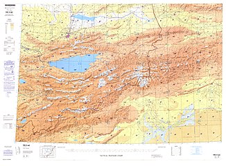
![Map including Uqturpan (labeled as WEN-SU (AKSU-KONE SHAHR)) and surrounding region from the International Map of the World (AMS, 1950)[b]](//upload.wikimedia.org/wikipedia/commons/thumb/9/93/A-k%60o-su_NK-44_%281950%29_-_panoramio.jpg/230px-A-k%60o-su_NK-44_%281950%29_-_panoramio.jpg) Map including Uqturpan (labeled as WEN-SU (AKSU-KONE SHAHR)) and surrounding region from the International Map of the World (AMS, 1950)
Map including Uqturpan (labeled as WEN-SU (AKSU-KONE SHAHR)) and surrounding region from the International Map of the World (AMS, 1950) -
 Map including Onsu (labeled as WENSU) (DMA, 1981)
 -
![From the Operational Navigation Chart; map including Onsu (labeled as WEN-SU (WENSU)) (DMA, 1985)[c]](//upload.wikimedia.org/wikipedia/commons/thumb/7/7e/Operational_Navigation_Chart_F-6%2C_6th_edition.jpg/331px-Operational_Navigation_Chart_F-6%2C_6th_edition.jpg) From the Operational Navigation Chart; map including Onsu (labeled as WEN-SU (WENSU)) (DMA, 1985)
From the Operational Navigation Chart; map including Onsu (labeled as WEN-SU (WENSU)) (DMA, 1985)
![Map including Uqturpan (labeled as WEN-SU (AKSU-KONE SHAHR)) and surrounding region from the International Map of the World (AMS, 1950)[b]](/key/File:A-k%60o-su_NK-44_(1950)_-_panoramio.jpg)

![From the Operational Navigation Chart; map including Onsu (labeled as WEN-SU (WENSU)) (DMA, 1985)[c]](/key/File:Operational_Navigation_Chart_F-6,_6th_edition.jpg)
Notes
- ^ Locals in Xinjiang frequently observe UTC+6 (Xinjiang Time), 2 hours behind Beijing.
- ^ From map: "THE DELINEATION OF INTERNATIONAL BOUNDARIES ON THIS MAP MUST NOT BE CONSIDERED AUTHORITATIVE"
- ^ From map: "The representation of international boundaries is not necessarily authoritative."
References
- ^ Xinjiang: Prefectures, Cities, Districts and Counties
- ^ Shohret Hoshur, Joshua Lipes (31 August 2018). "One in Six Uyghurs Held in Political 'Re-Education Camps' in Xinjiang's Onsu County". Radio Free Asia. Retrieved 28 April 2020.
Onsu (in Chinese, Wensu) county, in the XUAR's Aksu (Akesu) prefecture is home to around 230,000 people, according to the county government's website. Some 180,000 of them are members of minority groups—the largest of which is Uyghurs.
- ^ Ildikó Bellér-Hann; M. Cristina Cesàro; Rachel Harris; Joanne Smith Finley, eds. (2007). Situating the Uyghurs Between China and Central Asia. Ashgate Publishing. p. 159. ISBN 978-0-7546-7041-4 – via Google Books.
Qirmish Ata Mazar is located in a mountain valley 61 km west of Onsu county town, in Aqsu prefecture.
- ^ Missall, Siegmund; Abliz, Abdulla; Halik, Ümüt; Thevs, Niels; Welp, Martin (2018). "Trading Natural Riparian Forests for Urban Shelterbelt Plantations—A Sustainability Assessment of the Kökyar Protection Forest in NW China". Water. 10 (3): 343. doi:10.3390/w10030343.
Due to its location on the Aksu River, Aksu is water-rich, which allowed for the development of irrigation agriculture, forming a huge river oasis in the west, east and south of Aksu City (c. 1000 km, including Awat and Onsu County) [43].
- ^ 106-1 Hearing: Human Rights In China And Tibet, March 2, 2000. U.S. Government Printing Office. 2000. p. 66. ISBN 978-0-16-060826-1 – via Google Books.
Ablikim Abdiryim was born on 12 November 1973 in Onsu County of Aksu.
- ^ Onsu (Variant – V) at GEOnet Names Server, United States National Geospatial-Intelligence Agency
- ^ شىنجاڭنىڭ توردا نام چىقارغان بۇ جايلىرىنىڭ گۈزەل مەنزىرىسىنى كۆرۈشنىڭ ياخشى پەيتىنى قولدىن بەرمەڭ. ﺷﯩﻨﺠﺎﯓ ﻛﯘﺋﯧﻨﻠﯘﻥ ﺗﻮﺭﻯ (in Uyghur). 8 April 2019. Retrieved 29 April 2020.
ئونسۇ ناھىيىسى
- ^ Yu, Taishan (November 2013). "China and the Ancient Mediterranean World: A Survey of Ancient Chinese Sources" (PDF). Sino-Platonic Papers. University of Pennsylvania. ISSN 2157-9687. Retrieved 30 November 2019.
Wensuo, an oasis state on the Northern Route in the Western Regions, is first seen in the "Xiyu Zhuan" of the Hanshu (ch. 96).
- ^ [Traditions of the Western Regions]. Book of Han (in Chinese). Vol. 96 – via Wikisource.
- ^ "温宿县人民政府 领导致词" [Wensu County People's Government – Address by the Leaders] (in Chinese). 温宿县人民政府. 2019-03-22. Retrieved 30 November 2019.
温宿,维吾尔语意为"十股水"
- ^ Madeleine Reeves, ed. (2012). Movement, Power and Place in Central Asia and Beyond: Contested Trajectories. Routledge. p. 134. ISBN 978-0-415-50353-2.
Jeti Suu{...}Seven Waters
- ^ 阿克苏市概况. 阿克苏市人民政府 (in Simplified Chinese). Retrieved 18 May 2020.
阿克苏市,维吾尔语意为"白水城",
- ^ 温宿概况. 温宿县人民政府 (in Simplified Chinese). 9 March 2020. Retrieved 7 April 2020.
温宿,汉代西域地名。维吾尔语称"阿克苏阔纳协海尔",即阿克苏旧城意。也有解"温宿"维吾尔语为"多水"之意。
- ^ 夏征农; 陈至立, eds. (September 2009). 辞海:第六版彩图本 [Cihai (Sixth Edition in Color)] (in Chinese). 上海. Shanghai: 上海辞书出版社. Shanghai Lexicographical Publishing House. p. 2377. ISBN 978-7-5326-2859-9.
- ^ 历史人文. 温宿县人民政府. 9 March 2020. Retrieved 11 May 2020.
1958年5月29日,经国务院批准,温宿县并入阿克苏县,撤销温宿县建制。1962年,经国务院批准,恢复温宿县。合并于阿克苏县的原温宿县行政区域为温宿县的行政区域。
- ^ Kurban Niyaz, Roseanne Gerin (11 October 2017). "Authorities Require Uyghurs in Xinjiang's Aksu to Get Barcodes on Their Knives". Radio Free Asia. Translated by Kurban Niyaz. Retrieved 28 April 2020.
- ^ "China: Visiting Officials Occupy Homes in Muslim Region". Human Rights Watch. 13 May 2018. Retrieved 29 April 2020.
Since March, every cadre in Wensu County, Aksu Prefecture, has been required to stay in the homes of villagers "for no less than eight days a month." An official article describes how, after a work day at the office, cadres "brought their own bedding" to a minority villager's home, where they "will stay the night."
(See also Civil Servant-Family Pair Up) - ^ mingmei, ed. (24 August 2019). "China Focus: Foreign media praise Xinjiang's rural development, anti-terrorism efforts". Xinhua News Agency. Archived from the original on August 24, 2019. Retrieved 28 April 2020.
- ^ Alim Seytoff; Joshua Lipes (29 August 2019). "Skeptical Scholar Says Visit to Xinjiang Internment Camps Confirms Western Media Reports". Radio Free Asia. Retrieved 28 April 2020.
- ^ 温宿县历史沿革 [Onsu County Historical Development] (in Simplified Chinese). XZQH.org. 30 January 2015. Retrieved 28 April 2019.
2010年第六次人口普查,温宿县常住总人口233933人,其中:温宿镇42712人,吐木秀克镇10715人,克孜勒镇19545人,阿热勒镇23569人,佳木镇18108人,托乎拉乡12804人,恰格拉克乡15728人,依希来木其乡13047人,古勒阿瓦提乡17798人,博孜墩柯尔克孜族乡5235人,水稻农场6143人,青年农场6549人,共青团农场2111人,塔格拉克牧场3289人,博孜墩牧场2664人,萨瓦甫齐牧场2954人,恰其力克牧场1544人,佳木林场3393人,兵团五团17786人,兵团六团8239人。
- ^ 2019年统计用区划代码和城乡划分代码:温宿县 [2019 Statistical Area Numbers and Rural-Urban Area Numbers: Onsu County] (in Simplified Chinese). National Bureau of Statistics of the People's Republic of China. 2019. Retrieved 28 April 2019.
统计用区划代码 名称 652922100000 温宿镇 652922101000 吐木秀克镇 652922102000 克孜勒镇 652922103000 阿热勒镇 652922104000 佳木镇 652922105000 托甫汗镇 652922106000 共青团镇 652922107000 柯柯牙镇 652922200000 托乎拉乡 652922202000 恰格拉克乡 652922204000 依希来木其乡 652922206000 古勒阿瓦提乡 652922207000 博孜墩柯尔克孜族乡
- ^ Tumxuk (Approved – N) at GEOnet Names Server, United States National Geospatial-Intelligence Agency
- ^ ت. ئا.ئەركمان, ed. (7 July 2014). ئونسۇ ناھىيەسىنىڭ قىزىل بازىرى ئىلغارلارنى تەقدىرلەپ 1-ئىيۇلنى تەبرىكلىدى. People's Daily (in Uyghur). Retrieved 11 May 2020.
قىزىل بازىرى
- ^ Zhong Xingqi 钟兴麒, ed. (July 2008). 西域地名考录 (in Simplified Chinese). Beijing: 国家图书馆出版社. p. 46. ISBN 978-7-5013-3628-9.
阿热勒 (力) ā rè lè Aral {...} 3. 新疆温宿县阿热力乡,在城西南35公里。
- ^ تۇرغۇن ئابلىز, ed. (21 January 2016). ئونسۇ ناھىيە جام بازىرىدىكى ئامما مەدەنىيەت تامىقىدىن ئوزۇقلاندى. People's Daily (in Uyghur). Retrieved 12 May 2020.
- ^ ت. ئا.ئەركمان, ed. (15 April 2015). ئونسۇ ناھىيەسىنىڭ توخۇلا يېزىسى 6515 مو يەرگە بۇغداي تېرىدى. People's Daily (in Uyghur). Retrieved 12 May 2020.
- ^ Gule Awati (Approved – N) at GEOnet Names Server, United States National Geospatial-Intelligence Agency
- ^ 中国气象数据网 – WeatherBk Data (in Simplified Chinese). China Meteorological Administration. Retrieved 10 October 2023.
- ^ "Experience Template" 中国气象数据网 (in Simplified Chinese). China Meteorological Administration. Retrieved 10 October 2023.
- ^ Herold J. Wiens (November 1966). "Cultivation Development and Expansion in China's Colonial Realm in Central Asia". The Journal of Asian Studies. 26 (1): 75. doi:10.2307/2051832. JSTOR 2051832. S2CID 162339064.
- ^ 3-7 各地、州、市、县(市)分民族人口数 (in Simplified Chinese). Statistic Bureau of Xinjiang Uygur Autonomous Region. 15 March 2017. Archived from the original on 11 October 2017. Retrieved 3 September 2017.
- ^ Morris Rossabi, ed. (2004). Governing China's Multiethnic Frontiers (PDF). University of Washington Press. p. 179. ISBN 0-295-98390-6.