Loading
  • 21 Aug, 2019

  • By, Wikipedia

Portal:Indiana

Map of the United States
with Indiana highlighted

Indiana (/ˌɪndiˈænə/ IN-dee-AN) is a state in the Midwestern region of the United States. It borders Lake Michigan to the northwest, Michigan to the north and northeast, Ohio to the east, the Ohio River and Kentucky to the south and southeast, and the Wabash River and Illinois to the west. Nicknamed "the Hoosier State", Indiana is the 38th-largest by area and the 17th-most populous of the 50 states. Its capital and largest city is Indianapolis. Indiana was admitted to the Union as the 19th state on December 11, 1816.

Various indigenous peoples inhabited what would become Indiana for thousands of years, some of whom the U.S. government expelled between 1800 and 1836. Indiana received its name because the state was largely possessed by native tribes even after it was granted statehood. Since then, settlement patterns in Indiana have reflected regional cultural segmentation present in the Eastern United States; the state's northernmost tier was settled primarily by people from New England and New York, Central Indiana by migrants from the Mid-Atlantic states and adjacent Ohio, and Southern Indiana by settlers from the Upland South, particularly Kentucky and Tennessee.

Indiana has a diverse economy with a gross state product of $352.62 billion in 2021. It has several metropolitan areas with populations greater than 100,000 and a number of smaller cities and towns. Indiana is home to professional sports teams, including the NFL's Indianapolis Colts and the NBA's Indiana Pacers. The state also hosts several notable competitive events, such as the Indianapolis 500, held at Indianapolis Motor Speedway. (Full article...)

The Indiana Statehouse is the state capitol building of the U.S. state of Indiana. It houses the Indiana General Assembly, the office of the Governor of Indiana, the Indiana Supreme Court, and other state officials. The Statehouse is located in the capital city of Indianapolis at 200 West Washington Street. Built in 1888, it is the fifth building to house the state government.

The first statehouse, located in Corydon, Indiana, is still standing and is maintained as a state historic site. The second building was the old Marion County courthouse which was demolished and replaced in the early 20th century. The third building was a structure modeled on the Parthenon, but was condemned in 1877 because of structural defects and razed so the current statehouse could be built on its location. (Full article...)

List of selected articles

Selected image - show another

Soldiers' and Sailors' Monument
Credit: Library of Congress
The 284 ft. tall Soldiers' and Sailors' Monument in the center of Indianapolis, 1898.

Did you know - load new batch

Selected geographic article - show another

The Hartford City Courthouse Square Historic District is located in Hartford City, Indiana. Hartford City has a population of about 7,000 and is the county seat of Blackford County and the site of the county courthouse. The National Park Service of the United States Department of the Interior added the Hartford City Courthouse Square Historic District to the National Register of Historic Places on June 21, 2006—meaning the buildings and objects that contribute to the continuity of the district are worthy of preservation because of their historical and architectural significance. The District has over 60 resources, including over 40 contributing buildings, over 10 non-contributing buildings, one contributing object (a World War I statue), eight non-contributing objects, and two other buildings that are listed separately in the National Register.

Much of the District's significance relates to the discovery of natural gas in the east central region of Indiana. The discovery led to a regional economic boom known as the Indiana Gas Boom. Beginning in the late 1880s and lasting for about 15 years, the Gas Boom changed the economy and the appearance of the region. The Hartford City Courthouse Square Historic District is situated in what was the center of Hartford City in the 19th and 20th centuries, and most of the buildings within the District were constructed during the Gas Boom era. The buildings within the District were built in several architectural styles, including Commercial Italianate, Romanesque Revival, Renaissance Revival, and others. Many of the buildings' exteriors have not been changed from their original appearance. (Full article...)

Selected biography - show another

Harold Clayton Urey ForMemRS (/ˈjʊəri/ YOOR-ee; April 29, 1893 – January 5, 1981) was an American physical chemist whose pioneering work on isotopes earned him the Nobel Prize in Chemistry in 1934 for the discovery of deuterium. He played a significant role in the development of the atom bomb, as well as contributing to theories on the development of organic life from non-living matter.

Born in Walkerton, Indiana, Urey studied thermodynamics under Gilbert N. Lewis at the University of California, Berkeley. After he received his PhD in 1923, he was awarded a fellowship by the American-Scandinavian Foundation to study at the Niels Bohr Institute in Copenhagen. He was a research associate at Johns Hopkins University before becoming an associate professor of chemistry at Columbia University. In 1931, he began work with the separation of isotopes that resulted in the discovery of deuterium. (Full article...)

Selected quote

... the strongest of all governments is that which is most free.
William Henry Harrison, in an 1828 letter to Simón Bolívar

General images

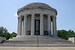
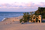
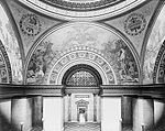
The following are images from various Indiana-related articles on Wikipedia.

Topics

Categories

Category puzzle
Category puzzle
Select [►] to view subcategories

Attractions


Recognized content

Good articles

WikiProjects

State facts

Indiana
CountryUnited States
Admitted to the UnionDecember 11, 1816 (19)
CapitalIndianapolis
Largest cityIndianapolis
Largest metro and urban areasIndianapolis-Carmel MSA
Government
 • GovernorEric Holcomb (R) (2017)
 • Lieutenant GovernorSuzanne Crouch (R) (2017)
LegislatureIndiana General Assembly
 • Upper houseSenate
 • Lower houseHouse of Representatives
U.S. senatorsTodd Young (R)
Mike Braun (R)
Population
 • Total6,080,485
 • Density169.5/sq mi (65.46/km)
Language
 • Official languageEnglish
Latitude37° 46′ N to 41° 46′ N
Longitude84° 47′ W to 88° 6′ W

Things you can do


Here are some tasks awaiting attention:

Associated Wikimedia

The following Wikimedia Foundation sister projects provide more on this subject:

Discover Wikipedia using portals

40°N 86°W / 40°N 86°W / 40; -86

  1. ^ "Elevations and Distances in the United States". U.S Geological Survey. 29 April 2005. Retrieved 2006-11-06.{{cite web}}: CS1 maint: year (link)