Loading
  • 21 Aug, 2019

  • By, Wikipedia

Portal:Indiana

State motto:
The Crossroads of America

Indiana (/ˌɪndiˈænə/ IN-dee-AN) is a state in the Midwestern region of the United States. It borders Lake Michigan to the northwest, Michigan to the north and northeast, Ohio to the east, the Ohio River and Kentucky to the south and southeast, and the Wabash River and Illinois to the west. Nicknamed "the Hoosier State", Indiana is the 38th-largest by area and the 17th-most populous of the 50 states. Its capital and largest city is Indianapolis. Indiana was admitted to the Union as the 19th state on December 11, 1816.

Various indigenous peoples inhabited what would become Indiana for thousands of years, some of whom the U.S. government expelled between 1800 and 1836. Indiana received its name because the state was largely possessed by native tribes even after it was granted statehood. Since then, settlement patterns in Indiana have reflected regional cultural segmentation present in the Eastern United States; the state's northernmost tier was settled primarily by people from New England and New York, Central Indiana by migrants from the Mid-Atlantic states and adjacent Ohio, and Southern Indiana by settlers from the Upland South, particularly Kentucky and Tennessee.

Indiana has a diverse economy with a gross state product of $352.62 billion in 2021. It has several metropolitan areas with populations greater than 100,000 and a number of smaller cities and towns. Indiana is home to professional sports teams, including the NFL's Indianapolis Colts and the NBA's Indiana Pacers. The state also hosts several notable competitive events, such as the Indianapolis 500, held at Indianapolis Motor Speedway. (Full article...)

Indiana is in the Great Lakes region of the U.S., in the northeastern-central part of the country.
Location of the state of Indiana in the United States, highlighted in red.

The U.S. state of Indiana has 17 official state emblems, as well as other designated official and unofficial items. The majority of the symbols in the list are officially recognized and created by an act of the Indiana General Assembly and signed into law by the governor. They are listed in Indiana Code Title 1, Article 2, State Emblems which also regulates the appearance and applicable use of the items.

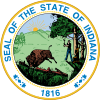
Compared to other states, Indiana has few official symbols. The first symbol was the Seal of Indiana, which was made official in 1801 for the Indiana Territory and again in 1816 by the state of Indiana. It served as the state's only emblem for nearly a century until the adoption of the state song in 1913. For many years, Indiana was the only state without a flag. The official state banner was adopted in 1917, and renamed the state flag in 1955. The newest symbol of Indiana is the state fossil, mastodon, which was declared in 2022. (Full article...)

List of selected articles

Selected image - show another

Pluto Spring, 1903
Pluto Spring, 1903
Credit: Twobees.com
Pluto Spring (source of famous Pluto Water), French Lick, Indiana, from a 1903 postcard.

Did you know - load new batch

Selected geographic article - show another

Corydon is a town in Harrison Township and the county seat of Harrison County, Indiana, located north of the Ohio River in the extreme southern part of the state. Corydon was founded in 1808 and served as the capital of the Indiana Territory from 1813 to 1816. It was the site of Indiana's first constitutional convention, which was held June 10–29, 1816. Forty-three delegates convened to consider statehood for Indiana and drafted its first state constitution. Under Article XI, Section 11, of the Indiana 1816 constitution, Corydon was designated as the capital of the state, which it remained until 1825, when the seat of state government was moved to Indianapolis. In 1863, during the American Civil War, Corydon was the site of the Battle of Corydon, the only official pitched battle waged in Indiana during the war. More recently, the town's numerous historic sites have helped it become a tourist destination. A portion of its downtown area is listed in the National Register of Historic Places as the Corydon Historic District. As of the 2010 census, Corydon had a population of 3,122. (Full article...)

Selected biography - show another

Frank Frederick Borman II (March 14, 1928 – November 7, 2023) was an American United States Air Force (USAF) colonel, aeronautical engineer, NASA astronaut, test pilot, and businessman. He was the commander of Apollo 8, the first mission to fly around the Moon, and together with crewmates Jim Lovell and William Anders, became the first of 24 humans to do so, for which he was awarded the Congressional Space Medal of Honor.

Four days before he graduated with the West Point Class of 1950, in which he was ranked eighth out of 670, Borman was commissioned in the USAF. He qualified as a fighter pilot and served in the Philippines. He earned a Master of Science degree at Caltech in 1957, and then became an assistant professor of thermodynamics and fluid mechanics at West Point. In 1960, he was selected for Class 60-C at the USAF Experimental Flight Test Pilot School at Edwards Air Force Base in California and qualified as a test pilot. On graduation, he was accepted as one of five students in the first class at the Aerospace Research Pilot School. (Full article...)
Selected quote

John Wooden at a ceremony on his 96th birthday
Ability may get you to the top, but it takes character to keep you there.

General images

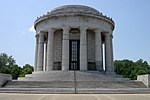
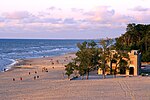
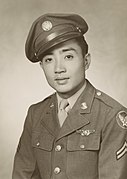
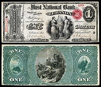
The following are images from various Indiana-related articles on Wikipedia.

Topics

Categories

Category puzzle
Category puzzle
Select [►] to view subcategories

Attractions


Recognized content

Good articles

WikiProjects

State facts

Indiana
CountryUnited States
Admitted to the UnionDecember 11, 1816 (19)
CapitalIndianapolis
Largest cityIndianapolis
Largest metro and urban areasIndianapolis-Carmel MSA
Government
 • GovernorEric Holcomb (R) (2017)
 • Lieutenant GovernorSuzanne Crouch (R) (2017)
LegislatureIndiana General Assembly
 • Upper houseSenate
 • Lower houseHouse of Representatives
U.S. senatorsTodd Young (R)
Mike Braun (R)
Population
 • Total6,080,485
 • Density169.5/sq mi (65.46/km)
Language
 • Official languageEnglish
Latitude37° 46′ N to 41° 46′ N
Longitude84° 47′ W to 88° 6′ W

Things you can do


Here are some tasks awaiting attention:

Associated Wikimedia

The following Wikimedia Foundation sister projects provide more on this subject:

Discover Wikipedia using portals

40°N 86°W / 40°N 86°W / 40; -86

  1. ^ "Elevations and Distances in the United States". U.S Geological Survey. 29 April 2005. Retrieved 2006-11-06.{{cite web}}: CS1 maint: year (link)