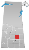
Rural Municipality Of Sasman No. 336
History
The RM of Sasman No. 336 incorporated as a rural municipality on January 1, 1913. The RM's name is a portmanteau of Saskatchewan and Manitoba.
Geography
Communities and localities
The following urban municipalities are surrounded by the RM.
The following unincorporated communities are within the RM.
- Localities
Demographics
In the 2021 Census of Population conducted by Statistics Canada, the RM of Sasman No. 336 had a population of 813 living in 362 of its 607 total private dwellings, a change of 6.3% from its 2016 population of 765. With a land area of 984.26 km (380.02 sq mi), it had a population density of 0.8/km (2.1/sq mi) in 2021.
In the 2016 Census of Population, the RM of Sasman No. 336 recorded a population of 765 living in 328 of its 568 total private dwellings, a -6.5% change from its 2011 population of 818. With a land area of 1,006.49 km (388.61 sq mi), it had a population density of 0.8/km (2.0/sq mi) in 2016.
Attractions
- Margo Recreation Site (51°51′12″N 103°23′51″W / 51.8532°N 103.3975°W) — a rest area within a protected wildlife area around Sakwasew Lake. Access is from Highway 5.
- Leslie Beach Regional Park — a park on Fishing Lake.
Government
The RM of Sasman No. 336 is governed by an elected municipal council and an appointed administrator that meets on the second Tuesday of every month. The reeve of the RM is Dwayne Nakrayko while its administrator is Michael Rattray. The RM's office is located in Kuroki.
Transportation
- Saskatchewan Highway 5
- Saskatchewan Highway 38
- Saskatchewan Highway 49
- Saskatchewan Highway 665
- Saskatchewan Highway 755
- Kelvington Airport
See also
References
- ^ "Pre-packaged CSV files - CGN, Canada/Province/Territory (cgn_sk_csv_eng.zip)". Government of Canada. July 24, 2019. Retrieved May 23, 2020.
- ^ "Rural Municipality Incorporations (Alphabetical)". Saskatchewan Ministry of Municipal Affairs. Archived from the original on April 21, 2011. Retrieved May 9, 2020.
- ^ "Municipality Details: RM of Sasman No. 336". Government of Saskatchewan. Retrieved May 21, 2020.
- ^ "Population and dwelling counts, for Canada, provinces and territories, and census subdivisions (municipalities), 2016 and 2011 censuses – 100% data (Saskatchewan)". Statistics Canada. February 8, 2017. Retrieved May 1, 2020.
- ^ Barry, Bill (September 2005). Geographic Names of Saskatchewan. Regina, Saskatchewan: People Places Publishing, Ltd. p. 379. ISBN 1-897010-19-2.
- ^ "2019-2020 Rural Revenue Sharing Organized Hamlet Grant". Government of Saskatchewan. Retrieved May 4, 2020.
- ^ "Saskatchewan Census Population" (PDF). Saskatchewan Bureau of Statistics. Archived from the original (PDF) on September 24, 2015. Retrieved May 9, 2020.
- ^ "Saskatchewan Census Population". Saskatchewan Bureau of Statistics. Retrieved May 9, 2020.
- ^ "Population and dwelling counts: Canada, provinces and territories, census divisions and census subdivisions (municipalities), Saskatchewan". Statistics Canada. February 9, 2022. Retrieved April 13, 2022.
- ^ "Margo Recreation Site". BRMB Maps. Mussio Ventures Ltd. Retrieved September 13, 2023.
- ^ "Margo Recreation Site". Canadian Geographical Names Database. Government of Canada. Retrieved September 11, 2023.
- ^ "30 Free Places to Camp in Saskatchewan". Explore. Explore Magazine. Retrieved April 3, 2024.
